Contributory members are able to log private notes and comments about each site
Sites Anne T has logged. View this log as a table or view the most recent logs from everyone
Shielknowe Burn Scooped Settlement
Trip No.37 Entry No.4 Date Added: 8th Aug 2017
Site Type: Ancient Village or Settlement
Country: Scotland (Scottish Borders)
Visited: Yes on 6th Aug 2017. My rating: Condition 2 Ambience 3 Access 4
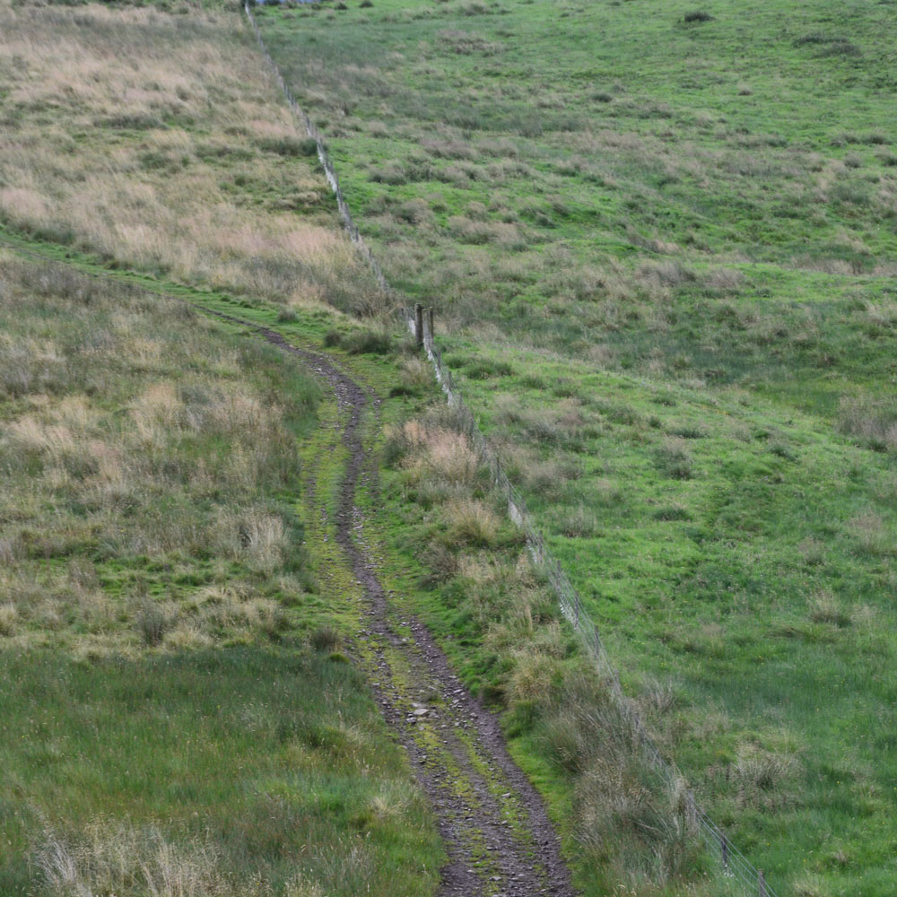
Shielknowe Burn Scooped Settlement submitted by Anne T on 8th Aug 2017. This Scooped Settlement can be seen from Shielknowe Enclosure. Its western most building platform is cut by a modern fence and St. Cuthbert's Way. Photograph taken from the almost ruined Shielknowe Enclosure to the south of Shielknowe Burn.
(View photo, vote or add a comment)
Log Text: Shielknowe Burn Scooped Settlement, Yetholm: This scooped settlement, lying on the northern side of Shielknowe Burn is much easier to see, and is visible from Shielknowe Enclosure, cut by the fence which also cuts the Enclosure. The muddy track from Shielknowe Enclosure runs downhill, crosses the burn, and leads up to join St. Cuthbert’s Way.
Two scooped out areas can be seen, although the farmer had very tightly knotted the twine securing the gate, so whilst Andrew (husband) hopped over the gate, I undid the ‘Gordion Knot’ to get into the settlement. The grass was very tussocky and wet, so walking along the banks of the western most scoop was interesting.
Much more exciting sites to come, so we didn’t spend an awful long time here.
Sheilknowe Burn Enclosure
Trip No.37 Entry No.3 Date Added: 8th Aug 2017
Site Type: Ancient Village or Settlement
Country: Scotland (Scottish Borders)
Visited: Yes on 6th Aug 2017. My rating: Condition 1 Ambience 3 Access 4
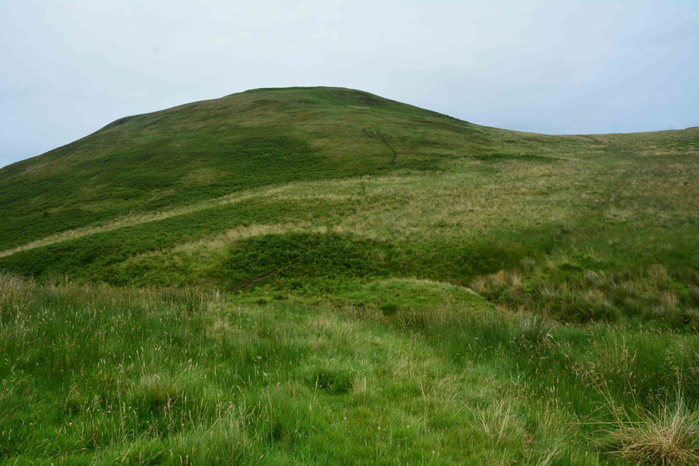
Shielknowe Burn Enclosure submitted by Anne T on 8th Aug 2017. Standing near the fence which cuts across the southern boundary of this horseshoe shaped enclosure, looking towards Shielknowe Burn, part of the land in a small loop of the burn seems to have slipped down. The burn forms the northern most boundary of the settlement. Green Humbleton hillfort is almost in the centre/top of the photograph.
(View photo, vote or add a comment)
Log Text: Shielknowe Enclosure, Yetholm: From the Virtue Well we made our way to Kirk Yetholm, finding the small side road which is actually the Pennine Way, but which can be driven down to a small parking area beside where the Halter Burn and Shielknowe Burn meet. Here a footbridge leads over the Burn, the Pennine Way and St. Cuthbert’s Way meeting at this point.
We tried St. Cuthbert’s Way first of all, running parallel to Shielknowe Burn on it’s eastern side, but after a few hundred yards, came across a rocky outcrop where I would have needed to turn into a mountain goat (OK for my husband, but not for me) so we retreated and walked almost back to the footbridge. There is another mown track which runs on the western side of the stream – boggier but much easier to follow and the sides of the small gorge not quite so precipitous.
It's a good job we had the GPS with us, together with a printed sheet of the Canmore details, otherwise we’d have walked across this settlement without knowing it was there. By finding it’s centre (the south western edge is almost at the corner of the fenced off field containing Shielknowe Burn Scooped Enclosure.
By carefully walking over the area, we could see very slight banks and changes in vegetation, but my goodness, had we not been out with NOWTAG, we would have missed this.
Virtue Well (Yetholm)
Trip No.37 Entry No.2 Date Added: 7th Aug 2017
Site Type: Holy Well or Sacred Spring
Country: Scotland (Scottish Borders)
Visited: Yes on 6th Aug 2017. My rating: Condition 2 Ambience 2 Access 4
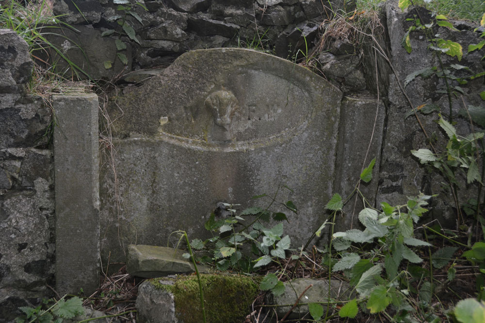
Virtue Well (Yetholm) submitted by Anne T on 7th Aug 2017. Close up of the central panel, showing the basin broken and lying at its base amongst a tumble of stones from the retaining wall.
(View photo, vote or add a comment)
Log Text: Virtue Well, Yetholm: From Venchen Farm Cottages Standing Stone, by the time we drove back down to the west side of the road bridge over Bowmont Water at NT 82132 28576, and parked at a little layby just before the road junction, the rain had eased off a little.
There were two routes up to the well, the first at NT 82128 28603 led up a wet, slippery hill towards a wood, which was rather overgrown. We opted for the footpath proper, starting at NT 82206 28645, with a proper track leading up to Braehouse Farm.
According to UK Grid Reference Finder, the path deviates through the woodland, past the well, but in real life, the track continues straight up to the farm, and we had to tramp through knee high grass through the wood.
Having found this poor little well, I couldn’t but help feel sorry for it. Such a tragedy. It reminded me of the well we’d seen in Middleham – broken up, dry and just part of an old garden wall. At least under the trees we were largely sheltered from the rain.
Venchen Farm Cottages (Town Yetholm)
Trip No.37 Entry No.1 Date Added: 7th Aug 2017
Site Type: Standing Stone (Menhir)
Country: Scotland (Scottish Borders)
Visited: Yes on 6th Aug 2017. My rating: Condition 3 Ambience 3 Access 5
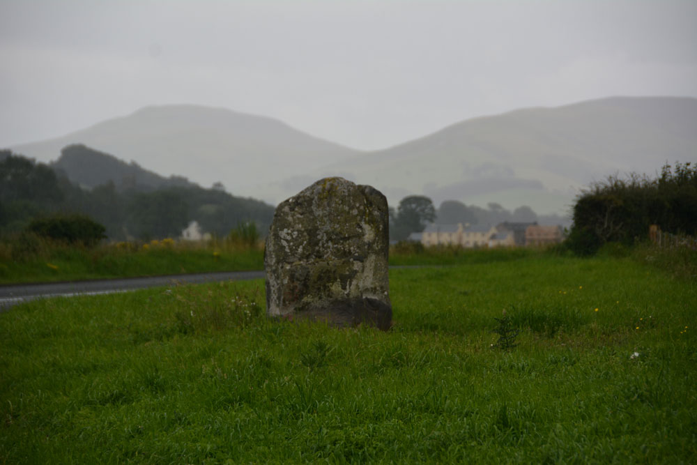
Venchen Farm Cottages (Town Yetholm) submitted by Anne T on 7th Aug 2017. The Venchen Farm Cottages stone, looking south east towards Town Yetholm, over the Bowmont Water Valley. It wasn't raining (much!) when I took this photograph - that's just 'Scotch Mist' in the background.
(View photo, vote or add a comment)
Log Text: Venchen Farm Cottages Standing Stone, Scottish Borders: Having left home to avoid days of damp, rainy weather, we went in search of sunshine and blue skies. The further we travelled up the A68, the more obvious it became that the grey skies got darker the more northerly we got. As we reached Town Yetholm, the heavy raindrops started to fall with the ferocity of hail.
Venchen Farm Cottages are easy enough to find, heading north about 1.6 km north out of the village. This stone looms large out of the grassy verge; at first I thought it was just a village sign. We pulled into a small parking spot just past the stone, nearer to the cottages, by which time it was pelting down even harder and I had the camera covered with kitchen towel and handkerchiefs to keep it dry.
The Canmore notes, which we’d printed off before setting off, said that a hedge had been removed for the stone to be exposed. On UK Grid Reference Finder, the hedge can be seen with the stone tucked away behind it. The grass verge itself didn’t seem to show any signs of disturbance, considering the hedge was only removed in February this year, although the earth around the stone was visible, together with some packing stones and the vegetation along the verge was more weeds than grass.
Difficult to get photographs with the rain, but managed to keep wiping the lens.
Carey Burn (Harthope Valley)
Trip No.36 Entry No.4 Date Added: 31st Jul 2017
Site Type: Ancient Village or Settlement
Country: England (Northumberland)
Visited: Yes on 30th Jul 2017. My rating: Condition 1 Ambience 2 Access 4
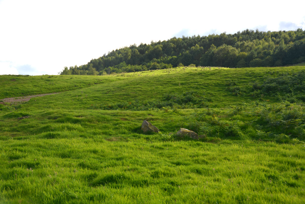
Carey Burn (Harthope Valley) submitted by Anne T on 31st Jul 2017. Looking westwards up Snear Hill to the second scooped settlement, which wasn't marked on the OS map. The western bank of this settlement can be seen running across the middle of the photograph, left to right.
(View photo, vote or add a comment)
Log Text: Carey Burn Votadinian settlement, Harthope Valley: After the beautiful Maiden/Pin Well, I got stuck on a 'precipice' above the Coldgate Burn trying to get to the Romano-British settlements to the west of North Middleton and bottled out (my dreaded fear of falling - I've subsequently found the map showed a low level, apparently straightforward footpath from North Middleton, although it was about a mile either way). After this experience, I need to try and regain my composure.
On the map, just across the road from the footpath we’d tried, and just west of Carey Burn Bridge, a track ran up the hill at NT 97513 24937, just above a currently empty barn. A settlement was shown here. An NNPA footpath ran up the hill, so we opened the gate and followed the path up.
We did find the settlement, but it looked as if a fence had recently been installed along the north western bank, crossing over part of it to the eastern side.
A long, low earth and stone bank about 1 metre tall and 2 metres wide ran parallel to the fence from NT 97353 24907 to NT 97301 24938 then curves around to the Carey Burn at NT 97337 25012. This bank can be seen on UK Grid Reference Finder.
On getting home, I discovered from Pastscape that the settlement we looked at was classed as Votadinian. There is a second settlement, which isn’t marked on the map at NT 97132488, which is further up the hill.
Maiden Well (Kettle Hill)
Trip No.36 Entry No.3 Date Added: 31st Jul 2017
Site Type: Holy Well or Sacred Spring
Country: England (Northumberland)
Visited: Yes on 30th Jul 2017. My rating: Condition 3 Ambience 5 Access 4
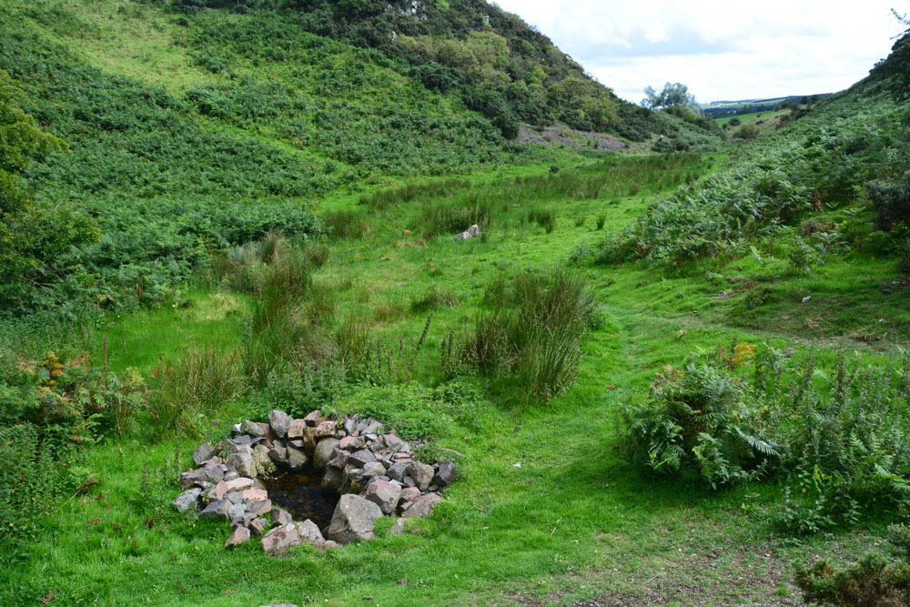
Maiden Well (Kettle Hill) submitted by Anne T on 31st Jul 2017. Standing just north of the well, looking back towards the quarry. The small stream which runs from the well is defined by small groups of stones placed along each side of the water course, together with a lush growth of bracken in the wetter parts of the ground. It's a very enigmatic spot, especially with The Kettles Hillfort rising up above you (to the right, out of sight, in this image).
(View photo, vote or add a comment)
Log Text: Maiden Well and The King's Chair, Wooler: After having walked round the outer perimeter of the promontory of The Kettles, we’d actually stood just above the site of the Maiden Well (Pin Well), but would have needed a rope and harness to descend the vertical cliff down to it. We walked back to the car, drove back into Wooler, then back out again on the road to the tiny (and ancient) hamlet of Earle.
Where the road splits at NT 99100 26973, we took the western fork (right hand if coming from Wooler) and take the track that runs from NT 98924 26750 to a small quarry. Note: the gate to this road is kept padlocked to prevent people taking vehicles up to the quarry, but there are gates for walkers. Husband Andrew hadn’t spotted the gate, so we ended up climbing the fence into the neighbouring field, then back out again!
Just before the main entrance to the quarry a small (overgrown) footpath leads to your left from NT 98808 26845. We followed this for some 300 metres, the nettles eventually giving way to open ground in a small valley/ravine. We first spotted the King's Chair protruding from the hill in front of you, although I was a bit dubious at first as the stone was hidden by lush, tall bracken growing round it from the rock face. Walking further forward the well is hidden under a hawthorn tree.
The well is in a lovely, enigmatic location. It looks as if someone has recently created this lovely circular ‘halo’ of stone around the clear water. A stone a metre of so to it’s north west has a hole at its base. Glimpsing down, I could see the water running into the well pool.
A small stream runs out of the well pool. The water course is marked by groups of stones leading back towards the entrance to the quarry, on either side of the small stream, which is also marked by lush grass and bracken growing on either side of it. I walked up a little way to look at various groups of stones, to find parts of the ground boggy and heavy with water.
With The Kettles rising up above you to the east, this is a really nice spot. I could have lingered longer, but 4-5 Romano-British settlements called. Time to move on.
The Kettles (Wooler)
Trip No.36 Entry No.2 Date Added: 31st Jul 2017
Site Type: Hillfort
Country: England (Northumberland)
Visited: Yes on 30th Jul 2017. My rating: Condition 3 Ambience 5 Access 4
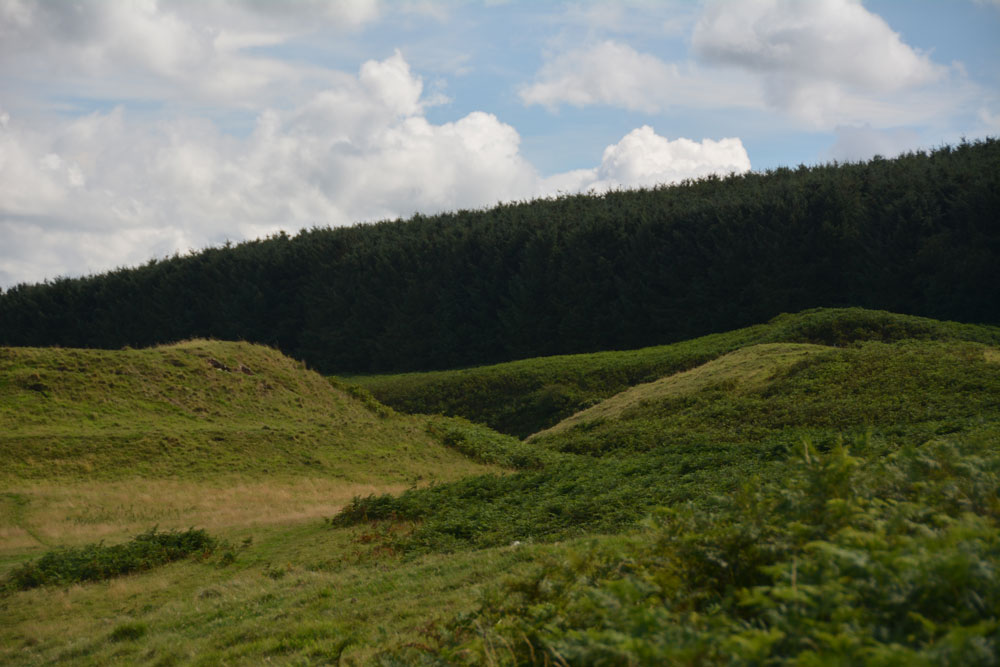
The Kettles (Wooler) submitted by Anne T on 31st Jul 2017. Getting closer to the rampart and ditch on the north western edge of the hillfort. The banks stand really tall, with steep sides, with an earth and stone construction.
(View photo, vote or add a comment)
Log Text: The Kettles Hillfort, Wooler: From Green Castle, we continued along the track leading first south west up the small hill, then turns south east along the top of the promontory. Our GPS told me there was just over 511 metres to walk from the small parking area to the grid reference given by Pastscape, but it seemed a lot less than this.
The paths are well kept, as on the Breamish Valley trails, with low, mown grass which is soft underfoot and easy to walk. As we walked along the promontory, the northern section of ramparts came into view. As we got closer, it became obvious how large these were.
Paths lead up into round the exterior edges of the hillfort. There are bracken and scree covered valleys on either side. The first thing we came across were some strange concrete blocks and what looked like the tiled remains of an old toilet at approx. NT 98398 27352, but then there are the recorded remains of pillboxes in this area, so must have been used for military training during the last war.
As we walked along, we crossed three distinct banks which had been cut by the paths, which are the three ramparts (in places four) that cut the fort into two. Walking past the fourth rampart, it felt as it had on Little Hill in the Scottish Borders, as if I was on the prow of a ship looking down across the land below. Crossing to the eastern side of the fort, at this point, we were almost directly above Maiden Well and the King’s Chair. To reach these, we would have need climbing equipment to abseil down, so we walked back to the car and drove round to the path leading to The Pin Well.
Looking at the aerial images on UK Grid Reference Finder, the outline of the fort is clearly visible.
Green Castle Ringwork
Trip No.36 Entry No.1 Date Added: 31st Jul 2017
Site Type: Misc. Earthwork
Country: England (Northumberland)
Visited: Yes on 30th Jul 2017. My rating: Condition 2 Ambience 3 Access 5
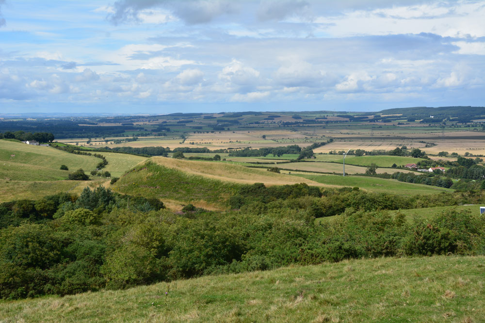
Green Castle Ringwork submitted by Anne T on 31st Jul 2017. Climbing (sorry, walking!) up the track from the small parking area near the cattle grid to Wooler Common, we got a good view of the mound from the top. It looks distinctly saucer shape, hence the Cup and Saucer name.
(View photo, vote or add a comment)
Log Text: Green Castle Ringwork, Wooler: After having stopped off at the ‘usual café’ in Wooler for refreshments, we headed off towards Wooler Common, from the High Street taking Ramsey Lane which becomes Common Road.
At NT 98195 27735 there is a small parking area, where a footpath leads south westerly up and over the Common. From here, the Ringwork looks like part of a giant rubbish tip, with its south and western sides protruding up over the hedgerow like a giant green triangle. Given that to it’s south east there is a huge area for storing skips, it looks at first sight as if the mound is used for a rubbish dump, but it’s not.
There is no access into the field the ringwork sits in (gates are padlocked, and the only gate that opened (immediately opposite the parking area) led down to a wooded area and small ravine.
We actually got a good view of what looks like a ‘Refresher’ sweet by walking up the path towards The Kettles. From here, even the stones in the south western side, where the mound has been eroded, are visible, together with a short section of ditch.
I didn’t spot the telephone wire snaking across the photograph until I loaded it onto my computer.
Newhall Hill (Paddockhole)
Trip No.35 Entry No.3 Date Added: 26th Jul 2017
Site Type: Ancient Village or Settlement
Country: Scotland (Scottish Borders)
Visited: Yes on 24th Jul 2017. My rating: Condition 2 Ambience 4 Access 3

Newhall Hill (Paddockhole) submitted by Anne T on 26th Jul 2017. First glimpse of Settlement B which is the lower of the two settlements on Newhall Hill. There is a massive earthen bank with a deep outer ditch. The curving banks make it look round, but it is fact rectangular with rounded edges. This photo looks over the entrance in the south east.
(View photo, vote or add a comment)
Log Text: Newhall Hill Settlements, near Paddockhill, Scottish Borders: From Little Hill, we thought we’d stop off at Balliehill Hillfort again, but driving up to it, it was covered in enormous cattle grazing contentedly within it. Taking one look, we decided to press onto Newhall Farm. Following the minor road that runs alongside the western bank of the Water of Milk, we enjoyed the views down the valley. Reaching Paddockhill, we turned right, then immediately right again, over Paddockhill Bridge and followed the road through Newhall Farm to a small bridge hidden between the trees. We couldn’t see the burn as it was being used as a dump for old industrial pipes and equipment, fencing and telegraph poles, but just before the bridge was a small area which had been hard-cored, so we parked there. The gate to the two tracks leading up Newhall Hill was just behind us. Taking the right hand track, we plodded up this steeper-than-it-looked hill. Would it never end??
Eventually the track ran out and we set off across the pasture to find the settlements. I heard the noise of a quad bike and the farmer appeared, with this two dogs, over the top of a hill, screeching to a halt in front of me. I thought he was going to hit me, so took a large backwards step, but he stopped in time. “Nearer to heaven here’ he said and pointed to all the wind farms surrounded the hill. “Don’t think they do any harm, do they?” he added. I put my hand out to stroke one of the dogs and the farmer barked at me: “Don’t! He’ll have your hand off.” He told us the settlements were just over the next small brow on the hill, said he lived at the small farm yonder rather than the big one down in the valley below that we could see, then hared off at great speed with both dogs balancing on the back of the quad bike.
Two hundred yards further on, a deep ditch and large bank of Settlement B came into view, complete with eyesore of a very large quarry beyond.
I walked all round the outer bank of the lower settlement, then went into the inside. Apart from a very boggy part, which looked like it might have been a well at some point, we couldn’t make out any features internally.
I would have liked to have walked up the hill to Settlement A but the heads and bodies of some very lively bullocks kept watching us. I didn’t fancy being surrounded by them, so we decided to walk back down to the car.
We would have ended up at the Severn Brethren stone circle, but as we neared it, realised we’d been here before, and it was very unremarkable.
Little Hill (Craig)
Trip No.35 Entry No.2 Date Added: 26th Jul 2017
Site Type: Hillfort
Country: Scotland (Scottish Borders)
Visited: Yes on 24th Jul 2017. My rating: Condition 2 Ambience 4 Access 4

Little Hill (Craig) submitted by Anne T on 26th Jul 2017. Standing in the middle of the entrance to the northern side of the hillfort looking more or less north over the Esk Valley below. There is an old hollow way which curves down to the modern road below.
(View photo, vote or add a comment)
Log Text: Little Hill Hillfort, Craig, Scottish Borders: This might be a 'short walk on a footpath', but it was a steady climb! After visiting Barntalloch Castle, we could see no way of getting into the old churchyard nearby, as it looked as if the building had been converted into a house. Mistake not to try, as Canmore said there was an inscribed stone.
We drove onto Little Hill, stopping to take a photograph of Barntalloch from a layby on the B709. The River Esk looks glorious sparkling in the sunshine with its loops and cobble banks.
There is a footpath/track leading up to Little Hill hillfort from just before the bend at Craig at NY 33656 88271, where there was room to tuck the car in at its junction with the road. There has been lots of activity with telegraph poles in this area, with lots of spare ones lying around; in fact climbing up the hill they got in the way of the view over to the west until we got above them. Craig Hill to the south of Little Hill looms large and dominates the scenery; there is also a settlement on its lower slopes south of Little Hill, although we didn’t spot this on the climb up.
We left the stony track up the hill and followed what seemed to be a hollow way up to the fort, approaching this from its north western side where I spotted the well at NY 33858 88237, next to a cattle feeder.
This is a lovely spot with its flower meadows and virtually 360 degree views. There don’t seem to be any features in the interior, or at least we didn’t see them as the grass was so lush. Andrew thought he saw a couple of roundhouses, due to the change in vegetation, but I thought it was a bit of a stretch, but there were two circular areas that were slightly scooped and had less wild flowers within them.
I walked down to the south western (stem end of the pear) end of the fort, which is slightly separated from the rest of the fort by a dip, effectively splitting the fort in two.
On the way back down we stopped to photograph the entrance at the northern end of the fort. From here we could see the racing tracks of the race horse training stables in the valley below. There was also a line of stones running from approx.. NY 33920 88223 to NY 33978 88200 near the road also seems to follow the line of a water course. If you plot the points of the well and these stones, they seem to follow a straight line. Some of the taller stones also hide springs.
A lovely walk and well worth stopping. The views on a sunny, warm day like today were lovely. As I keep repeating, our ancestors chose some very nice places to live.
Barntalloch (Langholm)
Trip No.35 Entry No.1 Date Added: 27th Jul 2017
Site Type: Misc. Earthwork
Country: Scotland (Scottish Borders)
Visited: Yes on 24th Jul 2017. My rating: Condition 2 Ambience 3 Access 5
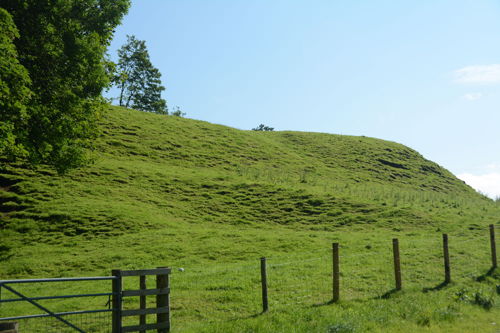
Barntalloch (Langholm) submitted by Anne T on 27th Jul 2017. First view of the motte as we took the south westerly track through the farmyard.
(View photo, vote or add a comment)
Log Text: Barntalloch Motte, Staplegordon, Langholm: It was dull and very wet at our house, and fed up of the rain, we decided to head off to the Scottish Borders for some sunny, 25 deg C weather. Landing in Langholm by 2.30pm, we stopped off for coffee and cake before heading off into the wilds of Eskdale.
I spotted this site on the map, just west of Langholm, down a small road leading to a hamlet called Staplegordon. It caught my eye because it not only had the motte but the remains of a chapel. I like looking around the gravestones.
We parked in what looked like a parking area for fishermen to the right of the far side of the bridge. There is actually another car park by the farm nearer to the motte. There are posts indicating the routes of different Langholm Walks.
Just past the farm to the left of the bridge, the track splits at NY 35445 87796. The northern section leads down to the old graveyard and a bungalow (looks like the chapel was converted into a dwelling). A track led through another farmyard to our left which curls to the south west, around the side of the motte.
The lady farmer roared up on her quad bike and stopped to say hello. She didn’t seem to mind us tramping through her farmyard, but wasn’t very forthcoming. When I got home and did some research on Canmore, I found out that the old chapel was supposed to have an inscribed stone. We didn’t walk down there as we couldn’t see a way of reaching the churchyard except through the main gate of the cottage.
Beanley Moor Enclosure
Trip No.34 Entry No.4 Date Added: 22nd Jul 2017
Site Type: Ancient Village or Settlement
Country: England (Northumberland)
Visited: Yes on 18th Jul 2017. My rating: Condition 1 Ambience 2 Access 4

Beanley Moor Enclosure submitted by Anne T on 22nd Jul 2017. The robbed out rampart can be seen as a shallow double ditch in the south west of the enclosure. This location has lovely views down to the River Breamish valley.
(View photo, vote or add a comment)
Log Text: Beanley Moor Iron Age Defended Settlement, Northumberland: We had an abortive attempt to find the Fawdon Cross Base at NU 0281 1591 (nowhere anywhere nearby to park) and Beanley Plantation Hillfort. The tracks to the latter were either waterlogged (husband said we needed diving equipment – a slight exaggeration, I think!), although we could have tried from the paths through the forest from the south (but didn’t). We then made our way to the Beanley Moor settlement/enclosure just to its north. This is a short hop up the field. There is a path leading up the slope (it’s all access land here) which brings you to the southern edge of the enclosure, although having spotted a slight bank popping up out of the grass, we made a more direct bee-line up the slope.
Curious how the landscape has changed in just a few miles. The area is completely sandy – like a beach, which it must have been at one point in the dim and distant path, although higher up the slope it becomes more of a loam.
Very, very little remains of this possible Iron Age settlement, although there was enough left of two parallel shallow ditches for us to follow their line round in a circle. Thought we spotted a possible entrance in the south west of the enclosure, a possible roundhouse partly built into the bank (although heavily disguised by tussocks and bracken in parts) and a hollow way leading north-west/south-east along the north eastern edge of the settlement, leading up to the Beanley Plantation Hillfort.
Brilliant views down to the River Breamish Valley, but that’s as much as can be said for this site. Glad we stopped off, though.
Haystack Hill (Ingram)
Trip No.34 Entry No.3 Date Added: 21st Jul 2017
Site Type: Ancient Village or Settlement
Country: England (Northumberland)
Visited: Yes on 18th Jul 2017. My rating: Condition 2 Ambience 4 Access 3
Haystack Hill (Ingram) submitted by SolarMegalith on 16th Mar 2013. Remains of a stone wall - view from the NE (photo taken on March 2013).
(View photo, vote or add a comment)
Log Text: Haystack Hill Settlement Complex, Ingram, Northumberland: Having stopped off at North Haystack Hill, it was getting hot by this point, although there was a pleasant breeze. The path was levelling out now and there was an electric fence to our left hand side. Where this had dropped down to the grass at one point, we made our way across to the gate at the north western part of the field. The ground here was very boggy, descending into deep puddles at various points, so we picked our way around. A sign on the gate said ‘end of access land’ although there is a permissive footpath around the edge of the field leading into the south western corner of this complex settlement.
This site is huge. I wish I’d printed off an aerial photograph to take with me, so I could have understood it better – a good excuse for a return visit.
We first explored the rectangular enclosure with its row of hut circles in, then made our way between the B2 (the southern most of the two B enclosures) and C.
Wow. Although deep in bracken, it was still possible to make out tall banks and circular features I felt very priviledged to have come here, as I did at Burdhope last week. A brilliant, brilliant site. With the other hillforts all around, it was very atmospheric.
North Haystack Hill
Trip No.34 Entry No.2 Date Added: 21st Jul 2017
Site Type: Ancient Village or Settlement
Country: England (Northumberland)
Visited: Yes on 18th Jul 2017. My rating: Condition 2 Ambience 4 Access 3

North Haystack Hill submitted by Anne T on 21st Jul 2017. Stepping over the medieval bank and walking some 30 metres into the enclosure, this circular bank came into view.
(View photo, vote or add a comment)
Log Text: North Haystack Hill, Ingram, Northumberland: After Ingram Hill Enclosure, we took the permissive footpath to its east, walking up between Turf Knowe to our east and Wether Hill to the west. From this point on, for the next quarter of a mile, we seemed to be constantly moving out of the way of a tractor and a small four-wheel drive van and trailer mowing bracken (they seemed to target us with every turn!), up until the division of footpaths just before this earthwork, which appeared as a low stone and earth mound, about 1 metre wide and 80cm high, running to the left of the footpath. It ran for several hundred metres with the occasional bank peeping out of the bracken to the east. By this time, we were 800 metres from Ingram Hill Settlement, and a couple of hundred yards from the main Haystack Hill complex. We stepped over the low electric wire that was keeping the sheep in a particular area and went to investigate.
What a view to have from your front door, down the Middledean Burn valley to the west and the Breamish Valley and Ingram below.
Getting back home and opening up Pastcape, I was surprised to find this is a recorded Iron Age/Roman enclosed settlement. Although the long bank is medieval, the settlement is described as ‘much mutilated’ with a number of scooped hut circles. It can be seen on UK Grid Reference Finder aerial images, with ridge and furrow ploughing cutting over the top.
Making our way back to the path, which by now was levelling off, we continued up the slope towards the larger Haystack Hill settlement.
Ingram Hill
Trip No.34 Entry No.1 Date Added: 21st Jul 2017
Site Type: Ancient Village or Settlement
Country: England (Northumberland)
Visited: Yes on 18th Jul 2017. My rating: Condition 2 Ambience 4 Access 4
Ingram Hill submitted by SolarMegalith on 18th Mar 2013. Course of the rampart in the eastern part of Ingram Hill settlement (photo taken on March 2013).
(View photo, vote or add a comment)
Log Text: Ingram Hill Settlement, Breamish Valley: Making the most of a warm, sunny day we set off to the Ingram in the Beamish Valley, not to walk the Hillfort Trail this time, but to look at some settlements marked on the OS map. Taking supposedly ‘the shortest route’ the roads were so twisty and windy that it took forever, and I ended up feeling travel sick for most of the afternoon.
I had forgotten how beautiful and calm this little valley is. There were a dozen or so cars parked on the grass by the river, with people picnicking. Passing the car park just outside Ingram, there was only one car – in Northumberland I expect to see more sheep than people on a day out. Setting off west out of Ingram, we parked just outside the village on a wide grass verge that people had obviously used before us. Walking the 100 metres or so to where the stony footpath climbed gently up to Turf Knowe, we had the old field boundary and modern wire fence to our left. Where the footpath meets the access land at the south western corner of the field, another permission footpath/stone covered track branched off to the south east towards Wether Hill. Typically, we didn’t use the path but tramped through the knee high grass and bracken, surprising the sheep who’d sought shade.
The circular banks of this settlement rose gently out of the turf. Some of the sheep were grazing on top. I walked all the way round the bank, which is 160 feet in diameter. There is a clear two roomed rectangular house on the interior northern bank, looking down to the River Breamish below.
Another circular feature, which I thought was a small roundhouse, was to be found towards the middle of the settlement. Pastscape says this is the remains of some shielings.
After taking a short break to make the most of the sunshine, we took the permissive path and headed up towards Haystack Hill.
Yatesfield Hill (Otterburn)
Trip No.33 Entry No.7 Date Added: 11th Jul 2017
Site Type: Standing Stone (Menhir)
Country: England (Northumberland)
Visited: Yes on 8th Jul 2017. My rating: Condition 3 Ambience 4 Access 5
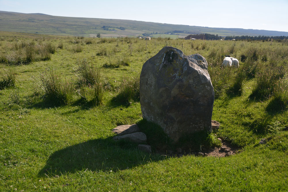
Yatesfield Hill (Otterburn) submitted by Anne T on 11th Jul 2017. This standing stone (rubbing post? way marker?) is sited just south of the top of Yatesfield Hill, on the way up to Yatesfield Settlement which is 650 metres to the north east.
(View photo, vote or add a comment)
Log Text: Yatesfield Hill Standing Stone, Otterburn Ranges: Driving up to Yatesfield Hill, I noticed this stone by the side of the road. There is no mention of it on Pastscape, English Heritage or the OS maps.
It might be a marker stone or a rubbing stone, as it is sited by the junction of Yatesfield Hill road and a trackway west, but looks as if it has been here for some time, as it is deeply embedded in the ground and has small stones and boulders packed around its base.
There was a lovely military Port-a-loo nearby!
Yatesfield (Otterburn)
Trip No.33 Entry No.6 Date Added: 11th Jul 2017
Site Type: Ancient Village or Settlement
Country: England (Northumberland)
Visited: Yes on 8th Jul 2017. My rating: Condition 2 Ambience 2 Access 5
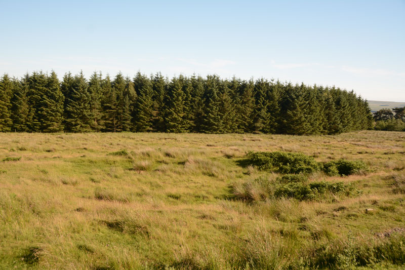
Yatesfield (Otterburn) submitted by Anne T on 11th Jul 2017. One of the roundhouses in the middle of the site can be seen by a change in vegetation, ringed around with bracken.
(View photo, vote or add a comment)
Log Text: Yatesfield Settlement, Otterburn Ranges: By this time, it was 6pm, and rather than face another long walk over rough ground to the Roman Tombs at Lamb Crag, we decided to save our feet and drive to this site up on the Otterburn Ranges. We spotted the two ‘archaeological area’ signs at the south and north ends of the site. It has obviously been split by the military tarmacked road. Standing at the western edge of the site, looking down over the gentle south east slope, it took a few minutes to ‘get my eye in’ and start to see the possible hut circles and lumps and bumps of various structures. In the end, I walked to the northern end and walked across the site, photographing as I went.
Parts of the ground were very boggy and I disturbed a hare sunning itself against the back wall, partly sunk into the bank (part earth, part stone) of one of the round houses nearest the road.
Burdhope (Rochester)
Trip No.33 Entry No.5 Date Added: 11th Jul 2017
Site Type: Ancient Village or Settlement
Country: England (Northumberland)
Visited: Yes on 8th Jul 2017. My rating: Condition 2 Ambience 5 Access 3
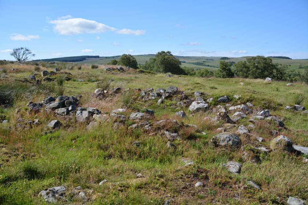
Burdhope (Rochester) submitted by Anne T on 11th Jul 2017. Standing almost at the middle, eastern edge of the site looking west across it. I interpreted this as one of the smaller round structures (hut?) with the bank of an enclosure in the foreground.
(View photo, vote or add a comment)
Log Text: Burdhope Hill Village, Rochester, Northumberland: After having stopped at the Camien Café for refreshments, we headed off into the hot sun again. This time it was only a few hundred metres up the road. There was a small layby at the side of the road opposite Woolaw Farm entrance. Crossing the road was fun as you could hear the roar of the motorbikes and cars coming from a fair distance, then they zoomed past, the rush of air lifting my hair. A quick run across the road was safely achieved.
Andrew had found out from friends who visit Trig Points that the only footbridge across the river was at Woolaw Farm, so we walked down the track and joined the footpath just west of the farm house.
The grass is tussocky and some parts of the field are boggy, other parts cut by modern field drains, but it wasn’t too challenging a walk (for me).
The monument is on access land, although it has been fenced off to protect it. As the gate into the field was at the top of the hill, we took a short cut by climbing through the barbed wire fence. We must have spent an hour wandering around, trying to interpret the different bits. Fascinating!
Brownrigg (Rochester)
Trip No.33 Entry No.4 Date Added: 10th Jul 2017
Site Type: Ancient Cross
Country: England (Northumberland)
Visited: Yes on 8th Jul 2017. My rating: Condition 3 Ambience 3 Access 4
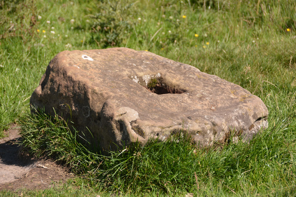
Brownrigg (Rochester) submitted by Anne T on 10th Jul 2017. The cross base doesn't quite sit at the centre of the slight hollow in which it is located. There is a build up of earth on one side and the sheep have been rubbing against one side.
(View photo, vote or add a comment)
Log Text: Brownrigg Ancient Cross Base, Rochester, Northumberland: Two cross bases in one day, although this one isn’t marked on the map. Husband, Andrew, found it by doing a location search on Pastscape before we set off (he gets to look at settlements and Roman forts he's interested in whilst I get the cross bases and tumuli!).
Again, just off a layby on the A68 just before it meets the A696, where a footpath goes north west towards Rattenraw. The layby was being used by a solitary motorbiker who looked at us curiously as we drove up and parked up.
Letting ourselves in through the farmgate to the footpath, which is signposted Rattenraw and Bagraw, we first of all tried to follow the ditch and mound of the line of Dere Street, but this was very boggy and the GPS was telling me we were getting further away.
Wading back to the farm track, the metres on the GPS dropped rapidly, then we suddenly came across the cross base, sitting slightly to the north of the farm track, some 30 metres short of where the official gps reading says it should be. I made the grid reference NY 85668 94716. On UK grid reference finder, the line of Dere Street crossing the field can be clearly seen, as can one of the banks/ditches which matches the line on the OS map.
The cross base is well buried in the grass and sits in a slight dip, just east of some old mine workings. Nothing terribly remarkable about this except the socket hole seemed really small, measuring only 10 cms square.
Worth stopping off to look, as no-one else seems to have spotted this, but nothing hugely exciting about this site. The next stop was most certainly the best of the last few months!
Woodhouse (West Woodburn)
Trip No.33 Entry No.3 Date Added: 10th Jul 2017
Site Type: Cairn
Country: England (Northumberland)
Visited: Yes on 8th Jul 2017. My rating: Condition 3 Ambience 4 Access 5
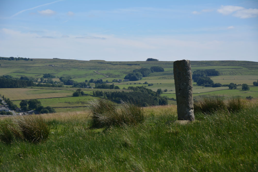
Woodhouse (West Woodburn) submitted by Anne T on 10th Jul 2017. This being England, we didn't climb the barbed wire fence for a closer look, but used the zoom lens on the camera. There are great views to the east across the Rede Valley.
(View photo, vote or add a comment)
Log Text: Woodhouse Round Cairn and Roman Milestone, Northumberland: How many times have we driven up and down this road and never spotted anything? Today I saw the stone peering above the stone wall to the west of the A68, where the Sandstone Way crosses it.
There was a tumulus marked on the map, so I started to look out for it. “There’s a standing stone,” I observed as we approached the spot, and as there was somewhere to pull in, we did. I hopped out of the car with the camera, seeing two boys with go-carts just inside the gate. I asked them if they lived there and we talked at cross purposes for a couple of minutes until one of them said ‘this is a bridleway’ so I felt free to open the gate, go in and have a closer look at the tumulus.
There is a distinct mound, with brilliant views over the Rede Valley to the east. I thought the ‘standing stone’ was in fact a gatepost as I thought there was a metal bracket in the stone on its northern side. It wasn’t until we got home and looked it up that we realised it was a Roman milestone which has been erected in this spot by the (yes, again!) The Redesdale Society.
Well worth stopping to have a look. Can’t believe we haven’t spotted this before.
