Contributory members are able to log private notes and comments about each site
Sites Anne T has logged. View this log as a table or view the most recent logs from everyone
Shielknowe Burn Scooped Settlement
Trip No.37 Entry No.4 Date Added: 8th Aug 2017
Site Type: Ancient Village or Settlement
Country: Scotland (Scottish Borders)
Visited: Yes on 6th Aug 2017. My rating: Condition 2 Ambience 3 Access 4
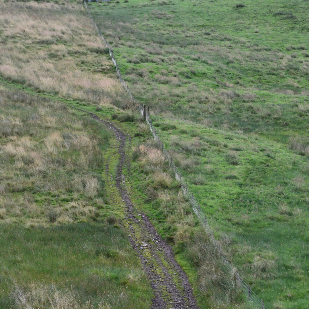
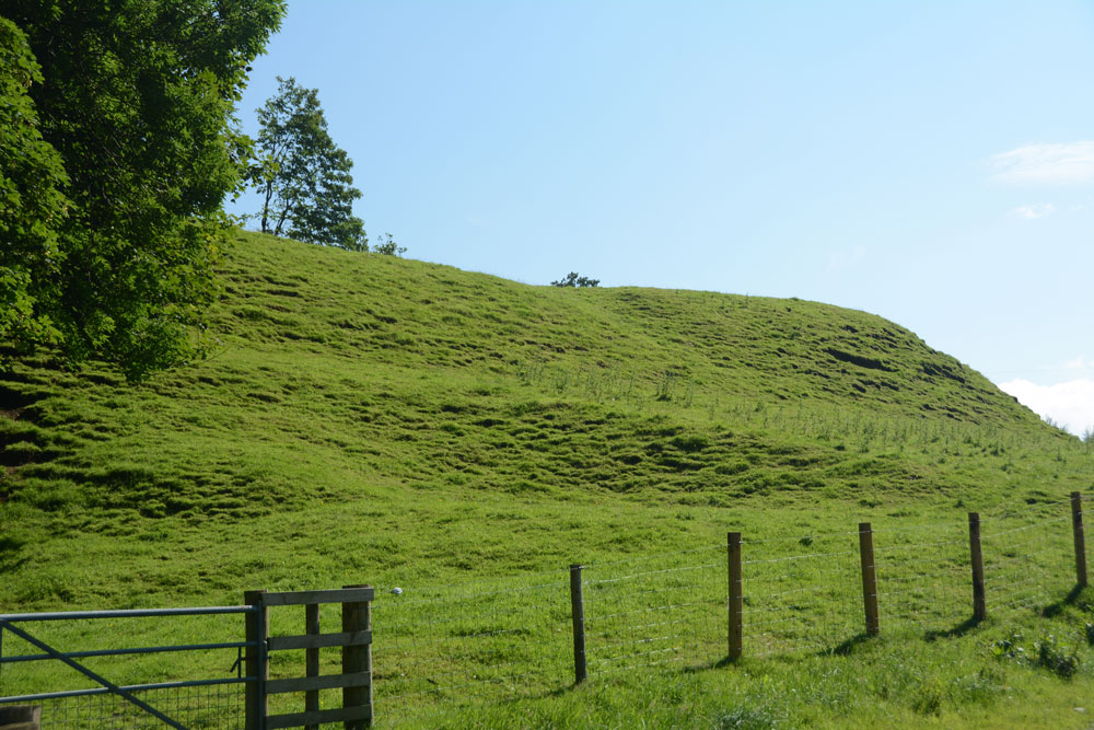
Shielknowe Burn Scooped Settlement submitted by Anne T on 8th Aug 2017. This Scooped Settlement can be seen from Shielknowe Enclosure. Its western most building platform is cut by a modern fence and St. Cuthbert's Way. Photograph taken from the almost ruined Shielknowe Enclosure to the south of Shielknowe Burn.
(View photo, vote or add a comment)
Log Text: Shielknowe Burn Scooped Settlement, Yetholm: This scooped settlement, lying on the northern side of Shielknowe Burn is much easier to see, and is visible from Shielknowe Enclosure, cut by the fence which also cuts the Enclosure. The muddy track from Shielknowe Enclosure runs downhill, crosses the burn, and leads up to join St. Cuthbert’s Way.
Two scooped out areas can be seen, although the farmer had very tightly knotted the twine securing the gate, so whilst Andrew (husband) hopped over the gate, I undid the ‘Gordion Knot’ to get into the settlement. The grass was very tussocky and wet, so walking along the banks of the western most scoop was interesting.
Much more exciting sites to come, so we didn’t spend an awful long time here.
Sheilknowe Burn Enclosure
Trip No.37 Entry No.3 Date Added: 8th Aug 2017
Site Type: Ancient Village or Settlement
Country: Scotland (Scottish Borders)
Visited: Yes on 6th Aug 2017. My rating: Condition 1 Ambience 3 Access 4
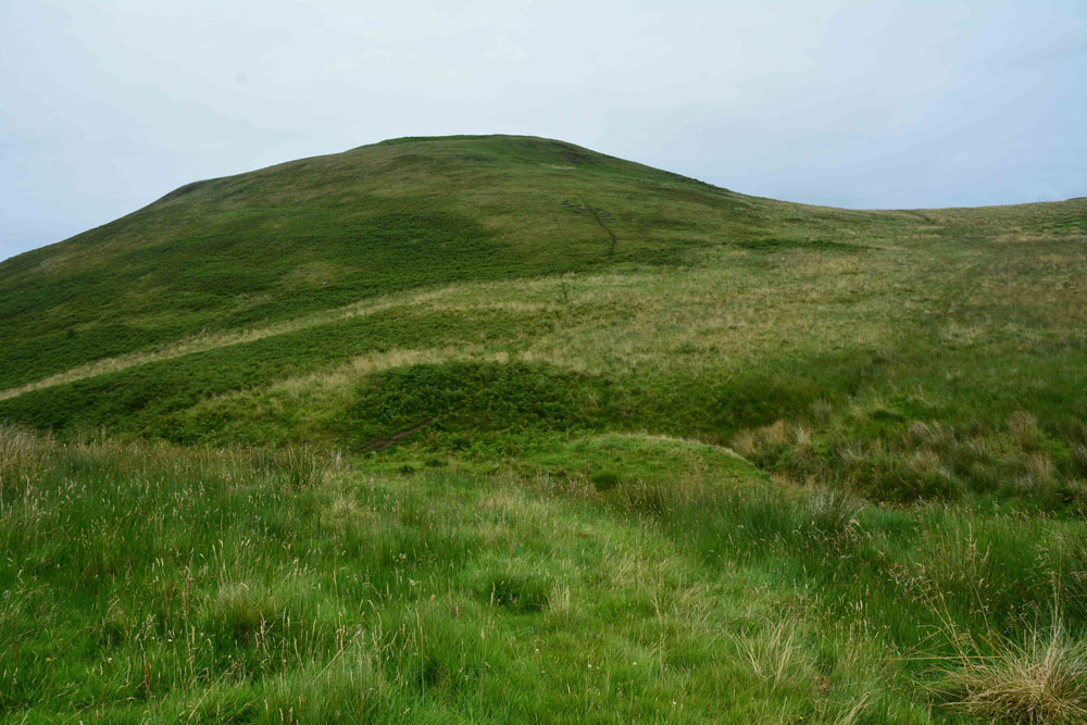
Shielknowe Burn Enclosure submitted by Anne T on 8th Aug 2017. Standing near the fence which cuts across the southern boundary of this horseshoe shaped enclosure, looking towards Shielknowe Burn, part of the land in a small loop of the burn seems to have slipped down. The burn forms the northern most boundary of the settlement. Green Humbleton hillfort is almost in the centre/top of the photograph.
(View photo, vote or add a comment)
Log Text: Shielknowe Enclosure, Yetholm: From the Virtue Well we made our way to Kirk Yetholm, finding the small side road which is actually the Pennine Way, but which can be driven down to a small parking area beside where the Halter Burn and Shielknowe Burn meet. Here a footbridge leads over the Burn, the Pennine Way and St. Cuthbert’s Way meeting at this point.
We tried St. Cuthbert’s Way first of all, running parallel to Shielknowe Burn on it’s eastern side, but after a few hundred yards, came across a rocky outcrop where I would have needed to turn into a mountain goat (OK for my husband, but not for me) so we retreated and walked almost back to the footbridge. There is another mown track which runs on the western side of the stream – boggier but much easier to follow and the sides of the small gorge not quite so precipitous.
It's a good job we had the GPS with us, together with a printed sheet of the Canmore details, otherwise we’d have walked across this settlement without knowing it was there. By finding it’s centre (the south western edge is almost at the corner of the fenced off field containing Shielknowe Burn Scooped Enclosure.
By carefully walking over the area, we could see very slight banks and changes in vegetation, but my goodness, had we not been out with NOWTAG, we would have missed this.
Stob Stones
Trip No.37 Entry No.6 Date Added: 8th Aug 2017
Site Type: Standing Stones
Country: Scotland (Scottish Borders)
Visited: Yes on 6th Aug 2017. My rating: Condition 3 Ambience 4 Access 3

Stob Stones submitted by Anne T on 7th Aug 2017. Whilst the rain lessened for a moment, the hills at the western side of the Bowmont Water Valley came briefly into view!
(View photo, vote or add a comment)
Log Text: Stob Stones, Scottish Borders: From the Green Humbleton Scooped Settlement, by the time we started climbing up towards the Stob Stones, not only was the wind was howling and I was leaning hard into it, but the rain drops were like small pins being driven into my cheeks. I confess to getting a bit fed up and wanting to turn around at this point, but a long-held desire to see these stones kept me going. It was worth it.
Walking over the Stob Rig earthworks (I stopped to photograph these on the way down), the Stob Stones are two standing stones, one now broken and lying prone, sitting on a sort of promontory as the ground to the north and west drops steeply down. Canmore says these stones are at over 1,000 ft above sea level and are situated 230 yards west of the Border. They definitely sit on some kind of mound.
To the west lies the border between England and Scotland, and we walked a 100 metres or so further up the hill, just so we could see the stone wall which makes up the boundary. Tantalisingly, we could see cairns on the adjacent hillside, but being England, different rules for walking (and I was too wet to want to go on).
Stob Rig (Yetholm)
Trip No.37 Entry No.7 Date Added: 8th Aug 2017
Site Type: Misc. Earthwork
Country: Scotland (Scottish Borders)
Visited: Yes on 6th Aug 2017. My rating: Condition 2 Ambience 4 Access 3
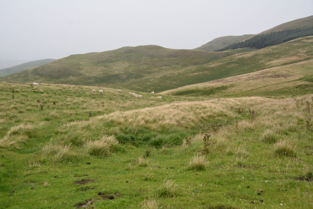
Stob Rig (Yetholm) submitted by Anne T on 7th Aug 2017. This is the eastern most of the banks with a slight ditch on its downhill side. The bank running parallel to it can be seen just on the horizon to the middle-left hand side of the photograph, delineated by the yellow grass growing on the bank.
(View photo, vote or add a comment)
Log Text: Stob Rig Earthworks: On the way up to the Stob Stones from the Pennine Way, there were two really obvious earthworks running in parallel towards the stones and we walked between them to reach the stones. I was keen to try and get out of the wind and the rain (almost impossible in this high, exposed spot) so didn't stop to photograph them.
On the way back down to re-join the Pennine Way, the earthworks were slightly less obvious. With the howling wind and the rain lashed sharply against my cheeks, I was tempted to put the camera safely in the rucksack, but having walked all this way up the hill, I wanted to document them.
In the end, I only managed to photograph the eastern most of the banks; the photos of the western-most had too many raindrops on the camera lens to be of any use.
Virtue Well (Yetholm)
Trip No.37 Entry No.2 Date Added: 7th Aug 2017
Site Type: Holy Well or Sacred Spring
Country: Scotland (Scottish Borders)
Visited: Yes on 6th Aug 2017. My rating: Condition 2 Ambience 2 Access 4
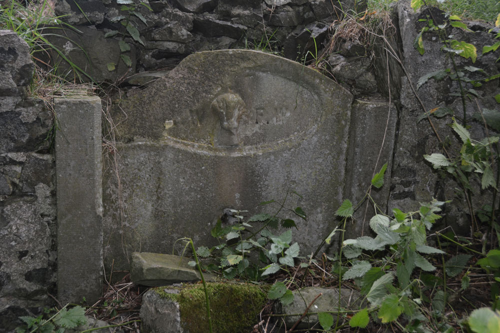
Virtue Well (Yetholm) submitted by Anne T on 7th Aug 2017. Close up of the central panel, showing the basin broken and lying at its base amongst a tumble of stones from the retaining wall.
(View photo, vote or add a comment)
Log Text: Virtue Well, Yetholm: From Venchen Farm Cottages Standing Stone, by the time we drove back down to the west side of the road bridge over Bowmont Water at NT 82132 28576, and parked at a little layby just before the road junction, the rain had eased off a little.
There were two routes up to the well, the first at NT 82128 28603 led up a wet, slippery hill towards a wood, which was rather overgrown. We opted for the footpath proper, starting at NT 82206 28645, with a proper track leading up to Braehouse Farm.
According to UK Grid Reference Finder, the path deviates through the woodland, past the well, but in real life, the track continues straight up to the farm, and we had to tramp through knee high grass through the wood.
Having found this poor little well, I couldn’t but help feel sorry for it. Such a tragedy. It reminded me of the well we’d seen in Middleham – broken up, dry and just part of an old garden wall. At least under the trees we were largely sheltered from the rain.
Venchen Farm Cottages (Town Yetholm)
Trip No.37 Entry No.1 Date Added: 7th Aug 2017
Site Type: Standing Stone (Menhir)
Country: Scotland (Scottish Borders)
Visited: Yes on 6th Aug 2017. My rating: Condition 3 Ambience 3 Access 5
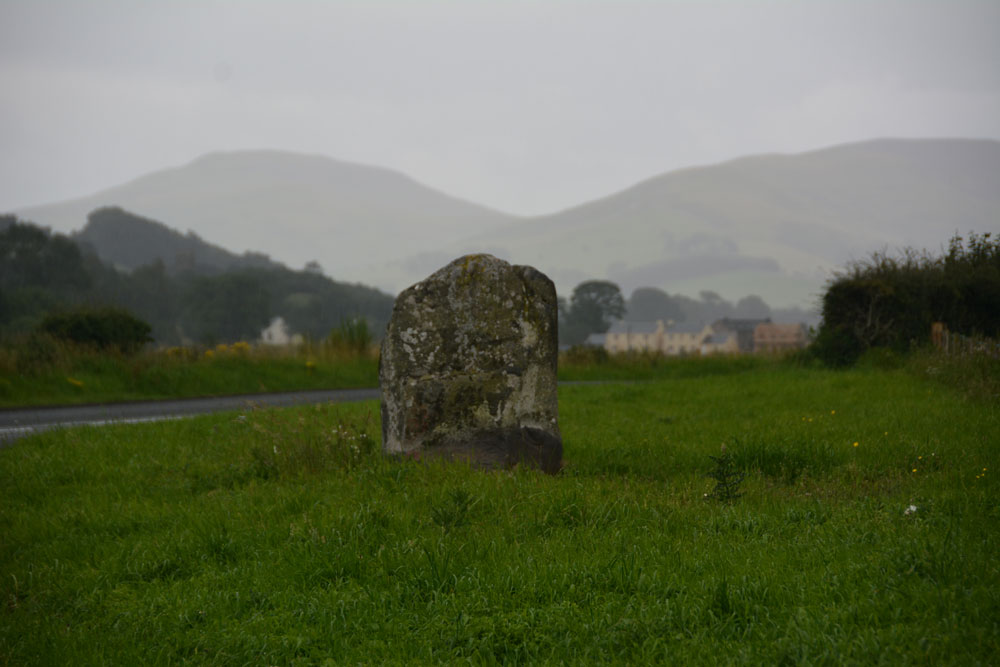
Venchen Farm Cottages (Town Yetholm) submitted by Anne T on 7th Aug 2017. The Venchen Farm Cottages stone, looking south east towards Town Yetholm, over the Bowmont Water Valley. It wasn't raining (much!) when I took this photograph - that's just 'Scotch Mist' in the background.
(View photo, vote or add a comment)
Log Text: Venchen Farm Cottages Standing Stone, Scottish Borders: Having left home to avoid days of damp, rainy weather, we went in search of sunshine and blue skies. The further we travelled up the A68, the more obvious it became that the grey skies got darker the more northerly we got. As we reached Town Yetholm, the heavy raindrops started to fall with the ferocity of hail.
Venchen Farm Cottages are easy enough to find, heading north about 1.6 km north out of the village. This stone looms large out of the grassy verge; at first I thought it was just a village sign. We pulled into a small parking spot just past the stone, nearer to the cottages, by which time it was pelting down even harder and I had the camera covered with kitchen towel and handkerchiefs to keep it dry.
The Canmore notes, which we’d printed off before setting off, said that a hedge had been removed for the stone to be exposed. On UK Grid Reference Finder, the hedge can be seen with the stone tucked away behind it. The grass verge itself didn’t seem to show any signs of disturbance, considering the hedge was only removed in February this year, although the earth around the stone was visible, together with some packing stones and the vegetation along the verge was more weeds than grass.
Difficult to get photographs with the rain, but managed to keep wiping the lens.
Hawick Mote
Trip No.29 Entry No.1 Date Added: 31st Jul 2017
Site Type: Misc. Earthwork
Country: Scotland (Scottish Borders)
Visited: Yes on 3rd Jun 2017. My rating: Condition 3 Ambience 3 Access 5
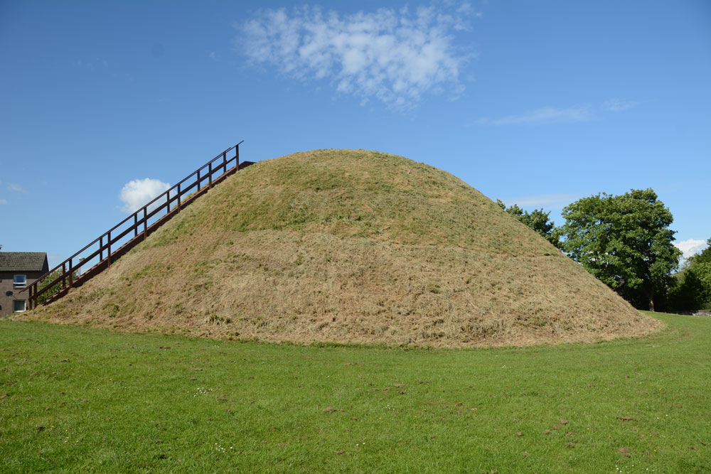
Hawick Mote submitted by Anne T on 27th Jul 2017. The Mote from the south western side, which has a ladder leading to the top of the mote which has an interpretation board.
(View photo, vote or add a comment)
Log Text: Hawick Motte/Mote, Scottish Borders: We arrived in Hawick, intending to buy a map, but the majority of the shops (apart from Dorothy Perkins, the bookmakers, charity shops and 1 café, were closed (looking at the opening times, they largely shut at 2pm on a Saturday. The town seemed deserted apart from a few tourists. We later found out that most local people had gathered near the community centre for the Riding of the Marches.
We couldn’t get a map, so relied on Andrew’s phone with TrigPoint on it. We were on our way to Lord’s Tree Cairn, driving down a street called Loan, when we spotted The Mote, so screeched to a halt by the side of the road and went round to take a photograph.
Quite extraordinary, The Mote is in the middle of a housing estate, with people’s washing hung up nearby. It rises steeply up out of the ground and there is a wooden staircase which takes you to the viewing point at the top. Andrew said it was only as large as our living room – no room for more than 12 people at most. Looking at this on UK Grid Reference Finder, it is located in Moat Park at the Southern end of the town. Plenty of dog walkers, all whom ignored me taking photographs.
The Dod
Trip No.29 Entry No.6 Date Added: 31st Jul 2017
Site Type: Ancient Village or Settlement
Country: Scotland (Scottish Borders)
Visited: Yes on 3rd Jun 2017. My rating: Condition 2 Ambience 4 Access 5
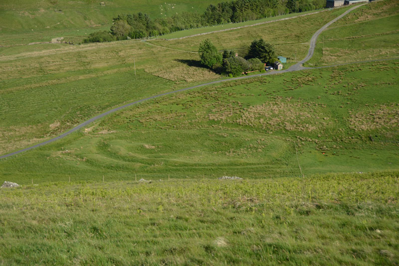
The Dod submitted by Anne T on 5th Jun 2017. The Dod settlement as seen from the slope just to the east of Burgh Hill Stone Circle.
(View photo, vote or add a comment)
Log Text: The Dod, near Bugh Hill Stone Circle and Hillfort: It was amazing what could be seen of this site from the slope just below Burgh Hill Stone Circle. Looking at the plan on Canmore, it is cut in two by the syke by the farm to it's south, but what remains, looking at the settlement from the road, are deep ditches and reasonably high banks.
The area is boggy, but the settlement can be reached by entering the field at its north-eastern end, walking westwards along the fence line next to the gate, then cutting across the field at the far end. For those not keen on boggy ground, a lot can be seen from the road.
Thankfully (after Burgh Hill Hillfort) The Dod was not windy! The sun was very strong at the time of our arrival here, and I struggled to avoid flare even using a polaroid and UV filters together. Was really pleased to have seen this site, but with so many other settlements and hill forts in the area, how to fit them all in? We decided to call it a day, calling in at Midshiels Standing Stone and Cairn on the way back home.
Burgh Hill Hillfort
Trip No.29 Entry No.5 Date Added: 31st Jul 2017
Site Type: Hillfort
Country: Scotland (Scottish Borders)
Visited: Yes on 3rd Jun 2017. My rating: Condition 3 Ambience 5 Access 3
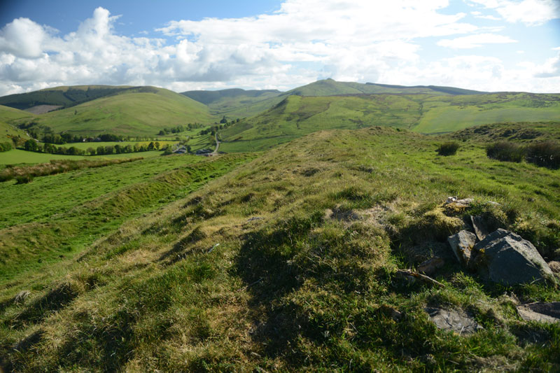
Burgh Hill Hillfort submitted by Anne T on 5th Jun 2017. Standing half way along the eastern upper bank of the fort, looking south west towards the hills beyond.
(View photo, vote or add a comment)
Log Text: Burgh Hill Hillfort, Scottish Borders: What is a 'bit more of a walk' for me is probably a 'short walk on a footpath' for others, but even so, this was a brilliant place to have visited.
With Burgh Hill Stone Circle (or possibly a cairn circle?) not far away, it was worth the additional short trek up to the south west summit of Burgh Hill. Goodness it was windy, although thankfully, as it was a nice warm spring/summer day, the wind was at least warm.
On the western side of the hillfort, the ground (as at Woden Law) dropped away sharply, making me take a quick step backwards to admire the views over the Allan Water valley below.
There are clear internal boundaries/banks/walls and a couple of hut circles, although these didn't come out very clearly on the photographs I took. There was a solitary large (standing) stone which didn't seem to be associated with any internal features.
The double banks and ditches on the south, east and northern sides of the fort were really visible, made of stone and earth, with two clear entrances to the north-east and south-west.
Burgh Hill Stone Circle
Trip No.29 Entry No.4 Date Added: 31st Jul 2017
Site Type: Stone Circle
Country: Scotland (Scottish Borders)
Visited: Yes on 3rd Jun 2017. My rating: Condition 3 Ambience 4 Access 3
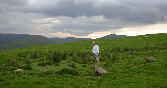
Burgh Hill Stone Circle submitted by nicoladidsbury on 17th Mar 2004.
(View photo, vote or add a comment)
Log Text: Burgh Hill Stone Circle, Hawick: After visiting Lord's Tree and Ca Knowe Cairns, we headed off towards Teviothead and some wild, lonely countryside. There is a track leading up the hill towards the stone circle (and the hill fort beyond), at NT 47365 06725, with parking for 2-3 cars opposite.
Following the track up the (reasonably steep) hill, we took the left hand fork and followed the mowed grassy track towards the stone circle. The circle lies just past the first peak with rocks outcrops to your right, but not as far as the fort. We went past the stones at first, having climbed too high up the hill, but Andrew found a metal pole with a large aluminium star attached to it, presumably marking this as an archaeological site.
Looking at the site on UK Grid Reference Finder, the circle lies in between two small banks running in very shallow arcs. The stones of the circle seem to lie in a dip with a small bank around. It reminded me very much of a cairn circle rather than a stone circle, as none of the stones seemed to be worked in any way, and they were all comparatively small. I note the Canmore record for this site says it's been re-designated a Stone Setting rather than a stone circle.
Having stayed to enjoy the views, and also photograph the Dod settlement from above, we climbed up to the fort, where it was VERY windy (but thankfully the wind was warm).
Midshiels Standing Stone
Trip No.29 Entry No.7 Date Added: 31st Jul 2017
Site Type: Standing Stone (Menhir)
Country: Scotland (Scottish Borders)
Visited: Yes on 3rd Jun 2017. My rating: Condition 3 Ambience 4 Access 4
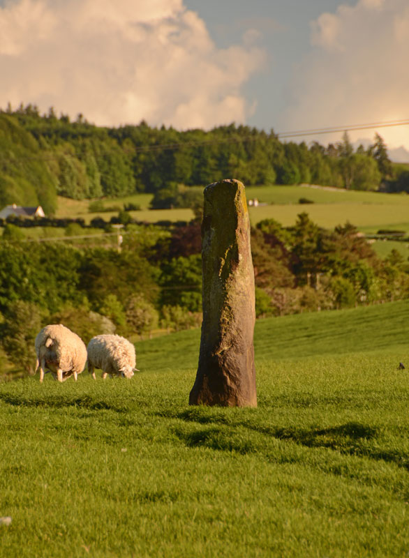
Midshiels Standing Stone submitted by Anne T on 4th Jun 2017. This is the nearest we could get to the standing stone on the evening of our visit. The field was full of quietly grazing sheep but many lively, curious young bullocks. The minute we started to open the gate, they were racing towards us.
(View photo, vote or add a comment)
Log Text: Midshiels Standing Stone, Hawick: We'd arrived (unknowingly) in Hawick on their Riding of the Marches day. The shops were shut and the town was almost deserted. Having visited some other sites on the southern side of Hawick, we decided to stop off to see this standing stone and cairn on the way back home. Following the curious one-way system though Hawick, we ended up on the Borders Abbey Way heading north-east out of the town. At Bucklands, we found where the entire town was - at a community centre at the edge of the town. A marshall stopped us and told us we wouldn't be able to get any further up the road as the procession of horses was coming through. Doubling back through the industrial estate, we took the A698 out of town, turning left over the picturesque Hornshole Bridge, rejoining Borders Abbey Way a few hundred yards before the entrance to Midshiels Farm.
A couple of hundred yards further north-east along the road, there was a large passing place, so we hugged the car into the hedgerow and hopped out. About 50 metres further back, on the other side of the road, a gate let us into the field leading to the dismantled railway embankment to the west. Following the left hand hedge-line along, we came to another gate, just before a tall brick bridge leading under the railway line. This gate gave access to the field with the standing stone and cairn.
However, the field was full of gently grazing sheep and lots of lively, curious bullocks along with what looked like a very large bull. My hand went onto the gate and they were running towards us. I elected to use the zoom lens on the camera, and was really disappointed not to have seen this standing stone closer up. But there is lots to see in this area, so undoubtedly a return visit will be in the offing at some point in the not too distant future.
Ca Knowe (Hawick)
Trip No.29 Entry No.3 Date Added: 31st Jul 2017
Site Type: Cairn
Country: Scotland (Scottish Borders)
Visited: Yes on 3rd Jun 2017. My rating: Condition 2 Ambience 4 Access 4
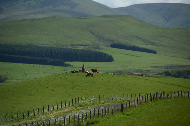
Ca Knowe (Hawick) submitted by Anne T on 4th Jun 2017. Ca Knowe Cairn from Lord's Tree Cairn.
(View photo, vote or add a comment)
Log Text: Ca Knowe Cairn, Hawick (aka Hero's Grave): Simply marked as ‘cairn’ on Trigpointing UK's OS map, we could see this cairn from Lord’s Tree Cairn. There is a proper tarmacked footpath up to the modern standing stone with plaque on it. Closer to, it is much larger than it appears from the mark on the map, and has a proper tarmacked path up to it.
Unfortunately, both on our way to our next site, and our way back to Hawick, the monument was surrounded by a number of very large cows with their calves, so we decided not to risk upsetting them and drove on after having taken some photographs.
Lord's Tree (Hawick)
Trip No.29 Entry No.2 Date Added: 31st Jul 2017
Site Type: Cairn
Country: Scotland (Scottish Borders)
Visited: Yes on 3rd Jun 2017. My rating: Condition 3 Ambience 4 Access 4
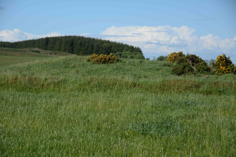
Lord's Tree (Hawick) submitted by Anne T on 4th Jun 2017. Standing at the southern side of the cairn looking up the slight slope to the low mound of the cairn. The circular bank around the cairn clearly visible.
(View photo, vote or add a comment)
Log Text: Lord's Tree Cairn, Hawick: We arrived in Hawick, intending to buy a map, but the majority of the shops (apart from the bookmakers, charity shops and 1 café, were closed (looking at the opening times, they largely shut at 2pm on a Saturday. The town seemed deserted apart from a few tourists. We later found out that most local people had gathered near the community centre for the Riding of the Marches.
Relying upon the Trigpointing UK maps (good job there was a phone signal!), we navigated our way through the town (stopping off to look at The Mote on the way), past the golf course and out into the glorious open countryside with the hills beyond.
This cairn appears as a slight bump at the top of a small rise of a hill; it's unmistakably a large, low cairn, and the lush green grass and wild flowers invited a walk through the meadow towards it.
Completely circular, there is a low bank surrounding the cairn. Shame the old Lord's Tree wasn't there. Lovely view down to Ca Knowe Cairn further south.
Carey Burn (Harthope Valley)
Trip No.36 Entry No.4 Date Added: 31st Jul 2017
Site Type: Ancient Village or Settlement
Country: England (Northumberland)
Visited: Yes on 30th Jul 2017. My rating: Condition 1 Ambience 2 Access 4
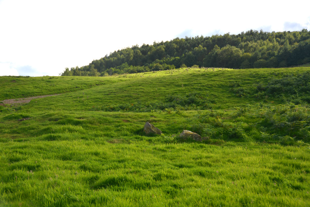
Carey Burn (Harthope Valley) submitted by Anne T on 31st Jul 2017. Looking westwards up Snear Hill to the second scooped settlement, which wasn't marked on the OS map. The western bank of this settlement can be seen running across the middle of the photograph, left to right.
(View photo, vote or add a comment)
Log Text: Carey Burn Votadinian settlement, Harthope Valley: After the beautiful Maiden/Pin Well, I got stuck on a 'precipice' above the Coldgate Burn trying to get to the Romano-British settlements to the west of North Middleton and bottled out (my dreaded fear of falling - I've subsequently found the map showed a low level, apparently straightforward footpath from North Middleton, although it was about a mile either way). After this experience, I need to try and regain my composure.
On the map, just across the road from the footpath we’d tried, and just west of Carey Burn Bridge, a track ran up the hill at NT 97513 24937, just above a currently empty barn. A settlement was shown here. An NNPA footpath ran up the hill, so we opened the gate and followed the path up.
We did find the settlement, but it looked as if a fence had recently been installed along the north western bank, crossing over part of it to the eastern side.
A long, low earth and stone bank about 1 metre tall and 2 metres wide ran parallel to the fence from NT 97353 24907 to NT 97301 24938 then curves around to the Carey Burn at NT 97337 25012. This bank can be seen on UK Grid Reference Finder.
On getting home, I discovered from Pastscape that the settlement we looked at was classed as Votadinian. There is a second settlement, which isn’t marked on the map at NT 97132488, which is further up the hill.
Maiden Well (Kettle Hill)
Trip No.36 Entry No.3 Date Added: 31st Jul 2017
Site Type: Holy Well or Sacred Spring
Country: England (Northumberland)
Visited: Yes on 30th Jul 2017. My rating: Condition 3 Ambience 5 Access 4
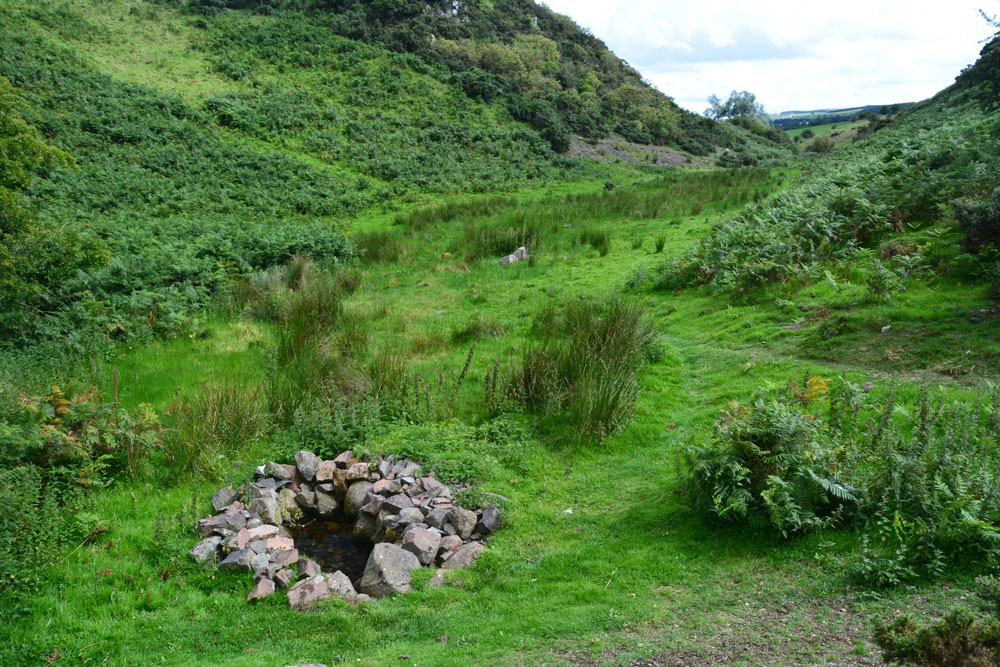
Maiden Well (Kettle Hill) submitted by Anne T on 31st Jul 2017. Standing just north of the well, looking back towards the quarry. The small stream which runs from the well is defined by small groups of stones placed along each side of the water course, together with a lush growth of bracken in the wetter parts of the ground. It's a very enigmatic spot, especially with The Kettles Hillfort rising up above you (to the right, out of sight, in this image).
(View photo, vote or add a comment)
Log Text: Maiden Well and The King's Chair, Wooler: After having walked round the outer perimeter of the promontory of The Kettles, we’d actually stood just above the site of the Maiden Well (Pin Well), but would have needed a rope and harness to descend the vertical cliff down to it. We walked back to the car, drove back into Wooler, then back out again on the road to the tiny (and ancient) hamlet of Earle.
Where the road splits at NT 99100 26973, we took the western fork (right hand if coming from Wooler) and take the track that runs from NT 98924 26750 to a small quarry. Note: the gate to this road is kept padlocked to prevent people taking vehicles up to the quarry, but there are gates for walkers. Husband Andrew hadn’t spotted the gate, so we ended up climbing the fence into the neighbouring field, then back out again!
Just before the main entrance to the quarry a small (overgrown) footpath leads to your left from NT 98808 26845. We followed this for some 300 metres, the nettles eventually giving way to open ground in a small valley/ravine. We first spotted the King's Chair protruding from the hill in front of you, although I was a bit dubious at first as the stone was hidden by lush, tall bracken growing round it from the rock face. Walking further forward the well is hidden under a hawthorn tree.
The well is in a lovely, enigmatic location. It looks as if someone has recently created this lovely circular ‘halo’ of stone around the clear water. A stone a metre of so to it’s north west has a hole at its base. Glimpsing down, I could see the water running into the well pool.
A small stream runs out of the well pool. The water course is marked by groups of stones leading back towards the entrance to the quarry, on either side of the small stream, which is also marked by lush grass and bracken growing on either side of it. I walked up a little way to look at various groups of stones, to find parts of the ground boggy and heavy with water.
With The Kettles rising up above you to the east, this is a really nice spot. I could have lingered longer, but 4-5 Romano-British settlements called. Time to move on.
The Kettles (Wooler)
Trip No.36 Entry No.2 Date Added: 31st Jul 2017
Site Type: Hillfort
Country: England (Northumberland)
Visited: Yes on 30th Jul 2017. My rating: Condition 3 Ambience 5 Access 4
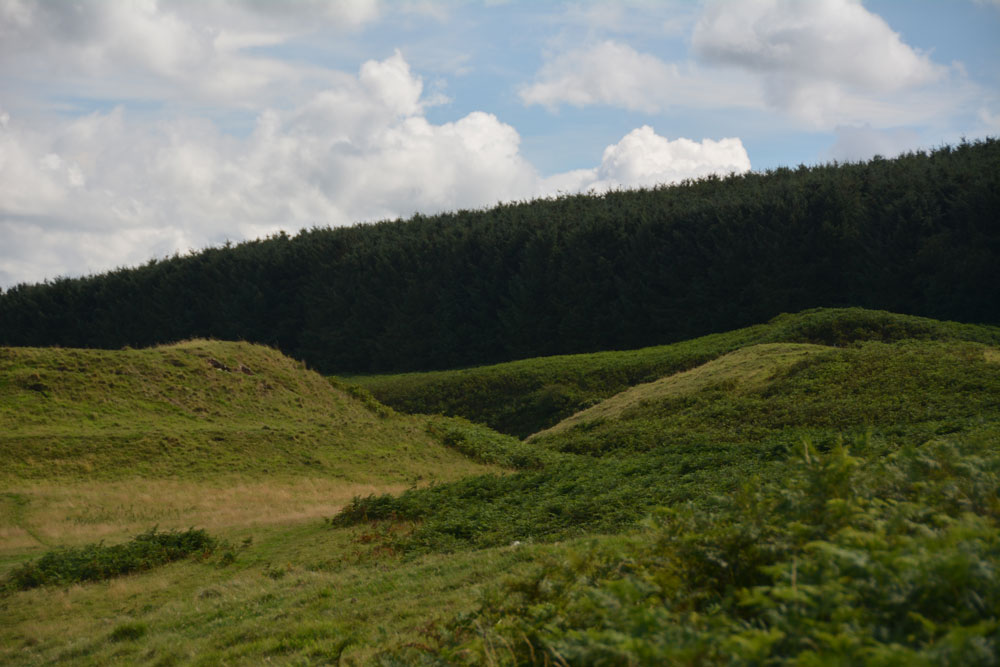
The Kettles (Wooler) submitted by Anne T on 31st Jul 2017. Getting closer to the rampart and ditch on the north western edge of the hillfort. The banks stand really tall, with steep sides, with an earth and stone construction.
(View photo, vote or add a comment)
Log Text: The Kettles Hillfort, Wooler: From Green Castle, we continued along the track leading first south west up the small hill, then turns south east along the top of the promontory. Our GPS told me there was just over 511 metres to walk from the small parking area to the grid reference given by Pastscape, but it seemed a lot less than this.
The paths are well kept, as on the Breamish Valley trails, with low, mown grass which is soft underfoot and easy to walk. As we walked along the promontory, the northern section of ramparts came into view. As we got closer, it became obvious how large these were.
Paths lead up into round the exterior edges of the hillfort. There are bracken and scree covered valleys on either side. The first thing we came across were some strange concrete blocks and what looked like the tiled remains of an old toilet at approx. NT 98398 27352, but then there are the recorded remains of pillboxes in this area, so must have been used for military training during the last war.
As we walked along, we crossed three distinct banks which had been cut by the paths, which are the three ramparts (in places four) that cut the fort into two. Walking past the fourth rampart, it felt as it had on Little Hill in the Scottish Borders, as if I was on the prow of a ship looking down across the land below. Crossing to the eastern side of the fort, at this point, we were almost directly above Maiden Well and the King’s Chair. To reach these, we would have need climbing equipment to abseil down, so we walked back to the car and drove round to the path leading to The Pin Well.
Looking at the aerial images on UK Grid Reference Finder, the outline of the fort is clearly visible.
Green Castle Ringwork
Trip No.36 Entry No.1 Date Added: 31st Jul 2017
Site Type: Misc. Earthwork
Country: England (Northumberland)
Visited: Yes on 30th Jul 2017. My rating: Condition 2 Ambience 3 Access 5
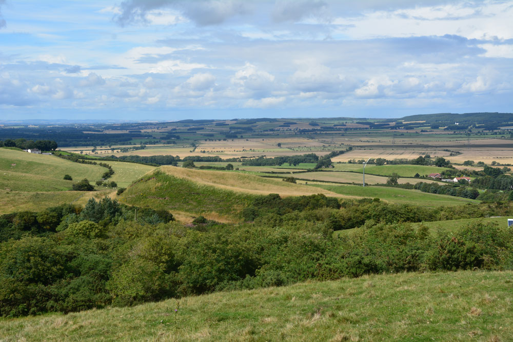
Green Castle Ringwork submitted by Anne T on 31st Jul 2017. Climbing (sorry, walking!) up the track from the small parking area near the cattle grid to Wooler Common, we got a good view of the mound from the top. It looks distinctly saucer shape, hence the Cup and Saucer name.
(View photo, vote or add a comment)
Log Text: Green Castle Ringwork, Wooler: After having stopped off at the ‘usual café’ in Wooler for refreshments, we headed off towards Wooler Common, from the High Street taking Ramsey Lane which becomes Common Road.
At NT 98195 27735 there is a small parking area, where a footpath leads south westerly up and over the Common. From here, the Ringwork looks like part of a giant rubbish tip, with its south and western sides protruding up over the hedgerow like a giant green triangle. Given that to it’s south east there is a huge area for storing skips, it looks at first sight as if the mound is used for a rubbish dump, but it’s not.
There is no access into the field the ringwork sits in (gates are padlocked, and the only gate that opened (immediately opposite the parking area) led down to a wooded area and small ravine.
We actually got a good view of what looks like a ‘Refresher’ sweet by walking up the path towards The Kettles. From here, even the stones in the south western side, where the mound has been eroded, are visible, together with a short section of ditch.
I didn’t spot the telephone wire snaking across the photograph until I loaded it onto my computer.
Barntalloch (Langholm)
Trip No.35 Entry No.1 Date Added: 27th Jul 2017
Site Type: Misc. Earthwork
Country: Scotland (Scottish Borders)
Visited: Yes on 24th Jul 2017. My rating: Condition 2 Ambience 3 Access 5
Barntalloch (Langholm) submitted by Anne T on 27th Jul 2017. First view of the motte as we took the south westerly track through the farmyard.
(View photo, vote or add a comment)
Log Text: Barntalloch Motte, Staplegordon, Langholm: It was dull and very wet at our house, and fed up of the rain, we decided to head off to the Scottish Borders for some sunny, 25 deg C weather. Landing in Langholm by 2.30pm, we stopped off for coffee and cake before heading off into the wilds of Eskdale.
I spotted this site on the map, just west of Langholm, down a small road leading to a hamlet called Staplegordon. It caught my eye because it not only had the motte but the remains of a chapel. I like looking around the gravestones.
We parked in what looked like a parking area for fishermen to the right of the far side of the bridge. There is actually another car park by the farm nearer to the motte. There are posts indicating the routes of different Langholm Walks.
Just past the farm to the left of the bridge, the track splits at NY 35445 87796. The northern section leads down to the old graveyard and a bungalow (looks like the chapel was converted into a dwelling). A track led through another farmyard to our left which curls to the south west, around the side of the motte.
The lady farmer roared up on her quad bike and stopped to say hello. She didn’t seem to mind us tramping through her farmyard, but wasn’t very forthcoming. When I got home and did some research on Canmore, I found out that the old chapel was supposed to have an inscribed stone. We didn’t walk down there as we couldn’t see a way of reaching the churchyard except through the main gate of the cottage.
Little Hill (Craig)
Trip No.35 Entry No.2 Date Added: 26th Jul 2017
Site Type: Hillfort
Country: Scotland (Scottish Borders)
Visited: Yes on 24th Jul 2017. My rating: Condition 2 Ambience 4 Access 4

Little Hill (Craig) submitted by Anne T on 26th Jul 2017. Standing in the middle of the entrance to the northern side of the hillfort looking more or less north over the Esk Valley below. There is an old hollow way which curves down to the modern road below.
(View photo, vote or add a comment)
Log Text: Little Hill Hillfort, Craig, Scottish Borders: This might be a 'short walk on a footpath', but it was a steady climb! After visiting Barntalloch Castle, we could see no way of getting into the old churchyard nearby, as it looked as if the building had been converted into a house. Mistake not to try, as Canmore said there was an inscribed stone.
We drove onto Little Hill, stopping to take a photograph of Barntalloch from a layby on the B709. The River Esk looks glorious sparkling in the sunshine with its loops and cobble banks.
There is a footpath/track leading up to Little Hill hillfort from just before the bend at Craig at NY 33656 88271, where there was room to tuck the car in at its junction with the road. There has been lots of activity with telegraph poles in this area, with lots of spare ones lying around; in fact climbing up the hill they got in the way of the view over to the west until we got above them. Craig Hill to the south of Little Hill looms large and dominates the scenery; there is also a settlement on its lower slopes south of Little Hill, although we didn’t spot this on the climb up.
We left the stony track up the hill and followed what seemed to be a hollow way up to the fort, approaching this from its north western side where I spotted the well at NY 33858 88237, next to a cattle feeder.
This is a lovely spot with its flower meadows and virtually 360 degree views. There don’t seem to be any features in the interior, or at least we didn’t see them as the grass was so lush. Andrew thought he saw a couple of roundhouses, due to the change in vegetation, but I thought it was a bit of a stretch, but there were two circular areas that were slightly scooped and had less wild flowers within them.
I walked down to the south western (stem end of the pear) end of the fort, which is slightly separated from the rest of the fort by a dip, effectively splitting the fort in two.
On the way back down we stopped to photograph the entrance at the northern end of the fort. From here we could see the racing tracks of the race horse training stables in the valley below. There was also a line of stones running from approx.. NY 33920 88223 to NY 33978 88200 near the road also seems to follow the line of a water course. If you plot the points of the well and these stones, they seem to follow a straight line. Some of the taller stones also hide springs.
A lovely walk and well worth stopping. The views on a sunny, warm day like today were lovely. As I keep repeating, our ancestors chose some very nice places to live.
Newhall Hill (Paddockhole)
Trip No.35 Entry No.3 Date Added: 26th Jul 2017
Site Type: Ancient Village or Settlement
Country: Scotland (Scottish Borders)
Visited: Yes on 24th Jul 2017. My rating: Condition 2 Ambience 4 Access 3

Newhall Hill (Paddockhole) submitted by Anne T on 26th Jul 2017. First glimpse of Settlement B which is the lower of the two settlements on Newhall Hill. There is a massive earthen bank with a deep outer ditch. The curving banks make it look round, but it is fact rectangular with rounded edges. This photo looks over the entrance in the south east.
(View photo, vote or add a comment)
Log Text: Newhall Hill Settlements, near Paddockhill, Scottish Borders: From Little Hill, we thought we’d stop off at Balliehill Hillfort again, but driving up to it, it was covered in enormous cattle grazing contentedly within it. Taking one look, we decided to press onto Newhall Farm. Following the minor road that runs alongside the western bank of the Water of Milk, we enjoyed the views down the valley. Reaching Paddockhill, we turned right, then immediately right again, over Paddockhill Bridge and followed the road through Newhall Farm to a small bridge hidden between the trees. We couldn’t see the burn as it was being used as a dump for old industrial pipes and equipment, fencing and telegraph poles, but just before the bridge was a small area which had been hard-cored, so we parked there. The gate to the two tracks leading up Newhall Hill was just behind us. Taking the right hand track, we plodded up this steeper-than-it-looked hill. Would it never end??
Eventually the track ran out and we set off across the pasture to find the settlements. I heard the noise of a quad bike and the farmer appeared, with this two dogs, over the top of a hill, screeching to a halt in front of me. I thought he was going to hit me, so took a large backwards step, but he stopped in time. “Nearer to heaven here’ he said and pointed to all the wind farms surrounded the hill. “Don’t think they do any harm, do they?” he added. I put my hand out to stroke one of the dogs and the farmer barked at me: “Don’t! He’ll have your hand off.” He told us the settlements were just over the next small brow on the hill, said he lived at the small farm yonder rather than the big one down in the valley below that we could see, then hared off at great speed with both dogs balancing on the back of the quad bike.
Two hundred yards further on, a deep ditch and large bank of Settlement B came into view, complete with eyesore of a very large quarry beyond.
I walked all round the outer bank of the lower settlement, then went into the inside. Apart from a very boggy part, which looked like it might have been a well at some point, we couldn’t make out any features internally.
I would have liked to have walked up the hill to Settlement A but the heads and bodies of some very lively bullocks kept watching us. I didn’t fancy being surrounded by them, so we decided to walk back down to the car.
We would have ended up at the Severn Brethren stone circle, but as we neared it, realised we’d been here before, and it was very unremarkable.
