Contributory members are able to log private notes and comments about each site
Sites Anne T has logged. View this log as a table or view the most recent logs from everyone
Haystack Hill (Ingram)
Trip No.34 Entry No.3 Date Added: 21st Jul 2017
Site Type: Ancient Village or Settlement
Country: England (Northumberland)
Visited: Yes on 18th Jul 2017. My rating: Condition 2 Ambience 4 Access 3
Haystack Hill (Ingram) submitted by SolarMegalith on 16th Mar 2013. Remains of a stone wall - view from the NE (photo taken on March 2013).
(View photo, vote or add a comment)
Log Text: Haystack Hill Settlement Complex, Ingram, Northumberland: Having stopped off at North Haystack Hill, it was getting hot by this point, although there was a pleasant breeze. The path was levelling out now and there was an electric fence to our left hand side. Where this had dropped down to the grass at one point, we made our way across to the gate at the north western part of the field. The ground here was very boggy, descending into deep puddles at various points, so we picked our way around. A sign on the gate said ‘end of access land’ although there is a permissive footpath around the edge of the field leading into the south western corner of this complex settlement.
This site is huge. I wish I’d printed off an aerial photograph to take with me, so I could have understood it better – a good excuse for a return visit.
We first explored the rectangular enclosure with its row of hut circles in, then made our way between the B2 (the southern most of the two B enclosures) and C.
Wow. Although deep in bracken, it was still possible to make out tall banks and circular features I felt very priviledged to have come here, as I did at Burdhope last week. A brilliant, brilliant site. With the other hillforts all around, it was very atmospheric.
Beanley Moor Enclosure
Trip No.34 Entry No.4 Date Added: 22nd Jul 2017
Site Type: Ancient Village or Settlement
Country: England (Northumberland)
Visited: Yes on 18th Jul 2017. My rating: Condition 1 Ambience 2 Access 4

Beanley Moor Enclosure submitted by Anne T on 22nd Jul 2017. The robbed out rampart can be seen as a shallow double ditch in the south west of the enclosure. This location has lovely views down to the River Breamish valley.
(View photo, vote or add a comment)
Log Text: Beanley Moor Iron Age Defended Settlement, Northumberland: We had an abortive attempt to find the Fawdon Cross Base at NU 0281 1591 (nowhere anywhere nearby to park) and Beanley Plantation Hillfort. The tracks to the latter were either waterlogged (husband said we needed diving equipment – a slight exaggeration, I think!), although we could have tried from the paths through the forest from the south (but didn’t). We then made our way to the Beanley Moor settlement/enclosure just to its north. This is a short hop up the field. There is a path leading up the slope (it’s all access land here) which brings you to the southern edge of the enclosure, although having spotted a slight bank popping up out of the grass, we made a more direct bee-line up the slope.
Curious how the landscape has changed in just a few miles. The area is completely sandy – like a beach, which it must have been at one point in the dim and distant path, although higher up the slope it becomes more of a loam.
Very, very little remains of this possible Iron Age settlement, although there was enough left of two parallel shallow ditches for us to follow their line round in a circle. Thought we spotted a possible entrance in the south west of the enclosure, a possible roundhouse partly built into the bank (although heavily disguised by tussocks and bracken in parts) and a hollow way leading north-west/south-east along the north eastern edge of the settlement, leading up to the Beanley Plantation Hillfort.
Brilliant views down to the River Breamish Valley, but that’s as much as can be said for this site. Glad we stopped off, though.
Green Castle Ringwork
Trip No.36 Entry No.1 Date Added: 31st Jul 2017
Site Type: Misc. Earthwork
Country: England (Northumberland)
Visited: Yes on 30th Jul 2017. My rating: Condition 2 Ambience 3 Access 5
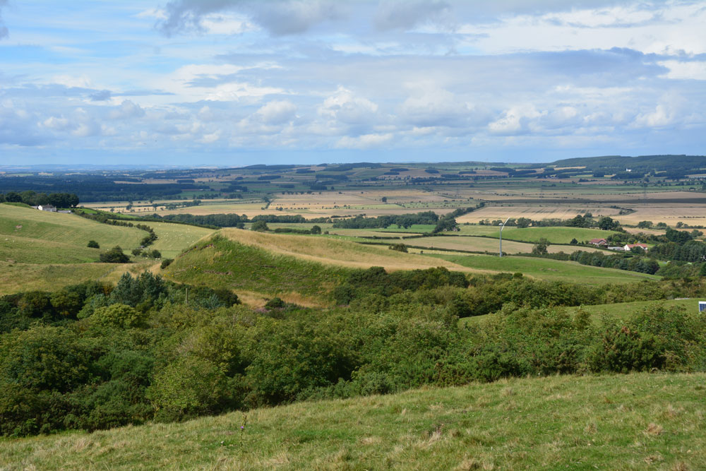
Green Castle Ringwork submitted by Anne T on 31st Jul 2017. Climbing (sorry, walking!) up the track from the small parking area near the cattle grid to Wooler Common, we got a good view of the mound from the top. It looks distinctly saucer shape, hence the Cup and Saucer name.
(View photo, vote or add a comment)
Log Text: Green Castle Ringwork, Wooler: After having stopped off at the ‘usual café’ in Wooler for refreshments, we headed off towards Wooler Common, from the High Street taking Ramsey Lane which becomes Common Road.
At NT 98195 27735 there is a small parking area, where a footpath leads south westerly up and over the Common. From here, the Ringwork looks like part of a giant rubbish tip, with its south and western sides protruding up over the hedgerow like a giant green triangle. Given that to it’s south east there is a huge area for storing skips, it looks at first sight as if the mound is used for a rubbish dump, but it’s not.
There is no access into the field the ringwork sits in (gates are padlocked, and the only gate that opened (immediately opposite the parking area) led down to a wooded area and small ravine.
We actually got a good view of what looks like a ‘Refresher’ sweet by walking up the path towards The Kettles. From here, even the stones in the south western side, where the mound has been eroded, are visible, together with a short section of ditch.
I didn’t spot the telephone wire snaking across the photograph until I loaded it onto my computer.
The Kettles (Wooler)
Trip No.36 Entry No.2 Date Added: 31st Jul 2017
Site Type: Hillfort
Country: England (Northumberland)
Visited: Yes on 30th Jul 2017. My rating: Condition 3 Ambience 5 Access 4
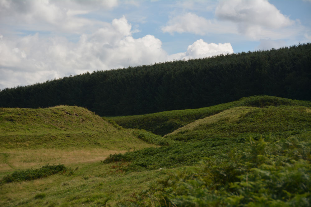
The Kettles (Wooler) submitted by Anne T on 31st Jul 2017. Getting closer to the rampart and ditch on the north western edge of the hillfort. The banks stand really tall, with steep sides, with an earth and stone construction.
(View photo, vote or add a comment)
Log Text: The Kettles Hillfort, Wooler: From Green Castle, we continued along the track leading first south west up the small hill, then turns south east along the top of the promontory. Our GPS told me there was just over 511 metres to walk from the small parking area to the grid reference given by Pastscape, but it seemed a lot less than this.
The paths are well kept, as on the Breamish Valley trails, with low, mown grass which is soft underfoot and easy to walk. As we walked along the promontory, the northern section of ramparts came into view. As we got closer, it became obvious how large these were.
Paths lead up into round the exterior edges of the hillfort. There are bracken and scree covered valleys on either side. The first thing we came across were some strange concrete blocks and what looked like the tiled remains of an old toilet at approx. NT 98398 27352, but then there are the recorded remains of pillboxes in this area, so must have been used for military training during the last war.
As we walked along, we crossed three distinct banks which had been cut by the paths, which are the three ramparts (in places four) that cut the fort into two. Walking past the fourth rampart, it felt as it had on Little Hill in the Scottish Borders, as if I was on the prow of a ship looking down across the land below. Crossing to the eastern side of the fort, at this point, we were almost directly above Maiden Well and the King’s Chair. To reach these, we would have need climbing equipment to abseil down, so we walked back to the car and drove round to the path leading to The Pin Well.
Looking at the aerial images on UK Grid Reference Finder, the outline of the fort is clearly visible.
Maiden Well (Kettle Hill)
Trip No.36 Entry No.3 Date Added: 31st Jul 2017
Site Type: Holy Well or Sacred Spring
Country: England (Northumberland)
Visited: Yes on 30th Jul 2017. My rating: Condition 3 Ambience 5 Access 4
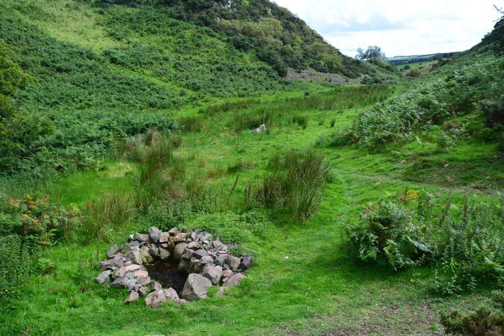
Maiden Well (Kettle Hill) submitted by Anne T on 31st Jul 2017. Standing just north of the well, looking back towards the quarry. The small stream which runs from the well is defined by small groups of stones placed along each side of the water course, together with a lush growth of bracken in the wetter parts of the ground. It's a very enigmatic spot, especially with The Kettles Hillfort rising up above you (to the right, out of sight, in this image).
(View photo, vote or add a comment)
Log Text: Maiden Well and The King's Chair, Wooler: After having walked round the outer perimeter of the promontory of The Kettles, we’d actually stood just above the site of the Maiden Well (Pin Well), but would have needed a rope and harness to descend the vertical cliff down to it. We walked back to the car, drove back into Wooler, then back out again on the road to the tiny (and ancient) hamlet of Earle.
Where the road splits at NT 99100 26973, we took the western fork (right hand if coming from Wooler) and take the track that runs from NT 98924 26750 to a small quarry. Note: the gate to this road is kept padlocked to prevent people taking vehicles up to the quarry, but there are gates for walkers. Husband Andrew hadn’t spotted the gate, so we ended up climbing the fence into the neighbouring field, then back out again!
Just before the main entrance to the quarry a small (overgrown) footpath leads to your left from NT 98808 26845. We followed this for some 300 metres, the nettles eventually giving way to open ground in a small valley/ravine. We first spotted the King's Chair protruding from the hill in front of you, although I was a bit dubious at first as the stone was hidden by lush, tall bracken growing round it from the rock face. Walking further forward the well is hidden under a hawthorn tree.
The well is in a lovely, enigmatic location. It looks as if someone has recently created this lovely circular ‘halo’ of stone around the clear water. A stone a metre of so to it’s north west has a hole at its base. Glimpsing down, I could see the water running into the well pool.
A small stream runs out of the well pool. The water course is marked by groups of stones leading back towards the entrance to the quarry, on either side of the small stream, which is also marked by lush grass and bracken growing on either side of it. I walked up a little way to look at various groups of stones, to find parts of the ground boggy and heavy with water.
With The Kettles rising up above you to the east, this is a really nice spot. I could have lingered longer, but 4-5 Romano-British settlements called. Time to move on.
Carey Burn (Harthope Valley)
Trip No.36 Entry No.4 Date Added: 31st Jul 2017
Site Type: Ancient Village or Settlement
Country: England (Northumberland)
Visited: Yes on 30th Jul 2017. My rating: Condition 1 Ambience 2 Access 4
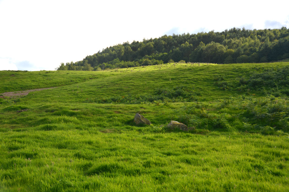
Carey Burn (Harthope Valley) submitted by Anne T on 31st Jul 2017. Looking westwards up Snear Hill to the second scooped settlement, which wasn't marked on the OS map. The western bank of this settlement can be seen running across the middle of the photograph, left to right.
(View photo, vote or add a comment)
Log Text: Carey Burn Votadinian settlement, Harthope Valley: After the beautiful Maiden/Pin Well, I got stuck on a 'precipice' above the Coldgate Burn trying to get to the Romano-British settlements to the west of North Middleton and bottled out (my dreaded fear of falling - I've subsequently found the map showed a low level, apparently straightforward footpath from North Middleton, although it was about a mile either way). After this experience, I need to try and regain my composure.
On the map, just across the road from the footpath we’d tried, and just west of Carey Burn Bridge, a track ran up the hill at NT 97513 24937, just above a currently empty barn. A settlement was shown here. An NNPA footpath ran up the hill, so we opened the gate and followed the path up.
We did find the settlement, but it looked as if a fence had recently been installed along the north western bank, crossing over part of it to the eastern side.
A long, low earth and stone bank about 1 metre tall and 2 metres wide ran parallel to the fence from NT 97353 24907 to NT 97301 24938 then curves around to the Carey Burn at NT 97337 25012. This bank can be seen on UK Grid Reference Finder.
On getting home, I discovered from Pastscape that the settlement we looked at was classed as Votadinian. There is a second settlement, which isn’t marked on the map at NT 97132488, which is further up the hill.
Ad Gefrin
Trip No.37 Entry No.9 Date Added: 28th Aug 2017
Site Type: Ancient Palace
Country: England (Northumberland)
Visited: Yes on 6th Aug 2017. My rating: Condition 1 Ambience 4 Access 5
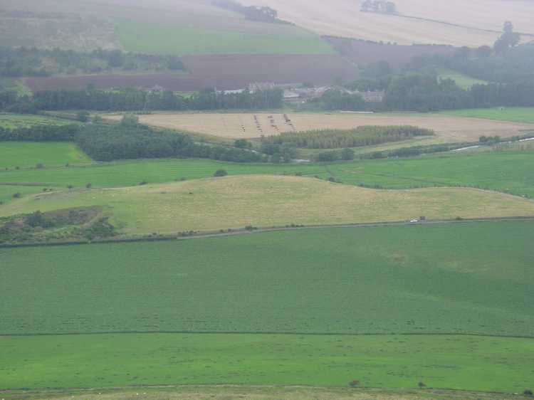
Ad Gefrin submitted by PaulH on 13th Mar 2003. Yeavering Bell hill fort
View of Ad Gefrin at NT926305
At the foot of Yeavering Bell is the site of probably the most impaces dating from the seventh century. The palace, Ad Gefrin, (the place of the goats) was one of the homes of King Edwin of Northumbria, whose name was given to another town - 'Edwin's Burgh', now known as Edinburgh.
It was at Ad Gefrin that St Paulinus baptised 3000 Northumbrians in 627 AD, just about twenty-five years prior to St Cuthbert's entry into Melrose Abbey.
(View photo, vote or add a comment)
Log Text: Ad Gefrin, Northumberland (near Yeavering): Trying to dry out from the walk to the Stob Stones, we decided to go back via Wooler and the A687 rather than back down the A68, passing Yeavering Bell on our way. Driving north, I was surprised to find we re-entered England from Scotland, back into Northumberland National Park. As we drove through Kirknewton, this ‘stone bus shelter’ and unusual gate posts caught my eye and we screeched to a halt.
I was amazed that we’d never heard of this site at all, and I read the interpretation board, then walked into the field to look at the other board. In front of me there was nothing but tall, yellow grass, with a faint darker green line where a narrow track ran along the edge of the field.
There was nothing on the interpretation board to tell us where about on the site we were. Seeing that the site spread across the road, I crossed and peered into the field. This, of course, now being England, I couldn’t just let myself into the field and wander around.
There being an excellent 4G signal here, I pulled up the Gefrin website and was really surprised to find this site described as the most evocative archaeological sites in Northumberland and also one of the most remarkable archaeological discoveries of the 20th century.
If I hadn’t been so wet and tired after a long day out, I’d have walked round the fields. As it was, we decided to return home, do some investigation and return to the site another day (adding to our ever growing list of ‘want to see’ sites).
Bendor Stone
Trip No.41 Entry No.1 Date Added: 27th Aug 2017
Site Type: Standing Stone (Menhir)
Country: England (Northumberland)
Visited: Yes on 26th Aug 2017. My rating: Condition 3 Ambience 4 Access 5
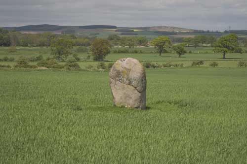
Bendor Stone submitted by kelpie on 16th May 2004. Standing stone found at NT96814 29428. Clearly visible from the road this stone is also known as The Battle stone as it is associated with the Battle of Homildon Hill in 1402, however, the stone itself was likely to have been erected in the Bronze Age.
(View photo, vote or add a comment)
Log Text: The Battle Stone, Bendor: The A697 was busy with holiday traffic today, and with a longish walk ahead of us, we stopped off in a very busy Wooler for refreshments, we headed off towards Kilham and Ring Chesters. As we whizzed along the A697 westwards, I spotted this stone standing in the middle of a field to the north of the road. Husband immediately turned right down the minor road leading to Bendor, a small hamlet just off the road. There was no parking here, just large private forecourts and it seemed the whole village was standing round talking, swinging round to look at us as we turned the car around.
Andrew had spotted a very narrow gateway which sloped down to the gate into the field at NT 96838 29400; this was litter-strewn and not suitable to take the car down. Pulling as far off the road as he could, I took the opportunity to clamber out and walk down to the gate. There was nothing in the field apart from a few curious sheep. Andrew said it was too dangerous to get out of the car, so I did something I wouldn’t normally do and let myself into the field and walked the 20 metres or so to the stone, telling myself if someone noticed me I’d ask permission.
Quickly taking photographs, particularly one with Yeavering Bell in the background (a bit difficult as the light was brightest in that direction and the camera was compensating), I headed back to the car and we turned around ready to resume our journey to Kilham.
Battle Stone (Kirknewton)
Trip No.41 Entry No.2 Date Added: 27th Aug 2017
Site Type: Standing Stone (Menhir)
Country: England (Northumberland)
Visited: Yes on 26th Aug 2017. My rating: Condition 3 Ambience 4 Access 4
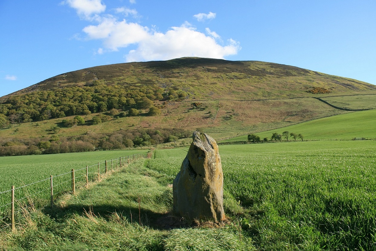
Battle Stone (Kirknewton) submitted by Postman on 14th Jun 2017. With Yeavering bell as backdrop, one day I'll get up there too.
(View photo, vote or add a comment)
Log Text: Battle Stone, Kirknewton: This was our second unscheduled stop of the day, and one I was very pleased to have made.
Having turned off the A697 onto the B6351, just before the site of Ad Gefrin to the west, I spotted this stone on the OS map. Goodness knows how I’d missed it before, but then it’s a tiny little dot right on the edge of two maps we were using (OL16 and 339).
The stone is in a large field just under the shadow of Yeavering Bell, which glowed purple with the heather. There is a largish entrance to the field, hard-cored over, but the field was covered in ripening wheat. We could see the stone from afar and managed to follow the tractor path to about 8 metres away.
The stone had very different shapes, depending on what angle we viewed it at. Looking at the Historic England notes when we got back home, discovered that there are the remains of Old Yeavering Henge, which is preserved as a cropmark and lies 150m to the WNW, so it would be interesting to go back next spring, when the crop has been harvested and the field might be under grass.
We continued along the B6351 towards Kilham and Ring Chesters.
Ring Chesters
Trip No.41 Entry No.5 Date Added: 27th Aug 2017
Site Type: Hillfort
Country: England (Northumberland)
Visited: Yes on 26th Aug 2017. My rating: Condition 3 Ambience 5 Access 3

Ring Chesters submitted by Creative Commons on 21st Dec 2011. Ring Chesters hillfort. Copyright Andrew Curtis (http://www.geograph.org.uk/profile/32242), re-used under Creative Commons licence.
(View photo, vote or add a comment)
Log Text: Ring Chesters, Elsdonburn Shank: This was a relatively long walk. Having parked at Thompsons Wall Farm (NT 86817 30529), we took the tarmacked footpath up to Elsdonburn Shank farm (discussed farmhouse but the land is still farmed) and neatly kept.
Just before the barn at Elsdonburn Shank, we diverted down the footpath to (an un-named burn) where there is a gate leading to the small stream with stones placed to step across. From here, it is uphill towards the north and south ‘villages’, with large boulders punctuating the path. Having left the villages, there is a reasonably steep climb 160 metres or so up to the start of Ring Chesters Hillfort.
The black clouds had been gathering all afternoon, and as soon as my foot touched the second ring of the hillfort, the wind began to howl and raindrops stung my face. A lot of my photographs have rain splatter across them, despite constantly wiping the lens. Although the wind was strong and it was raining, it was still warm and I was in my sleeveless blouse.
The views around this hillfort are impressive, with 360 degree views. You can see as far as the sea to the north east. I clambered up the norther rings, where a trackway through has been worn by the sheep. From the aerial photographs, the main route is in the north west, with another in the south east - although this was less obvious as it was staggered, and the wind was much stronger in this direction and I felt I was being blown back to the west!
A quad bike track has been worn in the south western section, and this leads onto a level platform which looks as if it might be for either crops or animals.
The top is covered in structures and archaeology, which in the wind and rain was impossible to appreciate fully. Several roundhouses were visible, one in particular which seemed to have a hearth.
As we walked back down the hill towards the ‘villages’ the rain and wind stopped. I confess it was a relief to get out of the wind. This time we followed the marked footpath, which is towards the fence which runs just to the north of the northern-most village enclosure, and followed this until it disappeared. We then picked up the line of stones running towards the burn, up and over it, and back up the hill towards Elsdonburn Shank farm.
From here, we went in search of the elusive shielings that we’d missing on the way up. Passing by the barn near the farmhouse, I somehow managed to disturb all the pigeons roosting, and they came flying out of the barn like bats emerging from the eaves of a house in the evening.
Longknowe (Kilham)
Trip No.41 Entry No.3 Date Added: 28th Aug 2017
Site Type: Ancient Village or Settlement
Country: England (Northumberland)
Visited: Yes on 26th Aug 2017. My rating: Condition 2 Ambience 3 Access 5
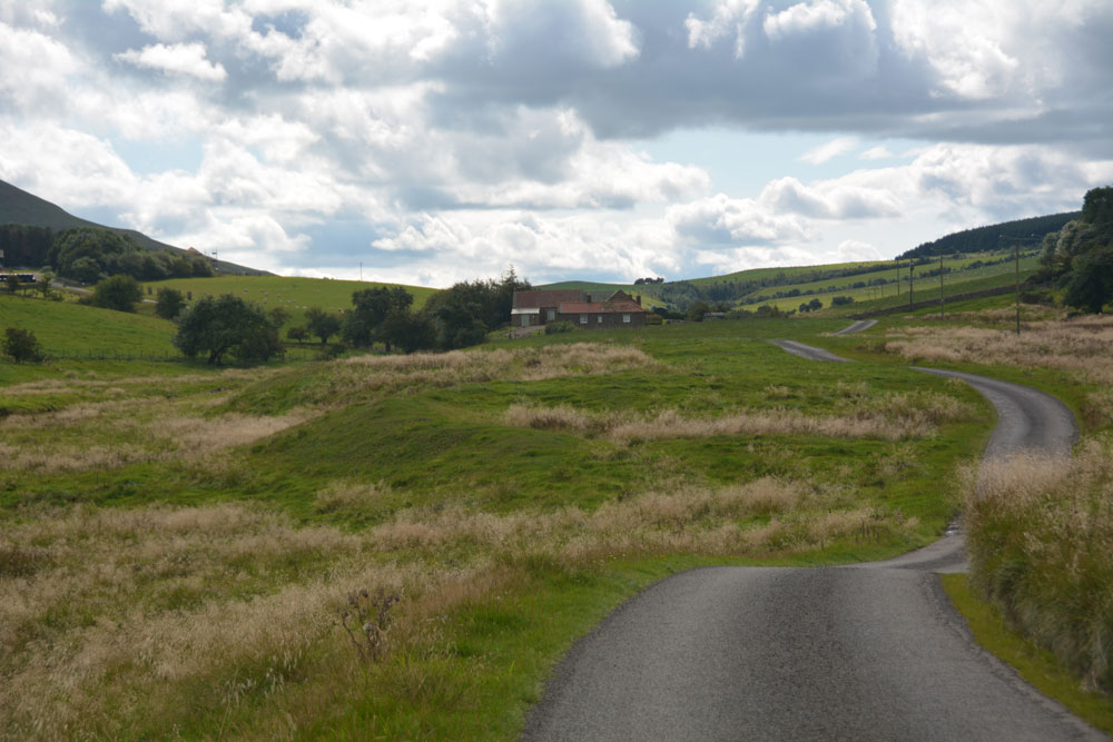
Longknowe (Kilham) submitted by Anne T on 28th Aug 2017. First view of the Longknowe settlement, approaching it from the minor road from Kilham to Longknowe and Thompsons Walls farms.
(View photo, vote or add a comment)
Log Text: Longknowe Settlement, Kilham: Our first scheduled stop of the day, having been diverted by two very interesting standing stones!
Driving down the single track road towards Longknowe Farm and Thompsons Walls, it was a bit tricky to track precisely where we were on the road because of all the little twists and turns it took. But when we first saw the settlement from a distance, cut by the road, it was obvious what it was.
This is a very pretty little valley, if somewhat remote, surrounded by tall hills to the south, east and west, with a pretty (unnamed burn/syke) running alongside the eastern side of the settlement, back towards Kilham. Another small stream, but with a fast water flow, trickled to the west. The farmer had cut a drainage channel with led this to the burn to the east of the settlement.
The stony banks of the settlement were an obvious brighter green and with shorter grass, than the tall yellow grass in the landscape surrounding it. The settlement has been clearly cut by the road. There is a large round hollow area in the northern part of the settlement, with a few stones peeking out of the grass - the remains of the 7m hut circle?
Described as ‘much robbed’ and in poor condition, if the farmer decides to put hay bales or any farming equipment here, then this will probably destroy what remains of this settlement.
Onwards and upwards to park the car at Thompsons Walls and walk up to Ring Chesters, with the dark clouds gathering above us.
Elsdonburn Shank (Kilham)
Trip No.41 Entry No.4 Date Added: 28th Aug 2017
Site Type: Ancient Village or Settlement
Country: England (Northumberland)
Visited: Yes on 26th Aug 2017. My rating: Condition 2 Ambience 4 Access 3
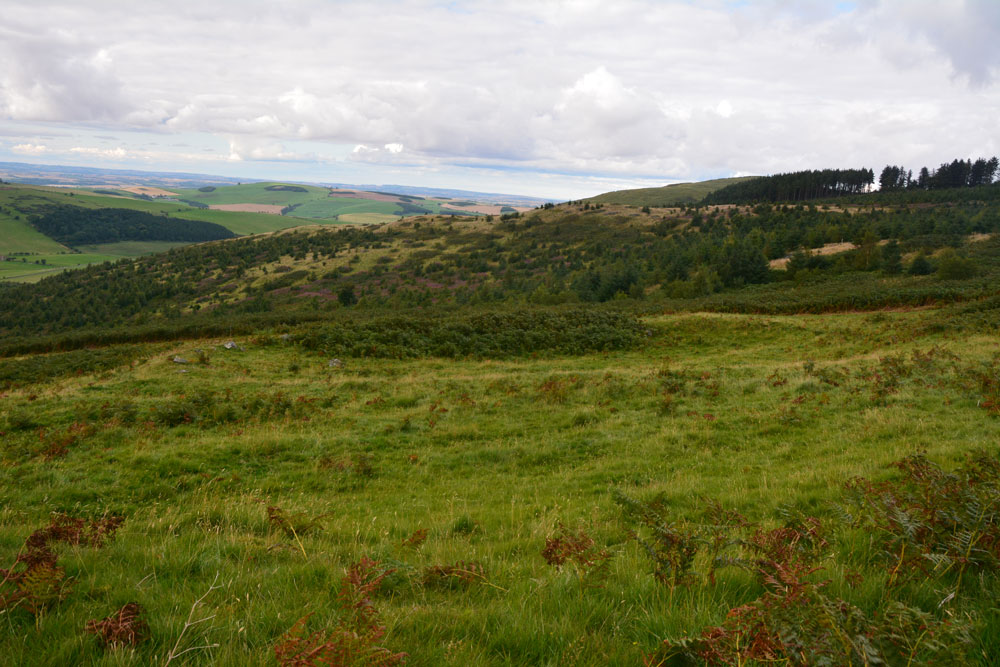
Elsdonburn Shank (Kilham) submitted by Anne T on 28th Aug 2017. Enclosure A from the northern-most part of the bank of Enclosure B.
(View photo, vote or add a comment)
Log Text: Elsdonburn Shank Villages, Kilham: Why are all the interesting sites up, up, up hill?? From Longknowe Settlement, we drove to Thompsons Walls and parked just behind their stack of sileage bales. The footpath continues here, and is metalled, but is a private road, so we decided not to drive any further.
It is a very pleasant walk along this road, with the hills looming around you on three sides. The ground looks very fertile here, and there were many, many sheep and their lambs on the green pasture. The farmer passed me with his large mower and gave a great wave. We later saw him mowing the grass in a meadow on the other side of the valley.
The footpath splits at the point where a burn tumbles down from a wood and goes underneath the road. We took the left hand fork which runs up to Elsdonburn Shank Farm, the house now deserted but the land and barn still used.
Just before the barn, the footpath dives off diagonally south east across the field, leading down to a gate just before the stream. It looks at first glance as if this stream is going to be wide, because the valley is quite deep, but when you get down to it, it’s just a little trickle, with a few stones placed across to make it easy to cross. From here, the footpath disappeared, and we ended up tracked north east up the hill, led by a string of large boulders which seemed (to us) to mark the track. In fact higher up, the footpath has been mown of bracken and leads along the fence line up the hill.
Just as I was getting tired of clambering up the slope, Village A came into view and we sat on the western side of the bank to have a drink before exploring. Well worth coming up here. Enclosure A was easier to decipher than B, which had much more bracken growing within it, and a tumble of stones peeking out of the grass.
With the dark skies getting darker, we plodded up the hill towards Ring Chesters.
Elsdonburn Shank Shielings (Kilham)
Trip No.41 Entry No.6 Date Added: 28th Aug 2017
Site Type: Ancient Village or Settlement
Country: England (Northumberland)
Visited: Yes on 26th Aug 2017. My rating: Condition 1 Ambience 3 Access 3
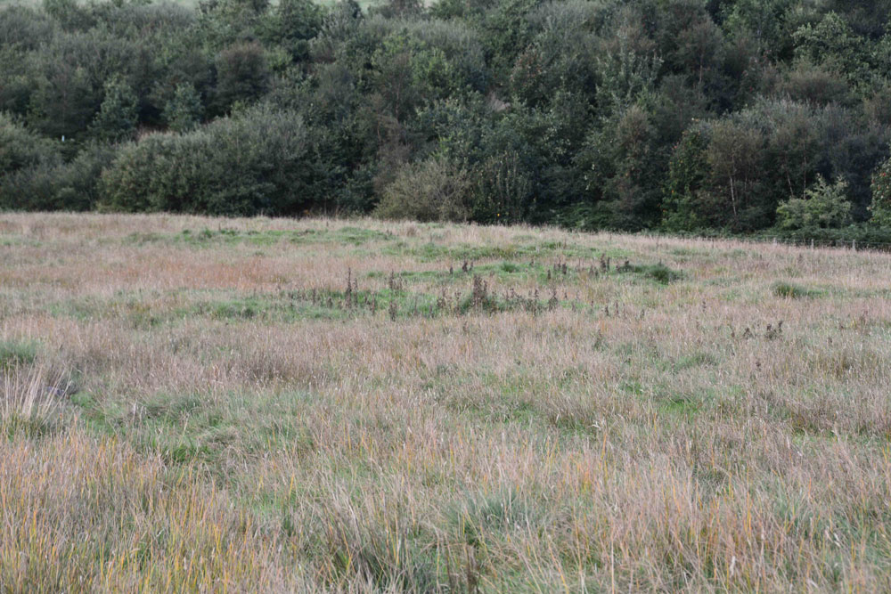
Elsdonburn Shank Shielings (Kilham) submitted by Anne T on 28th Aug 2017. Having walked by these shielings on the way up the hill, they were actually far more visible coming down the track from Elsdonburn Shank farm. The turf covered foundations, like Longknowe Settlement nearby, stood out as a darker green with lower growing grass, as opposed to the yellowing stems of taller grass around them.
(View photo, vote or add a comment)
Log Text: Elsdonburn Shank Shielings, Kilham: Husband had read somewhere that these might possibly have Saxon origins, although I’ve not been able to find the link.
Marked on the OS map as ‘old shielings’ we missed these on the walk up to Elsdonburn Shank as I was looking on the wrong side of the track. Actually, they were more visible on the way down, in the early evening light, with the very slight banks of the shielings a darker green and with lower growing grass on their surface. If I hadn’t been out with the archaeology group surveying shieldings, I would have passed these by.
We spent about 10 minutes here wandering around, trying to work out the shape of the structures. Not a huge amount so see, but another Pastscape site in the vicinity of Ring Chesters marked off.
St. Gregory's The Great (Kirknewton)
Trip No.41 Entry No.7 Date Added: 28th Aug 2017
Site Type: Sculptured Stone
Country: England (Northumberland)
Visited: Yes on 26th Aug 2017. My rating: Condition 3 Ambience 4 Access 5
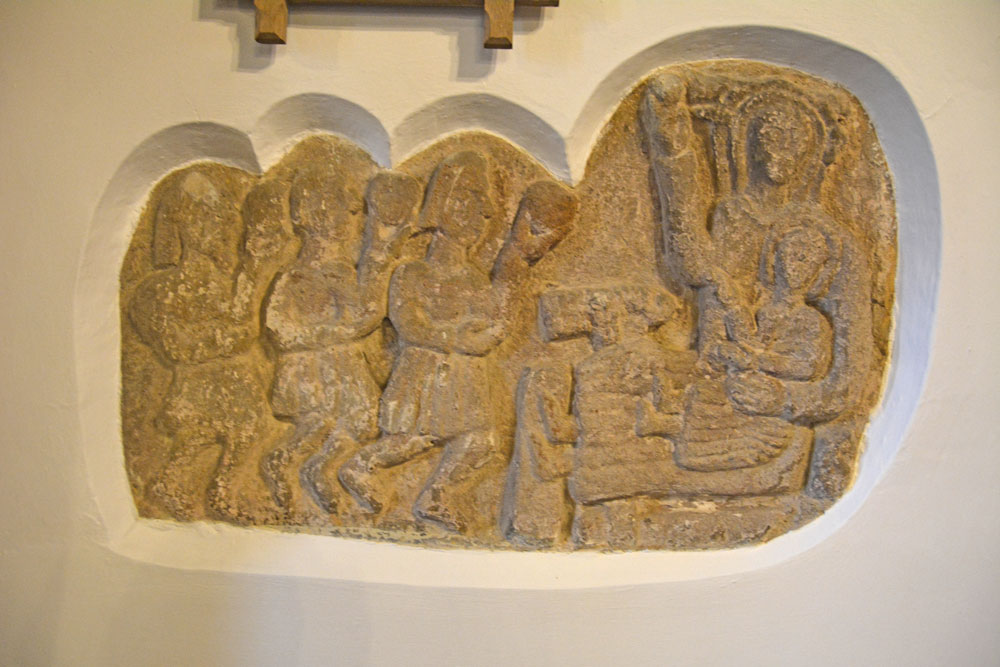
St. Gregory's The Great (Kirknewton) submitted by Anne T on 28th Aug 2017. The unusual Adoration of the Magi, with the Magi in what looks like kilts, but which are probably Roman tunics. Historic England says this dates from the 12th century, but the church thinks it might be several centuries earlier, pre-dating the church.
(View photo, vote or add a comment)
Log Text: The Adoration of the Magi (in Roman tunics): St. Gregory's The Great, Kirknewton: I confess to not being ready to go back home as it was such a nice evening, and this church looked very welcoming, so we stopped off for a look.
The main entrance to the church yard leads over a small, nicely landscaped stream. Immediately facing you to the left hand side of the path are some Commonwealth War Graves, very nicely tended, and all of air force pilots from 1943, mostly in their early 20s; one man was from Brazil. Inside the church there is a lovely sculpture and stained glass dedicated to these men.
There was no church guide to take away, but there were notices all over the church with explanations. There was a stone carving -The Adoration of the Magi, sited in the wall to the north side of the chancel.. The interpretation board near it reads: “The carving is quite amazing as it appear to show the Magi in kilts (but probably Roman tunics). The ancient stone relief is a great treasure of the church, being at least 12th century and could be earlier. There is some evidence to suggest that the style of the Magi “caps” is similar to an example in the Roman catacombs, so there could be the influence of St. Paulinus, himself a Roman (who supposedly preached at Kirknewton) and would date the carving at several centuries earlier, pre-dating the church (where was it prior to that?).”
The chancel and sanctuary look as if they have been fortified and used for defensive purposes (barrel vaulted ceiling and thick walls). I enjoyed walking round this church. It had a very friendly feel and was very well looked after.
Feldon Plain (Muggleswick)
Trip No.42 Entry No.5 Date Added: 29th Aug 2017
Site Type: Marker Stone
Country: England (Northumberland)
Visited: Yes on 28th Aug 2017. My rating: Condition 3 Ambience 3 Access 5

Feldon Plain (Muggleswick) submitted by Anne T on 29th Aug 2017. The stone (and sheep) as seen from the north east. There is a level mark almost at ground level, on the side facing the road. It certainly is in a lonely spot. It sits precisely on the parish boundary between Muggleswick and Hunstanwick (if I've read the map correctly) and also almost at the junction of two major routes across the moors.
(View photo, vote or add a comment)
Log Text: Marker Stone, junction of Meadows Edge & B6278: Despite quite an intensive search, I’ve not found any information on the internet (checked Pastscape, Historic England, National Geograph, etc).
Marked ‘BS’ on the OS map, this impressively large stone (in comparison to the others we saw on the way here) sits exactly on the Parish boundary between Muggleswick and Hunstanwick (if I’ve read the map correctly). Sitting right by the side of the B62787 to Edmundbyers, close to its junction with the Meadows Edge Road.
This is close to the remains of the Edmundbyers Cross Base, just to the north east, with Feldon Plain rising up gently behind it. It is a taller version of Hunstanworth North, again with the sloping top. It sits in a slight dip, as if the ground surface has built up around it, and there are a few packing stones visible at its base. Looks as if it has been here for a while.
Its shape echoes that of Hunstanworth Moor North, being long, thin & narrow with a sloping top.
Edmundbyers Cross (Muggleswick)
Trip No.42 Entry No.6 Date Added: 29th Aug 2017
Site Type: Ancient Cross
Country: England (Northumberland)
Visited: Yes on 28th Aug 2017. My rating: Condition 2 Ambience 3 Access 5
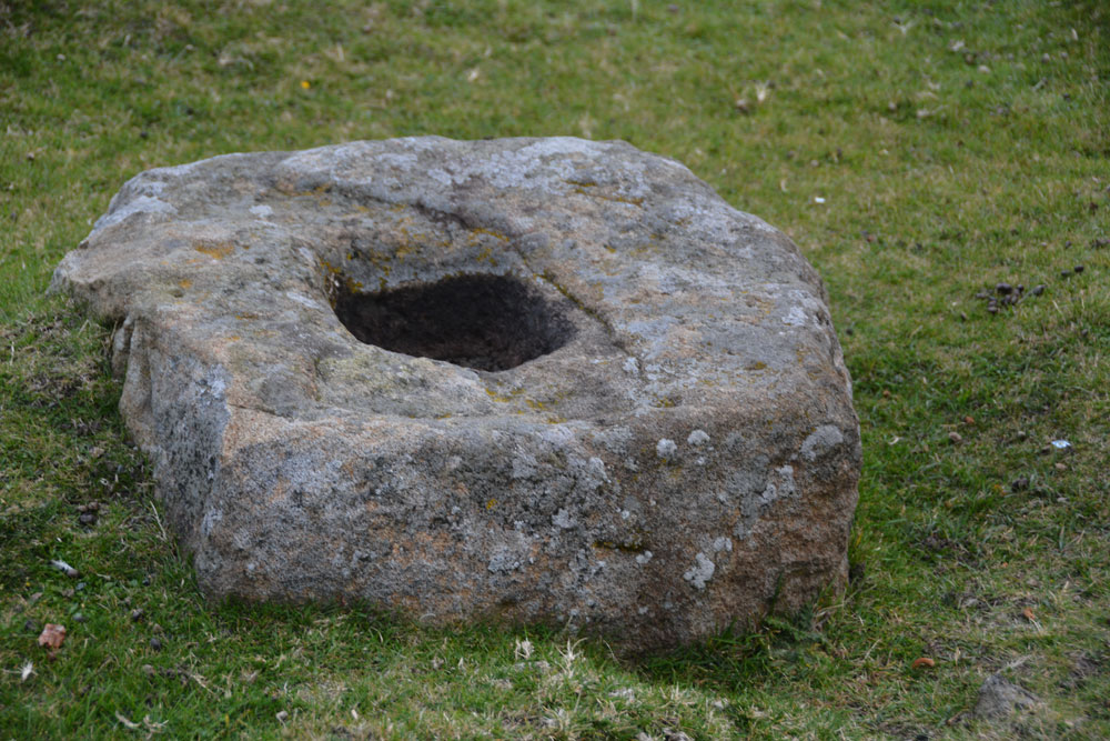
Edmundbyers Cross (Muggleswick) submitted by Anne T on 29th Aug 2017. Close up of the cross base, showing its socket hole.
(View photo, vote or add a comment)
Log Text: Remains of Edmundbyers Cross, Muggleswick: Marked in italic, old fashioned script on the OS map, I guess I was expecting something a little more exciting, such as a cross base with part of a shaft, but no. Just a cross base. Good job I knew what I was looking for as alongside the road there were other pieces of rectangular rock almost as large.
Sitting almost at the junction of the B6278 to Edmundbyers with the minor road leading almost to Smiddy Shaw Reservoir (just to the north of this road), it would have acted as a way marker. The cross base is located just over 1km from the boundary stone above.
When we got home, I was interested to read this from the Historic England entry: “Edmundbyers Cross is one of only three wayside crosses still in its original position in County Durham and the only known example on the route between Stanhope and Edmundbyers.”
Housesteads Tumulus
Trip No.43 Entry No.3 Date Added: 4th Sep 2017
Site Type: Artificial Mound
Country: England (Northumberland)
Visited: Yes on 2nd Sep 2017. My rating: Condition 2 Ambience 2 Access 5
Housesteads Tumulus submitted by SolarMegalith on 21st Jul 2016. The mound seen from the S-SE (photo taken on July 2016).
(View photo, vote or add a comment)
Log Text: Housesteads Tumulus, Northumberland: From photographing the remains of Triermain Castle and after having failed to see several sites today because of Boisterous Bullocks or lack of parking reasonably near the well, I wasn’t in the frame of mind to go straight home. As we were very near the B6318, I asked to go back that way to see ‘Solarmegaliths Mound’ opposite Housesteads. I hadn’t realised until I looked closely that this is marked on the OS Map.
By this time it was 7pm and the car park was empty apart from one car and a very large campervan. I confess that every time we’ve driven past this site, I thought how unsightly this ‘farmer’s dump’ was in the corner of the field. It was only when Cezary told me on one of the archaeological field days that he’d stopped off to see this site, that I promised myself one day I’d stop off and look for myself.
As a mound, it is a little non-descript, but having crossed the road from Housesteads car park, we let ourselves into the field (knot untying skills came in useful again) and walked round. The whole area around the base of the tumulus has been used as a dump and there is rubbish and fence posts around much of it.
Also marked on the OS map is a mound, further south and we walked further into the field (ducking from the farmer's trucks with trailers behind them, in case we got caught!).
Having walked back to the car park, we noticed a sign saying there had been an application made for number plate recognition for car park charging. We looked around for cameras, but couldn’t see any. If a parking charge notice comes through the door in the next few weeks, I will be cross.
Coanwood (Lambley)
Trip No.43 Entry No.1 Date Added: 5th Sep 2017
Site Type: Ancient Village or Settlement
Country: England (Northumberland)
Visited: Yes on 2nd Sep 2017. My rating: Condition 3 Ambience 3 Access 5
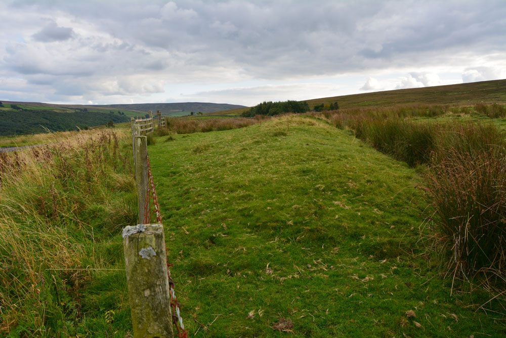
Coanwood (Lambley) submitted by Anne T on 5th Sep 2017. The eastern bank of the enclosure as it runs south along the fence line inside the field.
(View photo, vote or add a comment)
Log Text: Coanwood Settlement, Lambley: Driving from the Diamond Oak and the World War II prisoner of war camp to the north, this settlement lies immediately opposite the junction of the 68 Cycle Route and the A689 at Lambley. It lies very near the Roman route of Maiden Way, which in this part of the world goes over Hartleyburn Fell and Glendue Fell, and runs west of this settlement, following the route of the Pennine Way through Lambley Common.
We decided, on impulse, to stop and have a look, especially as there was a handy hard-cored parking space next to the green pumping station and were so interested, I did something I don’t usually do, and let myself into the field to walk along the track running parallel with the southern bank.
I could make out a rectangular structure in the south eastern corner, and possible hut circle mid-way across and one-third of the length south of the northern bank.
Haining House (Lambley)
Trip No.43 Entry No.2 Date Added: 5th Sep 2017
Site Type: Cairn
Country: England (Northumberland)
Visited: Yes on 2nd Sep 2017. My rating: Condition 3 Ambience 4 Access 4
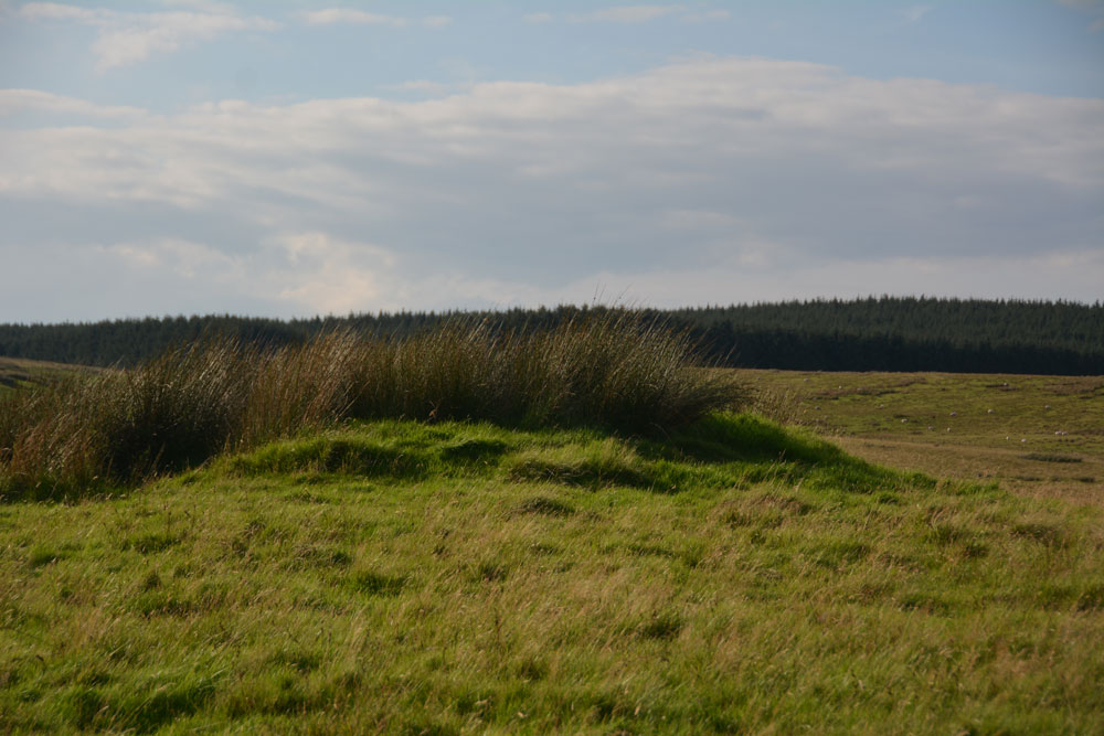
Haining House (Lambley) submitted by Anne T on 5th Sep 2017. First view of the cairn, peeking northwards over the stone wall which runs parallel with the track leading up to Haining House on Hartleyburn Common.
(View photo, vote or add a comment)
Log Text: Haining House Cairn, Hartleyburn Common: It was difficult to park here, as the road was so narrow. In the end we managed to bump the car up a slight bank to the north east of the track to Haining House. The track to the farm house was well looked after, although to drive to it, you’d have had to opened (and shut) three gates.
The cairn was easily identify-able, and being on access land, we walked to the gate located in the stone wall just to the west of the cairn, and walked back. There are some curiously deeply cut valleys to the north west of this cairn, now in a u-shaped feature. There are some cup and ring marked rocks along this section of the burn, although we planned to walk further west to see some more settlements this afternoon.
However, leaving the cairn and letting ourselves into a field with a gate, the heads of some very curious, and large, cattle/bullocks appeared above a slight mound. We retreated and went to look at the map for some other sites to see.
Hethpool Cairn
Trip No.45 Entry No.7 Date Added: 15th Sep 2017
Site Type: Cairn
Country: England (Northumberland)
Visited: Yes on 12th Sep 2017. My rating: Condition 2 Ambience 4 Access 5
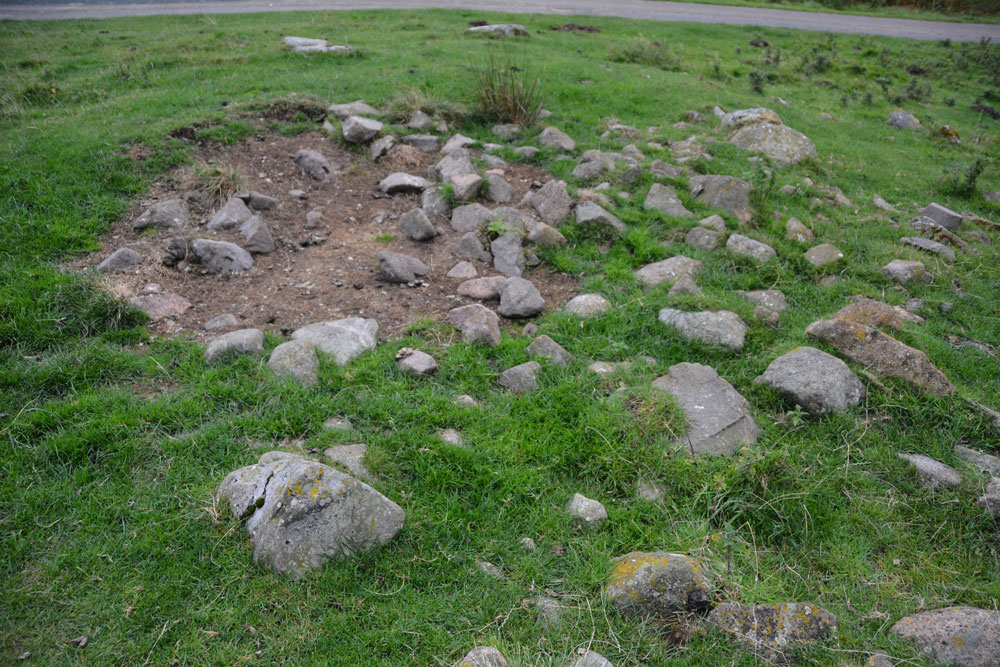
Hethpool Cairn submitted by Anne T on 13th Sep 2017. The Hethpool Cairn, showing its probably robbed centre.
(View photo, vote or add a comment)
Log Text: Hethpool Cairn, College Valley: By this time, it was getting reasonably late in the afternoon, and there was a definite chill in the air. After having been out a lot earlier than our normal setting off time, it seemed way past tea-time. Just as we were approaching Hethpool Stone circles, we both noticed a stony mound to the left hand side of the road, tucked between the road and a narrow band of forest that separates it from the stone circles.
OK, this could be just a dump of stones by the roadside, but I photographed it anyway, enjoying the view south down the valley before we set off for home. Opening up Pastscape later that evening, I was pleased to find this cairn recorded.
