Contributory members are able to log private notes and comments about each site
Sites Anne T has logged. View this log as a table or view the most recent logs from everyone
St. Mungo's Well (Simonburn)
Trip No.27 Entry No.1 Date Added: 27th May 2017
Site Type: Holy Well or Sacred Spring
Country: England (Northumberland)
Visited: Yes on 25th May 2017. My rating: Condition 2 Ambience 2 Access 4
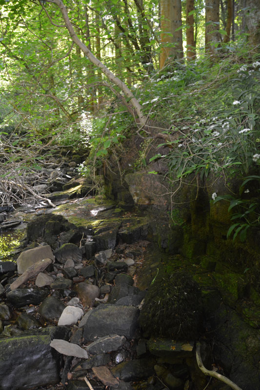
St. Mungo's Well (Simonburn) submitted by Anne T on 27th May 2017. This is the very tumbledown structure at the grid reference for the well. It hasn't been used for a very long time, and my husband wasn't convinced he'd found the right place, but it was the only structure that he could find around.
(View photo, vote or add a comment)
Log Text: St. Mungo's (Mugger's) Well, Simonburn: Our first stop on this hot, sunny day. Parking at Simonburn tea-rooms, we asked if it was OK to leave the car there whilst we walked round the village, and were told it was alright (there is another car park in between the south wall of the churchyard and the forest). I would thoroughly recommend sitting out in the tea-room gardens with a cup of tea and iced water, as they have very comfortable garden furniture and it’s a very quiet spot.
It was a relief to get into the cool of the forest leading down to the Crook Burn, which hardly had any water in it at all after so little rain for weeks and weeks. It was possible to walk on the stream bed.
Following the tracks through the forest to the burn, there is little or no sign of the well. There appears to be an flattened area which might represent an old path, running along the ledge at the top of the burn on its north side, but this has been long out of use. It’s also a three foot plus drop onto the bed of the burn at this point.
Lacking the confidence to walk along the large slippery blocks of stone along the stream bed, I handed the camera to my husband and went exploring the forest tracks. Andrew came back having seen the remains of a structure, long disused, at the grid point indicated for the well, so we are not entirely convinced this is it.
Bellshiel Law
Trip No.28 Entry No.1 Date Added: 29th May 2017
Site Type: Chambered Cairn
Country: England (Northumberland)
Visited: Yes on 28th May 2017. My rating: Condition 3 Ambience 5 Access 5
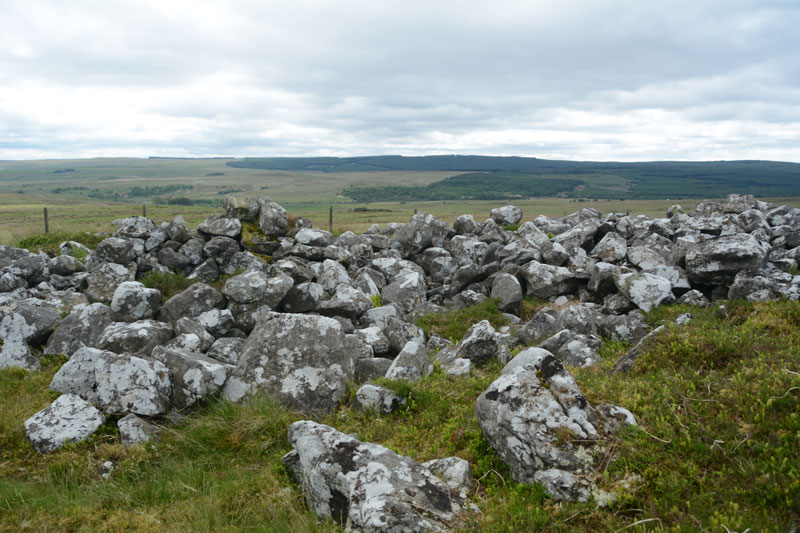
Bellshiel Law submitted by Anne T on 29th May 2017. The northern side of the cairn is partly earth and turf covered for the first few feet. Whether this is just build of earth through the prevailing wind blowing it in or the remains of a purpose built covering was difficult to tell.
(View photo, vote or add a comment)
Log Text: Bellshiel Law, Otterburn Ranges: It felt very strange driving onto the Otterburn Ranges with no red flags flying and no military around – I felt like I was trespassing. The ranges are absolutely huge – the Access map and Guide says they cover 90 square miles. We saw 3 other cars all day, 2 of those from a long distance, and 3 cyclists.
Bellshiel Law can be reached by a military road approx. 2 km on the western side of Rochester. The start to this road system is quite complex, but we headed left and left again taking us up over Bellshiel Road. AT NT 81079 01161 the road forks. At this point take the right hand fork. The cairn comes into view on the right hand side of the road. There is a small parking area underneath a natural crag at NT 81267 01260. My first reaction was “Wow, this is huge”.
Narrow trackways through the grass lead you to the cairn, which is fenced off and labelled “Archaeological Area” and “Out of bounds to Troops”. A gate (difficult to open with all the marren grass around it, but managed to squeeze through) lets you into the cairn. It is large – Pastscape recording it as 367 feet long and 52 feet wide at its eastern end, with a maximum height of 6ft (1932 measurements), which translates to 109m long, varying in width from 8.8m at the west end to 15m at the broader east end, maximum height of 1.6m (1994 English Heritage Scheduling).
Someone has built a sheep pen on the southern side, presumably using stones from the cairn. Walking along the stones at the side of the cairn, largely turf covered, I spotted a number of circular ‘rooms’ inside the cairn, with one oblong shape. Called a long cairn by Pastscape, they record “the cairn on the whole, was found to contain no structural remains of an earlier period (ie cists, chambers, revetments internal structures ….. and cannot be dated any earlier than Early Bronze Age and possibly later.”
Great views to the south to the River North Tyne Valley and beyond.
St Mungo's Well (Northumberland)
Trip No.28 Entry No.6 Date Added: 29th May 2017
Site Type: Holy Well or Sacred Spring
Country: England (Northumberland)
Visited: Yes on 28th May 2017. My rating: Condition 4 Ambience 4 Access 5
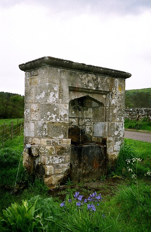
St Mungo's Well (Northumberland) submitted by KiwiBetsy on 27th Nov 2004. St Mungo's Well amidst well watered wildflowers.
(View photo, vote or add a comment)
Log Text: St. Mungo's Well, Holystone, Northumberland: We’d already visited the lovely Lady Well on 8th September 2013, but stopped to look at this one, which is at the side of the Coquet River. Sitting by the right hand side of the road just before entering the village from the Otterburn Ranges, just before the corner of the road leading up to Holystone Priory Farm and the footpath up to Lady’s Well.
The grass and weeds had grown right up to the well, although there was a small track to the well basin, showing a few other people had visited.
I did taste the water, which was clear, but didn’t taste of any particular mineral. The flow of water was strong (but not as strong as St. Cuthbert’s Well in Bellingham), indicating it might be artesian after a long spell of very dry weather in this part of the world.
I hadn’t done any research on this well before visiting, just passing by on the spur of the moment. Pastscape is dubious about this being a holy well. The shrubbery around the well hid the overflow pipe at the burn side of the structure, and I wished I had looked for the conduit at the village green. Another trip to this beautiful part of the county is called for.
Ridlees Cairn
Trip No.28 Entry No.5 Date Added: 29th May 2017
Site Type: Cairn
Country: England (Northumberland)
Visited: Yes on 28th May 2017. My rating: Condition 3 Ambience 4 Access 4
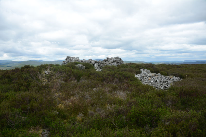
Ridlees Cairn submitted by Anne T on 29th May 2017. Approaching Ridlees Cairn from the east. It is a substantial cairn, made up of small and medium sized stones.
(View photo, vote or add a comment)
Log Text: Ridlees Cairn, Otterburn Ranges: This is one of the times I’ve actually made it up to a Trig Point (usually too steep a climb or too high a drop for my liking), but this was easy. Ridlees Cairn was actually 250 metres to the east north east of Bushman’s Crag, but I’m sure some people may visit the crag thinking it is the cairn. The views here are impressive. No wonder the military have a bunker hidden just up the road, and possibly hollowed out the centre of the cairn for use as a machine gun nest (apologies if this is not the case, this is just husband guessing).
Parking at the cairn (the metalled roads had deteriorated from this point and were very narrow), we walked to the east of the cairn and pushed through the heather to reach it.
It is substantial, with a flattened stone kerb around it, partly hidden by heather, partly by tumbled stones.
Outer Golden Pot (Otterburn)
Trip No.28 Entry No.4 Date Added: 29th May 2017
Site Type: Marker Stone
Country: England (Northumberland)
Visited: Yes on 28th May 2017. My rating: Condition 2 Ambience 4 Access 5
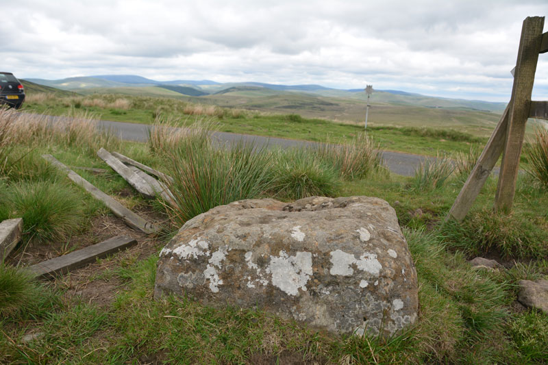
Outer Golden Pot (Otterburn) submitted by Anne T on 29th May 2017. From it's eastern side, the Outer Golden Pot has wonderful views over Upper Coquetdale.
(View photo, vote or add a comment)
Log Text: Outer Golden Pot (Otterburn): What stunning views across to Upper Coquetdale from here. No wonder the site is marked as a view point on the Otterburn Ranges Access Map. The fencing surrounding this Golden Pot has been broken on three sides, so it’s possible to appreciate its form more fully than the Middle Golden Pot.
The base is smaller than the Shitlington Cross but is about the same size as many of the Anglo Saxon Cross Bases we’ve seen in and around churches in North Yorkshire.
As I stepped back towards the road to photograph the base, I saw what looked like a cart track running diagonally up the hillside, crossing under the road and carrying on in a north-east/south-west direction. Andrew pointed out that if I moved a bit further over, I could see the second ditch, so this was the old course of Dere Street, now metalled and called ‘Roman Road’.
After stopping to photograph this stone, we went in search of Ridlees Cairn and Bushman’s Crag, to the south east of these intriguing cross bases.
Middle Golden Pot (Otterburn)
Trip No.28 Entry No.3 Date Added: 29th May 2017
Site Type: Marker Stone
Country: England (Northumberland)
Visited: Yes on 28th May 2017. My rating: Condition 2 Ambience 4 Access 5
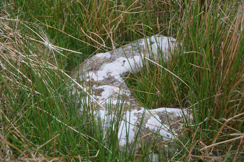
Middle Golden Pot (Otterburn) submitted by Anne T on 29th May 2017. The Middle Golden Pot from a different angle.
(View photo, vote or add a comment)
Log Text: Middle Golden Pot (Otterburn): Fenced off behind a nice, neat fence with a label “Do not feed the cross base” – no seriously, “Archaeological Area”. This stone was mostly hidden under the marsh grass and I struggled to get decent photographs as the camera kept focusing on the grass rather than the stone. Whilst I snapped away, Andrew went off wandering along the top of Dere Street off to the east – very well defined with a visible ditch on either side. The modern metalled road (imaginatively called ‘Roman Road’ turns a left-handed right angle here, as the course of Dere Street changes. Being just below the brow of a hill, I wondered why the stone was placed here, but looking at the change of direction of the road, it made sense. Stepping behind the stone and looking north-west, Dere Street could be seen running up hill, joining with the section to the east of the stone.
Harbottle
Trip No.28 Entry No.7 Date Added: 30th May 2017
Site Type: Modern Stone Circle etc
Country: England (Northumberland)
Visited: Yes on 28th May 2017. My rating: Condition 3 Ambience 5 Access 4
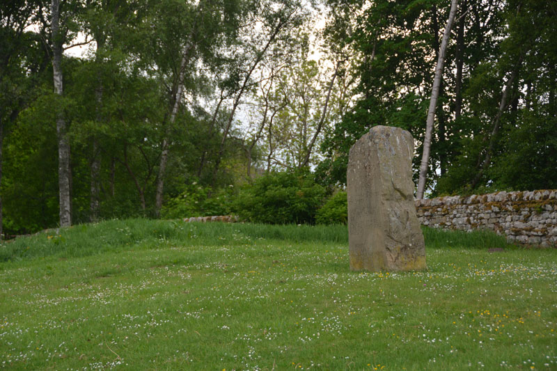
Harbottle submitted by Anne T on 30th May 2017. This modern standing stone can be found on a grassy bank at the western side of the car park for the castle.
(View photo, vote or add a comment)
Log Text: Harbottle Modern Standing Stone/Castle: From Holystone, we passed through Harbottle to get back to the A68, so stopped to look at the castle. The site is lovely.
I spotted the modern standing stone to the west of the car park. The standing stone is inscribed with words:
The Sad Castle
Who Made me/Into a ruin/like an old city?
Was it the soldiers who rode out on horseback?
Was it my old enemy the Scots?
Or was it those Border Reivers?
Perhaps it was just the centuries passing.
Felicity Lance
Apparently there are supposed to be 2 poems, the above by Felicity Lance, another by Robert Corley from Harbottle School, carved into the stone by local stonemason David Edwick. I walked all around the stone, even photographing the other faces to see if anything came up on the camera, but only saw the one poem.
The Pastscape record says there could have been a pre-Conquest fortress on the site. The motte is very steep, and a walk around the moat/outer ditch was charming. Walking into the ruins from the eastern side, there are lots of lumps and bumps of the remains of walls and buildings. Very enigmatic. Really pleased to have been here.
St. Cuthbert's Well (Farne Islands)
Trip No.30 Entry No.1 Date Added: 14th Jun 2017
Site Type: Holy Well or Sacred Spring
Country: England (Northumberland)
Visited: Yes on 11th Jun 2017. My rating: Condition 2 Ambience 4 Access 3
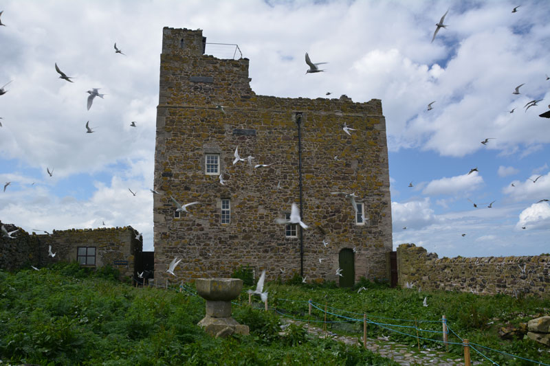
St. Cuthbert's Well (Farne Islands) submitted by Anne T on 14th Jun 2017. The traditional site of St. Cuthbert's well (described as being a fountain of water which emerged from the spring) is believed to be on the ground floor of Prior Castell's Tower. This is my version of the image on the Pastscape record for this site, with Arctic Terns in full flight protecting their chicks. The wardens told me that if you moved their equipment, there is a stone lined chamber with steps leading down, which still contains water.
(View photo, vote or add a comment)
Log Text: St. Cuthbert's Well (site of), Inner Farne: Requires boat trip and short walk from the jetty to see exterior of the building within which it is located. The sea was very calm today, but there were lots of people on the boat – there must have been around 3 to 4 space places. We had a trip around the islands, stopping to see the seals and various colonies of birds in their different nesting places.
Eventually arriving at Inner Farne, the island was full of people with big cameras and enormous lenses, and I felt the ‘poor relation’ with my small lens. The terns were in full flight, protecting their eggs and their chicks.
I took my list of sites with grid references and asked the National Trust Warden who was manning the information point. She said it was not possible to get into the lighthouse compound to look for the cross base, as it was owned by Trinity House and off-limits. She said there was a well in the basement (Pastscape says ground floor) of Prior Castell’s Tower, but as it was used by the wardens for accommodation, the public were not allowed in. She did confirm that there was a door/panel that could be opened, with a few steps leading down to a stone lined chamber containing water, which would be the well.
She also said that they believed what is now called “The Fisherman’s Hut” was the site of St. Cuthbert’s Cell and the place of his death. “There’s a small window where he would watch for people coming to the island, and if he didn’t want to talk to them, wouldn’t open the door.” Pastscape says there is considerable doubt about the position of the cell and there are various theories about its location.
I also had the location for a cross base, but as this was located inside the lighthouse grounds (or on the cliff edge!), this area was out of bounds to tourists.
Chatton 1a
Trip No.30 Entry No.2 Date Added: 14th Jun 2017
Site Type: Rock Art
Country: England (Northumberland)
Visited: Yes on 11th Jun 2017. My rating: Condition 2 Ambience 4 Access 4
Chatton 1a submitted by SolarMegalith on 18th Mar 2013. Cup-and-ring mark on Chatton 1a panel shining in the sun after the rain (photo taken on March 2013).
(View photo, vote or add a comment)
Log Text: Chatton 1a, Rock Art, Northumberland: After our trip to the Farne Islands, as we were nearby and had an hour or so to spare, we decided to head off to Chatton to see if we could find the rock art and the rock shelter. Little did I realise that we’d be blown off the top of the hill – I found it almost impossible to stand and take photographs, despite it being a relatively calm, sunny day.
Andrew (husband) related that friends (Martin Green and Dot) who’d visited the trig point here had been unable to find any rock art. They also said that there was now a sign on the gate leading onto the track (at NU 07833 28678) leading up to the rock art site, but we didn't see any. However, the track was clear and easy to follow.
I confess to being really disappointed, as the marks were very worn and faint, and we had difficulty identifying them, even though we knew what we were looking for. We found three examples: Chatton 1a, Chatton 2 and Chatton 3.
Husband set off to the Ketley Crags rock shelter, but didn't take the camera with him, so a separate trip will be required (note: found an alternative route avoiding the stream).
Dour Hill (Rochester)
Trip No.31 Entry No.1 Date Added: 19th Jun 2017
Site Type: Chambered Cairn
Country: England (Northumberland)
Visited: Yes on 17th Jun 2017. My rating: Condition 2 Ambience 4 Access 3
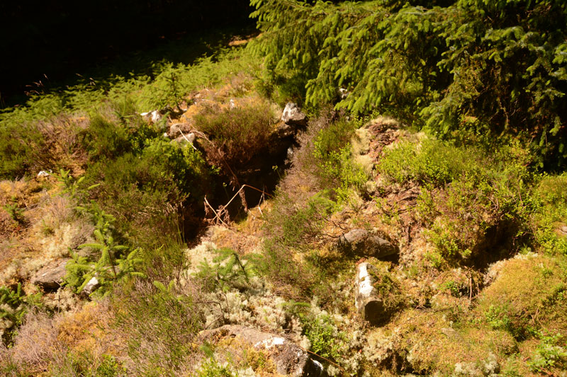
Dour Hill (Rochester) submitted by Anne T on 19th Jun 2017. This is the larger Bronze Age cist, sited towards the north western end of the cairn. We had to pull back a large conifer branch to get a clear view. This chamber was easily deeper and much more visible than the smaller chambers up and down the length of the cairn.
(View photo, vote or add a comment)
Log Text: Dour Hill Chambered Cairn, Near Otterburn: We picked the hottest day of the year so far to visit here, and climbed the gently sloping hill up past the very tall forest plantations towards the top of Dour Hill.
This visit was interesting as the army were carrying out exercises on the Otterburn Ranges less than 400 metres away. They must have been at the top of Dour Hill as, as soon as we'd reached the cairn, there was an almighty boom and the ground under our feet trembled with the ordnance being fired. On the way back to the A68 we heard the radios and voices not far away.
Unlike Bellshiel Law chambered cairn, this cairn sits in a forest clearing and nature has been allowed to reclaim it. The chambers can still be made out, and there is a large, deep Bronze Age cist cut into the cairn to the north west of its middle section (I had to pull back a large conifer branch to photograph it properly).
Well worth the walk. Would have liked to have seen the Bronze Age round cairn some 170 metres to its east but the forest was dense and we missed it.
Rochester (Otterburn)
Trip No.31 Entry No.2 Date Added: 19th Jun 2017
Site Type: Modern Stone Circle etc
Country: England (Northumberland)
Visited: Yes

Rochester (Otterburn) submitted by Anne T on 19th Jun 2017. View of this modern stone circle from the gateway into the field from the rear of the Camien Café.
(View photo, vote or add a comment)
Log Text: Rochester (Otterburn) Modern Four Poster: We’ve seen this stone circle and a tumble-down round house whilst driving by on the A68 on a number of occasions but never stopped. However, today, after a hot but pleasant afternoon walking to Dour Hill Cairn, we doubled back to the café for refreshments and got chatting to the owners.
The café owners told us there used to be a round house here, but it was demolished by the University of Newcastle who ran the Brigantium project. There is now a timber faced building on the site and they intend using it for ‘Dark Skies’ and the Redefest music festival which is run on 1st weekend of August in Redesdale (this year it will be Friday 4th August to Saturday, 5th August). See https://redefest.org.uk/about-us.
Gibbie's Knowe (Kielder)
Trip No.31 Entry No.3 Date Added: 19th Jun 2017
Site Type: Ancient Village or Settlement
Country: England (Northumberland)
Visited: Yes on 17th Jun 2017. My rating: Condition 3 Ambience 5 Access 3

Gibbie's Knowe (Kielder) submitted by Anne T on 19th Jun 2017. About 200 metres further south along the track, the whole of Gibbie's Knowe defended Iron Age settlement comes into view. It sits within a loop of Kielder Burn.
(View photo, vote or add a comment)
Log Text: Gibbie's Knowe, Kielder Forest: After our long trek up to Dour Hill Chambered Cairn, the heat was definitely getting to both of us. Andrew decided to drive the 12 miles down the Forest Drive toll road from Cottonshopeburnhaugh to Kielder. Goodness, this road is remote, but lovely.
We stopped off to see Gibbie’s Knowe, an Iron Age defended settlement, parking off Forest Drive just west of East Kielder Farm (there is a small layby at NY 65257 95857) and following the track south-south-west up the slope towards Kielder Village. We were unable to get down to the mound, but retraced our steps and drove further west along Forest Drive to park in the layby and walk down the overgrown track to the site of an old observation hide (no longer there) at NY 64791 95234. A lovely spot, with the sun glinting off this deep loop of Kielder Burn.
Unfortunately, it was almost 6pm by this time, and we were flagging with the heat, so we abandoned our next walk to Devil’s Lapful long cairn.
Robin of Risingham (Woodburn)
Trip No.33 Entry No.1 Date Added: 10th Jul 2017
Site Type: Carving
Country: England (Northumberland)
Visited: Yes on 8th Jul 2017. My rating: Condition 3 Ambience 3 Access 4
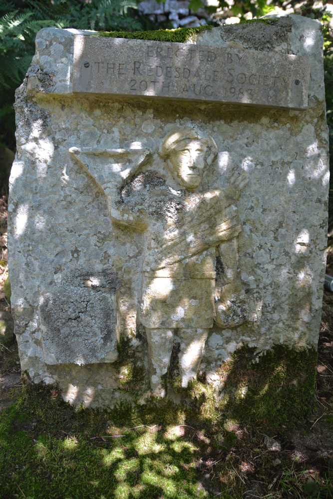
Robin of Risingham (Woodburn) submitted by Anne T on 9th Jul 2017. The carving (a half sized modern replacement put here by Redesdale Society in 1983). Behind this carved stone there is a gap of a few inches then a huge, odd shaped boulder. Despite numerous searches on the internet we've been unable to find where the remains (the legs) of the original carving are currently kept. They didn't appear to be on the boulder - we looked long and hard.
(View photo, vote or add a comment)
Log Text: Robin of Risingham, West Woodburn: Our first stop of the day, just south of West Woodburn on the A68. The sun was shining, it was warm and there was barely a breeze apart when the many motorbikes whizzed past at high speed.
Conveniently, there is a layby next to the start of the footpath leading from the A68 to Parkhead Farm at NY 90466 85463. Letting ourselves in through the gate into the field, the view was picturesque with views across the River Rede Valley to the west and pretty sheep and their large lambs.
We were keen to see this as the Historic England entry says this is the only known Roman statue carved from rock in Northumberland.
Making our way to the southern edge of the farm, there was a track leading through the field just to its east, just above their driveway. Following this to the end of the field, there was no way out – no stile, no sign, nothing. We retraced our steps and tried to find a different way past the farm buildings and ended up in a barn with some wonderful horses. In the end, we let ourselves into the farmyard and walked down the driveway, hoping to come across someone so we could ask where the proper path was.
There are some 3 to 4 houses along your left hand side here. Walking past the last one, Robin can be found about 100 metres further along the driveway. Husband Andrew then headed up the short tree covered slope to the wall separating the farm drive from the quarries above and found the carving hidden amongst the trees.
The dappled sunlight coming through the trees made this tricky to photograph. All the literature we’ve read said only the legs remain. We hunted for ages to see if they were on the rock behind the modern replica, or on the surrounding stone walls.
The intention later was to find the Roman Tombs on Otterburn Ranges which weren’t being used for military training this weekend, but we spent so long on other sites that we left this for another day.
Woodburnhill (East Woodburn)
Trip No.33 Entry No.2 Date Added: 10th Jul 2017
Site Type: Ancient Cross
Country: England (Northumberland)
Visited: Yes on 8th Jul 2017. My rating: Condition 3 Ambience 4 Access 4
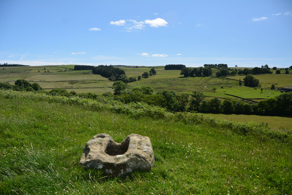
Woodburnhill (East Woodburn) submitted by Anne T on 10th Jul 2017. Looking south east across the Lisles Burn valley towards Stidlehill Common.
(View photo, vote or add a comment)
Log Text: Cross base near Woodburnhill Farm, Northumberland: Trying to find the footpath near Parkhead Farm to Robin of Risingham, I spotted the ‘cross (rems of)’ on the OS map just outside East Woodburn at Chairford Bridge.
As this wasn’t far away, we decided to explore. Parking at the northern side of the hamlet of Chairford Bridge, opposite the gate and track to Woodburnhill Farm, we let ourselves into the field and walked up towards the farm.
The cross base is sited on a small mound some 150 metres west of the farmhouse, not quite at the top of the hill. There are lovely views back to Chairford Bridge, south over the Lisles Burn valley and north to Darney Crag quarries and Hartside.
The cross base is roughly hewn but the socket is more substantial (larger) than others we’ve seen recently. The cross shaft would have been visible from a good way around.
Having found this spot, there are cairns and enclosures nearby which it would be nice to come back to.
Woodhouse (West Woodburn)
Trip No.33 Entry No.3 Date Added: 10th Jul 2017
Site Type: Cairn
Country: England (Northumberland)
Visited: Yes on 8th Jul 2017. My rating: Condition 3 Ambience 4 Access 5
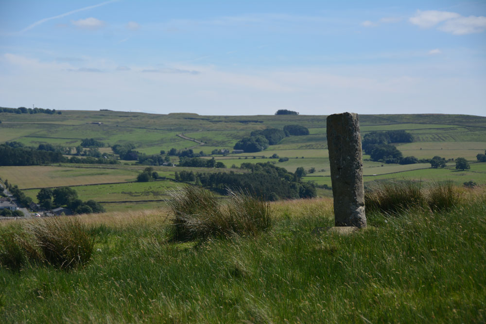
Woodhouse (West Woodburn) submitted by Anne T on 10th Jul 2017. This being England, we didn't climb the barbed wire fence for a closer look, but used the zoom lens on the camera. There are great views to the east across the Rede Valley.
(View photo, vote or add a comment)
Log Text: Woodhouse Round Cairn and Roman Milestone, Northumberland: How many times have we driven up and down this road and never spotted anything? Today I saw the stone peering above the stone wall to the west of the A68, where the Sandstone Way crosses it.
There was a tumulus marked on the map, so I started to look out for it. “There’s a standing stone,” I observed as we approached the spot, and as there was somewhere to pull in, we did. I hopped out of the car with the camera, seeing two boys with go-carts just inside the gate. I asked them if they lived there and we talked at cross purposes for a couple of minutes until one of them said ‘this is a bridleway’ so I felt free to open the gate, go in and have a closer look at the tumulus.
There is a distinct mound, with brilliant views over the Rede Valley to the east. I thought the ‘standing stone’ was in fact a gatepost as I thought there was a metal bracket in the stone on its northern side. It wasn’t until we got home and looked it up that we realised it was a Roman milestone which has been erected in this spot by the (yes, again!) The Redesdale Society.
Well worth stopping to have a look. Can’t believe we haven’t spotted this before.
Brownrigg (Rochester)
Trip No.33 Entry No.4 Date Added: 10th Jul 2017
Site Type: Ancient Cross
Country: England (Northumberland)
Visited: Yes on 8th Jul 2017. My rating: Condition 3 Ambience 3 Access 4
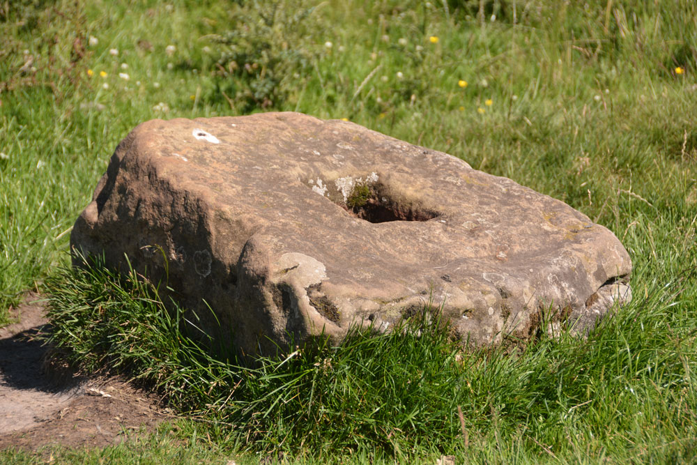
Brownrigg (Rochester) submitted by Anne T on 10th Jul 2017. The cross base doesn't quite sit at the centre of the slight hollow in which it is located. There is a build up of earth on one side and the sheep have been rubbing against one side.
(View photo, vote or add a comment)
Log Text: Brownrigg Ancient Cross Base, Rochester, Northumberland: Two cross bases in one day, although this one isn’t marked on the map. Husband, Andrew, found it by doing a location search on Pastscape before we set off (he gets to look at settlements and Roman forts he's interested in whilst I get the cross bases and tumuli!).
Again, just off a layby on the A68 just before it meets the A696, where a footpath goes north west towards Rattenraw. The layby was being used by a solitary motorbiker who looked at us curiously as we drove up and parked up.
Letting ourselves in through the farmgate to the footpath, which is signposted Rattenraw and Bagraw, we first of all tried to follow the ditch and mound of the line of Dere Street, but this was very boggy and the GPS was telling me we were getting further away.
Wading back to the farm track, the metres on the GPS dropped rapidly, then we suddenly came across the cross base, sitting slightly to the north of the farm track, some 30 metres short of where the official gps reading says it should be. I made the grid reference NY 85668 94716. On UK grid reference finder, the line of Dere Street crossing the field can be clearly seen, as can one of the banks/ditches which matches the line on the OS map.
The cross base is well buried in the grass and sits in a slight dip, just east of some old mine workings. Nothing terribly remarkable about this except the socket hole seemed really small, measuring only 10 cms square.
Worth stopping off to look, as no-one else seems to have spotted this, but nothing hugely exciting about this site. The next stop was most certainly the best of the last few months!
Burdhope (Rochester)
Trip No.33 Entry No.5 Date Added: 11th Jul 2017
Site Type: Ancient Village or Settlement
Country: England (Northumberland)
Visited: Yes on 8th Jul 2017. My rating: Condition 2 Ambience 5 Access 3
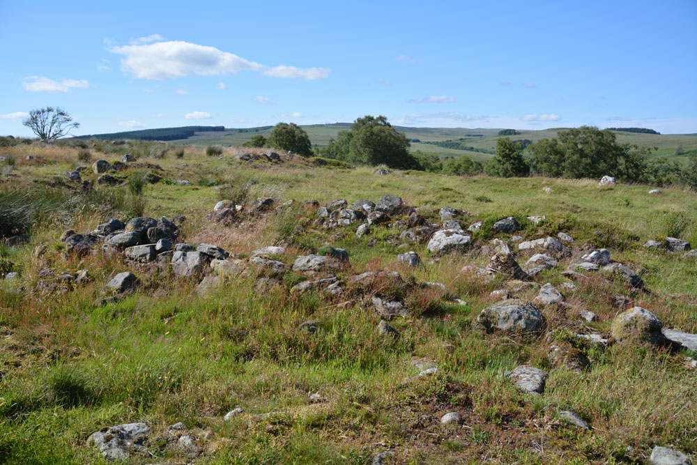
Burdhope (Rochester) submitted by Anne T on 11th Jul 2017. Standing almost at the middle, eastern edge of the site looking west across it. I interpreted this as one of the smaller round structures (hut?) with the bank of an enclosure in the foreground.
(View photo, vote or add a comment)
Log Text: Burdhope Hill Village, Rochester, Northumberland: After having stopped at the Camien Café for refreshments, we headed off into the hot sun again. This time it was only a few hundred metres up the road. There was a small layby at the side of the road opposite Woolaw Farm entrance. Crossing the road was fun as you could hear the roar of the motorbikes and cars coming from a fair distance, then they zoomed past, the rush of air lifting my hair. A quick run across the road was safely achieved.
Andrew had found out from friends who visit Trig Points that the only footbridge across the river was at Woolaw Farm, so we walked down the track and joined the footpath just west of the farm house.
The grass is tussocky and some parts of the field are boggy, other parts cut by modern field drains, but it wasn’t too challenging a walk (for me).
The monument is on access land, although it has been fenced off to protect it. As the gate into the field was at the top of the hill, we took a short cut by climbing through the barbed wire fence. We must have spent an hour wandering around, trying to interpret the different bits. Fascinating!
Yatesfield (Otterburn)
Trip No.33 Entry No.6 Date Added: 11th Jul 2017
Site Type: Ancient Village or Settlement
Country: England (Northumberland)
Visited: Yes on 8th Jul 2017. My rating: Condition 2 Ambience 2 Access 5
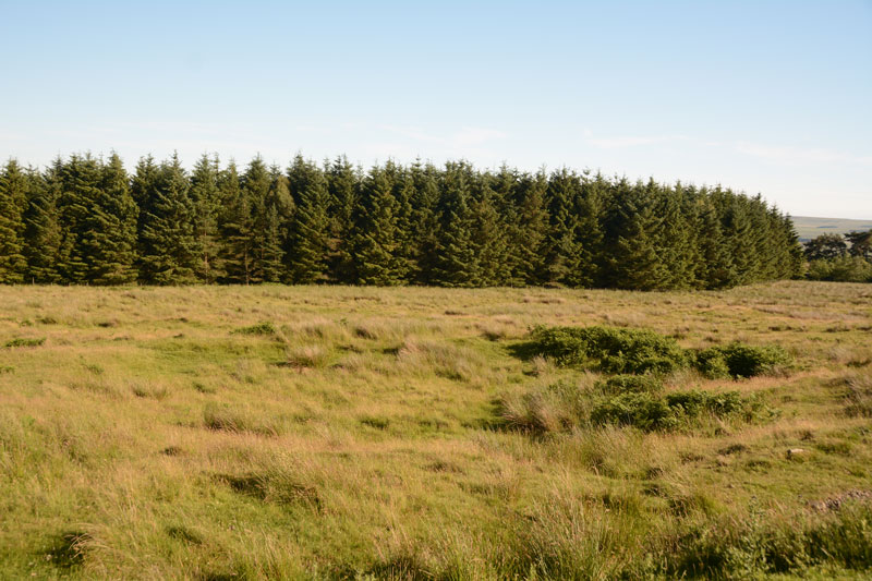
Yatesfield (Otterburn) submitted by Anne T on 11th Jul 2017. One of the roundhouses in the middle of the site can be seen by a change in vegetation, ringed around with bracken.
(View photo, vote or add a comment)
Log Text: Yatesfield Settlement, Otterburn Ranges: By this time, it was 6pm, and rather than face another long walk over rough ground to the Roman Tombs at Lamb Crag, we decided to save our feet and drive to this site up on the Otterburn Ranges. We spotted the two ‘archaeological area’ signs at the south and north ends of the site. It has obviously been split by the military tarmacked road. Standing at the western edge of the site, looking down over the gentle south east slope, it took a few minutes to ‘get my eye in’ and start to see the possible hut circles and lumps and bumps of various structures. In the end, I walked to the northern end and walked across the site, photographing as I went.
Parts of the ground were very boggy and I disturbed a hare sunning itself against the back wall, partly sunk into the bank (part earth, part stone) of one of the round houses nearest the road.
Ingram Hill
Trip No.34 Entry No.1 Date Added: 21st Jul 2017
Site Type: Ancient Village or Settlement
Country: England (Northumberland)
Visited: Yes on 18th Jul 2017. My rating: Condition 2 Ambience 4 Access 4
Ingram Hill submitted by SolarMegalith on 18th Mar 2013. Course of the rampart in the eastern part of Ingram Hill settlement (photo taken on March 2013).
(View photo, vote or add a comment)
Log Text: Ingram Hill Settlement, Breamish Valley: Making the most of a warm, sunny day we set off to the Ingram in the Beamish Valley, not to walk the Hillfort Trail this time, but to look at some settlements marked on the OS map. Taking supposedly ‘the shortest route’ the roads were so twisty and windy that it took forever, and I ended up feeling travel sick for most of the afternoon.
I had forgotten how beautiful and calm this little valley is. There were a dozen or so cars parked on the grass by the river, with people picnicking. Passing the car park just outside Ingram, there was only one car – in Northumberland I expect to see more sheep than people on a day out. Setting off west out of Ingram, we parked just outside the village on a wide grass verge that people had obviously used before us. Walking the 100 metres or so to where the stony footpath climbed gently up to Turf Knowe, we had the old field boundary and modern wire fence to our left. Where the footpath meets the access land at the south western corner of the field, another permission footpath/stone covered track branched off to the south east towards Wether Hill. Typically, we didn’t use the path but tramped through the knee high grass and bracken, surprising the sheep who’d sought shade.
The circular banks of this settlement rose gently out of the turf. Some of the sheep were grazing on top. I walked all the way round the bank, which is 160 feet in diameter. There is a clear two roomed rectangular house on the interior northern bank, looking down to the River Breamish below.
Another circular feature, which I thought was a small roundhouse, was to be found towards the middle of the settlement. Pastscape says this is the remains of some shielings.
After taking a short break to make the most of the sunshine, we took the permissive path and headed up towards Haystack Hill.
North Haystack Hill
Trip No.34 Entry No.2 Date Added: 21st Jul 2017
Site Type: Ancient Village or Settlement
Country: England (Northumberland)
Visited: Yes on 18th Jul 2017. My rating: Condition 2 Ambience 4 Access 3

North Haystack Hill submitted by Anne T on 21st Jul 2017. Stepping over the medieval bank and walking some 30 metres into the enclosure, this circular bank came into view.
(View photo, vote or add a comment)
Log Text: North Haystack Hill, Ingram, Northumberland: After Ingram Hill Enclosure, we took the permissive footpath to its east, walking up between Turf Knowe to our east and Wether Hill to the west. From this point on, for the next quarter of a mile, we seemed to be constantly moving out of the way of a tractor and a small four-wheel drive van and trailer mowing bracken (they seemed to target us with every turn!), up until the division of footpaths just before this earthwork, which appeared as a low stone and earth mound, about 1 metre wide and 80cm high, running to the left of the footpath. It ran for several hundred metres with the occasional bank peeping out of the bracken to the east. By this time, we were 800 metres from Ingram Hill Settlement, and a couple of hundred yards from the main Haystack Hill complex. We stepped over the low electric wire that was keeping the sheep in a particular area and went to investigate.
What a view to have from your front door, down the Middledean Burn valley to the west and the Breamish Valley and Ingram below.
Getting back home and opening up Pastcape, I was surprised to find this is a recorded Iron Age/Roman enclosed settlement. Although the long bank is medieval, the settlement is described as ‘much mutilated’ with a number of scooped hut circles. It can be seen on UK Grid Reference Finder aerial images, with ridge and furrow ploughing cutting over the top.
Making our way back to the path, which by now was levelling off, we continued up the slope towards the larger Haystack Hill settlement.
