Contributory members are able to log private notes and comments about each site
Sites Anne T has logged. View this log as a table or view the most recent logs from everyone
Kirklandhill
Trip No.52 Entry No.3 Date Added: 10th Oct 2017
Site Type: Standing Stone (Menhir)
Country: Scotland (East Lothian)
Visited: Saw from a distance on 27th Sep 2017. My rating: Condition 3 Ambience 3 Access 5
Kirklandhill submitted by minteddy on 14th Dec 2006. Kirkland hill: Standing stone in cultivated field on north side of A1 and east side of road to North Berwick. I think it is taller but thinner than the Pencraig Hill standing stone. I always think it looks rather forlorn standing in this field.
(View photo, vote or add a comment)
Log Text: Kirklandhill Standing Stone, East Lothian: From Pencraig Hill Standing Stone, we drove 3.6 kilometres east along the A199 (which runs parallel to the A1) turning left (north) up the A198. The Kirklandhill Standing Stone is in the middle of the field immediately to the right hand side of the A198.
Whilst the Pencraig Hill Stone was in a field of mature cabbages, this field was planted in well established brussel sprout plants, with no room between them, so we could only view it from the road. We tried looking for a gate into the field off the A198 and the A199, but the entrance must be near to the Kirklandhill Farm building.
I had to content myself with photographing this stone from the edge of the field next to the A198, which was very busy with traffic. Next stop on the list were some standing stones near Traprain Law hillfort.
St Colmac Cottages Stone Circle
Trip No.50 Entry No.7 Date Added: 9th Oct 2017
Site Type: Stone Circle
Country: Scotland (Isle of Bute)
Visited: Saw from a distance on 9th Oct 2017. My rating: Ambience 2 Access 4
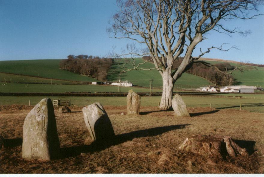
St Colmac Cottages Stone Circle submitted by saille on 20th Jan 2004. Stone Circle at Ettric bay.
NS044668
(View photo, vote or add a comment)
Log Text: St Colmac Cottages Stone Circle: Defeated by a pond between us and the stone circle, a large heap of cow dung by the gate, heavy mist, and running out of time before our ferry back, we stopped at the gate and photographed this from a distance.
We had tried to see the standing stone near Calmac Bridge, but the farmers were moving a large herd of cattle into the field, and we would have had to wait for ages. Rapidly running out of time before we needed to get back to Rounsay for the ferry, we pressed on to St. Colmac Cottages, where we parked at the entrance to the field with the stone circle. Here, the farmer has created a fenced walkway along the side of the road.
The walkway, however, was deep in wet slurry from the cows having just been moved down this path, and the field was sodden. Arriving at the gate into the field, the farmer had also dumped a whole load of cow manure just the other side of the gate, making it incredibly uninviting to walk to the stone circle, which we could just see through the mist in the field.
At this point, not having wellies, I realised I’d rather see the standing stone inscribed with a cross before we left the island, so we waded back to the car and set off just down the road to the ruined church at Calmac Bridge.
Barmore Fort
Trip No.48 Entry No.5 Date Added: 5th Oct 2017
Site Type: Hillfort
Country: Scotland (Cowal)
Visited: Saw from a distance on 21st Sep 2017. My rating: Condition 3 Ambience 4 Access 4
Barmore Fort submitted by SolarMegalith on 28th Aug 2017. The northern wall of the Barmore fort (photo taken on August 2017).
(View photo, vote or add a comment)
Log Text: Barmore Hillfort, Ormidale, Argyll: We saw this hillfort from a distance only. The map indicated a footbridge across the River Ruel. We drove up and down several times but couldn’t find it. The ground was so wet after heavy rain, we would have needed wellies to navigate the fields, so elected to view this from a distance only. We did drive back along the A886 looking for a parking space on the south eastern side of the fort, but there were only private driveways. A disappointing end to the day.
Castle Hill (Ancrum)
Trip No.47 Entry No.4 Date Added: 4th Oct 2017
Site Type: Hillfort
Country: Scotland (Scottish Borders)
Visited: Saw from a distance on 20th Sep 2017. My rating: Condition 2 Ambience 4 Access 4
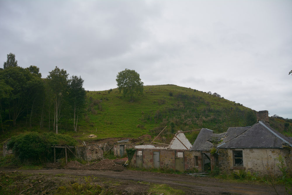
Castle Hill (Ancrum) submitted by Anne T on 4th Oct 2017. Walking through the gate at the eastern side of the ruins, and walking over the old pack horse bridge, the western side of the hillfort can be seen. We were unable to get any further along this path as it was closed due to building works. There is another route to the eastern side of the fort from Ancrum village.
(View photo, vote or add a comment)
Log Text: Castle Hill Hillfort, Ancrum, Scottish Borders: It was getting late in the evening, with dusk coming on, so sadly there wasn’t time to drive back into Ancrum and back round the other side to clamber up to this enticing hill fort, which is visible from Ancrum Old Church and can also be clearly seen on UK Grid Reference Finder. We did try walking across the pack horse bridge across Ale Water, letting ourselves out of the wrought iron gates at the eastern side, but the cottage and adjacent barns we’d have needed to walk through were a building site and were cordoned off.
Decided to leave this for another day, and drove back past the market cross to photograph that before heading off to Armadale.
Green Humbleton Hillfort
Trip No.37 Entry No.8 Date Added: 8th Aug 2017
Site Type: Hillfort
Country: Scotland (Scottish Borders)
Visited: Saw from a distance on 6th Aug 2017. My rating: Condition 3 Ambience 4 Access 3

Green Humbleton Hillfort submitted by NeilD on 6th Oct 2003. Green Humbleton-2
Northumberland
NT 846277
(View photo, vote or add a comment)
Log Text: Green Humbleton Hillfort: Having been virtually blown off the hillside at Green Humbleton Scooped Settlement on our way up the Pennine Way, we decided we’d visit the Stob Stones first and see if the wind died down on our way back. If the wind was bad on Stob Rig, then what would it be like on the top of this cone-shaped hill? It didn't, so reluctantly we decided to try on a warm, sunny day.
By the time we walked back down the Pennine Way/St Cuthbert’s Way, we were absolutely soaking wet, but at least in the valley below the wind had died down. Rather than the 6-8 cars in the parking area by Bowmont Water, there was only one camper van and our car. A lovely spot for some ‘wild camping’.
Midshiels Cairn
Trip No.29 Entry No.8 Date Added: 31st Jul 2017
Site Type: Cairn
Country: Scotland (Scottish Borders)
Visited: Saw from a distance on 3rd Jun 2017. My rating: Condition 3 Ambience 4 Access 4
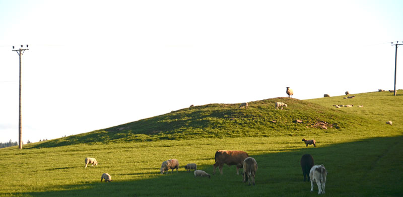
Midshiels Cairn submitted by Anne T on 4th Jun 2017. This is the closest we could get to the cairn on this visit - most of the young bullocks that had been on the right hand slope of the cairn were running (fast!) towards where we were standing at the gate to the field.
(View photo, vote or add a comment)
Log Text: Midshiels Cairn, Hawick: See visit report for Midshiels Standing Stone (the two are 90 metres apart), sites entered separately as Canmore lists them individually. Couldn't get really close to the cairn - would have loved to have walked up to it, but there was a really big bull and lots of over-friendly and very lively bullocks in the field. Must revisit at a different time of year!
There are plenty of other forts and settlements around here. The problem with another visit, is which sites to pick?
Elvaplain
Date Added: 23rd Jul 2017
Site Type: Stone Circle
Country: England (Cumbria)
Visited: Saw from a distance on 29th May 2016. My rating: Condition 3 Ambience 4 Access 4
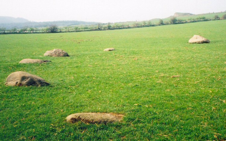
Elvaplain submitted by LizH on 29th Aug 2007. A closer picture of the stones in the circle
(View photo, vote or add a comment)
Log Text: Elvaplain Stone Circle, Setmurthy, Cumbria: After having seen the tumulus and settlements at Aughertree Fell we set off for Elva Hill. With a stunning image on the Visit Cumbria website, which told us this although this stone circle was on private land, it could be approached by a footpath, we found Elva Plain farm and the footpath up to Elva Hill easily enough. With well kept sheep and their large lambs, we enjoyed the sunshine as we walked up the hill. But, and there was a big BUT - the farmer had tied the gates up so strongly with thick twine it was like trying to untie the Gordian knot. With four gates to get through, and some of them wired shut, we could only see this stone circle from afar. Frustrating. If the farmer had been around, I would have asked (nicely) for access to the field. Whilst the stones are largely flat and just visible above ground (between the sheep!), this stone circle is in a stunning location, looking out over Bassenthwaite Lake in the valley to the south west and the fells beyond. Elva Hill (now quarried) lies to the north.
Carby Hill
Trip No.31 Entry No.5 Date Added: 30th Jun 2017
Site Type: Ancient Village or Settlement
Country: Scotland (Scottish Borders)
Visited: Saw from a distance on 24th Jun 2017. My rating: Condition 2 Ambience 4 Access 3
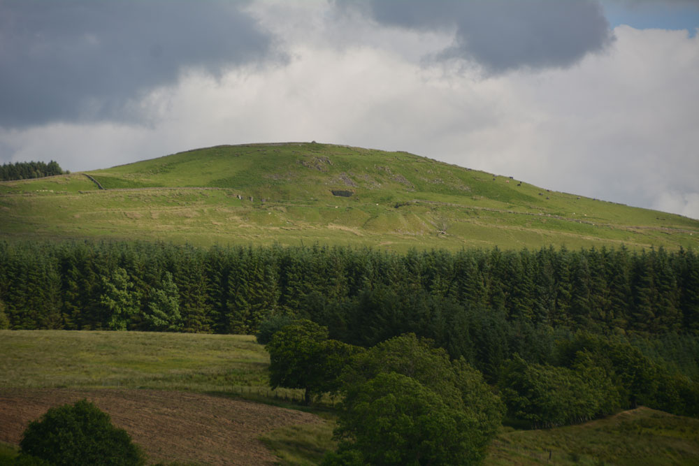
Carby Hill submitted by Anne T on 25th Jun 2017. We only saw Carby Hill Settlement from the Milnholm Cross just south of Newcastleton, then again from the track by the quarry just below the fort/settlement. When we arrived, we saw some enormous cattle grazing the site. Even my husband balked, and he was brought up on a farm and is used to these beasts. Looking forward to a return trip in the not too distant future - it looks amazing.
(View photo, vote or add a comment)
Log Text: Carby Hill Settlement, Scottish Borders: We only got to see this from a distance because of the ENORMOUS cattle grazing it's slopes. Even my husband, who was brought up on a farm was wary of these beasts. We plan to come back for a repeat visit in a month or so. Whilst the hill looks steep, from the path from the nearby quarry towards the base of the hill, the climb didn't look too bad.
Gogar Stone
Trip No.25 Entry No.4 Date Added: 21st May 2017
Site Type: Standing Stone (Menhir)
Country: Scotland (Midlothian)
Visited: Saw from a distance on 18th May 2017. My rating: Ambience 3 Access 4
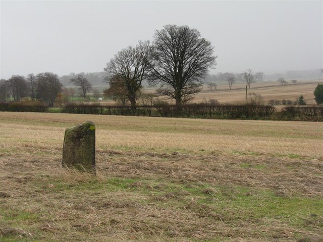
Gogar Stone submitted by Andy B on 13th Mar 2010. Standing stone at Gogar
Copyright M J Richardson and licensed for reuse under the Creative Commons Licence.
(View photo, vote or add a comment)
Log Text: The Gogar Stone, West Lothian: This stone was conveniently located on our way back into Edinburgh, although we were only able to see it from a distance. Sited towards southern edge of a huge field, about 300 metres south east of East Norton Farm, access to the field can be gained from Freelands Road through the large gaps in the hedge which runs to the northern side of the road.
At the time of our visit, a crop of wheat was almost knee high in the field. We walked along the crop-free area of the field running alongside Freelands Road side, seeking a tractor track we could walk along to reach the stone. Not finding this, we turned and walked north, following the edge of the field along Gogarstone Road. Again, no track. I started trying to place my feet carefully between the densely planted rows of wheat without damaging them, but even my feet were too large to fit sideways inside the rows; it took me five minutes to get some 20 rows in, and only 1/10th way there!
I could have kept walking round this enormous field, but time was running short. We decided to come back once the crop had been harvested, and moved on to the Physic Well in Corstophine.
Falla Knowe Cairn
Date Added: 24th Apr 2015
Site Type: Cairn
Country: Scotland (Scottish Borders)
Visited: Saw from a distance on 23rd Apr 2015. My rating: Access 4

Falla Knowe Cairn submitted by durhamnature on 3rd Oct 2012. Cross-section drawing from Berwickshire Naturalists via archive.org, showing location of urn and flint scraper.
Site in Scottish Borders Scotland
(View photo, vote or add a comment)
Log Text: Falla Knowe Cairn, Scottish Borders: Not quite the actual Falla Knowe robbed out cairn, but one nearby.
Travelling up Dere Street, having parked next to Pennymuir Roman Camp A just across the road from this section of the Roman Road, we made our way north up this deeply rutted section of the footpath towards Black Knowe and Trestle Cairns (wellies will be needed after wet weather - it was bad enough after a dry spell). Whilst there were a number of cairns, settlements and earthworks marked on the map in the field to our left, it was difficult to make out any features amongst the tussocks of grass and heather. The forest marked on the map immediately after the road has now been cut down, leaving large stumps sticking up out of the ground like ancient teeth.
We did notice that the corner of the stone wall/dyke and wooden fence post was placed almost dead centre of a circular raised mound. Whilst this cairn is marked on the Canmore Mapping for RCAHMS site 58154 no details are given. Grid reference for this cairn is NT 75204 14973.
Garn Turne
Date Added: 28th Aug 2014
Site Type: Chambered Tomb
Country: Wales (Pembrokeshire)
Visited: Saw from a distance on 23rd Aug 2014. My rating: Access 1
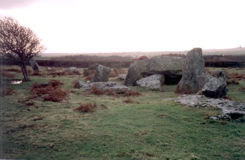
Garn Turne submitted by steveco on 24th Feb 2002. Garn Turn Burial Chamber SM979272.
(View photo, vote or add a comment)
Log Text: Burial chamber at Garn Turne Rocks, Pembrokeshire: (couldn't find anywhere to access this site): The final sites we wanted to see before hitting the motorway home to Northumberland were the burial chambers at Garn Turne. Having successfully located the field and the footpath nearest to the largest burial chamber, we parked in an extended passing place near the footpath. We met a couple of local ladies with their families picking blackberries in the hedgerows and chatted briefly, telling them where we were going; they didn’t seem to think there would be a problem with access.
Walking to 50 metres or so up the footpath to a gate in the field, we could see no access into the Garn Turne Enclosure. My husband hopped across the gate whilst I took photographs of the very curious cows in the adjacent field who’d come to see what we were up to!
From this footpath, the chamber appeared to be inaccessible – there seemed to be no gates whatsoever. When we looked at the Portal later in the day, there were lots of other photographs of this site, and we are left wondering how they accessed it. Other web sites mention squeezing through hedges, and I don’t like to do this without permission from the farmer. I had to be content with a photograph from a distance.
By way of compensation, we went to see Ogham and Latin inscribed stone at St. Dogwell’s Church (just marked as ‘Stone’ on the map, next to Sealyham Bridge).
However, there was a second chamber on the map, at approximate grid reference SM 98269 26566 (the UK Grid Finder’s images are shrouded in cloud, so can’t get a precise fix). We found the very overgrown footpath that took us closest to the chamber, only to be met by a very aggressive combine harvester driver, who forced us to reverse at least a quarter of a mile, pull over for him, then block our way. At this point we gave up and decided to head for home, only to catch up with said combine harvester and had to follow him at about 15 miles an hour for the next four or five miles (he refused to let us by at any available passing place).
Trefael
Date Added: 27th Aug 2014
Site Type: Rock Art
Country: Wales (Pembrokeshire)
Visited: Saw from a distance on 23rd Aug 2014
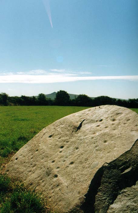
Trefael submitted by PaulM on 17th Aug 2002. This cup-marked stone stands in a field near Trefael at SN10294028. See main site entry for more details.
(View photo, vote or add a comment)
Log Text: Trafael Rock Art, Pembrokshire: We were looking forward to seeing this rare example of rock art in Wales, but despite driving up and down the B4582 road twice, we couldn’t find any of the marked footpaths. We could identify from the field pattern from our detailed map exactly where the stone was located. I suggested going to Bayvil church, further down the footpath, and walking back from there. On our second drive-past, we saw a very clear, official notice on the gate to the field saying ‘access to the capstone only with the permission of the landowner’. As we will have to research who the landowner is, we’ll need to save a visit to this rock art for another time.
However, we were well compensated by stumbling upon Nevern church with its stone crosses a few minutes later.
Ros Castle hillfort
Date Added: 19th Aug 2014
Site Type: Hillfort
Country: England (Northumberland)
Visited: Saw from a distance on 17th Aug 2014. My rating: Condition 4 Ambience 5 Access 3
Ros Castle hillfort submitted by SolarMegalith on 25th Jun 2014. Well-preserved rampart in the southern part of Ros Castle hillfort (photo taken on May 2014).
(View photo, vote or add a comment)
Log Text: Driving back across Hepburn Moor towards the A1, the purple heather spreading in front of us was truly impressive. Although early evening with looming black clouds, we were going to stop off and look at this really impressive ancient monument, but when I opened the car door, it was torn from my hand by the wind and the map I'd been using was whipped across the dashboard to the far side of the car. We'd also had difficulty standing upright in the wind at Fowberry Moor only an hour before, so despite seeing an intrepid family with backpacks and young children in tow make their way across the moor, we decided to leave walking to the top of this Iron Age Hill Fort until another day.
I wasn’t aware that there was any rock art in this area, but thanks to SolarMegalith’s photographs, we’ll look forward to seeing this on our next visit.
Merkland Cross (Woodhouse)
Trip No.190 Entry No.2 Date Added: 18th Sep 2024
Site Type: Ancient Cross
Country: Scotland (Dumfries and Galloway)
Visited: Yes on 13th Sep 2024. My rating: Condition 3 Ambience 3 Access 4
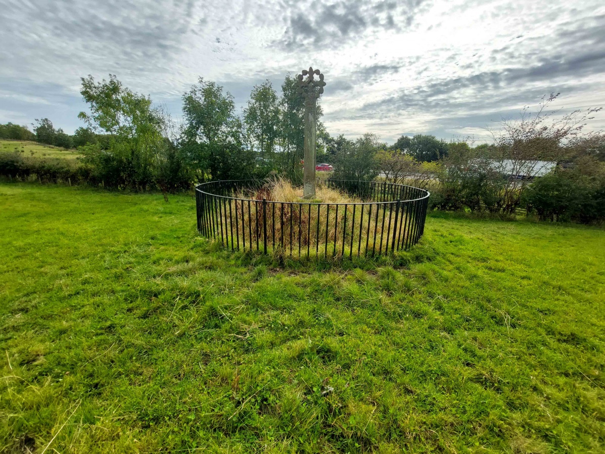
Merkland Cross (Woodhouse) submitted by Anne T on 15th Sep 2024. Standing behind the cross looking south westwards across the M74.
(View photo, vote or add a comment)
Log Text: Merkland Cross: Almost ten years have passed since our first visit in October 2014, but nothing much has changed. This would have been a glorious location if not for the tremendous amount of traffic rushing along the motorway to the west of this cross.
Langholm Market Cross
Trip No.190 Entry No.1 Date Added: 18th Sep 2024
Site Type: Ancient Cross
Country: Scotland (Dumfries and Galloway)
Visited: Yes on 13th Sep 2024. My rating: Condition 3 Ambience 3 Access 5
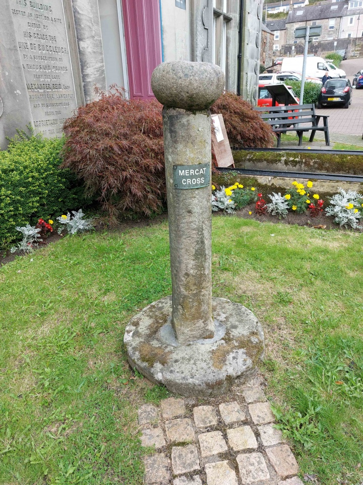
Langholm Market Cross submitted by Anne T on 17th Sep 2024. The cross, looking back towards the parking area in Parliament Square/Jouker's Close, showing the 'modern' sign attached to it explaining its purpose.
(View photo, vote or add a comment)
Log Text: Langholm Market Cross: It's odd to think we've driven past this cross many times, but never noticed it. A curiously small cross with a round boulder on top inscribed with a cross. Also an odd location, sited next to a statue, an information board about astronaut and first man on the moon, Neil Armstrong (now a freeman of the town) and an archway created by Thomas Telford.
The heavy traffic whizzing by on the main road made it difficult to take some of the photos without risking getting knocked over by the huge lorries driving through the narrow high street.
Birrens Roman Fort
Trip No.190 Entry No.3 Date Added: 18th Sep 2024
Site Type: Stone Fort or Dun
Country: Scotland (Dumfries and Galloway)
Visited: Yes on 13th Sep 2024. My rating: Condition 2 Ambience 3 Access 4

Birrens Roman Fort submitted by Anne T on 18th Sep 2024. Standing just inside the gate into the field containing the fort, looking south along the minor road from Middlebie.
(View photo, vote or add a comment)
Log Text: Birrens Roman Fort: I didn't even know this fort existed until we spotted it on the OS map and it was on our way home, so we stopped to look. My hip wouldn't allow me to climb over the stile, but the farmer had left the gate unpadlocked, so we let ourselves carefully in and out.
The field had been heavily churned up by cattle, so walking across it was difficult. Would like to return to this site with some of the reports mentioned in the Canmore record and in better weather.
St Michael's Churchyard Cross (Knill)
Date Added: 1st Aug 2024
Site Type: Ancient Cross
Country: England (Herefordshire)
Visited: Yes on 16th Jul 2024. My rating: Condition 3 Ambience 4 Access 4
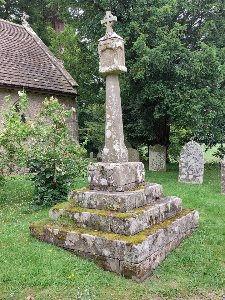
St Michael's Churchyard Cross (Knill) submitted by Anne T on 1st Aug 2024. The cross is about 4m south of the south porch and is very prominent in the churchyard.
(View photo, vote or add a comment)
Log Text: Knill churchyard cross: our first (and only) site visit for some considerable time, due to my current mobility issues. The church was easy to access, and it was lovely to be out in a really rural area on a warm, if overcast day.
Whilst old, the church seemed unremarkable, with no monuments inside of note apart from one very pretty stained glass window and the font, which is thought to date from the 12th century.
A very impressive carved large wooden dragon sits just to the south east of the church.
Penrith Museum
Trip No.189 Entry No.1 Date Added: 25th Feb 2023
Site Type: Museum
Country: England (Cumbria)
Visited: Yes on 13th Oct 2022. My rating: Condition 3 Ambience 4 Access 4
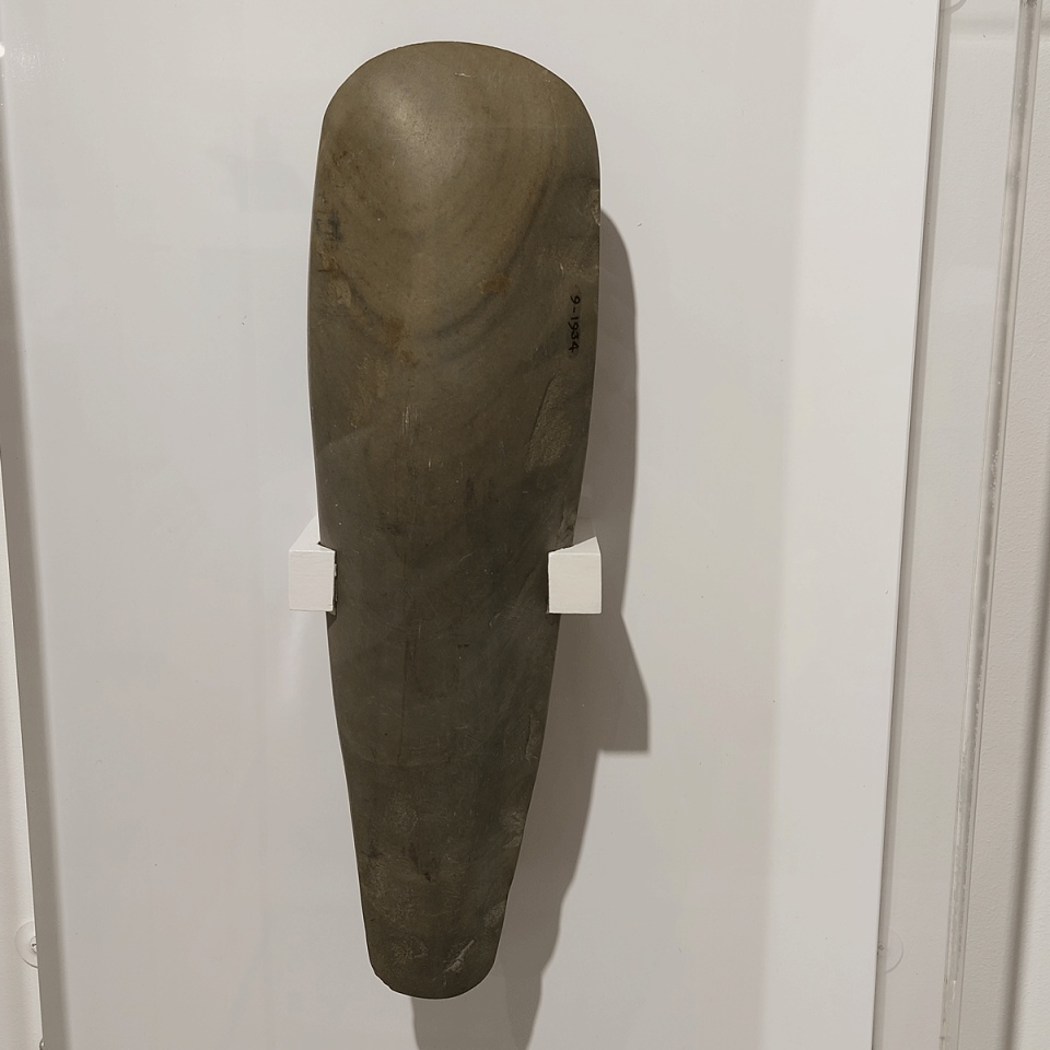
Penrith Museum submitted by Anne T on 25th Feb 2023. This polished late Neolithic Stone Axe was found in Botcherby (the village in which I now live), and comes from the Tullie House Museum collection.
(View photo, vote or add a comment)
Log Text: Penrith Museum: With relatively few trains running between Penrith and Carlisle, and recovering from a broken shoulder, this was of necessity a brief, but reasonably interesting visit. Only a relatively small museum, it has a surprising number of exhibits, although not displayed in any cohesive way, and with frustratingly little information about the items on display. However, I was made very welcome by the staff (volunteer?) members manning the reception desk.
I asked permission to take photographs of some of the exhibits, particularly the cross base, and this was readily granted, providing I didn't use flash. I would go back for another look next time I'm in Penrith, feeling better, and able to carry my proper camera with me, rather than using my mobile phone. Am planning on going back in the not too distant future.
Moor Divock 3
Date Added: 9th Feb 2023
Site Type: Cairn
Country: England (Cumbria)
Visited: Yes on 28th Jun 2014. My rating: Condition 3 Ambience 4 Access 3
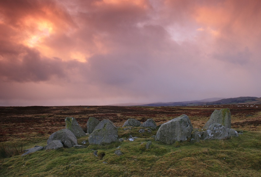
Moor Divock 4 submitted by postman on 25th Oct 2012. Sometimes a friend at work will ask why I do this , but the question isn't why I do, it's why don't you ? (though really I know the answer)
(View photo, vote or add a comment)
Log Text: After visiting the Cop Stone, we walked up to the Cairn Circle (which is clearly visible from the footpath). Whilst ruined, it's atmospheric. The more I sat on the edge of the cairn and looked round, the more there is to see. I'd like to go round with someone who knows this area better than I, so I can understand it better. [Note: I originally confused this with Moor Divock 4, the cairn circle and small stone row just to the north. Looking back on my photographs, I could find no evidence of this feature on the ground].
St Ninian's Preconquest Monastery (Ninekirks)
Trip No.188 Entry No.2 Date Added: 18th Sep 2022
Site Type: Ancient Village or Settlement
Country: England (Cumbria)
Visited: Yes on 13th Sep 2022. My rating: Condition 1 Ambience 4 Access 3
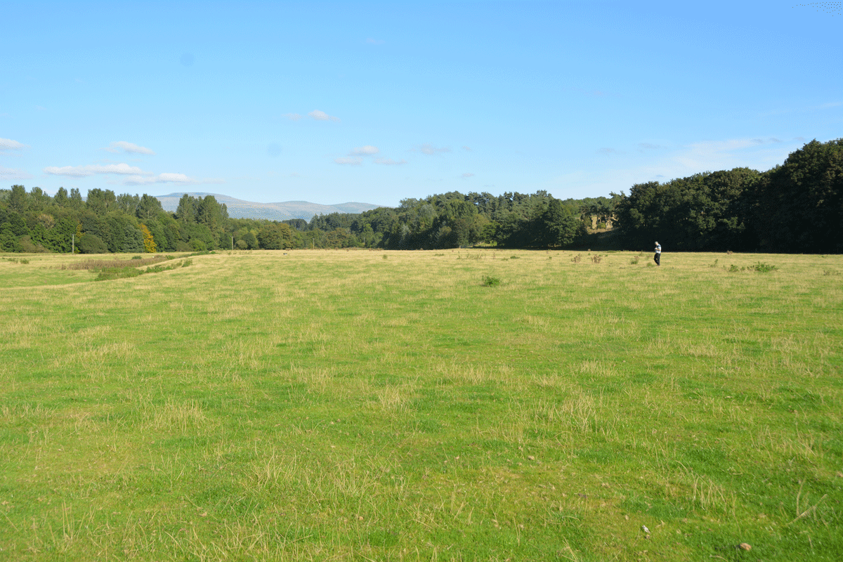
St Ninian's Preconquest Monastery (Ninekirks) submitted by Anne T on 18th Sep 2022. Husband, Andrew, stands at the grid reference given by Historic England for this site. Only a few very low 'lumps and bumps' visible in the landscape, but after a prolonged dry period, some lighter areas of grass may have identified the vague outline of foundations of buildings. Certainly some harder areas of ground (felt by our feet) seemed to run in straight lines, and could indicate stone foundations under the turf.
(View photo, vote or add a comment)
Log Text: St Ninian's Pre-Conquest Monastic Site: See visit report for St Ninian's Church (Ninekirks) for now. More details to follow.
