Contributory members are able to log private notes and comments about each site
Sites Anne T has logged. View this log as a table or view the most recent logs from everyone
Merrivale Centre N
Trip No.133 Entry No.3 Date Added: 4th Jul 2019
Site Type: Cairn
Country: England (Devon)
Visited: Yes on 14th May 2019. My rating: Condition 3 Ambience 4 Access 4
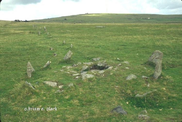
Merrivale Centre N submitted by bec-zog on 19th Nov 2003. Cyst (3) @ the Merrivale complex
(View photo, vote or add a comment)
Log Text: Merrivale Centre Cairn with Cist: Half way down Merrivale North (Row A or Row 1), we hopped across to row 2 to take a look at the cairn in the middle of the row. Fascinating. Worried about the complexity of recording all these sites in my photo/walk journal, Angie Lake told me about the Butler "Atlas of Antiquities" series of 5 books, which has hugely increased my understanding of these sites. Thanks, Angie!
Merrivale 6
Trip No.133 Entry No.10 Date Added: 17th Jul 2019
Site Type: Stone Row / Alignment
Country: England (Devon)
Visited: Yes on 14th May 2019. My rating: Condition 2 Ambience 3 Access 4
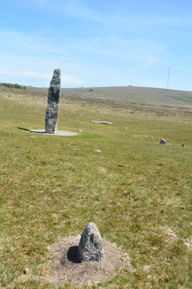
Merrivale 6 submitted by Anne T on 8th Jul 2019. Comparing my photographs to those on Sandy G's Stone Rows of Great Britain website, the only stone visible of Merrivale Row 6 is in the foreground of this photo. Standing just to its west, looking east.
(View photo, vote or add a comment)
Log Text: Merrivale 6 stone row: Only one stone was visible of this row, and thankfully we had Sandy G to point out the location of the row and the only stone of this very short row visible - the western most stone. So many features around the Merrivale Menhir. I'm really glad we had our guide for the day, and also, at home, the Butler "Dartmoor Atlas of Antiquities" (volume 3) to help interpret all the different stones, cairns and pits.
Merrivale 5
Trip No.133 Entry No.9 Date Added: 17th Jul 2019
Site Type: Stone Row / Alignment
Country: England (Devon)
Visited: Yes on 14th May 2019. My rating: Condition 2 Ambience 3 Access 4
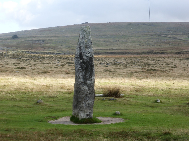
Merrivale 5 submitted by SandyG on 4th Mar 2017. View looking along the row from the western end. Hollow Tor on the horizon sits above the tall stone at the end of the row. 6 July 2016.
(View photo, vote or add a comment)
Log Text: Merrivale 5 stone row: I was getting really 'dazed and confused' about the different stone rows here and what I was photographing, so I asked Sandy, Dave and Andrew to each place a foot on or near each stone of this row!
Merkland Cross (Woodhouse)
Trip No.190 Entry No.2 Date Added: 18th Sep 2024
Site Type: Ancient Cross
Country: Scotland (Dumfries and Galloway)
Visited: Yes on 13th Sep 2024. My rating: Condition 3 Ambience 3 Access 4
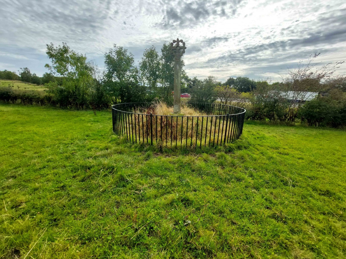
Merkland Cross (Woodhouse) submitted by Anne T on 15th Sep 2024. Standing behind the cross looking south westwards across the M74.
(View photo, vote or add a comment)
Log Text: Merkland Cross: Almost ten years have passed since our first visit in October 2014, but nothing much has changed. This would have been a glorious location if not for the tremendous amount of traffic rushing along the motorway to the west of this cross.
Mercat Cross (Kirkcudbright)
Trip No.183 Entry No.4 Date Added: 22nd Jul 2022
Site Type: Ancient Cross
Country: Scotland (Dumfries and Galloway)
Visited: Yes on 19th Jul 2022. My rating: Condition 3 Ambience 4 Access 5

Mercat Cross (Kirkcudbright) submitted by Anne T on 22nd Jul 2022. The cross at the top of the Tolbooth steps, showing the old buildings in this part of the town. Well worth a walk to see this historic part of town.
(View photo, vote or add a comment)
Log Text: Mercat Cross, Tolbooth, Kirkcudbright: We'd stopped to see the old well at Mclellan's Castle (not named, just a water supply for the castle, so not recorded here), then walked across to the High Street. This is a lovely old market cross, now displayed high on the steps of the Tolbooth. Well worth walking across town to the High Street, as there are some great historic, old buildings to see. Perhaps a little late for the Portal, this cross being 17th century, but well worth a visit. There is also a well/well head underneath the cross.
Mercat Cross (Clackmannan)
Trip No.84 Entry No.8 Date Added: 26th Jul 2018
Site Type: Ancient Cross
Country: Scotland (Clackmannanshire)
Visited: Yes on 14th Jul 2018. My rating: Condition 3 Ambience 4 Access 5
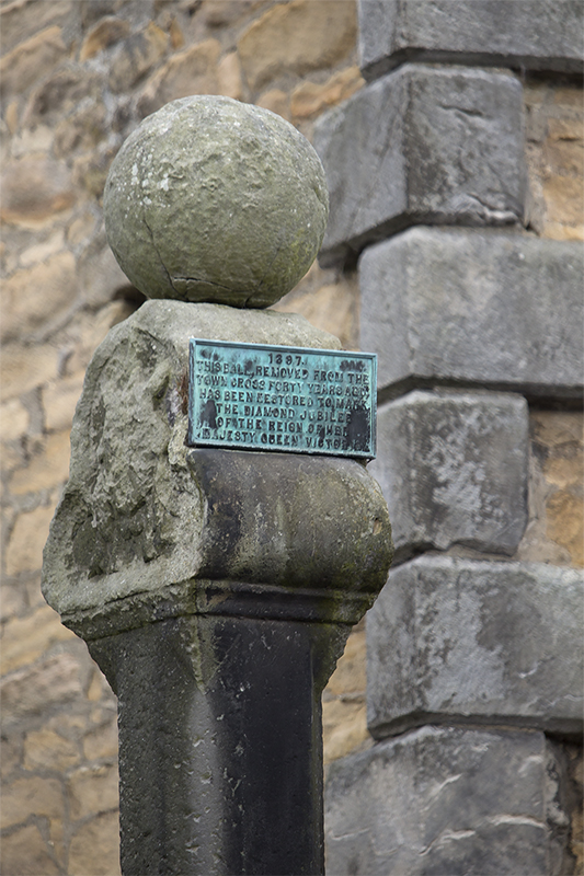
Mercat Cross (Clackmannan) submitted by peigimccann on 27th Aug 2017. Clackmannan market cross
(View photo, vote or add a comment)
Log Text: The Mercat Cross, Clackmannan: The Mercat Cross, the Stone of Mannan and the Tolbooth are all in the same small area. When we arrived, it was about 6.40pm and the sun was low in the sky, giving deep shadows. Much to the amusement of the people drinking outside the pub behind the Tolbooth, I took a number of photographs of these monuments, then retreated to the car to try and get out of the heat. Was worth seeing, but at this time of day I wanted something to eat, drink and cool shade!
Menzion
Trip No.5 Entry No.2 Date Added: 14th Aug 2016
Site Type: Standing Stones
Country: Scotland (Scottish Borders)
Visited: Yes on 10th Aug 2016. My rating: Condition 2 Ambience 3 Access 5
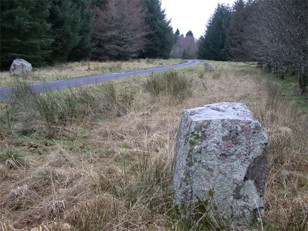
Menzion submitted by nicoladidsbury on 28th Jan 2005. This photo tries to capture the group of three stones, that make up the Menzion site.
This is a beautifully, quiet place. The stones are not very big, less than a metre high, but remarkable because they are absolutely covered in lichens, as are the branches of the over hanging trees. A sure sign of the purity of the air.
(View photo, vote or add a comment)
Log Text: Menzion Stones, Tweedsmuir: I confess to being really confused about this site (not too difficult, really!). Whilst the map showed three standing stones in close proximity at the sides of the road (2 at the western side, 1 on the eastern side) we could only find 2, one on either side of the road. Of the photos on the Portal, we couldn’t find the square topped one. Somehow we’d managed to misplace our GPS, so I felt a bit helpless and frustrated at having driven all this way and missed some of what we’d come to see.
According to the Canmore site, the grid references are NT 0952 2397, NT 0949 2398, NT 0953 2399. Getting out of the car into the ‘Scotch Mist’, I walked up and down the grass verges, peering into the tall undergrowth, for a couple of hundred yards trying to find the location of the third stone. We saw the stones at NT 0952 2397 and NT 0949 2398. The latter was almost hidden by a long, low conifer branch.
Had the sun been out, there would have been great views down to the River Tween to the north-west.
Megget Stone
Trip No.82 Entry No.2 Date Added: 23rd Jul 2018
Site Type: Standing Stone (Menhir)
Country: Scotland (Scottish Borders)
Visited: Yes on 12th Jul 2018. My rating: Condition 3 Ambience 4 Access 5
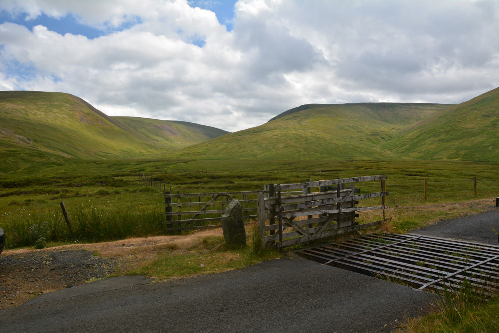
Megget Stone submitted by Anne T on 23rd Jul 2018. Looking across the Megget Stone to the West South West, across the step or shoulder in its eastern face, and trying to capture the majesty of the surrounding hills. Canmore tells us this is a slab of gritty greywacke, 7.5 ins thick, and 3ft 4ins high on one side, and 2ft 9ins above ground level; they add that the step/shoulder is apparently artificial.
(View photo, vote or add a comment)
Log Text: Megget Stone, east of Talla Reservoir: Continuing along the twisty, windy road that follows Talla Water, we passed an intrepid cyclist making his way slowly up the hills, and some motorcyclists who had stopped to photographs the waterfalls along the route.
When we got to the grid reference given for the Megget Stone, we couldn’t see it at first, as it was hidden by the gate. There was room for a car to park just past the cattle grid and gate. Hopping out to take photographs and examine this stone in more detail, the cyclist past us, and as he did, I realised that at this point, it was downhill all the way – the watershed.
This stone is definitely a boundary marker, not a true standing stone. It looks as if its eastern face has been broken. In a remote but lovely spot.
Meg's Well, Aydon
Date Added: 20th Jun 2014
Site Type: Holy Well or Sacred Spring
Country: England (Northumberland)
Visited: Yes on 28th May 2014
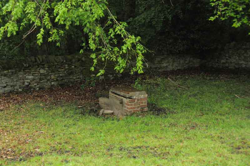
Meg's Well, Aydon submitted by Anne T on 28th May 2014. This is a view of Meg's Well from the road through the village, just below Aydon Cottage, adjacent to the footpath running towards Aydon Castle. The field appears to be private, and when we visited was full of livestock, so there's no direct access. I wouldn't have recognised the well without having already seen an image on the Megalithic Portal (so thank you!). There are no signposts to the well, and the site is very sadly neglected. I haven't been able to find much about the history of the ...
(View photo, vote or add a comment)
Log Text: None
Meckan's Grave (Loch Riddon)
Trip No.48 Entry No.4 Date Added: 5th Oct 2017
Site Type: Cist
Country: Scotland (Cowal)
Visited: Yes on 5th Oct 2017. My rating: Condition 2 Ambience 4 Access 5
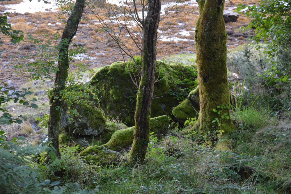
Meckan's Grave (Loch Riddon) submitted by Anne T on 5th Oct 2017. According to Canmore, the burial lies on the mudflat. I was disappointed not to be able to scramble down to take a closer look, but shot some photographs through the tree line. On closer inspection at home, I think this is the cist burial site - caught purely by chance!
(View photo, vote or add a comment)
Log Text: Meckan's Grave, Loch Ridon/Loch Ruel: There is only a signpost by natural crag but grid reference puts it on the mudflats at the head of Loch Riddon/Loch Ruel. There was a phone signal of sorts so I called up some images of Meckan’s Grave on the internet, only to find most people had photographed the crag, which had been blasted through to create the road.
It was virtually impossible for me to scramble down to the mudflats, so we ended up peering through the trees and caught what I thought might be a cist burial, which was more obvious on the computer screen at home. We didn’t spot the plaque.
We drove down to Shellfield Farm and looked back up at the head of the Loch from the fence next to the loch – wonderful in the early evening light.
Meacombe Cist
Trip No.131 Entry No.5 Date Added: 4th Jun 2019
Site Type: Burial Chamber or Dolmen
Country: England (Devon)
Visited: Yes on 12th May 2019. My rating: Condition 3 Ambience 4 Access 4
Meacombe Cist submitted by hamish on 14th Nov 2004. A fine little chambered tomb, found by chance.
(View photo, vote or add a comment)
Log Text: Meacombe Cist: We'd arrived in Devon in a torrential downpour, although this had cleared in the evening. The sheer amount of rain might have contributed to ripping away the road surface at the edge of the road leading to this burial chamber.
The roads to this burial chamber were atrocious, with very deep potholes and a centre ‘bank’ of earth and grass, which at times tickled the underneath of the car - we debated about turning back at one point. The road was so narrow and parking so difficult that we parked in the next field gate to the north of the cist. Andrew stayed with the car whilst I let myself into the adjacent field, which also looked as if it had archaeology (but are just rocky outcrops, nothing on Pastscape or HE), but didn’t stop as Andrew needed to move the car. Took some quick photos, then ran back.
I was worried about trespassing, but there was a well worn tractor track into an open gate into the next field, then a track from the gate to the burial chamber.
We had hoped to see the enclosure and hut circle to the south west, but no way of stopping, nor could we see any sensible places to stop.
Note: I only found this a 'short walk on the footpath' from the adjacent field.
Mayshiel Stone Circle
Trip No.105 Entry No.4 Date Added: 4th Nov 2018
Site Type: Stone Circle
Country: Scotland (East Lothian)
Visited: Yes on 27th Oct 2018. My rating: Condition 3 Ambience 4 Access 4
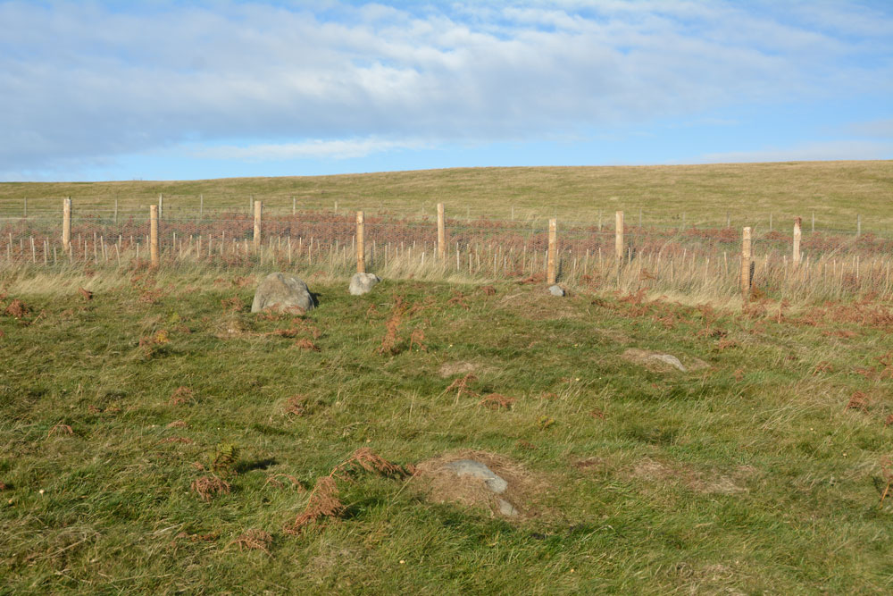
Mayshiel Stone Circle submitted by Anne T on 4th Nov 2018. The Mayshiel stones from the south. At the top of the slope, there were five stones which protruded out of the grass. Looking more closely, there were some further down-slope, largely hidden by turf, but nevertheless still part of this stone setting.
(View photo, vote or add a comment)
Log Text: Mayshiel Stone Setting: Whilst we were here to see the stones at NT 6298 6465, the first thing I spotted was a huge pile of clearance stones just up the hill in a field just north of the B6355. The second was what looked like a standing stone at the edge of the field at NT 62924 64612. On closer look, this may have been a large field clearance stone, which sits on top of other small boulders.
The stones at Mayshiel are very close to the road. At first glance, there are only three, but the longer we looked, more became evident.
There were also another group of stones at approx. NT 62814 64541 which had the appearance of a cist, but the stones forming the longer sides were very large. These stones may have just been a natural outcrop. One of the stones had been broken and the split off bit was lying half way along the northern end of the group.
Looking at the latter group of stones at home, they were similar in description to Canmore’s description of the Packman’s Grave (above).
At first glance, an insignificant site, but the more we walked round, the better it became, and it was well worth stopping off to look at this.
Maxton Burgh (St Boswells)
Trip No.50 Entry No.3 Date Added: 6th Oct 2017
Site Type: Ancient Cross
Country: Scotland (Scottish Borders)
Visited: Yes on 24th Sep 2017. My rating: Condition 3 Ambience 3 Access 5
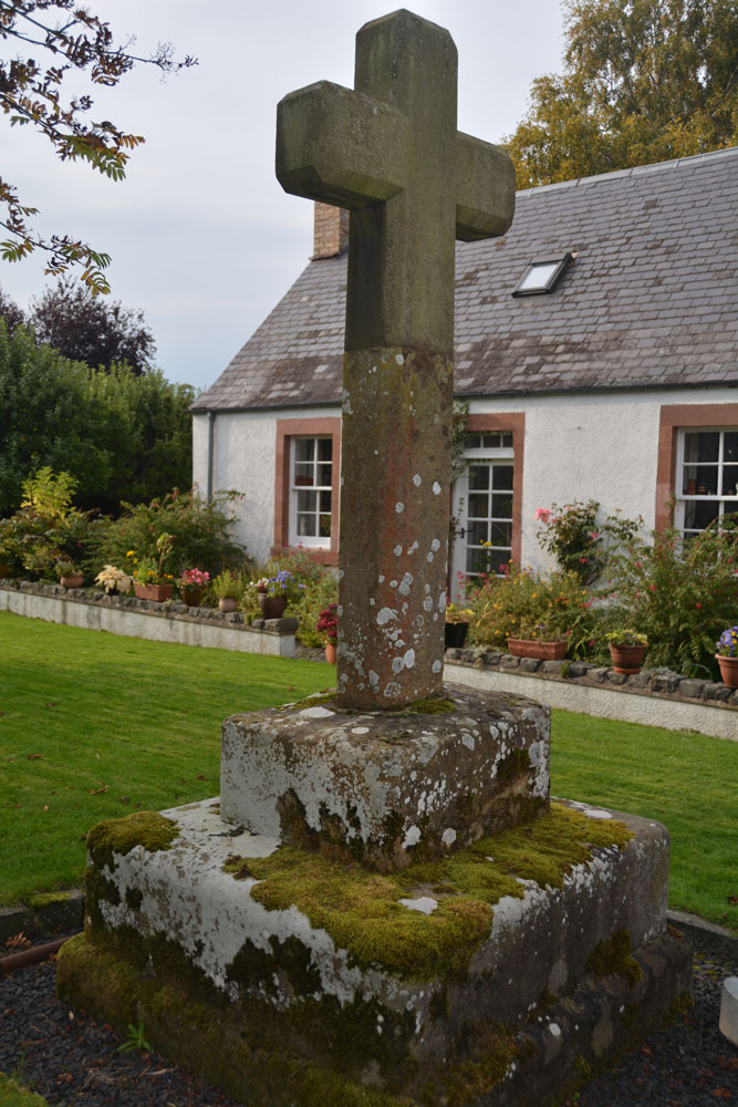
Maxton Burgh (St Boswells) submitted by Anne T on 6th Oct 2017. The cross from about 10 meters south east of it, trying to eliminate the view of the land rover parked immediately next to it.
(View photo, vote or add a comment)
Log Text: Maxton Burgh Cross, Scottish Borders: We stopped off at a garden centre café in Newton St. Boswell’s for refreshments, then carried on eastwards towards the small village of Maxton. We didn’t have precise grid references for this cross at the time, and with no mobile signal, we were a little lost as to where to find it. Eventually I managed to pull up the website for Maxton village, which described the location of the cross as being just off the main street, in front of what was the smiddy, “on what remains of the village green”. They state that “Parts of the cross are probably original 13th century, but the main part was replaced in 1881 by Sir William Ramsay Fairfax, Bart.”
We drove up and down the A699 through the village trying to find the old village green, even driving down St. Cuthbert’s Way to the church. Eventually, we decided to park on the main road and walk around. From here, the cross was easy to spot. The old village green is now someone’s private garden. The man who lived in the cottage immediately behind the cross said it was OK to go and look. Photographing the cross was somewhat hampered by the land rover parked immediately next to it. Fancy having the old village green for your private garden!
Mauley Cross
Trip No.7 Entry No.1 Date Added: 2nd Oct 2016
Site Type: Ancient Cross
Country: England (Yorkshire (North))
Visited: Yes on 1st Oct 2016
Mauley Cross submitted by vagabondnma on 13th Mar 2007. Mauley Cross standing on a raised area of land by the forest road backed by a plantation.
(View photo, vote or add a comment)
Log Text: Mauley Cross, north of Stape, North Yorkshire: Chrispy's directions were spot on - thanks! Trust us to arrive on the day of a rally, with all the cars coming in the opposite direction. Being off-stage, they needed to stick to the speed limit and we found ourselves constantly pulling in to passing places. It was fun to see the different cars.
Arriving at the junction of the metalled road (Keys Beck Road) which runs north through Stape then up over the moors and the forest track (Brown Howe Road) we came across ‘road closed 1st October 2016 due to the Trackrod Rally). There were some marshalls sitting at the wide entrance to this forest track, so we parked between their cars and wandered 50 metres or so up the track to find this cross, making sure to avoid the rally cars which zoomed down every minute or so. After a few minutes a doctor's car zoomed up the track past us and we took advantage of a lull in the stream of cars (there must have been an accident - hope everyone was OK).
Sitting a couple of metres off the forest track, the grass around the cross has been cleared and a couple of tributes sit at its base.
There are two Mauley Crosses listed on the ADS database, the second being just east of Saltergate (this is a similar cross, made out of one piece of sandstone, forming a boundary marker between the parishes of Allerston and Lockton at grid reference SE86679493.
Matfen
Date Added: 16th Jun 2014
Site Type: Standing Stone (Menhir)
Country: England (Northumberland)
Visited: Yes on 15th Jun 2014. My rating: Condition 3 Ambience 3 Access 5
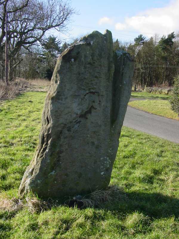
Matfen submitted by PaulH on 2nd Mar 2003. In the village of Matfen. About 2km north of the B6318, the modern road that follows the course of Hadrian's wall.
NZ032705
(View photo, vote or add a comment)
Log Text: This standing stone, near Matfen Hall Hotel/Golf Course, stands on the edge of a road in a hamlet called 'Standing Stone'. It is easy to find, being on a right hand turn just before the main entrance to Matfen Hall Golf Course, and opposite Standing Stone House, about 100 yards from the road junction.
It is difficult to park adjacent to the stone, unless you park in the entrance to the farm/farm buildings, but just opposite the road junction to Standing Stone hamlet, there is another left hand turn with room for a few cars to park at the side of the junction.
The short walk back to the stone was a little difficult, due to the stream of traffic and bicycles moving quickly along the road, but as long as you are careful, it's fine.
There are some impressive cup marks at the base of the north face of the stone, and some more at the top.
Worth seeing, and on the way to The Warrior Stone at Inghoe and Bygate Hill.
Market Cross (Kincardine)
Trip No.84 Entry No.10 Date Added: 26th Jul 2018
Site Type: Ancient Cross
Country: Scotland (Fife)
Visited: Yes on 14th Jul 2018. My rating: Condition 3 Ambience 2 Access 5

Market Cross (Kincardine) submitted by Anne T on 26th Jul 2018. Apart from the finial, this Mercat Cross in Kincardine was virtually identical in style to the Mercat Cross in Clackmannan, not that far away.
(View photo, vote or add a comment)
Log Text: Mercat Cross, Kincardine: Our last stop of this very hot day, thankfully. This cross was in a very busy stop, next to the main bus stop in the town, with lots of take away shops around the ‘triangle’ of what might have been the village green. Not an impressive site, although the cross (apart from the finial) seems almost identical to the Mercat Cross, Clackmannan. Just one to 'tick off the list' that we've seen it (and photographed it).
Mare and Foal
Date Added: 25th Jan 2016
Site Type: Standing Stones
Country: England (Northumberland)
Visited: Yes on 24th Jan 2016. My rating: Condition 3 Ambience 4 Access 5
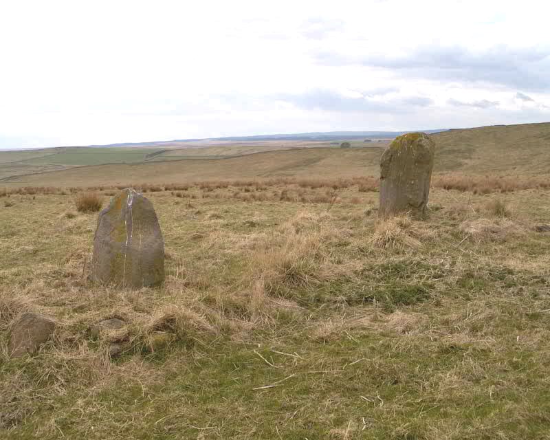
Mare and Foal submitted by spoors599 on 13th Apr 2002. Mare and Foal standing stones, Northumberland.
Landranger Sheet No:86 Grid ref: NY72546632
Located just off the B6318 and close to Hadrians Wall are two standing stones, the larger stone standing 1.51m high, the other 0.98m high at a distance apart of 4.82m. The 1769 Armstrong map of Northumberland marks 3 stones in situ. It has been suggested that the stones formed part of a ?four ? poster?. Loose boulders were packed around the base of the stones to prevent damage by cattle in 1992. The b...
(View photo, vote or add a comment)
Log Text: Mare & Foal Stone Circle, just west of Twice Brewed, Hadrian's Wall: After many months of not being able to get 'out and about', even though the day dawned dull, damp and dreary, it was great to be able to get out into the open countryside again. Strangely, we've driven past this little stone circle on many occasions as we've driven up and down the Military Road (the B6318), but I thought it was just north of Hadrian's Wall. How wrong can you be?
We'd been up into the Edges Green area to try and locate the course of the Roman Aqueduct which wends its way around the contours around here, but it's very difficult to pick out. Anyway, Roman's never did float my boat.
I've wanted to visit this stone circle for ages. We parked at the side of the road leading up toward Shield On The Wall farm. There is no actual footpath here, but it's possible to hop over the wooden fencing where the stone wall adjacent to the B6318 meets the wire fencing which runs northwards up the slope. There were no animals in the field, and the farmer was herding his sheep in the field opposite. I waved and he showed no signs of warning us off.
From the road looking west, it looks as if the stones sit on a low curved mound. The larger stone had a 'bruise' on one side, which in the photographs looked like a cup and ring, but actually seems to be where part of the stone has been broken away.
Mare and Foal
Date Added: 4th Jul 2016
Site Type: Standing Stones
Country: England (Northumberland)
Visited: Yes on 18th Jun 2016. My rating: Condition 3 Ambience 4 Access 4

Mare and Foal submitted by spoors599 on 13th Apr 2002. Mare and Foal standing stones, Northumberland.
Landranger Sheet No:86 Grid ref: NY72546632
Located just off the B6318 and close to Hadrians Wall are two standing stones, the larger stone standing 1.51m high, the other 0.98m high at a distance apart of 4.82m. The 1769 Armstrong map of Northumberland marks 3 stones in situ. It has been suggested that the stones formed part of a ?four ? poster?. Loose boulders were packed around the base of the stones to prevent damage by cattle in 1992. The b...
(View photo, vote or add a comment)
Log Text: Mare & Foal (2nd visit). We had been up at nearby Edges Green for a geology field day (afternoon) as part of the Tynedale North of the Wall Archaeology Group and had the pleasure of taking one of the members of the group (well known to the Portal, but I don't want to give his name here as I've not asked his permission) up to this small but brilliantly placed stone circle. Parking by the side of the minor road off the Military Road, we went through the gate in the field this time (as opposed to clambering over the wooden fence by the road). The ground was really tussocky and walking was difficult for the first 100 yards or so, having to balance on each one to take a step. Andrew and our guest marched off as if it was level ground, and I felt envious! Whilst there isn't a footpath up to this site, it looked as if other people had also recently walked this way.
Coming up to the Mare and Foal from the north-west the stones clearly sat on a raised bank. In the early evening light, it looked very inviting. Closer up, we could see the area around it had been heavily quarried in a number of areas and it looked as if the stones might have been re-erected judging by the packing around them. Standing just south of the smaller stone, looking north up to Cawfields Gap and the Hadrian's Wall ridge, there is a third, smaller stone buried deep in the grass.
Maiden Well (Kettle Hill)
Trip No.36 Entry No.3 Date Added: 31st Jul 2017
Site Type: Holy Well or Sacred Spring
Country: England (Northumberland)
Visited: Yes on 30th Jul 2017. My rating: Condition 3 Ambience 5 Access 4
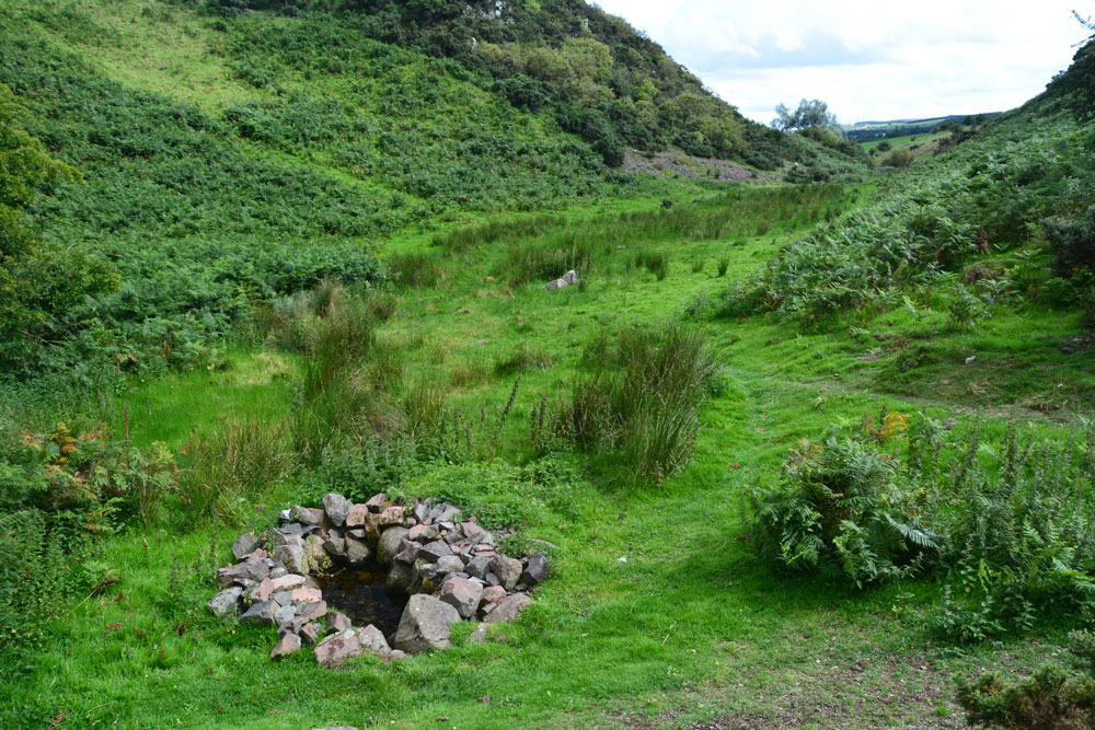
Maiden Well (Kettle Hill) submitted by Anne T on 31st Jul 2017. Standing just north of the well, looking back towards the quarry. The small stream which runs from the well is defined by small groups of stones placed along each side of the water course, together with a lush growth of bracken in the wetter parts of the ground. It's a very enigmatic spot, especially with The Kettles Hillfort rising up above you (to the right, out of sight, in this image).
(View photo, vote or add a comment)
Log Text: Maiden Well and The King's Chair, Wooler: After having walked round the outer perimeter of the promontory of The Kettles, we’d actually stood just above the site of the Maiden Well (Pin Well), but would have needed a rope and harness to descend the vertical cliff down to it. We walked back to the car, drove back into Wooler, then back out again on the road to the tiny (and ancient) hamlet of Earle.
Where the road splits at NT 99100 26973, we took the western fork (right hand if coming from Wooler) and take the track that runs from NT 98924 26750 to a small quarry. Note: the gate to this road is kept padlocked to prevent people taking vehicles up to the quarry, but there are gates for walkers. Husband Andrew hadn’t spotted the gate, so we ended up climbing the fence into the neighbouring field, then back out again!
Just before the main entrance to the quarry a small (overgrown) footpath leads to your left from NT 98808 26845. We followed this for some 300 metres, the nettles eventually giving way to open ground in a small valley/ravine. We first spotted the King's Chair protruding from the hill in front of you, although I was a bit dubious at first as the stone was hidden by lush, tall bracken growing round it from the rock face. Walking further forward the well is hidden under a hawthorn tree.
The well is in a lovely, enigmatic location. It looks as if someone has recently created this lovely circular ‘halo’ of stone around the clear water. A stone a metre of so to it’s north west has a hole at its base. Glimpsing down, I could see the water running into the well pool.
A small stream runs out of the well pool. The water course is marked by groups of stones leading back towards the entrance to the quarry, on either side of the small stream, which is also marked by lush grass and bracken growing on either side of it. I walked up a little way to look at various groups of stones, to find parts of the ground boggy and heavy with water.
With The Kettles rising up above you to the east, this is a really nice spot. I could have lingered longer, but 4-5 Romano-British settlements called. Time to move on.
Maiden Castle (N Yorks)
Date Added: 4th Aug 2014
Site Type: Ancient Village or Settlement
Country: England (Yorkshire (North))
Visited: Yes on 30th Jul 2014. My rating: Condition 4 Ambience 4 Access 3
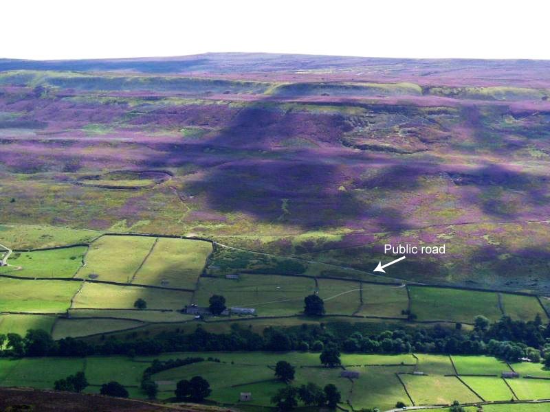
Maiden Castle (N Yorks) submitted by NeilD on 8th Sep 2005. SE 022981
Maiden Castle
(View photo, vote or add a comment)
Log Text: We ran out of time to see this site on 11th July, when we visited Thorborough Henges and West Agra (we got thoroughly distracted by the tremendous rock art at the latter), so took advantage of a trip down to Nottingham to detour via North Yorkshire and Swaledale to visit Maiden Castle.
Signs of the recent Tour de France were everywhere in this area (lots of yellow bunting and yellow bicycles, and spray-painted signs of encouragement to the riders on the roads). We stopped off in picturesque Reeth for lunch, then headed off southwards through the village of Grinton, turning west down a small narrow road with views of the river Swale to the north. This single track road runs for about 2km past ‘Bleak House’ and Harkerside Place. There are a number of footpaths and bridleways which run past Maiden Castle, but we picked the westernmost one, just past the fort, where there is a small parking area, sufficient for 4 or 5 cars.
From the car park, there is clearly marked path which runs (quite steeply) up past the western edge of the fort. As we were putting on our walking boots, two walkers were coming down and commented that the fort was ‘very well preserved; well worth seeing’.
I don’t like steep slopes or drops, but the path was relatively easy, and I needed a helping hand in only one or two rocky parts.
The fort was virtually invisible from the path, and is strangely situated part-way up the hillside. About 200 metres up the slope, the wsestern ditches of the fort suddenly come into view, then a few more paces open up a vista across the whole of the fort area. Turning to look back down the path, there are stunning views across the Swale valley and to the villages of Healaugh and Reeth across the valley.
There is a clear ditch and bank surrounding the fort; from the footpath to the west of the fort, it’s relatively easy to negotiate the ditch and bank easily (husband like a mountain goat, me picking my way gingerly), and ended up in a quiet, gentle spot, out of the wind and spotting rain. The brush underfoot wasn’t like other sites I’ve visited – the interior of the fort had what appeared to be low growing box plants with ferns, and we used sheep tracks to navigate from one point to the next within the fort area to avoid prickled ankles. At the southern end of the fort, where the slope drops steeply into the valley, there are quite a few tumbled stones, as if the fort had an outer wall at some point.
Before we visited, I had come across, and downloaded, the Durham University Archaeological Services report on Maiden Castle and West Hagg (geophysical surveys, report 2631, May 2011), which is available on the web when typing in ‘Maiden Castle Yorkshire’ on my web browser, so were able to largely identify the features they found within the fort, which was a real help in understanding what we were looking at.
Where their report had indicated a probable roundhouse, we found a circular area with very different vegetation, with low lying stones popping up through the grass to indicate where the foundation walls had been.
The walled approaches on the eastern side of the fort were impressive, giving the fort a ‘banjo’ shape. There is also a cairn/round barrow immediately adjacent to the northern end of the northern wall approach road to the fort.
Whilst exploring the fort, we saw other walkers pass by on the footpaths above and below, but very few people actually came into the fort, which was surprising. Definitely worth a visit.
