Contributory members are able to log private notes and comments about each site
Sites Anne T has logged. View this log as a table or view the most recent logs from everyone
Chatton 3
Trip No.30 Entry No.2 Date Added: 14th Jun 2017
Site Type: Rock Art
Country: England (Northumberland)
Visited: Yes on 11th Jun 2017. My rating: Condition 2 Ambience 4 Access 4
Chatton 3 submitted by SolarMegalith on 3rd Aug 2013. The best preserved motif on Chatton 3 panel seen at night (photo taken on June 2013).
(View photo, vote or add a comment)
Log Text: Chatton 3, Rock Art, Northumberland: See visit report for Chatton 1a.
Hurl Stone
Date Added: 31st May 2017
Site Type: Standing Stone (Menhir)
Country: England (Northumberland)
Visited: Yes on 30th Aug 2014. My rating: Condition 2 Ambience 3 Access 4
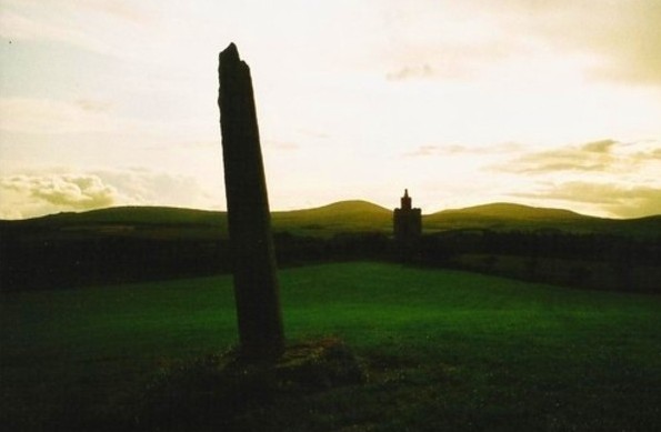
Hurl Stone submitted by Bladup on 30th Dec 2013. The Hurl stone, In the background is a folly built in 2000.
(View photo, vote or add a comment)
Log Text: The Hurl Stone, Newtown, Northumberland. Second visit: Saturday, 30th August 2014. Armed with a letter from the landowner allowing us access, we set off back to the Hurl Stone before the weather turned.
The farmer was busy herding sheep down the road to the field next to the Newtown Mill standing stone. He was using an army style buggy and 4 sheep dogs, which was fascinating in itself. Having watched this, we drove the 100 yards further up to farm at Newtown and bumped up onto the grass verge next to the gate leading into the Hurl Stone field.
It was a longer walk than it looked, through lush ankle high grass to the top of the slight hill. The tall Hurl Stone commandeered the horizon, but I was only about 20 yards away when I realised it had been concreted in. It looked as if at some time it had toppled and been recently re-erected (but if they’d done this, why let the stone lean, unless it was to give the impression it had indeed been hurled? Sorry, this is me being sceptical). This took a little of the shine off seeing the Hurl Stone, but my goodness, what a 360 degree view, which I’ve tried to represent in the photographs submitted to the Portal.
The face of the stone facing the recently built tower (I’m told this is used as a conference centre, but haven’t been able to verify this yet) looks as if it has broken at some time in the past. The quartz crystals within the stone sparkled in the sunlight. There was some, but not much, graffiti carved into it.
The landowner, who resides nearby, opens his gardens under the National Garden Scheme, and according to an archived article in the Hexham Courant, our local paper, has a 14th century chapel, a crusader tomb and two grave slabs belonging to Knights Templar, so I’ll be looking out for dates to go and see these other treasures.
I’m going to write to thank the landowner for allowing us access.
First visit, August 17th 2014: Driving down the road southwards past the hamlet of Newton, we at first only saw the recently built tower in the field to our right. Driving a little further on, we stopped at the standing stone on the opposite side of the road, just below Ewe Hill, to take photographs. When we turned the car and drove back up the road, the Hurl Stone appeared like a sharp needle, just below the top of the hill.
It’s proximity to the modern tower seems suspicious (we immediately asked ourselves if the stone had been moved to provide a good view of it from Liliburn Tower, the landowner’s house, as from the maps, the modern tower and the stone seem to be in direct alignment?).
There were no public footpaths to the stone, so I stopped at the field gateway and took a photograph. I have since written to the landowner to ask for permission to walk to the stone across the field.
Fowberry Park B
Date Added: 19th Aug 2014
Site Type: Rock Art
Country: England (Northumberland)
Visited: Yes on 17th Aug 2014. My rating: Condition 3 Ambience 5 Access 4

Fowberry Park E submitted by durhamnature on 2nd Sep 2012. Rock art, discovered in 1886 from Berwickshire Naturalists, via Archive.org.
(View photo, vote or add a comment)
Log Text: Having been disappointed at not being able to reach the Doddington Stone Cricle from the footpaths across the golf course (they seem to have vanished with an extension to the quarry) we were determined not to head home without having seen something. We spotted a number of other cup and ring marked rocks on the map around Fowberry Park, and headed for the easiest to find – opposite Fowberry Mains Farm.
There was sufficient room to park on the grass verge at the entrance to the footpath, and it was an easy walk up a slight hill, following a stone wall to the left. When we’d almost reached a field boundary to our right, there was a field gateway to the left giving access to outcrops of rock.
We thought we’d have to walk backwards to find our way around a spring, but the farmer has built a path over the small stream and the boggy part of the field, leading to a rocky outcrop immediately to the left on the far side of the stream. This outcrop did not appear to have any rock art.
Following the footpath up the slope to our right, we immediately came upon another, larger, outcrop, and the rock art sprang into view. I’d rate this as highly as the rock art stone at Roughting Linn.
The outcrop has been heavily quarried, but what is left is wonderful. The first set of cup marks we came across appear to have been painted in red ochre, although there seemed to be this red pigment on other parts of the rock, too.
Most astonishing was the long, almost grave-cover shaped rock covered in miniature marks in a row; on closer observation, the marks turned around the end of the rock, forming a tall, narrow U shape. I’ve not seen this formation of marks before.
There were other smaller rocks, buried in the turf, complete with rock art markings, too. The English Rock Art site records 8 different panels, and I’ve since printed off the images of each, together with the grid references (oh, for a GPS system to help!). I’m looking forward to going back to explore more.
Continuing up the hill towards Fowberry Moor, there is a homestead and a settlement. As it was blowing a gale, with gusts of 50 mph and possibly above, we didn’t linger too long. The map shows many other cup and ring marked rocks in the surrounding area, and
Most very definitely worth a second, third and possibly more trips to discover the richness of artefacts in this area.
Yatesfield Hill (Otterburn)
Trip No.33 Entry No.7 Date Added: 11th Jul 2017
Site Type: Standing Stone (Menhir)
Country: England (Northumberland)
Visited: Yes on 8th Jul 2017. My rating: Condition 3 Ambience 4 Access 5
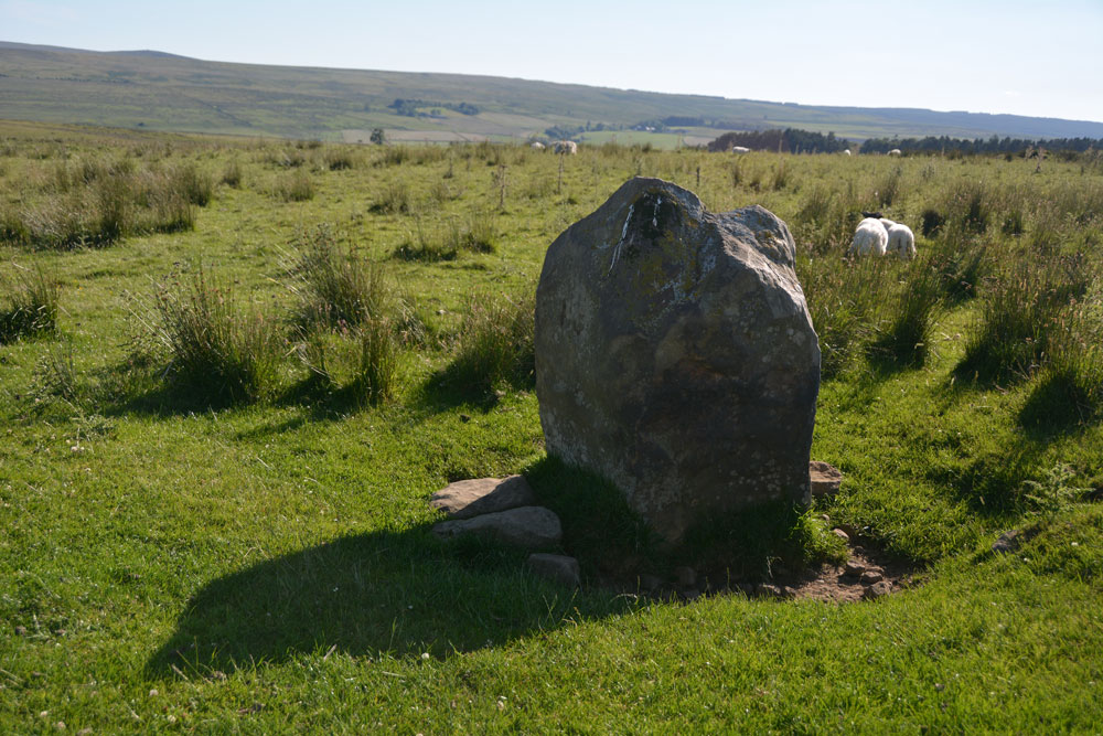
Yatesfield Hill (Otterburn) submitted by Anne T on 11th Jul 2017. This standing stone (rubbing post? way marker?) is sited just south of the top of Yatesfield Hill, on the way up to Yatesfield Settlement which is 650 metres to the north east.
(View photo, vote or add a comment)
Log Text: Yatesfield Hill Standing Stone, Otterburn Ranges: Driving up to Yatesfield Hill, I noticed this stone by the side of the road. There is no mention of it on Pastscape, English Heritage or the OS maps.
It might be a marker stone or a rubbing stone, as it is sited by the junction of Yatesfield Hill road and a trackway west, but looks as if it has been here for some time, as it is deeply embedded in the ground and has small stones and boulders packed around its base.
There was a lovely military Port-a-loo nearby!
The Poind And His Man
Date Added: 25th Aug 2014
Site Type: Standing Stone (Menhir)
Country: England (Northumberland)
Visited: Yes
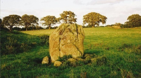
The Poind And His Man submitted by Bladup on 30th Dec 2013. The Poind And His Man, The standing stone (the man) with the edge of the barrow on the left and the outcrop in the background on the right.
(View photo, vote or add a comment)
Log Text: I didn’t expect this site to be as atmospheric as it was. We parked on the road that runs just south of Bolam Lake, in a small layby about 100 yards to the south west of Craig Hall, approx. grid reference: NZ 07126 82266 (only a couple of kilometres from the busy A696). We walked down the gravelled footpath past which turns left from this road through Bolam West Houses; in the second field to our left hand side past the houses, the tumulus came into view on the horizon. Whilst it is marked on the map as being just a tumulus, it is actually a tumulus with standing stone on its southern side.
Being on a slight hill, the tumulus stood out well against the surrounding terrain. There was no sign of the standing stone from this point, although some stones were poking up from the grass at the left hand (eastern) side of the tumulus.
We found out afterwards that there was actually no public access to this tumulus and standing stone, so I felt guilty about walking up to it, although it was a short distance from the main footpath. The field was full of the most beautiful sheep, all kinds of different breeds. As we approached the tumulus, the standing stone is on its southern side appeared - much larger than I anticipated.
I got the tape measure out, and husband Andrew helped me take the approximate dimensions of the standing stone: 2 metres from the current ground height, width on widest faces: 1.50 and 1.54m, and on the narrowest faces 0.6 metres each.
There were stunning views across the fields to the hills in the far distance to the east, south and west. The views to the north were blocked by the trees of the North Plantation. The sun was also very strong, and I didn’t manage to take photographs of the most spectacular views across to the south west and west.
There appeared to be another small circular mound slightly to the south west of the tumulus, and we wondered if this might be another tumulus.
Similar to the standing stone at Newtown Mill (which we saw on 17th August), the Devil’s Causeway Roman Road, which runs within a few yards to the east of Newtown Mill standing stone, runs immediately to the west of this tumulus, although this is no sign of the road in the landscape that we could spot.
There is a Northumberland County Council leaflet (Exploring Bolam, walk number 3, Bolam Lake to Shaftoe Crags) describing the tumulus: (this) “barrow or burial mound is in a prominent position and is 28m in circumference and 1.5m high. It was excavated in 1718 by Warburton, an Excise Officer with a keen interest in antiquities. Writing to a friend Warburton described that he - “found a stone coffin about 3ft in length and 2ft in breadth and 2ft deep which was black inside with smoke, and in it several lumps of glutinous matter….pieces of the dead heroes flesh” It is likely that that the main burial may be intact as Warburton did not dig deep enough. Such mounds were frequently re-used and may have many burials of different ages. The mound was important in Medieval times when Watches were set to warn of Scottish raids. In 1552 Wharton, Warden of the English East March stipulated that Watches should be set at “the two stones the Poind and his Man with two men nightly the inhibitors of Bolam”. The second stone is at Wallington Hall and was probably moved there by William Blackett. The Devil’s Causeway runs just to the west of the mound.”
In the same field, about 100 yards to the east of the Poind and His Man, there was an outcrop of rock, similar to the formation at West Agra, and we wandered over. The strong sunlight brought out what might be cup marks; in particular, there was a line of deep cup marks against a ledge in a crack in the middle of the rock, and what appeared to be a grouping of heavily weathered cup marks to the eastern edge. We need to research if Stan Beckensall has listed any marks on the ERA site.
Housesteads Mound
Trip No.43 Entry No.4 Date Added: 4th Sep 2017
Site Type: Misc. Earthwork
Country: England (Northumberland)
Visited: Yes on 2nd Sep 2017. My rating: Condition 2 Ambience 3 Access 4
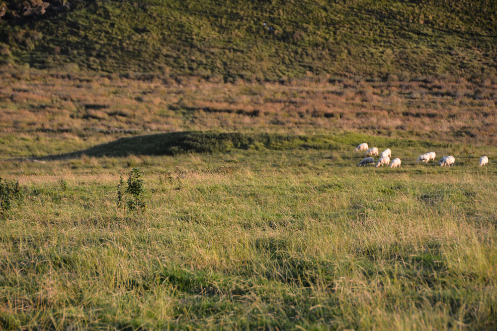
Housesteads Mound submitted by Anne T on 4th Sep 2017. We didn't walk down to the mound, as we didn't have permission to be in the field, but it looks like a small tumulus to my untrained eye. There are no other features like this along this section of land running alongside the B6318 Military Road, at least within about half a kilometre either side, apart from another tumulus on Green Brae, near East Crindledykes.
(View photo, vote or add a comment)
Log Text: Housesteads Mound, near Housesteads Tumulus, Bardon Mill: This mound is marked on the OS map as a mound, and as we were in the field, walked to the change in slope where the ground dipped into a hollow. The mound was certainly popular with the sheep. Didn’t walk down to it, as it was a fair way across the field and it was getting late. I’d called it up on my mobile phone, and it didn’t seem hugely important.
Dunsdale (College Valley)
Trip No.45 Entry No.4 Date Added: 14th Sep 2017
Site Type: Ancient Village or Settlement
Country: England (Northumberland)
Visited: Yes on 12th Sep 2017. My rating: Condition 1 Ambience 4 Access 5
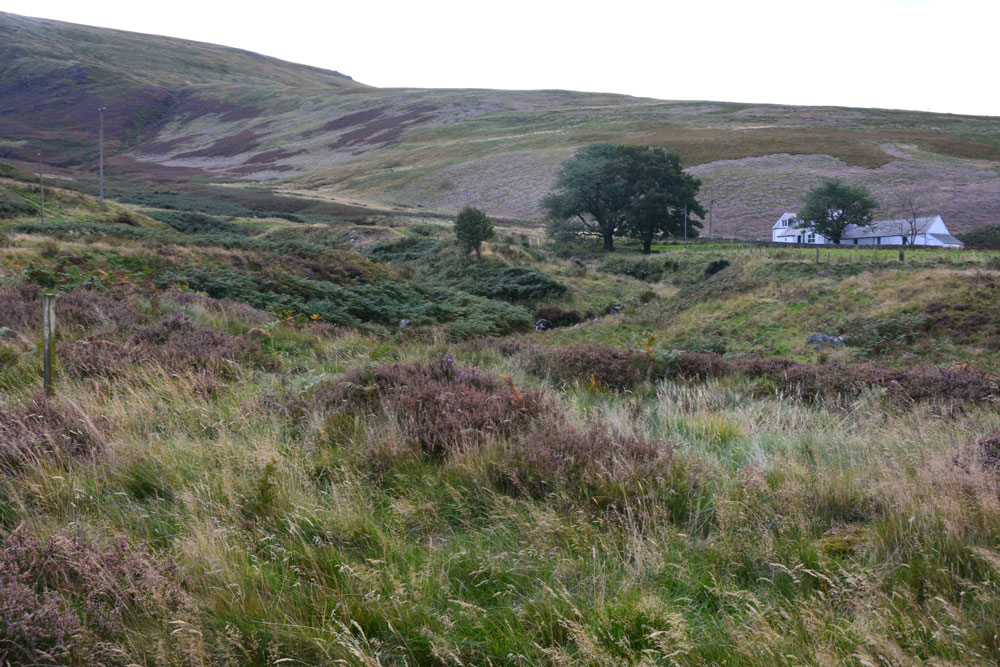
Dunsdale (College Valley) submitted by Anne T on 14th Sep 2017. Standing in the middle of the settlement (largely buried underneath bracken) looking over Bizzle Burn towards Dunsdale Farm
(View photo, vote or add a comment)
Log Text: Dunsdale Settlement, College Valley: Wow. The screen slopes to the north of this path are daunting and impressive at the same time. If there was a landslip here, you might be cut off for some time.
The settlement here was difficult to make out because of the very tall grass and heather, but we could feel stone foundations under our feet and depressions in the ground.
It is a very beautiful spot, with the scree slopes of Dunsdale Crag to the north and Bizzle Burn running to the west of this site.
Would really like to come back here in winter to see more of the site structure.
Southernknowe Farmstead (College Valley)
Trip No.45 Entry No.5 Date Added: 15th Sep 2017
Site Type: Ancient Village or Settlement
Country: England (Northumberland)
Visited: Yes on 12th Sep 2017. My rating: Condition 2 Ambience 3 Access 4
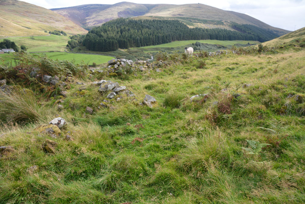
Southernknowe Farmstead (College Valley) submitted by Anne T on 15th Sep 2017. Standing almost at the sheepfold at the northern end of the farmstead, looking back down to College Burn (near where it meets Lambden Burn).
(View photo, vote or add a comment)
Log Text: Southernknowe Enclosed Farmstead, College Valley: This settlement sits high up the eastern slopes of Blackhaggs Riggs, almost opposite where Lambden Burn meets College Burn. Whilst we could see the stone walls/banks of this settlement from below, it was quite a hike up the steep slopes of the hill. Long and narrow, the inhabitants would have had a great view of any other people coming for miles. It is also very scenic, overlooking the meeting of Lambden Burn and College Burn. The river terraces in the valley below can be seen and it’s intriguing how the rivers have moved over the years.
Salters Nick Settlement
Date Added: 25th Aug 2014
Site Type: Ancient Village or Settlement
Country: England (Northumberland)
Visited: Yes
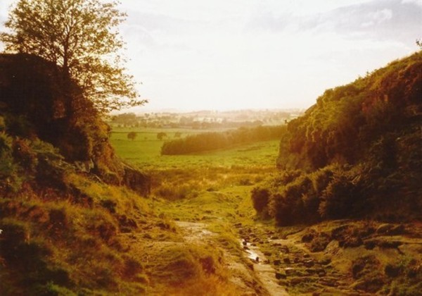
Salters Nick Settlement submitted by Bladup on 30th Dec 2013. The natural entrance through the crags to the settlement.
(View photo, vote or add a comment)
Log Text: Following our visit to The Poind And His Man, there was a settlement marked on the map at Salter's Nick, and I was keen to try and see this as it was nearby.
We continued westwards along the footpath from the Poind and His Man, the pebbly surface giving way to concrete slabs leading onto access land. The kindly farmer (presumably the one living in East Shaftoe Hall?) has provided a small car parking space for walkers, complete with signs about where to park, so next time we visit, we’ll drive down rather than walk from Craig Hall. There were other cars already parked there, although we walked for well over a kilometre before seeing other people on Shaftoe Crags to our left.
From the above mentioned car park, there is a gravelled track heading off left towards East Shaftoe Hall, but the actual footpath is over grass and carries on westwards, past a wood on the right; where this ends there is another small wood to the left. Walking slightly up hill, there is a well-built stone wall to the right hand side, and a limestone pavement which drops down a few feet to a small brook on the left, giving the impression of an old road. There were a large number of cows and calves in the field, complete with bull, but they appeared very docile and only mildly curious. Looking at the internet later, we found out that this track used to be an old Drover’s Road.
The settlement is just on top of the hill, just where the footpath takes a slight turn to the right. Walking into this area, the settlement isn’t immediately obvious given the covering of heather and bracken at this time of year, but a bank where the bracken stands taller than the rest defines its eastern boundary. It’s easy to step up this small bank and into the main settlement area; across what appears to be a valley to the south, large limestone blocks and outcrops can be seen. Walking a little further on into the settlement to where the western bank appears to rise up, we were suddenly taken aback by the appearance of steep drops to the south and west – we were suddenly on the edge of an amazing limestone outcrop, looking down on other walkers below, and across to others climbing on Shaftoe Crags.
A natural entrance, formed by a crack in the crags, became apparent as we walked across the settlement area to the north. I could immediately identify with our ancestors and why they had chosen to settle here – it was easily defensible from the west and south, with 360 degree views (hidden a little in modern days by the woods to the east) all around, and what looked like superb farmland to the west and east.
I wanted to see the natural entrance from below, so we walked back to the footpath and carried on westwards. There were clear signs of how the old drover’s road had been cut through the settlement (there were pick marks on the sandstone rocks), and an easy walk that takes you below the crags at the western end of Salter’s Nick.
We did try and find the heavily weathered rock art mentioned on the Northumbria County Council leaflet for this site (which I downloaded on my phone whilst we were there, so we could understand what we were looking at), but they didn’t identify exactly where these where, so we’ll need to research Stan Beckensall’s records to find out where they are. The same leaflet (Exploring Bolam, walk number 3, Bolam Lake to Shaftoe Crags), tells us: “This trackway was probably used for smuggling illicit salt into Scotland on pack horses during the time of the Salt Tax. The return cargo was often illegally distilled whisky. There is also a settlement split by the trackway. The southern end of the fort consists of a series of defensive walls and works, and two pairs of semi-detached stone foundation round-houses. Attached to the north side is an Iron Age field system, of native or Romano-British origin.”
Looking at the map, the Middleton Standing Stone is only about half a kilometre away, if you carry along the footpath after Salter’s Nick; we’d done the walk to Middleton the other way round, from South Middleton Medieval Village on 27th May 2014. This is a much easier (and prettier) walk than the walk we'd previously done, and we'd use this route again.
Thompson's Rock
Trip No.59 Entry No.2 Date Added: 19th Nov 2017
Site Type: Holed Stone
Country: England (Northumberland)
Visited: Yes on 12th Nov 2017. My rating: Condition 3 Ambience 4 Access 4
Thompson's Rock submitted by Bolddubhglas on 14th Jun 2008. Thompson's Rock Simonside Beacon
(View photo, vote or add a comment)
Log Text: Thompson's Rock, Simonside: This was the coldest, windiest day of the year so far,, and I thought we were going to a much more sheltered spot, so I wasn't dressed for the weather. Ashamed to say I sent husband off with the camera, as he was fully equipped for this moorland. He reported the rock was well worth going to see.
Piper Lane Standing Stone (Birtley)
Trip No.63 Entry No.4 Date Added: 10th Jan 2018
Site Type: Standing Stone (Menhir)
Country: England (Northumberland)
Visited: Yes on 7th Jan 2018. My rating: Condition 2 Ambience 3 Access 5
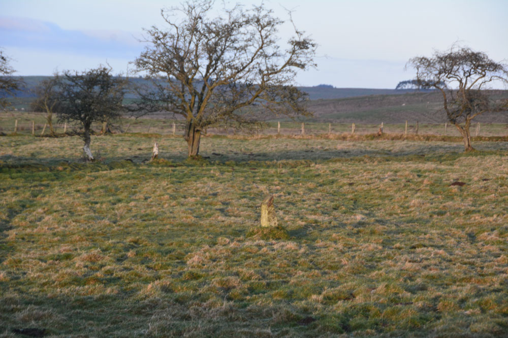
Piper Lane Standing Stone (Birtley) submitted by Anne T on 10th Jan 2018. The stone, in the middle of a water logged field. A rubbing stone, marker stone or a standing stone? It looks as if its been in the ground for some time and stands to the north of cultivation terraces.
(View photo, vote or add a comment)
Log Text: Piper Lane Stone, Birtley Shields: Spotted this on the way back from Birtley Shields, standing in the middle of the field. There was no easy access into the field and the ground was waterlogged, so passed up on climbing over the stone wall to get a closer look.
It's location is intriguing, as it stands north of the cultivation terraces marked on the OS maps. There are no other rubbing stones in the surrounding fields. Couldn't find anything about it on Pastscape, HE or by doing a general web search.
Weetwood Moor 3a
Date Added: 1st Sep 2014
Site Type: Rock Art
Country: England (Northumberland)
Visited: Yes on 31st Aug 2014. My rating: Condition 3 Ambience 5 Access 4
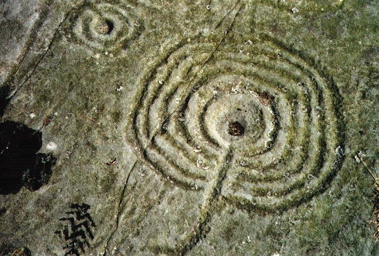
Weetwood Moor 3a submitted by rockartuk on 3rd Aug 2001.
(View photo, vote or add a comment)
Log Text: Weetwood Moor 3a (Bicycle Rock), Northumberland: My husband had seen photographs of the rock art at Weetwood Moor, which was very near the Fowberry Mains/Fowberry Park site we'd seen on 17th August 2014). Parking at the road junction next to where the metalled track runs alongside North Plantation, we walked down to find the footpath, which is located to the right hand side of the road, just passed the cattle grid. My goodness, was this overgrown for the first 20 to 30 metres – I stepped through head high bushes and gorse, eventually emerging into a rocky moorland.
After a 100 yards or so, the footpath bears left. There is a clear sign straight ahead, declaring ‘not access land’, but there was clear evidence of small footpaths carrying along across the heather. We went up a little way to try and see what was there, when a lady walking her dog sailed past us, waving and shouting ‘hello’ cheerfully as she went, so we assumed it was alright to carry on (we’ve since found a published Rock Art walk which takes us past the rocks we wanted to see).
Andrew found the Bicycle rock first of all – this was amazing - and I took photographs. To the east of this rock, someone had built a small cairn in a cup shape, this cup containing what looked like a Wiccan altar with sea shells, a bone and some berries.
Walking to the quarry face immediately to the east of Bicycle Rock, I noticed (for the first time) evidence of fluting on the edge of the rock, similar to the weathering on other standing stones in the area (ones that immediately spring to mind are Matfen and the Newtown Mill standing stone).
We found other rocks with cup marks, and I’ll need to sit down and compare my images to the other pages for Weetwood Moor on the Portal, to make sure I’m recording them against the right pages.
Doddington Moor
Date Added: 1st Sep 2014
Site Type: Stone Circle
Country: England (Northumberland)
Visited: Couldn't find on 30th Aug 2014
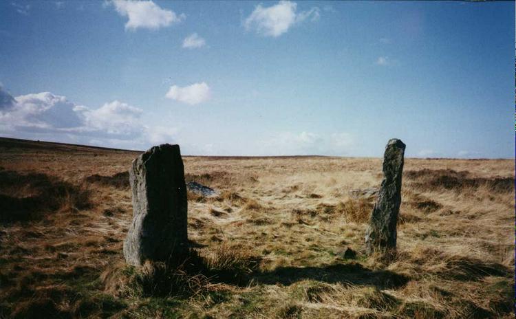
Doddington Moor submitted by Andy B on 24th Nov 2001. Doddington Moor Stone Circle
(View photo, vote or add a comment)
Log Text: Doddington Stone Circle, Northumberland (second failed attempt!). Having visited Weetwood Moor, as we were so near, and it was still only relatively early (5pm), we decided to drive a couple of miles further up the road to Weetwood Hall and try the footpath I’d identified as a possible easier route to Doddington Stone Circle.
We parked the car park where the footpath splits off northwards from the road just after Weetwood Hall (there is just room for one car opposite the field entrance at the corner of the junction). There is a metalled road which goes past the two or more houses to the left hand side, then it become a grassy path between two hedges, with tractor ruts in either side. After about half a mile, just past a wood to the right hand side, there is a gate with a footpath sign on, and the track becomes quad bike marks in the grass, and we followed these up the hill. There is a new stile (narrow, but new) , then the track more or less disappears, and is marked by a series of Scots Pines, standing alone, but growing more or less in a line north-north-west up the hill.
Passing an outcrop of rock to our left hand side, we climbed to the brow of the hill, but just where the land started to go downhill again, we were met by boggy land, covered completely with a heavy coverage of low growing thistles and gorse, which went on as far as the eye could see. Andrew decided this was impossible, so we turned back and went to find the cup and ring marked rocks marked on the map on the way back down the hill.
We'd previously tried to visit on 17th August 2014, but the quarry next to Wooler Golf Club had been extended and the footpaths had disappeared (or we couldn't find them).
There is a third possible footpath to try, from West Horton, so this will go on the 'want to do' list.
Wall Crags Settlement
Date Added: 3rd Sep 2014
Site Type: Ancient Village or Settlement
Country: England (Northumberland)
Visited: Yes on 25th Aug 2014. My rating: Condition 2 Ambience 3 Access 4
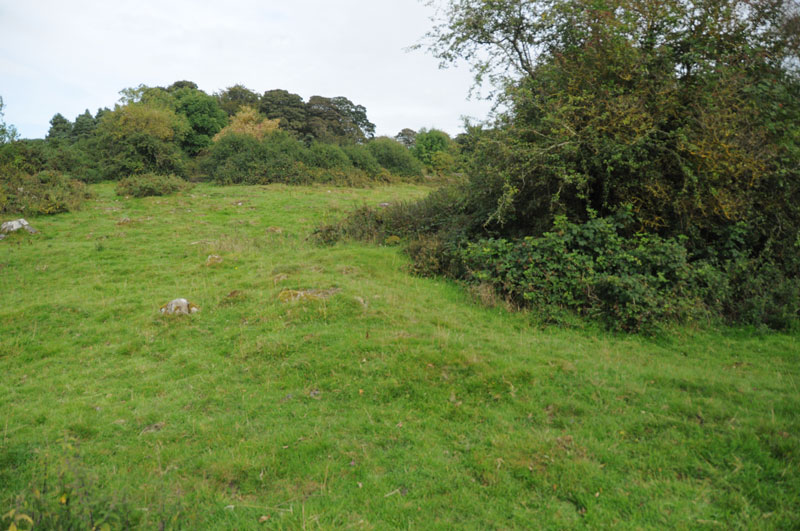
Wall Crags Settlement submitted by Anne T on 1st Sep 2014. To our untutored eye, the circular bank running from the centre of the photograph to the right hand side looked like the possible foundations of a roundhouse (now has trees growing in the middle).
(View photo, vote or add a comment)
Log Text: Wall Crags Settlement, Northumberland: It was 4pm on Bank Holiday Monday and we wanted to go somewhere, but didn’t have time to go far. Husband Andrew had spent the afternoonon the internet looking at rock art on the old Roman Bridges at Chollerford, and spotted the settlement to the east of Wall village as somewhere else to go on route. We drive through Wall on a regular basis, and neither of us had been aware of a settlement here until we looked closer at the map.
We parked on a side street just above the chapel in Wall at approx. grid reference NY 91744 69094, and walked down to the chapel, turning left towards the park. There were some very old cottages to our left hand side (on the walk back, I’m sure the one nearest the start of the footpath was dated 1642). The footpath took us across the southern end of the park, with a gate leading to some stone steps leading up the hill.
We climbed quickly up the steep slope, then the steps stopped, and open grassland began. The slope must have been about 40 degrees, and was slippery enough in the dry, and would have been lethal in the wet. I’m afraid I bottled out at this point - getting up would have been OK, but getting down (for me) would have been a nightmare, so I sat on the grass and handed the camera to Andrew, so he's to thank for the images on the Portal.
He was gone about 20 minutes, coming back to say it was fairly difficult to identify the features up on top of the hill, as whilst the top was level, there were trees, large stones and the ground looked as if it had been heavily trampled by cattle and was difficult to walk on. The ramparts were visible, as were the possible foundations of a couple of roundhouses.
I haven’t been able to find out much about this settlement at all, except for a brief mention on Keys To The Past (page reference N13760) which is a shame, but I’ll keep my eyes open for any information.
Chesters Roman Site b
Date Added: 3rd Sep 2014
Site Type: Rock Art
Country: England (Northumberland)
Visited: Yes on 25th Aug 2014. My rating: Condition 4 Ambience 4 Access 4
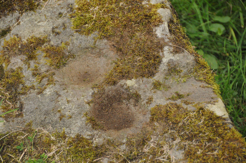
Chesters Roman Site b submitted by Anne T on 1st Sep 2014. Photograph showing two cup marks (0.09m) on stone, with third just on right hand edge.
(View photo, vote or add a comment)
Log Text: Chesters Roman Bridge Rock Art, Chollerford, Northumberland: Parking at the George Hotel at Chollerford on the north side of the river Tyne, we walked back over the bridge and found the small gate to the west side of the bridge to the footpath leading to the Roman Bridge. This is a really easy walk along a long straight footpath defined by wired fences on both sides (it feels like being a sheep being herded to a pen!). After a short kilometre, the path bears right down to the river, and a further gate lead to remains of two old Roman bridges on the same site. The ruins are impressive.
There seems to be some confusion about what rock art is at this site, and what isn’t. What is certain is that we found a stone block with three clear cup marks on in the location described by the England’s Rock Art record 769. Thank goodness we had the images of the location of this stone downloaded onto my phone, otherwise we would have spent hours searching the bridge piers.
This is a lovely location, right next to the Tyne, surrounded by old Roman remains. It would have been nice to have been able to see the other two stones purportedly found here, too.
There are also substantial remains of the bridges and other structures on the northern bank of the Tyne, which we'll go back and explore at some time in the future.
Our find was 'rewarded' with a drink at the hotel afterwards - this was a very pleasant early evening in late August.
Robin Hood's Well (Chollerton)
Date Added: 4th Sep 2014
Site Type: Holy Well or Sacred Spring
Country: England (Northumberland)
Visited: Yes on 3rd Sep 2014. My rating: Condition 1 Ambience 2 Access 4

Robin Hood's Well (Chollerton) submitted by Anne T on 4th Sep 2014. Walking across the field from the footpath from the B6342 to Well House Farm, this is the first view of Robin Hood's Spring/Holy Well. [I double checked the grid reference to ensure I had the right place].
(View photo, vote or add a comment)
Log Text: Robin Hood's Well, Colwell, Northumberland: I last visited Colwell on 13th June 2014, when we went in search of the old chapel (located in someone’s back garden, so not accessible without permission), the two wells in the centre of the village – Coley’s Well and Pricky’s Well – and Blue Crags Hill Fort (also known as Brecken Hills Fort).
Both Coley’s Well and Pricky’s Well are at the eastern edge of the village at the cross-roads where the northern most side-road from the A68 leads eastwards to meet the B6342. Whilst part of the area’s rich history, neither well is pleasing to the eye (very similar to Meg’s Well in Aydon). They sit alongside a small stream, the Coal Burn.
About 200 yards south of the village is a third well, Robin Hood’s Well. As this is recorded as a holy spring, I was keen to see this, so stopped off whilst I was passing by.
There is parking in a layby by the road junction mentioned above, near to Pricky’s Well. From here, it is a 200 yard walk south down the B6342 to the footpath which leads eastwards towards Well House (grid reference: NY 96641 74198. This is a very busy little road, with no footpaths, so I had to keep stepping up onto the grass verges to avoid the traffic.
Robin Hood’s Well is almost on the field boundary next to the road. To reach it, on opening the gate to the field by the footpath sign, you need to turn right immediately and walk 50 yards or so to the south (towards the woodland). The first view is of a post sticking up from marsh grass, which looks like a fence post. As you get closer, you will see a stone lying next to the post. A closer look shows a pool of water around the post and stone, and boggy ground surrounding it – a shame it is so unremarkable for such a historic well.
There is a further spring which appears 100 yards further south down the field, which has a clearer water course marked by stones on either side, but was dry (although the ground was very boggy) on the day of my visit.
At (or near) Well House Farm (according to the Hexham Courant and Visitor UK web sites) there is also a fourth sulphurous well, The Bore Well, reputed to improve fertility and which is well cared for with a proper housing.
Hexham Abbey
Date Added: 24th Aug 2015
Site Type: Ancient Cross
Country: England (Northumberland)
Visited: Yes on 3rd Sep 2014. My rating: Condition 3 Ambience 4 Access 5
Hexham Abbey submitted by Thorgrim on 18th Sep 2004. Roman tombstone now in Hexham Abbey NY773684
Memorial to Flavinus a Roman Standard hero
(see same design in Colchester Castle)
(View photo, vote or add a comment)
Log Text: Hexham Abbey, Northumberland: St Acca and Spital Cross Shafts.
23rd August 2015: Took my daughter and her husband to the new visitor centre after a lovely lunch in the Refectory (much recommended). We had great fun dressing up as Queen Ethelreda, Bishop Wilfrid and Augustinian monks). There was brass rubbing and computerised caligraphy to try. As well as interactive displays for the young at heart, there is also a serious section with a display of Anglo Saxon and Viking stones, a model of, and press-screen history of the abbey. A great time was had by all and I found not only the Spital Cross but a number of other stones I'd been searching for in the Anglo Saxon Corpus of Stone Sculpture and not found in my previous visit. Well worth coming.
3rd September 2014: Acca succeeded St. Wilfrid as the Bishop of Hexham in AD709, withdrawing (or also said to have been deposed) from office in AD732 and dying in AD740. The two crosses purported to mark the head and foot of his grave stand in the south transept of Hexham Abbey (on the right hand side as you enter the main church from the porch), next to St. Etheldreda’s Chapel. However, there is some confusion as to whether or not these two cross shafts are St. Acca’s grave markers, or whether the larger may just be a preaching cross set up in the first years of Christianity. However, Hexham Abbey proudly displays them as St. Acca’s.
The two cross shafts stand side by side. The larger cross shaft is called ‘St. Acca’s Cross’. The second, smaller cross-shaft, is known as the ‘Spital Cross’.
I approached a steward to ask if was OK to take some photographs, and he told me it was, providing I didn’t use flash. He knew a fair bit about the crosses, very kindly photocoping a leaflet on Acca and Acca’s Cross for me to take away. He told me that St. Acca’s cross had been broken up in antiquity and the pieces scattered, being put back together in the 19th century – there is a plain piece of modern stone where the cross arms would have been. Interestingly, he told me that the lower portion of St. Acca’s cross was found at nearby Dilston, where it had been used as a lintel in a farmhouse door.
St. Acca’s Cross is most gloriously decorated with vine scrolls which interleave and entwine.
The Spital Cross, as described in his leaflet: “was found at Spital which is 1.3 km west of Hexham, and stood near a house on the site of the medieval Hospital ofSt. Giles.” This cross shaft has very interesting vine scrolls on three sides and a crucifixion scene on its front face.
The area within the Abbey immediately around the crosses is used by the Stewards who greet people who come to look at the Abbey and to display information for visitors and worshippers – which strangely echoes their possible past uses as preaching crosses. When I was there, most people actually walked by without noticing them, although because I was taking photographs, a couple of people came up to ask more.
Opposite both cross shafts, and at the bottom of the Abbey night stair, is a Roman tombstone which dates from the first century.
St Michael's Church (Warden)
Date Added: 5th May 2019
Site Type: Ancient Cross
Country: England (Northumberland)
Visited: Yes on 3rd Sep 2014. My rating: Condition 4 Ambience 4 Access 5
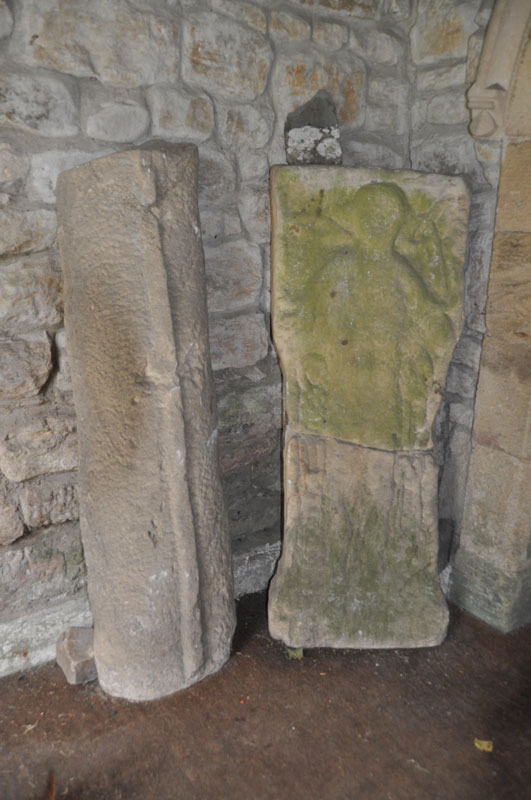
St Michael's Church (Warden) submitted by Anne T on 4th Sep 2014. The Warden Man, carved on a stone split from a Roman altar, situated on the western wall of the porch. Another grave cover stands to it's left hand side in this image.
(View photo, vote or add a comment)
Log Text: St Michael's Church, Warden, Northumberland: On the way back from Robin Hoods' Holy Well at Colwell, I detoured via Warden, a church we’ve visited before whilst visiting the Roman enclosure on the hill above Warden, but not really seen. On this last visit, on approaching St Michael’s, we heard a saxophone being played nearby – the same tune repeated over and over (and very badly (sorry, player!)). As we were going into the church, another couple were coming out. The noise of the saxophone got louder and louder, and a man appeared to serenade us. He proved a bit of a nuisance, so we escaped to the Boat pub for a drink, only to be closely followed by the saxophone and it’s player who then sat next to us.
The current church is 18th century, but built on much older foundations, originally thought to be the site of the oratory of the Anglo-Saxon saint St. John of Beverley.
On today's visit, I met a lady going into the church with some leaflets, and got chatting to her. She told me the same man still lives in the village, and she’d just come from his house. She also told me the Parish had just had the church restored and how proud they were of it now, pointing out the 7th century cross at the south side of the tower, by the porch.
The lady didn’t know anything about the Warden Man, so as we went into the porch, I spotted it and pointed it out. “Perhaps we should scrape the moss of it”, she exclaimed. I gulped loudly. “I think you should leave it as it is – you need to ask a professional before doing that”.
There are some fascinating features within the church – the 11th century arch at the base of the tower includes a roman stone, and the Saxon gravestone which is on the floor in the chancel (northern wall, next to the choir stalls, just before the altar rails).
The Saxon gravestone, in the right light, shows tegulations (a word I hadn’t heard of before I picked up the guide book for the church! – “use light and shade to create a distinctive appearance”) to look like a tiled roof. Outside, there is the 7th century cross (which the Keys To The Past record says is 7th to 11th century), gravestones with iron hoops over them to prevent body-snatchers taking the bodies and a Saxon tower.
In the porch, opposite the Warden Man, is a collection of grave stones. There was a really interesting small roundel, with what looked like knot-work on it. I was unable to find out any more about the date of these.
Millstone Burn 1d
Trip No.71 Entry No.6 Date Added: 7th May 2018
Site Type: Rock Art
Country: England (Northumberland)
Visited: Yes on 7th May 2018. My rating: Condition 2 Ambience 4 Access 4
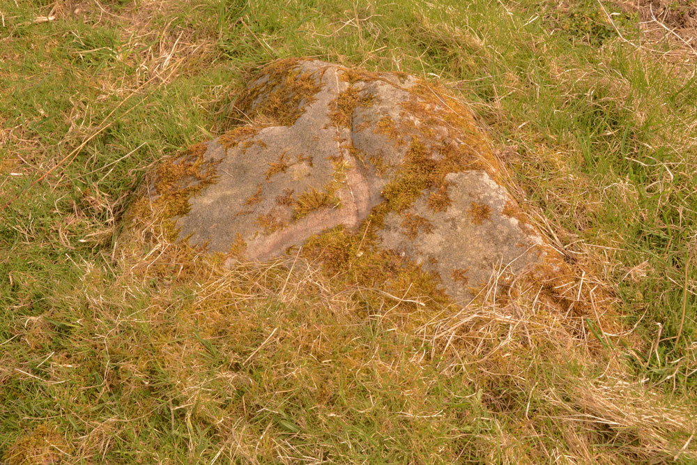
Millstone Burn 1d submitted by Anne T on 7th May 2018. Millstone Burn 1d from a different angle, showing the 'scar' across the middle of the rock, which looks relatively recent.
(View photo, vote or add a comment)
Log Text: Millstone Burn 1d: This rock art panel is just to the east of the A697 and largely covered in turf. There is a deep scar in the rock which looks relatively recent. It also has a curious vein of quartz which runs through the rock.
Millstone Burn 2bb
Trip No.71 Entry No.2 Date Added: 8th May 2018
Site Type: Rock Art
Country: England (Northumberland)
Visited: Yes on 7th May 2018. My rating: Condition 3 Ambience 3 Access 4
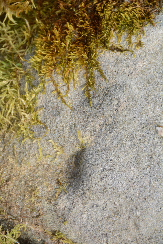
Millstone Burn 2bb submitted by Anne T on 8th May 2018. The oval and groove, as shown on the ERA drawing for Millstone Burn 2bb.
(View photo, vote or add a comment)
Log Text: Millstone Burn 2bb: This would be a 'short walk on a footpath' if we'd come in through the gate we used at our last visit. This time we approached it from Millstone Burn 2c, walking down the hill towards the start of the bend in the A697 from Longframlington. The rock was instantly recognisable from ERA's description, as was finding the two indentations at its apex and the oval and groove on ERA's drawing. The three cup marks in a line were there, but underneath a heavy covering of moss and lichen. They could be felt by running your fingertips over the rock.
