Contributory members are able to log private notes and comments about each site
Sites Anne T has logged. View this log as a table or view the most recent logs from everyone
Gleneagles A
Trip No.83 Entry No.9 Date Added: 25th Jul 2018
Site Type: Standing Stone (Menhir)
Country: Scotland (Perth and Kinross)
Visited: Yes on 13th Jul 2018. My rating: Condition 3 Ambience 4 Access 5
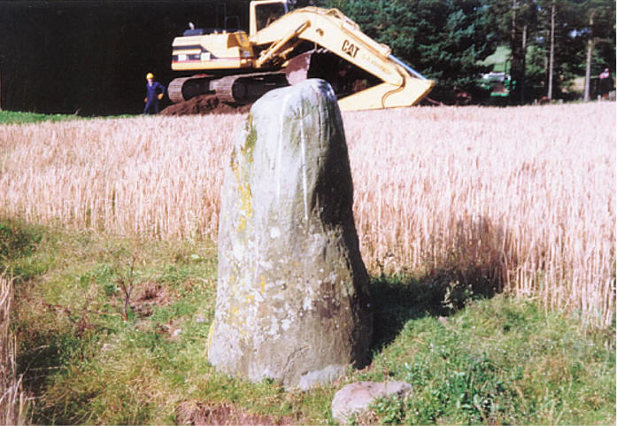
Gleneagles A submitted by hamish on 23rd Jun 2005. I took this picture, including the phone mast erectors, and ran out of film so couldn't take another one. Maybe another time.
Interesting stone though, there are some markings on the right side.
(View photo, vote or add a comment)
Log Text: Peterhead Farm Standing Stone, Gleneagles: Our last stop of the day. Driving (it was too hot, and we were too lazy to walk) further along the single track road towards the mast and the entrance to Peterhead Farm, we parked near the mast and walked across the road. The nearest gate into the field appeared to be near the farm buildings, so we clambered over the wooden fence at the corner of the road with the farm track.
This standing stone looks as if it sits just below the top of a natural mound. There were quite a few packing stones around the base of the stone, with others scattered around the ground nearby.
Gleneagles B
Trip No.83 Entry No.8 Date Added: 25th Jul 2018
Site Type: Standing Stone (Menhir)
Country: Scotland (Perth and Kinross)
Visited: Yes on 13th Jul 2018. My rating: Condition 3 Ambience 3 Access 4
Gleneagles B submitted by cosmic on 19th Feb 2005. The Incised Mark/s on the North Side
(View photo, vote or add a comment)
Log Text: Peterhead Farm Pictish Symbol Stone: Right next to the A9, so the atmosphere wasn’t brilliant, but ignoring the traffic, looking east, this was a glorious setting.
There was a gate into this field full of sheep, so we let ourselves in and walked over to the stone, which now sits within 30m of a slip road leading to the A9. The Gleneagles roundabout with its golf club ‘sculpture’ provide a strange backdrop.
The views to the east are somewhat different, and facing this way, you could almost believe you were in the country. Whilst the black clouds were gathering to the north and east, there was no rain.
I was fascinated by the two quartz inclusions underneath the symbols.
Dunblane Cathedral
Trip No.83 Entry No.7 Date Added: 25th Jul 2018
Site Type: Class III Pictish Cross Slab
Country: Scotland (Stirling)
Visited: Yes on 13th Jul 2018. My rating: Condition 3 Ambience 4 Access 5
Dunblane Cathedral submitted by Alta-Falisa on 29th Jun 2015. Photo : May 2015.
(View photo, vote or add a comment)
Log Text: Ancient crosses at Dunblane Cathedral: Having been bitten and bitten again by horseflies at Sheriffmuir Stone Row, the weather being very hot and humid, and the Sheriffmuir Inn decidedly shuttered up, we decided to go into Dunblane to find a cup of tea and a late lunch. We managed to find a parking spot just opposite the cathedral, so after tea and a jacket potato at the Beech Tree café, we walked back and went into the cathedral.
This is a really welcoming and peaceful church. The young lady who greeted us and sold us a guide book could hardly be heard for the organist “practising for tomorrow – but you can enjoy the music. You can take photographs, but don’t use the flash around the organist.”
The highlight for me was the two cross marked stones at the western end of the northern aisle. There is a lot of information about the cathedral itself, but not much about the crosses. We marvelled at how worn some of the bases of the columns and other architectural features, as part of the cathedral stood roofless for over 300 years from the late 1500s (says the guide book).
The guide book (page 10) talks about the crosses, saying in the North Aisle: “Here there is a large carved cross – evidence that Dunblane was a religious centre from an early date. Discovered beneath the chapter house floor in 1873, it dates from the 9th century. On the back of the stone are allegorical figures – there are two animals sitting entwined and a horse and rider with an animal, perhaps a wolf, below the horse. Also on display is a fragment from a similar cross-slab found in 1836. It also dates to the 8th or 9th century. The presence of both stones suggests that there may have been an earlier church on this site. Architectural fragments dating from the 1100s and 1200s were found during the construction of the boiler house under the chancel and chapter house in 1836. Some of these fragments are on display in the north aisle. The finely worked chevrons (zigzags) on the arch fragments, and the elaborate column cap hint at the exquisite decoration of the earlier cathedral. Fragments from the 1300s and 1400s are also on display.”
I completely forgot about the four cists around the cathedral, and I didn't have a mobile signal to call up the Portal or the Canmore records, but we will be coming back here at some point in the relatively near future.
The Boat Stone
Trip No.83 Entry No.6 Date Added: 24th Jul 2018
Site Type: Standing Stone (Menhir)
Country: Scotland (Perth and Kinross)
Visited: Yes on 13th Jul 2018. My rating: Condition 3 Ambience 4 Access 4
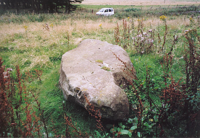
The Boat Stone submitted by hamish on 23rd Jul 2005. After you have been to Sherriffmuir Stones keep on up the road. Don't try to find Wester Briggs Circle, it's hidden in the heather. Just down the road past the woods on the left is the Boat Stone. You have to clamber over the stone wall with a barbed wire topping to get to this stone. Nearly broke my leg but survived.
(View photo, vote or add a comment)
Log Text: The Boat Stone, Sheriffmuir to Dunblane lane: Marked on the OS map, but not on Canmore, this fallen standing stone is featured on the Portal and The Northern Antiquarian. The road is single track at this point, with not many passing places. The farmer had left the gate into the field wide open, and it was dry, bare soil. We dared to pull the car just inside the gate.
The farmer had heaped a beautifully large pile of maturing manure between the gate and the stone, so I took a slightly wider berth round this than I might have, with the heat and the flies!
This large stone is impressive. It sites on a mound (I walked around it to photograph it and had to step up the mound to get to the top of the stone) and has some lovely quartz inclusions.
Sheriff Muir Row
Trip No.83 Entry No.2 Date Added: 24th Jul 2018
Site Type: Stone Row / Alignment
Country: Scotland (Stirling)
Visited: Yes on 13th Jul 2018. My rating: Condition 3 Ambience 5 Access 4
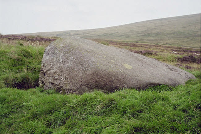
Sheriff Muir Row submitted by hamish on 15th Jul 2005. The recumbant stone it must have been quit impressive when upright.
(View photo, vote or add a comment)
Log Text: Sheriffmuir Stone Row: Please can I claim the Portal prize for 'the most horsefly bites at one ancient site'? At first glance, it looked easy to walk to this stone row. The reality was it was a couple of hundred yards from the road, in deep heather. Having waded through the shrubbery, and having found the Wallace Stone, however, finding the rest of the stones was easy, as they are more or less in a line running north east to south west. I managed to pull up Sandy G’s ”Stone Rows of Great Britain” website, with details of the stones, which helped enormously.
The horse flies were horrendous. I got eaten alive, and was glad to get back to the car to slap some antihistamine on. It was a real shame the Sheriffmuir Inn wasn’t open, as we were desparate for a cold drink (any drink, really) by the time we’d walked to, and photographed, all five stones.
We decided to go onto Dunblane for a cup of tea and something to eat (and lots of antihistamine cream for me!). Despite all the bites, I thoroughly enjoyed exploring this stone row, in the brilliant sunshine and glorious views.
The Gathering Stone
Trip No.83 Entry No.1 Date Added: 24th Jul 2018
Site Type: Standing Stone (Menhir)
Country: Scotland (Stirling)
Visited: Yes on 13th Jul 2018. My rating: Condition 3 Ambience 4 Access 4
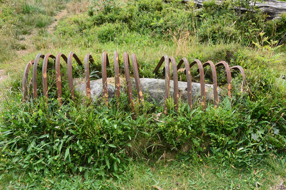
The Gathering Stone submitted by Anne T on 24th Jul 2018. Getting nearer, this is the Gathering Stone, split into at least three pieces. Its iron ribs are reminiscent of old graves being protected from grave robbers, but these metal strips screamed at me "we're stopping this standing stone from becoming upright again".
(View photo, vote or add a comment)
Log Text: The Gathering Stone, Sheriffmuir: From the Sheriffmuir Cairn & Macrae Clan Monument at NN 81569 01934, we followed the footpath to its eastern side, between the main monument and the cairn, following the line of the stone wall, heading in a roughly north westerly direction.
Eventually a path split off to our left, slightly more westwards and this led us to the Gathering Stone – a strange, strange sight, being protected by its ‘iron ribs’. It most definitely looks like a recumbent standing stone, now split into at least three parts.
The ribs are very reminiscent of graves covered to protect them from graverobbers. To me, in this setting, it felt like the iron bars constrained the standing stone from getting up off the ground and becoming upright again.
Continuing slightly further west along the track, you cross some rocks which have been much graffitied. We read that the mounds of earth here are the graves of 600 of the fallen from the Battle of Sheriffmuir.
Stobo Kirk standing stone
Trip No.82 Entry No.9 Date Added: 24th Jul 2018
Site Type: Standing Stone (Menhir)
Country: Scotland (Scottish Borders)
Visited: Yes on 12th Jul 2018. My rating: Condition 3 Ambience 5 Access 4
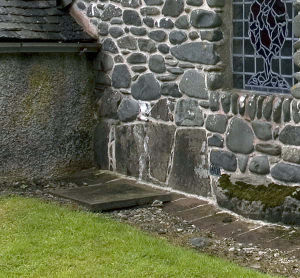
Stobo Kirk standing stone submitted by nicoladidsbury on 14th Oct 2007. Stobo Kirk - standing stone 2 - close up
(View photo, vote or add a comment)
Log Text: Stobo Kirk, Scottish Borders: This was the highlight of my visit. A church I’ve wanted to see for a long, long time, and I thought I’d better grab the chance whilst we were nearby. As we drew up outside the church, my heart sank, as it looked just like another austere Church of Scotland church. “This isn’t the church I saw on the Portal”, I said to Andrew, “their images are of a pebble built wall with standing stones in it.”
All was explained when we walked into the church and saw the north aisle chapel, from the inside first.
My photography skills were challenged trying to photograph the three large tombstones held by iron staples to the wall. This part of the church felt very old.
We looked at the long stone in the external west wall of the north aisle chapel carefully (due to the chairs in the chapel, we couldn’t really see much without removing several rows of tightly packed wooden chairs). At first glance, it looked as if it went from the south side of the window cill, southwards. Closer inspection made us realise it extended under the window as well.
We bought a guide book and a couple of the postcards of the stained glass windows, as by this time, it was getting quite late and it was at least another hour until we reached our bed for the night. Much too brief a visit - a return visit in bright sunshine is a must!
Dreva Hill West (Broughton)
Trip No.82 Entry No.8 Date Added: 24th Jul 2018
Site Type: Ancient Village or Settlement
Country: Scotland (Scottish Borders)
Visited: Yes on 12th Jul 2018. My rating: Condition 2 Ambience 3 Access 4
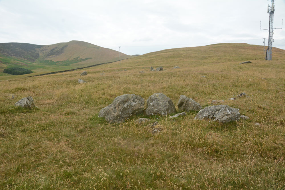
Dreva Hill West (Broughton) submitted by Anne T on 24th Jul 2018. A cluster of boulders towards the mid point of the northern side of the settlement, perhaps part of an internal structure, with a line of stones forming the outer bank beyond. It was difficult to ascertain whether or not this was part of the primary or secondary settlement phase.
(View photo, vote or add a comment)
Log Text: Dreva Hill West, Broughton, Scottish Borders: To the east of the road, there is a gate leading to a farm track, which we followed for about 100m then headed up towards the mast. In typical Tate fashion, Andrew had muddled up the entries for Dreva Craig Fort and this settlement, so I spent ages photographing boulders around the site, thinking they were the ‘chevaux de frixes’.
It’s a great site for a mast, but it’s so close to this settlement, to me it feels invasive and insensitive. The tall grass made it difficult to see any of the outer banks, although I could feel the rise and fall of the low banks at various points as I walked across the settlement. Because I was able to pick out more features here, on a flatter land with fewer boulders, I was more interested in this site than Laigh Hill. It would be nice to be able to track down a plan, so I can really interpret what I saw.
Laigh Hill (Tweeddale)
Trip No.82 Entry No.5 Date Added: 24th Jul 2018
Site Type: Ancient Village or Settlement
Country: Scotland (Scottish Borders)
Visited: Yes on 12th Jul 2018. My rating: Condition 2 Ambience 3 Access 3
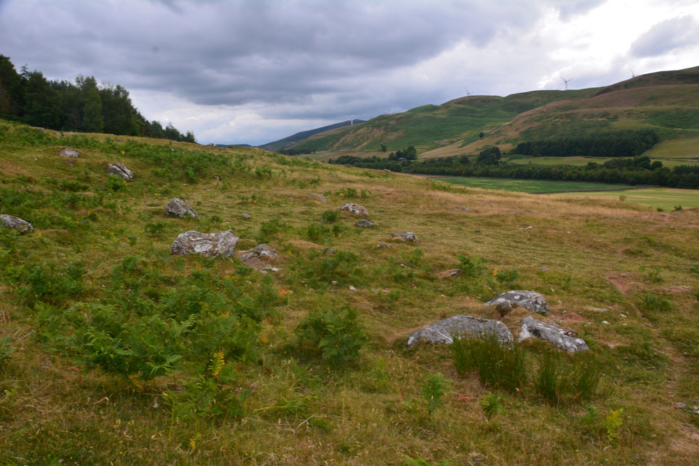
Laigh Hill (Tweeddale) submitted by Anne T on 24th Jul 2018. Standing just north west of the middle of the settlement, looking over both what we think are the remains of the foundations of an internal structure, plus boulders which emerge from the hillside. We found it a little tricky to pick out any particular features within this settlement. According to Canmore, just east of the entrance, a semi-circular stony bank marks what may have been a round stone-walled house. This may very well be this feature!
(View photo, vote or add a comment)
Log Text: Laigh Hill Settlement, below Norman's Castle, Scottish Borders: I was really looking forward to seeing this large settlement on the slopes of Laigh Hill, with the River Tweed to the south below.
The walk was easy, along a track, and only 400m past the Patervan Mound. Leaving the track and following the well-worn sheep tracks up the slope, through the low outer banks at the south west of the settlement, we arrived amongst a confusing array of circular flat areas, stony structures and boulders. Even though we'd seen a number of settlements, with our somewhat inexperienced eyes, we had difficulty trying to trace any particular structures to photograph. I called up the Canmore record on my phone, but there was no plan to orientate ourselves to, so we contented ourselves with trying our own interpretations, trying to match what we were seeing with the written description.
Norman's Castle was impressive, on the rocky knoll high above us. This really dominated the scene. Making our way over to the gate in the fence which led up to the rocks, I realised that I wouldn't be able to scramble up to the Dun, so left mountain-goat Andrew to climb up with the camera, hoping the camera would return in one piece!
Norman's Castle
Trip No.82 Entry No.6 Date Added: 24th Jul 2018
Site Type: Stone Fort or Dun
Country: Scotland (Scottish Borders)
Visited: Yes on 12th Jul 2018. My rating: Condition 2 Ambience 4 Access 3
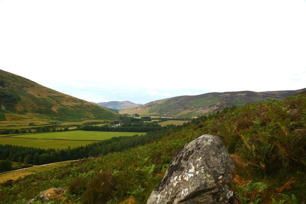
Norman's Castle submitted by Anne T on 24th Jul 2018. Looking directly north across the large rock above the entrance to Norman's Castle.
(View photo, vote or add a comment)
Log Text: Norman's Castle, Laigh Hill, Patervan: Strictly, I only saw this dun from a distance, as it was scramble to get to the top of the hill, and my fear of falling kept me on Laigh Hill settlement below. Husband, Andrew, with all the skills of a mountain goat, and no fear of heights, went tramping up with the camera. When he came back down he said: "Goodness knows why they live in such places - it's difficult to get into!" Presumably, raiders would have been deterred by the climb, so the settlers would have been well defended.
From Laigh Hill settlement below, a large rock protruding from the surrounding cliff face dominates, together with what looks like a cairn, but the scramble across the rocks to take a closer look was deemed a little tricky.
There are certainly 360 degree views all around this dun. Very little of the foundations could be seen, due to the high growth of bracken and overlying turf.
Patervan Cairn, Buildings & Mound
Trip No.82 Entry No.4 Date Added: 23rd Jul 2018
Site Type: Cairn
Country: Scotland (Scottish Borders)
Visited: Yes on 12th Jul 2018. My rating: Condition 2 Ambience 3 Access 4
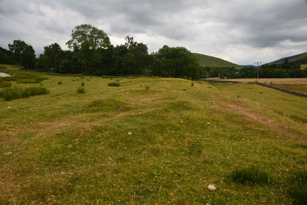
Patervan Cairn, Buildings submitted by Anne T on 23rd Jul 2018. Standing two thirds of the way along the length of the buildings, looking south south west, towards Patervan Steading and the cairn (to this side of the trees). Whilst Canmore doesn't date these buidings, to us they looked remarkably like some shielings we'd helped to survey at Sewingshields Crags, Northumberland.
(View photo, vote or add a comment)
Log Text: Patervan Cairn, Buildings & Prehistoric Mound, Scottish Borders: There is actually a rich archaeological landscape around here, although I’m pleased we’ve been out with an Archaeology Group, or I would have had trouble interpreting what we saw. We passed all of these features, all of which are within 100m of each other, on the way to the Laigh Hill settlement, just to the north east, so stopped with the GPS to make sure I was photographing the right thing!
They are perched on top of a river terrace above the alluvial (flood) plain of the River Tweed, which is 100m to the west. The surrounding hills provide an atmospheric backdrop (especially with black clouds (but no rain) looming above us).
Megget Stone
Trip No.82 Entry No.2 Date Added: 23rd Jul 2018
Site Type: Standing Stone (Menhir)
Country: Scotland (Scottish Borders)
Visited: Yes on 12th Jul 2018. My rating: Condition 3 Ambience 4 Access 5
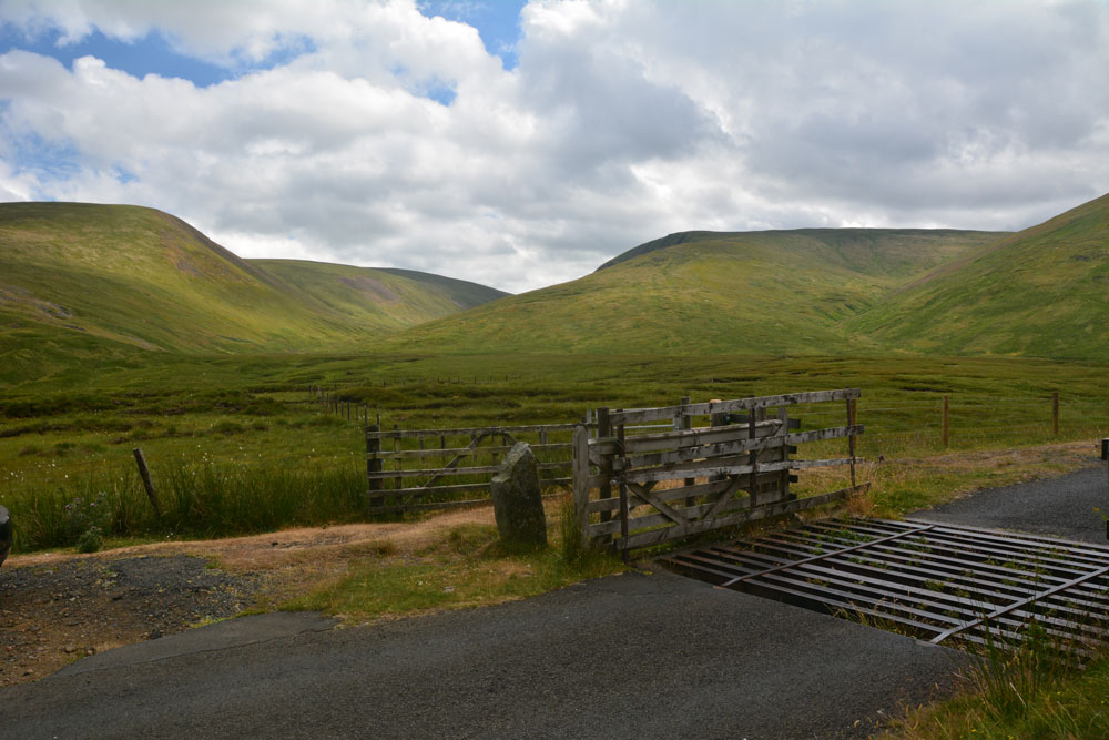
Megget Stone submitted by Anne T on 23rd Jul 2018. Looking across the Megget Stone to the West South West, across the step or shoulder in its eastern face, and trying to capture the majesty of the surrounding hills. Canmore tells us this is a slab of gritty greywacke, 7.5 ins thick, and 3ft 4ins high on one side, and 2ft 9ins above ground level; they add that the step/shoulder is apparently artificial.
(View photo, vote or add a comment)
Log Text: Megget Stone, east of Talla Reservoir: Continuing along the twisty, windy road that follows Talla Water, we passed an intrepid cyclist making his way slowly up the hills, and some motorcyclists who had stopped to photographs the waterfalls along the route.
When we got to the grid reference given for the Megget Stone, we couldn’t see it at first, as it was hidden by the gate. There was room for a car to park just past the cattle grid and gate. Hopping out to take photographs and examine this stone in more detail, the cyclist past us, and as he did, I realised that at this point, it was downhill all the way – the watershed.
This stone is definitely a boundary marker, not a true standing stone. It looks as if its eastern face has been broken. In a remote but lovely spot.
St Mungo's Well (Bromfield)
Trip No.81 Entry No.2 Date Added: 22nd Jul 2018
Site Type: Holy Well or Sacred Spring
Country: England (Cumbria)
Visited: Yes on 9th Jul 2018. My rating: Condition 3 Ambience 4 Access 4
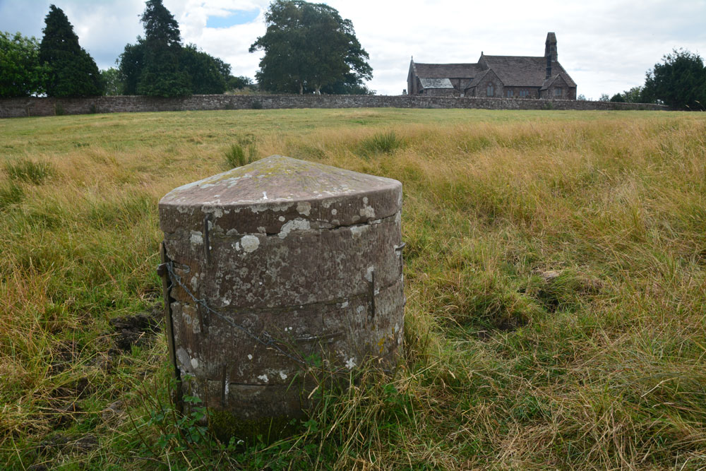
St Mungo's Well (Bromfield) submitted by Anne T on 10th Jul 2018. Standing just to the north of the well, looking back at St Kentigern's Church.
(View photo, vote or add a comment)
Log Text: St Mungo's Holy Well, Bromfield: The kissing gate from the north of the churchyard led down some sandstone gate, although the gate had been wired shut with a cable tie, so we had to clamber over. Even though there had been a long period of dry weather, parts of the ground around the well were still damp and the cattle’s hooves had sunk deep into the ground, creating tussocks and hollows. The well cavity itself was dry. In a very scenic setting, with lazy cattle (and a bull) lazing against a nearby hedgerow, looking over at us, but fortunately too hot to move.
A lovely well in a very nice, tranquil setting.
St Mary's Church (Gilcrux)
Trip No.81 Entry No.4 Date Added: 10th Jul 2018
Site Type: Ancient Cross
Country: England (Cumbria)
Visited: Yes on 9th Jul 2018. My rating: Condition 3 Ambience 4 Access 4
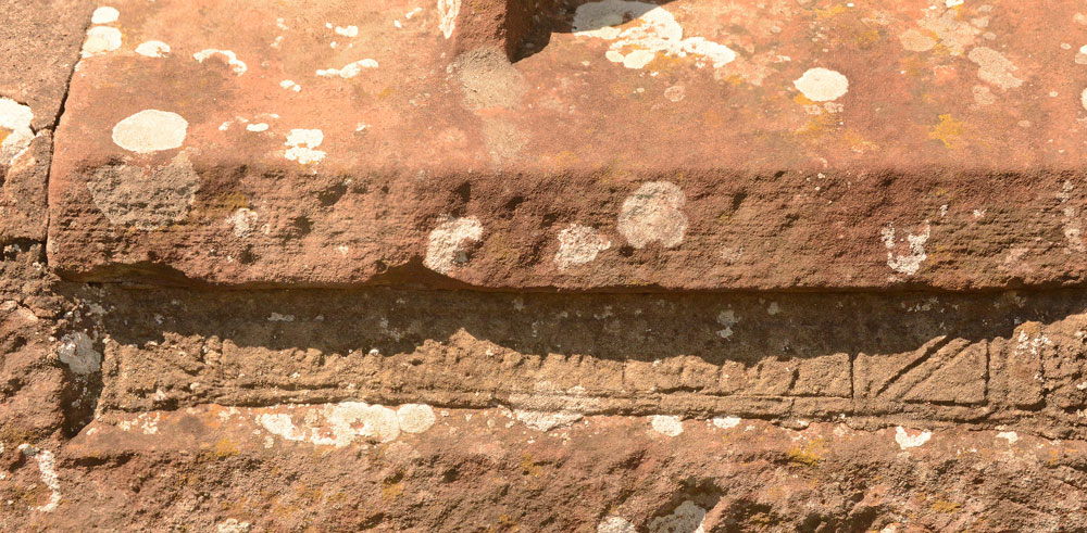
St Mary's Church (Gilcrux) submitted by Anne T on 10th Jul 2018. We may not have been able to see the Viking cross head and shaft fragment, but we did spot this underneath the window in the southern external wall of the sanctuary. The notes inside the church say it is the remains of a grave slab, recut for use as a lintel.
(View photo, vote or add a comment)
Log Text: Viking cross head and shaft fragments, St Mary's Church, Gilcrux: We arrived here to find the outer screen door open, but the door into the church very firmly locked. To say this was disappointing was an understatement, as the building looking fascinating with a lot of history from the outside.
I have since exchanged emails the vicar, who is arranging for the church to be opened for us on either 13th or 14th August.
The Hatching Well (Gilcrux)
Trip No.81 Entry No.3 Date Added: 10th Jul 2018
Site Type: Holy Well or Sacred Spring
Country: England (Cumbria)
Visited: Yes on 9th Jul 2018. My rating: Condition 4 Ambience 3 Access 5
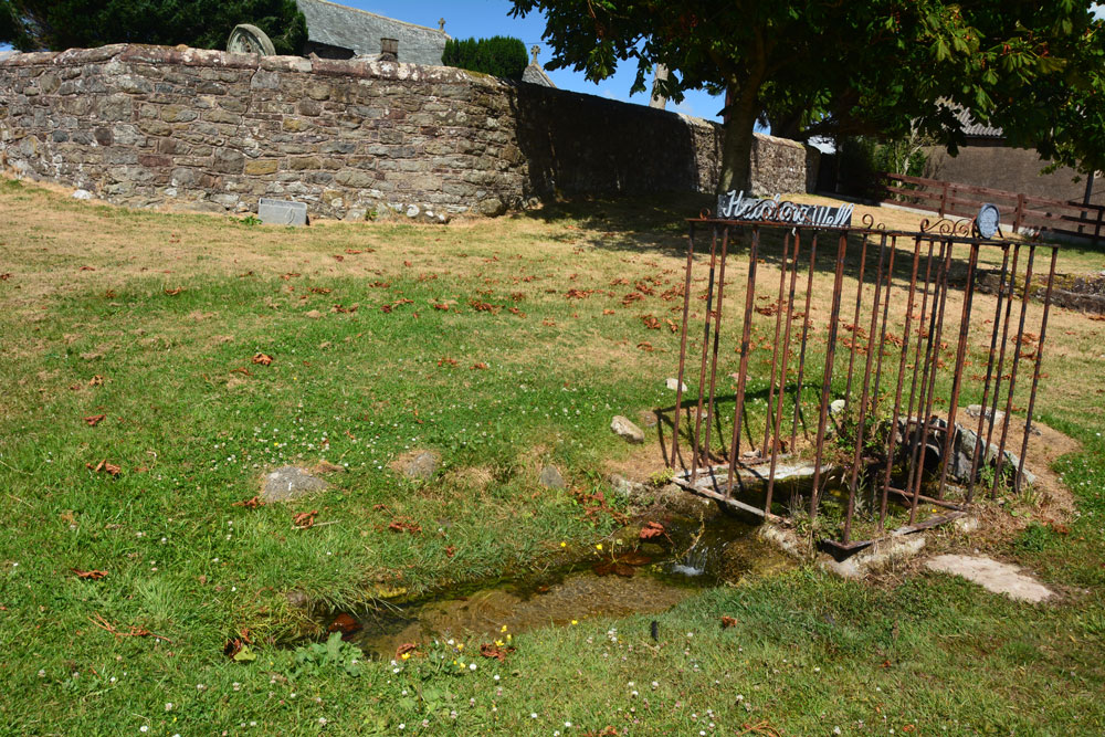
The Hatching Well (Gilcrux) submitted by Anne T on 10th Jul 2018. Standing just to the west of The Hatching Well, looking towards the southern boundary wall of St Mary's churchyard, just behind.
(View photo, vote or add a comment)
Log Text: The Hatching Well, Gilcrux: We arrived here and find this well bubbling away just outside the church - completely unexpected as it's not got any entries on Pastscape or Historic England. Neither is it mentioned in the Wikipedia entry for Gilcrux.
I guess finding this well made up for not being able to get into the church, which was very firmly locked and bolted, despite thinking we'd be able to get in. I'm trying to arrange with the vicar to go back mid-August to see AS Corpus Gilcrux 01.
Blennerhasset Cross
Trip No.81 Entry No.6 Date Added: 10th Jul 2018
Site Type: Ancient Cross
Country: England (Cumbria)
Visited: Yes on 9th Jul 2018. My rating: Condition 3 Ambience 4 Access 5
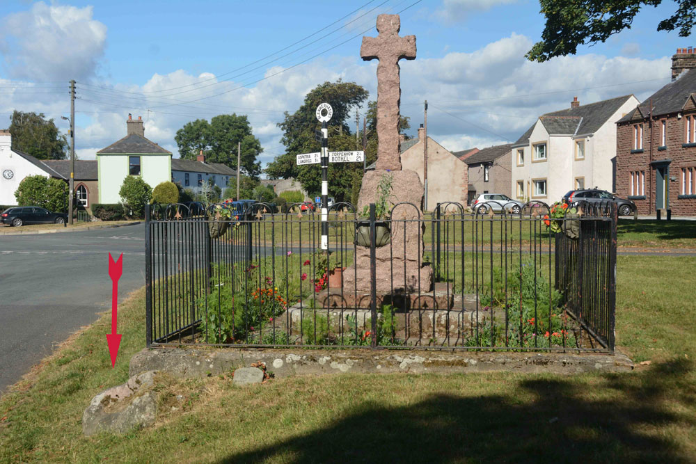
Blennerhasset Cross submitted by Anne T on 10th Jul 2018. The memorial, with discarded socket stone to the bottom left (highlighted by the red arrow), taken from the western side.
(View photo, vote or add a comment)
Log Text: Three crosses in one, Blennerhasset, Cumbria: Having been to four churches to see Anglo Saxon carved stones, and only found one unlocked, I wanted to stop and see the 'cross' marked on the OS map in this small village. This really is a stunning medieval village, and I wish we’d had more time to wander round and admire the old buildings. There was a lovely bridge over the river, although there was a children’s picnic and football match going on next to it, so we didn’t disturb them. There were two information boards outside the school, but neither mentioned the cross. Despite it looking like a war memorial, I wandered across only to find the base of the medieval cross and the discarded socket stone. Brilliant!
St Mary's Church (Wycliffe)
Trip No.80 Entry No.2 Date Added: 2nd Jul 2018
Site Type: Ancient Cross
Country: England (County Durham)
Visited: Yes on 1st Jul 2018. My rating: Condition 3 Ambience 4 Access 4

St Mary's Church (Wycliffe) submitted by Anne T on 2nd Jul 2018. Close up of the main face of the hog back sited to the west of the south door, inside the church. Recorded as AS Corpus Wycliffe 05, this hogback dates to the first half of the 10th century. The church guide says it is Danish and was dug up on the north side of the church, found at a depth of 4ft 6ins, in 1801. The Corpus says the panels contain the tops of interlace patterns, probably four-cord plait.
(View photo, vote or add a comment)
Log Text: Hogback and Anglo Danish/Saxon cross fragments, Wycliffe, County Durham: This is a spectacular little village, down a narrow, dead end lane leading to the River Tees. It was difficult to park, as the lane to the church has a sign saying ‘private road’ (although a sign also says ‘to the church’), so we bumped up on the verge, as close to a stone wall as we dared, leaving just enough room for another car to pass (everywhere else said ‘private’ or ‘no parking’.
Walking down the lane to the church, we approached from the north west, walking round to the south porch, which held a ‘welcome’ notice. A strange church – lovely, warm (but very worn) yellow sandstone, but no tower, just a couple of bells.
The main hogback fragment is just to the west of the south door, inside the church, with another fragment immediately opposite, and more against the western wall.
There is a really old Bishop’s chair against the north wall of the sanctuary, a Norman (11th century) font also against the north wall of the sanctuary and some really interesting 13th and 14th century glass.
When I got a phone signal, we realised we’d not seen the hogback fragment in the exterior southern wall, and as we were passing on our way back, went back to spot this and also found a boundary marker at the entrance to the churchyard.
Cleatlam Wayside Cross
Trip No.80 Entry No.1 Date Added: 2nd Jul 2018
Site Type: Ancient Cross
Country: England (County Durham)
Visited: Yes on 1st Jul 2018. My rating: Condition 2 Ambience 3 Access 5
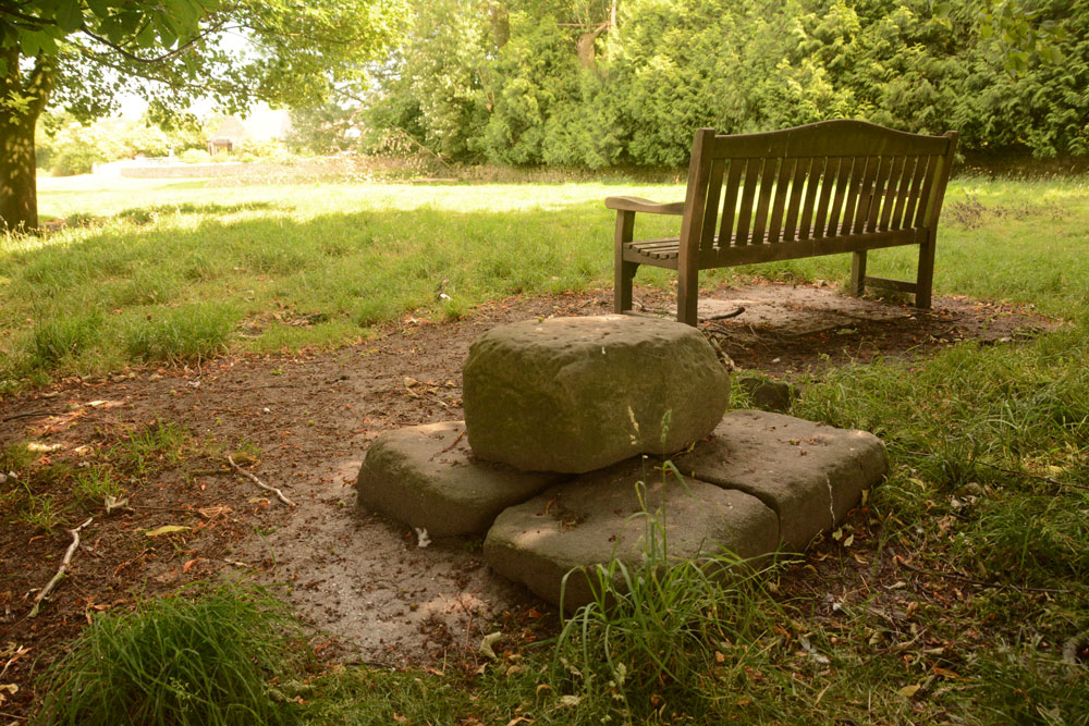
Cleatlam Wayside Cross submitted by Anne T on 2nd Jul 2018. First view of the cross base, approaching from the north and the minor road through the village.
(View photo, vote or add a comment)
Log Text: Cleatlam Wayside Cross, County Durham: This tiny village is picturesque, with large houses and farms on either side of the minor road through the village. The cross base wasn't easy to spot, hidden behind trees in a temporarily fenced off area of land, which looked like it used to be the old village green.
Sited just to the north of a wooden bench, the remains of this cross base is very odd. At first view, it looks to be a square block of stone split into two, but closer inspection reveals it is two separate pieces of stone embedded into the ground, with a smaller block placed on top.
Both Pastscape and HE say there is no socket hole, so presumably the cross would have been quite low and stood directly on top of this slab.
One of the strangest cross bases I've seen. In the field opposite, there are some interesting lumps and bumps, with a hollow way running almost parallel to the modern stone wall. Several housing/building platforms can be made out in the field. Pastscape attributes these earthworks to 'village shrinkage'.
The Shearers
Trip No.79 Entry No.2 Date Added: 2nd Jul 2018
Site Type: Stone Row / Alignment
Country: Scotland (Scottish Borders)
Visited: Yes on 27th Jun 2018. My rating: Condition 3 Ambience 4 Access 3
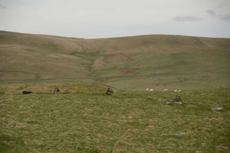
The Shearers submitted by Anne T on 8th May 2015. This was my first view of The Shearers, running across the centre/middle of the photograph from left to right.
(View photo, vote or add a comment)
Log Text: The Shearers, Hownam, Scottish Borders: By the time we got to the Shearers, the sun was high in the sky and beating down on us. Many horseflies, but thankfully no ticks. I was able to help with Sandy G's survey by acting as ‘the target’ for the disto (holding a piece of paper upright against the ranging pole so they could get accurate distances from the pole to each stone).
It occurred to me that where the row goes down the slope and ends at what is now a bog, at NT 7907 1927, perhaps this might have been a spring in ‘the olden days’ and been the water source for the hillfort.
The top end of the row seems to ‘bend’ slightly to the south east, heading towards looks like a hollowed out/partially excavated cairn.
It was fascinating to watch Sandy’s process of surveying the row, the row being too long to survey in one, so it was done in two halves. First he measured the distance of the centre of each stone from a ranging pole located in one spot, then took the angle of the stone from its central point to the ranging pole, transferring the measurements onto a plan, then photographed each stone individually. Finally, he walked up and down looking for ‘sighting lines’ – seeing what was visible from each stone, in which direction, and whether or not the stones echoed the shapes of any features in the landscape.
The conclusion Sandy came to (I think, as he says working out the details later will confirm or not) is that he counts this as a ‘possible’ stone row. It appears to be clearly associated with the nearby hill fort. I still dispute Canmore’s interpretation as the remains of a field boundary, as surely it would be connected to other old field boundaries nearby. None of these other boundary features had the earth removed from them.
We finally got back to the car at 6.30pm - the time had just flown. A very educational afternoon, and I was really pleased to have been involved in Sandy's survey. Pleasant day in pleasant company.
Horseshoe Wood (Hownam)
Trip No.79 Entry No.1 Date Added: 1st Jul 2018
Site Type: Standing Stone (Menhir)
Country: Scotland (Scottish Borders)
Visited: Yes on 27th Jun 2018. My rating: Condition 3 Ambience 4 Access 4

Horseshoe Wood (Hownam) submitted by Anne T on 8th May 2015. One of the broader faces of this enigmatic standing stone in its gloriously scenic setting.
(View photo, vote or add a comment)
Log Text: Horseshoe Wood Standing Stone: This was my first real 'day out' since being ill with flu and having been confined to bed for a week, so not feeling hugely great in myself, but great to be outside again. We met Sandy G (of Stone Rows of Great Britain fame) in Hownam Village and followed The Street, Sandy kindly moderating his pace to a slow 'plod' to accommodate me, until we reached Horseshoe Wood. The sun was bright and the temperature rose higher as we walked up the slope. I was glad to stop at the standing stone for a drink and to take some photographs. Great to hear Sandy’s views about the location of the stone and its context; it’s difficult to know what ages standing stones actually are, and whether they are in their original location. However, this one is placed right next to an important route, The Street, described as a ‘historic cross border route), which provides the context.
There is a quarry to the immediate east of the stone, which makes the location look a little suspicious, but the stone looks as if it is in its original location with packing stones around its base and on a low, oval mound.
