Contributory members are able to log private notes and comments about each site
Sites Anne T has logged. View this log as a table or view the most recent logs from everyone
Leckuary Rock Art
Trip No.88 Entry No.15 Date Added: 2nd Aug 2018
Site Type: Rock Art
Country: Scotland (Argyll)
Visited: Yes on 18th Jul 2018. My rating: Condition 3 Ambience 5 Access 3
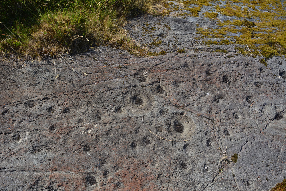
Leckuary Rock Art submitted by Anne T on 2nd Aug 2018. …. all these motifs became visible in the strong sunlight.
(View photo, vote or add a comment)
Log Text: Luckuary Rock Art Panel: A new find, some three years ago, and about to be included in a survey of Kilmichael Glen, which sounds similar to the England's Rock Art project. This was most definitely one of the highlights of our trip, thanks to the farmer who is very interested in archaeology and works very closely with Historic Scotland and Kilmartin Museum.
Torbhlaran Stone
Trip No.88 Entry No.13 Date Added: 2nd Aug 2018
Site Type: Standing Stone (Menhir)
Country: Scotland (Argyll)
Visited: Yes on 18th Jul 2018. My rating: Condition 3 Ambience 4 Access 4
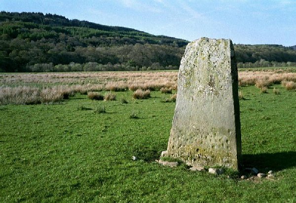
Torbhlaran Stone submitted by rockartuk on 9th Dec 2002. Torbhlaren, Strathclyde, Argyll and Bute
Main Grid Ref: NR86359451.
Located 1 km NNE of Kilmichael Glassery, 190m N of Glenalva Cottage in a (private?) field.
A cup-marked standing stone.
(View photo, vote or add a comment)
Log Text: Torbhlaren Standing Stone: A farmer in a red tractor had been mowing the field here, but had left his tractor and mower sitting by the side of the gate with the light flashing. There was no sign of the farmer. We parked in the next layby down the road, where there was a passing space on both sides of the road.
We let ourselves in through the open gate and walked to the standing stone. I had hoped to say hello to the farmer who turned up in his pickup truck, left it by the gate, hopped in his tractor and started mowing again, simply ignoring us (he must see plenty of tourists doing what we were doing).
The standing stone had cup marks on both sides. The ones on its NW face were obvious and low down; the cups on its SE face I only saw when I looked at the photos, because this face was in deep, deep shade. According to Canmore, there was also a second stone (see ID 39544 below), which now acts as a bridge over the River Add to the SW of this stone.
Torbhlaran 2
Trip No.88 Entry No.14 Date Added: 2nd Aug 2018
Site Type: Rock Art
Country: Scotland (Argyll)
Visited: Yes on 18th Jul 2018. My rating: Condition 3 Ambience 4 Access 4
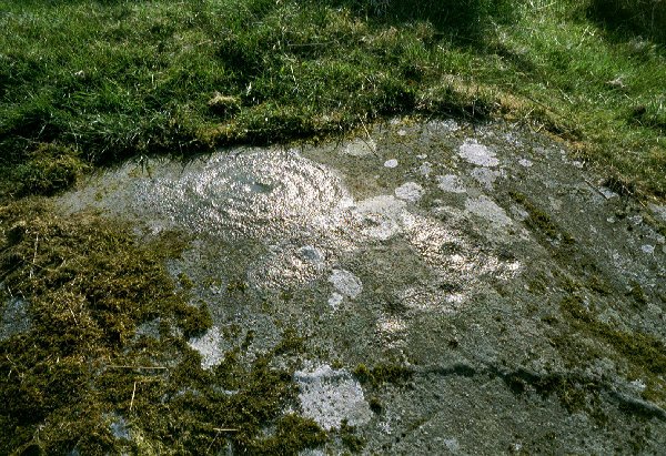
Torbhlaran 2 submitted by rockartuk on 9th Dec 2002. Torbhlaren, Strathclyde, Argyll and Bute
Main Grid Ref: NR86359451.
Located 1 km NNE of Kilmichael Glassery, 190m N of Glenalva Cottage in a (private?) field.
A possible spiral motif on the N-side of the most Northerly whale-back schist outcrop. First reported by Miss Marion Campbell in 1960.
(View photo, vote or add a comment)
Log Text: Torbhlaran 2: A large portion of the rock was covered in turf, so there may have been plenty of motifs which were under a soil cover, but we were unable to identify anything at the time of our visit.
Kilmichael Glassary 1
Trip No.88 Entry No.12 Date Added: 2nd Aug 2018
Site Type: Rock Art
Country: Scotland (Argyll)
Visited: Yes on 18th Jul 2018. My rating: Condition 3 Ambience 4 Access 4
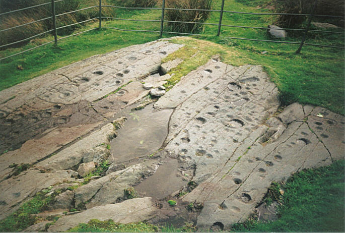
Kilmichael Glassary 1 submitted by hamish on 31st Jul 2005. What a great sight this is on the edge of a housing estate. For all the modernity around it is still enthralling to be here so much to see. Try counting them.
(View photo, vote or add a comment)
Log Text: Kilmichael Glassary 1, Rock Art: This was a real treat. From the small car park by the play park opposite the kirk, we followed the road up the slight hill, past the houses. The rocks are railed off, but to my surprise, walking to the top of the railings, there is a step to allow you to climb in to the compound.
The markings were really clear in the strong sunlight. There must have been rain here recently, as some of the deeper bowls contained pools of water.
There was also another smaller rock behind the ‘compound’ for the main rock, which someone had recently de-turfed the edges of. There were fewer markings on this, with plenty more of the outcrop under turf, so we wondered what else might lie under the grass covering.
We used the interpretation board to help us pick out key motifs, such as the oval cup and the keyhole motifs.
A young couple came and looked at the stone, and we were really respectful of each other taking photographs, which was nice. We would come across this young couple again at another couple of rock art sites and at Dunnad fort
Kilmichael Glassary Kirk
Trip No.88 Entry No.11 Date Added: 2nd Aug 2018
Site Type: Ancient Cross
Country: Scotland (Argyll)
Visited: Yes on 18th Jul 2018. My rating: Condition 3 Ambience 4 Access 5
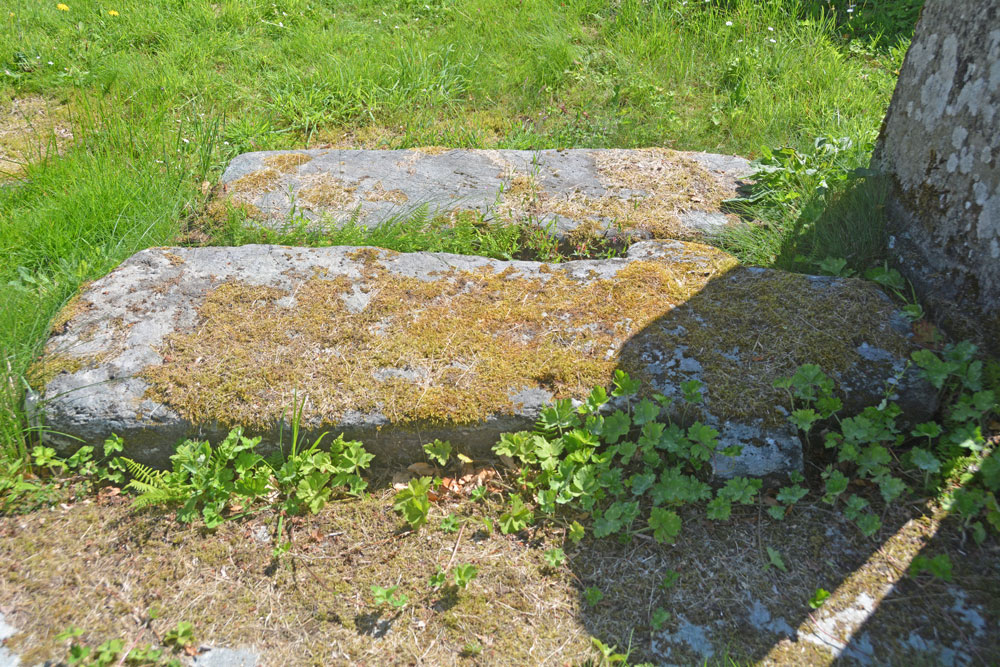
Kilmichael Glassary Kirk submitted by Anne T on 2nd Aug 2018. The cross slab from a different angle trying to capture any inscriptions on it, but it was too heavily moss-covered. We continued to look round the churchyard, as there were many other interesting gravestones and chest tombs; the church was in use for a community event so we were unable to get inside.
(View photo, vote or add a comment)
Log Text: Kilmichael Glassary Kirk, Cross Slab: [note: visit 88:10 was to Kilmartin Museum. Am still awaiting permission to publish some photos.] We parked in the small car park opposite the church and next to the small, very busy, playground. At first glance, this church is very intimidating and Scottish, but on closer inspection parts of it appear very old, particularly the churchyard. There were banners across the gate of the church announcing a “Book Swap” today, and as we approached the church, there were the noises of a large group of people inside laughing and talking. We decided to just explore the churchyard and not disturb them.
I picked this cross slab up from the “In the Footsteps of Kings” book (page 128) that “Look out for the early Christian stone to the right of the gate, which bears a Latin ring headed cross”. We didn’t find the wheel-headed cross, but another, one of three, shaped like a cross, which was referenced in Canmore. The way the sun was shining left part of it in very heavy shade. Even shining a torch on it didn’t eliminate the shadows.
This stone was heavily encrusted in moss, which we did not disturb. The graveyard was full of other interesting gravestones, some from the 14th to 15th century. The church was still busy after we’d finished looking at the rock art, up the hill, so we drove to our next venue. Wish we’d gone back, but then there was so much else to see, and our time here was drawing to a rapid close.
Creagantairbh Beag
Trip No.88 Entry No.5 Date Added: 1st Aug 2018
Site Type: Standing Stone (Menhir)
Country: Scotland (Argyll)
Visited: Yes on 18th Aug 2018. My rating: Condition 3 Ambience 4 Access 4

Creagantairbh Beag submitted by hamish on 2nd Apr 2002. Creagantairbh Beag
NM859015
Map 55.
Found off the B840 Loch Awe road about 2 miles from the junction with the A816.On the map it is called Creganterve Beg.
(View photo, vote or add a comment)
Log Text: Creagantairbh Beag Standing Stone: I hadn’t spotted these on the OS map as we were driving along, but saw the still standing stone through the fence line. Quickly stopping by the side of the road to take a photograph, I noticed there was also a fallen stone. We decided to stop and investigate further on the way back down the road from Ford village.
On way back from Ford, we turnedthe car onto a track signposted to ‘Kilmichael Glen 7’ we were immediately into the same field as the standing stones(s), only on the right side of the fence. Getting closer we realised that the cracks on both sides of the stone matched almost precisely, so the fallen part must have been the top of the stump. This would have been amazingly tall!
In the field of the house opposite were some brown and black alpacas, and I took a photo to remind me.
Ford Stone (Kilmartin)
Trip No.88 Entry No.8 Date Added: 1st Aug 2018
Site Type: Standing Stone (Menhir)
Country: Scotland (Argyll)
Visited: Yes on 18th Jul 2018. My rating: Condition 3 Ambience 4 Access 4
Ford Stone (Kilmartin) submitted by cosmic on 30th Aug 2003. The Ford Standing Stone at NM867034
(View photo, vote or add a comment)
Log Text: The Ford Stone, near Torran: We spotted this stone to the west of the road as we drove towards Ford village to see the cairn marked on the OS map and the Torran Cross Incised Stone, but the road was narrow and we could find nowhere to stop, so we decided to look on the way back.
This time, we managed to pull into the side of the road by a gate into a field on the opposite side of the road. Andrew stayed in the car in case it needed to be moved. A man on his ride quad bike and grass mower trailer was mowing up and down near the gate into the field with the standing stone. He stopped when he saw me hovering and I asked if it was OK if I went to take a look at the standing stone. He replied jovially: “This is Scotland, you can go where you want! ….. There’s another gate up there; go in through the right hand one.The horses are friendly.” I walked up the hill, avoiding him whizzing up and down on his mower. High up above the road, on a flat plain, it has lovely views to the east.
As I approached the standing stone, I realised a heap of stones nearby might possibly be a cairn, so photographed this as well.
Torran Standing Stone
Trip No.88 Entry No.7 Date Added: 1st Aug 2018
Site Type: Standing Stone (Menhir)
Country: Scotland (Argyll)
Visited: Yes on 18th Jul 2018. My rating: Condition 3 Ambience 4 Access 4
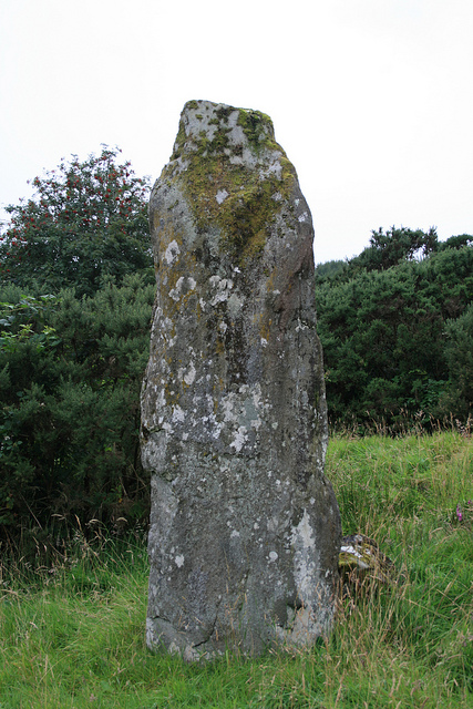
Torran Standing Stone submitted by Jackanol on 7th Sep 2015. We visited in 2012. The stone (which is quite impressive) is basically in the garden of what was then a newly-built and uninhabited house.
(View photo, vote or add a comment)
Log Text: Torran Cross Incised Standing Stone: This was to be the first time we’d seen a cross-inscribed standing stone, so we were pretty keen to locate it. From Ford, we continued up the minor road towards Torran, passing An Lodan Loch to our right hand side. We parked at the wide stony entrance to a small housing estate at NM 87884 04817 and walked up the slight slope. We could see the top of the stone poking up at the front of some tall gorse bushes to our right hand side.
Having a good mobile phone signal here, I brought up the Canmore image to try and find out where the crosses on the stone were, and discovered the stone was originally behind the back fence of one of the gardens. These fences have now been removed. It felt a bit like trespassing, walking into the gardens, but none of the houses were occupied, and there was evidence of building work going on in most of them, so we took a chance. The only person who saw us was the postwoman who was working her way up the estate in her van and she gave us a wave.
On the front of the stone (facing the houses) there were four horizontal lines, which are the remains of the cross on the back face.
To see the back of the stone, we had to clamber up behind another smaller stone to the ‘back’ of the main standing stone (away from the houses) and look down hill. The photography was a bit difficult as this part of the stone was in deep, deep shade. Andrew went and got the flash gun from the car, which I slaved to the camera flash, but it didn’t go off as the light was too bright by the stone. I kept trying at different angles, complete with torch from our mobile phone, and ended up with some good photographs.
I was curious as to the location of the stone, and where it was in relation to the valley. Walking back onto the main road, the stone could clearly be seen from the road, and eastwards looked along a small (what appears to be a) valley, which from the map, leading into An Lodan. The stone, slightly up the hill, would have been in a commanding position for anyone walking by. I had though the stone would be at the top of the hill, but the stone seems to be located near a bend in the current road leading up to Inverliever.
Ford Cist
Trip No.88 Entry No.6 Date Added: 1st Aug 2018
Site Type: Cist
Country: Scotland (Argyll)
Visited: Yes on 18th Aug 2018. My rating: Condition 2 Ambience 2 Access 5
Ford Cist submitted by caradoc68 on 20th Feb 2012. Very easy to get to being on the Ford cross roads, with a bus stop within feet of this monument.
(View photo, vote or add a comment)
Log Text: Ford Cist: Not having access to the internet, we thought this was just a cairn which had been marked on the OS map. This monument is in an odd location, just inside the village boundary, tucked between the junction of the road through to Torran and the B840 running along the south shore of Loch Awe, opposite the Crown Hotel and next to a bus stop. Tis mound was fenced off, with no means of accessing the area (apart from climbing the fence) and no information board.
We took some photographs of the mound, but didn’t climb the slope, as we were keen to see the cross-inscribed standing stone at Torran and didn’t know if we’d find it, plus we’d seen another standing stone is a field to the west of the road just before we entered the village and wanted to make time to explore that. The cist was just to the south of a babbling River Ford and a small road bridge over the river.
Creagantairbh Beag Cairns
Trip No.88 Entry No.4 Date Added: 1st Aug 2018
Site Type: Cairn
Country: Scotland (Argyll)
Visited: Yes on 18th Jul 2018. My rating: Condition 2 Ambience 4 Access 4

Creagantairbh Beag Cairns submitted by Anne T on 1st Aug 2018. This is the larger cairn, near the large tree in the field, before you reach the standing stone. It does look as if it has a kerb or a slight ditch around it, judging by the difference in vegetation around it.
(View photo, vote or add a comment)
Log Text: Creagantaribh Beag Cairns (near gate to the track leading to the Glennan Standing Stones: see report for Glennan Standing Stones. We spotted the larger cairn on the way to the standing stone; these smaller two (nearest the gate) we spotted on the way back to the car.
Glennan Standing Stone
Trip No.83 Entry No.3 Date Added: 1st Aug 2018
Site Type: Standing Stone (Menhir)
Country: Scotland (Argyll)
Visited: Yes on 18th Aug 2018. My rating: Condition 3 Ambience 5 Access 4
Glennan Standing Stone submitted by cosmic on 29th Aug 2003. Glennan Standing Stone.
(View photo, vote or add a comment)
Log Text: Glennan Standing Stones and Cairns: What could top Kintraw Standing Stones & Cairns? But we found places that almost did. Carrying on down the A816 towards Kilmartin, we turned east on the road towards the small village of Ford, travelling along a very beautiful valley. We stopped at Old Glennan farmhouse (pulled into the gateway to the track up to the house, which looked as if it hadn’t been used in ages, and was in sight of the stone). Letting ourselves in through the gate, we followed the track up, with the line of an old stone wall, now only ankle height, up to where it turned a corner, just to the north of the house. The stone appeared to be incorporated into a taller part of the wall.
Walking back to the car, I spotted what looked like a cairn with a slight ditch around it. Andrew looked up the Canmore reference on his phone and determined there were two cairns near the gate, one much reduced. According to Canmore there is a cup marked stone on one, although both cairns were well grassed over at the time of our visit.
Kintraw (Kilmartin)
Trip No.88 Entry No.2 Date Added: 31st Jul 2018
Site Type: Standing Stone (Menhir)
Country: Scotland (Argyll)
Visited: Yes on 18th Jul 2018. My rating: Condition 3 Ambience 5 Access 4
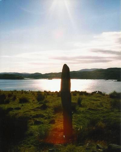
Kintraw (Kilmartin) submitted by Bladup on 25th Apr 2013. Kintraw standing stone.
(View photo, vote or add a comment)
Log Text: Kintraw Standing Stones and Cairns: This standing stone, when we spotted it on the evening of 17th July looked magnificent, but we couldn’t find anywhere to park; approaching this stone from the direction of Ardfern, there was a gateway to the field to pull into, which gave us just room to pull off this busy, fast road.
What a complex site. And what beautiful weather we had to enjoy it.The standing stone first catches your eye, but then the large cairn, with its huge pile of stones, grabs the attention, and then to the north east, with a smaller one by your feet almost next to the gate. Walking closer, we became aware of a ring cairn (?) just to the south east of the standing stone., at first view this looked like a ‘court’ cairn, made up of a ring of small upright stones – all with views over Loch Craignish from this perch on the hillside. Brilliant.
There were also traces of another, flattened cairn, to the north of the ring cairn-standing stone-larger cairn alignment.
To the east-south-east of the larger cairn was what looked like an old stone farm building, which I didn’t photograph as I thought this was modern. According to the OS map which I’m looking at now, it is noted as a ‘fort’.
This is my new ‘favourite spot’. Can I come back soon, please?
Port Nan Athlaich (Craignish)
Trip No.88 Entry No.1 Date Added: 31st Jul 2018
Site Type: Cist
Country: Scotland (Argyll)
Visited: Yes on 18th Jul 2018. My rating: Condition 3 Ambience 4 Access 3
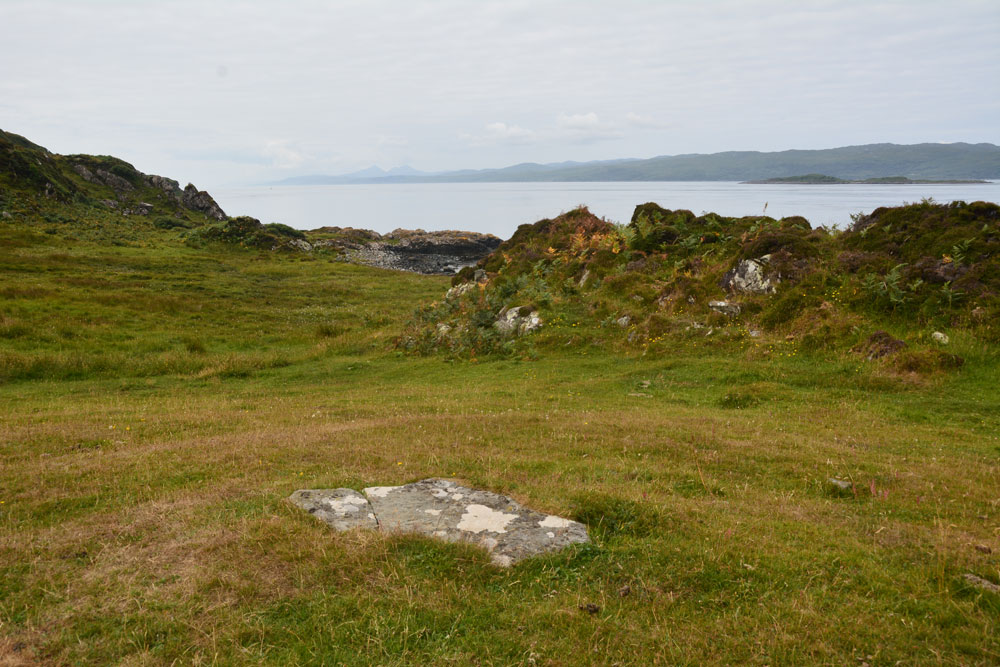
Port Nan Athlaich (Craignish) submitted by Anne T on 31st Jul 2018. The cist cover, looking south west out to the Isle of Jura and the sea.
(View photo, vote or add a comment)
Log Text: Port Nan Athlaich Cist, Aird, Craignish: I counted this as 'a bit more of a walk' as it wasn't a simple walk along a footpath, but involved a large step over a ruinous barbed wire fence and taking a few stepping stones across a stream. The walk is glorious, and is to be recommended.
Since we’d stayed at the small cottage on Aird’s Farm not far away, we’d wanted to come here and watch the sun go down of an evening, but quite a few other visitors also wanted to do that, so we watched from our hillside vantage point above.
Finally, on our last but one day, we made the trip down the track. We parked at the small car park half way down the headland, finding other people already camped out at Aird Jetty, and started to walk down to the end of the peninsula, with map in hand, to try and find the cist marked on the OS map. As we’d had no internet connection in all the time we’d been here, we had no idea of the actual grid reference, or what we might find – all we knew was that ‘cist’ was marked on the OS map.
Apart from clambering over some ruinous fences, fording a small stream and trying not to get bogged down in the marshy bits, the cist wasn’t actually difficult to find, as it was on top of a cairn like mound with a great view out to sea to the south and west.
The cist burial seemed to be completely undisturbed. The capstone was cracked, and when I stood on the smaller section to photograph the crack, the smaller part of the rock moved a few inches. Curious, we very gently eased it out of the way by a couple of inches and had a quick look inside. It was very similar to the recreated cist we saw at the Kilmartin museum.
Looking at the cist from afar, it looked as if the cist was on a natural mound, but enhanced around the burial itself.
Bessygarth Well (King's Meaburn)
Trip No.90 Entry No.5 Date Added: 31st Jul 2018
Site Type: Holy Well or Sacred Spring
Country: England (Cumbria)
Visited: Yes on 30th Jul 2018. My rating: Condition 3 Ambience 4 Access 4
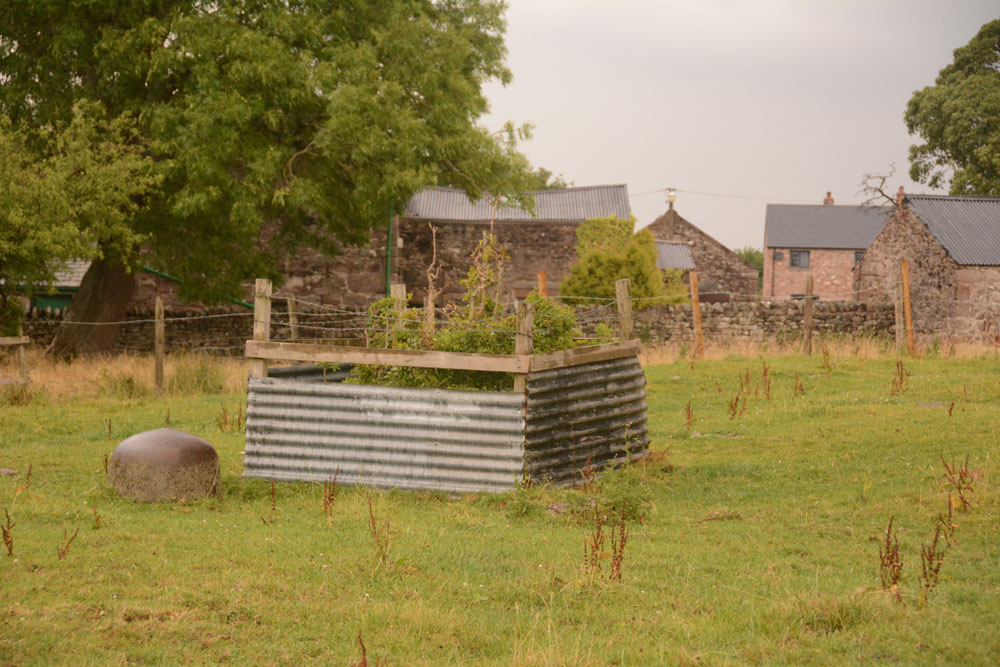
Bessygarth Well (King's Meaburn) submitted by Anne T on 31st Jul 2018. Getting closer, the peculiar cast iron 'bowl' (the cap for an old pump?) can be seen to the left hand side of the well. Thinking this was a drinking bucket for cattle/sheep, I tried to overturn it to look closer, only to find it was deeply embedded in the ground, and very heavily constructed.
(View photo, vote or add a comment)
Log Text: Bessygarth Well, King's Meaburn: This is a very old village, with a scheduled 17th century barn opposite the bus stop next to the village hall where we parked. The village runs in a long ribbon along both sides of the road, with an incongruous caravan park tucked behind the village hall.
Despite being marked on the OS map, we couldn’t find this well at first, so asked someone who’d pulled up outside one of the cottages opposite. He was only visiting, but was kind enough to ask inside the house, and relayed a message, saying that “if there’s some old tin in the field, that’s the well”. We were told it was OK to go into the field, providing we ensured the gate was shut.
Andrew dropped a stone down it, and it sounded deep! There was a most peculiar solid cast iron ‘bowl’ deeply embedded into the ground next to the well. Was this the cap of an old pump?
The field behind the well is covered in lumps and bumps. Researching it when I got home, found it was the site of the medieval settlement.
Powdonnet Well (Morland)
Trip No.90 Entry No.4 Date Added: 31st Jul 2018
Site Type: Holy Well or Sacred Spring
Country: England (Cumbria)
Visited: Yes. My rating: Condition 3 Ambience 3 Access 4
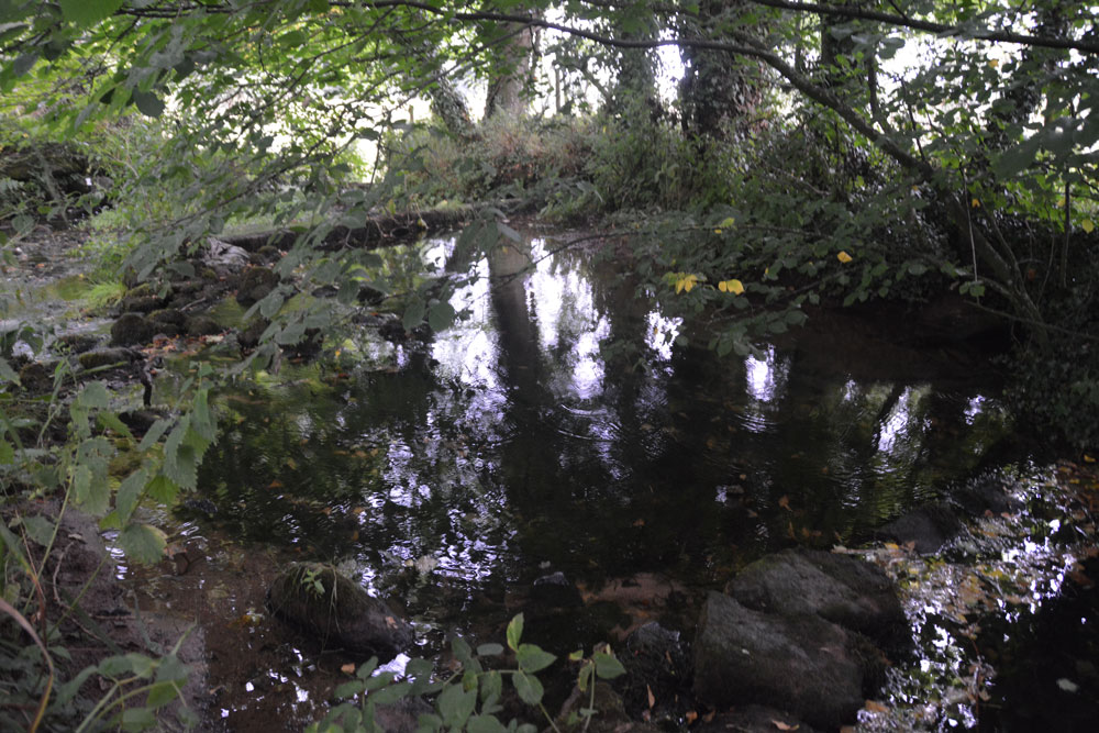
Powdonnet Well (Morland) submitted by Anne T on 31st Jul 2018. The well pool is clear and inviting. Parts of it, particularly under the tree to the right hand side of the photograph, look deep, but the stones at the bottom of the pool can be clearly seen. A little overgrown, and in the sunshine would be a lovely spot.
(View photo, vote or add a comment)
Log Text: Powdonnet Well, Morland, Cumbria: If not quite so overgrown, I'd have awarded this a '4: Good' rating on Ambience (despite the downpour after the long dry spell!). This well is marked on the OS map, but there is no mention in either Pastscape or HE.
The Holy Wells of Cumbria booklet describes this well as: “Morland. Location: Approx. 6.5 miles south east of Penrith. At the northern end of Morland village. Take road from Morland towards Cliburn. On right, as you leave village, opposite ‘Morland’ sign, is a small parking area. The standing stone and pool are close to the road.
The well had been neglected since the booklet was written in 2008 and we had to pick our way through the tangle of tree branches. We were just approaching the site of the well when the heavens opened, and there was an absolute downpour. Somewhat protected by the trees, we nevertheless decided to explore.
The easiest way to the standing stone and well is to find the overgrown footpath at the southern end of the bridge across the small stream which crosses under the road and joins the Morland Beck to the east of the well site.
The water in the pool is crystal clear. The water really does appear from nowhere. We stood at the southern end of the spring, listening to the water rushing up from the ground. The pool has been created by a couple of stone/concrete dams across the spring just to the northern part of the site. A lovely place. Next time we visit, remember to bring pruning shears!
Chapel Well (Staffield)
Trip No.90 Entry No.3 Date Added: 31st Jul 2018
Site Type: Holy Well or Sacred Spring
Country: England (Cumbria)
Visited: Yes on 30th Jul 2018. My rating: Condition 3 Ambience 5 Access 4
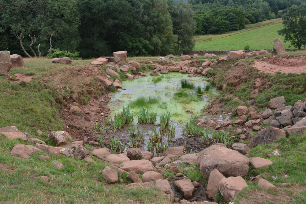
Chapel Well (Staffield) submitted by Anne T on 31st Jul 2018. The well with its pond, taken from the western end. The water bubbled out of the ground just in front of the stone bowl at the time of our visit, and was a fair flow. Between the well pool and the 'pond proper' were some lovely clumps of irises. Certainly peaceful and restful.
(View photo, vote or add a comment)
Log Text: Chapel Well, Near Staffield, Cumbria: Not far from the incised stone at Cross House. We parked near the junction down the hill where there was room to bump up onto the grass verge and walked to the gate at NY 53603 43081, which is signposted towards ‘Dale’. We kept the dry stone wall to our right hand side, and as we approached the gate into the wood, a stone drinking trough and a tree with a ditch leading from it came into view. Slightly up the slope there were some red sandstone boulders on the horizon, with a sheep track leading up to it.
The drinking trough is at NY 53774 43194 and is similar to the ones we saw at Newbeggin. The tree with its accompanying ditch is at NY 53778 43244, and there are signs of another stone structure under the tree, now dry and ruined, but possibly a secondary outlet for the well during wet weather. At the bottom of the slope, a small hole leads through the stone wall into Croglin Water just beyond.
This well is certainly in a lovely spot, hidden in a dip towards the top of the slope. There were two ‘standing stones’, one on either side of the large well pool; the rest of the large boulders had been quarried and placed around the top of the pool. A circular well bowl can be seen at the top, centre of the well, and a good flow of water came from the well (not as much as Powdonnet Well). Half a sheep had been left to rot at the south eastern end of the pool, which spoilt the ambience, and stopped me from exploring the exit pipe, but taking that away, we could have lingered for a long while. Beautiful!
Cross House Incised Stone
Trip No.90 Entry No.2 Date Added: 31st Jul 2018
Site Type: Ancient Cross
Country: England (Cumbria)
Visited: Yes on 30th Jul 2018. My rating: Condition 3 Ambience 4 Access 4
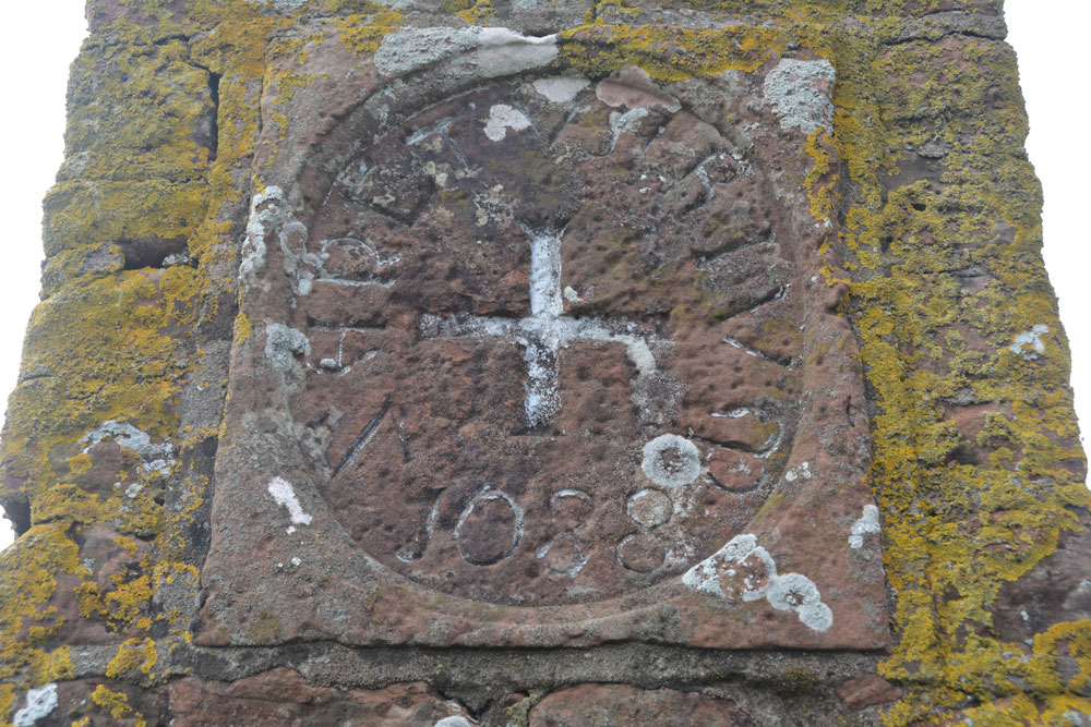
Cross House Incised Stone submitted by Anne T on 31st Jul 2018. The inscribed stone, now mounted in a 19th century pillar. The age of the stone is unknown, but it is believed to be the remains of an old wayside or boundary cross.
(View photo, vote or add a comment)
Log Text: Cross House Incised Stone, Staffield: We parked at NY 53519 43219, where a gate lets you into the footpath which goes down the hill, and joins a second footpath to Chapel Well. We walked back up the hill towards Cross House. The pillar was just visible through the hedge. We let ourselves in to the field by the gate near Cross House (there was no-one around to ask) and quickly walked to the pillar to photograph the cross.
Interesting that HE classes this as a sanctuary cross, and Pastscape as a possible wayside or boundary cross.
On processing the photographs to post to the Portal this morning, I realised we’d been to this site in October 2015, but hadn’t submitted a new site or photos to the Portal. I had asked the lady hanging out her washing in the garden of Cross House and she’d given us permission to go into the field.
Splendid views south over to the River Eden and the site of the old priory. The pillar was very near the hedge, , but it was still possible to get photos of the recut stone in its 19th century pillar.
St Mary's Well (Wreay)
Trip No.90 Entry No.1 Date Added: 31st Jul 2018
Site Type: Holy Well or Sacred Spring
Country: England (Cumbria)
Visited: Yes on 30th Jul 2018. My rating: Condition 3 Ambience 4 Access 4
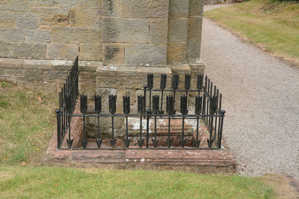
St Mary's Well (Wreay) submitted by Anne T on 31st Jul 2018. Approaching the well, with its curious railings made up of arrows, which represent 'death' according to the leaflets in the church.
(View photo, vote or add a comment)
Log Text: St Mary's Well and copy of the Bewcastle Cross, Wreay: This is a delightful little village, with some very old houses. The church is very easy to find, right in the middle of the village, opposite the colourful school, with plenty of parking on the streets nearby.
This well is to the southern side of the exterior western wall, although it has been dry for some considerable time. The well spout, in the form of an animal head, is quite superb and unusual (like the gargoyles on the roof line of the church).
The Holy Wells of Cumbria booklet (page 14) describes this well as:
Location: Approx. 9 miles south of Carlisle. The well is found by the front wall of St. Mary’s Church, Wreay.
Description: Although it is unknown whether this was a holy well, the highly unusual and attractive church is well worth a visit in itself. The original church dates back to 1319, and was rebuilt by Sarah Losh in 1840-42 – see also well 4 at Brisco – in memory of her sister Catherine and her parents. Italian in style, it is full of highly original and deeply symbolic carvings in wood and stone, many representing in forms from nature the eternal contrast between light and dark, or life and death. The well outside is a curious construction surrounded by cast iron arrows. Dog-leg stone steps lead down into the well, where water flows from a lion’s (or dog’s head) into a aquare stone piscina blessed with a solitary green fern and scattering of copper coins. The well (in 2008) was recently restored and is in excellent condition."
There was no water, no fern and no coins when we visited. Whilst the church, the sundial and the font in the churchyard are all scheduled, there is no mention of the well or the copy of the Bewcastle Cross. The church is indeed well worth looking inside. Andrew opened the door and said "I'm leaving you to go in first - it's scary!"
Clenamacrie Stone Row
Trip No.87 Entry No.9 Date Added: 31st Jul 2018
Site Type: Stone Row / Alignment
Country: Scotland (Argyll)
Visited: Yes on 17th Jul 2018. My rating: Condition 3 Ambience 3 Access 5
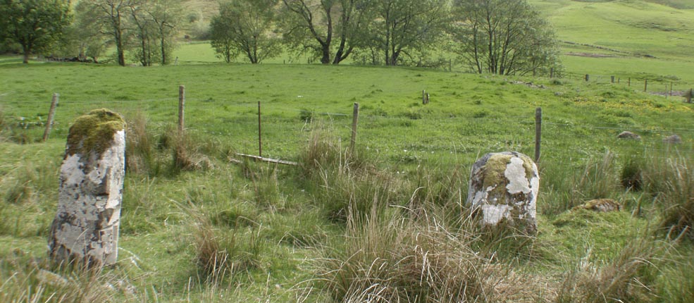
Clenamacrie Stone Row submitted by Tom_Bullock on 26th Feb 2005. Photo used by kind permission of Tom Bullock. More details of this location are to be found on his Stone Circles and Rows CD-ROM.
(View photo, vote or add a comment)
Log Text: Glenamacrie/Clenamacrie Stone Row: After An Dun, we headed off a few hundreds yards west back down the road. I took two lots of photos here, because I think I mistook an outcrop (an unmown area of the field with stones protruding, at NM 92745 28409). Andrew had mentioned both a ‘stone row’ and ‘four stones forming a chamber’, so I thought I had photographed the right thing. Driving down to the farm, I spotted the right three standing stones in a field nearer the farm, which I also photographed. Andrew said the ‘lump’ in the field behind was also a cairn, but this was the closest I could get, so we’ve got these standing stones with the cairn behind.
I wish now I’d had the courage to go and ask to see these up close, but I felt intimidated because the farm was so big and the gate into the field seemed to be along the far end of the track. I can’t get used to the ‘responsible right to roam’ act in Scotland, but it still feels like trespassing at times, especially when you are going doing someone’s driveway.
Glenamacrie Dun
Trip No.87 Entry No.8 Date Added: 30th Jul 2018
Site Type: Stone Fort or Dun
Country: Scotland (Argyll)
Visited: Yes on 17th Jul 2018. My rating: Condition 3 Ambience 4 Access 4
Glenamacrie Dun submitted by caradoc68 on 6th Feb 2012. Probably one of the easiest Dun's you will ever drive too, get out of car and you are standing on An Dun.
(View photo, vote or add a comment)
Log Text: An Dun/Glenamachrie Dun: Not far to the east of the cairns and standing stone at Glenamachrie Farm. We bypassed those, and came here first to take photos then turn the car around to go back and photograph the standing stones and cairn. When husband came back, he said he’d had the most bizarre experience. As we stopped at the different sites along this road, we kept being passed by three men in a white truck; Andrew said they’d stopped him asking him if he’d seen a crane. I think on these narrow roads we’d most definitely have been run off the road and noticed. He said ‘no’. However, that alerted us to having to move on, just in case.
Left alone in the middle of nowhere for a few minutes, my first reaction was: “If this is a fort, there weren’t really any outer banks and ditches – this just looked like a large outcrop with a small terrace around it.” These Scottish duns/fort are quite unlike the hillforts we have in England. But then I hadn’t seen Dun Add.
