Contributory members are able to log private notes and comments about each site
Sites Anne T has logged. View this log as a table or view the most recent logs from everyone
Jingling Gate
Trip No.22 Entry No.1 Date Added: 11th May 2017
Site Type: Ancient Village or Settlement
Country: England (Northumberland)
Visited: Yes on 9th May 2017. My rating: Condition 2 Ambience 4 Access 5
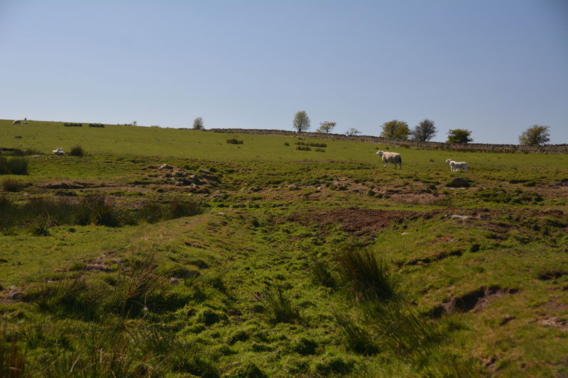
Jingling Gate submitted by Anne T on 11th May 2017. The double rampart on the northern side of this homestead.
(View photo, vote or add a comment)
Log Text: Jingling Gate Homestead, near Dotland, Hexhamshire: OK, probably this should have been called Edge House Homestead, but the name Jingling Gate sounds so much nicer! What a spot this is. Farmland here is so lush and green and the views are tremendous. Locals still hold onto much of their Hexhamshire identity rather than claim Northumberland citizenship.
This homestead is clearly visible on UK Grid Finder, but a little harder to make out on the ground. There was no gate into the field - there was a very long, continuous stone wall (must form the boundary of a farm), so we ended up peering over the stone wall.
The double banks on the northern side of the homestead were very clear, as was the southern corner, where it executes a tidy turn.
The middle has been quarried across, which makes the western side of the homestead a little difficult to make out. We didn't know there were hut circles inside until we got home and looked at the Pastscape record.
On the opposite side of the road, just north of the homestead, there is a long, low earth and stone boundary feature. No mention of a field system around the homestead. This is probably medieval, but interesting nevertheless.
It is so peaceful and quiet here. No one but the sheep and the occasional tractor. Bliss. On from here to find wells that were named on the OS Map - Midge Well, Jack's Well and Holly Well.
Joicey Shaft a
Trip No.141 Entry No.1 Date Added: 1st Jul 2019
Site Type: Rock Art
Country: England (Northumberland)
Visited: Yes on 30th Jun 2019. My rating: Condition 3 Ambience 3 Access 4
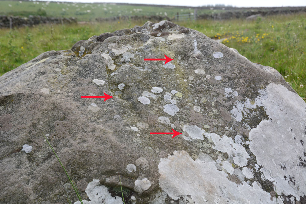
Joicey Shaft a submitted by Anne T on 1st Jul 2019. ERA/NADRAP says there are two cups here, the one to the east "fed by a natural gully from above". We thought we found three cups, marked with the red arrows, but there were so many erosion features, it was difficult to be certain.
(View photo, vote or add a comment)
Log Text: Joicey Shaft A: With the most of the rest of the UK enjoying warm sunshine, up in this part of Northumberland, the storm clouds had gathered. Having checked the weather forecast to make sure rain wasn't due to arrive until this evening, we set off to find these rock art panels, within easy reach of a road. This road was marked on the old OS map as a bridle path, but on the modern OS map it is now a metalled, yellow road, indicating it can be driven down.
OK, the road isn't the best, being potholed in parts, but the stone can be found just through a gate across the road at NY 82906 66462. Both boulders are on the northern side of the road, about 40m apart.
Being here was really wierd, as holes had been drilled in the northern-most gatepost, and as the wind howled through them, it played a tune, the 'melody' varying between different notes dependant upon the width of the hole.
I managed to photograph panel A before the rain started to come down, then we had to sit in the car for 10 minutes or so before there was a break in the clouds.
In walking back from panel B, I spotted through the gate on the south side of the road, a lump which looked like a cairn. I almost dismissed it as a farmer's manure dump, but realised the tractor track respected its western side (albeit cutting it a little). Andrew has just pointed out it is shown on the 1860 OS map.
Joicey Shaft b
Trip No.141 Entry No.2 Date Added: 1st Jul 2019
Site Type: Rock Art
Country: England (Northumberland)
Visited: Yes on 30th Jun 2019. My rating: Condition 3 Ambience 3 Access 4
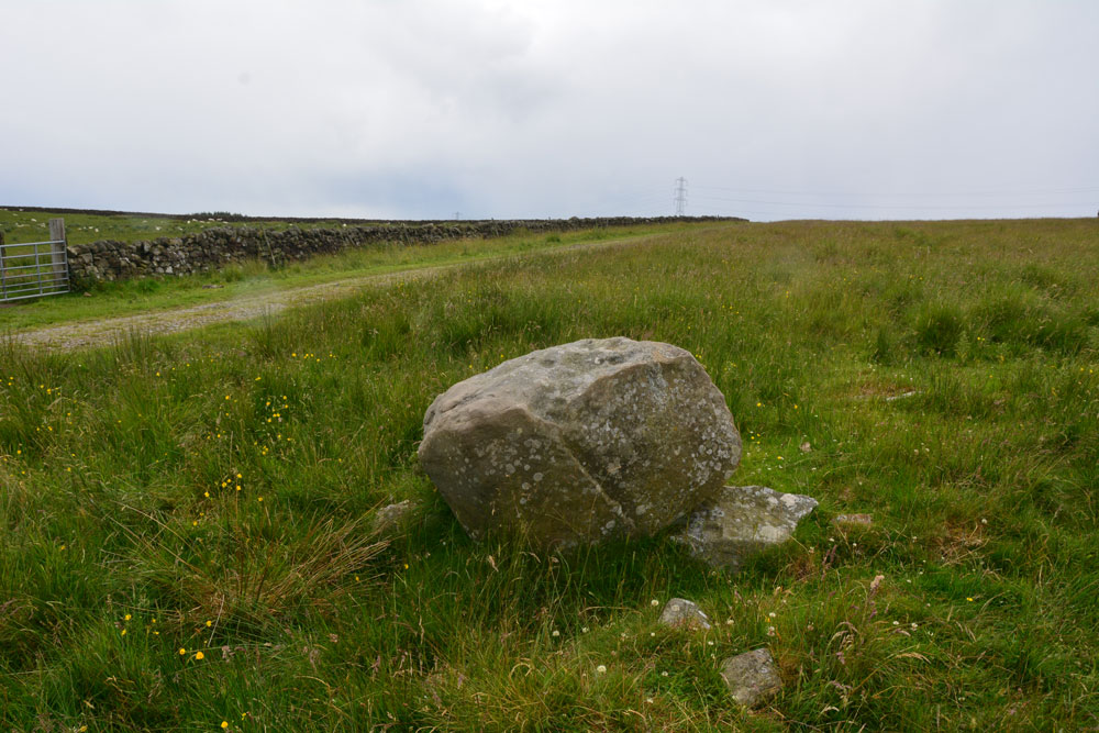
Joicey Shaft b submitted by Anne T on 1st Jul 2019. Photograph showing the Panel B boulder in relation to the track running to its south. The boulder sits on top of other stones, apparently the remains of an old field boundary/dry stone wall.
(View photo, vote or add a comment)
Log Text: Joicey Shaft B: This boulder is only 40m or so to the WSW of panel A, and is the only other large boulder in the field near this location. It is propped on top of other stones, part of the demolished field wall that ERA/NADRAP talk about.
ERA/NADRAP talk about two possible cup marks, which I found by comparing the shape of the stone with the NADRAP drawings. We also thought we saw two more, but these may be just solution holes or natural erosion.
Joicey Shaft Cairn
Trip No.141 Entry No.3 Date Added: 1st Jul 2019
Site Type: Round Barrow(s)
Country: England (Northumberland)
Visited: Yes on 30th Jun 2019. My rating: Condition 2 Ambience 3 Access 4
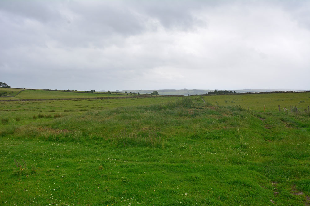
Joicey Shaft Cairn submitted by Anne T on 1st Jul 2019. The cairn as seen from the gate into the field at NY 82860 66456, showing how the farmer has driven his tractor over the western side of the mound, but the track 'bends' away from it, respecting most of the mound.
(View photo, vote or add a comment)
Log Text: Joicey Shaft Cairn: I spotted this mound almost by accident as I was photographing Joicey Shaft B from the track. At first I dismissed it as a manure heap, or possible tailings from the leading mining which used to take place here, but the more I walked round it, the more convinced I was it was a cairn, especially with its proximity to the rock art panels on the opposite side of the track, and because the modern field boundary and the track leading N-S to its western side 'bent' round to accommodate most of the barrow.
It is not recorded by HE or Pastscape, but it is on the old OS maps, so has been here for a while.
Kalmott cairn circle
Date Added: 9th Sep 2014
Site Type: Ring Cairn
Country: England (Cumbria)
Visited: Yes on 7th Sep 2014. My rating: Condition 3 Ambience 3 Access 4
Kalmott cairn circle submitted by VapourTrail on 28th Sep 2009. Kalmott cairn on a typically dull Cumbrian day in September.
(View photo, vote or add a comment)
Log Text: Kalmott Cairn Circle, Oddendales, Cumbria: Arriving at Oddendales to see the cairns marked on the OS map, just past the footpath sign pointing us to the Coast-to-Coast/Crosby Ravensworth, we were surprised to come across what appeared to be a small cairn with a ring of stones with a central cluster. It’s not marked on the Ordnance Survey maps.
Sitting between the stone wall of Oddendales Farm on the left and the modern trackway we were walking on, it seemed surprising that this cairn had survived intact. Not been able to find out any more about it, which has been frustrating. I record a photograph here to show what we saw. I’ve now only just found a photograph and brief description about this on Hedge Druid's web site; Hedge Druid says he then submitted it to the Portal for inclusion.
Having taken a couple of photos, we then made our way up to Seal Howe Cairn.
Keld Bank (Ingleborough)
Trip No.144 Entry No.3 Date Added: 13th Aug 2019
Site Type: Rock Art
Country: England (Yorkshire (North))
Visited: Yes on 8th Aug 2019. My rating: Condition 3 Ambience 4 Access 3
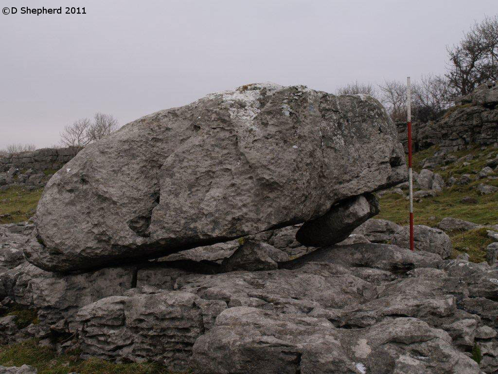
Keld Bank (Ingleborough) submitted by DavidShepherd on 10th May 2018. Keld Bank Propped Stone, photo taken by David Shepherd.
Top stone seems to have come from the adjacent collapse feature on the scar. There is an enlarged joint beneath blocked with a flake.
(View photo, vote or add a comment)
Log Text: Keld Bank Propped Stone: We parked in the small car park for Great Douk Caves on the northern side of the B6255, Low Sleights Road, and began by following the footpath up to the caves, passing the lime kiln on the way. We then largely followed a quad bike track SSE up the slope to the first limestone scar, then headed north east towards the grid reference given by David Shepherd.
The piece of land this propped stone sits on is a nature reserve, managed by Natural England, so we assumed we were safe to walk up over the limestone ridges or scars, of which I counted three. There were easy routes up over each raised section of scar, so I made the walk to the stone easily. Again, we needed to use the GPS and David’s photograph to confirm we were looking at the correct stone, as there were a number of possibilities in the area, including one nicely ‘balanced’ stone nearby.
My comments about this propped stone as the same as above. Even Andrew was less convinced this time, given there were so many other stones around that could also have been counted as ‘propped’ or ‘balanced’.
We ‘called off’ the walk for the third stone as a result of this visit, opting to go and find the stone circle at Casterton.
Keld Bank Settlement
Trip No.144 Entry No.4 Date Added: 13th Aug 2019
Site Type: Ancient Village or Settlement
Country: England (Yorkshire (North))
Visited: Yes on 8th Aug 2019. My rating: Condition 2 Ambience 4 Access 3
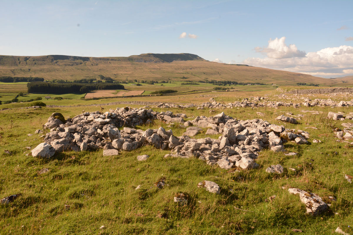
Keld Bank Settlement submitted by Anne T on 13th Aug 2019. The remains of the roundhouse, with an attached enclosure, on the western edge of the settlement. This view looks NW. On the terrace below, there are the remains of clearance cairns and the low banks of field systems
(View photo, vote or add a comment)
Log Text: Keld Bank Settlement: Sitting down in the sunshine, recording the photographs I’d taken for the Keld Bank Propped Stone, I picked up the OS map and realised there was a settlement here. In fact, where I’d chosen to sit, on the edge of a scar, was right on the eastern edge of it.
This settlement is marked on the HE map of the area, but not recorded or scheduled. It was very reminiscent of the Whittenknowles Rocks settlement on Dartmoor, where the walls and hut circles had been built round the natural stones/boulders. Built on the terrace just below the propped stone, extending to the terrace below. The sharp ‘edges’ of the terrace by the hut circle made it look a little like a hill fort – natural defences.
Towards the northern side, I identified a clear hut circle with an enclosure attached; this is clearly visible on UK Grid Reference Finder. There were other clearance cairns and the remains of old buildings and field systems in the terrace below the propped stones.
Kells Well (Newbeggin)
Trip No.96 Entry No.5 Date Added: 13th Sep 2018
Site Type: Holy Well or Sacred Spring
Country: England (Cumbria)
Visited: Yes on 11th Sep 2018. My rating: Condition 2 Ambience 1 Access 5
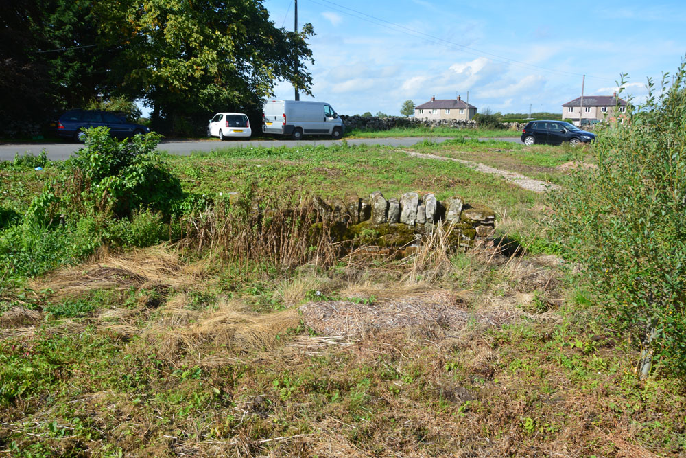
Kells Well (Newbeggin) submitted by Anne T on 13th Sep 2018. Standing to the east of the well, looking back across the road which leads into Newbeggin to the left and to the junction with the B5288 to the right. There doesn't appear to be a well trough any more, although all the ground around here is wet and spongy, indicating its the site of a spring.
(View photo, vote or add a comment)
Log Text: Kells Well, Newbeggin: This well is located opposite a house called Rockholme on the OS map, and near the Clickem Inn, just south of the B5288
The farmer from Sycamore View told us about the well, saying it had recently been “done up and claimed for the village” by the villagers. This was more like a glorified rubbish tip – the place was horrible, one of the worst places we’ve stopped at in years.
There was an old pebbled path leading round the well, together with the remains of an old stone structure, now largely covered in weeds and falling down. There was a pool of water to its northern side, and the whole of the central area around the stone structure was boggy and puddled; a small stream ran to a partly culverted ditch just to the north. Horrible. Glad to escape.
Kelvingrove Museum and Art Gallery
Trip No.107 Entry No.4 Date Added: 15th Nov 2018
Site Type: Museum
Country: Scotland (North Lanarkshire)
Visited: Yes on 29th Oct 2018. My rating: Condition 3 Ambience 3 Access 5

Kelvingrove Museum and Art Gallery submitted by Creative Commons on 13th Mar 2014. Kelvingrove Art Gallery And Museum
Taken from Kelvingrove Park.
Copyright Paul McIlroy and licensed for reuse under this Creative Commons Licence
Site in North Lanarkshire Scotland
(View photo, vote or add a comment)
Log Text: Kelvingrove Museum, Glasgow: After Glasgow Cathedral and the Govan Stones, I found the exhibition of Scotland's Early People a little small and disappointing, but what they had on display was interesting. Best items on display for me were the beaker found when they excavated Temple Wood in Kilmartin and a wooden ladder from a crannog. And of course the rock art stone Andy B was photographed with!
Kemp Howe
Date Added: 7th Jul 2014
Site Type: Stone Circle
Country: England (Cumbria)
Visited: Yes on 5th Jul 2014. My rating: Condition 2 Ambience 2 Access 4
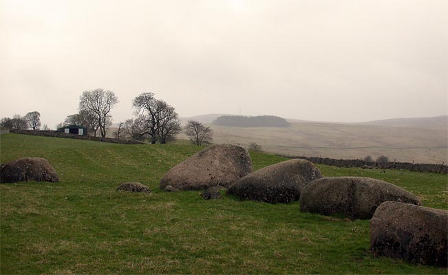
Kemp Howe submitted by nicoladidsbury on 29th Mar 2004. This is the remains of what must have been a beautiful stone circle. The stones are pink granite and have a lovely glow. Unfortunately the ambience has been shattered by the "wonderful" victorians, who built the railway on top of it.
(View photo, vote or add a comment)
Log Text: Having been kept awake most of the night by heavy, heavy rain, then being greeted by leaden skies with a distinctly autumn feel, the weather in Cumbria, according to the weather forecast, seemed a lot more appealing.
Armed with information from the Portal and a map with the locations of stones in the Stone Row from the Shap Local History Society, we hopped in the car and drove west.
We parked at the entrance to the field with Kemp Howe in it (the gate to the field was left wide open, and there was a short trackway up to the stones, although the road was horrendously busy), and walked the 100 feet or so up to the stones. Whilst the grass in the field had recently been cut, the undergrowth round the stones had been left uncut.
I confess to being horrified at the damage done to these stones by the Victorians - what a travesty. We got to admire several trains passing by at very close quarters, and could almost have waved to the quarry men the other side of the railway line. The views of the fells to the west (across the road) and beyond was appreciated and were in stark contrast with what was behind us.
This marked the start of an afternoon well spent exploring the Stone Row in glorious sunshine, with a nice lunch stop at the Shap Coffee Shop in the village, then taking in the stones at the west of Shap Village, finishing with the Tumulus at Skellow Hill and the Thunder Stone.
Kes Tor Cairn
Trip No.135 Entry No.5 Date Added: 31st Jul 2019
Site Type: Cairn
Country: England (Devon)
Visited: Yes on 16th May 2019. My rating: Condition 2 Ambience 3 Access 3
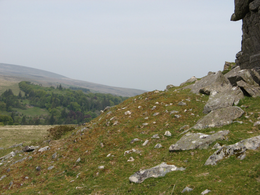
Kes Tor Cairn submitted by davep on 31st Jul 2019. Photograph taken 16th May 2019. Kes Tor Reported Cairn from Prehistoric Dartmoor Walks (site 1923).
(View photo, vote or add a comment)
Log Text: Kes Tor Cairn: As the group gathered around the western side of the tor, we saw what I initially thought was a tumble of smaller rocks from the side of the Tor, but as I walked around photographing it, thought it resembled a cairn. Walking back to join the group, Sandy and Dave were in conversation, concluding it was indeed probably a cairn. Dave took a gps with his garmin, remarkably similar to mine with my basic model, and has now included the cairn on Prehistoric Dartmoor Walks as a 'reported cairn' (site 1923).
Kes Tor Rock Basin
Trip No.135 Entry No.4 Date Added: 31st Jul 2019
Site Type: Natural Stone / Erratic / Other Natural Feature
Country: England (Devon)
Visited: Yes on 16th May 2019. My rating: Condition 3 Ambience 4 Access 3
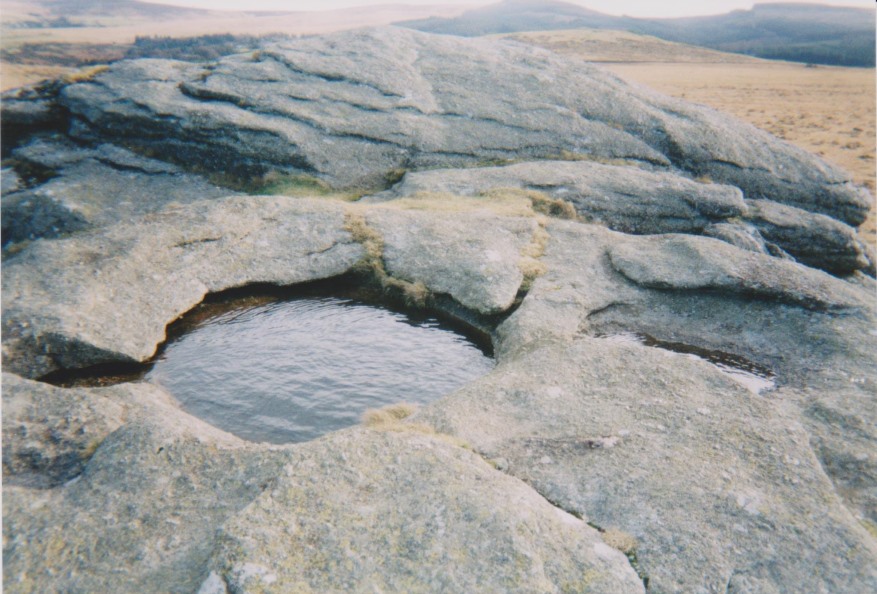
Kes Tor Rock Basin submitted by AngieLake on 28th Jul 2017. Another view of the rock basin here. Probably taken in 2002 on old film camera.
(View photo, vote or add a comment)
Log Text: Kes Tor Outcrop: My fear of falling stopped me from going to the top of this amazing outcrop to see the rock basin (I saw another walker trip over and narrowly miss going over the edge whilst I was there), but I admired the outcrop from down below. I hope I can still tick this site off my Dartmoor list as having visited!
Kestor Settlement
Trip No.135 Entry No.2 Date Added: 31st Jul 2019
Site Type: Ancient Village or Settlement
Country: England (Devon)
Visited: Yes on 16th May 2019. My rating: Condition 3 Ambience 4 Access 4
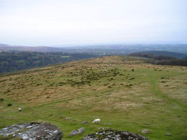
Kestor Settlement submitted by thecaptain on 24th Oct 2004. View northeast from Kestor rocks overlooking Kestor Settlement. The entire hilltop and hillsides here are covered in the ancient remains of ancient huts and field systems.
(View photo, vote or add a comment)
Log Text: Kestor Settlement (of which Round Pound is part of): Only across the road from the Round Pound, which I learned later was part of this settlement and not separate from it, as we walked up the slope to the east of Round Pound, I couldn’t believe the amount, and quality, of the structures that remained here.
At first, it was all a little mind-boggling, but then Sandy G produced a plan of the site, and I kept asking where we were on the plan, so I could sort my photographs accordingly. The views to the east and north east would have been quite amazing, had it not been for the mist around that day.
At home, I poured over Butler's "Dartmoor Atlas of Antiquities", volume 2, pages 170 onwards, which has a map of the settlement and descriptions of the field systems and the individual houses and enclosures within it. Brilliant!
Ketley Crag Rock Shelter 1
Date Added: 28th Jul 2014
Site Type: Rock Art
Country: England (Northumberland)
Visited: Couldn't find on 27th Jul 2014. My rating: Access 1
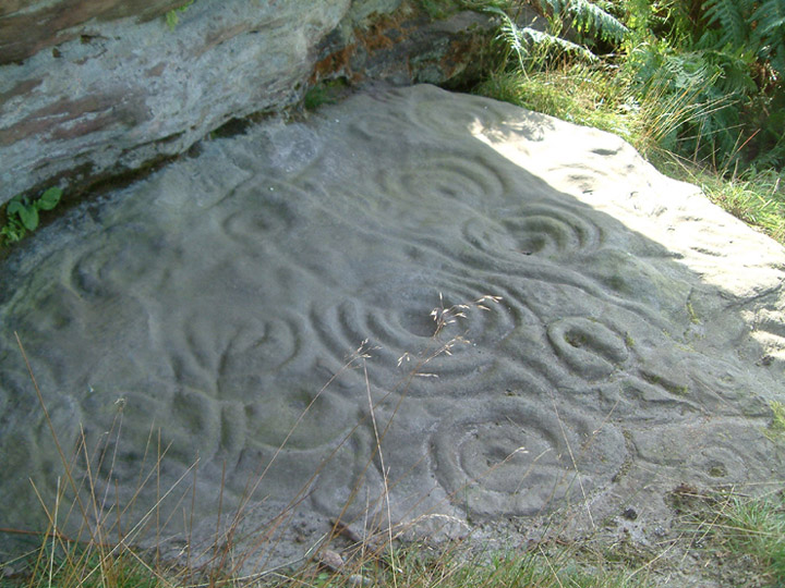
Ketley Crag Rock Shelter 1 submitted by stu on 11th Oct 2003. NU0743 2978. Is there anything better looking? I'd say not.....lots of other impressive cup and ring carvings on the walk over from Chatton Hill.
(View photo, vote or add a comment)
Log Text: We went to seek this magnificent example of rock art, well armed with map, compass and camera, and parked outside South Lyham farm. At the adjacent cottages, one of the residents came out to speak to us, and pointed out the way to the permissive footpath across to Ketley Crag and Chattonpark Hill, telling us how to find the Ketley Stone. It had rained heavily the night before, and following the footpath across the first field from the farm, we remained undeterred by boggy ground and wet feet in the dip where the permissive path splits off right from the farm track. After a search, we found the wooden footbridge across the stream and the permissive footpath sign.
The bracken was shoulder high, and 50 feet further up the path, we were confronted by a high wall of bracken, which proved impossible to get through. So sadly we retraced our steps. Apparently we missed a sheep track through the bracken, which the resident, talking to us on our way back, told us had been there a month before.
We then tried again from the access track from the B6349, at grid reference NU 06362 30614. This was easy walking for the first kilometre or so, but just past the ford, the trackway became very overgrown, with deep ruts and it was very hard work to make progress through the weeds, and despite waterproofs, we were soggy. We did try walking along the edges of the fields rather than on the trackway, but there were no gates between fields, so sadly we had to give up.
I had been really looking forward to seeing this rocky crag; there is a third option, which is from this same trackway, but from Chatton Park Farm, which takes us up over the top of Chattonpark Hill, so we'll try this another day.
We then went in search of some rock art at Doddington, to see if this was more accessible
Kilmartin Churchyard
Trip No.87 Entry No.18 Date Added: 7th Aug 2018
Site Type: Sculptured Stone
Country: Scotland (Argyll)
Visited: Yes on 17th Jul 2018. My rating: Condition 3 Ambience 4 Access 4
Kilmartin Churchyard submitted by Ghriogair on 16th Jul 2009. Kilmartin Churchyard
(View photo, vote or add a comment)
Log Text: Kilmartin Churchyard: Having booked ourselves in for an evening meal at the Kilmartin Arms opposite the church (warning: the portions were huge, but really good), we went across to the churchyard to find the cross slabs in the churchyard that Rachel Butter mentions in her "Kilmartin" book (page 99) and found so much more. This really finished the evening off nicely.
There is also a lapidarium and the Poltalloch Enclosure with some really nice carved grave slabs.
There is a small car park immediately outside the church, and there is disabled access into the church with its crosses inside. The churchyard itself was a little tricky to negotiate, as we had to step over old chest tombs to see some of the carved slabs. Nice views down to the glen below, and a peaceful place to spend time.
Kilmartin Churchyard (Lapidarium)
Trip No.87 Entry No.18 Date Added: 20th Aug 2018
Site Type: Sculptured Stone
Country: Scotland (Argyll)
Visited: Yes on 17th Jul 2018. My rating: Condition 3 Ambience 4 Access 4
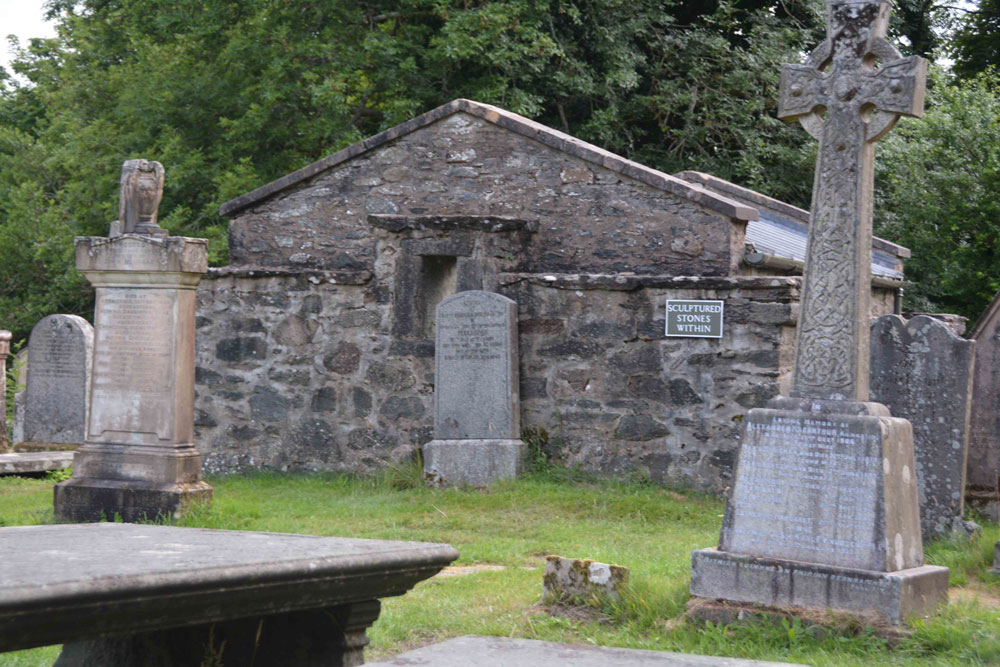
Kilmartin Churchyard (Lapidarium) submitted by Anne T on 20th Aug 2018. The lapidarium, as seen from the path to the left hand side of Kilmartin Church (entering from the main gate by the car park by the A816 opposite the Kilmartin Arms/Hotel).
(View photo, vote or add a comment)
Log Text: Kilmartin Church (Lapidarium): See visit report for Kilmartin Churchyard (MP87.18)
Kilmartin Churchyard (Poltalloch Enclosure)
Trip No.87 Entry No.18 Date Added: 20th Aug 2018
Site Type: Sculptured Stone
Country: Scotland (Argyll)
Visited: Yes on 17th Jul 2018. My rating: Condition 3 Ambience 3 Access 4
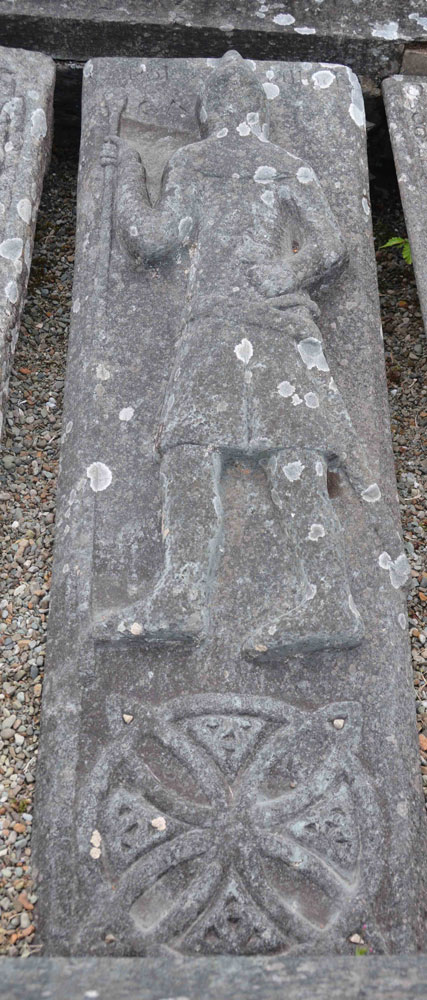
Kilmartin Churchyard (Poltalloch Enclosure) submitted by Anne T on 20th Aug 2018. This tapered slab, in the Poltalloch Enclosure, measures 1.85m by 0.59m. It has an armed figure above a large ring-knot with triquetra knots in the interspaces. At the top there are the added names POLTALLOCH and CA (?MPBELL). Loch Awe School. Dates to the 14th to 15th century.
(View photo, vote or add a comment)
Log Text: The Poltalloch Enclosure, Kilmartin churchyard: See main report for Kilmartin churchyard (MP 87.18).
Kilmartin House
Trip No.88 Entry No.10 Date Added: 18th Aug 2018
Site Type: Museum
Country: Scotland (Argyll)
Visited: Yes on 18th Jul 2018. My rating: Condition 4 Ambience 4 Access 5
Kilmartin House submitted by DrewParsons on 29th Jun 2010. Located in the middle of the village of Kilmartin, the museum has a good display of local finds and interesting descriptions of the prehistoric sites in the neighbourhood. There is also a well stocked museum shop on the premises.
(View photo, vote or add a comment)
Log Text: Kilmartin Museum: We managed to get a space in the car park. From the number of cars parked outside the museum and along the roads, we thought the place would be heaving with people (including a bus tour which had turned up), but the café was quiet and relaxing and there was only one other lady and a younger man who was with her, in the museum.
The museum was small, and a bit disappointing for the £7 entry fee, but it was nicely laid out and they gave you a map of the sites to visit. The lady on reception told us we were allowed to take photographs, but as long as they were not for publication on the internet.
I bought 4 postcards and “In The Footsteps of Kings” book of walks around the Kilmartin area, which gave a lot of information about the area, together with photographs and what to look for, which helped inform our visits greatly – wonderful photos in it, too!
I photographed Glebe Cairn from the path running outside the conservatory.
I have since been in contact with the Visitor Services Office, at the museum, and received the following reply on 14th August 2018 (see private notes).
Kilmichael Glassary 1
Trip No.88 Entry No.12 Date Added: 2nd Aug 2018
Site Type: Rock Art
Country: Scotland (Argyll)
Visited: Yes on 18th Jul 2018. My rating: Condition 3 Ambience 4 Access 4
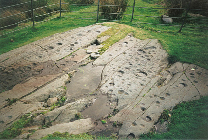
Kilmichael Glassary 1 submitted by hamish on 31st Jul 2005. What a great sight this is on the edge of a housing estate. For all the modernity around it is still enthralling to be here so much to see. Try counting them.
(View photo, vote or add a comment)
Log Text: Kilmichael Glassary 1, Rock Art: This was a real treat. From the small car park by the play park opposite the kirk, we followed the road up the slight hill, past the houses. The rocks are railed off, but to my surprise, walking to the top of the railings, there is a step to allow you to climb in to the compound.
The markings were really clear in the strong sunlight. There must have been rain here recently, as some of the deeper bowls contained pools of water.
There was also another smaller rock behind the ‘compound’ for the main rock, which someone had recently de-turfed the edges of. There were fewer markings on this, with plenty more of the outcrop under turf, so we wondered what else might lie under the grass covering.
We used the interpretation board to help us pick out key motifs, such as the oval cup and the keyhole motifs.
A young couple came and looked at the stone, and we were really respectful of each other taking photographs, which was nice. We would come across this young couple again at another couple of rock art sites and at Dunnad fort
Kilmichael Glassary Kirk
Trip No.88 Entry No.11 Date Added: 2nd Aug 2018
Site Type: Ancient Cross
Country: Scotland (Argyll)
Visited: Yes on 18th Jul 2018. My rating: Condition 3 Ambience 4 Access 5
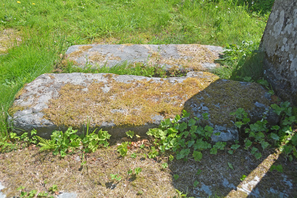
Kilmichael Glassary Kirk submitted by Anne T on 2nd Aug 2018. The cross slab from a different angle trying to capture any inscriptions on it, but it was too heavily moss-covered. We continued to look round the churchyard, as there were many other interesting gravestones and chest tombs; the church was in use for a community event so we were unable to get inside.
(View photo, vote or add a comment)
Log Text: Kilmichael Glassary Kirk, Cross Slab: [note: visit 88:10 was to Kilmartin Museum. Am still awaiting permission to publish some photos.] We parked in the small car park opposite the church and next to the small, very busy, playground. At first glance, this church is very intimidating and Scottish, but on closer inspection parts of it appear very old, particularly the churchyard. There were banners across the gate of the church announcing a “Book Swap” today, and as we approached the church, there were the noises of a large group of people inside laughing and talking. We decided to just explore the churchyard and not disturb them.
I picked this cross slab up from the “In the Footsteps of Kings” book (page 128) that “Look out for the early Christian stone to the right of the gate, which bears a Latin ring headed cross”. We didn’t find the wheel-headed cross, but another, one of three, shaped like a cross, which was referenced in Canmore. The way the sun was shining left part of it in very heavy shade. Even shining a torch on it didn’t eliminate the shadows.
This stone was heavily encrusted in moss, which we did not disturb. The graveyard was full of other interesting gravestones, some from the 14th to 15th century. The church was still busy after we’d finished looking at the rock art, up the hill, so we drove to our next venue. Wish we’d gone back, but then there was so much else to see, and our time here was drawing to a rapid close.
