Contributory members are able to log private notes and comments about each site
Sites Anne T has logged. View this log as a table or view the most recent logs from everyone
Purveshaugh
Trip No.50 Entry No.2 Date Added: 6th Oct 2017
Site Type: Standing Stone (Menhir)
Country: Scotland (Scottish Borders)
Visited: Yes on 24th Sep 2017. My rating: Condition 3 Ambience 3 Access 5
Purveshaugh submitted by mafenty on 18th Sep 2006. Good views of Eildon Hills and Black Hill of Earlston in background
(View photo, vote or add a comment)
Log Text: Purveshaugh (Earlston) Standing Stone, Scottish Borders: Our second stop of the day. Although the B6105 is supposed to be a minor road, it is still very busy and traffic rushes along it at a pace of knots. We managed to pull into the ungated field entrance without causing too much chaos.
A few steps into the field, we realised it was planted with wheat. We managed to navigate the 10 metres or so from the field entrance to the stone by following the empty ground where the tractor wheels had run, so didn’t cause any damage.
I was really amused to see the stone had its own name sign ‘Standing Stone’. It really is the most oddly shaped stone, like a small chair. Canmore says it is unsculptured, and it looks as if it has been quarried before being located here. I was surprised to find Canmore had two other records for this site, within a few tens of metres of the stone – a post medieval farmstead (Canmore ID 343237) and a well (Canmore ID 343240), neither of which we saw evidence for on the day.
Not a great location in modern times, with power lines running almost overhead, and the busy road.
Pumplaburn
Trip No.124 Entry No.6 Date Added: 11th Apr 2019
Site Type: Cairn
Country: Scotland (Dumfries and Galloway)
Visited: Saw from a distance on 4th Apr 2019. My rating: Condition 1 Ambience 2 Access 4
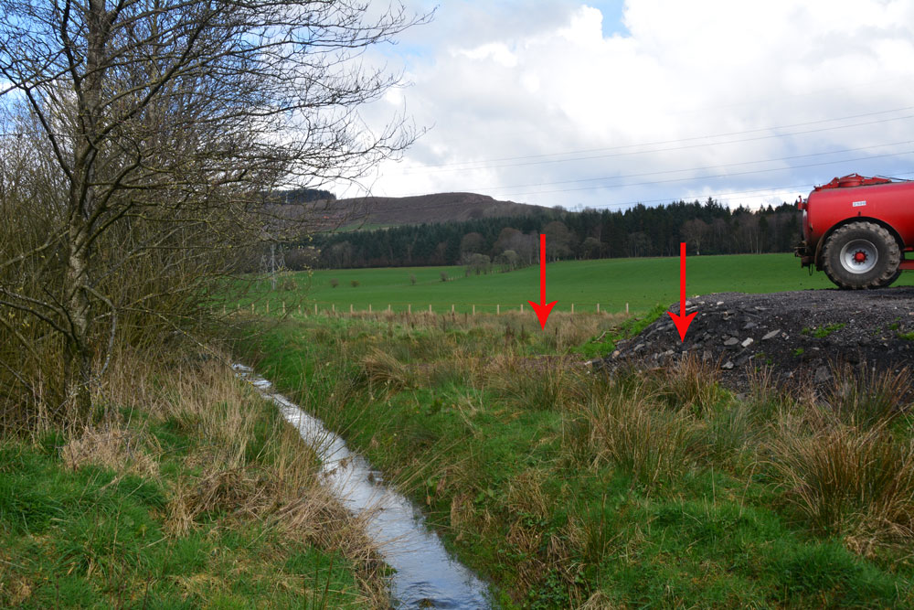
Pumplaburn submitted by Anne T on 11th Apr 2019. The two arrows show approximately where the two cairns should be - one buried (almost buried?) by the new hardstanding area; the other further back in the field. Photograph taken from the corner of the field at NY 11832 96456.
(View photo, vote or add a comment)
Log Text: Pumplaburn Cairns: Making our way back towards Annandale Water, we went under the smallest railway bridge we’d ever travelled under – 7ft tall and 7ft wide! We didn’t find these cairns, despite wandering up and down the road. Looks like they may have been buried by the large hardstanding for tractors next to Pumplaburn Steading. From plotting the ngrs on UK Grid Reference Finder, the cairn at NY 1191 9650 may still be there, but we only saw it from a distance.
Pudding Pie Hill
Date Added: 29th Sep 2014
Site Type: Round Barrow(s)
Country: England (Yorkshire (North))
Visited: Yes on 26th Sep 2014. My rating: Condition 3 Ambience 4 Access 4
Pudding Pie Hill submitted by rogerkread on 11th Sep 2014. The large mound of Pudding Pie Hill.
(View photo, vote or add a comment)
Log Text: Pudding Pie Hill, Sowerby near Thirsk: From St Mary The Virgin at Leake, we headed south to Thirsk, leaving the A19 at its junction with the A168 to get as close as we could to Pudding Pie Hill.
It wasn’t possible to get to the round barrow from this direction, as there are all private roads leading to houses and small holdings, so we tried driving back into Thirsk and back round to Sowerby.
I always like coming to Thirsk, but never been to Sowerby, and it’s a really quaint little village. Blakey Bridge was closed to traffic so we walked across, through the field with Cod Beck to our right hand side.
The barrow rises up out of what appears to be the flood plain for the Cod Beck. If it weren’t for the very busy A168 roaring past on the eastern side, this barrow would be in a lovely spot indeed.
There is an information board by the footpath leading up to the barrow which explains something of the history and has old photographs of children on the barrow.
We walked up to the top of the mound, and there is indeed a hollow where they excavated it in the nineteenth century.
The ditch around the mound can be seen to its eastern and southern sides. Definitely worth coming to visit briefly.
Prudhoe Castle
Date Added: 12th Apr 2016
Site Type: Rock Art
Country: England (Northumberland)
Visited: Yes on 26th Mar 2016. My rating: Condition 3 Ambience 4 Access 4

Prudhoe Castle submitted by Anne T on 27th Mar 2016. Close up the cup and ring marked stone at Prudhoe Castle. The two larger cups with multiple rings (which appear to overlap) can be clearly seen, if somewhat worn.
(View photo, vote or add a comment)
Log Text: Rock Art @ Prudhoe Castle, Northumberland: I only found out about this stone because I'd been doing some research for the Tynedale North of the Wall Archaeology Group and spotted a record for Prudhoe Castle on the ERA web site (also another one in the Monastic Workshop in Hexham Abbey, which I’ve emailed them about). We’ve lived here for almost 14 years and never been to the castle. I confess to it being prettier than I’d imagined.
Coming up from the Badger Roundabout in Low Prudhoe (junction of the A695 with Station Road), the access road seems pretty tight, although it is wider than it appears. The car park is about 100 yards from the main entrance of the castle. There is a pond to the left of the gate, fed from a stream which is piped under the road from the hillside behind. There are some really nice yew block hedges which really make the entrance. If the trees were out in leaf, you wouldn’t be able to see the castle from the road.
The path climbs gently up the slope, through the gatehouse and under the gatehouse with chapel over. This leads into the outer bailey and immediately in front of you the block with rock art stands against the sloping north wall of the castle, with the ticket office to the left hand side. The sign next to it reads “prehistoric cup and ring marked stone found reused in the footings of a late medieval building on this site.” England’s Rock Art record (ERA-750) tell us that “this stone is very close to the north wall of the castle building (about 0.32m), by a small window. The carved surface faces south to the castle gateway and is in a fairly sheltered position and gets the sun. It was found during excavations of a 14th century hall within the castle. Motifs consist of two, possibly three single cups and two larger cups with multiple rings, the lower cup has three rings and the higher has two, both the outer rings overlap. The rings could be pennannulars, but they’re extremely faint and difficult to make out. Short radial grooves run from the central cups.”
The outer bailey is quite fascinating. When there were no trees (and no toilet roll factory) there would have been brilliant views across the Tyne towards Ovingham.
A footpath runs around the castle in a ditch and we walked round, seeing the foundations of a round tower that once stood. There are the remains of a mill to the left hand side as you leave the gatehouse, with an old mill stone dated 1786 propped by the wall. The old mill leat runs along a paved bed of stones and runs down to the Tyne below.
Priest's Well (Catlowdy)
Trip No.187 Entry No.1 Date Added: 2nd Sep 2022
Site Type: Holy Well or Sacred Spring
Country: England (Cumbria)
Visited: Couldn't find on 30th Aug 2022

Priest's Well (Catlowdy) submitted by Anne T on 2nd Sep 2022. Priest's Well is shown on the 1864 25 inch OS map, see Priest's Well, Catlowdy. Shared under the National Library of Scotland Creative Commons Attribution-Non-Commercial-ShareAlike 4.0 International (CC-BY-NC-SA) licence.
(View photo, vote or add a comment)
Log Text: Priest's Well, Catlowdy: Tried to find, but the footpath appears block by recently constructed areas for horses. Not wanting to disturb these beautiful animals, we gave up on our search, and will try and seek permission to enter from another direction at a future date.
Priest's Well (Bewcastle)
Trip No.69 Entry No.3 Date Added: 6th May 2018
Site Type: Holy Well or Sacred Spring
Country: England (Cumbria)
Visited: Yes on 23rd Apr 2018. My rating: Condition -1 Ambience 3 Access 4
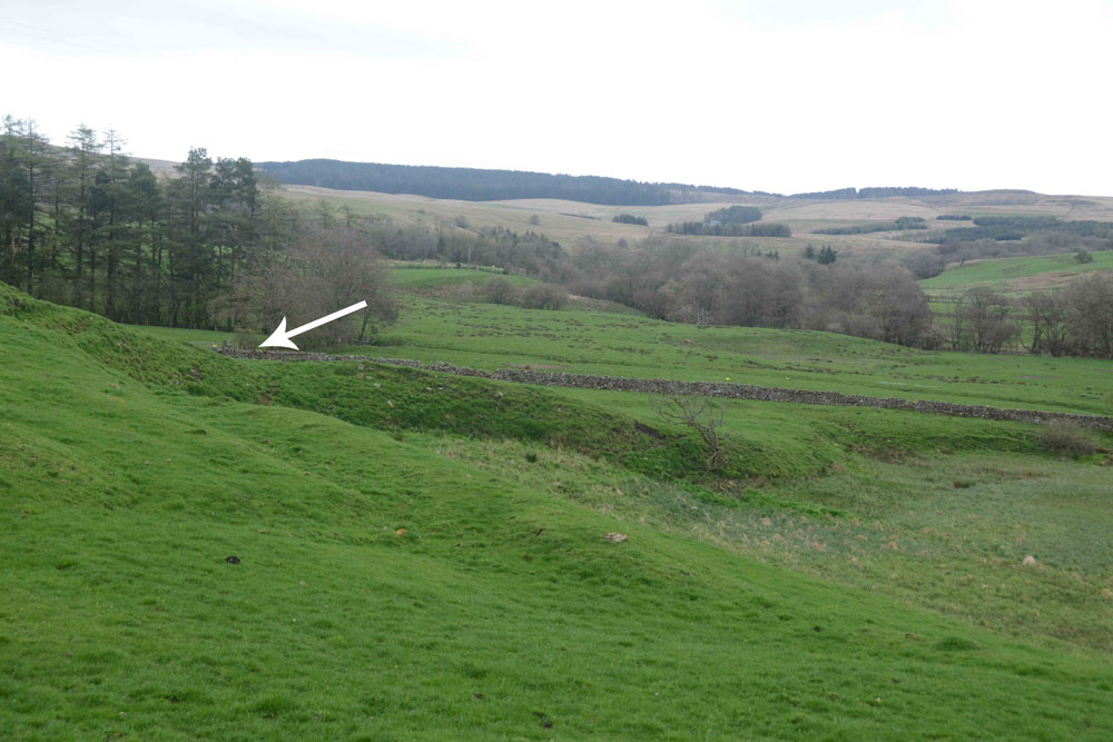
Priest's Well (Bewcastle) submitted by Anne T on 6th May 2018. This photograph was taken from the south eastern corner of the churchyard, the current landforms seeming to indicate that a spring once issued from here, disappearing into the Kirk Beck below.
(View photo, vote or add a comment)
Log Text: Priest's Well, Bewcastle (site of): As the ground was far too boggy to go and see the three cairns to the west of Parkgate Bridge, I found this well marked on the OS map, so we decided to go and see it. Arriving at St. Cuthbert’s and the Bewcastle Cross, we orientated ourselves with the map to find the well is actually on private farmland. The farmer was busy driving around the field in his tractor, so we decided we could probably see the well from the eastern end of the churchyard.
We did see some indication of where the site of the well was, but there was no well housing or water flowing. I could find very little information on this well, apart from the mention in the Old Cumbria Gazetteer, which says it is a spring. As I finished photographing the site of where the well probably was, drizzle started to hurtle down.
Pricky's Well
Date Added: 3rd Aug 2019
Site Type: Holy Well or Sacred Spring
Country: England (Northumberland)
Visited: Yes on 13th Jun 2014. My rating: Condition 2 Ambience 3 Access 4
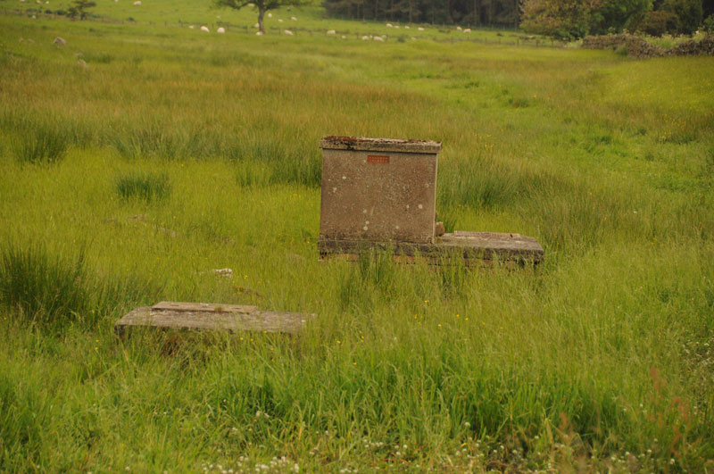
Pricky's Well submitted by Anne T on 4th Sep 2014. Close up of Pricky's Well from the layby by the track to Liddell Hall off the B6342.
(View photo, vote or add a comment)
Log Text: Pricky's Well, Colwell: One of three wells in close proximity in Colwell village. This one sits right by the burn, but is now just a modern brick well house with a wooden door, used to storage some buckets and animal feed inside.
Preston Park Museum (Stockton on Tees)
Trip No.186 Entry No.2 Date Added: 12th Aug 2022
Site Type: Museum
Country: England (Yorkshire (North))
Visited: Yes on 10th Aug 2022. My rating: Condition 4 Ambience 4 Access 4
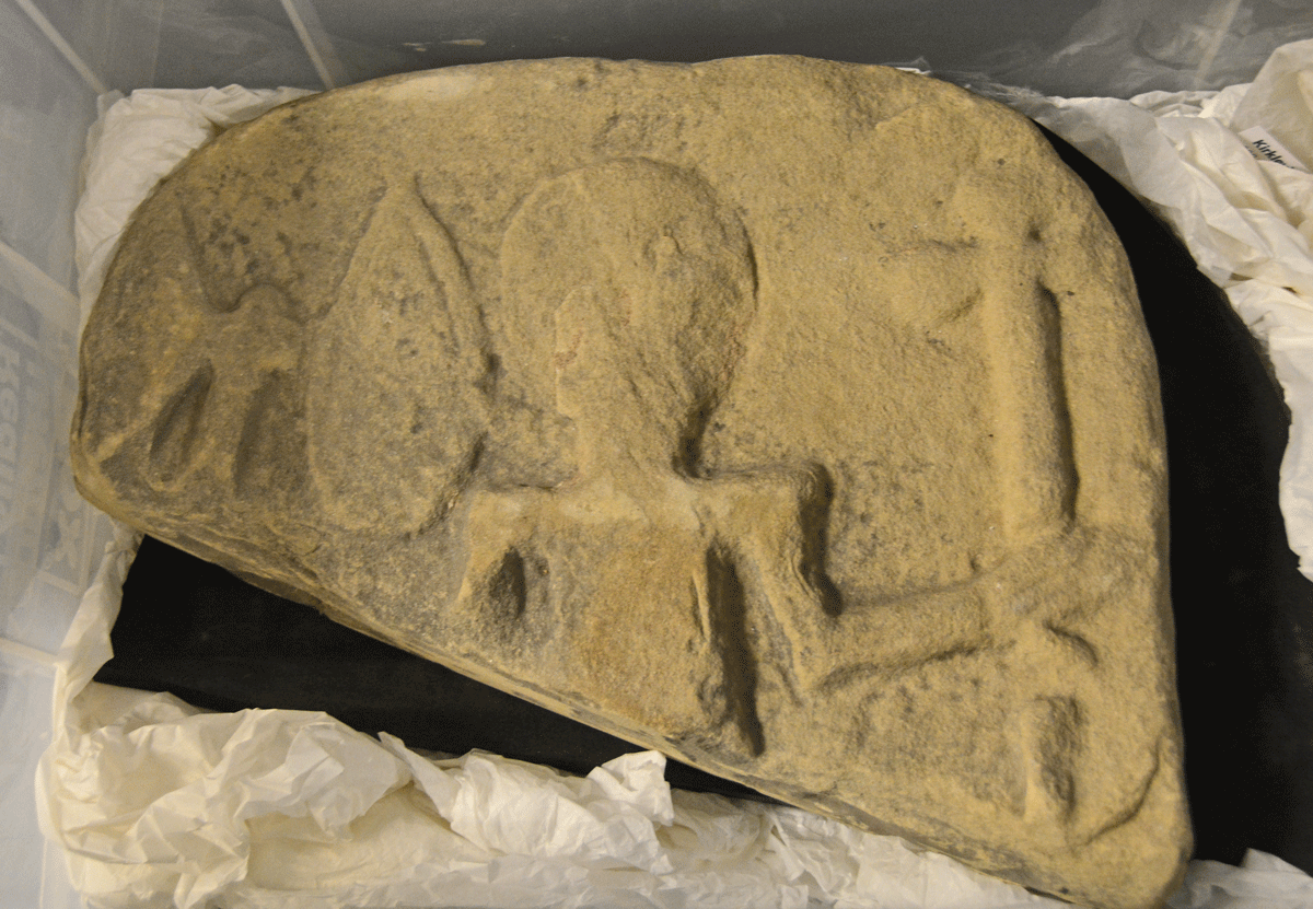
Preston Park Museum (Stockton on Tees) submitted by Anne T on 12th Aug 2022. This is part of an Anglo-Scandinavian marker stone. Not recorded on the Corpus of Anglo Saxon Stone Sculpture, notes from a presentation on the Kirklevington Stones by Craig Beckham and the Collections Team at the Museum, tell us: "the face of the stone depicts a soldier with an axe, shield and spear. This example may in fact be later than the Kirklevington crosses, but commemorates a Viking warrior in the same manner. The kite shaped shield and the axe are also typical of the time period".
(View photo, vote or add a comment)
Log Text: Preston Park Museum (Kirklevington Stones): I'd tried to arrange a visit here a couple of months before the first pandemic lockdown hit, but the museum closed early, and it's been well over two years until I was able to rearrange the visit.
Some of the Kirklevington Stones are one display (some of the more important ones behind glass), some in the museum store. A small archaeology section, but with impressive exhibits.
Got to see the museum store, but the stones were stored on the floor under a very deep shelf, so some of them were impossible to photograph properly, which was disappointing.
I personally preferred this museum to Beamish, as there were more shops to go into in their Victorian Street, a small cafe, which wasn't too busy (most people were queued up in the cafe in the park), and small, but interesting exhibits.
Preston Cleugh Fort
Date Added: 3rd Jun 2015
Site Type: Hillfort
Country: Scotland (Scottish Borders)
Visited: Yes on 30th May 2015. My rating: Condition 2 Ambience 4 Access 4
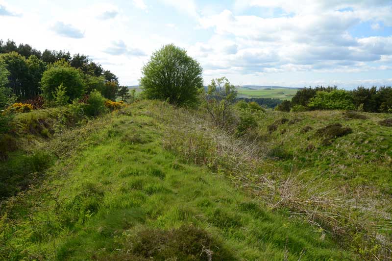
Preston Cleugh Fort submitted by Anne T on 2nd Jun 2015. Standing at the south east corner of the fort looking west.
(View photo, vote or add a comment)
Log Text: Preston Cleugh Fort, Scottish Borders: On our way to Edin’s Hall Hill Fort & Broch, having stopped in Duns for a late lunch, this fort was right next to the road on our way, so we decided to stop and take a closer look. Taking the A6112 through Preston, just after where the B6438 forks off the A6112 on the right hand side, there is a forestry track leading into Preston Plantation, where it’s possible to park against the verge along the edge of the track, close to where it meets the main road. There were signs all along this track saying ‘Entry Prohibited’, ‘Forestry Operations’, ‘Do Not Climb On the Timber Stacks’, but only a short way up this forestry track was a sign saying the ancient monument was 127 metres away. Stepping over a small bank and wading through growing ferns and weeds (which will be knee high in a few weeks), the double bank of the fort rose out of the ground before us. These defensive banks and ditches continue along the west and south sides, the north and east being formed by natural slopes.
There is a clear entrance-way to the north western side. To the north east, Cockburn Law Hill Fort rises high above this fort.
The Canmore site notes (site 58616) say that this fort measures 77m by 57 metres internally, having been built in two phases: the first phase being a double earthern rampart and ditch with its entrance on the western side; the second included the construction of a stone rampart on the line of the inner rampart, continuing along the entire perimeter of the fort, with a new entrance being cut on the eastern side.
A peaceful spot, worth stopping off to visit, particuarly with a print of the plan from the Portal 'Drakemuir Forts' to understand what we were seeing. Thanks, Portal, another good place to visit.
Powdonnet Well (Morland)
Trip No.90 Entry No.4 Date Added: 31st Jul 2018
Site Type: Holy Well or Sacred Spring
Country: England (Cumbria)
Visited: Yes. My rating: Condition 3 Ambience 3 Access 4
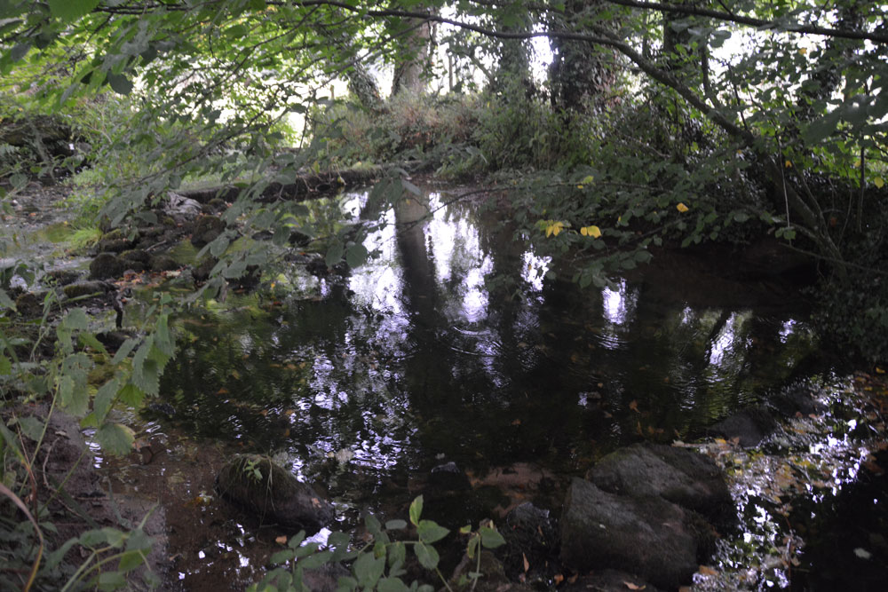
Powdonnet Well (Morland) submitted by Anne T on 31st Jul 2018. The well pool is clear and inviting. Parts of it, particularly under the tree to the right hand side of the photograph, look deep, but the stones at the bottom of the pool can be clearly seen. A little overgrown, and in the sunshine would be a lovely spot.
(View photo, vote or add a comment)
Log Text: Powdonnet Well, Morland, Cumbria: If not quite so overgrown, I'd have awarded this a '4: Good' rating on Ambience (despite the downpour after the long dry spell!). This well is marked on the OS map, but there is no mention in either Pastscape or HE.
The Holy Wells of Cumbria booklet describes this well as: “Morland. Location: Approx. 6.5 miles south east of Penrith. At the northern end of Morland village. Take road from Morland towards Cliburn. On right, as you leave village, opposite ‘Morland’ sign, is a small parking area. The standing stone and pool are close to the road.
The well had been neglected since the booklet was written in 2008 and we had to pick our way through the tangle of tree branches. We were just approaching the site of the well when the heavens opened, and there was an absolute downpour. Somewhat protected by the trees, we nevertheless decided to explore.
The easiest way to the standing stone and well is to find the overgrown footpath at the southern end of the bridge across the small stream which crosses under the road and joins the Morland Beck to the east of the well site.
The water in the pool is crystal clear. The water really does appear from nowhere. We stood at the southern end of the spring, listening to the water rushing up from the ground. The pool has been created by a couple of stone/concrete dams across the spring just to the northern part of the site. A lovely place. Next time we visit, remember to bring pruning shears!
Powburn Rock Art
Date Added: 21st Sep 2014
Site Type: Rock Art
Country: England (Northumberland)
Visited: Yes on 22nd Sep 2013. My rating: Condition 2 Ambience 3 Access 5
Powburn 1 submitted by SolarMegalith on 16th Mar 2013. The main motif - a cup with two rings (photo taken on March 2013).
(View photo, vote or add a comment)
Log Text: Stopped at the Visitor Centre during our Breamish Valley Hill Fort Trail walk, to visit St. Michael's Church at Ingram.
Beautiful setting next to the river. Came across this stone quite by chance outside the Visitor Centre (now closed and The Muddy Boots Cafe).
Port Nan Athlaich (Craignish)
Trip No.88 Entry No.1 Date Added: 31st Jul 2018
Site Type: Cist
Country: Scotland (Argyll)
Visited: Yes on 18th Jul 2018. My rating: Condition 3 Ambience 4 Access 3
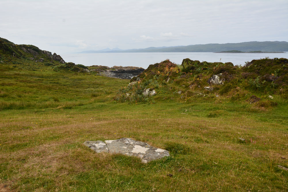
Port Nan Athlaich (Craignish) submitted by Anne T on 31st Jul 2018. The cist cover, looking south west out to the Isle of Jura and the sea.
(View photo, vote or add a comment)
Log Text: Port Nan Athlaich Cist, Aird, Craignish: I counted this as 'a bit more of a walk' as it wasn't a simple walk along a footpath, but involved a large step over a ruinous barbed wire fence and taking a few stepping stones across a stream. The walk is glorious, and is to be recommended.
Since we’d stayed at the small cottage on Aird’s Farm not far away, we’d wanted to come here and watch the sun go down of an evening, but quite a few other visitors also wanted to do that, so we watched from our hillside vantage point above.
Finally, on our last but one day, we made the trip down the track. We parked at the small car park half way down the headland, finding other people already camped out at Aird Jetty, and started to walk down to the end of the peninsula, with map in hand, to try and find the cist marked on the OS map. As we’d had no internet connection in all the time we’d been here, we had no idea of the actual grid reference, or what we might find – all we knew was that ‘cist’ was marked on the OS map.
Apart from clambering over some ruinous fences, fording a small stream and trying not to get bogged down in the marshy bits, the cist wasn’t actually difficult to find, as it was on top of a cairn like mound with a great view out to sea to the south and west.
The cist burial seemed to be completely undisturbed. The capstone was cracked, and when I stood on the smaller section to photograph the crack, the smaller part of the rock moved a few inches. Curious, we very gently eased it out of the way by a couple of inches and had a quick look inside. It was very similar to the recreated cist we saw at the Kilmartin museum.
Looking at the cist from afar, it looked as if the cist was on a natural mound, but enhanced around the burial itself.
Poldean menhir
Trip No.124 Entry No.3 Date Added: 5th Apr 2019
Site Type: Standing Stone (Menhir)
Country: Scotland (Dumfries and Galloway)
Visited: Yes on 4th Apr 2019. My rating: Condition 3 Ambience 3 Access 4
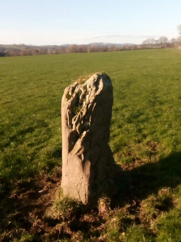
Poldean submitted by Apocryphus on 20th Jan 2019. A smaller stone located opposite Poldean Farm on a minor road south of Moffat
(View photo, vote or add a comment)
Log Text: Poldean Standing Stone: The third stop of the day with this stone easily visible just to the west of the road, towards the eastern edge of a large field of pasture.
We let ourselves in through the gate NY 10424 99981, walking over a small stream, again with the River Annan to its west and the busy A754(M) in the distance.
The eastern side of the stone is very craggy, as if bedding planes have been worn/broken away. There appears to have been a cup low down on its western side, but this could be a solution hole, if the stone had been lying flat for some considerable time in the past.
Poldean menhir
Trip No.164 Entry No.1 Date Added: 26th Jun 2021
Site Type: Standing Stone (Menhir)
Country: Scotland (Dumfries and Galloway)
Visited: Yes on 25th Jun 2021. My rating: Condition 3 Ambience 4 Access 4

Poldean submitted by Apocryphus on 20th Jan 2019. A smaller stone located opposite Poldean Farm on a minor road south of Moffat
(View photo, vote or add a comment)
Log Text: Poldean menhir: Re-visited this stone whilst in the Moffat area. Not much has changed, except the weeds have been allowed to grow high around the stone. The area around its base has been heavily trampled, and was difficult to walk across. Two VERY large, very handsome bulls in the field of pasture, but thankfully an electric fence between us and them.
Pocklington's Druid Stone
Trip No.155 Entry No.3 Date Added: 15th Jan 2020
Site Type: Modern Stone Circle etc
Country: England (Cumbria)
Visited: Yes on 12th Jan 2020. My rating: Condition 4 Ambience 4 Access 4
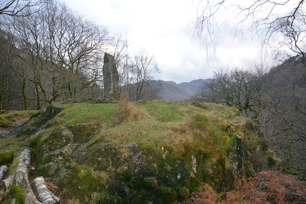
Pocklington's Druid Stone submitted by Anne T on 15th Jan 2020. Pocklington's Druid Stone, a relatively modern megalith, having been erected here in around 1778, stands on top of a rocky outcrop just to the south of the Bowder Stone. This view looks south, with the B5289 and the River Derwent below.
(View photo, vote or add a comment)
Log Text: Pockington's Druid Stone at the Bowder Stone: A short distance from the Bowder Stone, almost hidden from sight by a small cottage, this 'modern' monolith stands on top of a rocky outcrop high above the road below. At first, I thought it might be a memorial, as there appeared to be writing on the stone. Getting closer, the 'writing' was just striations on the stone.
Plague Stone (Penrith)
Trip No.180 Entry No.1 Date Added: 10th Jul 2022
Site Type: Ancient Cross
Country: England (Cumbria)
Visited: Yes on 9th Jul 2022. My rating: Condition 3 Ambience 3 Access 4
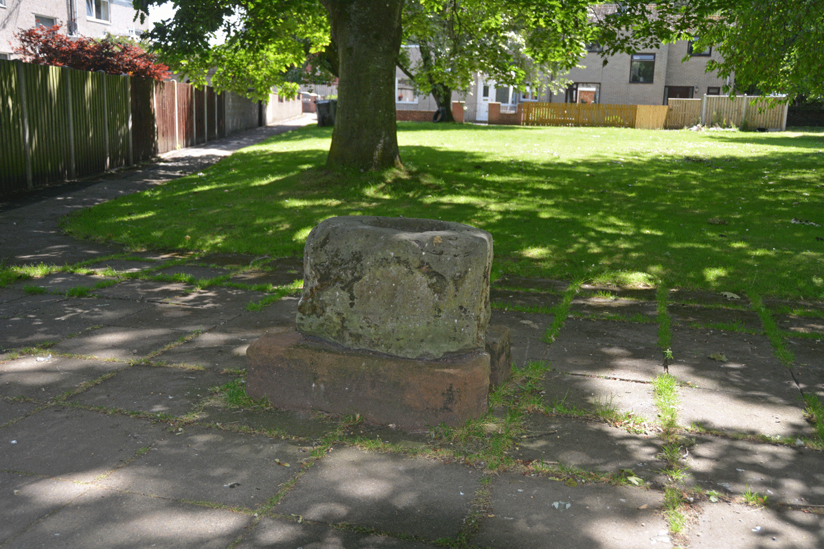
Plague Stone (Penrith) submitted by Anne T on 10th Jul 2022. The cross base/plague stone is sadly being used as a rubbish bin by all the passing walkers.
(View photo, vote or add a comment)
Log Text: Plague Stone/Cross Base, Penrith: We've driven by this site many a time without realising this stone was here. A bit difficult to find somewhere to park, as the stone is near the hospital, community college and fire station, but there is a modern housing estate, so disk parking is available along Tynefield Drive.
The stone was easily found, once we picked it out from amongst the shadows of the surrounding trees.
I wasn't aware of The Great Plague of Cumbria until I researched more about this stone. Definitely a re-purposed cross base. Shame it's being used as a rubbish bin by people who pass by.
Pitcorthie.
Trip No.111 Entry No.3 Date Added: 14th Nov 2018
Site Type: Standing Stone (Menhir)
Country: Scotland (Fife)
Visited: Yes on 2nd Nov 2018. My rating: Condition 3 Ambience 2 Access 4
Pitcorthie. submitted by Nick on 3rd Nov 2003. NT113863
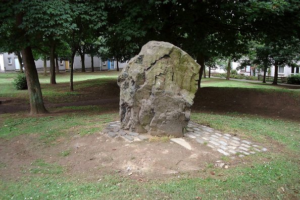
Also known as Easter Pitcorthie, Pitcorthie standing stone resides in the middle of a Dunfermline housing estate. It stands approx 1.5m in height and has an unsculptred and jagged appearance. Although it is a pretty cool stone the presence of 100 living and bedroom windows does not induce a lengthy stay . NMRS state that the stone appears to have been subjected to fire or heat. It has been subjected to graffiti.
This unsculptured standing stone, on the crest of slightly rising gro...
(View photo, vote or add a comment)
Log Text: Pitcorthie Standing Stone, Dunfermline: Our last site visit of our short holiday, and I wish we'd picked a better spot to end on. After the Balfarg Henge, I shouldn't have been surprised that this stone is surprisingly right in the middle of a housing estate, on Standing Stone Walk.
It is a poor, sadly neglected stone; it could just have been a garden feature, especially as it is set in a rectangular pavement of black stones. Like a previous visitor to the stone, being surrounded by rows and rows of houses, we very much felt watched as I was taking photographs and looking around.
Piper Lane Standing Stone (Birtley)
Trip No.63 Entry No.4 Date Added: 10th Jan 2018
Site Type: Standing Stone (Menhir)
Country: England (Northumberland)
Visited: Yes on 7th Jan 2018. My rating: Condition 2 Ambience 3 Access 5
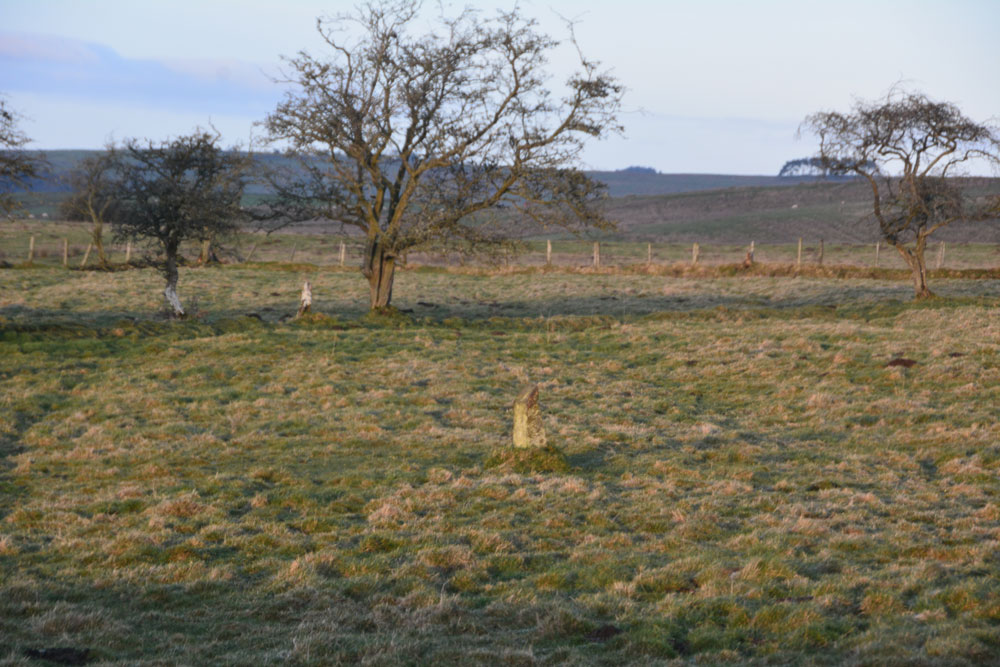
Piper Lane Standing Stone (Birtley) submitted by Anne T on 10th Jan 2018. The stone, in the middle of a water logged field. A rubbing stone, marker stone or a standing stone? It looks as if its been in the ground for some time and stands to the north of cultivation terraces.
(View photo, vote or add a comment)
Log Text: Piper Lane Stone, Birtley Shields: Spotted this on the way back from Birtley Shields, standing in the middle of the field. There was no easy access into the field and the ground was waterlogged, so passed up on climbing over the stone wall to get a closer look.
It's location is intriguing, as it stands north of the cultivation terraces marked on the OS maps. There are no other rubbing stones in the surrounding fields. Couldn't find anything about it on Pastscape, HE or by doing a general web search.
Physic Well (Corstorphine)
Trip No.25 Entry No.5 Date Added: 21st May 2017
Site Type: Holy Well or Sacred Spring
Country: Scotland (Midlothian)
Visited: Yes on 18th May 2017. My rating: Condition 3 Ambience 4 Access 5

Physic Well (Corstorphine) submitted by feorag on 31st Aug 2006. The overgrown remains of the Physic Well, Corstorphine. Photographed 23rd October 2005.
(View photo, vote or add a comment)
Log Text: The Physic Well, Corstophine, Edinburgh: Pulling up on the northern section of Dunsmuir Court from Ladywell Road, I thought we’d spotted the well head under the trees between the houses and the main road, but this turned out to be a milestone!
Thankfully having the image of the well from the Portal, we followed the Court round to the garden at the back, and found the well behind a black metal railing which looked as if it had been painted recently.
The area between the houses has been turned into a modern garden, with tall stones looking like standing stones between the plants.
A lovely little spot, a little oasis away from the busy Edinburgh roads not far away. The blocks of flats here are being renovated and the area has a bright, airy feel. Shame there was no water in the well, though, especially as it used to be such a tourist attraction in the past.
Peter Hill Roundhouse (Whithorn)
Trip No.136 Entry No.13 Date Added: 1st Jul 2019
Site Type: Ancient Village or Settlement
Country: Scotland (Dumfries and Galloway)
Visited: Yes on 18th Jun 2019. My rating: Condition 4 Ambience 4 Access 4

Peter Hill Roundhouse (Whithorn) submitted by Anne T on 1st Jul 2019. Submitted with the kind permission of The Whithorn Trust. The Peter Hill Roundhouse, located in a garden opposite the Museum buiding at Whithorn. Seen from the entrance to the garden.
(View photo, vote or add a comment)
Log Text: Peter Hill Roundhouse: Part of the visitor experience at the Whithorn Museum. We arrived just after a small guided tour had started. We asked if we could go round after the tour had finished, but were told we could only get in while there was an official guide there. I cheekily asked if we could join the tour for 10 minutes, and to my surprise, were allowed to go in.
I was really surprised and impressed by the inside of the roundhouse - the compartments for privacy, the central fire pits, and the sheer amount of room within it. Shame we didn't have time for the full tour, but I was so keen to see the early Christian stones in the museum.
