Contributory members are able to log private notes and comments about each site
Sites Anne T has logged. View this log as a table or view the most recent logs from everyone
Kilmichael Glassary 1
Trip No.88 Entry No.12 Date Added: 2nd Aug 2018
Site Type: Rock Art
Country: Scotland (Argyll)
Visited: Yes on 18th Jul 2018. My rating: Condition 3 Ambience 4 Access 4
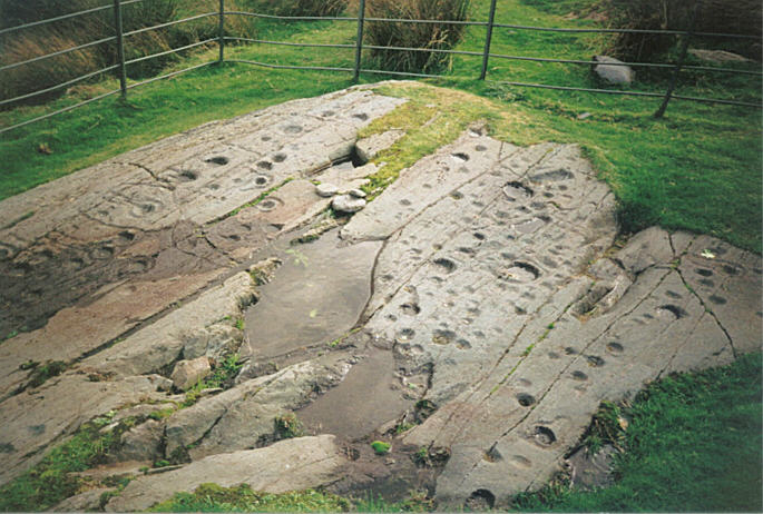
Kilmichael Glassary 1 submitted by hamish on 31st Jul 2005. What a great sight this is on the edge of a housing estate. For all the modernity around it is still enthralling to be here so much to see. Try counting them.
(View photo, vote or add a comment)
Log Text: Kilmichael Glassary 1, Rock Art: This was a real treat. From the small car park by the play park opposite the kirk, we followed the road up the slight hill, past the houses. The rocks are railed off, but to my surprise, walking to the top of the railings, there is a step to allow you to climb in to the compound.
The markings were really clear in the strong sunlight. There must have been rain here recently, as some of the deeper bowls contained pools of water.
There was also another smaller rock behind the ‘compound’ for the main rock, which someone had recently de-turfed the edges of. There were fewer markings on this, with plenty more of the outcrop under turf, so we wondered what else might lie under the grass covering.
We used the interpretation board to help us pick out key motifs, such as the oval cup and the keyhole motifs.
A young couple came and looked at the stone, and we were really respectful of each other taking photographs, which was nice. We would come across this young couple again at another couple of rock art sites and at Dunnad fort
Torbhlaran Stone
Trip No.88 Entry No.13 Date Added: 2nd Aug 2018
Site Type: Standing Stone (Menhir)
Country: Scotland (Argyll)
Visited: Yes on 18th Jul 2018. My rating: Condition 3 Ambience 4 Access 4
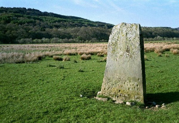
Torbhlaran Stone submitted by rockartuk on 9th Dec 2002. Torbhlaren, Strathclyde, Argyll and Bute
Main Grid Ref: NR86359451.
Located 1 km NNE of Kilmichael Glassery, 190m N of Glenalva Cottage in a (private?) field.
A cup-marked standing stone.
(View photo, vote or add a comment)
Log Text: Torbhlaren Standing Stone: A farmer in a red tractor had been mowing the field here, but had left his tractor and mower sitting by the side of the gate with the light flashing. There was no sign of the farmer. We parked in the next layby down the road, where there was a passing space on both sides of the road.
We let ourselves in through the open gate and walked to the standing stone. I had hoped to say hello to the farmer who turned up in his pickup truck, left it by the gate, hopped in his tractor and started mowing again, simply ignoring us (he must see plenty of tourists doing what we were doing).
The standing stone had cup marks on both sides. The ones on its NW face were obvious and low down; the cups on its SE face I only saw when I looked at the photos, because this face was in deep, deep shade. According to Canmore, there was also a second stone (see ID 39544 below), which now acts as a bridge over the River Add to the SW of this stone.
Torbhlaran 2
Trip No.88 Entry No.14 Date Added: 2nd Aug 2018
Site Type: Rock Art
Country: Scotland (Argyll)
Visited: Yes on 18th Jul 2018. My rating: Condition 3 Ambience 4 Access 4
Torbhlaran 2 submitted by rockartuk on 9th Dec 2002. Torbhlaren, Strathclyde, Argyll and Bute
Main Grid Ref: NR86359451.
Located 1 km NNE of Kilmichael Glassery, 190m N of Glenalva Cottage in a (private?) field.
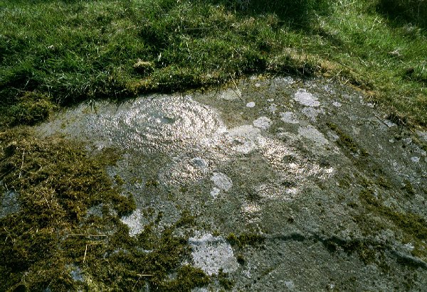
A possible spiral motif on the N-side of the most Northerly whale-back schist outcrop. First reported by Miss Marion Campbell in 1960.
(View photo, vote or add a comment)
Log Text: Torbhlaran 2: A large portion of the rock was covered in turf, so there may have been plenty of motifs which were under a soil cover, but we were unable to identify anything at the time of our visit.
Leckuary Rock Art
Trip No.88 Entry No.15 Date Added: 2nd Aug 2018
Site Type: Rock Art
Country: Scotland (Argyll)
Visited: Yes on 18th Jul 2018. My rating: Condition 3 Ambience 5 Access 3
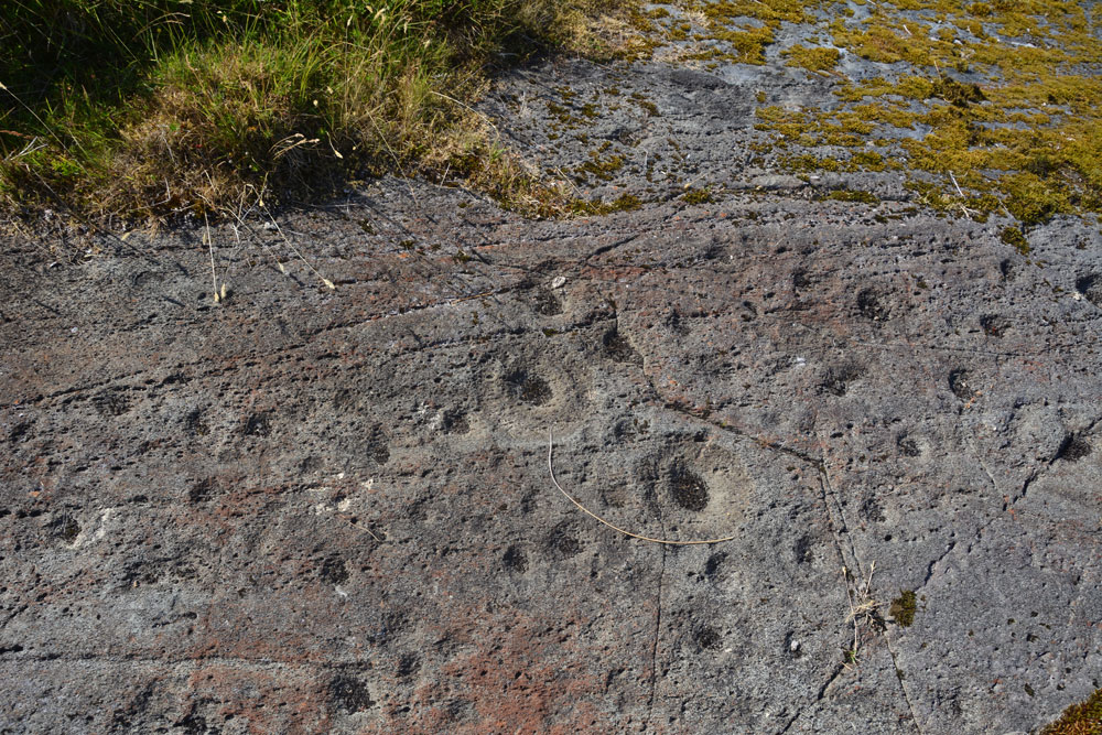
Leckuary Rock Art submitted by Anne T on 2nd Aug 2018. …. all these motifs became visible in the strong sunlight.
(View photo, vote or add a comment)
Log Text: Luckuary Rock Art Panel: A new find, some three years ago, and about to be included in a survey of Kilmichael Glen, which sounds similar to the England's Rock Art project. This was most definitely one of the highlights of our trip, thanks to the farmer who is very interested in archaeology and works very closely with Historic Scotland and Kilmartin Museum.
Leckuary Dolmen
Trip No.88 Entry No.16 Date Added: 2nd Aug 2018
Site Type: Burial Chamber or Dolmen
Country: Scotland (Argyll)
Visited: Yes on 18th Jul 2018. My rating: Condition 3 Ambience 5 Access 3
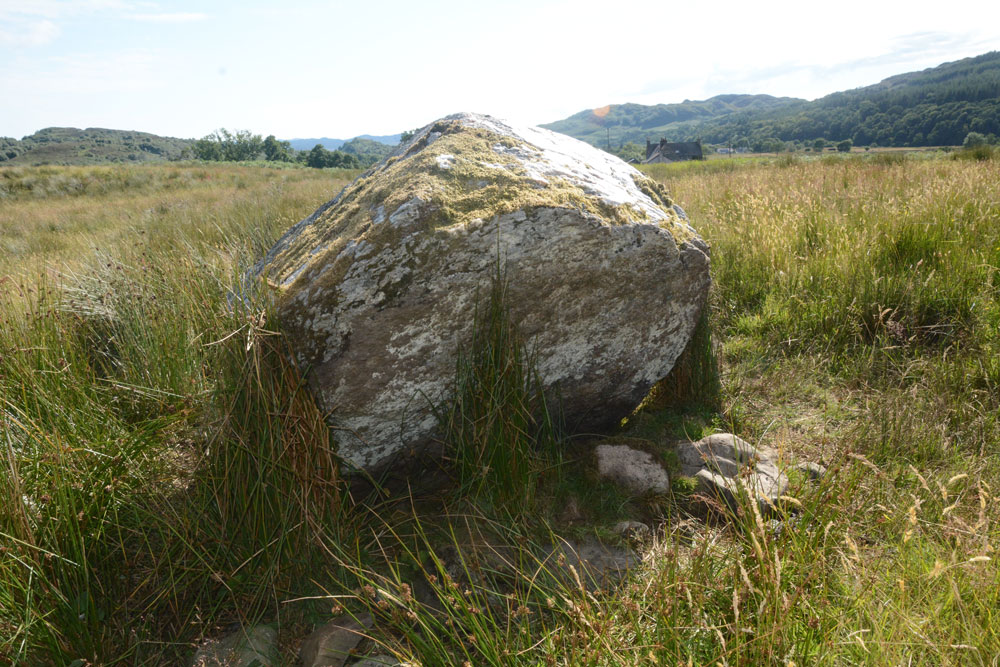
Leckuary Dolmen submitted by Anne T on 2nd Aug 2018. This quartz covered rock sits on a bed of smaller stones, on top of an almost circular mound, with great views almost 360 degrees. A burial chamber, yet to be recorded, or just a figment of my imagination? The stone was certainly visible from quite a way away in the sunshine.
(View photo, vote or add a comment)
Log Text: Leckuary Dolmen or just a quartz covered stone? This stone protruded from the surrounding pasture like a gleaming white, stubby standing stone. We walked over to it and photographed it. It appears to sit on a low, almost circular mound with this stone in the middle, which in turn sits on a bed of smaller stones. Having seen quartz on The Boat Stone and the Glenagles Symbol Stone, the importance of quartz in picking a rock for a monument seems both important and symbolic. Whilst not recorded on Canmore, will this site be included in the survey of Kilmichael Glen that is due to start in August 2018? I'd love to know more about this site, and have it confirmed as a burial mound or just a figment of my imagination.
An Car, Leckuary
Trip No.88 Entry No.17 Date Added: 2nd Aug 2018
Site Type: Standing Stone (Menhir)
Country: Scotland (Argyll)
Visited: Yes on 18th Jul 2018. My rating: Condition 3 Ambience 5 Access 4
An Car, Leckuary submitted by caradoc68 on 30th Apr 2012. http://canmore.rcahms.gov.uk/en/site/39447/details/an+car+leckuary/
An Car, Leckuary. Is a great standing stone even though it is leaning whether that was the propose of the builders!
(View photo, vote or add a comment)
Log Text: An Car Standing Stone, Leckuary: We found this stone on the OS map, and it is also featured on page 130 (walk 17) of the “In The Footsteps of Kings” book. We are advised by the book: “Please call at the farm if you wish to get closer to this stone”.
We thought about letting ourselves in through the gates at the bottom of the farm track, next to the road, but there were four gates all tied together with twine. Putting my hand on one of them had the whole lot rocking; no way they’d bear my weight clambering over. We decided to walk up towards the farm to see if there was another way into the field, and ended up at the bottom of the hill where the track climbed up a slope towards the farmhouse. Being almost at the farm, I walked up the track, and heard voices coming from the garden right at the back of the farm. There the farmer, his wife and three friends were enjoying the afternoon sunshine.
After apologising for interrupting their afternoon, they were only too pleased to let us see the stone. I got into discussion with the farmer, who did a lot of archaeology with Historic Scotland and Kilmartin Museum. He, in his impressive yellow aviator shades, very kindly gave us directions to a rock art panel, found by him three years ago and currently unrecorded, but about to be included in a survey of rock art sites in the Glen, starting August 2018. The farmer did warn me to be careful when opening and closing the gates: “make sure they don’t fall over!” so he’s obviously aware of the problem with the gates at the bottom of the track.
We let ourselves in the field from the gate at the bottom of the hill up to the farmhouse (the farmhouse, looking back from the stone, appears to be on top of a large, flattened mound, which seemed a little like a motte).
The sun was low in the sky by now and trying to find the right angle to photograph this stone was interesting. The farmer had heaped a pile of stones around the base of this now leaning standing stone, whether field clearance or to keep it upright, or both; this gave the appearance of being a modern day cairn or grave. I wondered who was buried underneath. Canmore says no one, but I’d prefer to be more romantic about it!
Dunchraigaig Cairn
Trip No.88 Entry No.18 Date Added: 3rd Aug 2018
Site Type: Cairn
Country: Scotland (Argyll)
Visited: Yes on 18th Jul 2018. My rating: Condition 3 Ambience 4 Access 5

Dunchraigaig Cairn submitted by andy_h on 6th Mar 2003. Dunchraigaig Cairn, Kilmartin Valley, Argyll.
(View photo, vote or add a comment)
Log Text: Dunchcraigaig Cairn: Parking in the small car park opposite the cairn, we crossed (ran over between the cars doing at least 60mph) the busy road to have a look at yet another large, stony cairn (special in its own right, but so many of them around here!). Just as we drew into the car park, a black mini-bus with the name “Tour of the Tor”; we kept coming across this bus and its people a number of times for the next few days. They do ‘sacred tours’ of a number of areas, including Glastonbury and the Celtic Lands. I don’t know where they went, but they didn’t arrive at the cairn until after we’d started on towards the standing stones.
On the way down to the standing stones/stone row at Ballymeanoch, I spotted a smaller cairn to its north eastern side, and another chamber, topped by a large lintel stone on its southern side (note: Canmore says so much material may have been moved from this side of the cairn, it may have been the primary burial).
This was an impressive location, despite its proximity to the busy road.
Ballymeanoch Stone Row
Trip No.88 Entry No.20 Date Added: 3rd Aug 2018
Site Type: Stone Row / Alignment
Country: Scotland (Argyll)
Visited: Yes on 18th Jul 2018. My rating: Condition 3 Ambience 5 Access 4

Ballymeanoch Stone Row submitted by ainsloch on 3rd Apr 2015. Stone Roses
(View photo, vote or add a comment)
Log Text: Ballymeanoch Stone Row: Continued from 88.19 visit report (“Who let the bullocks out?”). This was our last stop of the day. We had hoped to fit in DunnAd fort, but we were ‘all monumented out’ by this time of the evening. A truly wonderful spot, with some fantastic standing stones/stone row.
We didn’t get to see the henge due to the very large and very challenging bullocks in the field, but a really fantastic way to end our day.
Dunadd Standing Stone
Trip No.89 Entry No.1 Date Added: 3rd Aug 2018
Site Type: Standing Stone (Menhir)
Country: Scotland (Argyll)
Visited: Yes on 19th Jul 2018. My rating: Condition 3 Ambience 4 Access 4
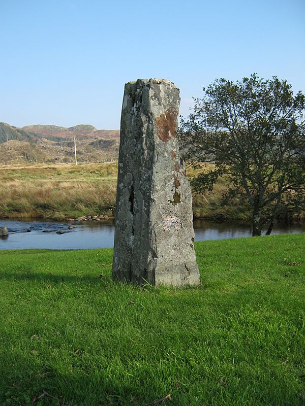
Dunadd Standing Stone submitted by Klingon on 10th Oct 2010.
(View photo, vote or add a comment)
Log Text: Dunadd Standing Stone: This was an amusing visit to start off with. As we drew up in the car park, the “Tour of the Tor” minibus drew up behind us, along with the young couple we’d seen at Kirkmichael Glassary Rock Art yesterday. Other parties of walkers came along the path and marched off up the track to the fort. We later saw them standing on top of the fort waving down to those left below.
We set off towards the farmhouse and the river to see the standing stone, which at first sight looked like a garden feature. We were closely followed by an American lady with her walking poles, a large rucksack and camera. When my husband stopped just before the stone, she stopped next to him and watched me clicking away. “Why’s she taking photos?” she asked. “It’s a standing stone”, Andrew replied. “Oh. Oh!” and with that she got out her own camera and started taking snaps.
Whilst the stone was actually in the garden, a man was coming out to his car by the house and he waved me towards it as if telling me it was OK to take a closer look.
What a really beautiful spot in this valley. With the sun shining and blue skies, it would have been lovely to sit by the river and contemplate the world for a while.
It wasn't until I looked at Canmore later that evening, I discovered other standing stones nearby, which I could have investigated whilst Andrew was playing 'mountain goat' on the fort.
Dunadd Fort
Trip No.89 Entry No.2 Date Added: 4th Aug 2018
Site Type: Hillfort
Country: Scotland (Argyll)
Visited: Yes on 19th Jul 2018. My rating: Condition 3 Ambience 5 Access 4
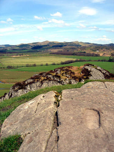
Dunadd Fort submitted by mickb1953 on 26th May 2005. Well worth the short climb - beautiful 360 degree views of argyll and isles from top. Three other carvings within a metre are a boar, an inscription in ogham and a rock cut basin
(View photo, vote or add a comment)
Log Text: Dunadd Fort, with well, footprint, boar carving and cup marked rock: I confess to seeing this site 'from a distance' as the path was too steep for me to feel comfortable. Whilst I say 'this is a short walk on a footpath', the climb is reasonably short, but steep.
Also, being on the tourist trail, this site was busy, busy, busy even at 10am. We bumped into the “Tour of Tor” minibus again (saw them at the Dunchraigaig Cairn last night), who pulled into the car park just after us.
After going some way up the track and seeing the reproduction of the boar carving in the cottage to the left of the track by the gate up to the fort, I decided it was too steep for me. Even Andrew, when he came back down, said he’d had to put his hands out several times to steady himself on the slope, so even he struggled a little.
As well as the fort, this site also has a well and a footprint and carved rock. Andrew said the guide for the Sacred Tour actually took his boot and shoe off, placed it in the footprint and enacted the old oath. Wish I’d seen that!
Andrew commented on finding what he thought was a ‘look out post’ – a small chamber with a lintel over; the well now has a stone slab over it. We’ve yet to sit down and map out where the photographs were taken, so I can tie them in with the plan above.
Cairnbaan 1
Trip No.89 Entry No.3 Date Added: 4th Aug 2018
Site Type: Rock Art
Country: Scotland (Argyll)
Visited: Yes on 19th Jul 2018. My rating: Condition 3 Ambience 5 Access 4
Cairnbaan 1 submitted by SolarMegalith on 3rd May 2013. Cup-marks on Cairnbaan 1 southern panel (photo taken on April 2013).
(View photo, vote or add a comment)
Log Text: Cairnbaan 1 Rock Art: This site is marked on the OS map, and we also got details from “In The Footsteps of Kings” page 149. Following the directions in the book (between the hotel and the neighbouring houses is a sign saying “Cup Marked Rocks”. After a flat start to the path, it then climbs relatively steeply for around 100 metres, then is a pleasant walk through woods, following the metal arrow signs.
We came across the main outcrop, protected by a metal railing, but with two sets of steps to allow you to get in and out of the compound. Someone had recently deturfed the main rock, although the rest were heavily turf covered and apart from a few cups, couldn’t make out much.
Just as we arrived at the site, we came across the same young couple who had been at Kilmichael Glassary yesterday and Dunadd this morning. They were travelling back to Huddersfield today and said the next panel was “a nice one to end on”.
To our surprise, there was a sign saying ‘further panels’, pointing further north, so we followed the track through the grass into another fenced off area, with the most remarkable carving (next entry).
Since getting back home, I’ve managed to get hold of a second hand copy of Stan’s book “The Prehistoric Rock Art of Kilmartin” and will be comparing my photos with his writings as soon as we get a dull, rainy day (or two or three). So much to learn!
Cairnbaan 2
Trip No.89 Entry No.4 Date Added: 4th Aug 2018
Site Type: Rock Art
Country: Scotland (Argyll)
Visited: Yes on 19th Jul 2018. My rating: Condition 3 Ambience 5 Access 3
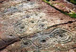
Cairnbaan 2 submitted by rockartuk on 19th Aug 2001. On the crossing of the A83 and B841 (to Crinan), behind The Cairnbaan Hotel, there is a signposted path leading to two panels with great Rock Art. This is site 2 (not fenced!). Beautiful combined carvings. Prehistoric loudspeakers; stock-still........
(View photo, vote or add a comment)
Log Text: Cairnbaan 2 Rock Art Panel: Leaving Cairnbaan 1 by its western corner, there’s a notice saying ‘further panels’. This was a little further than we thought, but very much worth the additional walk.
This second panel was truly magnificent, with its interlinked carvings. As the nice young couple from Huddersfield said: “A lovely one to finish on.”
We waited for the sun to come out to get the best contrast on the motifs. I really, really enjoyed seeing this panel.
As it was very hot, we decided to wander back through the forest slowly and make our way to Lochgilphead for refreshments. With only two more standing stones on the list to see, this almost concluded our Scottish visit.
Achnabreac
Trip No.89 Entry No.5 Date Added: 3rd Aug 2018
Site Type: Standing Stones
Country: Scotland (Argyll)
Visited: Yes on 19th Jul 2018. My rating: Condition 3 Ambience 3 Access 4
Achnabreac submitted by caradoc68 on 18th Mar 2012. Can spend all day in and around this part of Kilmartin....
(View photo, vote or add a comment)
Log Text: Stane Alane (Achnabreac), Lochgilphead Cemetery: The time was fast approaching when we needed to head back to Armadale, but there were still two more standing stones we wanted to see. Looking at the map, the quickest way appeared to be to drive to the cemetery, walk through the cemetery and walk a hundred metres or so along the track that ran from its northern wall. This was a large cemetery with a tall back wall. Eventually finding the gate to the north western side of the cemetery, we let ourselves onto a long, almost straight lane. This stone obviously hadn’t been visited in a while, as it was almost half covered in ferns to the front and back.
In taking a closer look at the back of the stone, we discovered it was on a slight mound. Canmore confirms it is incorporated into a turf and stone dyke.
Achnabreck Stone
Trip No.89 Entry No.6 Date Added: 3rd Aug 2018
Site Type: Standing Stone (Menhir)
Country: Scotland (Argyll)
Visited: Yes on 18th Jul 2018. My rating: Condition 3 Ambience 3 Access 4
Achnabreck Stone submitted by caradoc68 on 20th Mar 2012. Fallen stone easy to see just of the track way close to the gate.
(View photo, vote or add a comment)
Log Text: Achnabreck Standing Stone, Lochgilphhead: Continuing on down the track from the Stane Alane, we came across some new build houses, closely followed by some older ones, close to a road junction with a minor road leading from the A816 towards Auchoish Burn (so presumably the stone could also be driven to). This stone was in the house of a wooden ‘hut’ which fronted a pond, presumably created by enlarging a section of the burn. I looked in the houses opposite, and whilst their doors were open, could find no-one to ask, so nipped quickly in through the farm gate and took a few photos.
Whilst this is a tall standing stone, which looks in great condition, I wonder if this is in its original location, or if it has been moved to become a garden feature. It is very close to the old trackway which runs parallel to the modern main road. Looking at the Canmore record, it sits within a landscape rich with cup and ring marked rocks, with the Stane Alane standing stone some 400m away. Studying the Canmore entry more, they say this stone had “already fallen by 1867”.
St Mary's Well (Wreay)
Trip No.90 Entry No.1 Date Added: 31st Jul 2018
Site Type: Holy Well or Sacred Spring
Country: England (Cumbria)
Visited: Yes on 30th Jul 2018. My rating: Condition 3 Ambience 4 Access 4
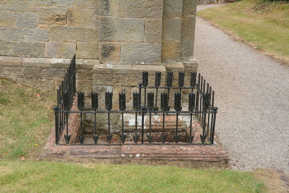
St Mary's Well (Wreay) submitted by Anne T on 31st Jul 2018. Approaching the well, with its curious railings made up of arrows, which represent 'death' according to the leaflets in the church.
(View photo, vote or add a comment)
Log Text: St Mary's Well and copy of the Bewcastle Cross, Wreay: This is a delightful little village, with some very old houses. The church is very easy to find, right in the middle of the village, opposite the colourful school, with plenty of parking on the streets nearby.
This well is to the southern side of the exterior western wall, although it has been dry for some considerable time. The well spout, in the form of an animal head, is quite superb and unusual (like the gargoyles on the roof line of the church).
The Holy Wells of Cumbria booklet (page 14) describes this well as:
Location: Approx. 9 miles south of Carlisle. The well is found by the front wall of St. Mary’s Church, Wreay.
Description: Although it is unknown whether this was a holy well, the highly unusual and attractive church is well worth a visit in itself. The original church dates back to 1319, and was rebuilt by Sarah Losh in 1840-42 – see also well 4 at Brisco – in memory of her sister Catherine and her parents. Italian in style, it is full of highly original and deeply symbolic carvings in wood and stone, many representing in forms from nature the eternal contrast between light and dark, or life and death. The well outside is a curious construction surrounded by cast iron arrows. Dog-leg stone steps lead down into the well, where water flows from a lion’s (or dog’s head) into a aquare stone piscina blessed with a solitary green fern and scattering of copper coins. The well (in 2008) was recently restored and is in excellent condition."
There was no water, no fern and no coins when we visited. Whilst the church, the sundial and the font in the churchyard are all scheduled, there is no mention of the well or the copy of the Bewcastle Cross. The church is indeed well worth looking inside. Andrew opened the door and said "I'm leaving you to go in first - it's scary!"
Cross House Incised Stone
Trip No.90 Entry No.2 Date Added: 31st Jul 2018
Site Type: Ancient Cross
Country: England (Cumbria)
Visited: Yes on 30th Jul 2018. My rating: Condition 3 Ambience 4 Access 4
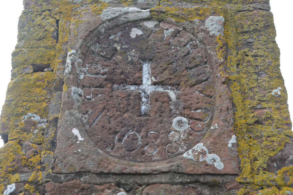
Cross House Incised Stone submitted by Anne T on 31st Jul 2018. The inscribed stone, now mounted in a 19th century pillar. The age of the stone is unknown, but it is believed to be the remains of an old wayside or boundary cross.
(View photo, vote or add a comment)
Log Text: Cross House Incised Stone, Staffield: We parked at NY 53519 43219, where a gate lets you into the footpath which goes down the hill, and joins a second footpath to Chapel Well. We walked back up the hill towards Cross House. The pillar was just visible through the hedge. We let ourselves in to the field by the gate near Cross House (there was no-one around to ask) and quickly walked to the pillar to photograph the cross.
Interesting that HE classes this as a sanctuary cross, and Pastscape as a possible wayside or boundary cross.
On processing the photographs to post to the Portal this morning, I realised we’d been to this site in October 2015, but hadn’t submitted a new site or photos to the Portal. I had asked the lady hanging out her washing in the garden of Cross House and she’d given us permission to go into the field.
Splendid views south over to the River Eden and the site of the old priory. The pillar was very near the hedge, , but it was still possible to get photos of the recut stone in its 19th century pillar.
Chapel Well (Staffield)
Trip No.90 Entry No.3 Date Added: 31st Jul 2018
Site Type: Holy Well or Sacred Spring
Country: England (Cumbria)
Visited: Yes on 30th Jul 2018. My rating: Condition 3 Ambience 5 Access 4
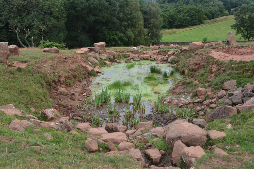
Chapel Well (Staffield) submitted by Anne T on 31st Jul 2018. The well with its pond, taken from the western end. The water bubbled out of the ground just in front of the stone bowl at the time of our visit, and was a fair flow. Between the well pool and the 'pond proper' were some lovely clumps of irises. Certainly peaceful and restful.
(View photo, vote or add a comment)
Log Text: Chapel Well, Near Staffield, Cumbria: Not far from the incised stone at Cross House. We parked near the junction down the hill where there was room to bump up onto the grass verge and walked to the gate at NY 53603 43081, which is signposted towards ‘Dale’. We kept the dry stone wall to our right hand side, and as we approached the gate into the wood, a stone drinking trough and a tree with a ditch leading from it came into view. Slightly up the slope there were some red sandstone boulders on the horizon, with a sheep track leading up to it.
The drinking trough is at NY 53774 43194 and is similar to the ones we saw at Newbeggin. The tree with its accompanying ditch is at NY 53778 43244, and there are signs of another stone structure under the tree, now dry and ruined, but possibly a secondary outlet for the well during wet weather. At the bottom of the slope, a small hole leads through the stone wall into Croglin Water just beyond.
This well is certainly in a lovely spot, hidden in a dip towards the top of the slope. There were two ‘standing stones’, one on either side of the large well pool; the rest of the large boulders had been quarried and placed around the top of the pool. A circular well bowl can be seen at the top, centre of the well, and a good flow of water came from the well (not as much as Powdonnet Well). Half a sheep had been left to rot at the south eastern end of the pool, which spoilt the ambience, and stopped me from exploring the exit pipe, but taking that away, we could have lingered for a long while. Beautiful!
Powdonnet Well (Morland)
Trip No.90 Entry No.4 Date Added: 31st Jul 2018
Site Type: Holy Well or Sacred Spring
Country: England (Cumbria)
Visited: Yes. My rating: Condition 3 Ambience 3 Access 4
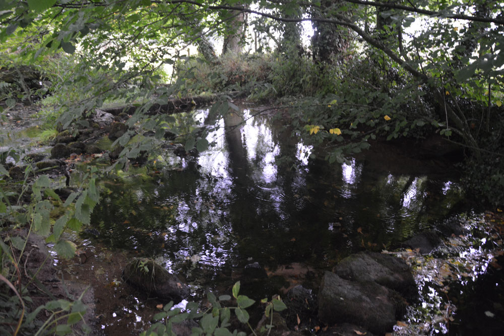
Powdonnet Well (Morland) submitted by Anne T on 31st Jul 2018. The well pool is clear and inviting. Parts of it, particularly under the tree to the right hand side of the photograph, look deep, but the stones at the bottom of the pool can be clearly seen. A little overgrown, and in the sunshine would be a lovely spot.
(View photo, vote or add a comment)
Log Text: Powdonnet Well, Morland, Cumbria: If not quite so overgrown, I'd have awarded this a '4: Good' rating on Ambience (despite the downpour after the long dry spell!). This well is marked on the OS map, but there is no mention in either Pastscape or HE.
The Holy Wells of Cumbria booklet describes this well as: “Morland. Location: Approx. 6.5 miles south east of Penrith. At the northern end of Morland village. Take road from Morland towards Cliburn. On right, as you leave village, opposite ‘Morland’ sign, is a small parking area. The standing stone and pool are close to the road.
The well had been neglected since the booklet was written in 2008 and we had to pick our way through the tangle of tree branches. We were just approaching the site of the well when the heavens opened, and there was an absolute downpour. Somewhat protected by the trees, we nevertheless decided to explore.
The easiest way to the standing stone and well is to find the overgrown footpath at the southern end of the bridge across the small stream which crosses under the road and joins the Morland Beck to the east of the well site.
The water in the pool is crystal clear. The water really does appear from nowhere. We stood at the southern end of the spring, listening to the water rushing up from the ground. The pool has been created by a couple of stone/concrete dams across the spring just to the northern part of the site. A lovely place. Next time we visit, remember to bring pruning shears!
Bessygarth Well (King's Meaburn)
Trip No.90 Entry No.5 Date Added: 31st Jul 2018
Site Type: Holy Well or Sacred Spring
Country: England (Cumbria)
Visited: Yes on 30th Jul 2018. My rating: Condition 3 Ambience 4 Access 4
Bessygarth Well (King's Meaburn) submitted by Anne T on 31st Jul 2018. Getting closer, the peculiar cast iron 'bowl' (the cap for an old pump?) can be seen to the left hand side of the well. Thinking this was a drinking bucket for cattle/sheep, I tried to overturn it to look closer, only to find it was deeply embedded in the ground, and very heavily constructed.
(View photo, vote or add a comment)
Log Text: Bessygarth Well, King's Meaburn: This is a very old village, with a scheduled 17th century barn opposite the bus stop next to the village hall where we parked. The village runs in a long ribbon along both sides of the road, with an incongruous caravan park tucked behind the village hall.
Despite being marked on the OS map, we couldn’t find this well at first, so asked someone who’d pulled up outside one of the cottages opposite. He was only visiting, but was kind enough to ask inside the house, and relayed a message, saying that “if there’s some old tin in the field, that’s the well”. We were told it was OK to go into the field, providing we ensured the gate was shut.
Andrew dropped a stone down it, and it sounded deep! There was a most peculiar solid cast iron ‘bowl’ deeply embedded into the ground next to the well. Was this the cap of an old pump?
The field behind the well is covered in lumps and bumps. Researching it when I got home, found it was the site of the medieval settlement.
St Mungo's Church (Bromfield)
Trip No.91 Entry No.1 Date Added: 15th Aug 2018
Site Type: Ancient Cross
Country: England (Cumbria)
Visited: Yes on 14th Aug 2018. My rating: Condition 3 Ambience 4 Access 4

St Mungo's Church (Bromfield) submitted by Anne T on 10th Jul 2018. The dark red semi-circular stone is (the remains of) AS Corpus Bromfield 04, a 10th century hogback, as seen from the inside of the south porch. Located above the main door of the church, we stood for ages trying to make out the original hogback. The wavy edge at the top of this dark red sandstone is the only clue. According to the AS Corpus photos, the hogback can be better seen from inside the church, but the church was locked, so we were unable to see.
(View photo, vote or add a comment)
Log Text: St Mungo's Church, Bromfield: We'd arranged with the church warden for the church to be left open for us for an hour or so this morning, so this was our first stop on a 'five church stop' tour. We were looking forward to finding cross head and cross shaft fragments, and to being able to see the reverse side of the hogback stone above the doorway.
Whilst it looks quite daunting from the outside, the inside of the church is lovely, with some unique features, such as unusual corbels and the chancel arch, which is 'transitional between Norman and Gothic styles'.
I found the cemented remains of the cross head cemeted to the west end of the north aisle, and had to remove umbrellas and a carpet sweeper to see it. It was very cobwebby, and looked sadly neglected.
AS Corpus Bromfield 02 was in two pieces. There was a collection of old stones in the north transept, and we needed to move a low bench and a collection of chairs to be able to see this.
The hogback from the other side (inside the church) was much more convincing, and there was also a consecration cross on the right hand door jamb of the south door. Well worth returning to see.
