Contributory members are able to log private notes and comments about each site
Sites Anne T has logged. View this log as a table or view the most recent logs from everyone
Wamphray Place
Trip No.124 Entry No.5 Date Added: 11th Apr 2019
Site Type: Misc. Earthwork
Country: Scotland (Dumfries and Galloway)
Visited: Saw from a distance on 4th Apr 2019. My rating: Condition 1 Ambience 3 Access 4
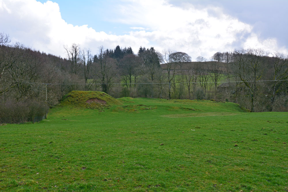
Wamphray Place submitted by Anne T on 11th Apr 2019. Having seen the cross slab at Wamphray Church, we stopped by the side of the road to photograph this picturesque motte and bailey castle, high above Wamphray Water, but as we had a rendezvous, didn't stop to explore further. This site was known to be occupied in the 12th century and was still in use until the mid 18th century. Possibly, the motte is built upon a more ancient site.
(View photo, vote or add a comment)
Log Text: Wamphray Place Motte & Bailey: Continuing down the hill (north west) from Wamphray Church, past the mill and over the narrow bridge, as we climbed the hill at the other side of the river, we spotted this small, compact motte and bailey and stopped to take a few quick photos. Wish we’d had more time to explore and photograph this site from the river, but we wanted to try and find the cairn cemetery at Pumplaburn before heading off to meet our daughter at Annandale Water services.
Pumplaburn
Trip No.124 Entry No.6 Date Added: 11th Apr 2019
Site Type: Cairn
Country: Scotland (Dumfries and Galloway)
Visited: Saw from a distance on 4th Apr 2019. My rating: Condition 1 Ambience 2 Access 4
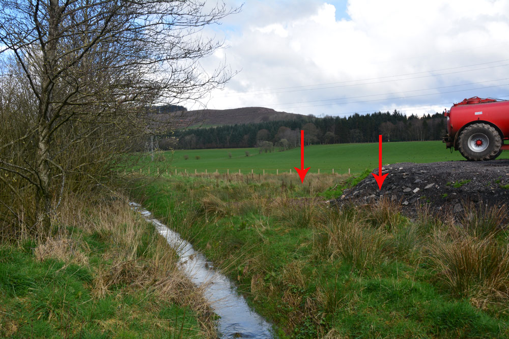
Pumplaburn submitted by Anne T on 11th Apr 2019. The two arrows show approximately where the two cairns should be - one buried (almost buried?) by the new hardstanding area; the other further back in the field. Photograph taken from the corner of the field at NY 11832 96456.
(View photo, vote or add a comment)
Log Text: Pumplaburn Cairns: Making our way back towards Annandale Water, we went under the smallest railway bridge we’d ever travelled under – 7ft tall and 7ft wide! We didn’t find these cairns, despite wandering up and down the road. Looks like they may have been buried by the large hardstanding for tractors next to Pumplaburn Steading. From plotting the ngrs on UK Grid Reference Finder, the cairn at NY 1191 9650 may still be there, but we only saw it from a distance.
Rugley Walls (Cambo)
Trip No.119 Entry No.4 Date Added: 27th Feb 2019
Site Type: Holy Well or Sacred Spring
Country: England (Northumberland)
Visited: Saw from a distance on 24th Feb 2019. My rating: Condition 2 Ambience 3 Access 4

Rugley Walls (Cambo) submitted by Anne T on 27th Feb 2019. The site of the holy well, as seen from the road, which shows up as a puddle and a brighter green grass against the rest of the pasture. A return trip in better light, more time and a pair of wellies will occur in the relatively near future …..
(View photo, vote or add a comment)
Log Text: Rugley Walls Holy Well: (note wellies a must if trying to get to the well): We stopped off here very quickly as we wanted to leave enough time to see the settlement at Catcherside.
Whilst we could see the source of the well, and there was a gate into the field, we would have need our wellies to get over the stream and boggy area to reach the well. As the light was starting to fail, we elected to carry on to Catcherside.
The well is shown on HE map but no mention on Pastscape. I need to look up the Holy Wells of Northumberland papers. All indications from Keys to the Past are that the well is connected to the deserted medieval village of Rugley Walls, which lies to the eastern side of the B342 road which runs through here.
I'd really like to see the structure that Andy Curtis photographed, so a return visit is on my wish list.
Deil's Cradle (Dollar)
Trip No.109 Entry No.5 Date Added: 11th Nov 2018
Site Type: Natural Stone / Erratic / Other Natural Feature
Country: Scotland (Clackmannanshire)
Visited: Saw from a distance on 31st Oct 2018. My rating: Condition 3 Ambience 3 Access 3
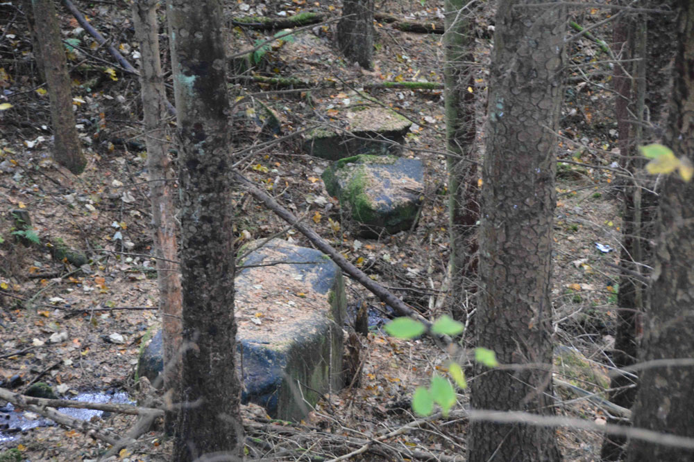
Deil's Cradle (Dollar) submitted by Anne T on 11th Nov 2018. Site in Clackmannanshire Scotland. With this large erratic at the bottom of a small gorge, with daylight failing, we wanted to get to Tullibody to see the Maiden's Stone, so photographed it from a distance only.
(View photo, vote or add a comment)
Log Text: Devil's Cradle, Dollar: With this being Halloween, I was keen to try and see this massive erratic rock. From the Wizard’s Stone eastwards, the road gets narrower, not much wider than a single track road, so we parked in Tarmangie Drive, at NS 96743 99038, and walked up Upper Hillfoot Road (the southern part) at NS 96743 99038. Looking down through the woodland, we saw a large erratic by the side of a small burn.
This stone is in a very deep gorge, and we couldn’t immediately see a way to get to it With a 70 degree slope on one side and a near vertical drop on the other, we decided, with the failing light, to carry on to Tullibody and see sites which we really wanted to get to before dark, so photographed this stone only from a distance.
Carleith (Crook of Devon)
Trip No.109 Entry No.3 Date Added: 11th Nov 2018
Site Type: Cairn
Country: Scotland (Perth and Kinross)
Visited: Saw from a distance on 31st Oct 2018. My rating: Condition 3 Ambience 4 Access 4
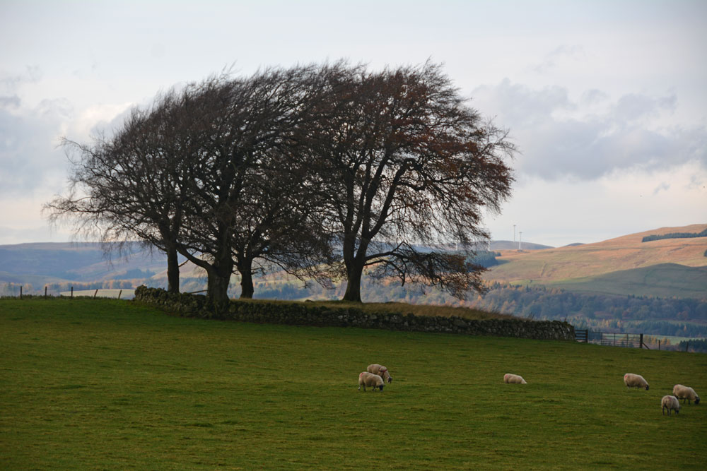
Carleith (Crook of Devon) submitted by Anne T on 11th Nov 2018. Using the camera lens on maximum zoom to try and get an idea of this perfectly circular cairn, bounded by a drystone dyke.
(View photo, vote or add a comment)
Log Text: Carleith Cairn (Crook of Devon): We didn’t go into the field as there were two very boisterous young bullocks who crowded the gate, along with their protective mothers, so I photographed it mainly from the gate into the field. From the edge of the field, this looked almost completely round, and I would have loved to have walked over it. The view to the distant hills was lovely.
Bamburgh Barrow 1
Trip No.102 Entry No.6 Date Added: 13th Oct 2018
Site Type: Round Barrow(s)
Country: England (Northumberland)
Visited: Saw from a distance on 9th Oct 2018. My rating: Condition 1 Ambience 3
Bamburgh Barrow 1 submitted by SolarMegalith on 13th Feb 2014. A Bronze Age cist with broken capstone and one of the upright stones visible (photo taken on February 2014).
(View photo, vote or add a comment)
Log Text: Rubbing Stone & Tumulus, Bamburgh: Spotted this apparent 'standing stone' in the field when we were walking back along Doctor's Lane towards St Aidan's Well. There was no obvious way into the field along this route, and we'd already walked for miles, so we contented ourselves with photographing from the stone wall in the next field.
On researching this site when I got home, found out that it was marked on the 1860 OS map as a tumulus with rubbing stone. The tumulus has now been destroyed and the stone is a 19th century insertion into the mound.
Had we realised there was still a visible cist, we might have tried harder to access the field. However, there is such a lot of history in Bamburgh, I'm sure we'll be making a return trip in the not too distant future.
Whitcastle Hill
Trip No.93 Entry No.10 Date Added: 31st Aug 2018
Site Type: Hillfort
Country: Scotland (Scottish Borders)
Visited: Saw from a distance on 29th Aug 2018. My rating: Condition 2 Ambience 4 Access 3
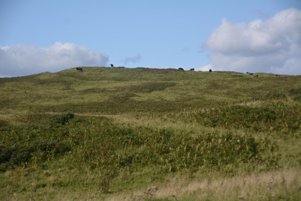
Whitcastle Hill submitted by Anne T on 31st Aug 2018. The groove of the outer defensive bank and ditch of this large prehistoric earthwork/hillfort can be seen at the top of the hill. Having already had one encounter with large cattle earlier in the day, we elected to return another day to take a closer look.
(View photo, vote or add a comment)
Log Text: Whitcastle Hill Prehistoric Earthwork: We decided to return to this site another day, having had a glimpse of the herd of very large cattle grazing over the site. Shame - the aerial photograph of this site on Canmore looks absolutely fascinating!
Rubers Law
Trip No.93 Entry No.2 Date Added: 31st Aug 2018
Site Type: Hillfort
Country: Scotland (Scottish Borders)
Visited: Saw from a distance on 29th Aug 2018. My rating: Condition 3 Ambience 4 Access 3
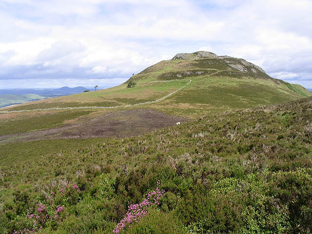
Rubers Law submitted by Creative Commons on 30th Aug 2010. Site in Scottish Borders Scotland
Approaching Rubers Law
Walking through heather near Cloon Craig towards the distinctive summit of Rubers Law with the Eildon Hills on the horizon to the left.
Copyright Walter Baxter and licensed for reuse under the Creative Commons Licence.
http://www.geograph.org.uk/profile/6638
(View photo, vote or add a comment)
Log Text: Rubers Law (only seen from a distance): This impressive hill fort dominates the area. We decided it was too far and too high to attempt today, although I was fascinated by its changing profile as we drove along the minor roads to Bedrule. We will come back when we're feeling fit and strong - it looks like a long walk, gaining height very quickly over a relatively short distance.
I stopped to take photo from the well house (MP 93.1), then at various points along the route:
1. NT 57304 12321
2. NT 59495 15298 By entrance to track signposted to Rubers Law
3. NT 59965 17983 From Bedrule Parish Church
Loch Ederline
Date Added: 1st Aug 2018
Site Type: Crannog
Country: Scotland (Argyll)
Visited: Saw from a distance on 18th Jul 2018. My rating: Condition 2 Ambience 3
Loch Ederline submitted by crannog on 22nd Feb 2012. Aw, lovely wee crannog, sitting pretty and watching the world go by.
(View photo, vote or add a comment)
Log Text: Loch Ederline Crannog: We saw this from a distance only, as the view was impeded by a line of trees and shrubs. We needed to stop on the side of the road, going downhill from Ford, where there was only a short length of fence between us and the loch. A great tanker needed to get past us, so Andrew had to move the car right into the side of the road; even so, he only just scraped by. I hurriedly took some photographs, steadying the camera on a fence post to try and get a decent shot.
It was hot and humid, so we decided to beat a retreat to Kilmartin to get refreshments. Only 2pm and already 9 sites under our belt!
Glenamacrie Farm
Trip No.87 Entry No.10 Date Added: 30th Jul 2018
Site Type: Cairn
Country: Scotland (Argyll)
Visited: Saw from a distance on 17th Jul 2018. My rating: Condition 3 Ambience 3 Access 4
Glenamachrie Farm submitted by caradoc68 on 6th Feb 2012. This cairn can been easily seen from the road side, with the Glenomachrie standing stone's in the next field. The cairn is in the farmers yard/land though so might be better to ask before going to have a look.
(View photo, vote or add a comment)
Log Text: Glenamacrie Farm Cairn: Having stopped to look at the standing stones, with waist height, new wire fence and barbed wire all around this field, the nearest gate appeared to be by the farmhouse. If we'd been bold enough to walk up the farm track to get a closer look, we'd have got much better photos, but something about these big farms always holds me back. I contented myself with photographing the stones by leaning over the top of the fence, trying not to get caught by the barbed wire. It wasn’t until I got back to the car that Andrew (who’d stayed in the car in case the roadworks crane needed to come by) had got a mobile signal and told me this was a cairn. I’ve only got it photographed over the top of the standing stones/stone row.
Barnacarry
Trip No.87 Entry No.1 Date Added: 28th Jul 2018
Site Type: Crannog
Country: Scotland (Argyll)
Visited: Saw from a distance on 17th Jul 2018. My rating: Condition 3 Ambience 4
Barnacarry submitted by caradoc68 on 15th Dec 2011. There is a amazing amount of Archaeology around this Loch with four Crannog's in the Loch but only two can be seen above water today.
(View photo, vote or add a comment)
Log Text: Barnacarry Crannog, Loch Nell: (note on access: boat needed to get across!) Not having any broadband or mobile connection at the cottage we were staying in, we relied on the OS map. Andrew picked today’s sites, but mistakenly thought the area we were going to was only 10 miles north of Ardfern. Wrong. More like 30 and an hour and a half’s drive along twisty roads. Having wanted to come to the Kilmartin area for so long, I was cross that we’d already strayed so far from what I really wanted to see. However, the sites we did see today more than made up for this, I’m pleased to say.
First on the agenda were two sites close to each other – the Barnacarry Crannog and the Kilmore, Dalineun (or Dalnaneum) Chambered Cairn. A real treat.
Driving along the road from Kilmore village to the south, we came to the southern shore of Loch Nell. Just after Barnacarry Farm, before we sighted the crannog, we came across Clan (holiday?) cottages, which looked like they were really old and thatched. We couldn’t get close enough to really tell. This is a hugely pretty spot.
Without a boat, we couldn’t really get close to the crannog, but stood on a very small piece of sandy shore (where someone had left a nicely carved wooden seat and table, presumably for fishing), and looked from a distance. A very pretty little island, covered in trees. Not too far from the shore, although the water looked deep.
Dunning
Trip No.84 Entry No.2 Date Added: 25th Jul 2018
Site Type: Standing Stone (Menhir)
Country: Scotland (Perth and Kinross)
Visited: Saw from a distance on 14th Jul 2018. My rating: Condition 3 Ambience 3 Access 4

Dunning submitted by Nick on 5th Nov 2002. The stone looking north
(View photo, vote or add a comment)
Log Text: Dunning North Standing Stone: From St Serf’s church, we walked along Kirk Wynd, down alongside the stream, down past some cottages, to where the footpath split. The standing stone was right in front of us, albeit in the middle of a ripening crop of wheat. It seemed very far away, and I was very, very reluctant to trample any of the crop, so we stuck to the footpath. With the camera lens on maximum zoom I tried to capture the different faces of the stone, but as the footpath ran roughly west-east, we couldn’t really get close.
The guide in the church told us there were two standing stones nearby; most people visited the northern (this) stone, but apparently not many people went to the southern stone.
If the field hadn’t been set with a crop, I’d have been tempted to look for the gate, or an alternate route to get closer.
Our next stop was to the very peculiar "Maggie Wall Monument", 1km west of Dunning on the B8062. This is a 20ft tall monument topped by a cross to a witch called Maggie Wall who was apparently burnt in 1657. The stories I've all tracked down say Maggie Wall didn't exist. This monument definitely made me shiver!
Patervan Settlement
Trip No.82 Entry No.3 Date Added: 23rd Jul 2018
Site Type: Ancient Village or Settlement
Country: Scotland (Scottish Borders)
Visited: Saw from a distance on 12th Jul 2018. My rating: Condition 2 Ambience 3 Access 4
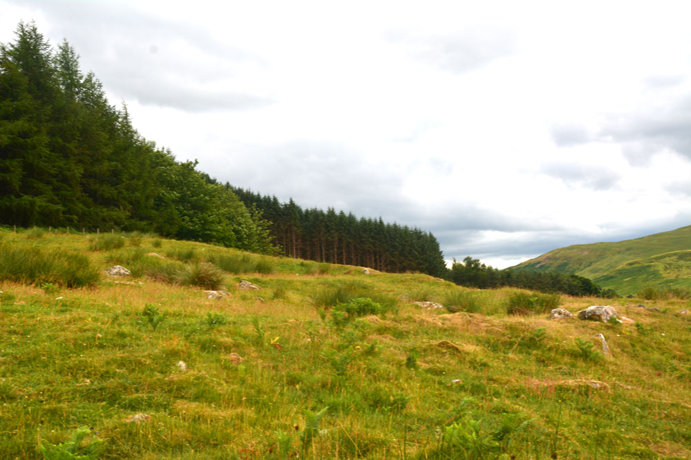
Patervan Settlement submitted by Anne T on 23rd Jul 2018. The outer wall of the settlement curves along the middle/bottom of the photograph, and contains boulders/facing stones which are believed to be in situ. Inside this 8ft wide bank, there is a large house platform measuring some 28ft in diameter.
(View photo, vote or add a comment)
Log Text: Patervan/Polmood Settlement, just west of Patervan Farm Cottage: After the Meggat Stone, we stopped off at Henderland Chapel (aka Chapel Knowe and Cockburn’s Tombstone) at NT 23112 23414, which was well worth a look, but too modern for the Portal!
This settlement is (almost!) easily reached. We parked at a layby on the western side of the A701, just north of the entrance to Patervan farm at NT 10850 28570. To think we’ve driven this way many, many times before over the years, but didn’t even consider exploring this area.
We crossed over the River Tweed (with its river monitoring station) via the robust bridge, and followed the track up to Patervan farm. We passed the cottage on our right hand side. then diverted on the footpath which led into the field just before the sign for ‘Patervan Steading’. The gate into the field on the other side of the track at this point was chained and padlocked, along with an electrified fence. We clambered over the wooden fence next to the gate, only to be confronted by another chained and locked gate. As we wanted to get on and climb up to the hillfort and another, larger settlement, we decided to hedge out bets and simply looked over the stone wall, deciding if there was time on the way back, to hop over and take a closer look (but we ran out of time).
I was really surprised to find so many ancient sites, almost an entire archaeological landscape, in a relatively small area. Worth investigating again, although not hugely, hugely exciting.
Talla Linnfoots
Trip No.82 Entry No.1 Date Added: 23rd Jul 2018
Site Type: Cairn
Country: Scotland (Scottish Borders)
Visited: Saw from a distance on 12th Jul 2018. My rating: Condition 2 Ambience 3 Access 4

Talla Linnfoots submitted by Anne T on 23rd Jul 2018. I'm not sure if I've photographed the right monument, as we couldn't get through the tall, very long deer fence, but this is the site estimated from the map and using our GPS to help. The enclosure lies some 100m to the north west of this 'cairn', which is the grassy lump which runs across the middle of the photograph.
(View photo, vote or add a comment)
Log Text: Cairn & Enclosure at south eastern end of Talla Reservoir: Our first, proper, stop of the day, as I can’t count the visit to Tweedmuir Kirk, as the stone we saw from from the 1600s.
This is a remote, but very pretty spot, albeit with tall, brooding hills around, only tempered by the gentle trickling of the Coddleteth Burn, Games Hope Burn and Talla Water, which join up before entering the reservoir lake.
We were prevented from getting right up to this cairn and enclosure by a long, continuous deer fence. I think I’ve photographed the cairn, but we had difficulty in seeing the enclosure on the ground.
The enclosure can just be seen, very faintly, on UK Grid Reference Finder.
Long Nanny
Trip No.75 Entry No.2 Date Added: 21st May 2018
Site Type: Standing Stone (Menhir)
Country: England (Northumberland)
Visited: Saw from a distance on 20th May 2018. My rating: Condition 3 Ambience 3 Access 4
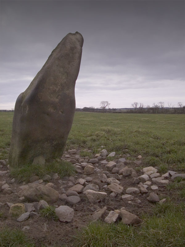
Long Nanny submitted by wayland on 31st Jan 2005. "Long Nanny" Close up showing rubble around base.
(View photo, vote or add a comment)
Log Text: Long Nanny Standing Stone, Tughall: On our way into Beadnell, on the B1340, husband Andrew screeched the car to a halt on the busy road, telling me there was a standing stone in the field that only had a couple of photographs on the Portal. We could only see this from a distance, as there were large cattle and a BIG bull in the field. I took a couple of photographs from the side of the road, although the stone was so far away, even resting the camera on the fence and the window ledge of the car, the shot was hazy.
Like wayland, I can’t find anything on Pastscape or Historic England. Intriguing. Need to go back and have a look when the bull and his ladies have been moved out of the field.
Will O'Greena's Stane
Trip No.73 Entry No.2 Date Added: 14th May 2018
Site Type: Standing Stone (Menhir)
Country: Scotland (Scottish Borders)
Visited: Saw from a distance on 13th May 2018. My rating: Condition -1 Ambience 4 Access 4
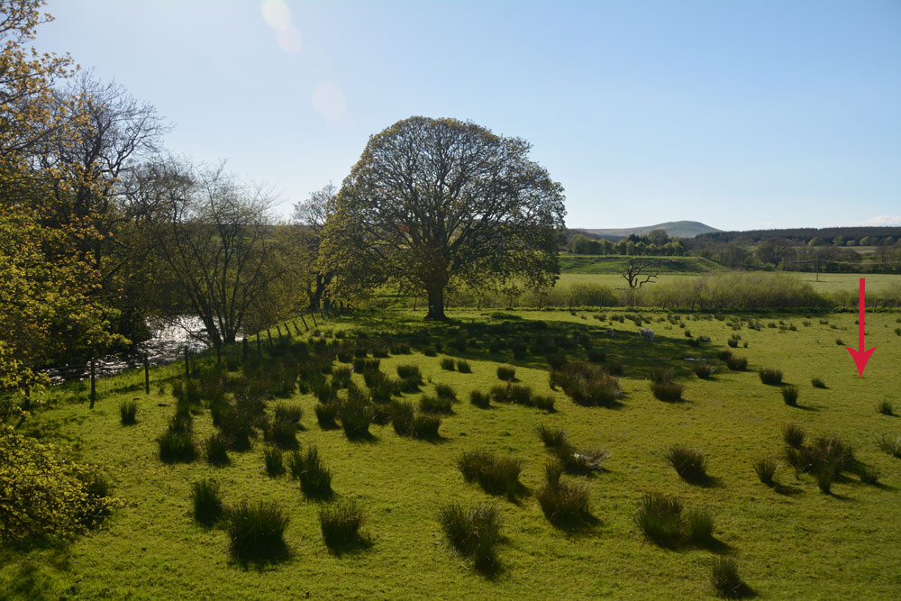
Will O'Greena''s Stane submitted by Anne T on 14th May 2018. The red arrow points to the approximate grid reference where this prehistoric standing stone was originally sited.
(View photo, vote or add a comment)
Log Text: Will O'Greena's Stone, Kersehopefoot: What a beautiful spot, where Kersehope Burn meets Liddel Water. Certainly very historic, if you can reconcile Canmore's version with the interpretation board on site. On the Reiver's Trail, its an easy (if wet, due to heavy rain) walk along the old railway embankment, although to descend into the field between the embankment and the river to find the stone, it's a six foot or so slither down the embankment. We walked up and down, down and up, trying to find any sandstone boulder/stone which matched the description on Canmore (thank goodness for a mobile signal to call up the record 'in the field').
I eventually spotted this stone next to a gate/fence backing onto private property. The strong fence with two lines of barbed wire made me think twice about hopping across the fence, and we could see no obvious other route into the field to check. A beautiful spot but so disappointing that, having mentioned this famous stone, they hadn't made sure it (what remained of it) could be seen.
Towerbrae Cairn
Trip No.69 Entry No.2 Date Added: 5th May 2018
Site Type: Cairn
Country: England (Cumbria)
Visited: Saw from a distance on 23rd Apr 2018. My rating: Condition 2 Ambience 3 Access 4

Towerbrae Cairn submitted by Anne T on 5th May 2018. This very blurry photograph was taken from the road just north of Luke's Cottage. We had planned to walk up to the cairn, but moments later a heavy downpour sent us up to the Bewcastle Cross instead.
(View photo, vote or add a comment)
Log Text: Towerbrae Cairn, Near Bewcastle: We stopped on the road to St. Cuthbert's, Bewcastle to find out how to walk to this cairn, which was basically up a quad bike track just south of Luke's Cottage. As there was nowhere near to park on a grass verge, we decided to go onto try and find Priest's Well at Bewcastle and stop on the way back.
The weather intervened, and a heavy downpour and heavy black clouds stopped us from doing this walk, but we will come back again.
The cairn is highly visible in the landscape. Apparently there is a modern marker on the cairn, and I'd like to complete our trip by returning soon.
Mossthorn Long Cairn 2
Trip No.60 Entry No.4 Date Added: 24th Nov 2017
Site Type: Cairn
Country: England (Cumbria)
Visited: Saw from a distance on 20th Nov 2017. My rating: Condition 2 Ambience 3 Access 3
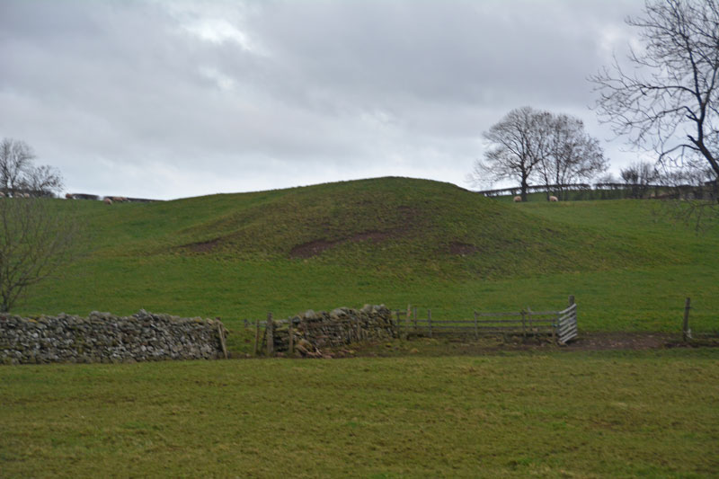
Mossthorn Long Cairn 2 submitted by Anne T on 13th Feb 2017. The long cairn at grid reference NY 48289 30440, taken from the layby outside The Wreays on the minor road from the A66 to Greystoke.
(View photo, vote or add a comment)
Log Text: Mossthorn Long Cairn 2, Copt Howe, Newton Reigny: See the visit report for Mossthorn Long Cairn 1 for more details. This is the side of the long cairn (or natural feature, as Pastscape says?) we couldn’t see from the road on our last visit on 12th February 2017. This time, we could only see it from the field boundary near the southern end of Mossthorn Long Cairn 1. From this angle, it does look like a natural hummock, although more like a cairn from the main road.
Lawers
Trip No.53 Entry No.6 Date Added: 11th Oct 2017
Site Type: Standing Stone (Menhir)
Country: Scotland (Perth and Kinross)
Visited: Saw from a distance on 28th Sep 2017. My rating: Condition 3 Ambience 3 Access 4

Lawers submitted by BigSweetie on 19th May 2004. Perthshire stones photo by Andy Sweet
(View photo, vote or add a comment)
Log Text: Lawers Standing Stone, East of Comrie: From St Fillan’s Chapel, we headed back towards Comrie, this time continuing east along the A85 until we reached the gatehouse at the northern side of the road, just before Comrie Croft Caravan Park.
The landowner had padlocked all the gates, but being within site of the stone, we ended up scrambling over the low stone wall by the small stream running parallel with the eastern side of the field, and separated from the field by a tree lined footpath/track.
On getting level with the stone, I tried (very hard) to photograph it, but was constantly head-butted by a very friendly ginger horse! He was to friendly to contemplate climbing the wooden fence into the field without a bag of apples or pony nuts, so I had to content myself with having my sleeves chewed whilst I tried to photograph the standing stone.
We walked back along the footpath and along the northern side of the field, but the stone was too far away to get a good image of, even with maximum zoom on the camera lens. Having reached the western side of the field, the gates were padlocked. Andrew could squeeze between the wooden rails of the fence, but I was a bit too plump, so clambered unceremoniously over the somewhat higher stone wall at this end of the field.
Traprain Law
Trip No.52 Entry No.4 Date Added: 10th Oct 2017
Site Type: Hillfort
Country: Scotland (East Lothian)
Visited: Saw from a distance on 27th Sep 2017. My rating: Condition 2 Ambience 5 Access 3
Traprain Law submitted by caradoc68 on 14th Feb 2012. Hold on to your hat its windy up there !
(View photo, vote or add a comment)
Log Text: Traprain Law Hillfort, East Lothian: We only saw this from afar. It would have taken too long to climb up and get back down and see the rest of the sites we wanted to see this afternoon. Brilliant view. The farmer’s wife from Standingstone Farm told us there were wild Exmoor ponies living on top (we could see them moving around on the top of the slopes), but their water was at the bottom of the hill.
