Contributory members are able to log private notes and comments about each site
Sites Anne T has logged. View this log as a table or view the most recent logs from everyone
Knock Stone Circle
Trip No.25 Entry No.2 Date Added: 21st May 2017
Site Type: Modern Stone Circle etc
Country: Scotland (West Lothian)
Visited: Yes on 18th May 2017. My rating: Condition 4 Ambience 4 Access 5
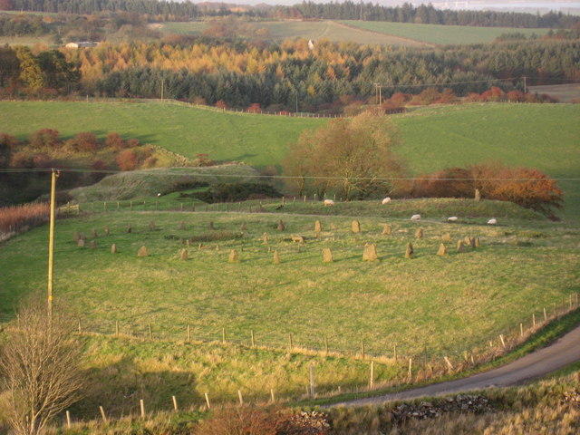
Knock Stone Circle submitted by Andy B on 12th Mar 2011. A faux stone circle, located by Knock in the Bathgate Hills, 2 miles (3 km) northeast of Bathgate in West Lothian. Comprising 50 stones, arranged in two concentric circles in a field by the roadside, the circle was built as a 50th Birthday surprise for the farmer by his son in 1998 and was undoubtedly inspired by the nearby Neolithic site at Cairnpapple Hill.
Copyright Chris Martin and licensed for reuse under this Creative Commons Licence.
(View photo, vote or add a comment)
Log Text: Knock Modern Stone Circle, West Lothian: Having passed this stone circle on the way to Cairnpapple, it looked impressive and I couldn’t wait to get back for a closer look. “Is this what a real stone circle looks like?” my friend (who is a relatively novice Megalith-hunter) asked. I chuckled as I read out the description from the Portal page which I’d printed off before I left home
It certainly looks as if it’s been here longer than 20 years!
The field was full of enormous sheep. The farmer has kindly built a small stile into the fence by the gate, which allowed us access into the field. We wandered round taking photographs. I really liked the little stone ‘seat’ in the inner ring, which the sheep gathered round.
I walked over to the outlier, which sits on a mound to the north-east of the circle.
On our way out, a car pulled out, parking half an inch from the bumper of our car. Out popped a photographer with a really big lens on his camera. He wandered up and down the road by the fence, taking photographs. We told him he could get into the field, either through the gate or over the stile. He said ‘thanks, but I’m waiting to get photos without the sheep’. As there were around 50 or so sheep in the field, I’m guessing he might have had some time to wait.
We headed off to Torphinchen for a snack and to visit the Preceptory (which was closed, even though the sign said it should have been open).
Galabraes
Trip No.49 Entry No.1 Date Added: 5th Oct 2017
Site Type: Standing Stone (Menhir)
Country: Scotland (West Lothian)
Visited: Yes on 22nd Sep 2017. My rating: Condition 3 Ambience 4 Access 4
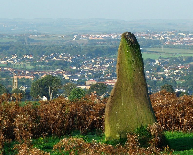
Galabraes submitted by postman on 11th Nov 2012. Site in West Lothian Scotland
Galabraes standing stone, it's not far from Cairnpapple and very close to the road, how com no-ones posted on here before
(View photo, vote or add a comment)
Log Text: Gala Braes Standing Stones, Bathgate: We drove up and down the road, but couldn’t see a gate into the field along either from the ‘main’ road (Drumcross Road) or the side road running north-south up to Cairnpapple Hill, so we ended up clambering over an almost demolished stone wall and squeezing through the wire fencing. There was a big (very unfriendly looking) bull in the field just below the western end of the ridge, who stood his ground and kept looking at us, so we didn’t dare approach the other small knoll where the other stone (B) should have been located.
As we were leaving, I spotted some old boundary features to the south of the standing stone so was photographing these, when I heard some cawing behind me. Looking up, a large crow was sitting on the standing stone, bobbing up and down. Eerie!
Cockleroy Hill (Beecraigs)
Trip No.49 Entry No.3 Date Added: 22nd May 2019
Site Type: Hillfort
Country: Scotland (West Lothian)
Visited: Yes on 22nd Sep 2017. My rating: Condition 2 Ambience 3 Access 4
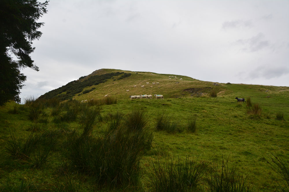
Cockleroy Hill (Beecraigs) submitted by Anne T on 5th Oct 2017. First view of Cockleroy Hillfort, having walked from the small car park to the gate into the field. The hill rises reasonably steeply up to 278 metres and has a trig point and view point on top.
(View photo, vote or add a comment)
Log Text: Cockleroy Hillfort, Beecraigs Country Park: From Lower Craigmailing Socketed Stone, we drove north past the Korean War Memorial to Beescraig Country Park. There was a small car park at about NS 99445 74270, where a path led through the forest, leading to a gate into the field containing the hillfort.
According to the Scotsman of 9th December 2012, Cocklroy means “the hat of the kings”. Situated in Beecraigs Country Park forest, there is a climb of 278 metres to the top and a mown path goes straight up the hill to the top of the fort, where there is a viewpoint. I wasn’t feeling too good, so opted out half way up the climb. Andrew continued up to the trig point at the top, and had great views across Lochcote Reservoir to the south west and the Forth Bridges at Queensferry to the north east.
Andrew said there wasn’t much to see of the fort itself – there were very little signs on the ground. I sat on the large stones about half way up the slope, at first thinking they were defensive ditches and banks, but were in fact modern quarries, when I looked closer!
Gormyre
Trip No.49 Entry No.4 Date Added: 6th Oct 2017
Site Type: Standing Stone (Menhir)
Country: Scotland (West Lothian)
Visited: Yes on 22nd Sep 2017. My rating: Condition 3 Ambience 4 Access 4
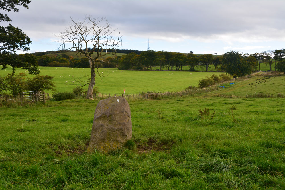
Gormyre submitted by Anne T on 23rd Mar 2019. Hi, AstroGeologist, With reference to your comment about the farmer having moved the stone, I don't think he has. Here's my version of your photo shown in PID 194979 with the same tree, albeit from a slightly different angle, taken on 22nd September 2017. The stone still sits on top of the distinct, flat-topped high point on the hill. The angle of the hedge line running across the photo is still the same. The stone was recorded by Canmore as being at this same location in 1856.
(View photo, vote or add a comment)
Log Text: Gormyre Stone, Torphichen: Ever since I went to Torphichen on 13th May 2017, I’ve wanted to come back and not only look round the Preceptory, but also try to find the other refuge stones associated with the Sanctuary Stone in the churchyard.
Today, despite not feeling 100% I was glad to be in search of this stone, and delighted to be able to see it from the road. We parked at NS 98072 72853 (there was just enough room by the gate to pull off the road), approximately 1.2 km east of Torphichen Preceptory.
The farmer had padlocked the gates into the field and the track which ran alongside it; these were really high and a little precarious to climb over (didn’t want to break them), so I ended up clambering gingerly over the wooden fence next to the gate. Following the grassy trackway north, just over 200 metres further on there was another gate, again padlocked, so we negotiated the wooden fence next to it. Thankfully, the huge bull and his ladies were in the adjoining field.
This stone sits on top of a natural mound. We couldn’t see the outline of the Maltese Cross on the north face of the stone, despite careful looking at a number of different angles and distances (although looking at one of the photographs, it does stand out a little). A really nice location, and a very friendly stone.
Westfield Farm Refuge Stone
Trip No.54 Entry No.1 Date Added: 11th Oct 2017
Site Type: Early Christian Sculptured Stone
Country: Scotland (West Lothian)
Visited: Yes on 30th Sep 2017. My rating: Condition 2 Ambience 2 Access 4
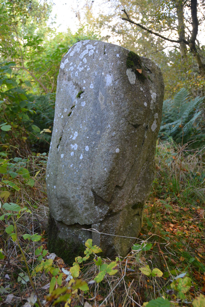
Westfield Farm Refuge Stone submitted by Anne T on 11th Oct 2017. One of the other faces of the stone, where it shows slight traces of damage, presumably from having been toppled and re-erected. If the 1998 excavation report from Historic Scotland is correct, this stone may be prehistoric and associated with a larger prehistoric site, maybe having been reused as a Refuge Stone after the establishment of Torphichen Preceptory.
(View photo, vote or add a comment)
Log Text: Westfield Farm Refuge Stone (possibly prehistoric), West Lothian: Our last day for exploring before heading home, and this was a day we’d set aside during the week to try and find some of the refuge stones associated with Torphichen Preceptory. We didn’t have a detailed map for this area, and didn’t pass a place to buy one, so had to make do with mobile phones and Canmore records.
The Westfield Farm Refuge Stone is situated to the east of Westfield Village, south of the B8047, near a ‘fish food factory’. Driving through Westfield village on the B8028, we turned right onto the B8047 and followed it round a couple of bends and found the factory. Just before the factory, located on a bend, I spotted a sign saying ‘Refuge Stone’, heading off south east through some wasteland.
We managed to park just by the sign, in a small layby which had been used for fly-tipping. Following the very vague footpath through the wooded area, this eventually disappeared and we were left surrounded by birch trees and weeds. Through the shrubbery there was a mound, and peering closer, there was a set of very overgrown steps that had been cut into the bank. Climbing up these, and hunting around some more, we finally spotted this much neglected stone virtually hidden in the weeds. I trod down some of the taller weeds to see the stone more clearly.
A treasure, but one hidden away in a tumble of brambles, nettles and detritus. It looked as if no-one had visited this stone in a long time. I was very pleased to have found it.
North Couston Refuge Stone
Trip No.54 Entry No.2 Date Added: 12th Oct 2017
Site Type: Early Christian Sculptured Stone
Country: Scotland (West Lothian)
Visited: Couldn't find on 30th Sep 2017. My rating: Condition -1 Ambience 3 Access 4
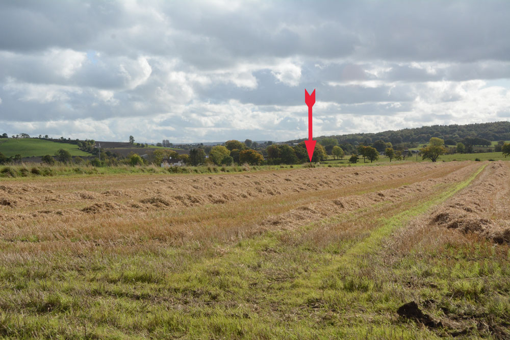
North Couston Refuge Stone submitted by Anne T on 12th Oct 2017. The arrow marks the approximate position in the field where this stone was last recorded. We walked up and down the field boundary twice, me poking the weeds and bushes on both sides with my walking pole at very short intervals, but could find nothing.
(View photo, vote or add a comment)
Log Text: North Couston Refuge Stone, West Lothian: From the Westfield Farm Refuge Stone, we set off towards North Couston with only a very small scale book of maps and Trigpointing UK on our mobile phone to try and find this stone. From Westfield, we got back onto the A801 southbound, then turned left onto the A800, turning left again onto a minor road to a farm, parking in a largish concreted area next to the field entrance at NS 95279 70925. From the Canmore record, we didn’t have much hope, but given as we were not far away, wanted to check whether or not this Refuge Stone was still there.
We waded around the edges of the very wet entrance to the field (the gates into the neighbouring field were almost shoulder high – too high for me to attempt to climb over, although this route would have been dry). The field edges of this recently harvested field were then drier, so we walked along the eastern side, then headed south at the corner, along the old, grubbed out hedge line. We walked most of the length of the Followed the field edges, prodding the fence line as I went, but could find no evidence of any stone along the field boundary.
Torphichen Churchyard Stone
Trip No.54 Entry No.3 Date Added: 12th Oct 2017
Site Type: Standing Stone (Menhir)
Country: Scotland (West Lothian)
Visited: Yes on 30th Sep 2017. My rating: Condition 2 Ambience 4 Access 5

Torphichen Churchyard Stone submitted by Anne T on 15th May 2017. The side of the Sanctuary stone showing at least five cup marks. The stone 'swells' from the ground to the top, which Canmore says is 12 and one half inches square.
(View photo, vote or add a comment)
Log Text: Torphichen Preceptory (next door to the church): Also known as Hospital Of Torphichen; Preceptory Of St John; War Memorials.
Finally, on our third attempt, just after 2pm on a Saturday afternoon, we managed to find the small visitor portacabin open and a guide present. Guide was Liam from Order of St. John. Charming, very helpful man, in looks reminiscent of the Knights Templar. Because he was giving individual tours to everyone who turned up, he was over-stretched, and didn’t really have time to spent with us, but answered my questions as best he could.
Liam pointed out some of the features in the Preceptory itself, including old architects drawings on the walls, and walked us up to the exhibition on first floor of tower – up 45 spiral stone steps – where he pointed out a grave marker used as a lintel.
When another family arrived, he left us to take them round. I found out, through reading the display, that there was an incised stone with cross in the Parish church; Liam said unfortunately he didn’t have the keys for the church, but to come back if we wanted to look.
Cairnpapple Hill
Trip No.54 Entry No.4 Date Added: 12th Oct 2017
Site Type: Round Cairn
Country: Scotland (West Lothian)
Visited: Yes on 30th Sep 2017. My rating: Condition 3 Ambience 4 Access 4
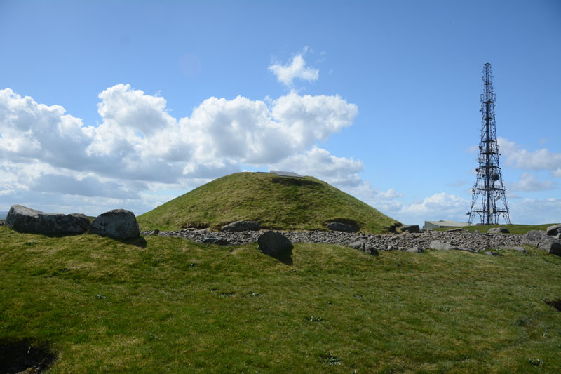
Cairnpapple Hill submitted by Anne T on 21st May 2017. View of the north side of the cairn, looking back towards the visitor centre and mast behind.
(View photo, vote or add a comment)
Log Text: Cairnpapple (Chamber), West Lothian: We’d spent quite a lot of time around Cairnpapple and surrounding area, but on this trip had not visited. Andrew had not seen this site before, so we parked and joined the other families visiting in the wind and drizzle, and I managed to buy a guide book and as the other visitors drifted off, went back to talk to the guide. I saw the display showing the cup and cup & ring marked stones in the chamber.
The chamber into the concrete dome was open today, but the ladder was really steep, and even Andrew described it as difficult to get down. After he emerged from taking the first batch of photographs, I took him back into the hut to speak to the guide and he clambered back into the chamber and took some more photos. I confess the photograph in the hut made the cup and ring marks a lot more visible than in reality!
Then onto our last trip of our holiday, and one I was looking forward to – another of the Torphichen Refuge Stones.
Craigmailing Boundary Marker (Torphichen)
Trip No.54 Entry No.5 Date Added: 12th Oct 2017
Site Type: Marker Stone
Country: Scotland (West Lothian)
Visited: Yes on 30th Sep 2017. My rating: Condition 3 Ambience 4 Access 3
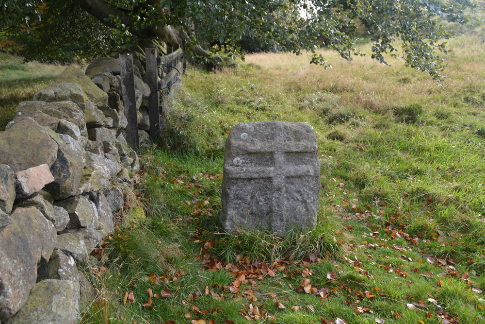
Craigmailing Boundary Marker (Torphichen) submitted by Anne T on 12th Oct 2017. Another view of the northern face of this stone, showing its proximity to the stone wall.
(View photo, vote or add a comment)
Log Text: Craigmailing/Witchcraigs Boundary Stone: To find this stone, we parked near to the Little Criagmailling cross base found earlier this week and followed a little-used footpath through the woodland. This footpath joined another wider one, crossing a stile into a little tree-lined lane which followed a trickling stream to our left hand side.
This, very unexpectedly, opened up into an area of grass/heath with a viewpoint. As soon as you sight the viewpoint with its dry stone wall and information boards, the refuge stone is to your right hand side. This is a really rather special place. And being named Witch Crag made it much more atmospheric!
The refuge stone is no longer in the wall, but has been sited at 90 degrees to it.
Boar Stone (Armadale)
Trip No.106 Entry No.7 Date Added: 6th Nov 2018
Site Type: Natural Stone / Erratic / Other Natural Feature
Country: Scotland (West Lothian)
Visited: Yes on 28th Oct 2018. My rating: Condition 3 Ambience 4 Access 4
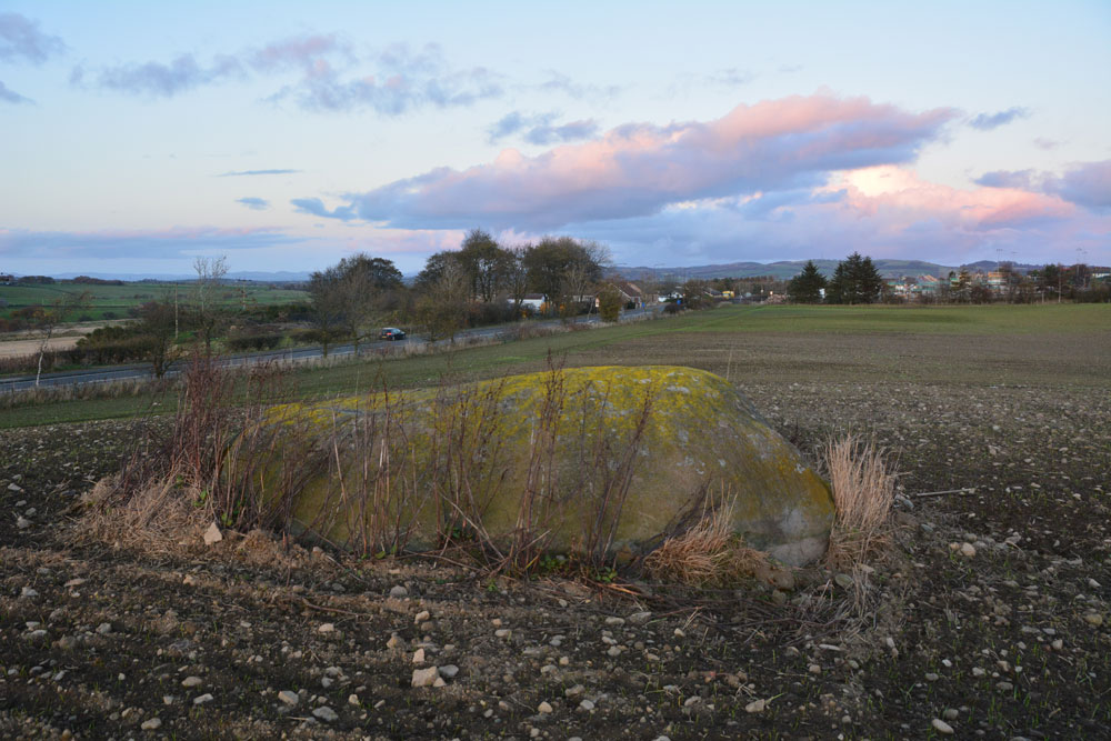
Boar Stone (Armadale) submitted by Anne T on 6th Nov 2018. This photo is looking east over the stone, towards Armadale. Daylight was fading fast, and while there were a few scars and scrapes on top of the stone, we did not see any carvings or markings.
(View photo, vote or add a comment)
Log Text: The Boar Stone (Barbachlaw), Armadale: This is another site we'd picked up from the Ancient Stones website, and although it's not far from my daughter's house in Amadale, we wouldn't normally drive this road. This stone is clearly visible from the A89. We managed to park in the gateway to another field opposite, crossed the road and had to climb over the gate as it was tied shut with some very tight knots.
The field had been planted and there were some young seedlings showing through. By walking along the edge of the field, then up a tractor track, we managed to reach the stone and walk round it.
Goodness knows how much of this stone is underneath the ground – it was certainly large, and no wonder they hadn’t tried to move it!
Randolphfield Stones
Trip No.108 Entry No.1 Date Added: 8th Nov 2018
Site Type: Standing Stones
Country: Scotland (Stirling)
Visited: Yes on 30th Oct 2018. My rating: Condition 3 Ambience 3 Access 4
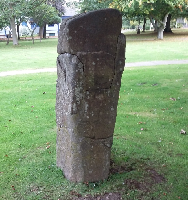
Randolphfield Stones submitted by rogerkread on 16th Oct 2015. The larger stone, showing evidence of destruction and subsequent repair.
(View photo, vote or add a comment)
Log Text: Randolphfield Stones, Sterling: This visit felt really strange, as the stones were literally in front of the police station, and I wondered if I’d get a tap on the shoulder and the memory card from my camera confiscated! No one seemed to turn a hair, though I took a number of photographs of both stones.
Coneypark Nursery (Cambusbarron)
Trip No.108 Entry No.6 Date Added: 10th Nov 2018
Site Type: Cairn
Country: Scotland (Stirling)
Visited: Yes on 31st Oct 2018. My rating: Condition 2 Ambience 3 Access 5
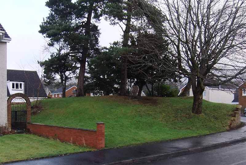
Coneypark Nursery (Cambusbarron) submitted by peigimccann on 24th Dec 2017. Coneypark mound photo by David Sibbald
(View photo, vote or add a comment)
Log Text: Coneypark Nursery Cairn: This cairn is right in the middle of a modern housing estate, where it has been left as a corner ‘open space’. The sides of the cairn have been marginally cut away to create the road and the gardens for the houses, but it is possible to walk over the cairn. A few of the residents were arriving home and in their driveways; none of them took (much) notice of me taking photographs and having a walk all around the cairn.
There is nothing much to see here, but it was ‘one to tick off our list’.
Airthrey Stone
Trip No.51 Entry No.1 Date Added: 9th Oct 2017
Site Type: Standing Stone (Menhir)
Country: Scotland (Stirling)
Visited: Yes on 26th Sep 2017. My rating: Condition 4 Ambience 4 Access 3
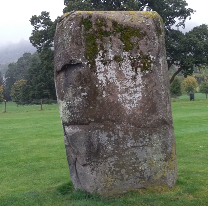
Airthrey Stone submitted by rogerkread on 16th Oct 2015. The Northern face of the Airthrey Stone.
(View photo, vote or add a comment)
Log Text: Airthrey Castle Standing Stone, Stirling University: I have visited the University of Stirling on a number of occasions over the years, visiting an organisation at the Beta Innovation Park, but not known (until I saw them on the Portal) that there were standing stones within the grounds.
We parked at the Wallace Monument, thinking it would be quick half hour walk around Stirling University Campus. Wrong! From the car park, we walked east up Hillfoots Road (the B989) cutting into the Alpha Centre Innovation Park, then walking round the east side of the lake to the University Sports Ground.
As soon as we reached the fence into this area, this huge standing stone stood out. I found the stiles a little too high for my dodgy knees, so it was interesting getting over them!
The surrounding hills, and the view back to the Wallace Monument make this an interesting spot. There were lots of dog walkers and students around, but none seemed to take any notice of the stone – presumably they are all familiar with it. By the time we’d visited Logie Old Church and the Pathfoot Standing Stone, my feet were aching! But no time to relax – Stirling Castle called with a loud, clear voice!
Pathfoot Stone
Trip No.51 Entry No.3 Date Added: 9th Oct 2017
Site Type: Standing Stone (Menhir)
Country: Scotland (Stirling)
Visited: Yes on 26th Sep 2017. My rating: Condition 2 Ambience 3 Access 5
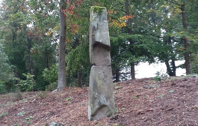
Pathfoot Stone submitted by rogerkread on 14th Oct 2015. Side view.
(View photo, vote or add a comment)
Log Text: Pathfoot Standing Stone, University of Stirling: Walking back across the campus from Logie Old Church, we got caught in a very heavy shower of rain and had to shelter by the student residences at the western side of the campus.
When I caught sight of this, I thought this was a sculpture, not a real standing stone at first. It is at the side of Armitage Road, just north of its’ (busy) junction with Grange Road at the north western side of the campus. We clambered up the wet, slippery slope to take some photos, stared at by the passing students.
By this time, my feet were aching, as we’d spent the best part of 2 hours walking round and round the campus. With Stirling Castle still to come, I welcomed getting back into the car.
Logie Old Kirk (Stirling)
Trip No.51 Entry No.2 Date Added: 9th Oct 2017
Site Type: Early Christian Sculptured Stone
Country: Scotland (Stirling)
Visited: Yes on 26th Sep 2017. My rating: Condition 3 Ambience 4 Access 4
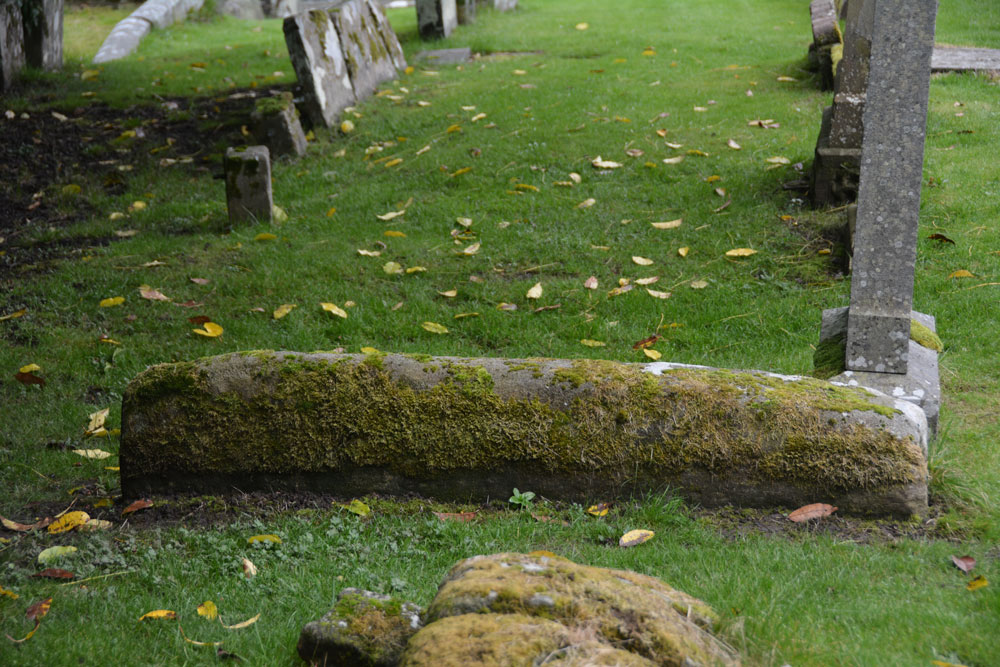
Logie Old Kirk (Stirling) submitted by Anne T on 9th Oct 2017. The hogback as seen from its northern side. Just to its north of this stone is a collection of broken stones, orientated north-south which look like another broken up hogback, but nothing is mentioned by Canmore.
(View photo, vote or add a comment)
Log Text: Hogbacks at Logie Old Kirk, Stirling: To reach the church from the University Halls of Residence, we had to walk through the gardener’s compound/offices. The top two gates around the churchyard were locked; the actual entrance was next to the small stone building to the south of the churchyard, near the stream, with an information board by a small car park, so there is access from the main road.
The churchyard is full of wonderful (morbid!) tombstones. Could have spent the day photographing them. It was also a lovely location with a small stream trickling along the eastern side of the churchyard.
Found one hogback SE of the church, the second is just a lump at the end (by the church) of the 6th row of graves, counting from the stream at the east end of the churchyard. A wonderful location. Really could have spent hours here.
The Gathering Stone
Trip No.83 Entry No.1 Date Added: 24th Jul 2018
Site Type: Standing Stone (Menhir)
Country: Scotland (Stirling)
Visited: Yes on 13th Jul 2018. My rating: Condition 3 Ambience 4 Access 4
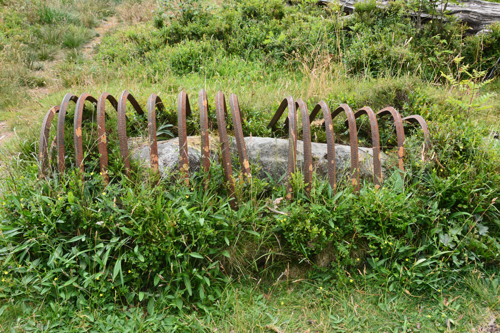
The Gathering Stone submitted by Anne T on 24th Jul 2018. Getting nearer, this is the Gathering Stone, split into at least three pieces. Its iron ribs are reminiscent of old graves being protected from grave robbers, but these metal strips screamed at me "we're stopping this standing stone from becoming upright again".
(View photo, vote or add a comment)
Log Text: The Gathering Stone, Sheriffmuir: From the Sheriffmuir Cairn & Macrae Clan Monument at NN 81569 01934, we followed the footpath to its eastern side, between the main monument and the cairn, following the line of the stone wall, heading in a roughly north westerly direction.
Eventually a path split off to our left, slightly more westwards and this led us to the Gathering Stone – a strange, strange sight, being protected by its ‘iron ribs’. It most definitely looks like a recumbent standing stone, now split into at least three parts.
The ribs are very reminiscent of graves covered to protect them from graverobbers. To me, in this setting, it felt like the iron bars constrained the standing stone from getting up off the ground and becoming upright again.
Continuing slightly further west along the track, you cross some rocks which have been much graffitied. We read that the mounds of earth here are the graves of 600 of the fallen from the Battle of Sheriffmuir.
Sheriff Muir Row
Trip No.83 Entry No.2 Date Added: 24th Jul 2018
Site Type: Stone Row / Alignment
Country: Scotland (Stirling)
Visited: Yes on 13th Jul 2018. My rating: Condition 3 Ambience 5 Access 4
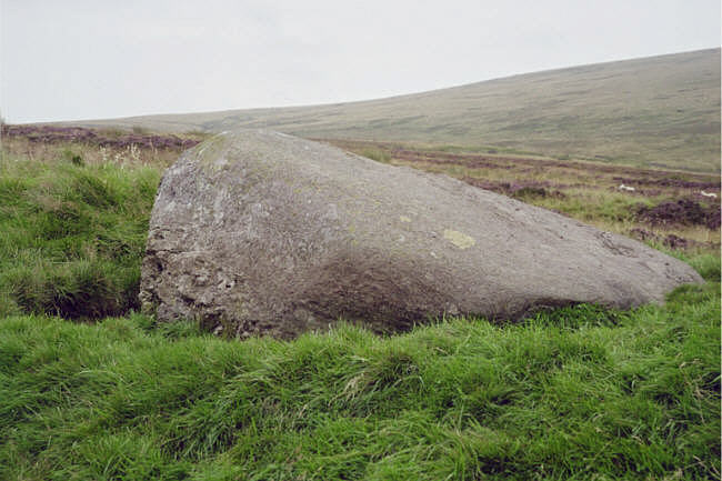
Sheriff Muir Row submitted by hamish on 15th Jul 2005. The recumbant stone it must have been quit impressive when upright.
(View photo, vote or add a comment)
Log Text: Sheriffmuir Stone Row: Please can I claim the Portal prize for 'the most horsefly bites at one ancient site'? At first glance, it looked easy to walk to this stone row. The reality was it was a couple of hundred yards from the road, in deep heather. Having waded through the shrubbery, and having found the Wallace Stone, however, finding the rest of the stones was easy, as they are more or less in a line running north east to south west. I managed to pull up Sandy G’s ”Stone Rows of Great Britain” website, with details of the stones, which helped enormously.
The horse flies were horrendous. I got eaten alive, and was glad to get back to the car to slap some antihistamine on. It was a real shame the Sheriffmuir Inn wasn’t open, as we were desparate for a cold drink (any drink, really) by the time we’d walked to, and photographed, all five stones.
We decided to go onto Dunblane for a cup of tea and something to eat (and lots of antihistamine cream for me!). Despite all the bites, I thoroughly enjoyed exploring this stone row, in the brilliant sunshine and glorious views.
Dunblane Cathedral
Trip No.83 Entry No.7 Date Added: 25th Jul 2018
Site Type: Class III Pictish Cross Slab
Country: Scotland (Stirling)
Visited: Yes on 13th Jul 2018. My rating: Condition 3 Ambience 4 Access 5
Dunblane Cathedral submitted by Alta-Falisa on 29th Jun 2015. Photo : May 2015.
(View photo, vote or add a comment)
Log Text: Ancient crosses at Dunblane Cathedral: Having been bitten and bitten again by horseflies at Sheriffmuir Stone Row, the weather being very hot and humid, and the Sheriffmuir Inn decidedly shuttered up, we decided to go into Dunblane to find a cup of tea and a late lunch. We managed to find a parking spot just opposite the cathedral, so after tea and a jacket potato at the Beech Tree café, we walked back and went into the cathedral.
This is a really welcoming and peaceful church. The young lady who greeted us and sold us a guide book could hardly be heard for the organist “practising for tomorrow – but you can enjoy the music. You can take photographs, but don’t use the flash around the organist.”
The highlight for me was the two cross marked stones at the western end of the northern aisle. There is a lot of information about the cathedral itself, but not much about the crosses. We marvelled at how worn some of the bases of the columns and other architectural features, as part of the cathedral stood roofless for over 300 years from the late 1500s (says the guide book).
The guide book (page 10) talks about the crosses, saying in the North Aisle: “Here there is a large carved cross – evidence that Dunblane was a religious centre from an early date. Discovered beneath the chapter house floor in 1873, it dates from the 9th century. On the back of the stone are allegorical figures – there are two animals sitting entwined and a horse and rider with an animal, perhaps a wolf, below the horse. Also on display is a fragment from a similar cross-slab found in 1836. It also dates to the 8th or 9th century. The presence of both stones suggests that there may have been an earlier church on this site. Architectural fragments dating from the 1100s and 1200s were found during the construction of the boiler house under the chancel and chapter house in 1836. Some of these fragments are on display in the north aisle. The finely worked chevrons (zigzags) on the arch fragments, and the elaborate column cap hint at the exquisite decoration of the earlier cathedral. Fragments from the 1300s and 1400s are also on display.”
I completely forgot about the four cists around the cathedral, and I didn't have a mobile signal to call up the Portal or the Canmore records, but we will be coming back here at some point in the relatively near future.
Butt Well
Trip No.108 Entry No.2 Date Added: 9th Nov 2018
Site Type: Holy Well or Sacred Spring
Country: Scotland (Stirling)
Visited: Yes on 30th Oct 2018. My rating: Condition 3 Ambience 4 Access 4
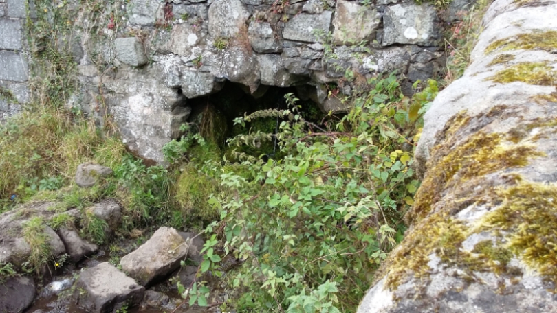
Butt Well submitted by rogerkread on 16th Oct 2015. The waters which would once have flowed into the Butt Well now tumble down the hillside on the far side of the wall behind the wellhead.
(View photo, vote or add a comment)
Log Text: Butt Well, Sterling Castle: We parked in the layby near the King’s Knot, just off the A811. There is a footpath signposted to Butt Well leading through the field next to the layby, just down the grassy slope.
Walking up towards the Castle, we were met by a fair number of dog walkers walking to or from the well. The footpaths here look as if they give access up to the castle, but we stopped short at the well.
Our first sight of part of this feature was a small well chamber, still with a fair flow of water running into it, just over the dry stone wall, below the main well housing and at the bottom of the flight of steps, at NS 78937 93894. The water from this runs in a small channel across the field to the northern side of the wall, at the opposite side to the footpath. Looking down at this chamber from above, there appears to be the remains of a stone drinking trough just outside the chamber, but largely buried under the grass and weeds around it.
The well itself, at NS 78948 93898, is now dry and capped off, with a handy bench next to it.
Climbing up the few steps above the main well housing, there is a channel running underneath the footpath running off to the north west at NS 78952 93902.
As I was photographing the well, a young black Labrador was running around with a large tree branch in his mouth. I was laughing at him, and his owner came up and asked us where we were from. He said when he was young, he used to play on the ‘cup and saucer’ (the King’s Knot) then run up here for a drink; “the water was the clearest you’ll ever taste”. He told me that they’d capped the well off some 20 to 30 years ago.
St Ninian's Well (Stirling)
Trip No.108 Entry No.3 Date Added: 10th Nov 2018
Site Type: Holy Well or Sacred Spring
Country: Scotland (Stirling)
Visited: Yes on 30th Oct 2018. My rating: Condition 3 Ambience 2 Access 5
St Ninian's Well (Stirling) submitted by KiwiBetsy on 16th Oct 2006. It is said that a chapel stood near the well and was still in existence in 1497 but that none of it now remains and the structure now covering the well is a wash house.
(View photo, vote or add a comment)
Log Text: St Ninian's Well, Stirling: This was just over the road from the Wellgreen Carpark, but we had difficulty in finding this well, because of its rather hidden location. Despite the GPS telling us we were only 20m away, we were unable to find it until we saw the footpath leading to Wellgreen Place at the southern side of the A811 Wellgreen Road. Shame the area is used by smokers, as the rubbish is horrible.
Opposite the well, nearer to the office block is a small set of steps leading upwards to a now very much overgrown garden area. The steps are virtually hidden under shrubbery, and although Andrew had a try at climbing up, it was very difficult and we gave up and went onto our next destination.
