Contributory members are able to log private notes and comments about each site
Sites Anne T has logged. View this log as a table or view the most recent logs from everyone
St Hilda's Church (Hartlepool)
Trip No.156 Entry No.1 Date Added: 11th Feb 2020
Site Type: Early Christian Sculptured Stone
Country: England (County Durham)
Visited: Yes on 5th Feb 2020. My rating: Condition 4 Ambience 4 Access 4
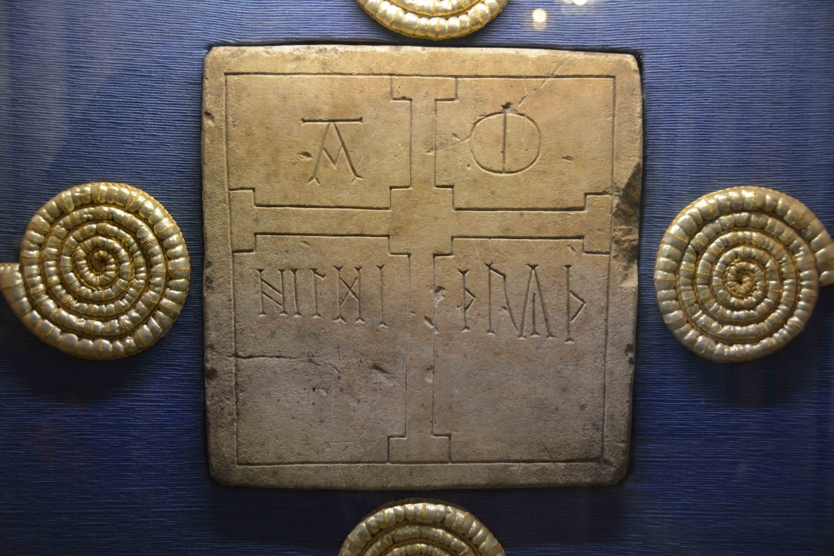
St Hilda's Church (Hartlepool) submitted by Anne T on 11th Feb 2020. The impressive Hildthryth namestone, on display on the eastern wall of the St Nicolas Chapel, on the southern side of the sanctuary. Also recorded as Hartlepool 01 on the Corpus of Anglo Saxon Stone Sculpture. The stone measures 27cms high, 29cms wide and 11cms deep. Poinds tells us: "The west face is decorated with a plain border which surrounds a large cross whose centre is square rather than circular and whose cross arms are square ended. The lettering on each side of the upper vertical arm o...
(View photo, vote or add a comment)
Log Text: St Hilda's, the Headland, Hartlepool: What a magnificent building, with its collection of huge flying buttresses supporting the external walls of the tower. Inside, it is more like a mini-cathedral than a parish church.
We had the pleasure of being greeted by Mr. John Hogg, parishioner with responsibility for Visitor Ministry, and the most knowledgeable guide we could wish to meet.
We spent almost the full hour and a half looking round the church, the fragments in the Brus Chapel and the old south door, plus admiring the Hildthryth stone in the St Nicholas Chapel. I just wish the opening hours of the church had been longer, as I was really interested to see the display boards located around the south and north walls of the nave.
The altar rails are also interesting, as they are made of 1,000 year old oak (but do look Victorian!). A real gem, and well worth a visit.
St Hilda's Wayside Cross (Hartlepool)
Trip No.156 Entry No.2 Date Added: 11th Feb 2020
Site Type: Ancient Cross
Country: England (County Durham)
Visited: Yes on 5th Feb 2020. My rating: Condition 3 Ambience 4 Access 5

St Hilda's Wayside Cross (Hartlepool) submitted by Anne T on 11th Feb 2020. Looking down into the socket hole of the cross base, which is about 20cms square, and 5-6cms deep. The remains of old lead can be seen around the edges of the socket hole, indicating it once held a cross shaft or other fragment.
(View photo, vote or add a comment)
Log Text: Wayside Cross base outside St Hilda's Church: I spotted this more by accident than design, and photographed it, before we rushed off to the old Gray Art Gallery and Museum site to try and track down its old site. We couldn't find it where the grid reference placed it. A worker from the now office building, William Gray House, which now houses the Council and Tees Archaeology, told us the art gallery had closed in 1995 although people still came looking for it. He had no knowledge of a cross base in the grounds.
It wasn't until I got home and was doing some research that I came across the HE entry, which we hadn't seen earlier, which told us the cross base had been moved to this location in 1997.
Grasmere Cup-Marked Rocks
Date Added: 20th Jun 2014
Site Type: Rock Art
Country: England (Cumbria)
Visited: Yes on 2nd Jun 2014
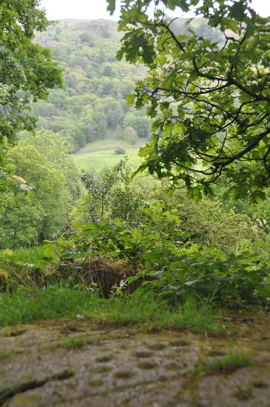
Grasmere Cup-Marked Rocks submitted by Anne T on 2nd Jun 2014. We made an impromptu visit to Grasmere yesterday (1st June) and as the café we were in had WiFi, I checked the Portal, and found the images taken by DrewParsons of the Cup-Marked Rocks at the entrance to the car park we were parked in. Thank you - this was an unexpected treat. This image shows the context of the rock outcrop, overlooking the river Rothay and (I think) Rydal Fell in the background. A beautiful spot.
(View photo, vote or add a comment)
Log Text: None
Goggleby Stone
Date Added: 1st Jul 2014
Site Type: Standing Stone (Menhir)
Country: England (Cumbria)
Visited: Yes on 28th Jun 2014. My rating: Condition 3 Ambience 4 Access 4
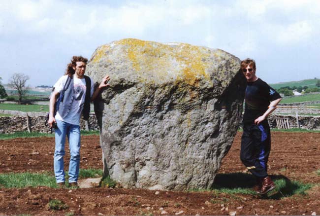
Goggleby Stone submitted by blingo on 30th Jan 2003. Goggleby stone near Shap.
(View photo, vote or add a comment)
Log Text: After failing to park along the narrow lanes around Keld, to see various stones in Shap Row, we finally parked outside the Fire Station on the A6 running through Shap, and followed the footpaths westward to the Googleby Stone and the partially toppled stone in Asper's Field.
This is a short walk, with a couple of stiles to cross, but easy enough.
I was impressed by the size of this stone, although we could discern no cup or ring marks anywhere on it.
I was a bit disappointed to see this stone had been concreted into place to keep it upright!
White Raise Cairn
Date Added: 1st Jul 2014
Site Type: Cairn
Country: England (Cumbria)
Visited: Yes on 28th Jun 2014. My rating: Condition 3 Ambience 4 Access 3
White Raise Cairn submitted by baz on 3rd May 2003. White Raise Cairn (NY489224). This 20m. long cairn has an exposed central cist.
(View photo, vote or add a comment)
Log Text: From the footpath leading from the Cop Stone to The Cockpit Stone Circle, this cairn lies after the Cairn Circle, on the right hand side of the footpath.
It initially appears unremarkable as a large mound with stones marking the extent of the cairn, but walking up the slope I came across the excavated burial chamber, which was a great surprise.
It's clearly a favourite with sheep, as the stones retain the heat from the sun, and they were unmoving as we wandering around.
There are great views across the valley towards Ullswater, although it's not quite possible to see the lake from the cairn.
Well worth a visit.
Moor Divock 3
Date Added: 9th Feb 2023
Site Type: Cairn
Country: England (Cumbria)
Visited: Yes on 28th Jun 2014. My rating: Condition 3 Ambience 4 Access 3
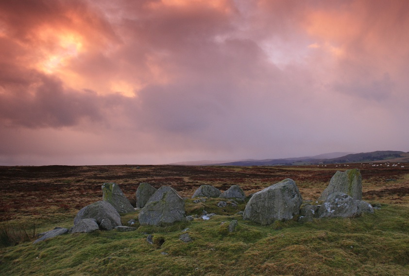
Moor Divock 4 submitted by postman on 25th Oct 2012. Sometimes a friend at work will ask why I do this , but the question isn't why I do, it's why don't you ? (though really I know the answer)
(View photo, vote or add a comment)
Log Text: After visiting the Cop Stone, we walked up to the Cairn Circle (which is clearly visible from the footpath). Whilst ruined, it's atmospheric. The more I sat on the edge of the cairn and looked round, the more there is to see. I'd like to go round with someone who knows this area better than I, so I can understand it better. [Note: I originally confused this with Moor Divock 4, the cairn circle and small stone row just to the north. Looking back on my photographs, I could find no evidence of this feature on the ground].
Cop Stone
Date Added: 1st Jul 2014
Site Type: Standing Stone (Menhir)
Country: England (Cumbria)
Visited: Yes on 28th Jun 2014. My rating: Condition 4 Ambience 4 Access 4
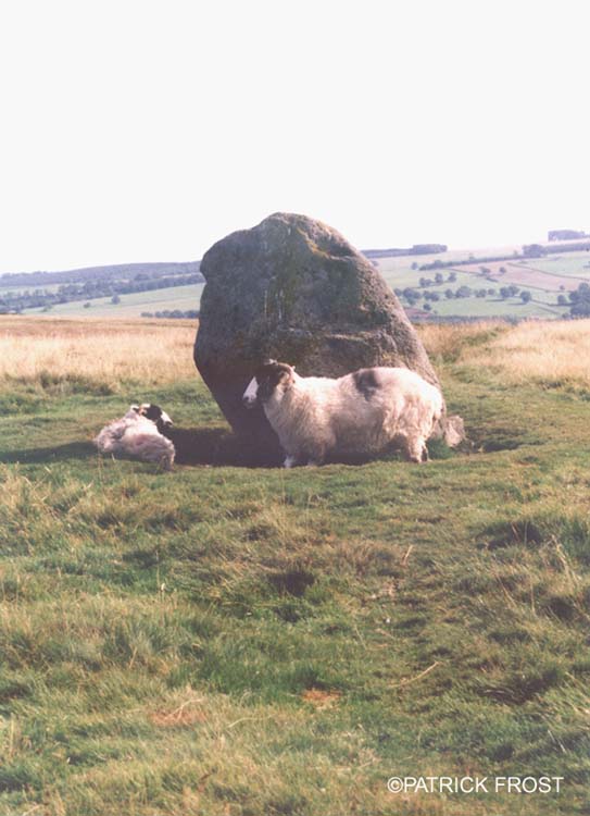
Cop Stone submitted by Patrick Frost on 14th Oct 2002. The Cop Stone in Cumbria at GR: 496216
(View photo, vote or add a comment)
Log Text: For a long time we've wanted to walk along High Street, the Roman Road, but the scramble up from Ullswater side was too difficult for me. My husband managed to identify another route, via the B road through Askham and Helton, then following the track past Outgang Farm and Heltonhead. There were other cars parked on the grass at the side of the road, so we joined them, and walked the 100 yards up to Cop Stone.
This was just the start of our journey through this fascinating landscape; whilst there are obvious quarried area and shake holes, there are a wide variety of cairns and tumuli, with the footpath leading up past The Cockpit Stone Circle and High Street.
The more we looked, the more there was to see. Well worth a visit, and easy walking.
Thunder Stone (Shap)
Date Added: 26th Sep 2016
Site Type: Natural Stone / Erratic / Other Natural Feature
Country: England (Cumbria)
Visited: Yes on 5th Jul 2014. My rating: Condition 4 Ambience 4 Access 4
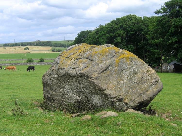
Thunder Stone submitted by LivingRocks on 7th Jul 2005. The enormous Thunder Stone, the largest stone of the Shap Avenue.
(View photo, vote or add a comment)
Log Text: Return visit 5th July 2014: We recently obtained the farmer's permission to walk across the fields to look at any of the Shap Row Stones on his land. Having woken up after a night of heavy, heavy rain to grey skies, we hopped in the car and went over to the Lake District, where the forecast was much better, having spent half an hour researching the exact position of the stones near Shap Village from a map the Shap Local History Society website (well worth a visit to get further information).
The Thunder Stone field was commanded (literally!) by a young bull who was very protective of his cows and calves, and made a move for us the minute we opened the gate, so we backed off (the farmer did warn us he had a bull in the field, but some bulls can be quite placid if kept at a distance). Having come all this way, I didn't want to go away without a picture, so walked up the farm track in front of High Buildings Farm House and round the back of the barns, to get a photograph from the gate to the field.
There is a smaller stone within this same field, so when we go back to Shap in the autumn, once the undergrowth has died back more), we'll visit again to get some more photographs.
First visit 28th June 2014: We went to have a look at some of the stones in Shap Stone Row, but found it almost impossible to park on the very narrow lanes around Keld. I was curious to see The Thunder Stone, and we managed to squeeze our car into the road junction leading down to Shap Abbey and walked back to look at the stone. It lies within a private field, and a clear view was difficult. I have since written to the landowner to ask for permission to get into the field to take photographs, so I'll see what comes back. There is a footpath along the far edge of the field the stone is in, but this leads away from the stone, so this was the closest we could get for now.
The stone is a little difficult to make out in the photograph I've submitted, as there was a lot of farming 'clutter' around the stone.
Aspers Field
Date Added: 1st Jul 2014
Site Type: Standing Stone (Menhir)
Country: England (Cumbria)
Visited: Yes on 28th Jun 2014. My rating: Condition 4 Ambience 4 Access 3
Aspers Field submitted by baz on 26th Apr 2003. This stone (at NY558152) lies in the next field to the more well known Goggleby Stone (NY559151), from which I took this picture (with zoom). Both of these stones form a part of the Shap Stone Avenue.
(View photo, vote or add a comment)
Log Text: This stone is within sight of the Googleby Stone, although a little more difficult to access. The gate to access the field is in Keld Lane, but it's difficult to park here, and we were wary about walking in private fields. There were some dog walkers from the nearby caravan park walking in the fields, so we took advantage of a tumbled stone wall to get a photograph of the cup and ring mark.
Having come home and found out the extent of the stone row at Shap, we'll be going back to see more.
The Cockpit
Date Added: 1st Jul 2014
Site Type: Stone Circle
Country: England (Cumbria)
Visited: Yes on 28th Jun 2014. My rating: Condition 3 Ambience 4 Access 3
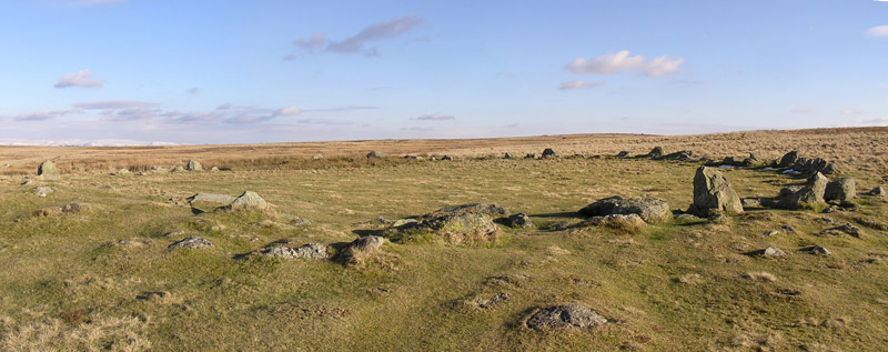
The Cockpit submitted by LivingRocks on 18th Mar 2005. A panoramic view of the Cockpit Stone Circle which according to Magicmap ‘includes a circular kerbed stone bank 2.8m -11.2m wide and up to 0.5m high which encloses an area approximately 27m in diameter. There are 27 (?) standing and recumbent stones set largely into the internal face of this bank, thereby creating the stone circle. The tallest standing stone measures about 0.95m high and some of the recumbent stones are up to 1.9m in length. Within the eastern side of the stone circle, abuttin...
(View photo, vote or add a comment)
Log Text: Almost at the course of High Street Roman Road, there is a view of Ullswater from the footpath just below the Cock Pit Stone Circle.
As the circle is on a good footpath, most of the people stopped at the circle. It's always nice to see people appreciate ancient sites, but I had to wait quite a while to get take photographs without anyone else in it! We found a couple of the outlying stones, and identified a couple of cairns nearby, but couldn't get good enough photographs to make these out properly.
By standing just below the circle, on the main footpath, it's possible to make out the bank.
Well worth a visit, and the view of Ullswater and Pooley Bridge below was worth the easy walk.
Swinside
Date Added: 7th Jul 2014
Site Type: Stone Circle
Country: England (Cumbria)
Visited: Yes on 5th Jul 2014. My rating: Condition 4 Ambience 5 Access 3
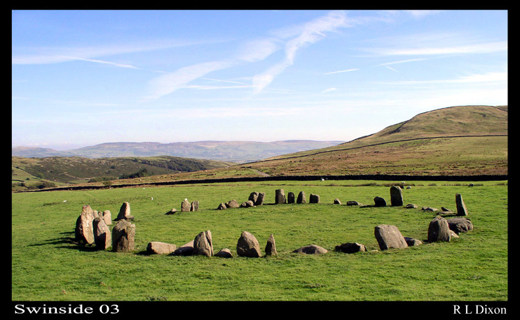
Swinside submitted by rldixon on 15th Jan 2006. Swinside well worth the walk
(View photo, vote or add a comment)
Log Text: After an afternoon spent visiting the Shap Stone Row, my husband was particularly keen to see Swinside Stone Circle, so we took an additional hour to travel to this site. I have to say it was well worth the visit, and I would very definitely go again.
We parked in a small layby just down from Cragg Hall and walked up the marked public bridleway to Swinside (Sunkenkirk) Stone Circle. The first part of the track was steep, but concreted and thankfully short; the rest of the walk was relatively level and had magnificent views. Visibility during our visit was amazing, and we estimated we could see a good 30 miles to the eastern lakes in the far distance. The tide was out, but we had a good view of (what I am assuming from my limited map reading skills!) Duddon Sands in the estuary below until the land levelled out and we could see the circle in the far distance ahead of us.
Surprisingly, we were passed by two separate cars heading up to the farmhouses further up the track - what a remote, but very lovely place to live.
The circle surpassed my expectations. It had a wonderful atmosphere, and I would happily have stayed there until sunset, which, being summer, was a good 5 or 6 hours away, and sadly we had to get home the same evening.
My photographs aren't as good as some of the ones already on the Portal website, so in the images I've submitted, I've tried to pick out some of the features which stood out for me, which include the portal stones at the entrance to the circle.
On reflection, I think we should have climbed up Swinside Fell to get a distant shot of the circle, which would have completed my album for the circle. Next time.
Just to note that in the fields to either side of the bridlepath (particularly the right hand side) leading up to the circle, there were a large number of what appeared to be shaped stones, and we wondered if at one time there had been an avenue leading up to the circle. I've submitted a picture of one stone which has a striking resemblance to the stone in the circle with the quartz banding across it.
Kemp Howe
Date Added: 7th Jul 2014
Site Type: Stone Circle
Country: England (Cumbria)
Visited: Yes on 5th Jul 2014. My rating: Condition 2 Ambience 2 Access 4
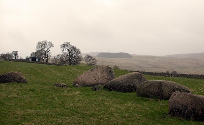
Kemp Howe submitted by nicoladidsbury on 29th Mar 2004. This is the remains of what must have been a beautiful stone circle. The stones are pink granite and have a lovely glow. Unfortunately the ambience has been shattered by the "wonderful" victorians, who built the railway on top of it.
(View photo, vote or add a comment)
Log Text: Having been kept awake most of the night by heavy, heavy rain, then being greeted by leaden skies with a distinctly autumn feel, the weather in Cumbria, according to the weather forecast, seemed a lot more appealing.
Armed with information from the Portal and a map with the locations of stones in the Stone Row from the Shap Local History Society, we hopped in the car and drove west.
We parked at the entrance to the field with Kemp Howe in it (the gate to the field was left wide open, and there was a short trackway up to the stones, although the road was horrendously busy), and walked the 100 feet or so up to the stones. Whilst the grass in the field had recently been cut, the undergrowth round the stones had been left uncut.
I confess to being horrified at the damage done to these stones by the Victorians - what a travesty. We got to admire several trains passing by at very close quarters, and could almost have waved to the quarry men the other side of the railway line. The views of the fells to the west (across the road) and beyond was appreciated and were in stark contrast with what was behind us.
This marked the start of an afternoon well spent exploring the Stone Row in glorious sunshine, with a nice lunch stop at the Shap Coffee Shop in the village, then taking in the stones at the west of Shap Village, finishing with the Tumulus at Skellow Hill and the Thunder Stone.
Shap Avenue
Date Added: 7th Jul 2014
Site Type: Multiple Stone Rows / Avenue
Country: England (Cumbria)
Visited: Yes on 5th Jul 2014. My rating: Condition 2 Ambience 4 Access 3
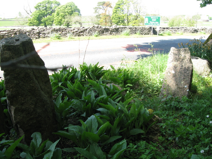
Shap Avenue submitted by AngieLake on 3rd Jun 2011. These were the most noticeable stones fringing the east side of the road, heading back towards the village after visiting Kemp Howe, that might have possibly come from the ancient monuments.
(View photo, vote or add a comment)
Log Text: Armed with information from the Portal and a map of the locations of the stones they've mapped in the stone row so far from Shap Local History Society, we started off at Kemp Howe stone circle, and walked round the village looking for stones. We met a couple of the more senior locals as we went round, and they were keen to help and point out where the stones were, and tell us of others. There are so many stones around and near to the village, most of them clearly on the same alignment that we became quite overwhelmed with the scale and sense of what our ancestors achieved and what it all represented.
We ended up at Skellaw Hill and the Thunder Stone, then had to call it a day, as we wanted to travel over to Swinside Stone Circle before heading off home.
The Shap Stone Row is certainly intriguing, and I came back with around 100 photos of possible stones and locations - I've picked two to submit that aren't already recorded on this page.
Well worth exploring, and whilst visiting, I'd also recommend hopping down to Shap Abbey and Keld Chapel nearby, too. Both are free to get into, and are in picturesque locations, with a lot of history attached.
Newbeggin Stone Row
Trip No.9 Entry No.4 Date Added: 15th Feb 2017
Site Type: Stone Row / Alignment
Country: England (Cumbria)
Visited: Visited (still working on) on 12th Feb 2017
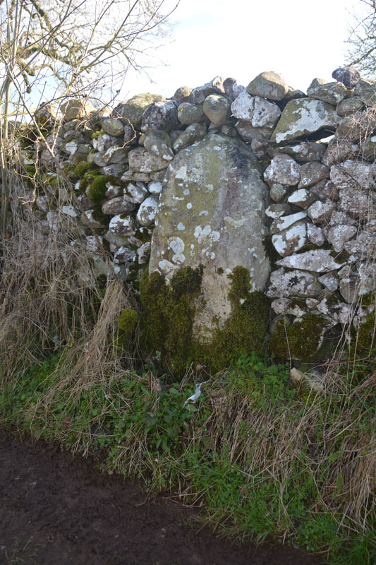
Newbeggin Stone Row (Possible) submitted by Anne T on 28th Mar 2017. This stone is built into a stone wall on a footpath which follows the Carlsike Burn, around Hoghouse Hill to Newbeggin. Located at NY 48058 29531. Note: 3rd April 2017. The Lead Officer for the Historic Environment and Commons says "This is slightly more interesting. I would not like to guess at when this might have been erected."
(View photo, vote or add a comment)
Log Text: Newbiggin Stone Row, near Penrith: See comment on main page. Tried to find. Seen an image of a stone in an enclosure wall but unable to locate. Working on finding exact location and will return!
The Galloway Stone
Trip No.15 Entry No.2 Date Added: 3rd Apr 2017
Site Type: Natural Stone / Erratic / Other Natural Feature
Country: England (Cumbria)
Visited: Yes on 2nd Apr 2017. My rating: Condition 3 Ambience 2 Access 5
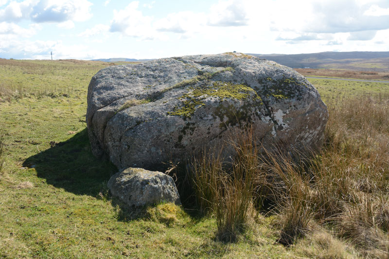
The Galloway Stone submitted by Anne T on 3rd Apr 2017. Looking south east over the Galloway Stone to the hills beyond.
(View photo, vote or add a comment)
Log Text: The Galloway Stone, near Orton, Cumbria: Spotted this named stone on the map as we drove towards Orton to find refreshments. There were many other large (but not quite as large as this) stones in the vicinity. With the M6 Northbound carriageway almost immediately behind, and above, this stone, I could have been forgiven for thinking this was left over from building the motorway.
In close up, the stone is clearly pink Shap granite, and had a red tint in the sunlight. A big surprise was find the bench mark with its large rivet on top of the stone.
Irthington Motte
Trip No.40 Entry No.3 Date Added: 24th Aug 2017
Site Type: Misc. Earthwork
Country: England (Cumbria)
Visited: Yes on 20th Aug 2017. My rating: Condition 2 Ambience 3 Access 5
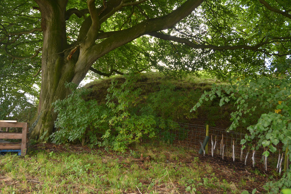
Irthington Motte submitted by Anne T on 24th Aug 2017. Leaning over the fence from the builder's yard, the oval of this earthwork was more obvious. I would have liked to have gone in to the yard for a closer look, but there was a lot of rubble, heavy equipment and a padlocked gate.
(View photo, vote or add a comment)
Log Text: Irthington Motte, Cumbria: We continued walking down the lane which leads to the River Irthing. At first, nothing appeared to stand out as a motte, then I realised that the mound behind the fence, sitting between the farm and the builder’s yard was actually the motte.
Walking down nearer to the entrance to the builder’s yard, the shrubbery was less intrusive and the oval shape of the motte became more apparent.
I would have liked to have gone into the builder’s yard but there was so much rubble, heavy equipment and a padlocked gate. No-one in the farm yard to ask, despite several cars being around.
Tullie House Museum
Trip No.46 Entry No.1 Date Added: 19th Sep 2017
Site Type: Museum
Country: England (Cumbria)
Visited: Yes on 18th Sep 2017. My rating: Condition 4 Ambience 2 Access 4
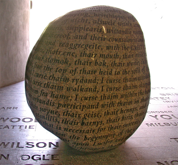
Tullie House Museum submitted by nicoladidsbury on 13th Mar 2005. Cursing Stone, Tullie House Millenium Walkway, Carlisle
The polished granite stone is inscribed with the curse, which was cast on all the reivers of the English/Scottish borders in the 16th Centuary.
The names of those reivers are inscribed in the stones that make up the floor of the millenium walkway, Armstrongs, Grahams, Robsons, Elliotts, and Kerrs to made a few.
The Tullie House Museum has a 10-minute wide-screen audio-visual spectacular which gives a dramatic impression of the lawles...
(View photo, vote or add a comment)
Log Text: The Cursing Stone, Carlisle: This stone is located in the strangely lit underpath that runs the dual carriageway near Tullie House Museum and Carlisle Castle, next to Tullie House museum. We came across this quite by chance, thinking it was located inside the museum. It is actually on the Tullie House side of the pedestrian underpass from the Castle to the Museum.
There is nothing on the walls of the underpass to tell you what this stone is. I’d read about it on the Portal some time ago and recognised it. The wording of the curse is recorded below.
Snuff Mill (Stainton)
Trip No.60 Entry No.1 Date Added: 24th Nov 2017
Site Type: Standing Stone (Menhir)
Country: England (Cumbria)
Visited: Yes on 20th Nov 2017. My rating: Condition 3 Ambience 3 Access 5

Snuff Mill (Stainton) submitted by Anne T on 24th Nov 2017. First view of the stone from across the road. The dry stone wall behind and to the north eastern side of the stone has been dog-legged around it, indicating the stone was here well before the wall.
(View photo, vote or add a comment)
Log Text: Snuff Mill Standing (?) Stone: On the way back from Pooley Bridge to Stainton and Newbeggin, I saw a standing stone by the side of the road (A592) so Andrew turned around and we parked in the driveway of Snuff Mill Water Treatment Centre. The stone was just passed a corner of this busy little road, and it felt quite dangerous as none of the cars moved very far out of the way for us walkers.
The dry stone wall had been ‘kinked’ to go around the stone. It was heavily covered in moss.
I can’t find anything about it on Pastscape or Historic England, so will email Mark Brennand at Cumbria County Council.
Mossthorn Long Cairn 2
Trip No.60 Entry No.4 Date Added: 24th Nov 2017
Site Type: Cairn
Country: England (Cumbria)
Visited: Saw from a distance on 20th Nov 2017. My rating: Condition 2 Ambience 3 Access 3
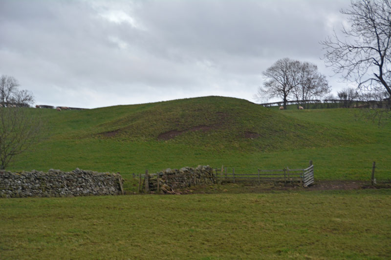
Mossthorn Long Cairn 2 submitted by Anne T on 13th Feb 2017. The long cairn at grid reference NY 48289 30440, taken from the layby outside The Wreays on the minor road from the A66 to Greystoke.
(View photo, vote or add a comment)
Log Text: Mossthorn Long Cairn 2, Copt Howe, Newton Reigny: See the visit report for Mossthorn Long Cairn 1 for more details. This is the side of the long cairn (or natural feature, as Pastscape says?) we couldn’t see from the road on our last visit on 12th February 2017. This time, we could only see it from the field boundary near the southern end of Mossthorn Long Cairn 1. From this angle, it does look like a natural hummock, although more like a cairn from the main road.
King Arthur's Round Table
Trip No.68 Entry No.8 Date Added: 7th Apr 2018
Site Type: Henge
Country: England (Cumbria)
Visited: Yes on 5th Apr 2018. My rating: Condition 3 Ambience 4 Access 5
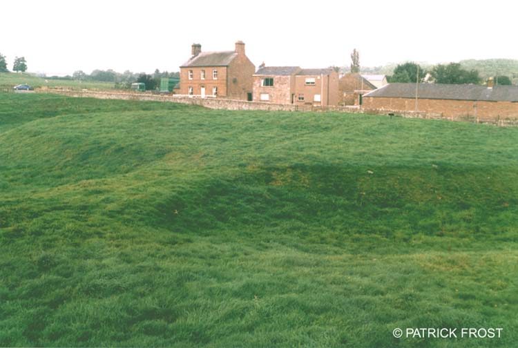
King Arthur's Round Table submitted by Patrick Frost on 14th Oct 2002. King Arthur's Round Table in Cumbria.
(View photo, vote or add a comment)
Log Text: King Arthur's Round Table Henge, Eamont Bridge: We tried to stop here on the way down to Langwathby, but the traffic was so dense and moving in so many different directions at the traffic lights, we decided to try when it was quieter. Thankfully, we managed to park in the layby opposite on the way back and let ourselves in through the kissing gate by the western side of the A66.
The scale of this monument is huge, and we walked all around its outer bank, trying to photograph the whole. Well worth stopping off and taking a look.
I didn't realise until I got home and was looking up information that there is a Little Round Table henge at NY 52387 28180.
