Contributory members are able to log private notes and comments about each site
Sites Anne T has logged. View this log as a table or view the most recent logs from everyone
Gors Fawr Stone Circle
Date Added: 28th Aug 2014
Site Type: Stone Circle
Country: Wales (Pembrokeshire)
Visited: Yes on 23rd Aug 2014. My rating: Condition 4 Ambience 5 Access 4
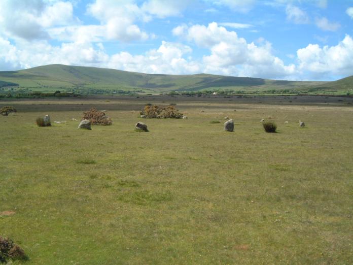
Gors Fawr Stone Circle submitted by enkidu41 on 3rd Jun 2004. A circle of 16 stones in an almost perfect 73’ diameter circle. This shot proves that it's not always wet in Wales.
(View photo, vote or add a comment)
Log Text: Gors Fawr Stone Circle, Pembrokeshire: After stopping off at St. Brynach’s church in Nevern to see the stone crosses, we started on our long journey home to Northumberland. We’d identified a number of ancient sites we wanted to see on our way back, including the Gors Fawr Stone Circle. My husband had hoped to see the site in the Presili Hills where they’d quarried the stones for Stonehenge, but time (and my horror of precipices and steep drops) wouldn’t allow – on our next trip, we’ll need to allow another month at least to see all the things we want to in the area!
Following the A478 and turning off towards Mynacholog-ddu at the village of Crymych, it was easy to find the little gem of Gors Fawr. Again, I hadn’t realised what a tourist attraction this was. There was a small lay-by across from the house ‘Pen-rhos’, and an easy walk across the field to the circle.
It was much smaller than I imagined from the photographs I’d seen on the Portal, but if I’m allowed to, I'd use the word ‘cute’ as the most accurate description that comes to mind. One of the first things I saw almost in the middle of the circle was a small Wiccan altar, made of small rounded blue pebbles, with its apex pointing towards the Gors Fawr Outliers.
Walking just outside the perimeter of the circle, we became aware of smaller stones buried in the grass at regular intervals about 3-4 metres outside the main circle, and wondered if there was an outer circle (but then there were so many other stones in the field that we let our imaginations run a little riot with ideas of stone avenues and tumuli). Since I've been home, I've read on the Ancient Wisdom of Wales web site that a survey had been done, and nothing found.
But what a place to build a circle – on a wide, flat plateau of moorland, with the Presili hills rising to the north. This stone circle seeming to lie in the centre of the graceful bowl formed by the hills, which rose up blue and misty in the distance. The circle somehow seemed to me to capture the essence and magnificence of the landscape.
There was a small, constant stream of other visitors. I got into conversation with a family who said they’d had trouble finding the circle, and had stopped by the Outliers and walked back. The man told us about the apparent alignments between the Outliers and the Circle at Solstice, so I’ll need to check this out. I didn't have the courage to ask him if he was another Portal user (but next time I won't be so shy!).
I would have loved to have stayed until sunset.
Gosforth Cross
Date Added: 27th Oct 2014
Site Type: Ancient Cross
Country: England (Cumbria)
Visited: Yes on 24th Oct 2014. My rating: Condition 4 Ambience 4 Access 5
Gosforth Cross submitted by Thorgrim on 30th Jul 2003. Probably the finest Anglo-Scandinavian carving in the north of England, this red sandstone cross has stood for over a thousand years in the churchyard at Gosforth. Depicting Pagan scenes of Odin, Thor and Loki as well as of Christ crucified, the mixed symbolism is intriguing. Inside the church are fine Viking hog-back tombstones including one showing the famous scene of Thor fishing for the Midgard Serpent. Gosforth in Cumbria is 12 miles from Whitehaven at map ref: NY 072036.
(View photo, vote or add a comment)
Log Text: The Gosforth Cross and Hogbacks, Gosforth, Cumbria: This was a busy, busy little village. By this time, it was 3pm and I was more than ready for a cup of tea, but the cafe above the village store was closing. Away from the main car park for the village, we struggled to park, but in the end managed to get a spot outside the eastern end of the churchyard, where a delivery van had just pulled away.
What a delightful little church, where we were given a very warm welcome.
Rather than walk up to the lych gate, I opened the lower gate into the churchyard, where we were almost immediately greeted by some iron railings round a very unusual tree. We walked over the grass to the Gosforth Cross, and as I was taking photographs, we were greeted by a very jolly gentleman who told us he’d seen us come in through the bottom of the churchyard, and asked if we’d spotted the railings. “As far as we know, this is the most northerly growing cork tree.” He then proceeded to take us into the church and showed us where the Fishing Stone was, together with the light switches to see the other stones and hogback tombstones.
There was a very busy group of ladies who were cleaning the church from top to bottom, using the space between the hogback tombstones to hide their handbags (I gingerly moved them and replaced them to get my photographs.
I picked up a leaflet in the church about the grave covers and was taking (yet more) photographs in the porch. A gentleman with a sweeping brush came out to clear the leaves away and told us about the Grade 1 listed building at north east corner of church yard built out of grave stones, so we went to look. Fascinating! I’m glad I didn’t miss this feature.
Grasmere Cup-Marked Rocks
Date Added: 20th Jun 2014
Site Type: Rock Art
Country: England (Cumbria)
Visited: Yes on 2nd Jun 2014
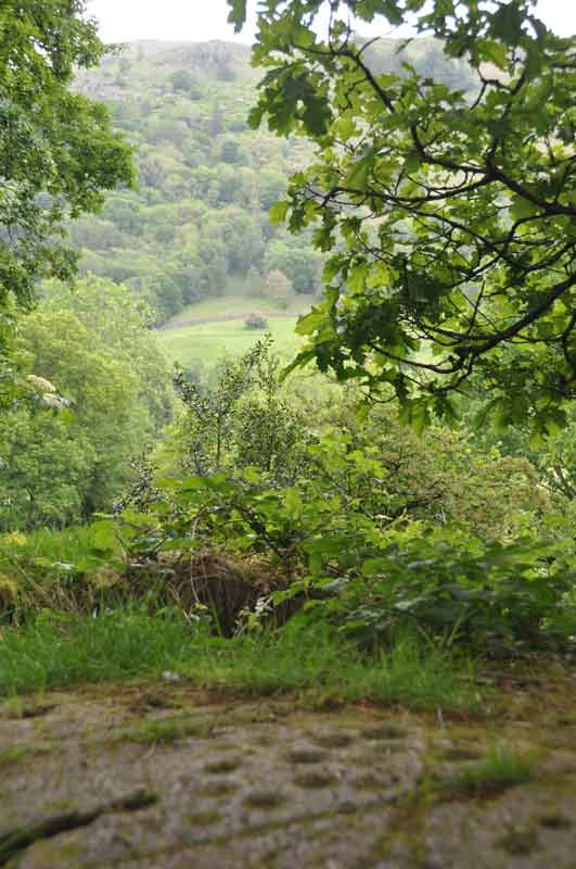
Grasmere Cup-Marked Rocks submitted by Anne T on 2nd Jun 2014. We made an impromptu visit to Grasmere yesterday (1st June) and as the café we were in had WiFi, I checked the Portal, and found the images taken by DrewParsons of the Cup-Marked Rocks at the entrance to the car park we were parked in. Thank you - this was an unexpected treat. This image shows the context of the rock outcrop, overlooking the river Rothay and (I think) Rydal Fell in the background. A beautiful spot.
(View photo, vote or add a comment)
Log Text: None
Grassmarket modern menhir
Trip No.98 Entry No.1 Date Added: 21st Sep 2018
Site Type: Standing Stone (Menhir)
Country: Scotland (Midlothian)
Visited: Yes on 18th Sep 2018. My rating: Condition 3 Ambience 3 Access 5

Grassmarket modern menhir submitted by ladrin on 8th Mar 2018. Modern menhir on the Grassmarket, Edinburgh.
(View photo, vote or add a comment)
Log Text: Modern Megalith, Grassmarket, Edinburgh: This stone was on our walk for the afternoon. It took a bit of finding, located behind the bins and underneath the trees. This modern megalith stands under a group of trees on the paved area of Grassmarket. In the time we spent photographing it, no-one else appeared remotely interested, despite the large numbers of tourists in the area.
It has a plaque which reads: “This plaque was unveiled on 3rd of October 1977 by the Rt. Hon. Kenneth Borwick, Lord Provost of the City of Edinburgh, to commemorate the 500th anniversary of a reorganisation of Edinburgh Markets authorised by King James III on 3rd of October 1477. The Cattle Market was situated at the western end of the Grassmarket and in King’s Stables Road. This area was then just outside the Burgh.” Underneath this larger plaque is a smaller one which says: “Stone laid by Grassmarket Area Traders Association, 3rd October 1977.”
Gray Stone (Dunning)
Trip No.84 Entry No.5 Date Added: 26th Jul 2018
Site Type: Standing Stone (Menhir)
Country: Scotland (Perth and Kinross)
Visited: Yes on 14th Jul 2018. My rating: Condition 3 Ambience 4 Access 4
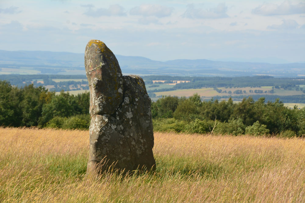
Gray Stone (Dunning) submitted by Anne T on 26th Jul 2018. Getting closer to the stone, approaching it from the gate into the field (south), we started to see the 'shoulder' on its northern side.
(View photo, vote or add a comment)
Log Text: The Gray Stone, Dunning: Thrilled to be seeing my second standing stone of the day (and one we were likely to get close to), we parked at the end of the driveway up to The Knowes farm. The stone is signposted, but the signpost follows the line of the fence and wood to the north west. Undecided whether to follow the sign and walk through the knee high grass or take the farm track which ran directly westwards. Consulting the map, we didn’t come to any firm conclusion, so to avoid having to climb over any fences, we ended up walking up the farm track, ending up at the cottage just before the gate to the big farmhouse to the left. Turning to our right here, in front of the cottage, there is a way across the deep, wide ditch which ran to our right hand side all along the track, then followed another farm track which ran north east to two field gates at NO 02171 11700. Opening the left hand gate, we let ourselves into the field, and the stone was immediately in front of us, about half way along the middle of the field, near to the fence line with the neighbouring wood which is to the stone’s eastern side.
Walking towards the stone (through what looked like a field of wheat, looking back on the photos, but is actually tall, yellow grass which has gone to seed) which is about 7ft tall, we realised it had a ‘shoulder’ to its northern side. Having seen a few other stones like this recently (the Megget Stone springs immediately to mind), I wondered if this had been deliberately cut like this, but looking at the bashes this stone has had, and the cracks and loose pieces on it, it looks as if it has fractured and a piece fallen off.
Whilst the views to the south and east are blocked now by forestry, there was a great vista northwards to Dunning and the hills (which appeared as a blue mist) in the far distance. On its northern side, there is a change in slope down from the stone; to its west and slightly to the south, there is a very slight rise. I wondered if the change in ground level might be because either farming, or perhaps a prevailing wind over time, has caused the ground level to build up here.
A very peaceful and beautiful place.
Great North Museum
Trip No.72 Entry No.1 Date Added: 10th May 2018
Site Type: Museum
Country: England (Tyne and Wear)
Visited: Yes on 4th May 2018. My rating: Condition 4 Ambience 4 Access 5

Great North Museum submitted by durhamnature on 25th Jul 2012. The Great North Museum, formerly the Hancock. The best museum in the north east.
(View photo, vote or add a comment)
Log Text: Great North Museum, Newcastle: The last time I visited here was some 8 or 9 years ago, with some police officers from York. We spent most of our time at the Hadrian's Wall exhibit, with them comparing Roman soldier's battle kit to their modern day riot gear. I found the layout of the galleries confusing, and the signs not terribly clear, but we spent a good couple of hours looking at Anglo Saxon artefacts and rock art. I also enjoyed the Ancient Egyptian gallery, and found the Mouse House for under 5's - definitely a place to return to with my grand-daughter.
I'd love to come back to their library sometime, which is open to all. The coffee shop on the first floor was also good.
Great North Museum (Anglo Saxon Stones)
Trip No.72 Entry No.2 Date Added: 13th May 2018
Site Type: Museum
Country: England (Tyne and Wear)
Visited: Yes on 4th May 2018. My rating: Condition 3 Ambience 4 Access 5

Great North Museum (Anglo Saxon Stones) submitted by Anne T on 11th May 2018. This is the front of the Rothbury Cross head, described as one of the finest pieces of Anglo-Saxon sculpture from the Kingdom of Northumbria. It is carved with scenes of the crucifixion and other motifs. The museum sign says it was made about 100 years after the Lindisfarne Gospels but "clearly belongs to the same artistic tradition." From the collection of the Society of Antiquities of Newcastle upon Tyne. Submitted with the kind permission of the Great North Museum.
(View photo, vote or add a comment)
Log Text: Great North Museum, Anglo Saxon Exhibit: A small but nicely presented collection of Anglo Saxon cross fragments and grave goods. Ground floor. See general SID page for Great North Museum for main visit report.
Great North Museum (Rock Art)
Trip No.72 Entry No.3 Date Added: 13th May 2018
Site Type: Museum
Country: England (Tyne and Wear)
Visited: Yes on 4th May 2018. My rating: Condition 3 Ambience 4 Access 5
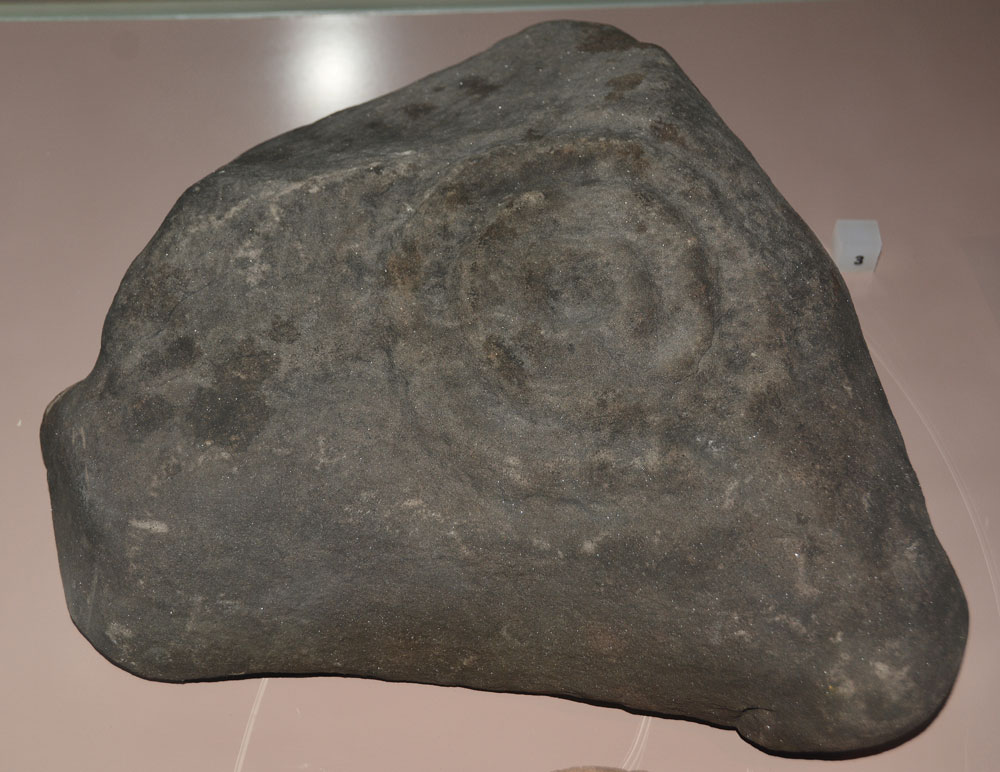
Great North Museum (Rock Art) submitted by Anne T on 10th May 2018. On display in a case in the Prehistoric display on the ground floor. Comparing photographs, I think this is Fowberry Moor Farm, Island/Deershed Plantation Panel, ERA-1842, Beckensall 179. The panel is stained dark red due to peat staining.
Submitted with the kind permission of the Great North Museum.
(View photo, vote or add a comment)
Log Text: Great North Museum (Rock Art): in the 'Prehistoric' Exhibition on the ground floor (see the general Great North Museum page for full visit report). A real shame that most of the exhibits were behind glass, and very close together, which made them difficult to photograph. It was nice to see some of the Beckensall RA stones which had been donated to the museum - but I wonder where the rest are, and there are quite a few. These seemed relatively poor examples given the photos I've seen on the ERA website. Much enjoyed seeing these.
Great Urswick Burial Chamber
Date Added: 26th Jun 2015
Site Type: Burial Chamber or Dolmen
Country: England (Cumbria)
Visited: Yes on 23rd Jun 2015. My rating: Condition 2 Ambience 3 Access 4
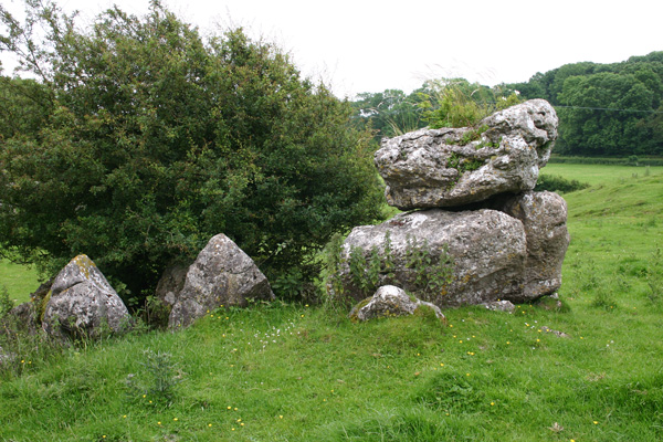
Great Urswick Burial Chamber submitted by ocifant on 26th Jun 2005. Looking south to the road.
(View photo, vote or add a comment)
Log Text: Great Urswick Burial Chamber, Cumbria: There is not much on the web about this site, and nothing (apart from a finger post in the vicinity) on ADS, apart from the fact this site is ‘ruined’ and ‘possibly Bronze age’. Parking on these narrow lanes was dreadful and were also very busy with traffic, so going round a bend you were likely to come bumper to bumper with a vehicle going the other way. When we finally found a grass verge with room for one car there was a large truck and a horse and rider stopped to natter to each other, so we drove around again – it would have been easier to walk from the village (also avoiding the bull in the field - see later).
The first part of the footpath across the meadows from Middle Barrow Lane was easy enough. There was a tumble-down stile, built up by a mound of stones on the far side (at grid reference SD 26018 7483). We then lost the footpath and ended up going through various fields towards the village.
We found a lone gate post sitting in a dip between two small hills. I thought at first it was a standing stone, but it had the remains of a hook embedded in it. Carrying on towards Great Urswick, there is a hill rising to the left hand side with limestone pavement on top. Walking up the slope the chamber comes into view, although I wasn’t convinced at first. The chamber lies within the context of surrounding limestone pavement, on a slope and largely consists of a few larger stones piled on top of each other with a gap between smaller stones lower down the slope. The whole chamber is mostly covered by large hawthorn bushes. I had to call up the photograph on the Portal to make sure we were looking at the right thing!
Walking back to the car, the footpath was clearly visible from this side, walking north westwards along the top of the hill. However, we were stopped dead in our tracks by a very large tan and white bull which splayed its front legs and stared us out. We turned quietly round and went back down into the shallow valley to follow the way we’d come. We found the footpath signs easily on the way back. There was an iron kissing gate in the hedge to our left hand side, followed by a short but steep climb into the field with the bull. Thereafter an easy walk to the burial chamber.
Great Urswick Cross
Date Added: 25th Jun 2015
Site Type: Ancient Cross
Country: England (Cumbria)
Visited: Yes on 23rd Jun 2015. My rating: Condition 3 Ambience 4 Access 5
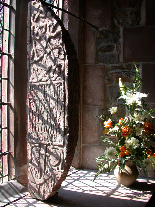
Great Urswick Cross submitted by nicoladidsbury on 5th May 2005. Ancient Cross at St Mary and Michael's Church, Great Urswick.
The stone was found on the site by a turn-of-the-century vicar and was investigated on the site by the respected historian WG Collingwood, and may possibly describe a meeting between two important church leaders, and church rune stone holds the key to a 1600 year-old story that reveals the origins of Christianity in Britain.
(View photo, vote or add a comment)
Log Text: Great Urswick/The Tunwini Cross, Great Urswick, Cumbria: Turning right off the A590 just south of Ulverston/Swarthmoor, along a road signposted only to ‘Urswick’, we headed off on narrow little lanes, just as the sun broke through the clouds. The village of Great Urswick is built round two sides of Urswick Tarn. The church can be found on the left/western side of the tarn, almost at the southern end of the village. A small car park allows visitors to draw up to the gate, where a footpath and stile runs off through the churchyard around the southern side of the tarn. Whilst the church itself is surrounded by trees, walking past the church to the southern boundary of the churchyard gives superb views over to Birkrigg Common.
Inside the church was pretty spooky, as the darkness seemed to suck all the light out. We found the light switches but none worked (must have been on a timer or master switch), so we were left to look around by the light of the few lamps that had been left on at the west end of the church.
Entering the church through the south porch, the Great Urswick/Tunwini Cross is on the first window sill on the south aisle, and is impressive in size. The church guide makes reference to two crosses; we were unable to find another fragment, although there was a drawing of another Viking cross with a knot design on the wall behind the font. The Furness Blog Spot, which I found this morning, tells me that this fragment is not on display in the church, but then doesn’t say where it is housed.
Going through the door to the belfry, we were immediately struck by the thickness of the walls, which was apparently a pele tower used to protect inhabitants and animals in time of war/marauders. In the chancel there are also some fantastic choir stall end carvings, all with cherubs playing different musical instruments.
At the entrance to the south porch there are clear marks on the eastern side where arrows have been sharpened, together with the remains of an old cow chain (the vicar used to apparently have grazing rights in the churchyard, although sheep are kept there now) and the barely visible remains of a mass hour dial on the western side of the porch.
Green Castle Ringwork
Trip No.36 Entry No.1 Date Added: 31st Jul 2017
Site Type: Misc. Earthwork
Country: England (Northumberland)
Visited: Yes on 30th Jul 2017. My rating: Condition 2 Ambience 3 Access 5
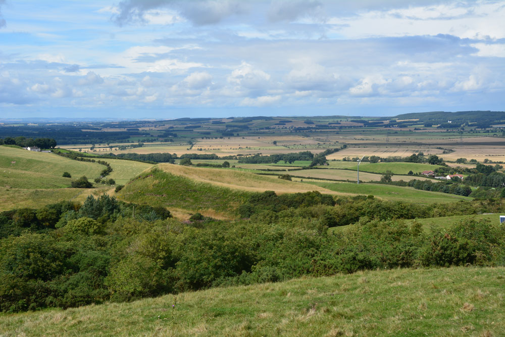
Green Castle Ringwork submitted by Anne T on 31st Jul 2017. Climbing (sorry, walking!) up the track from the small parking area near the cattle grid to Wooler Common, we got a good view of the mound from the top. It looks distinctly saucer shape, hence the Cup and Saucer name.
(View photo, vote or add a comment)
Log Text: Green Castle Ringwork, Wooler: After having stopped off at the ‘usual café’ in Wooler for refreshments, we headed off towards Wooler Common, from the High Street taking Ramsey Lane which becomes Common Road.
At NT 98195 27735 there is a small parking area, where a footpath leads south westerly up and over the Common. From here, the Ringwork looks like part of a giant rubbish tip, with its south and western sides protruding up over the hedgerow like a giant green triangle. Given that to it’s south east there is a huge area for storing skips, it looks at first sight as if the mound is used for a rubbish dump, but it’s not.
There is no access into the field the ringwork sits in (gates are padlocked, and the only gate that opened (immediately opposite the parking area) led down to a wooded area and small ravine.
We actually got a good view of what looks like a ‘Refresher’ sweet by walking up the path towards The Kettles. From here, even the stones in the south western side, where the mound has been eroded, are visible, together with a short section of ditch.
I didn’t spot the telephone wire snaking across the photograph until I loaded it onto my computer.
Green Humbleton Hillfort
Trip No.37 Entry No.8 Date Added: 8th Aug 2017
Site Type: Hillfort
Country: Scotland (Scottish Borders)
Visited: Saw from a distance on 6th Aug 2017. My rating: Condition 3 Ambience 4 Access 3

Green Humbleton Hillfort submitted by NeilD on 6th Oct 2003. Green Humbleton-2
Northumberland
NT 846277
(View photo, vote or add a comment)
Log Text: Green Humbleton Hillfort: Having been virtually blown off the hillside at Green Humbleton Scooped Settlement on our way up the Pennine Way, we decided we’d visit the Stob Stones first and see if the wind died down on our way back. If the wind was bad on Stob Rig, then what would it be like on the top of this cone-shaped hill? It didn't, so reluctantly we decided to try on a warm, sunny day.
By the time we walked back down the Pennine Way/St Cuthbert’s Way, we were absolutely soaking wet, but at least in the valley below the wind had died down. Rather than the 6-8 cars in the parking area by Bowmont Water, there was only one camper van and our car. A lovely spot for some ‘wild camping’.
Green Humbleton Settlement
Trip No.37 Entry No.5 Date Added: 8th Aug 2017
Site Type: Ancient Village or Settlement
Country: Scotland (Scottish Borders)
Visited: Yes on 6th Aug 2017. My rating: Condition 2 Ambience 4 Access 3

Green Humbleton Settlement submitted by Anne T on 8th Aug 2017. The western half of the scoop. Green Humbleton Hill can be seen just starting to rise up on the middle/upper right hand side of the image. The hillfort certainly dominated the western view.
(View photo, vote or add a comment)
Log Text: Green Humbleton Scooped Settlement, Yetholm: Now this was a settlement I could get excited about, and what views! If the first two enclosures on the way up here were somewhat dull, this more than made up for it! To the north and east the land dropped steeply away to Humbleton Syke and to the west Green Humbleton hillfort dominated the view.
By the time we got here, the wind was absolutely howling and we had to retreat to the walls of the scoop to get some respite.
There is a very clear oval scoop with a D-shaped enclosure to its north. To the north east of the D-shape there were some stones that Andrew called me over to look at. I did want to be persuaded they formed a cist. What a place to be buried. It could be a well, but there is no mention of either in the Canmore records.
If it hadn’t been so windy, I would have loved to have spent more time here. With the dark clouds looming, we decided to go up to the Stob Stones rather than risk being blown off the top of Green Humbleton hillfort. If the weather was favourable, we’d try on our way back.
Grey Stones (Barningham Moor)
Trip No.117 Entry No.5 Date Added: 12th Feb 2019
Site Type: Ancient Village or Settlement
Country: England (Yorkshire (North))
Visited: Yes on 6th Feb 2019. My rating: Condition 2 Ambience 4 Access 4
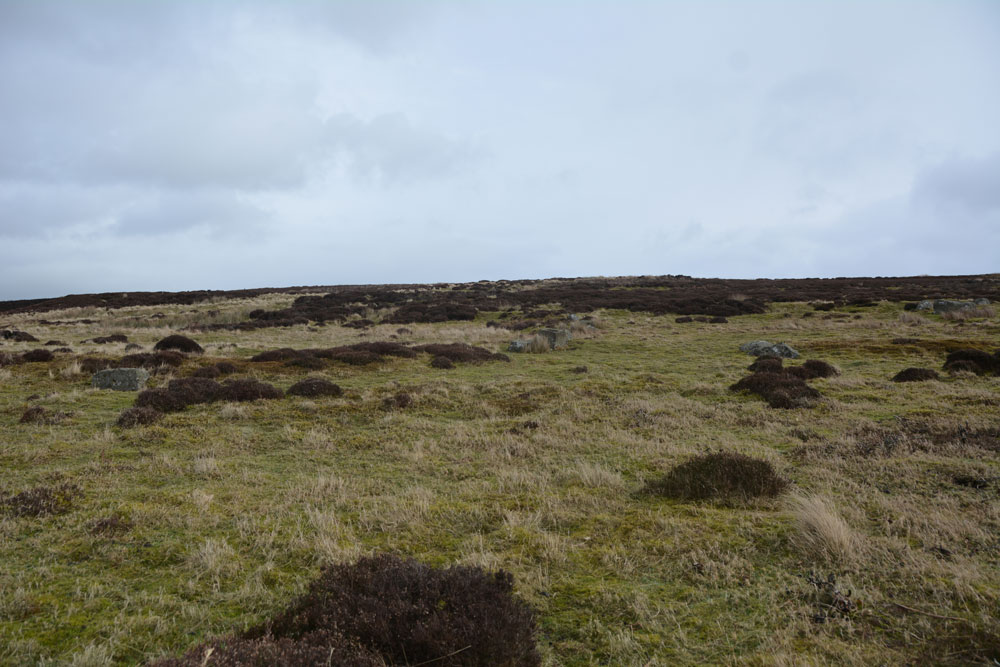
Grey Stones (Barningham Moor) submitted by Anne T on 12th Feb 2019. Looking virtually east across the settlement, from its southern most side. The circular bank, which incorporates the stone blocks, can just be made out.
(View photo, vote or add a comment)
Log Text: Grey Stones Settlement, Barningham Moor: As we parked just to the east of this settlement and walked south onto the moor, it was obvious we were walking up into something, but what that something was a little difficult to make out, until I started to be able to see low, circular banks. The blocks positioned on the banks made these easier to see.
Taking some photos and later comparing them with the HE and Pastscape records made it easier to understand what it was we were standing in. I’d love to go back with the notes and walk around again.
The carved rock (Barningham Moor 97) is within the settlement.
Greystoke Village Cross
Trip No.146 Entry No.7 Date Added: 30th Aug 2019
Site Type: Ancient Cross
Country: England (Cumbria)
Visited: Yes on 27th Aug 2019. My rating: Condition 3 Ambience 4 Access 5
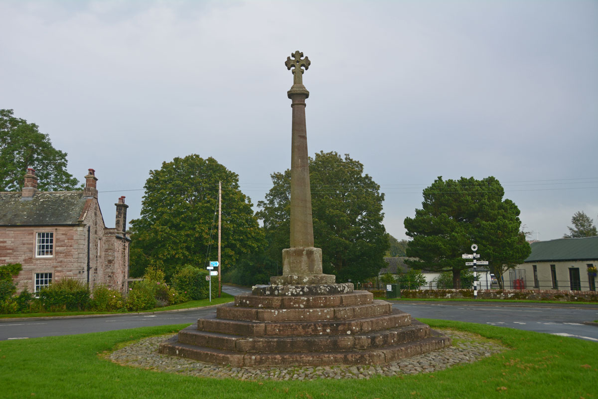
Greystoke Village Cross submitted by Anne T on 30th Aug 2019. Looking eastwards across the village green and the cross, along the B5288 which goes to Click Em and Pallethill.
(View photo, vote or add a comment)
Log Text: Greystoke Village Cross: We've been to this area before, on the hunt for the possible Newbeggin Stone Rows, but never driven into this very pretty little village. We left this until the last stop of the day (just before the rain started to hurl down), after having seen the Eyekeld Well, the village Church and the Sanctuary Stone.
There are parts of the original medieval cross built into this largely 'modern' structure. Whilst Pastscape and HE say the socket stone is original, it looked like the top three steps were original (the new socket stone had chamfered and shaped corners and was a much brighter/less weathered stone than the rest).
Hadrian's Wall (Brunton Turret)
Trip No.142 Entry No.1 Date Added: 7th Jul 2019
Site Type: Misc. Earthwork
Country: England (Northumberland)
Visited: Yes on 4th Jul 2019. My rating: Condition 3 Ambience 4 Access 4
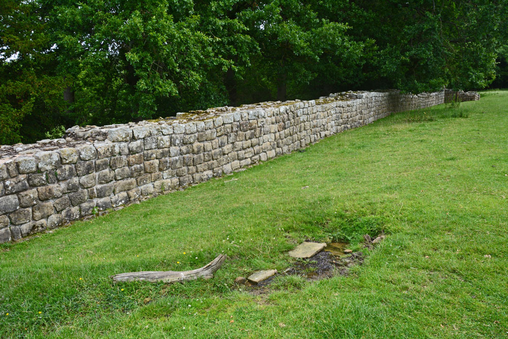
Hadrian's Wall (Brunton Turret) submitted by Anne T on 7th Jul 2019. Walking east along with wall, from near its south western corner. The small structure in the right/foreground is the spring, which was flowing freely at the time of our visit. There were the remains of some stone slabs around where it emerged from the ground.
(View photo, vote or add a comment)
Log Text: Brunton Turret 26b, Hadrian's Wall: Parked at the layby by the stile. We met a party of four Americans who were walking the wall and who had started at Newcastle on Monday, and from Corbridge this morning. I wished them a ‘happy 4th July’ and one of the ladies replied “Good job we’re friends again”, which raised a smile.
There was also a spring at NY 92109 69847 with the remains of a structure around it, flowing quite quickly and forming a small stream running downhill and round the bottom end of the turret.
The information sign at the top end of the site reads: ”Turrets were positioned equidistantly between largely milecastles where small garrisons of soldiers guarded gates that allowed for trave lthrough the Wall. Shortly after work on the wall started, large forts, such as Chesters, were also constructed to house garrisons of between 500 and 1,000 soldiers.
(Image) Right: layout of Brunton turret. The ‘curtain’ wall is a different thickness on each side of the turret. The turret was laid out with short ‘wing’ walls either side. These were supposed to be incorporated within the curtain wall once it was finished. But between completing the section of the Wall to the west and that to the east, the builders were ordered to narrow the curtain wall. This left about 1m of eastern wind-wall exposed”.
Hadrian's Wall (Chesters Bridge Abutment)
Trip No.142 Entry No.2 Date Added: 7th Jul 2019
Site Type: Misc. Earthwork
Country: England (Northumberland)
Visited: Yes on 4th Jul 2019. My rating: Condition 3 Ambience 4 Access 4
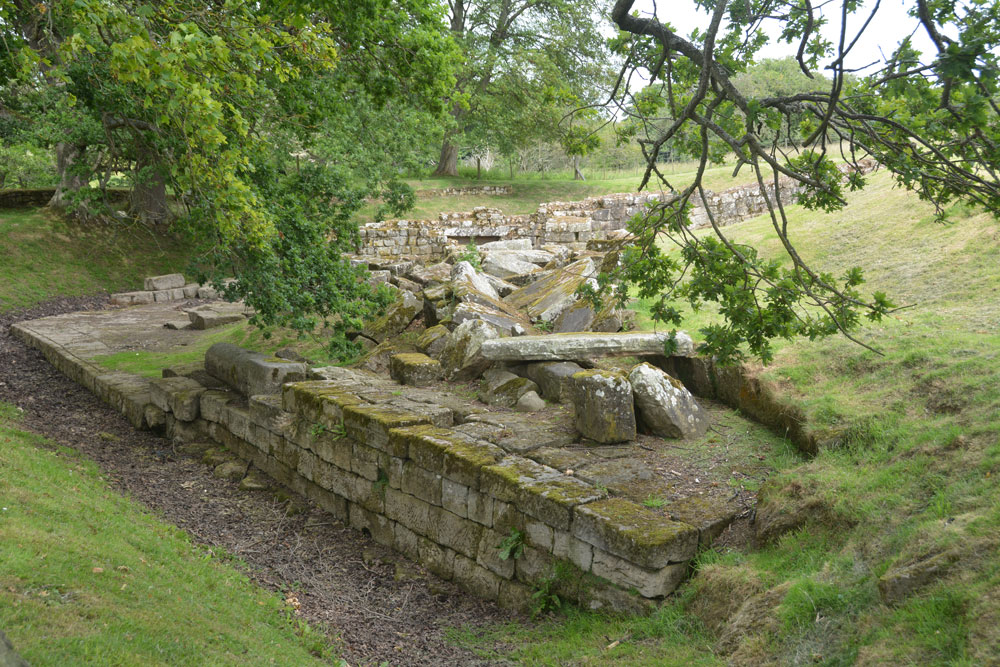
Hadrian's Wall (Chesters Bridge Abutment) submitted by Anne T on 7th Jul 2019. A look at the western side of the bridge abutment, giving an idea of its substantial structure and size. Behind me is a huge store of blocks which have fallen from the structure over the years and have been placed neatly waiting for restoration at some point?
(View photo, vote or add a comment)
Log Text: Chesters Bridge Abutment: It's been some time since we came here to photograph the rock art panel, which is still here (although heavily lichen covered). This is where “The River Hunters” did a search in their series not long ago, just opposite the bath house at Chesters on the opposite bank. This was visible from the bridge abutment.
We met the American party again and another gentleman who said he had been walking round the poppy field trying to get some good photos. I set him a challenge - looking for the phallus symbol and the rock art. He got quite excited about the symbol and told me that he walked the wall looking for these symbols. He'd recently been trying to find one near Gilsland but without success.
One of the sources used by Historic England is my book bought for £1 from Hexham car boot sale: Bruce, J C, Handbook to the Roman wall, (1863), 117-120 and Bruce, J C, Handbook to the Roman wall, (1863), 109-111
Hadrian's Wall (Coria)
Date Added: 3rd Aug 2019
Site Type: Stone Fort or Dun
Country: England (Northumberland)
Visited: Yes on 12th Jul 2015. My rating: Condition 3 Ambience 4 Access 5

Hadrian's Wall (Coria) submitted by Anne T on 3rd Aug 2019. Some of the granary structures in the north western part of the site.
(View photo, vote or add a comment)
Log Text: Corbridge Roman Site: Having lived near here for over 10 years, we'd never visited. We came primarily to see the Corbridge Rock Art panel, but were equally as interested in the well preserved remains of this small fort/town, with great views over to modern-day Corbridge and the Tyne Valley.
Hadrian's Wall (Heddon on the Wall)
Date Added: 17th Jul 2019
Site Type: Misc. Earthwork
Country: England (Northumberland)
Visited: Yes on 20th Sep 2018. My rating: Condition 3 Ambience 4 Access 5
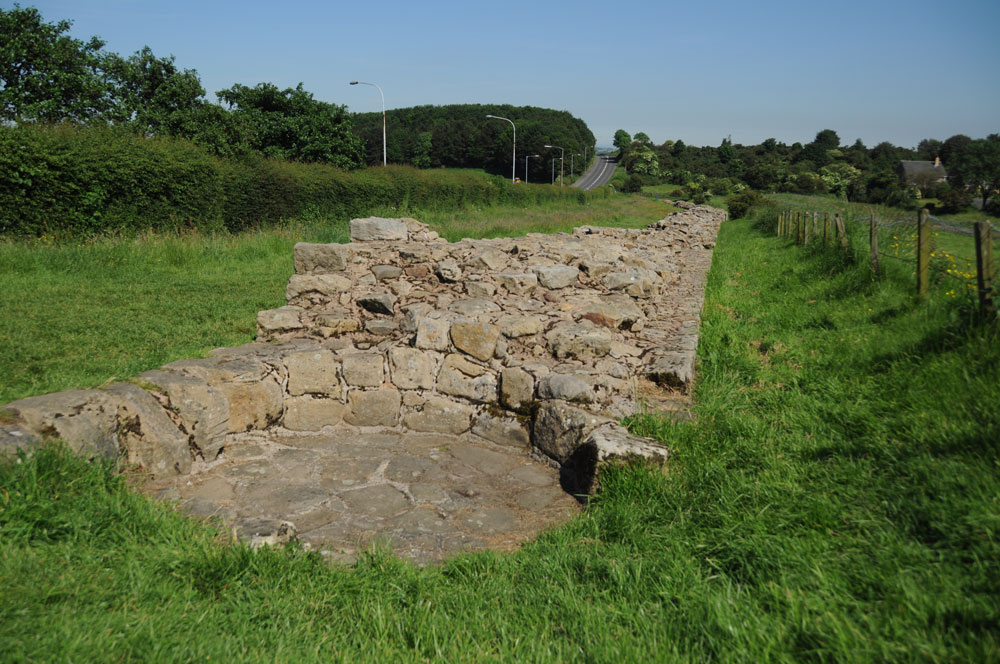
Hadrian's Wall (Heddon on the Wall) submitted by Anne T on 8th Jul 2019. This round structure, built into the body of the wall, is thought to be a medieval corn drying kiln. A creative use of this stone structure! Photo taken 14th June 2014. Looking east down the stretch of wall, with the B6528 running parallel, to the west of the line of the Wall.
(View photo, vote or add a comment)
Log Text: Section of Hadrian's Wall at Heddon-on-the-Wall: This well preserved section of the 'wide' wall can be found a few hundred metres to the east of the church, and comes as quite a surprise as I turned the corner from The Towne Gate, heading east.
There are some structures built into the body of the wall, one said to be medieval corn drying kiln. I saw quite a few tourists passing this spot on the other side of the B6528, but none stopped to walk into this part of the wall and take a closer look.
Hadrian's Wall (Poltross Burn)
Trip No.143 Entry No.1 Date Added: 11th Jul 2019
Site Type: Stone Fort or Dun
Country: England (Cumbria)
Visited: Yes on 8th Jul 2019. My rating: Condition 3 Ambience 4 Access 4
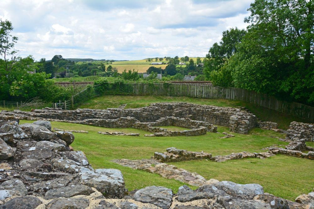
Hadrian's Wall (Poltross Burn) submitted by Anne T on 11th Jul 2019. Standing at the south western corner of the milecastle/small fort, looking towards its north eastern corner.
(View photo, vote or add a comment)
Log Text: Poltross Burn Milecastle: We last visited this site on 27th October 2013, and it hasn’t’ changed at all. Andrew, in typical engineering fashion, went round and talked about the offsets and revetted construction of this small fort. It’s layout is remarkably easy to read.
Andrew recalled reading about a house built right on top of the wall, but we were unable to find it.
