Contributory members are able to log private notes and comments about each site
Sites Anne T has logged. View this log as a table or view the most recent logs from everyone
Kilmartin House
Trip No.88 Entry No.10 Date Added: 18th Aug 2018
Site Type: Museum
Country: Scotland (Argyll)
Visited: Yes on 18th Jul 2018. My rating: Condition 4 Ambience 4 Access 5
Kilmartin House submitted by DrewParsons on 29th Jun 2010. Located in the middle of the village of Kilmartin, the museum has a good display of local finds and interesting descriptions of the prehistoric sites in the neighbourhood. There is also a well stocked museum shop on the premises.
(View photo, vote or add a comment)
Log Text: Kilmartin Museum: We managed to get a space in the car park. From the number of cars parked outside the museum and along the roads, we thought the place would be heaving with people (including a bus tour which had turned up), but the café was quiet and relaxing and there was only one other lady and a younger man who was with her, in the museum.
The museum was small, and a bit disappointing for the £7 entry fee, but it was nicely laid out and they gave you a map of the sites to visit. The lady on reception told us we were allowed to take photographs, but as long as they were not for publication on the internet.
I bought 4 postcards and “In The Footsteps of Kings” book of walks around the Kilmartin area, which gave a lot of information about the area, together with photographs and what to look for, which helped inform our visits greatly – wonderful photos in it, too!
I photographed Glebe Cairn from the path running outside the conservatory.
I have since been in contact with the Visitor Services Office, at the museum, and received the following reply on 14th August 2018 (see private notes).
Barmishaw Stone
Date Added: 20th Apr 2015
Site Type: Rock Art
Country: England (Yorkshire (West))
Visited: Couldn't find on 17th Apr 2015
Barmishaw Stone submitted by DavidRaven on 3rd Nov 2003. The Barmishaw Stone. Very faint carvings including the odd 'ladder' motif. I
could hardly make out the shapes. The stone is just above the wood near the
'Keighley Road' track that traverses the moor, west of White Wells, by a
footpath.
(View photo, vote or add a comment)
Log Text: Barmishaw Stone, Ilkley: we planned to find this piece of rock art after visiting the Comet Stone as it's not far away. From the small car park on the Keighley Road near the Comet Stone grid reference, there is no direct footpath but a track through the moorland grass could be made out. My husband was bold enough to try, but his route was blocked by a rock face. An approach from a different direction will be needed on our next visit.
We abandoned finding this stone to get to the Wulfhere Cross at Addingham before the church closed for the evening.
Cow and Calf Rocks
Date Added: 16th Jul 2017
Site Type: Rock Outcrop
Country: England (Yorkshire (West))
Visited: Yes on 30th Jun 2014. My rating: Condition 3 Ambience 4 Access 4
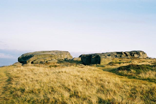
Cow and Calf Rocks submitted by andy_h on 10th Nov 2003. The most prominent landmark for miles around. There are no visible megalithic remains at this huge rock outcrop, but local folklore refers to this being a place worthy of strong consideration.
I've always found it a little strange that as the most prominent landmark for miles around, the Cow n' Calf didn't bear any cup n' ring marks as they can be found both to the left and the right of the outcrop. It is possible that any that may have been on the rock could have been lost under the onslaugh...
(View photo, vote or add a comment)
Log Text: Cow & Calf Rocks, Ilkley: We visited here on a very blustery day after having seen Maiden Castle hill fort. By now rain was threatening and the moorland bleak. Parking at the café down below, we walked up the footpath. The view from the Cow and Calf over to Ilkley was great, although there were lots of people around. Walking into the horseshoe shaped quarry next to these crags there were groups of climbers roped up to the rock face.
All Saints (Otley)
Date Added: 2nd Apr 2015
Site Type: Ancient Cross
Country: England (Yorkshire (West))
Visited: Yes on 25th Mar 2015. My rating: Condition 3 Ambience 4 Access 5

All Saints (Otley) submitted by Anne T on 2nd Apr 2015. The collection of Anglo Saxon cross pieces inside All Saints, Otley, next to the Fairfax tomb. There are some good display panels which explain what you are seeing.
(View photo, vote or add a comment)
Log Text: Anglo Saxon Crosses, All Saints, Otley: Having been to Leeds in the morning, we decided to make the rest of the day one of exploration (the first one for a long time!), so made our way back to the north-east via Otley, Weston and Weston Moor. Coming down into Otley from the A660 from Leeds, All Saints is clearly visible in the town centre. We managed to park right outside the church on Burras Lane. Whilst the crosses are well worth seeing, the display of crosses in the church is a little disappointing - on the day we visited they were surrounded by stacked chairs, music stands, speakers and other things, making them seem unimportant.
Right next to the impressive tomb, there are good display boards describing what you are looking at (although no guide book that we could find).
In the churchyard, we found what looked like part of another Anglo Saxon cross shaft in the north-west corner, piled with other architectural pieces. There is an amazing old yew tree with branches touching the ground in places. Nice coffee shops in the vicinity.
St Oswald (Guiseley)
Date Added: 11th Apr 2015
Site Type: Ancient Cross
Country: England (Yorkshire (West))
Visited: Yes on 10th Apr 2015. My rating: Condition 3 Ambience 4 Access 5

St Oswald (Guiseley) submitted by rldixon on 29th Apr 2010. detail of rear of cross head
27-04-2010
(View photo, vote or add a comment)
Log Text: Anglo Saxon Cross, St. Oswald's Church, Guiseley: I had tried on several occasions to phone the vicar, the parish office and some of the church wardens to find out if the church was open during the day, even leaving messages on voice mails which weren’t returned. A couple of hours before our visit I did manage to get through to one of the churchwardens who said it was no trouble to meet us at the church at 1pm. “We always aim to please,” he told me. The church is apparently now kept locked as they caught some intruders levering brass plaques off the church wall but they always try and accommodate visitors.
I’d explained in advance that we wanted to see the Anglo Saxon cross, and expected to keep him only 10-15 minutes. But on arriving at the church he told us he was going to give us the “full church tour” – 1 hour and 40 minutes later I felt very rude when I had to make excuses as we were expected over at All Saints in Weston and had to cut the tour a little short. Make no mistake, St. Oswald’s church itself is very interesting and this gentleman knew his history; he spoke with knowledge and enthusiasm - the time flew by.
On the left hand side of the main entrance there can be seen the vague outline of one of seven original consecration crosses (now the only one remaining); the church unusually has two sanctuaries, it is also where the parents of the Brontes were married and the Patrons of the church include Trinity College Cambridge.
Entering through the porch with its now interior original Norman archway into the church, the Guiseley cross is immediately on your left hand side at the north entrance to the baptistery. Dating from the 9th century, it is very obviously an original cross shaft, mounted on a stone block with one part of a cross arm bolted/cemented on top to make it look like a full cross. The whole is blackened by soot and the churchwarden told us it had stood for many years outside in Town Gate nearby. He told us the church had considered having the cross cleaned but been advised to keep it in its current state. I found it difficult to photograph due to the bright spotlights shining down on it (had we been on our own we would have turned the lights off) and the proximity of the rear of the cross due to the stone column behind.
The churchwarden led us to what we were told was the original Saxon part of the church (now the Lady Chapel? I haven’t been able to find a floor plan of the church to double check this). He told us as a small boy he attended worship with his class from school to find two gentlemen had lifted up a slab in the floor of this part of the church; he could see a staircase leading downwards and was told there was a charnel house with many bones it in. It’s not accessible to the public and he hasn’t been down there since he saw it as a youngster.
The southern aisle is unmistakeable Norman with the original columns (although the churchwarden said there was some debate about whether or not this had been moved to accommodate a further extension at some time). There are some very notable stained glass windows in the church and one of the original box pews.
My one regret was that having to rush away to All Saints in Weston as we were very late, I wasn’t able to get any photographs of the exterior of the building. I had little time to also look at the cross. We had an invitation to phone up and arrange another visit sometime soon, and we will do that as there wasn’t enough time to take everything
Westwood Drive 01
Date Added: 19th Apr 2015
Site Type: Rock Art
Country: England (Yorkshire (West))
Visited: Visited (still working on) on 17th Apr 2015. My rating: Condition 2 Ambience 2 Access 5
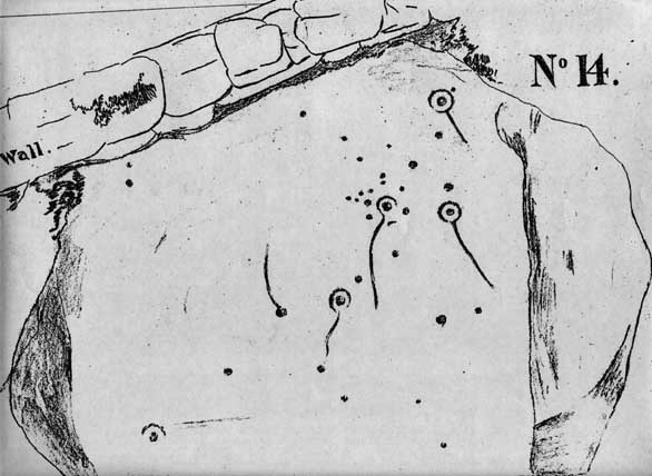
Westwood Drive 01 submitted by brigantia on 30th Nov 2006. The Comet Stone:
First known drawing of this carving done around 1878 and collated in J. Thornton Dale's previously unpublished "Collection of 14 drawings of cup-marked rocks deposited at Ilkley Library, prepared and presented by Dr. Call" in 1880.
(View photo, vote or add a comment)
Log Text: The Comet Stone, Ilkely: (we found the grid reference but queried if this was the stone): From the Panorama Stones, driving the 700 metres up towards the moor we parked by the footpath sign just west of the junction of Moorlands and Westwood Drive and headed up the steep path (with steps) onto the moor (to get nearer, Keighley Road travels up onto the moor and there is a small car park near to the grid reference given).
The grid reference led us to the back stone wall of a house. The grass had been badly overgrown and someone had put weed-killer down on this patch of ground, but nettles were springing up in between the dead undergrowth.
Walking up and down the wall and identifying several possible stones, the grid reference led us back again and again to the same stone over which the stone boundary wall between a garden and the moorland was built. Cheekily peering over the wall of the house, found the stone extended some way into the garden. It had shrubs growing over the sides and was covered by moss and twigs so it wasn’t possible to make out any of the rock art by eye.
Shame, as I thought I’d be the first to submit a photograph of this stone, but it will take a knock on the door of the house when someone is in to get permission to go round and look!
Panorama Stone
Date Added: 19th Apr 2015
Site Type: Rock Art
Country: England (Yorkshire (West))
Visited: Yes on 17th Apr 2015. My rating: Condition 3 Ambience 3 Access 5
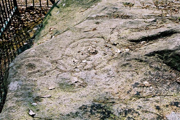
The Panorama Stone, Ilkley, West Yorkshire submitted by andy_h on 15th May 2003. Now situated in Victorian railings, in a small piece of woodland opposite St Margaret's Church. They were moved from their original location before late Victorian development around the Panorama Rocks. All three stones have Cup and Ring markings, the largest featuring the famous 'Ilkley Ladder' motif. Although it's very hard to make out as the designs are now badly worn.
(View photo, vote or add a comment)
Log Text: Panorama Stones, Ilkley (Rock Art): Climbing up out of the town centre, we found St. Margaret’s Church on Queen’s Road easily and parked outside it. Just across the road there is indeed a small wood and the enclosure around the Panorama Rocks can be clearly seen.
I have to say it felt like a “Do not feed the rock art” notice should have been placed on the railing around the enclosure (sorry, just my sad sense of humour), and although worn the rock art was good to see although very worn and it was easy to understand the railing was to stop people clambering all over the rocks and wearing them away further.
Of the three stones, the rock art on the largest stone (broken into four pieces and reassembled) was easiest to see. I could just about make out some cup marks on the two smaller stones.
Whilst we were there another couple came along, studied the board and said “Oh, rock art” then wandered away again - clearly impressed.
Worth a visit if you're passing.
All Saints (Ilkley)
Date Added: 20th Apr 2015
Site Type: Ancient Cross
Country: England (Yorkshire (West))
Visited: Yes on 17th Apr 2015. My rating: Condition 3 Ambience 4 Access 5
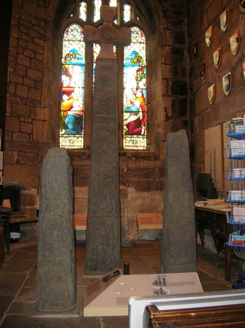
All Saints (Ilkley) submitted by TimPrevett on 2nd Sep 2007. The three superb crosses within All Saints' Ilkley. Further details available on the church's website.
Many thanks to my wife for taking time out of a trip to visit and photograph these for me, and to the church for enabling the visit by arrangement.
(View photo, vote or add a comment)
Log Text: Three Anglo Saxon Crosses, All Saints, Ilkley: On the way I telephoned All Saints in Ilkley to find out if they were open as some churches we've visited recently have been kept locked because of vandalism. A very nice lady in the Parish Office answered and told me the church was open until dusk and that we’d be very welcome to visit.
We found the church easily enough, being just out of the town centre. We parked in a nearby car park, just off West Street (grid reference: SE 11593 47690) which is central for the shops as well, and walked round to the church.
The three Anglo Saxon crosses are kept under the 15th century tower in the west end of the church. They are impressive, although cluttered up with other things being used by the church and such bright spot lights I had to use flash to counter-balance the light. The light also streamed in from the window in the west end making photography (for me) a little difficult. There are some good interpretation boards, and also three Roman altar stones displayed against the west wall.
The tallest cross is impressive, although the cross shaft and cross head are an amalgamation of two pieces; the cross-piece on top came from the River Wharfe where it was found in 1884. The top panel on the front of the cross (as it is displayed) “depicts Jesus seated in glory with a palm branch or pastoral staff in one hand and the other hand raised in blessing.” I confess to thinking at first that the palm branch was a set of ribs and I was looking at a skeleton! I was rapidly corrected.
The second tallest has the most beautiful carving; even though worn and damaged (it has in the past been used as a churchyard gatepost). It has cable edging and rounded scroll stems.
The smallest cross (to the left of the tallest cross as you face the west window) probably dates from the late eighth century.
The interpretation boards say that these crosses were probably grave markers although other sources say they are preaching crosses.
There were some other lovely features in the church – a box pew dating from Elizabethan times (dated 1633) and a font cover with an impressive counterweight.
After this we ended up at Betty’s for a much welcome pot of tea and toasted tea-cake with strawberry preserve - much recommended.
Billey Keld
Trip No.161 Entry No.6 Date Added: 8th Jun 2021
Site Type: Holy Well or Sacred Spring
Country: England (Yorkshire (West))
Visited: Yes on 31st May 2021. My rating: Condition 3 Ambience 3 Access 4
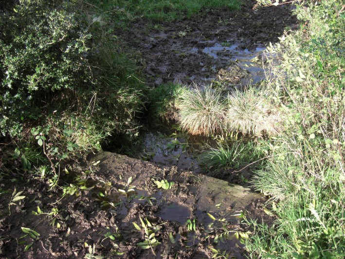
Billey Keld submitted by jamesrattue on 23rd Oct 2008. Billey Keld at Grewelthorpe, photographed 15th October 2008.
(View photo, vote or add a comment)
Log Text: Billey Keld Well, Grewelthorpe: With some very lively bullocks in the field, we decided not to venture into the field through the gate to look at well. However, we managed to see some of the structure from the roadside.
A local lady walking her dog stopped to talk to us and say she remembers visiting the well to collect water when she was a child.
All Hallows (Bardsey)
Trip No.19 Entry No.3 Date Added: 2nd May 2017
Site Type: Ancient Cross
Country: England (Yorkshire (West))
Visited: Yes on 27th Apr 2017. My rating: Condition 3 Ambience 4 Access 5
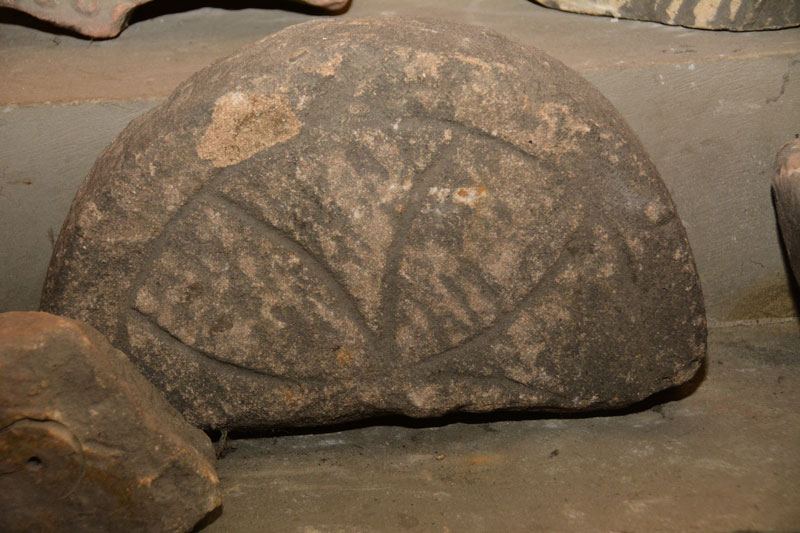
All Hallows (Bardsey) submitted by Anne T on 2nd May 2017. Close up of the cross head fragment. This is very similar to one embedded into the vestry wall at St. Oswald's @ Collingham.
(View photo, vote or add a comment)
Log Text: Anglo Saxon crosses, Bardsey, West Yorkshire: This is a very lovely spot, not far from the main A58 travelling south into Leeds. Considering how close it is to the main road, this is a peaceful, tranquil spot. Having checked with the parish office beforehand, the church is open all day until 5pm.
First impressions of the building were lovely. Approaching from the west wall, there is evidence on the external wall of many different roof lines, inserted windows and additions. Inside the building it is fascinating to see the tower, complete with windows, now completely absorbed into the interior.
Whilst there, a group of four people came in and started asking us questions about the building, of which I could only answer a couple. We gave them the church guide leaflets.
I found the collection of ancient stones on both sides of the door into the Maleverer Chantry. I most liked the 12th century font bowl, which Andrew found in two pieces at the base of the steps, tucked into a dark corner, the cross head fragment and the 11th century grave marker inscribed with a crude Latin cross.
Collingham Crosses
Trip No.19 Entry No.5 Date Added: 2nd May 2017
Site Type: Ancient Cross
Country: England (Yorkshire (West))
Visited: Yes on 27th Apr 2017. My rating: Condition 3 Ambience 4 Access 5
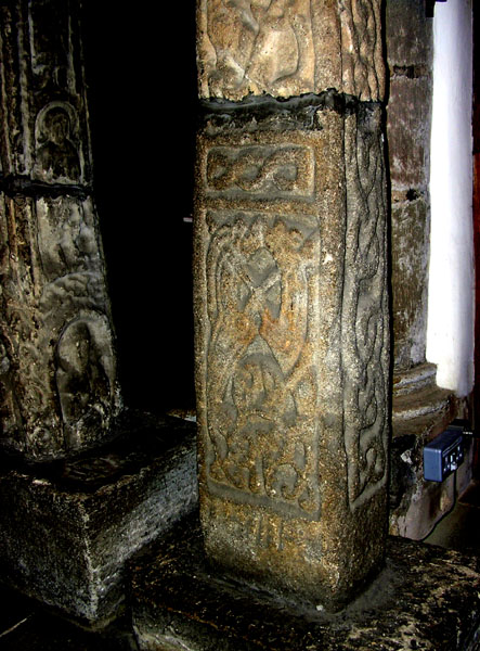
Collingham Crosses submitted by Thorgrim on 22nd May 2005. Dated to about 875 AD (the early years of the Viking occupation of the land around York) this cross is known as the Aerswith Cross. It shows clear Jellinge style carvings in the Danish manner.
(View photo, vote or add a comment)
Log Text: Collingham Crosses, West Yorkshire: What are the chances of meeting someone whose grandparents built the house you live in now and has recollections of visiting, together with photographs of what the house used to look like? The grandparents of Rev. Sylvia Earle who is vicar of Collingham did in fact build our house, and she was able to tell us what it was like when she was younger, and provided us with a photograph of what our (then) bungalow was like when it was first built.
The church has to be kept locked these days as Rev Earle told us someone had stolen a fragment from the west end, and someone tried to set a fire against the wood panelling at the east end of the north aisle. Shame.
We were left with the keys to return once we’d finished, so spent a good 40 minutes wandering around the church, photographing the crosses and fragments, including the cross fragment built into the north wall of the vestry. The Victorian builders built the nave and chancel at an angle. The Runic and Apostle crosses were lovely, together with the unusual round creset.
Most of the furniture within the building looked new and well cared for, with pristine kneelers. Much enjoyed this visit: we were made very welcome and this is a pleasant sanctuary inside, although the noise from the A58 invaded the privacy of the churchyard.
Berry Well
Trip No.161 Entry No.4 Date Added: 8th Jun 2021
Site Type: Holy Well or Sacred Spring
Country: England (Yorkshire (West))
Visited: Yes on 31st May 2021. My rating: Condition 3

Berry Well submitted by jamesrattue on 23rd Oct 2008. Berry Well at Swinton, photographed 18th October 2008.
(View photo, vote or add a comment)
Log Text: Berry Well, Swinton Park Hotel: After St Michael's Well in Well, we stopped off in Masham for refreshments, stopping to photograph the water troughs/Renton Well in Masham before setting off to find Berry Well.
We parked at SE 21443 79735, just to the south of the hotel lodge gates. As I stepped out of the car, I immediately noticed the trough.
The area of grass verge up to the well from the hotel gates has been recently strimmed. The sound of running water can be clearly heard. The well basin is well under the current ground level, and largely hidden by the weed trimmings. The water is piped under the road, although there is no indication that we could find of where the water goes to.
There is a pond on the other side of the wall, which feeds the well. There is a small, lively, very clear stream which wends its way down a very gentle slope in the grounds of the Swinton Park Hotel. (The gates of the hotel were open, so we popped in and followed the wall along).
There is another section of trough on the hotel side of the wall.
Ings Well (Mickley)
Trip No.161 Entry No.7 Date Added: 9th Jun 2021
Site Type: Holy Well or Sacred Spring
Country: England (Yorkshire (West))
Visited: Yes on 31st May 2021. My rating: Condition 3 Ambience 4 Access 4
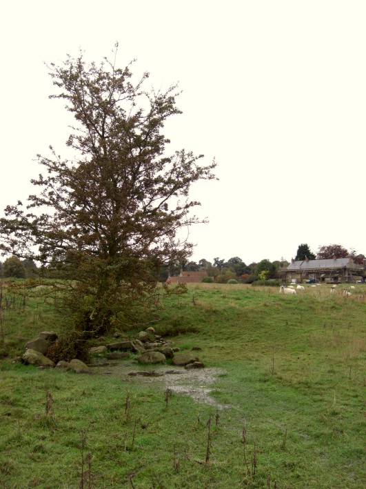
Ings Well (Mickley) submitted by jamesrattue on 23rd Oct 2008. Ings Well at Mickley, photographed 15th October 2008.
(View photo, vote or add a comment)
Log Text: Ings Well & Spring, Mickley (North Yorkshire): Our last stop of the day, and what a pretty site, with an easy walk down the Ripon Rowel Way from Mickley village. Note: there was a very rickety stile to cross as you entered the field at SE 25833 77052 (the top step was like a see-saw, although climbing the gate might have been easier!).
Sited under a lone hawthorn tree to the left hand side of the footpath, water flows freely out of the ground and spreads out into the field.
At SE 25954 77141 a large wooden post marks the location of a spring, the waters of which appear to flow south-east to north-west along a drainage channel. I wanted to investigate further, and also walk to another well (marked 'W' on the HE map search) at SE 26090 77149, but the field was far too wet and boggy and I was sinking up to my ankles in water. So wish I'd taken a pair of wellies!
St Peter's Minster (Conisbrough)
Trip No.17 Entry No.1 Date Added: 18th Apr 2017
Site Type: Sculptured Stone
Country: England (Yorkshire (South))
Visited: Yes on 15th Apr 2017. My rating: Condition 3 Ambience 4 Access 5
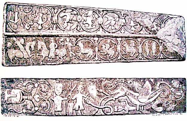
St Peter's Minster (Conisbrough) submitted by Sunny100 on 15th Aug 2010. Detailed illustration of the two early Medieval grave-slabs that are both richly carved with an assortment of mythical characters, beasts and symbols. These stone slabs are said to be the finest example of their kind in England.
(View photo, vote or add a comment)
Log Text: Anglo Saxon Carvings, Conisbrough: Having seen this on the Portal, with only a sepia image of the stones, I had been keen to visit this church for some time as it was only a short detour from my step-father's house; the nearby castle had been my very first ever school trip, over half a century ago (gulp). We managed to park in the (small) free car park outside the community centre, right next to the church.
We arrived just as the children’s Easter Egg hunt/service had ended, and children and parents streamed out of the church. With 2 year old grand-daughter in tow, desperate to join in, one lady coming out of the church saw us waiting and asked if we were visiting. When I said we were, she said we were very welcome, waited until the crowds had lessened, then took us in. Another gentleman took us round to see the grave stones and made sure we had the free history leaflet of the church. Grand-daughter and husband made a great game of finding all the Mouseman mice on the pews.
The church, whilst it looks Victorian from the outside, clearly has some very old parts, evident in the blocked up windows in the arches in the nave, and the tower. The church guide tell us that this is the "oldest building in South Yorkshire and is one of the ten oldest churches in England, with parts dating back to at least 750AD." The church warden was telling us that the church came many years before the castle, and so is sited on the highest part of the town; the castle therefore had to take the second highest spot.
As well as the grave stones, there is the very worn shaft of a cross outside, which the church guide leaflet says dates from the very earliest times of this church, around 750 AD. Lovely welcome and well worth the detour. Carried on to look at the castle before heading off into Doncaster.
Robin Hood's Well (Burghwallis)
Trip No.64 Entry No.1 Date Added: 16th Jan 2018
Site Type: Holy Well or Sacred Spring
Country: England (Yorkshire (South))
Visited: Yes on 15th Jan 2018. My rating: Condition 2 Ambience 2 Access 5
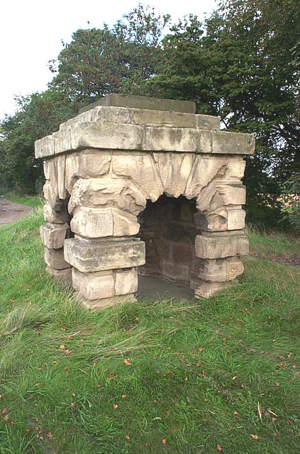
Robin Hood's Well (Burghwallis) submitted by Andy B on 18th Oct 2010. The old well has now been capped with concrete.
(View photo, vote or add a comment)
Log Text: Robin Hood's Well, just off the A1 near Burghwallis: With the rain pounding down on the car and a warning light just appeared on the car dashboard, we were glad to pull off the A1 near Burghwallis. It was easy enough to pull onto the layby (it was a busy place), but difficult to get back onto the A1 and we had to wait quite a long time for a big enough gap in the traffic to appear.
I pulled my coat on and headed off the few metres from the car to the well housing, getting soaked on the way. Having wanted to stop off here for years, but never having succeeded, I confess to being really disappointed. This really is just a recently constructed stone 'well house', with a bit of graffiti inside and a vague hollow for where the well pipe might have been situated. Still, I achieved it and got a few photos, having to wipe the camera down well once I huddled back in the car to warm up.
Little John's Well (Hampole)
Trip No.64 Entry No.2 Date Added: 16th Jan 2018
Site Type: Holy Well or Sacred Spring
Country: England (Yorkshire (South))
Visited: Yes on 15th Jan 2018. My rating: Condition 2 Ambience 2 Access 5

Little John's Well (Hampole) submitted by Creative Commons on 8th Feb 2013. Little John's Well. Located in woodland just off the A638 North of the road to Skelbrooke.
Copyright Gerald England and licensed for reuse under the Creative Commons Licence.
(View photo, vote or add a comment)
Log Text: Little John's Well, Hampole: Please note, when I say disabled access - the site is visible (just) from the road, but there are a few steps up the brambled covered slope (not enough to say 'short walk on a footpath' because there is none). For what seemed to be like a country area with a few little villages around, there was an endless stream of traffic, including huge lorries, but then I guess there is a huge quarry immediately adjacent to this site, plus it sits by the side of the A638, a main road into Doncaster.
With parked on the wide entrance to Hazel Lane (made so because the huge lorries need to be able to swing round) and walked round the corner to the A638 and found the well hidden behind a large clump of brambles.
Not having expected to come here (it wasn’t far off the route and we had half an hour to kill) I wasn’t dressed for clambering up slippery, bramble covered slopes (being attired in long skirt and shoes for scattering my step father’s ashes), but with the help of my husband, I made it up the short slope anyway. There was a further stone structure higher up the slope, and from the Pastscape entry, this appears to be the main spring, which feeds into the well trough below.
There were also stone facings higher up the hill, but Andrew said these were more likely to be there to support the slope. From reading the Pastscape entry this morning, these stone may have been part of the enclosure for the well.
Thornborough Central
Date Added: 14th Jul 2014
Site Type: Henge
Country: England (Yorkshire (North))
Visited: Yes on 11th Jul 2014. My rating: Condition 3 Ambience 4 Access 4
Thornborough Central submitted by DavidRaven on 28th Nov 2003. Thornborough central, by the southern gap in the henge banks. November 2003.
(View photo, vote or add a comment)
Log Text: I was completely taken back by the sheer scale of Thornborough Henges. Wow. My husband had managed to get the afternoon off, so I picked him up at Thirsk, and we followed the A61 then the B6267 through Ainderby Quernhow, under the A1, until we got to Nosterfield - a distance of just over 9 miles. It didn't help that Thornborough Henges are one third on one Ordnance Survey map (302) and two thirds on another, which I didn't have with me. However .... Turning left at Nosterfield, we drove past the Northern Henge, but there was nowhere to park, so we decided to carry onto West Tanfield, where we turned left at the mini roundabout, then the next left, towards Thorborough. Back Lane, as I think this is called, goes right past the quarries and immediately to the southern end of Thornborough Central. We bumped up onto the grass verge about 100 yards away and walked back to the Henge. Up and over the very rickety style (one leg was at 45 degrees to vertical) and over into the field.
The scale of this henge was too big to take in - certainly almost too big for the camera. The outer banks of the henge are largely still in place, although it looks as though people have been digging on top of them, although with the rough grass in the middle of the banks, it wasn't possible to see any of the internal ditches.
After having walked all around the banks, we tried to walk down the side of the farm to the northern edge of the henge, which we thought was a bridlepath coming down from Moor Road, close to the Northern Henge, but the field was full of lively cattle, so we gave up and walked back to Back Lane.
There was a bridlepath heading off left about 50 yards up the road towards West Tanfield, so we decided to walk to the southern henge.
After the first 200 yards, the bridlepath went through a field of very ripe oil seed rape plants, and it was hard going getting through this.
We were almost at the place where we thought the southern henge was located when someone starting shooting very close to the bridlepath; they were shooting at birds, and one came down very near me. Whoever it was didn't respond to our (loud) voices asking if it was safe to continue, so sadly, we had to retreat.
We went back to the car and drove round to Thorborough North, where we found a place to bump up onto the side of the road, where we weren't blocking traffic down this relatively narrow lane.
Thornborough N
Date Added: 14th Jul 2014
Site Type: Henge
Country: England (Yorkshire (North))
Visited: Yes on 14th Jul 2014. My rating: Condition 3 Ambience 4 Access 4
Thornborough N henge submitted by MarionBenham on 4th Nov 2003. N henge Thornborough, despite the trees its easy to see the form of the henge, this pic was taken looking South toward the central henge through the opening in the henge bank.SE281801
(View photo, vote or add a comment)
Log Text: After visiting Thorborough Central (and having tried to see where Thornborough South was), we went back to the Northern Henge. Having driven past the first time and failed to find somewhere to park, this time we spotted where other people had parked, complete with a gap in the trees to nip through.
The henge is completely covered in trees, although the outer banks, berm and inner ditch are visible, although not conducive to good photography. There is a footpath which leads all the way round the berm.
We managed to get to the southern entrance of the henge and looked out to central henge. I've submitted a photograph of the view from one henge to another on the 'Thornborough Central' page.
With the sun coming through the trees and no-one else around, this was a very atmospheric spot.
West Agra
Date Added: 15th Jul 2014
Site Type: Rock Art
Country: England (Yorkshire (North))
Visited: Yes on 11th Jul 2014. My rating: Condition 4 Ambience 4 Access 3
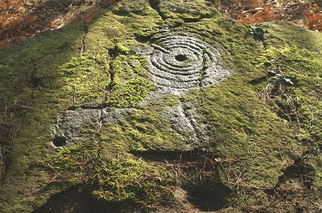
West Agra submitted by rich32 on 9th Jan 2006. West Agra, nr Masham, N Yorks - SE1424681758
(View photo, vote or add a comment)
Log Text: Google maps showed it was only just over 10 miles between Thornborough Henges, which we had just visited, and West Agra. Stopping off in Masham for a cup of tea, we need to take a minor road passing through the small villages of Fearby and Healey. We took a wrong turn which lead us down over the River Burn and to a reservoir, so we had to turn back and take the higher road past High Barn and Gollinglith Foot. Just after the road had done a sharp right/left about 1km past Gollinglith Foot, the entrance track to West Agra Farm appeared on the right hand side; there is room for 2 or 3 cars to park at the bottom. We then walked along the road for about half a kilometre to where the footpath heads off right up the hill (note coming back there is another footpath which is not marked on the map but passes about 100 yards in front of the farmhouse and leads back to the road). The footpath appears steep, but it’s on a soft, well kept grassy path, and is easy to climb. After the second gate, the area becomes a Site of Special Scientific Interest, with many different types of bird nesting in the area around.
We followed the trackway up to the junction of the drystone wall with the plantation, to our right hand side. Just before the end of the wall there is a gate into the field, then another gate to the north which leads into the plantation. We did go into the fields and the plantation, only later finding out we should have asked permission from Swinton Estates to walk across their land and through the plantation.
The West Agra site has at least 9 prehistoric carved rocks in 7 different areas on the southern side of West Agra Plantation and in the fields around West Agra Farm. They are significant because of the number of different carvings in the same area. 6 of the carvings are on individual rocks; the seventh is in a group of closely spaced rocks on the westerly side of the field system around the farm, which show heavily weathered cup marks. During the summer, the rocks within the plantation are covered by heavy bracken and mossy growth; it would be interesting to return in the winter months to find the rest of the stones.
We walked past the group of rocks in the field immediately to the east of the footpath, but couldn’t see any rock art; on our way back down to the car, we looked again, and because the light had changed, cup marks became very apparent and we wondered why we’d missed them in the first place.
Easiest to spot was the rock lying underneath the drystone wall – there is a great hump in the wall where it travels over the stone, which appears to be bedrock. The ground round the stone is very marshy, particularly on the eastern side of the stone on the other side of the wall, which also has a cup mark. The cup and groove marks on this stone were quite remarkable; the grooves appear to surround groups of cup marks . On the southern side of the stone there were other cup and worn groove marks which looked vaguely like a man, but it was difficult to tell. English Heritage say there are over 40 cup marks with grooved lines on this stone.
Since coming home, we’ve found the map showing the seven different areas, and we’ll definitely go back to see this site again nearer to Christmas.
Maiden Castle (N Yorks)
Date Added: 4th Aug 2014
Site Type: Ancient Village or Settlement
Country: England (Yorkshire (North))
Visited: Yes on 30th Jul 2014. My rating: Condition 4 Ambience 4 Access 3
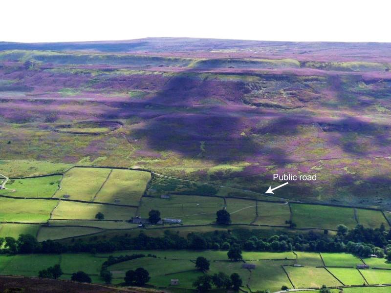
Maiden Castle (N Yorks) submitted by NeilD on 8th Sep 2005. SE 022981
Maiden Castle
(View photo, vote or add a comment)
Log Text: We ran out of time to see this site on 11th July, when we visited Thorborough Henges and West Agra (we got thoroughly distracted by the tremendous rock art at the latter), so took advantage of a trip down to Nottingham to detour via North Yorkshire and Swaledale to visit Maiden Castle.
Signs of the recent Tour de France were everywhere in this area (lots of yellow bunting and yellow bicycles, and spray-painted signs of encouragement to the riders on the roads). We stopped off in picturesque Reeth for lunch, then headed off southwards through the village of Grinton, turning west down a small narrow road with views of the river Swale to the north. This single track road runs for about 2km past ‘Bleak House’ and Harkerside Place. There are a number of footpaths and bridleways which run past Maiden Castle, but we picked the westernmost one, just past the fort, where there is a small parking area, sufficient for 4 or 5 cars.
From the car park, there is clearly marked path which runs (quite steeply) up past the western edge of the fort. As we were putting on our walking boots, two walkers were coming down and commented that the fort was ‘very well preserved; well worth seeing’.
I don’t like steep slopes or drops, but the path was relatively easy, and I needed a helping hand in only one or two rocky parts.
The fort was virtually invisible from the path, and is strangely situated part-way up the hillside. About 200 metres up the slope, the wsestern ditches of the fort suddenly come into view, then a few more paces open up a vista across the whole of the fort area. Turning to look back down the path, there are stunning views across the Swale valley and to the villages of Healaugh and Reeth across the valley.
There is a clear ditch and bank surrounding the fort; from the footpath to the west of the fort, it’s relatively easy to negotiate the ditch and bank easily (husband like a mountain goat, me picking my way gingerly), and ended up in a quiet, gentle spot, out of the wind and spotting rain. The brush underfoot wasn’t like other sites I’ve visited – the interior of the fort had what appeared to be low growing box plants with ferns, and we used sheep tracks to navigate from one point to the next within the fort area to avoid prickled ankles. At the southern end of the fort, where the slope drops steeply into the valley, there are quite a few tumbled stones, as if the fort had an outer wall at some point.
Before we visited, I had come across, and downloaded, the Durham University Archaeological Services report on Maiden Castle and West Hagg (geophysical surveys, report 2631, May 2011), which is available on the web when typing in ‘Maiden Castle Yorkshire’ on my web browser, so were able to largely identify the features they found within the fort, which was a real help in understanding what we were looking at.
Where their report had indicated a probable roundhouse, we found a circular area with very different vegetation, with low lying stones popping up through the grass to indicate where the foundation walls had been.
The walled approaches on the eastern side of the fort were impressive, giving the fort a ‘banjo’ shape. There is also a cairn/round barrow immediately adjacent to the northern end of the northern wall approach road to the fort.
Whilst exploring the fort, we saw other walkers pass by on the footpaths above and below, but very few people actually came into the fort, which was surprising. Definitely worth a visit.
