

<< Our Photo Pages >> Westwood Drive 01 - Rock Art in England in Yorkshire (West)
Submitted by brigantia on Friday, 01 December 2006 Page Views: 6206
Rock ArtSite Name: Westwood Drive 01 Alternative Name: ERA-2624; Boughey & Vickerman (247); SAM 25356; PRN172; The Comet Stone (Yorkshire)Country: England County: Yorkshire (West) Type: Rock Art
Nearest Town: Ilkley
Map Ref: SE1098346887
Latitude: 53.918012N Longitude: 1.834267W
Condition:
| 5 | Perfect |
| 4 | Almost Perfect |
| 3 | Reasonable but with some damage |
| 2 | Ruined but still recognisable as an ancient site |
| 1 | Pretty much destroyed, possibly visible as crop marks |
| 0 | No data. |
| -1 | Completely destroyed |
| 5 | Superb |
| 4 | Good |
| 3 | Ordinary |
| 2 | Not Good |
| 1 | Awful |
| 0 | No data. |
| 5 | Can be driven to, probably with disabled access |
| 4 | Short walk on a footpath |
| 3 | Requiring a bit more of a walk |
| 2 | A long walk |
| 1 | In the middle of nowhere, a nightmare to find |
| 0 | No data. |
| 5 | co-ordinates taken by GPS or official recorded co-ordinates |
| 4 | co-ordinates scaled from a detailed map |
| 3 | co-ordinates scaled from a bad map |
| 2 | co-ordinates of the nearest village |
| 1 | co-ordinates of the nearest town |
| 0 | no data |
Internal Links:
External Links:
I have visited· I would like to visit
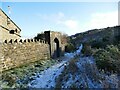
Anne T visited (still working on) on 17th Apr 2015 - their rating: Cond: 2 Amb: 2 Access: 5 The Comet Stone, Ilkely: (we found the grid reference but queried if this was the stone): From the Panorama Stones, driving the 700 metres up towards the moor we parked by the footpath sign just west of the junction of Moorlands and Westwood Drive and headed up the steep path (with steps) onto the moor (to get nearer, Keighley Road travels up onto the moor and there is a small car park near to the grid reference given).
The grid reference led us to the back stone wall of a house. The grass had been badly overgrown and someone had put weed-killer down on this patch of ground, but nettles were springing up in between the dead undergrowth.
Walking up and down the wall and identifying several possible stones, the grid reference led us back again and again to the same stone over which the stone boundary wall between a garden and the moorland was built. Cheekily peering over the wall of the house, found the stone extended some way into the garden. It had shrubs growing over the sides and was covered by moss and twigs so it wasn’t possible to make out any of the rock art by eye.
Shame, as I thought I’d be the first to submit a photograph of this stone, but it will take a knock on the door of the house when someone is in to get permission to go round and look!
")
In Arthur Raistrick's 1934 article, he gave the stone a descriptive name of being like 'comets' (hence the name!). Several other local authors have mentioned this stone, which is included in Boughey & Vickerman's (2003) survey as stone number 247.
For more information see England's Rock Art entry for ERA-2624 Westwood Drive 01, which includes a description, photographs, a plan of the rock and its motifs.
Please note this rock art panel is located on private land.
You may be viewing yesterday's version of this page. To see the most up to date information please register for a free account.
")
")
Do not use the above information on other web sites or publications without permission of the contributor.
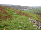
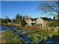
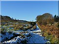
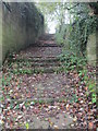
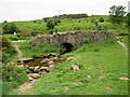
Nearby Images from Geograph Britain and Ireland:
©2023(licence)
©2023(licence)
©2014(licence)
©2023(licence)
©2021(licence)
The above images may not be of the site on this page, they are loaded from Geograph.
Please Submit an Image of this site or go out and take one for us!
Click here to see more info for this site
Nearby sites
Key: Red: member's photo, Blue: 3rd party photo, Yellow: other image, Green: no photo - please go there and take one, Grey: site destroyed
Download sites to:
KML (Google Earth)
GPX (GPS waypoints)
CSV (Garmin/Navman)
CSV (Excel)
To unlock full downloads you need to sign up as a Contributory Member. Otherwise downloads are limited to 50 sites.
Turn off the page maps and other distractions
Nearby sites listing. In the following links * = Image available
44m NNE 24° Westwood Drive 02* Rock Art (SE1100146927)
436m S 177° Graining's Head 02* Rock Art (SE1100746451)
442m SSE 165° Barmishaw 01* Rock Art (SE1109746460)
450m SSW 209° Graining's Head 01* Rock Art (SE1076746492)
475m SW 231° Weary Hill Stone* Rock Art (SE1061546585)
475m SW 231° Weary Hill 03* Rock Art (SE1061546585)
512m SSE 156° Barmishaw Stone* Rock Art (SE1119246419)
529m WSW 239° Silver Well 05* Rock Art (SE1052746616)
533m WSW 248° Silver Well 03* Rock Art (SE1048946682)
559m WSW 242° Silver Well 04* Rock Art (SE1048946623)
567m WSW 244° Silver Well 02* Rock Art (SE1047446635)
592m W 281° Tree Stone (Ilkley) Rock Art (SE104470)
615m WNW 285° Panorama Rocks 05* Rock Art (SE1038847048)
615m WNW 283° Panorama Woods 04* Rock Art (SE1038247027)
617m WNW 283° Panorama Woods 03* Rock Art (SE1038047027)
619m WNW 283° Panorama Woods 02a* Rock Art (SE1037847027)
620m WNW 283° Panorama Woods 01* Rock Art (SE1037747027)
627m NE 50° Panorama Rocks 02* Rock Art (SE1146747287)
628m NE 50° Panorama Rocks 03* Rock Art (SE1146847288)
630m NE 51° Panorama Stone* Rock Art (SE1147147287)
668m ESE 116° Willy Hall's Wood Stone* Rock Art (SE1158446592)
686m SW 217° Weary Hill 01* Rock Art (SE1057246336)
690m W 280° Panorama Stone (226) Rock Art (SE1030047000)
734m SSW 210° Weary Hill 02* Rock Art (SE1061446251)
752m SW 232° Coarse Stone Edge 02a* Rock Art (SE1039246419)
View more nearby sites and additional images


 We would like to know more about this location. Please feel free to add a brief description and any relevant information in your own language.
 Wir möchten mehr über diese Stätte erfahren. Bitte zögern Sie nicht, eine kurze Beschreibung und relevante Informationen in Deutsch hinzuzufügen.
 Nous aimerions en savoir encore un peu sur les lieux. S'il vous plaît n'hesitez pas à ajouter une courte description et tous les renseignements pertinents dans votre propre langue.
 Quisieramos informarnos un poco más de las lugares. No dude en añadir una breve descripción y otros datos relevantes en su propio idioma.