Contributory members are able to log private notes and comments about each site
Sites Anne T has logged. View this log as a table or view the most recent logs from everyone
Patervan Cairn, Buildings & Mound
Trip No.82 Entry No.4 Date Added: 23rd Jul 2018
Site Type: Cairn
Country: Scotland (Scottish Borders)
Visited: Yes on 12th Jul 2018. My rating: Condition 2 Ambience 3 Access 4
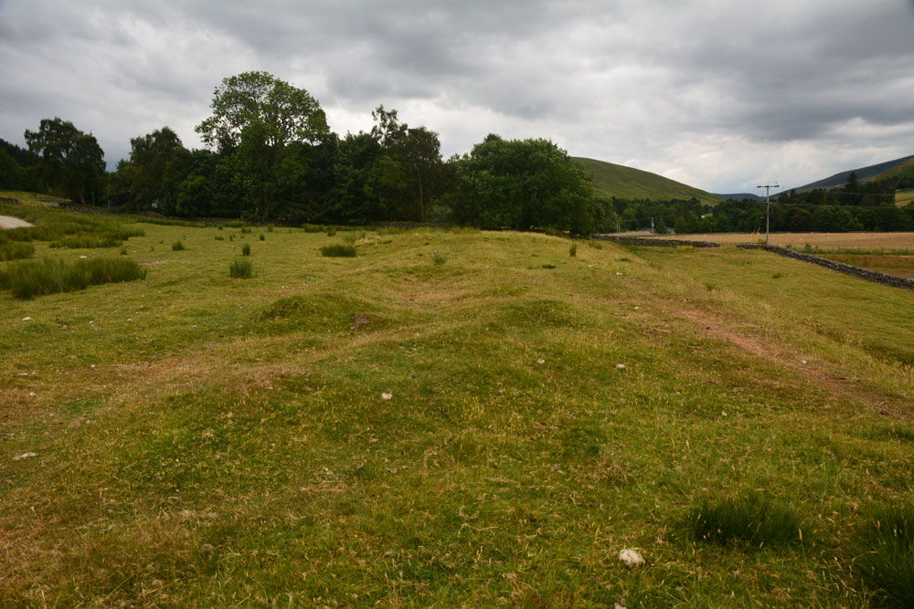
Patervan Cairn, Buildings submitted by Anne T on 23rd Jul 2018. Standing two thirds of the way along the length of the buildings, looking south south west, towards Patervan Steading and the cairn (to this side of the trees). Whilst Canmore doesn't date these buidings, to us they looked remarkably like some shielings we'd helped to survey at Sewingshields Crags, Northumberland.
(View photo, vote or add a comment)
Log Text: Patervan Cairn, Buildings & Prehistoric Mound, Scottish Borders: There is actually a rich archaeological landscape around here, although I’m pleased we’ve been out with an Archaeology Group, or I would have had trouble interpreting what we saw. We passed all of these features, all of which are within 100m of each other, on the way to the Laigh Hill settlement, just to the north east, so stopped with the GPS to make sure I was photographing the right thing!
They are perched on top of a river terrace above the alluvial (flood) plain of the River Tweed, which is 100m to the west. The surrounding hills provide an atmospheric backdrop (especially with black clouds (but no rain) looming above us).
Laigh Hill (Tweeddale)
Trip No.82 Entry No.5 Date Added: 24th Jul 2018
Site Type: Ancient Village or Settlement
Country: Scotland (Scottish Borders)
Visited: Yes on 12th Jul 2018. My rating: Condition 2 Ambience 3 Access 3
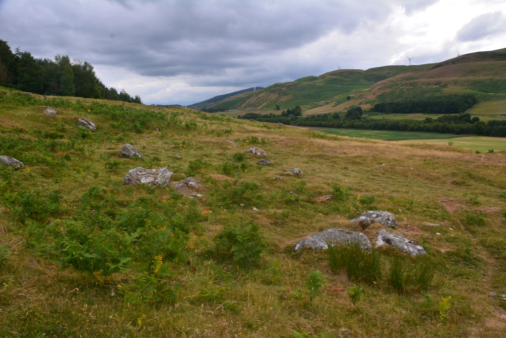
Laigh Hill (Tweeddale) submitted by Anne T on 24th Jul 2018. Standing just north west of the middle of the settlement, looking over both what we think are the remains of the foundations of an internal structure, plus boulders which emerge from the hillside. We found it a little tricky to pick out any particular features within this settlement. According to Canmore, just east of the entrance, a semi-circular stony bank marks what may have been a round stone-walled house. This may very well be this feature!
(View photo, vote or add a comment)
Log Text: Laigh Hill Settlement, below Norman's Castle, Scottish Borders: I was really looking forward to seeing this large settlement on the slopes of Laigh Hill, with the River Tweed to the south below.
The walk was easy, along a track, and only 400m past the Patervan Mound. Leaving the track and following the well-worn sheep tracks up the slope, through the low outer banks at the south west of the settlement, we arrived amongst a confusing array of circular flat areas, stony structures and boulders. Even though we'd seen a number of settlements, with our somewhat inexperienced eyes, we had difficulty trying to trace any particular structures to photograph. I called up the Canmore record on my phone, but there was no plan to orientate ourselves to, so we contented ourselves with trying our own interpretations, trying to match what we were seeing with the written description.
Norman's Castle was impressive, on the rocky knoll high above us. This really dominated the scene. Making our way over to the gate in the fence which led up to the rocks, I realised that I wouldn't be able to scramble up to the Dun, so left mountain-goat Andrew to climb up with the camera, hoping the camera would return in one piece!
Norman's Castle
Trip No.82 Entry No.6 Date Added: 24th Jul 2018
Site Type: Stone Fort or Dun
Country: Scotland (Scottish Borders)
Visited: Yes on 12th Jul 2018. My rating: Condition 2 Ambience 4 Access 3
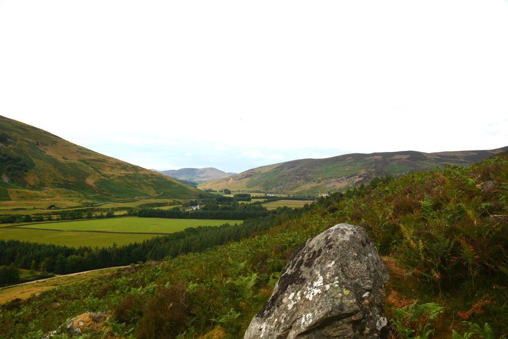
Norman's Castle submitted by Anne T on 24th Jul 2018. Looking directly north across the large rock above the entrance to Norman's Castle.
(View photo, vote or add a comment)
Log Text: Norman's Castle, Laigh Hill, Patervan: Strictly, I only saw this dun from a distance, as it was scramble to get to the top of the hill, and my fear of falling kept me on Laigh Hill settlement below. Husband, Andrew, with all the skills of a mountain goat, and no fear of heights, went tramping up with the camera. When he came back down he said: "Goodness knows why they live in such places - it's difficult to get into!" Presumably, raiders would have been deterred by the climb, so the settlers would have been well defended.
From Laigh Hill settlement below, a large rock protruding from the surrounding cliff face dominates, together with what looks like a cairn, but the scramble across the rocks to take a closer look was deemed a little tricky.
There are certainly 360 degree views all around this dun. Very little of the foundations could be seen, due to the high growth of bracken and overlying turf.
Dreva Hill West (Broughton)
Trip No.82 Entry No.8 Date Added: 24th Jul 2018
Site Type: Ancient Village or Settlement
Country: Scotland (Scottish Borders)
Visited: Yes on 12th Jul 2018. My rating: Condition 2 Ambience 3 Access 4
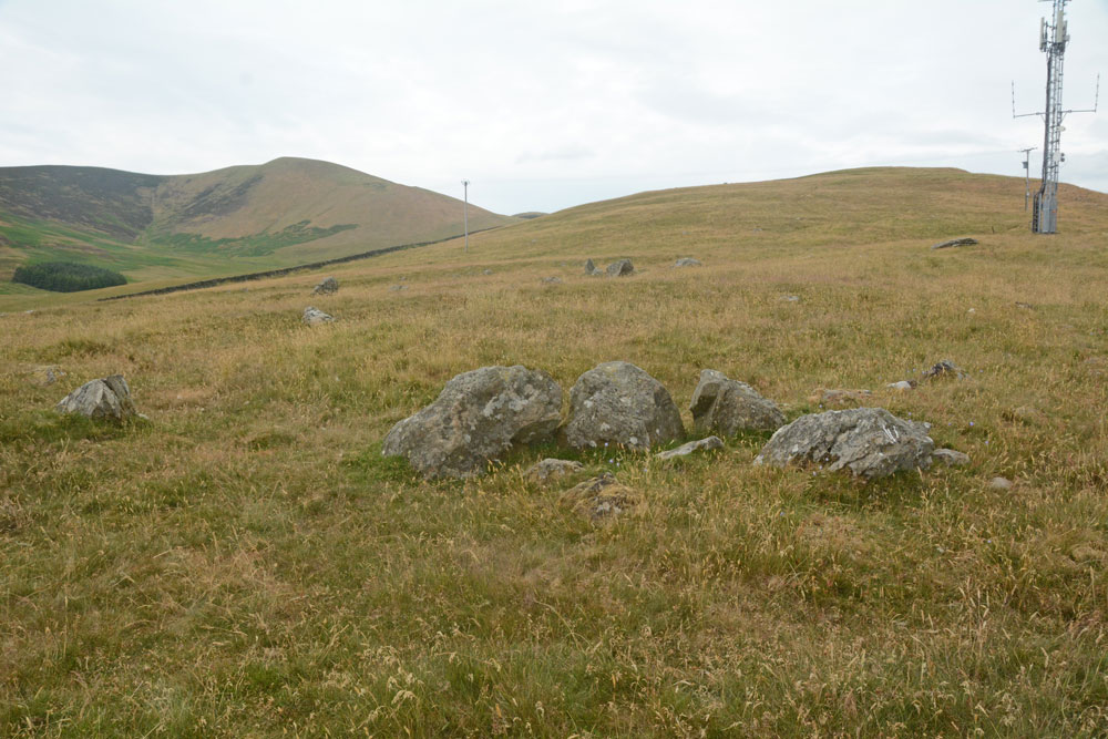
Dreva Hill West (Broughton) submitted by Anne T on 24th Jul 2018. A cluster of boulders towards the mid point of the northern side of the settlement, perhaps part of an internal structure, with a line of stones forming the outer bank beyond. It was difficult to ascertain whether or not this was part of the primary or secondary settlement phase.
(View photo, vote or add a comment)
Log Text: Dreva Hill West, Broughton, Scottish Borders: To the east of the road, there is a gate leading to a farm track, which we followed for about 100m then headed up towards the mast. In typical Tate fashion, Andrew had muddled up the entries for Dreva Craig Fort and this settlement, so I spent ages photographing boulders around the site, thinking they were the ‘chevaux de frixes’.
It’s a great site for a mast, but it’s so close to this settlement, to me it feels invasive and insensitive. The tall grass made it difficult to see any of the outer banks, although I could feel the rise and fall of the low banks at various points as I walked across the settlement. Because I was able to pick out more features here, on a flatter land with fewer boulders, I was more interested in this site than Laigh Hill. It would be nice to be able to track down a plan, so I can really interpret what I saw.
Stobo Kirk standing stone
Trip No.82 Entry No.9 Date Added: 24th Jul 2018
Site Type: Standing Stone (Menhir)
Country: Scotland (Scottish Borders)
Visited: Yes on 12th Jul 2018. My rating: Condition 3 Ambience 5 Access 4
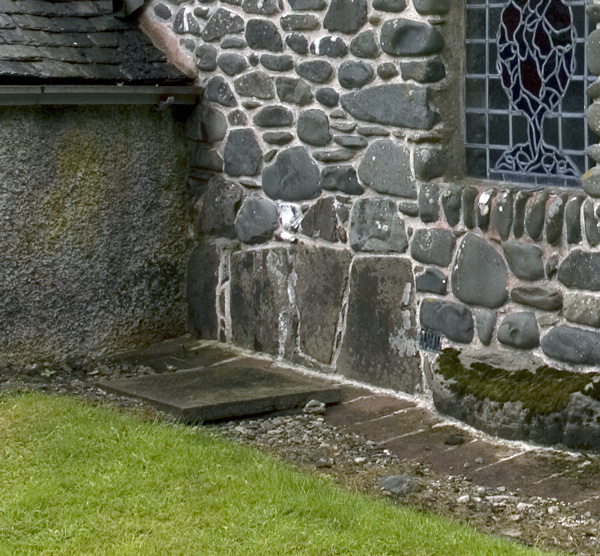
Stobo Kirk standing stone submitted by nicoladidsbury on 14th Oct 2007. Stobo Kirk - standing stone 2 - close up
(View photo, vote or add a comment)
Log Text: Stobo Kirk, Scottish Borders: This was the highlight of my visit. A church I’ve wanted to see for a long, long time, and I thought I’d better grab the chance whilst we were nearby. As we drew up outside the church, my heart sank, as it looked just like another austere Church of Scotland church. “This isn’t the church I saw on the Portal”, I said to Andrew, “their images are of a pebble built wall with standing stones in it.”
All was explained when we walked into the church and saw the north aisle chapel, from the inside first.
My photography skills were challenged trying to photograph the three large tombstones held by iron staples to the wall. This part of the church felt very old.
We looked at the long stone in the external west wall of the north aisle chapel carefully (due to the chairs in the chapel, we couldn’t really see much without removing several rows of tightly packed wooden chairs). At first glance, it looked as if it went from the south side of the window cill, southwards. Closer inspection made us realise it extended under the window as well.
We bought a guide book and a couple of the postcards of the stained glass windows, as by this time, it was getting quite late and it was at least another hour until we reached our bed for the night. Much too brief a visit - a return visit in bright sunshine is a must!
The Gathering Stone
Trip No.83 Entry No.1 Date Added: 24th Jul 2018
Site Type: Standing Stone (Menhir)
Country: Scotland (Stirling)
Visited: Yes on 13th Jul 2018. My rating: Condition 3 Ambience 4 Access 4
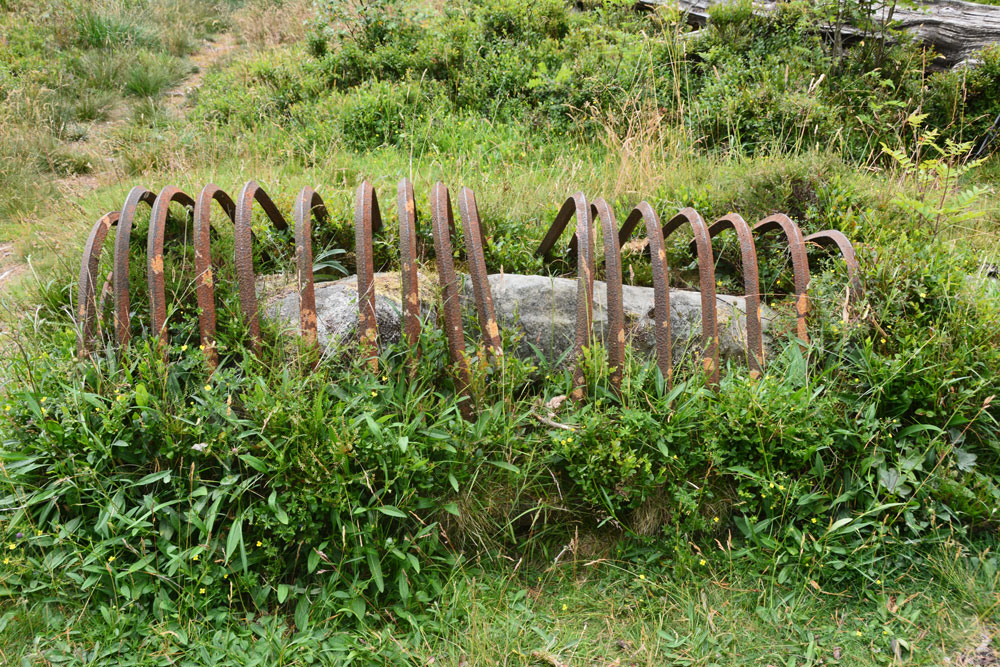
The Gathering Stone submitted by Anne T on 24th Jul 2018. Getting nearer, this is the Gathering Stone, split into at least three pieces. Its iron ribs are reminiscent of old graves being protected from grave robbers, but these metal strips screamed at me "we're stopping this standing stone from becoming upright again".
(View photo, vote or add a comment)
Log Text: The Gathering Stone, Sheriffmuir: From the Sheriffmuir Cairn & Macrae Clan Monument at NN 81569 01934, we followed the footpath to its eastern side, between the main monument and the cairn, following the line of the stone wall, heading in a roughly north westerly direction.
Eventually a path split off to our left, slightly more westwards and this led us to the Gathering Stone – a strange, strange sight, being protected by its ‘iron ribs’. It most definitely looks like a recumbent standing stone, now split into at least three parts.
The ribs are very reminiscent of graves covered to protect them from graverobbers. To me, in this setting, it felt like the iron bars constrained the standing stone from getting up off the ground and becoming upright again.
Continuing slightly further west along the track, you cross some rocks which have been much graffitied. We read that the mounds of earth here are the graves of 600 of the fallen from the Battle of Sheriffmuir.
Sheriff Muir Row
Trip No.83 Entry No.2 Date Added: 24th Jul 2018
Site Type: Stone Row / Alignment
Country: Scotland (Stirling)
Visited: Yes on 13th Jul 2018. My rating: Condition 3 Ambience 5 Access 4
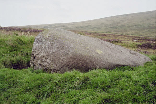
Sheriff Muir Row submitted by hamish on 15th Jul 2005. The recumbant stone it must have been quit impressive when upright.
(View photo, vote or add a comment)
Log Text: Sheriffmuir Stone Row: Please can I claim the Portal prize for 'the most horsefly bites at one ancient site'? At first glance, it looked easy to walk to this stone row. The reality was it was a couple of hundred yards from the road, in deep heather. Having waded through the shrubbery, and having found the Wallace Stone, however, finding the rest of the stones was easy, as they are more or less in a line running north east to south west. I managed to pull up Sandy G’s ”Stone Rows of Great Britain” website, with details of the stones, which helped enormously.
The horse flies were horrendous. I got eaten alive, and was glad to get back to the car to slap some antihistamine on. It was a real shame the Sheriffmuir Inn wasn’t open, as we were desparate for a cold drink (any drink, really) by the time we’d walked to, and photographed, all five stones.
We decided to go onto Dunblane for a cup of tea and something to eat (and lots of antihistamine cream for me!). Despite all the bites, I thoroughly enjoyed exploring this stone row, in the brilliant sunshine and glorious views.
Glennan Standing Stone
Trip No.83 Entry No.3 Date Added: 1st Aug 2018
Site Type: Standing Stone (Menhir)
Country: Scotland (Argyll)
Visited: Yes on 18th Aug 2018. My rating: Condition 3 Ambience 5 Access 4
Glennan Standing Stone submitted by cosmic on 29th Aug 2003. Glennan Standing Stone.
(View photo, vote or add a comment)
Log Text: Glennan Standing Stones and Cairns: What could top Kintraw Standing Stones & Cairns? But we found places that almost did. Carrying on down the A816 towards Kilmartin, we turned east on the road towards the small village of Ford, travelling along a very beautiful valley. We stopped at Old Glennan farmhouse (pulled into the gateway to the track up to the house, which looked as if it hadn’t been used in ages, and was in sight of the stone). Letting ourselves in through the gate, we followed the track up, with the line of an old stone wall, now only ankle height, up to where it turned a corner, just to the north of the house. The stone appeared to be incorporated into a taller part of the wall.
Walking back to the car, I spotted what looked like a cairn with a slight ditch around it. Andrew looked up the Canmore reference on his phone and determined there were two cairns near the gate, one much reduced. According to Canmore there is a cup marked stone on one, although both cairns were well grassed over at the time of our visit.
Wester Biggs (Dunblane)
Trip No.83 Entry No.5 Date Added: 24th Jul 2018
Site Type: Stone Circle
Country: Scotland (Perth and Kinross)
Visited: Couldn't find on 13th Jul 2018. My rating: Condition -1 Ambience 4 Access 5
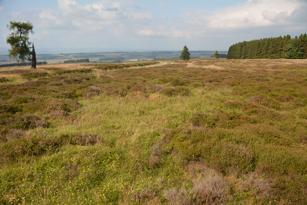
Wester Biggs (Dunblane) submitted by Anne T on 24th Jul 2018. Thinking this stone circle was just by the side of the road, and therefore relatively easy to see, we spent ages with our GPS wandering around trying to spot stones of any description. The heather and vegetation was calf deep, so any small stones would have been difficult to spot. However, 6m away from where our GPS said the circle was, there was only this slight change in vegetation (the shorter, green area). Either the stones are hidden, or they've been sadly removed. View looking NE, towar...
(View photo, vote or add a comment)
Log Text: Wester Biggs Stone Circle, Near Dunblane: Returning from tea and cakes in Dunblane, we resumed our search for megalithic sites. Next stop, hopefully, a not-before-photographed stone circle, right by the side of the road.
Finding the telephone mast and driving a couple of hundred yards further on, we parked at NN 86368 06240 and walked back south along the road, armed with the Canmore listing on my phone and the GPS.
Despite an intensive search of the land east of the road around this point, we were unable to locate any stones amongst the tall heather. However, there was a circle of gras/vergetation which was different from any heather at almost exactly the grid reference given by Canmore, so I photographed ‘the spot’. Andrew thinks the stones may have been removed. Always possible, but I think we need to return when the shrubbery has died back.
The Boat Stone
Trip No.83 Entry No.6 Date Added: 24th Jul 2018
Site Type: Standing Stone (Menhir)
Country: Scotland (Perth and Kinross)
Visited: Yes on 13th Jul 2018. My rating: Condition 3 Ambience 4 Access 4
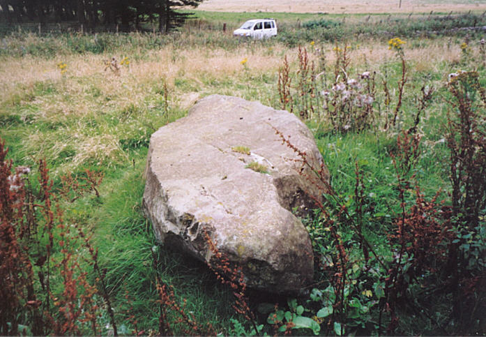
The Boat Stone submitted by hamish on 23rd Jul 2005. After you have been to Sherriffmuir Stones keep on up the road. Don't try to find Wester Briggs Circle, it's hidden in the heather. Just down the road past the woods on the left is the Boat Stone. You have to clamber over the stone wall with a barbed wire topping to get to this stone. Nearly broke my leg but survived.
(View photo, vote or add a comment)
Log Text: The Boat Stone, Sheriffmuir to Dunblane lane: Marked on the OS map, but not on Canmore, this fallen standing stone is featured on the Portal and The Northern Antiquarian. The road is single track at this point, with not many passing places. The farmer had left the gate into the field wide open, and it was dry, bare soil. We dared to pull the car just inside the gate.
The farmer had heaped a beautifully large pile of maturing manure between the gate and the stone, so I took a slightly wider berth round this than I might have, with the heat and the flies!
This large stone is impressive. It sites on a mound (I walked around it to photograph it and had to step up the mound to get to the top of the stone) and has some lovely quartz inclusions.
Dunblane Cathedral
Trip No.83 Entry No.7 Date Added: 25th Jul 2018
Site Type: Class III Pictish Cross Slab
Country: Scotland (Stirling)
Visited: Yes on 13th Jul 2018. My rating: Condition 3 Ambience 4 Access 5
Dunblane Cathedral submitted by Alta-Falisa on 29th Jun 2015. Photo : May 2015.
(View photo, vote or add a comment)
Log Text: Ancient crosses at Dunblane Cathedral: Having been bitten and bitten again by horseflies at Sheriffmuir Stone Row, the weather being very hot and humid, and the Sheriffmuir Inn decidedly shuttered up, we decided to go into Dunblane to find a cup of tea and a late lunch. We managed to find a parking spot just opposite the cathedral, so after tea and a jacket potato at the Beech Tree café, we walked back and went into the cathedral.
This is a really welcoming and peaceful church. The young lady who greeted us and sold us a guide book could hardly be heard for the organist “practising for tomorrow – but you can enjoy the music. You can take photographs, but don’t use the flash around the organist.”
The highlight for me was the two cross marked stones at the western end of the northern aisle. There is a lot of information about the cathedral itself, but not much about the crosses. We marvelled at how worn some of the bases of the columns and other architectural features, as part of the cathedral stood roofless for over 300 years from the late 1500s (says the guide book).
The guide book (page 10) talks about the crosses, saying in the North Aisle: “Here there is a large carved cross – evidence that Dunblane was a religious centre from an early date. Discovered beneath the chapter house floor in 1873, it dates from the 9th century. On the back of the stone are allegorical figures – there are two animals sitting entwined and a horse and rider with an animal, perhaps a wolf, below the horse. Also on display is a fragment from a similar cross-slab found in 1836. It also dates to the 8th or 9th century. The presence of both stones suggests that there may have been an earlier church on this site. Architectural fragments dating from the 1100s and 1200s were found during the construction of the boiler house under the chancel and chapter house in 1836. Some of these fragments are on display in the north aisle. The finely worked chevrons (zigzags) on the arch fragments, and the elaborate column cap hint at the exquisite decoration of the earlier cathedral. Fragments from the 1300s and 1400s are also on display.”
I completely forgot about the four cists around the cathedral, and I didn't have a mobile signal to call up the Portal or the Canmore records, but we will be coming back here at some point in the relatively near future.
Gleneagles B
Trip No.83 Entry No.8 Date Added: 25th Jul 2018
Site Type: Standing Stone (Menhir)
Country: Scotland (Perth and Kinross)
Visited: Yes on 13th Jul 2018. My rating: Condition 3 Ambience 3 Access 4
Gleneagles B submitted by cosmic on 19th Feb 2005. The Incised Mark/s on the North Side
(View photo, vote or add a comment)
Log Text: Peterhead Farm Pictish Symbol Stone: Right next to the A9, so the atmosphere wasn’t brilliant, but ignoring the traffic, looking east, this was a glorious setting.
There was a gate into this field full of sheep, so we let ourselves in and walked over to the stone, which now sits within 30m of a slip road leading to the A9. The Gleneagles roundabout with its golf club ‘sculpture’ provide a strange backdrop.
The views to the east are somewhat different, and facing this way, you could almost believe you were in the country. Whilst the black clouds were gathering to the north and east, there was no rain.
I was fascinated by the two quartz inclusions underneath the symbols.
Gleneagles A
Trip No.83 Entry No.9 Date Added: 25th Jul 2018
Site Type: Standing Stone (Menhir)
Country: Scotland (Perth and Kinross)
Visited: Yes on 13th Jul 2018. My rating: Condition 3 Ambience 4 Access 5
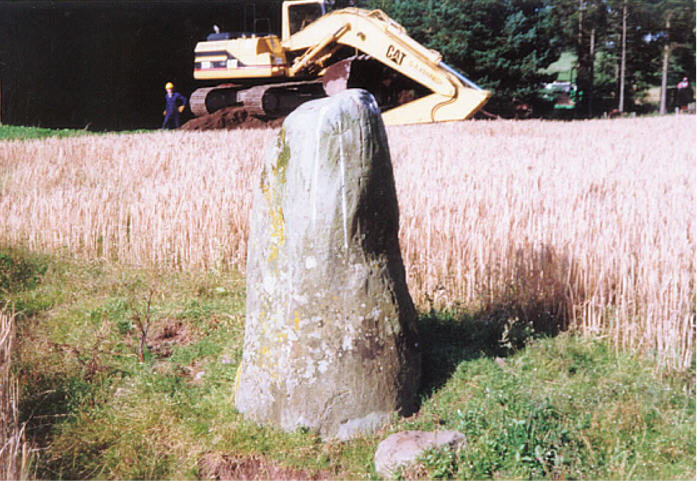
Gleneagles A submitted by hamish on 23rd Jun 2005. I took this picture, including the phone mast erectors, and ran out of film so couldn't take another one. Maybe another time.
Interesting stone though, there are some markings on the right side.
(View photo, vote or add a comment)
Log Text: Peterhead Farm Standing Stone, Gleneagles: Our last stop of the day. Driving (it was too hot, and we were too lazy to walk) further along the single track road towards the mast and the entrance to Peterhead Farm, we parked near the mast and walked across the road. The nearest gate into the field appeared to be near the farm buildings, so we clambered over the wooden fence at the corner of the road with the farm track.
This standing stone looks as if it sits just below the top of a natural mound. There were quite a few packing stones around the base of the stone, with others scattered around the ground nearby.
Dupplin Cross
Trip No.84 Entry No.1 Date Added: 25th Jul 2018
Site Type: Ancient Cross
Country: Scotland (Perth and Kinross)
Visited: Yes on 14th Jul 2018. My rating: Condition 4 Ambience 4 Access 5
Dupplin Cross submitted by cosmic on 16th May 2007.
Back of the cross with the dedication panel top middle
(View photo, vote or add a comment)
Log Text: Dupplin Cross, St Serf's, Dunning: Our first stop of the day, and a very old, popular, tourist village. We first saw a drinking fountain outside the churchyard, almost at the cross roads.
By the southern door to the church were two hogbacks.
Inside was the Duppline Cross and a smaller cross slab to its north west. There was a guide, already talking to a gentleman about the cross, but when she saw us, she interrupted her talk and came up to us to ask us to join in. Not usually one for ‘tours’ we reluctantly joined her, as I really wanted space and time to drink in this cross on my own, then photograph it; this was not to be, as there was a steady stream of visitors coming into the church. As we went out, another family came in, followed later by a large walking group.
I photographed most of the individual panels around the Dupplin cross and need to sort these out using the diagrams in the 'Official Souvenir Guide' (£1). I was particularly fascinated by the base, which appeared to have carved lines across one corner, and cups (or very worn interlacing) on its base.
Dunning
Trip No.84 Entry No.2 Date Added: 25th Jul 2018
Site Type: Standing Stone (Menhir)
Country: Scotland (Perth and Kinross)
Visited: Saw from a distance on 14th Jul 2018. My rating: Condition 3 Ambience 3 Access 4

Dunning submitted by Nick on 5th Nov 2002. The stone looking north
(View photo, vote or add a comment)
Log Text: Dunning North Standing Stone: From St Serf’s church, we walked along Kirk Wynd, down alongside the stream, down past some cottages, to where the footpath split. The standing stone was right in front of us, albeit in the middle of a ripening crop of wheat. It seemed very far away, and I was very, very reluctant to trample any of the crop, so we stuck to the footpath. With the camera lens on maximum zoom I tried to capture the different faces of the stone, but as the footpath ran roughly west-east, we couldn’t really get close.
The guide in the church told us there were two standing stones nearby; most people visited the northern (this) stone, but apparently not many people went to the southern stone.
If the field hadn’t been set with a crop, I’d have been tempted to look for the gate, or an alternate route to get closer.
Our next stop was to the very peculiar "Maggie Wall Monument", 1km west of Dunning on the B8062. This is a 20ft tall monument topped by a cross to a witch called Maggie Wall who was apparently burnt in 1657. The stories I've all tracked down say Maggie Wall didn't exist. This monument definitely made me shiver!
St Andrew's Church (Forteviot)
Trip No.84 Entry No.3 Date Added: 25th Jul 2018
Site Type: Class III Pictish Cross Slab
Country: Scotland (Perth and Kinross)
Visited: Visited (still working on) on 14th Jul 2018. My rating: Ambience 3 Access 5
Log Text: St. Andrew's, Forteviot: We drove up to this church to find a lovely local lady garden by the gate into the churchyard. She told us the church would be locked, "but it'll be open on 29th (July)." We explained we were only here for the day, so this was too late. She told us about the recently erected modern cross, just down the road from the church, next to the bus stop. We thanked her kindly and walked down to take a look.
Forteviot Cross
Trip No.84 Entry No.4 Date Added: 25th Jul 2018
Site Type: Sculptured Stone
Country: Scotland (Perth and Kinross)
Visited: Yes on 14th Jul 2018. My rating: Condition 5 Ambience 4 Access 5
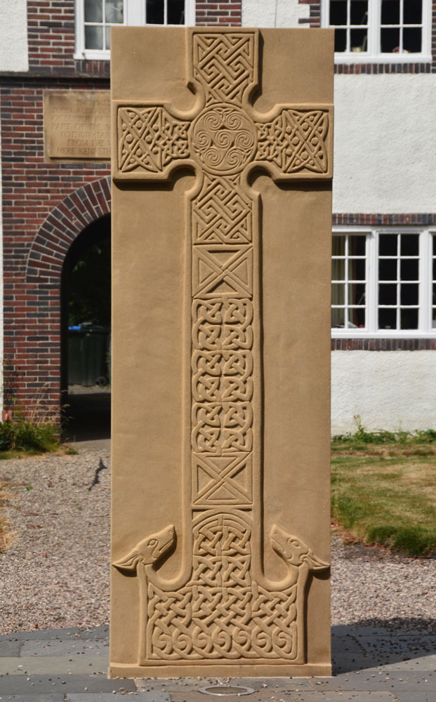
Forteviot Cross submitted by Anne T on 25th Jul 2018. The front of this modern Pictish cross slab, only unveiled in mid-March this year.
(View photo, vote or add a comment)
Log Text: Modern Pictish Cross Slab, Forteviot: Having been spooked by the Maggie Wall Memorial and disappointed at not being able to get into Forteviot parish church (St. Andrews), the lady gardener told us to walk down the road to look at the new cross slab that had just been erected.
Just behind the bus-stop, and in front of a charming courtyard of whitewashed houses, we found out later this cross had been erected only on either 17th or 18th March 2018, so very new.
The lady gardener told us there were some leaflets ‘in the bus stop’ and indeed there were several tucked underneath the bus timetable board. The cross was carved by David McGovern, of Monikierockart for the 2017 Tay Landscape Partnership project. “In the form of a Pictish Cross Slab, the new cross celebrates Forteviot’s status as an early Christian site and its association with King Cinead mac Alpin. The Pictish stone fragments that inspired the cross design can also be visited across the road in St Andrew’s Church (when open).” The leaflet also gives a guide to the patterns on the cross.
Gray Stone (Dunning)
Trip No.84 Entry No.5 Date Added: 26th Jul 2018
Site Type: Standing Stone (Menhir)
Country: Scotland (Perth and Kinross)
Visited: Yes on 14th Jul 2018. My rating: Condition 3 Ambience 4 Access 4
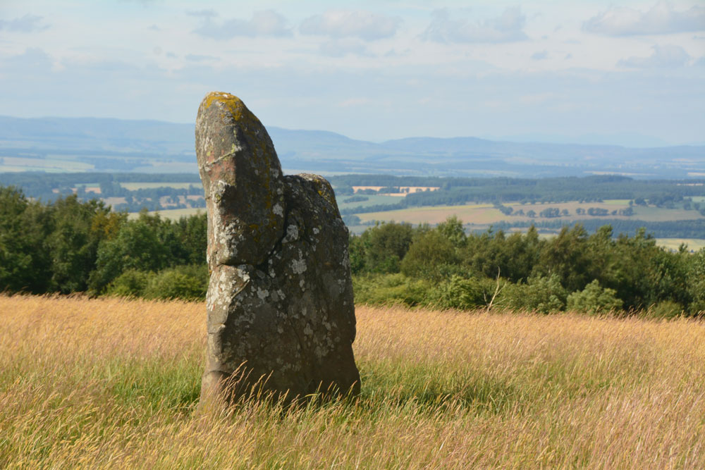
Gray Stone (Dunning) submitted by Anne T on 26th Jul 2018. Getting closer to the stone, approaching it from the gate into the field (south), we started to see the 'shoulder' on its northern side.
(View photo, vote or add a comment)
Log Text: The Gray Stone, Dunning: Thrilled to be seeing my second standing stone of the day (and one we were likely to get close to), we parked at the end of the driveway up to The Knowes farm. The stone is signposted, but the signpost follows the line of the fence and wood to the north west. Undecided whether to follow the sign and walk through the knee high grass or take the farm track which ran directly westwards. Consulting the map, we didn’t come to any firm conclusion, so to avoid having to climb over any fences, we ended up walking up the farm track, ending up at the cottage just before the gate to the big farmhouse to the left. Turning to our right here, in front of the cottage, there is a way across the deep, wide ditch which ran to our right hand side all along the track, then followed another farm track which ran north east to two field gates at NO 02171 11700. Opening the left hand gate, we let ourselves into the field, and the stone was immediately in front of us, about half way along the middle of the field, near to the fence line with the neighbouring wood which is to the stone’s eastern side.
Walking towards the stone (through what looked like a field of wheat, looking back on the photos, but is actually tall, yellow grass which has gone to seed) which is about 7ft tall, we realised it had a ‘shoulder’ to its northern side. Having seen a few other stones like this recently (the Megget Stone springs immediately to mind), I wondered if this had been deliberately cut like this, but looking at the bashes this stone has had, and the cracks and loose pieces on it, it looks as if it has fractured and a piece fallen off.
Whilst the views to the south and east are blocked now by forestry, there was a great vista northwards to Dunning and the hills (which appeared as a blue mist) in the far distance. On its northern side, there is a change in slope down from the stone; to its west and slightly to the south, there is a very slight rise. I wondered if the change in ground level might be because either farming, or perhaps a prevailing wind over time, has caused the ground level to build up here.
A very peaceful and beautiful place.
Castleton (Dollar)
Trip No.84 Entry No.6 Date Added: 26th Jul 2018
Site Type: Standing Stone (Menhir)
Country: Scotland (Clackmannanshire)
Visited: Yes on 14th Jul 2018. My rating: Condition 4 Ambience 4 Access 4

Castleton (Dollar) submitted by Anne T on 26th Jul 2018. Standing stone in Clackmannanshire Scotland. Standing just to the south west of the stone, looking at its location in relation to the surrounding hills and capturing its shadow at this time of the evening.
(View photo, vote or add a comment)
Log Text: Castleton Standing Stone, Pool of Muckhart: To find this stone, we followed the signs to the ‘Japanese’ garden, which had a large car park. The entrance and part of the car park were still in the process of being constructed, but was obviously just about to close for the night, so we parked as close a wall outside the entrance. Scanning the field for a gate, there was one by the farm house, some distance away (and it looked as if there was a small stream we’d have had to cross to reach the stone) or an old, painted red iron gate (very ornate) virtually opposite from where we parked. This had not been used in some time, and our usual gate opening skills didn’t work. We ended up climbing over the gate and walked across the field.
It was by now so hot and sticky, that the sheep had taken shelter under the trees to the east of this stone, in what looked like an old sheep fold, now fallen into ruin. This standing stone had two sides which were eroded, one with what looked like cups, but (having seen similar examples doing the ERA data entry exercise) are probably small holes where pebbles have fallen out, or possible solution holes if the stone had lain on the ground for some considerable time.
A very lovely spot, with gentle rolling hills to the north and north west.
Parkmill Cross (Alloa)
Trip No.84 Entry No.7 Date Added: 26th Jul 2018
Site Type: Ancient Cross
Country: Scotland (Clackmannanshire)
Visited: Couldn't find on 14th Jul 2018. My rating: Condition -1
Log Text: Parkmill Cross, Alloa: Could not find this – the grid reference seemed to be somewhere in a breaker’s yard. Parking in the nearby housing estate just to the south west of this location, we followed the footpath sign to the footpath which ran west-east along the bottom of the field this cross base is supposed to be in, the tall fence and padlocked gates prevented entry. Andrew tried to gain access from the car breakers yard to the north-west, but said it looks as if their site has been extended to cover where this cross might have been.
