Contributory members are able to log private notes and comments about each site
Sites Anne T has logged. View this log as a table or view the most recent logs from everyone
Sticklepath Boundary Marker
Trip No.132 Entry No.11 Date Added: 8th Jun 2019
Site Type: Marker Stone
Country: England (Devon)
Visited: Yes on 13th May 2019. My rating: Condition 3 Ambience 3 Access 4
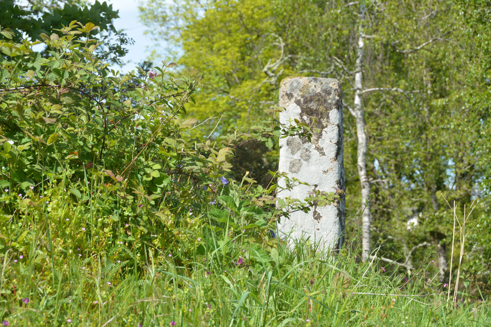
Sticklepath Boundary Marker submitted by Anne T on 8th Jun 2019. The southern face of the cross, which had a cross carved in relief upon it. We were unable to make out any carvings at the time of our visit.
(View photo, vote or add a comment)
Log Text: Sticklepath Inscribed Boundary Stone: This stone is only within 20m of Lady Well, separated by a minor road junction. At the time of our visit, the ambience was spoilt by roadworks which had been set up next to, and almost up to it.
With the stone sitting on top of a retaining wall between the pavement and the main road running through Sticklepath, and a footpath running up slope to its WSW side, Andrew stepped onto the bank and photographed all sides of it for me at close quarters.
Despite peering closely at each side of the stone, we were unable to make out any clear carvings on it at all. The only thing that was clear was the hole for the ball finial which topped the stone at some time in its past.
Belstone Boundary Marker
Trip No.132 Entry No.12 Date Added: 9th Jun 2019
Site Type: Marker Stone
Country: England (Devon)
Visited: Yes on 13th May 2019. My rating: Condition 3 Ambience 3 Access 5

Belstone Boundary Marker submitted by Anne T on 9th Jun 2019. Having parked down the narrow lane just to the west of this boundary stone, this was my first view of it as I approached the road junction.
(View photo, vote or add a comment)
Log Text: Belstone Boundary Marker: Only 1km from the Sticklepath Boundary Stone, this supposedly pre-Conquest stone at the junction of the B3260 and a minor dead-end road which goes north east to a farm.
I got some strange stares from the cars as I photographed this stone, which is no longer on the parish boundary, presumably to accommodate road improvements. Had it not been for the busy road, this would have been in a gloriously peaceful countryside location, with lovely views northwards (the hedge to the south was too tall to see over).
I think the description in the Pastscape entry has been confused with the Sticklepath BS, near Lady Well, as this stone is triangular in shape and the only marking we could see was a partial bench mark on its front.
The acute angle of the minor road junction with the B3260 made the turn right out of the busy road a little tricky, but possible after waiting for a sufficiently large gap in the traffic.
Belstone Ring Cross
Trip No.132 Entry No.13 Date Added: 9th Jun 2019
Site Type: Ancient Cross
Country: England (Devon)
Visited: Yes on 13th May 2019. My rating: Condition 3 Ambience 4 Access 4
Belstone Ring Cross submitted by hoya105 on 23rd May 2019. Inside St Marys Church, in the lovely village of Belstone with its Holy Well and great pub!
(View photo, vote or add a comment)
Log Text: Ring headed cross at St Mary The Virgin, Belstone: A lovely little village, with not only the ring headed cross in the church but the Coronation Stone and the old stocks on the village green.
The church has a lovely atmosphere, tucked away to the west of the little village shop cum pub. The church had a slim guide book which made interesting reading, and I went through it during our visit to make sure we didn’t miss anything special.
The ring-headed cross is against the south wall of the church, near where the nave and sanctuary join. It’s base had been covered with an Easter scene.
We wandered back to the village green and had tea and cake in the Old Schoolroom Tearooms. This was to be my first experience of “toilet twinning” – there were photos of toilets in other countries that the tearoom toilet had been twinned with – brilliant!)
West Wykes Farm Tau and Latin Crosses
Trip No.132 Entry No.16 Date Added: 9th Oct 2019
Site Type: Ancient Cross
Country: England (Devon)
Visited: Yes on 13th May 2019. My rating: Condition 3 Ambience 5 Access 4

West Wykes Farm Tau and Latin Crosses submitted by Anne T on 9th Jun 2019. The Latin cross under the tree at West Wyke farm, having been rescued from 'duty as a gatepost' by E. Masson Phillips in 1958 and erected here. The cross has lost one of its arms, and on each face there is are incised Latin crosses. One, carved somewhat lopsidedly is 1 foot 7 inches high by 1 foot 2 inches. On the reverse face the cross measures 11 inches high by 11 inches across. Just to the right of the tree (just above centre right of the photo) can be see the octagonal arm of the Tau cross.
(View photo, vote or add a comment)
Log Text: West Wyke Tau and Latin Crosses: The lane to West Wyke farm and the houses here is marked private, so we parked at the viewpoint at SX 65298 93020 and walked the 600m or so up the lane - a very pleasant walk in the evening sunshine.
Despite taking the HE and Pastcape printouts with us, I didn't appreciate what I'd seen until sitting at the computer today (9th June 2019). Good job I photographed the pile of stones at the western side of the tree, as this was the Tau Cross! The smaller cross next to the entrance to the barns on the opposite side of the road is not recorded on HE or Pastscape, and I'd been really confused until re-reading the entries.
Merrivale settlement
Trip No.133 Entry No.1 Date Added: 22nd Jun 2019
Site Type: Ancient Village or Settlement
Country: England (Devon)
Visited: Yes on 14th May 2019. My rating: Condition 3 Ambience 4 Access 4
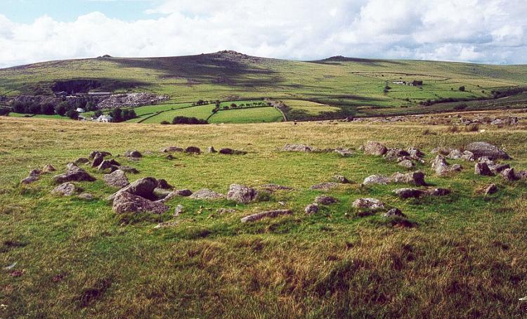
Merrivale settlement submitted by Brian Byng on 7th Feb 2002.
(View photo, vote or add a comment)
Log Text: Merrivale Prehistoric Settlement: This was our first stop of the day as part of a three day guided tour by Sandy G, who certainly knew his way around this site, and all the others in this Bronze Age complex.
We parked in the small car park at SX 55311 75018 and, having introduced ourselves to the rest of Sandy's small Expeditionary Force, we walked the short distance onto the moor to start at this site. With the nearer stone rows within site just at the top of the hill, expectations for an exciting rest of the day rose rapidly.
The only downside was the absolutely howling wind that blew throughout the day, sometimes makingit difficult to stand upright. However, it was a cheap way of exfoliating!
I found out when copying photos from the memory card of my camera to my computer that the external GPS device on my camera had stopped working, so I was unable to identify the precise locations of the hut circles I photographed.
Bennet's Cross
Trip No.134 Entry No.1 Date Added: 22nd Jun 2019
Site Type: Ancient Cross
Country: England (Devon)
Visited: Yes on 15th May 2019. My rating: Condition 3 Ambience 4 Access 4
Bennet's Cross submitted by thecaptain on 2nd Aug 2006. This is a lovely cross, believed to have been carved from a prehistoric menhir.
It stands about 1.7 metres tall, and is just beside the B3212 road near its high point as it crosses the moor between Moretonhampstead and Postbridge.
(View photo, vote or add a comment)
Log Text: Bennet's Cross, Devon: Not on our schedule for the day, but as we drove right past this cross, we pulled over in the small car park just to the eastern side of the B3212to take a closer look at this cross and to take some photographs. A slight problem on the morning, as the car park, even before 9.30am was chock-a-block with a party of ‘twitchers’, so as our car was blocking some of theirs in, Andrew stayed with the car and I ran over to the cross.
The early morning sunshine was really bright, so parts of the cross were in deep shade. I did see the carved WB on the cross, but the shadows were really deep. The intention was to stop on the way back and photograph the cross in a different light, but we were so tired at the end of the day, I forgot.
Merrivale Centre S
Trip No.133 Entry No.6 Date Added: 7th Jul 2019
Site Type: Cairn
Country: England (Devon)
Visited: Yes on 14th May 2019. My rating: Condition 2 Ambience 3 Access 4
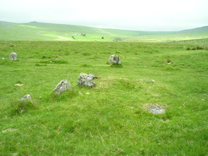
Merrivale Centre S submitted by thecaptain on 1st Nov 2004. Looking northish at the end of row 3 and the remains of its cairn.
The stones in the background are some of those in the southern (or central) avenue.
(View photo, vote or add a comment)
Log Text: Merrivale Centre S Cairn (cairn at the head of Merrivale 3/C stone row): Thank heavens for Sandy G's Stone Rows of Great Britain and Dave P's Prehistoric Dartmoor Walks websites to help sort out the photos for Merrivale 3and its cairn. This area certainly has a glut of stone rows and cairns, and the GPS device on my camera had failed. Whilst I carefully wrote down the numbers of the photographs and the sites they related to, and constantly asked Sandy G on the day which site I was looking at, there's nothing like being able to make a direct comparison almost two months later. Thanks, guys!
As the cairn has a separate site page, but I've recorded them both together, as per the Pastscape record (440357), I've given these two the same visit number.
Merrivale circle
Trip No.133 Entry No.7 Date Added: 7th Jul 2019
Site Type: Stone Circle
Country: England (Devon)
Visited: Yes on 14th May 2019. My rating: Condition 3 Ambience 3 Access 4

Merrivale circle submitted by AngieLake on 9th Feb 2008. Merrivale Circle and menhir looking south towards King's Tor, at about 6.15pm on 10.10.07
(View photo, vote or add a comment)
Log Text: Merrivale Stone Circle: Will you forgive me for saying I wasn't hugely impressed by this stone circle. For some reason I was expecting the stones to be larger and for it to sit more dramatically in the landscape.
On walking to the circle from the western end of Row 2, we came across an impressively large, black coloured boulder buried in the grass, which does not appear to be marked by Butler. I estimated its grid reference to be SX 55304 74704, or just south of this.
The group walked round the circle and the menhir, looking at the pits in the ground, wondering if these could possibly be the remains of holes for other stones. Dave Parks said he had read somewhere that there was thought to have been a double stone circle here, but no proof had yet been found. He later came back to tell me that Butler has marked the pits on his diagrams of Merrivale, see pages 29-31 inclusive of Volume 3 of "Dartmoor Atlas of Antiquities".
I do like Butler's description of the circle: "Their arrangement is markedly eccentric, perhaps deliberately so, with the majority of stones up to a metre off a true circle 19m across and with very variable intervals between" and his notes that the numbers of stones seem to vary across the ages: "several detailed nineteenth century accounts of the site show that the number of stones has actually increased, a most unusual phenomenon, from 9 in the early part of the century, 9 in 1828 (Smith), 10 (1827, Rowe, 1829 Kempe), and 9 (1859 Wilkinson), before reaching the present total of 11 in Worth’s 1895 plan. It seems at least 2 stones have been added, probably by some of the early investigators who were not always particular in recording their restorations, which in any case were often somewhat arbitrary".
Leeden Tor
Trip No.133 Entry No.13 Date Added: 9th Jul 2019
Site Type: Stone Row / Alignment
Country: England (Devon)
Visited: Yes on 14th May 2019. My rating: Condition 2 Ambience 3 Access 5
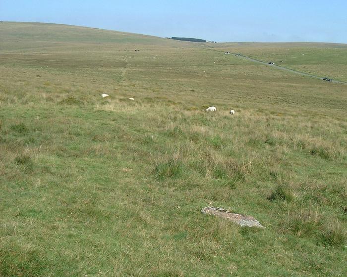
Leeden Tor submitted by Brian Byng on 7th Feb 2002. Leeden Tor - Cairn at upper end SX 5653 7147.
A scrappy row 107 m long but with only 4 stones still upright. Cairn 6m dia
with large central pit. Runs NW - SE with cairn at uphill N W end. The cairn
Has a reeve cutting across it and the row has another reeve cutting across.
Reeve - local word for a prehitoric field boundary maade from roughly
assembled granite blocks now sometimes only traces exist as here. Reeve
building on Dartmoor circa 1400 BC. Seems likely that the rows pred...
(View photo, vote or add a comment)
Log Text: Leeden Tor Stone Row: It was now the afternoon of 14th May. Having driven from Merrivale to the small car park nearest this site at SX 56725 71397, we had 10-15 minutes to spare before everyone arrived. In the meantime, Sandy led us up the hill to look at this stone row. By this time the wind was howling around us, with strong gusts that threatened to blow me over - thank goodness for my walking poles! I took a little satisfaction in watching the small group of soldiers out on exercise also being pummelled by the wind.
When the stones in the row and the cairn at its head were pointed out to me, I could see the alignment and also its relationship to the reave.
Whilst this stone row is near the car park, the tussocky grass made walking a little tricky.
Black Tor (Meavy)
Trip No.133 Entry No.14 Date Added: 17th Jul 2019
Site Type: Multiple Stone Rows / Avenue
Country: England (Devon)
Visited: Yes on 14th May 2019. My rating: Condition 3 Ambience 4 Access 4
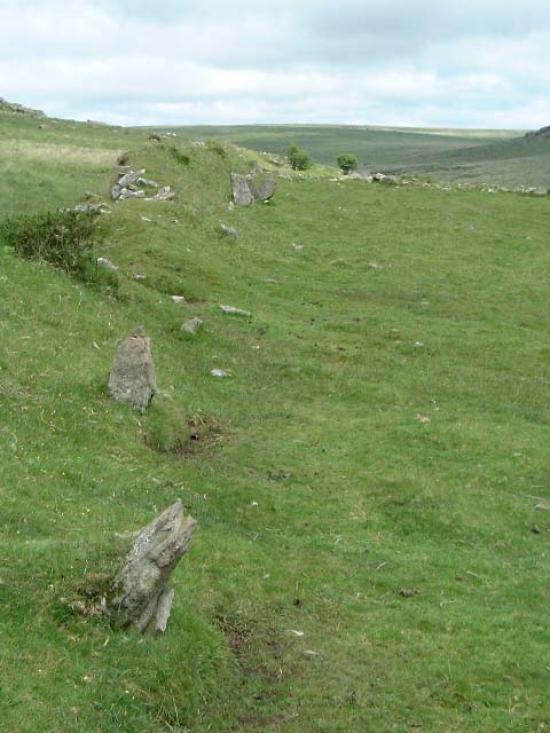
Black Tor (Meavy) submitted by Brian Byng on 7th Feb 2002.
(View photo, vote or add a comment)
Log Text: Stanlake Stone Row (aka Black Tor): Our second stop of the afternoon, and our hope was that as we crossed the road and descended from the slopes that we'd be more sheltered from the wind. Not a chance! However, this did not spoil my enjoyment of the next few sites.
From the Leeden Tor stone row, we crossed the main road, ending up in what -after a spell of wet weather - would have been a boggy dip, but at the time of our visit was relatively dry. Even so trying to find a way across that I, and my wonky knees could manage, was a little amusing. Angie stopped to have her photographs taken against the Tors and woodland behind.
This double stone row is partly hidden by a dry stone wall/earthen bank, put up when the landowner enclosed his land, telling his workers to ‘enclose up to and including the stone row’ according to Sandy.
We had intended to come back and photograph this stone row on the way back, but because I couldn’t make it to the sites we'd planned to go to later in the afternoon because of the steep drops by the leat, we didn’t return this way.
Black Tor Stone Row Cairns (Stanlake)
Trip No.133 Entry No.15 Date Added: 17th Jul 2019
Site Type: Cairn
Country: England (Devon)
Visited: Yes on 14th May 2019. My rating: Condition 2 Ambience 3 Access 4
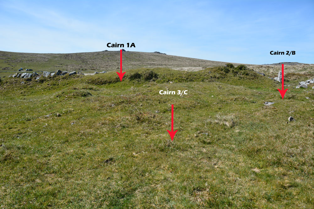
Black Tor Stone Row Cairns (Stanlake) submitted by Anne T on 10th Jul 2019. The three cairns which can be found at the south western end of the Black Tor/Stanlake Stone Row.
(View photo, vote or add a comment)
Log Text: Black Tor, cairns at south-western end of the stone row: These cairns lie just to the south western end of the stone row, to the south of the field boundary containing the northern side of the stone row and just to the west of another field boundary which runs NNW-SSE. Whilst I vaguely recognised these as cairns, without Dave Parks and his magic GPS, and Sandy G coming to give us an explanation, I might have dismissed these as being relatively unimportant. Wrong!
These cairns are recorded on Sandy’s Site Report 4 for the stone row (diagram 6, page 12) but again it was too windy to get these out and study them in any detail. I would really have loved to have spent more time here on a lovely, bright sunny day.
These run just to the west of another field boundary which runs NNW to SSE and just south of the field boundary containing the stone row.
Stanlake Settlement
Trip No.133 Entry No.16 Date Added: 17th Jul 2019
Site Type: Ancient Village or Settlement
Country: England (Devon)
Visited: Yes on 14th May 2019. My rating: Condition 2 Ambience 4 Access 4

Stanlake Settlement submitted by AngieLake on 29th May 2019. With the men out of the way we can see the abundance of lovely bluebells inside the hut circle on this sunny, but very windy, 14 May!
(View photo, vote or add a comment)
Log Text: Stanlake Prehistoric Settlement: Walking down slope from the western end of the stone row, we soon came upon a very interesting, complex and intriguing mix of hut circles, dry stone walls and other features. I lagged behind the group a little, trying to determine what I was seeing as I saw it, but failed miserably - there was so much to take in!
Sandy waited for his Intrepid Dartmoor Expedition Group around the spot marked 6 on his plan (taken from his survey report for Meavy Valley Archaeology: site report 1, figure 3, which I've added as a link to Angie's main site page text.
It is interesting that in his report, Sandy links this settlement to the nearby production of tin, with a large tin works just to the south of the Devonport leat.
Having studied point 6 for some time, we wandered over the hut circles and attached compounds, walking to the south and west, and back round to the long house, of which very little now remains, but there are low banks in the ground, partly cut by a modern field wall.
I was sad to leave, as I could have spent at least another couple of hours here. Yet it was to be my last site of the day, as further to the NW along the Devonport Leat, there was a section of steep drops down into the river and the l eat, and I was unable to proceed any further. As it happened, it was a good job we stopped earlier (it was gone 4pm by this time), as Andy B has caught an earlier train and was waiting in Newton Abbott.
Whittenknowles Rocks
Trip No.134 Entry No.2 Date Added: 11th Jul 2019
Site Type: Ancient Village or Settlement
Country: England (Devon)
Visited: Yes on 15th May 2019. My rating: Condition 2 Ambience 4 Access 3
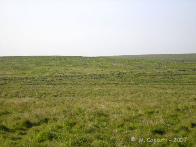
Whittenknowles Rocks submitted by thecaptain on 15th Jun 2008. To the west of the Drizzlecombe sites, on a southern facing hillside, can be found the remains of the very large Whittenknowles Rocks ancient settlement.
(View photo, vote or add a comment)
Log Text: Whittenknowles Rocks Enclosed Settlement: We parked in the small car park at SX 57880 67316 next to a small stream and a ford. Walking across the road bridge, we dived off across a small stream and walked next to a small wood, entering the moorland and continuing in a southerly direction, following an old dry stone wall, then turning eastwards. Most of the walking was really easy, even though this was rough moorland.
We started to come across wall lines and groups of stones, and as I started to ‘get my eye in’, the hut circles and compounds became much clearer (see Butler’s plan, “Dartmoor Atlas of Antiquities”, volume 3, page 126). The hut circles and enclosures were inter-dispersed with uncleared lines of rocks, which Sandy said were natural, and the occupants had just left them as they were.
Towards the southern side of the site, towards the long houses, we came across a small leat, where Sandy explained there had been ‘in the past, a natural disaster’ and all the soil had come down the slope, presumably leaving no soil for growing crops.
I couldn’t believe how far this site extends – some 4.7 hectares (11.61 acres).
I took photographs, blithely thinking the external GPS device on my camera was capturing the locations of the photographs. It wasn't until a couple of days later that I realised there was no lat/long information on the photographs, so I've had to guess, from Butler's plan, more or less where the photos were taken.
Drizzlecombe row 1
Trip No.134 Entry No.4 Date Added: 2nd Aug 2019
Site Type: Multiple Stone Rows / Avenue
Country: England (Devon)
Visited: Yes on 15th May 2019. My rating: Condition 3 Ambience 4 Access 3
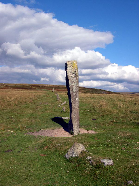
Drizzlecombe row 1 submitted by Karen on 27th Oct 2003. Drizzlecombe SE row looking up the row from its longstone
(View photo, vote or add a comment)
Log Text: Drizzlecombe 1 Stone Row: Having been able to glimpse these stones rows as we walked across the moorland from Whittenknowles Rocks settlement, I couldn’t wait to see these rows at last. But, my goodness, what a richness and complexity of sites all in one small-ish area. I made careful notes throughout the day of which photographs belonged to which row, and hopefully these now all make sense.
Stone Row 1, similar in some ways to the Merrivale Rows, but then again not, had a much, much taller pillar stone. Located at the SW end of the row, this pillar stone can be seen on UK Grid reference finder: SX 59053 66858.
The stone row is unusual because it starts off as a single row (74.5m), then becomes a double row (for 47m), then back to a single row (28m to the cairn) – total length 149.5m.
I was surprised to see quite a few walkers stroll along this valley bottom, some along the row, others not. With the River Plym to our east, the water shimmered in the afternoon light. There were also a lot of cattle in the field, but all seemed used to people and just carried on grazing.
Drizzlecombe Giant's Basin
Date Added: 17th Jul 2019
Site Type: Cairn
Country: England (Devon)
Visited: Yes on 15th May 2019. My rating: Condition 3 Ambience 4 Access 3
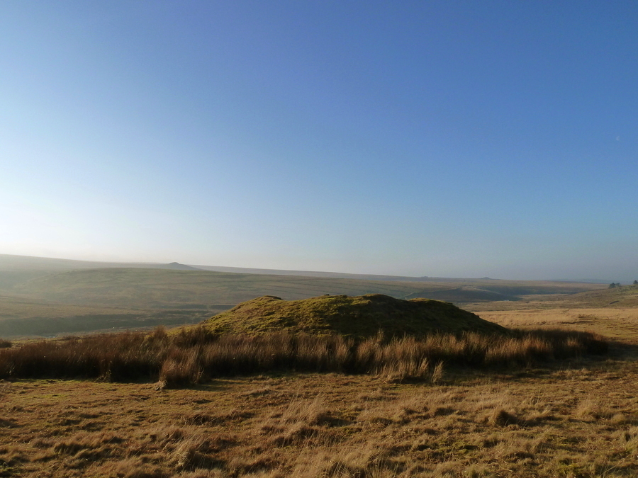
Drizzlecombe Giant's Basin submitted by Bladup on 12th May 2017. The large Giant's Basin.
(View photo, vote or add a comment)
Log Text: Giant's Basin and associated smaller cairns: Before we arrived at the stone rows, despite having printed off the Pastscape and Historic England entries for these sites, I hadn’t really got the full picture of how complex and interesting this area of Drizzlecombe was.
The Giant’s Basin, to the south east of the cairn at the top of Drizzlecombe Stone Row 1/A, is enormous, and reminiscent of the large cairns at Kilmartin, albeit covered in grass.
Thanks to Dave P and his trusty GPS (along with vast knowledge of Dartmoor, of course!) took me over and pointed at the three cairns at its western side.
I walked half way up the slope to the top of the cairn and photographed part of the the robbed out interior.
Drizzlecombe row 2
Trip No.134 Entry No.7 Date Added: 17th Jul 2019
Site Type: Stone Row / Alignment
Country: England (Devon)
Visited: Yes on 15th May 2019. My rating: Condition 3 Ambience 4 Access 3
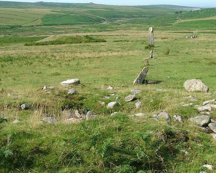
Drizzlecombe row 2 submitted by Brian Byng on 7th Feb 2002. View of what the natives call row C the one with the 14ft (4.3m) high
terminal stone in Burls book page 114. The chinese graphic is on the largest
stone that can be seen at the far end & is facing the camera.
(View photo, vote or add a comment)
Log Text: Drizzlecombe 2: Having three stone rows, their cairns, cists and longstones all in a very close proximity was quite stunning. As we walked up and down this row with Sandy G and the rest of the Intrepid Dartmoor Expedition Group, I was barely able to take it all in - so much to see and understand.
When we started off at the longstone at the western end of the row, there was blue sky and whispy clouds; by the time we'd wandered up to the cairn at the eastern end of the row, a mist/clag had started to descend, so the views from/around the stone row weren't quite as good as earlier, but the atmosphere of this place was just amazing.
The longstone is a really peculiar shape. Butler, volume 3 of "Dartmoor Atlas of Antiquities", page 138, says "According to Worth, it was probably dragged here from Higher Hartor Tor, about a kilometre away".
Drizzlecombe cairn 3
Trip No.134 Entry No.9 Date Added: 17th Jul 2019
Site Type: Ring Cairn
Country: England (Devon)
Visited: Yes on 15th May 2019. My rating: Condition 2 Ambience 4 Access 3

Drizzlecombe cairn 3 submitted by simcon on 27th Aug 2003. SX593671 Drizzle Combe Cairn West, Dartmoor Devon. This cairn is at the top end of the leftmost row at this site. The view in this picture is looking back down the row in a south westerly direction. You can clearly see the other row in the left of this picture extending way down the hill.
(View photo, vote or add a comment)
Log Text: Drizzlecombe Cairn 3: cairn at the head of Drizzlecombe Stone Row 3. The stone row is just offset from the centre of the cairn. Butler, in his "Dartmoor Atlas of Antiquities, page 138, says: "the third row descends from cairn 3 surrounded by an outer ring of slabs 8.6m across mostly in contact with its base ... probably only three stones are missing out of t10, the largest of those remaining standing about a metre high facing the row". Of the three cairns at the eastern end of the row, this cairn has the tallest stones protruding out of it, and the most character. See Butler's diagram of it on page 139 (fig. 49.19.3).
After looking at the eastern end of the row, we proceeded up the slope, looking for the Drizzlecombe Cist and the settlements at the top of the slope, meandering back along stone row 3 as we came back.
Drizzlecombe row 3
Trip No.134 Entry No.10 Date Added: 2nd Aug 2019
Site Type: Stone Row / Alignment
Country: England (Devon)
Visited: Yes on 15th May 2019. My rating: Condition 3 Ambience 4 Access 3
Drizzlecombe row 3 submitted by ernar on 17th Oct 2004. The NW stone row at Drizzlecombe begins at the center cairn (of a 3-cairn group oriented SE just downhill the settlement) and is aligned at 235º.
(View photo, vote or add a comment)
Log Text: Drizzlecombe Stone Row 3: The last of the stone rows we visited today (although there was to be a minor, minor surprise at Yellowmead to end the afternoon). This surprising row, the same length as Row 1, and bends in the middle (it’s not straight).
We split the visit to this row into two; the first part was looking at the eastern end of the row and the cairn; the second was after we’d wandered up slope to look at the larger cist, the settlements and another large cairn. We then meandered back down Row 3. It was on the way back that I found a compass between the tussocks of grass, covered in heavy dew and I thought the moisture had got inside the mechanism and was ruined. I was going to leave it by the stones in case anyone collected it, but given where it was, we concluded no-one was likely to walk along this particular spot between the rows. I later found out that it was a military compass, probably dropped by one of the many soldiers who carry out exercises in this location.
The longstone at the eastern end of the row was intriguing. It appeared to be undressed granite, and bore some sort of resemblance to the marker stone seen earlier today, but is most definitely part of row 3. The large, but friendly, cattle in the field liked to lean against it, presumably because it absorbed the heat of the sun, or to scratch.
Drizzlecombe W row
Trip No.134 Entry No.13 Date Added: 17th Jul 2019
Site Type: Stone Row / Alignment
Country: England (Devon)
Visited: Yes on 15th May 2019. My rating: Condition 1 Ambience 3 Access 3
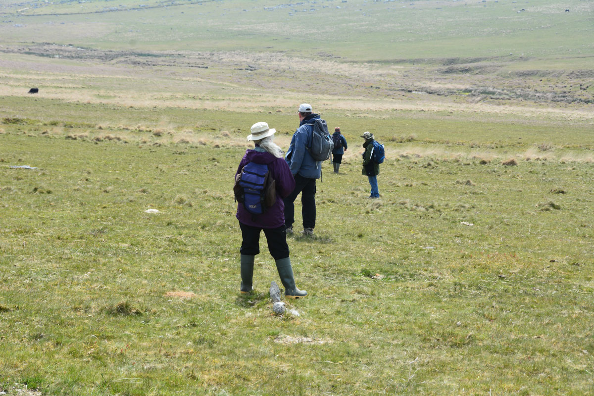
Drizzlecombe W row submitted by Anne T on 15th Jul 2019. In trying to identify this elusive row, Sandy asked members of the group to stand on stones they thought might be part of the stone row. From foreground to background: Janet Daynes, Dave Parks (Prehistoric Dartmoor Walks), Gordon Fisher (just off to the right) and Sandy G. Sandy G is walking down the line of stones. He is planning a return trip later in the year to take a closer look.
(View photo, vote or add a comment)
Log Text: Drizzlecombe West Stone Row: Whilst Sandy G had our group here, he asked us all to help him have a look for this elusive stone row, and we were happy to help, which mentioned in Burl but not in Butler (I haven’t been able to find the mention in Burl, yet).
The others in the group had a far keener eye than me for spotting the lines of stones in the grass, so I wandered up slope and stood on a cairn, observing. Not having my GPS with me, I think this is Butler Drizzlecombe Cairn 15 at SX 5925 6721.
Sandy had the rest of the group stand on stones which they thought might be part of the row, to see how they lined up.
He plans a return visit in September 2019, so I’ll need to watch for an update.
Drizzlecombe Settlement
Trip No.134 Entry No.15 Date Added: 17th Jul 2019
Site Type: Ancient Village or Settlement
Country: England (Devon)
Visited: Yes on 15th May 2019. My rating: Condition 2 Ambience 4 Access 3
Drizzlecombe Settlement submitted by ernar on 17th Oct 2004. Settlement ruins on Drizzlecombe. With a breathtaking view of the megalithic complex and the valley, this settlement was located uphill from the several cairns and Stone Rows forming the Complex. Behind the stone maniacs and the grass managers (sheep) you can see the westernmost cairn shown on the OS map.
(View photo, vote or add a comment)
Log Text: Drizzlecombe Settlements: After the stone rows, we move up-slope to try and find row 4. Whilst the rest of the group helped Sandy G identify possible stones in this row, I wandered over to Butler's Cairn 18, photographing what looked like some hut circles embedded in the turf. Arriving at Cairn 18, I walked to the top of to look at the enclosed settlement to its south/south western side, which I found fascinating.
Dave Parks was also meandering around the cairn, so he and I wandered back towards the group, with me taking photos of the long, low banks running across the pasture.
Higher up the hill was yet another settlement(s) which I barely took in. This area is so complex and interesting, yet I confess to 'brain overload' by this time of the afternoon, especially as there was so much more yet to come!
I've since managed to get hold of a pdf copy of Jennifer Robertson's unpublished thesis "Archaeology of the Upper Plym Valley" (all 592 pages), which I'll dip into soon, to try and understand more about this area.
