Contributory members are able to log private notes and comments about each site
Sites Anne T has logged. View this log as a table or view the most recent logs from everyone
Dalginross
Trip No.53 Entry No.3 Date Added: 10th Oct 2017
Site Type: Stone Circle
Country: Scotland (Perth and Kinross)
Visited: Yes on 28th Sep 2017. My rating: Condition 3 Ambience 4 Access 5
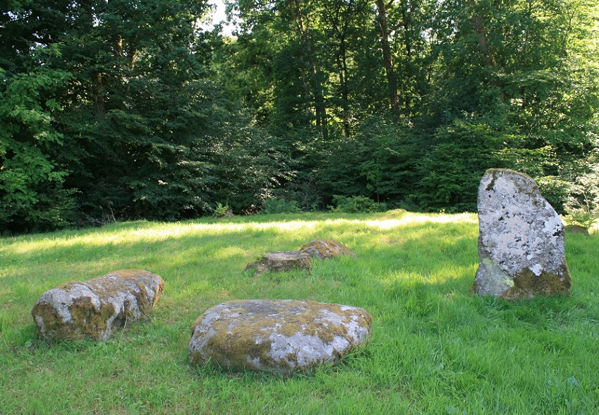
Dalginross submitted by postman on 13th Aug 2013. Peace and quiet, some cars may have gone past, but I didn't notice them.
(View photo, vote or add a comment)
Log Text: Dalginross Four Poster, Near Comrie: From the Roman Stone and its companions, we headed north towards Comrie. Where the B827 takes a sharp left hand turn through Dalginross and Comrie, take the South Crieff Road towards Easter Dalginross and Muirhead Cemetery, where there is ample parking.
From the layby by the cemetery, we walked back to the road junction with South Crieff Road and the trck to Dalginross Muir Farm; the stone circle is nestled under the trees, with moss covered tree stumps around it.
Quite an enigmatic little stone circle, but I confess that it seemed a little like it had been recently put in here, perhaps as a landscaping feature. I had a bit of a hard time convincing myself it was Bronze Age, but Canmore confirms it is indeed.
Tullybannocher
Trip No.53 Entry No.4 Date Added: 11th Oct 2017
Site Type: Stone Circle
Country: Scotland (Perth and Kinross)
Visited: Yes on 28th Sep 2017. My rating: Condition 3 Ambience 4 Access 4
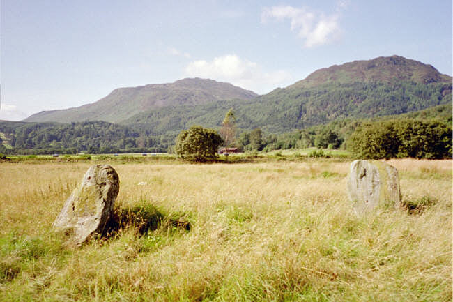
Tullybannocher submitted by hamish on 23rd Jul 2005. It's easy to miss this one, I stopped in a field gateway to look at the map glanced round and there it was in that field. It was a four poster by repute but only two remain. Nick thinks there are cupmarks on the stones but not so sure myself.
(View photo, vote or add a comment)
Log Text: Wester Tullybannocher Stone Circle, Comrie: From the Dalginross/Dunmoid Four Poster Stone Circle, we made our way north through Comrie, heading west on the A85, over Dalginross Bridge then turning left. The road goes through a zig-zag then a bend, passing a caravan park on the right hand side at Twenty Shilling Wood. Just after the road turns a right hand bend there is a farm track to your right hand side, with room for a car to pull in before the gate (on opening the gate there is a small area of hard-standing for a couple of cars). We parked just in front of the gate and walked along the farm track to the stones, which were peeping out of knee high grass in the un cultivated part of the field to our left hand side.
We couldn’t spot any cup marks on the western stone, despite walking round the stones several times. Sited on flat pastureland with low hills rising around, and lying just north of the River Earn, this is a lovely spot, although a little spoiled by the heavy traffic on the A85 just to the south of the stones.
St Fillan's Chapel (Comrie)
Trip No.53 Entry No.5 Date Added: 11th Oct 2017
Site Type: Ancient Cross
Country: Scotland (Perth and Kinross)
Visited: Yes on 28th Sep 2017. My rating: Condition 2 Ambience 4 Access 4

St Fillan's Chapel (Comrie) submitted by Anne T on 11th Oct 2017. The cross slab, lying just to the south of the south wall of the chapel. In 2014 it was found recumbent but, comparing photographs with the Canmore page (24872), it has now been stood upright.
(View photo, vote or add a comment)
Log Text: St. Fillan's Chapel, west of Comrie: From Wester Tullybannocher Stone Circle, we carried on west along the A85, turning left into a road leading down to St. Fillan’s Golf Club and Western Dundurn Farm. Just before the farm buildings, the track splits. The eastern most track is gated off, and the road was very narrow, so we squeezed the car in by the gate intending to run back and move it if it got in the way. There was a herd of cattle in the field, although the churchyard has a dry stone wall around it.
Walking along the track, watched curiously by the golfers on the adjacent course, until I was level with the church ruins (very like Logie Old Kirk), then squidged my way through the wet turf to the far side, where the iron gate to the churchyard was locked, but there was a stone stile into the graveyard.
This is a very, very pretty spot. It is a very old site. Typically, there was no phone signal here so I couldn’t call up the Canmore record. I went round photographing lots of different things. I managed to miss the recumbent cross slab (most of them were overgrown with grass), although there were a couple of other interesting stones and features. Lovely site but disappointing not to have found the cross slab, even though I must have looked at it.
Also known as St Fillian's; Dundurn Burial-ground; Stewarts Of Ardvoirlich Burial-place.
Lawers
Trip No.53 Entry No.6 Date Added: 11th Oct 2017
Site Type: Standing Stone (Menhir)
Country: Scotland (Perth and Kinross)
Visited: Saw from a distance on 28th Sep 2017. My rating: Condition 3 Ambience 3 Access 4

Lawers submitted by BigSweetie on 19th May 2004. Perthshire stones photo by Andy Sweet
(View photo, vote or add a comment)
Log Text: Lawers Standing Stone, East of Comrie: From St Fillan’s Chapel, we headed back towards Comrie, this time continuing east along the A85 until we reached the gatehouse at the northern side of the road, just before Comrie Croft Caravan Park.
The landowner had padlocked all the gates, but being within site of the stone, we ended up scrambling over the low stone wall by the small stream running parallel with the eastern side of the field, and separated from the field by a tree lined footpath/track.
On getting level with the stone, I tried (very hard) to photograph it, but was constantly head-butted by a very friendly ginger horse! He was to friendly to contemplate climbing the wooden fence into the field without a bag of apples or pony nuts, so I had to content myself with having my sleeves chewed whilst I tried to photograph the standing stone.
We walked back along the footpath and along the northern side of the field, but the stone was too far away to get a good image of, even with maximum zoom on the camera lens. Having reached the western side of the field, the gates were padlocked. Andrew could squeeze between the wooden rails of the fence, but I was a bit too plump, so clambered unceremoniously over the somewhat higher stone wall at this end of the field.
Craigneich Farm
Trip No.53 Entry No.7 Date Added: 11th Oct 2017
Site Type: Standing Stone (Menhir)
Country: Scotland (Perth and Kinross)
Visited: Yes on 11th Oct 2017. My rating: Condition 3 Ambience 3 Access 5
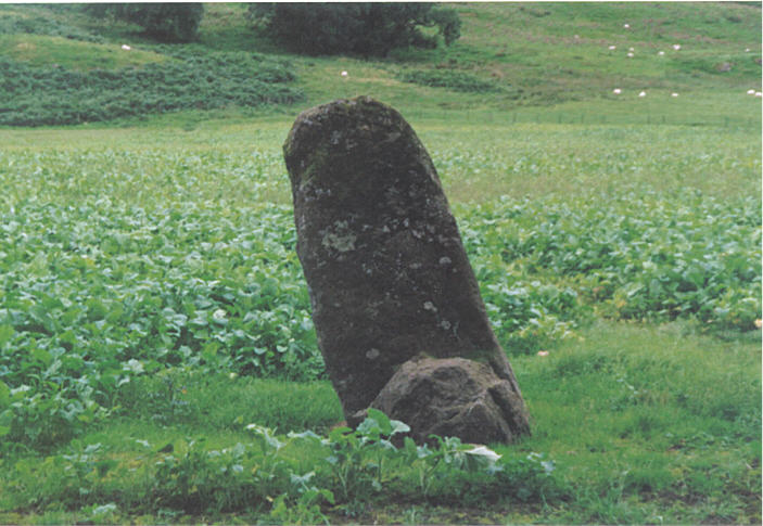
Craigneich Farm submitted by hamish on 26th Jul 2005. This stone is easily seen from the roadside.
(View photo, vote or add a comment)
Log Text: Craigneich Farm Standing Stone, south of Comrie: From the Lawers Standing Stone, we drove south back through Comrie on the B827, to the junction of a minor road at Coilcambus with a phone box on the corner. Turning right (travelling south), we followed the road along to where Machany Water ran close to the road, just before Craigneich Farm. There was a track leading up to the moors on the opposite side of the road, and on this single track road, we needed to pull the car into this entrance for a few minutes while we looked for the stone. We had to climb over wall into field, but the stone wall was low and the wiring broken, so it was easy to access the field.
A somewhat neglected stone, separated from those on the moorland to the south by the road and hedges, it was oddly shaped. By now it was dusk, and I had to use the flash on the camera to get a decent photograph. Worth stopping to have a look.
There were other standing stones which we could see up on the moor to the south, but it was too late in the day to walk up to these and back as it would have been dark by the time we reached the first one.
Westfield Farm Refuge Stone
Trip No.54 Entry No.1 Date Added: 11th Oct 2017
Site Type: Early Christian Sculptured Stone
Country: Scotland (West Lothian)
Visited: Yes on 30th Sep 2017. My rating: Condition 2 Ambience 2 Access 4
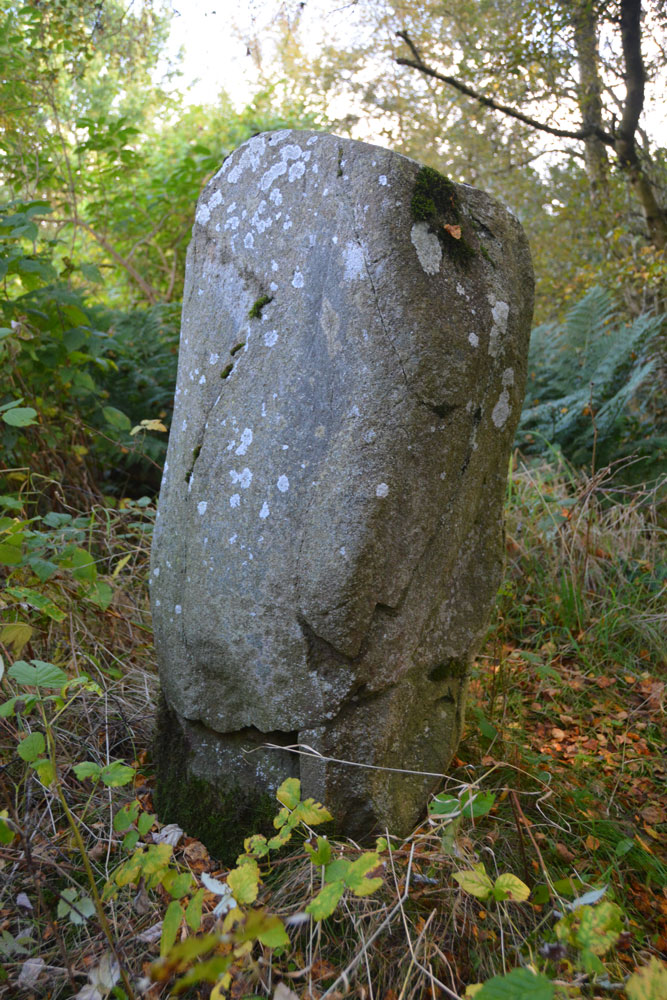
Westfield Farm Refuge Stone submitted by Anne T on 11th Oct 2017. One of the other faces of the stone, where it shows slight traces of damage, presumably from having been toppled and re-erected. If the 1998 excavation report from Historic Scotland is correct, this stone may be prehistoric and associated with a larger prehistoric site, maybe having been reused as a Refuge Stone after the establishment of Torphichen Preceptory.
(View photo, vote or add a comment)
Log Text: Westfield Farm Refuge Stone (possibly prehistoric), West Lothian: Our last day for exploring before heading home, and this was a day we’d set aside during the week to try and find some of the refuge stones associated with Torphichen Preceptory. We didn’t have a detailed map for this area, and didn’t pass a place to buy one, so had to make do with mobile phones and Canmore records.
The Westfield Farm Refuge Stone is situated to the east of Westfield Village, south of the B8047, near a ‘fish food factory’. Driving through Westfield village on the B8028, we turned right onto the B8047 and followed it round a couple of bends and found the factory. Just before the factory, located on a bend, I spotted a sign saying ‘Refuge Stone’, heading off south east through some wasteland.
We managed to park just by the sign, in a small layby which had been used for fly-tipping. Following the very vague footpath through the wooded area, this eventually disappeared and we were left surrounded by birch trees and weeds. Through the shrubbery there was a mound, and peering closer, there was a set of very overgrown steps that had been cut into the bank. Climbing up these, and hunting around some more, we finally spotted this much neglected stone virtually hidden in the weeds. I trod down some of the taller weeds to see the stone more clearly.
A treasure, but one hidden away in a tumble of brambles, nettles and detritus. It looked as if no-one had visited this stone in a long time. I was very pleased to have found it.
North Couston Refuge Stone
Trip No.54 Entry No.2 Date Added: 12th Oct 2017
Site Type: Early Christian Sculptured Stone
Country: Scotland (West Lothian)
Visited: Couldn't find on 30th Sep 2017. My rating: Condition -1 Ambience 3 Access 4
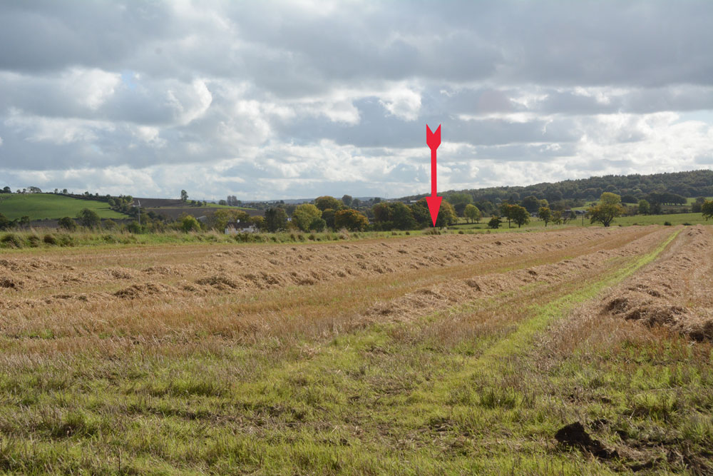
North Couston Refuge Stone submitted by Anne T on 12th Oct 2017. The arrow marks the approximate position in the field where this stone was last recorded. We walked up and down the field boundary twice, me poking the weeds and bushes on both sides with my walking pole at very short intervals, but could find nothing.
(View photo, vote or add a comment)
Log Text: North Couston Refuge Stone, West Lothian: From the Westfield Farm Refuge Stone, we set off towards North Couston with only a very small scale book of maps and Trigpointing UK on our mobile phone to try and find this stone. From Westfield, we got back onto the A801 southbound, then turned left onto the A800, turning left again onto a minor road to a farm, parking in a largish concreted area next to the field entrance at NS 95279 70925. From the Canmore record, we didn’t have much hope, but given as we were not far away, wanted to check whether or not this Refuge Stone was still there.
We waded around the edges of the very wet entrance to the field (the gates into the neighbouring field were almost shoulder high – too high for me to attempt to climb over, although this route would have been dry). The field edges of this recently harvested field were then drier, so we walked along the eastern side, then headed south at the corner, along the old, grubbed out hedge line. We walked most of the length of the Followed the field edges, prodding the fence line as I went, but could find no evidence of any stone along the field boundary.
Torphichen Churchyard Stone
Trip No.54 Entry No.3 Date Added: 12th Oct 2017
Site Type: Standing Stone (Menhir)
Country: Scotland (West Lothian)
Visited: Yes on 30th Sep 2017. My rating: Condition 2 Ambience 4 Access 5

Torphichen Churchyard Stone submitted by Anne T on 15th May 2017. The side of the Sanctuary stone showing at least five cup marks. The stone 'swells' from the ground to the top, which Canmore says is 12 and one half inches square.
(View photo, vote or add a comment)
Log Text: Torphichen Preceptory (next door to the church): Also known as Hospital Of Torphichen; Preceptory Of St John; War Memorials.
Finally, on our third attempt, just after 2pm on a Saturday afternoon, we managed to find the small visitor portacabin open and a guide present. Guide was Liam from Order of St. John. Charming, very helpful man, in looks reminiscent of the Knights Templar. Because he was giving individual tours to everyone who turned up, he was over-stretched, and didn’t really have time to spent with us, but answered my questions as best he could.
Liam pointed out some of the features in the Preceptory itself, including old architects drawings on the walls, and walked us up to the exhibition on first floor of tower – up 45 spiral stone steps – where he pointed out a grave marker used as a lintel.
When another family arrived, he left us to take them round. I found out, through reading the display, that there was an incised stone with cross in the Parish church; Liam said unfortunately he didn’t have the keys for the church, but to come back if we wanted to look.
Cairnpapple Hill
Trip No.54 Entry No.4 Date Added: 12th Oct 2017
Site Type: Round Cairn
Country: Scotland (West Lothian)
Visited: Yes on 30th Sep 2017. My rating: Condition 3 Ambience 4 Access 4
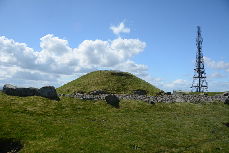
Cairnpapple Hill submitted by Anne T on 21st May 2017. View of the north side of the cairn, looking back towards the visitor centre and mast behind.
(View photo, vote or add a comment)
Log Text: Cairnpapple (Chamber), West Lothian: We’d spent quite a lot of time around Cairnpapple and surrounding area, but on this trip had not visited. Andrew had not seen this site before, so we parked and joined the other families visiting in the wind and drizzle, and I managed to buy a guide book and as the other visitors drifted off, went back to talk to the guide. I saw the display showing the cup and cup & ring marked stones in the chamber.
The chamber into the concrete dome was open today, but the ladder was really steep, and even Andrew described it as difficult to get down. After he emerged from taking the first batch of photographs, I took him back into the hut to speak to the guide and he clambered back into the chamber and took some more photos. I confess the photograph in the hut made the cup and ring marks a lot more visible than in reality!
Then onto our last trip of our holiday, and one I was looking forward to – another of the Torphichen Refuge Stones.
Craigmailing Boundary Marker (Torphichen)
Trip No.54 Entry No.5 Date Added: 12th Oct 2017
Site Type: Marker Stone
Country: Scotland (West Lothian)
Visited: Yes on 30th Sep 2017. My rating: Condition 3 Ambience 4 Access 3
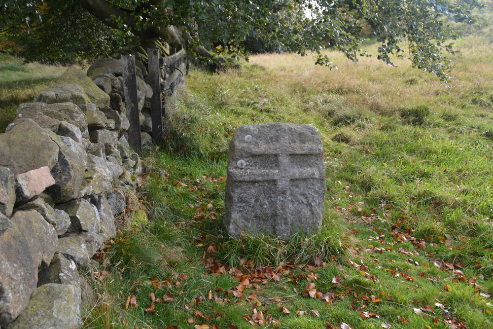
Craigmailing Boundary Marker (Torphichen) submitted by Anne T on 12th Oct 2017. Another view of the northern face of this stone, showing its proximity to the stone wall.
(View photo, vote or add a comment)
Log Text: Craigmailing/Witchcraigs Boundary Stone: To find this stone, we parked near to the Little Criagmailling cross base found earlier this week and followed a little-used footpath through the woodland. This footpath joined another wider one, crossing a stile into a little tree-lined lane which followed a trickling stream to our left hand side.
This, very unexpectedly, opened up into an area of grass/heath with a viewpoint. As soon as you sight the viewpoint with its dry stone wall and information boards, the refuge stone is to your right hand side. This is a really rather special place. And being named Witch Crag made it much more atmospheric!
The refuge stone is no longer in the wall, but has been sited at 90 degrees to it.
Sourhope Hillfort
Trip No.55 Entry No.1 Date Added: 12th Oct 2017
Site Type: Hillfort
Country: Scotland (Scottish Borders)
Visited: Yes on 8th Oct 2017. My rating: Condition 2 Ambience 4 Access 3
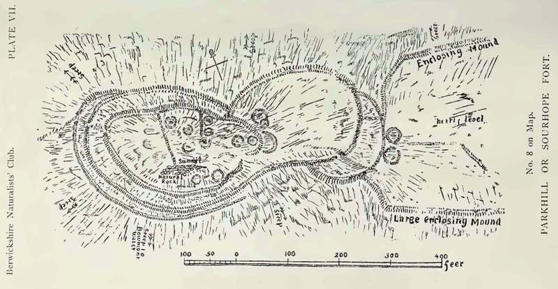
Sourhope Hillfort submitted by durhamnature on 5th Sep 2012. Drawing of the hillfort, 1897, from Berwickshire Naturalists via archive.org
Site in Scottish Borders Scotland
(View photo, vote or add a comment)
Log Text: Sourhope Hillfort, Scottish Borders: Well, this morning was a surprise, as rain had been forecast, but we woke up to a blue and cloudy sky, with little wind, so we decided to make the most of the nice weather before the clocks go back at the end of the month.
We used an ‘unusual’ (twisty/windy) route to reach this site. We drove up using the A68 past Carter’s Bar, then taking the first turning right and following the minor roads up through Hownam towards Yetholm, turning right and heading back down south at Primsidemill.
We followed the Bowmont Water Valley along to where the Sourhope Burn joins it, then headed north east up the dead end road to Sourhope Farm. Just past the cattle grid by the barns to the south west end of SouthopeFarm, there is room to park the car on the verge. We then headed up past the farm, turning right and going through two gates by a barn at NT 84596 20177, then following the path uphill towards Park Law Fort, then turning south west at NT 85047 19886 and following a quad bike up a relatively steep part of the hill, to approach the fort from its eastern side, entering at NT 84858 19793 on the south eastern side.
The outlines of the fort can be clearly seen on UK Grid Reference Finder. From below, we could see what looked like telegraph poles on top of the fort; getting closer, there are two television aerials on the western side of the fortifications!
There were great view from the top of this hillfort. We’d printed off the Canmore plan and description before we went, but even so, it was difficult to tie the words up with what we were trying to make out on the ground. The structures and hut circles on the eastern side of the fort were the easiest to interpret.
It was a nice walk, and exploring the hillfort was really thought-provoking, thinking what it would have been like for the occupants of this fort.
Fasset Hill (Sourhope)
Trip No.55 Entry No.2 Date Added: 12th Oct 2017
Site Type: Ancient Village or Settlement
Country: Scotland (Scottish Borders)
Visited: Yes on 8th Oct 2017. My rating: Condition 2 Ambience 3 Access 3
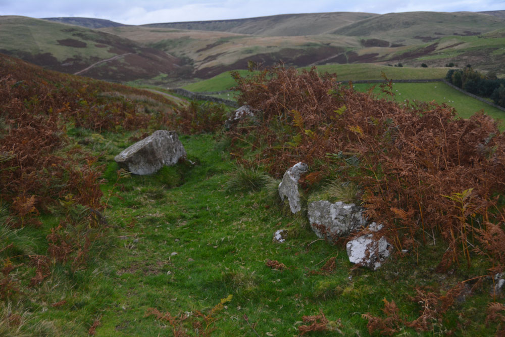
Fasset Hill (Sourhope) submitted by Anne T on 12th Oct 2017. The boulder faced rubble wall to the south end of this rectangular enclosure - badly disturbed/decayed but the line is still visible amongst the tall bracken.
(View photo, vote or add a comment)
Log Text: Fasset Hill Scooped Settlement, Sourhope: It was probably a silly time of year to look at this settlement, as the bracken was very tall, and probably also too late in the evening, as dusk was falling. But, hey ho, we were nearby and decided to walk back down to Sourhope Farm, and follow the track up Fasset Hill.
From Sourhope hillfort we walked back down the track to the farmhouse near the junction of the Sourhope and Kaim Burns, turned north east and walked over the wooden bridge at NT 84588 20250. From there we followed the metalled road up past a dump/quarry area, where the metalled road turns left/west and a stony track continues east. The Fasset Hill settlement is around the sheepfold on the hill just to the north of the track just past the ‘dump’.
The photographs don’t really do this site justice, as it was easier to see with the naked eye rather than catch it on photographs – the area was well defined on the ground. The sheepfold now occupies just west of centre, and what look to be the foundations of buildings can be found in its south east corner. The site looks like a building platform scooped out of the hillside. Canmore says it was probably constructed in Romano British times, and later reoccupied in the medieval.
There were a couple of other settlements nearby, but it was getting so dark, it was getting silly. We decided to walk swiftly back to the car and head home.
St Peter's Church (Bishopton)
Trip No.56 Entry No.1 Date Added: 16th Oct 2017
Site Type: Ancient Cross
Country: England (County Durham)
Visited: Yes on 15th Oct 2017. My rating: Condition 2 Ambience 4 Access 5
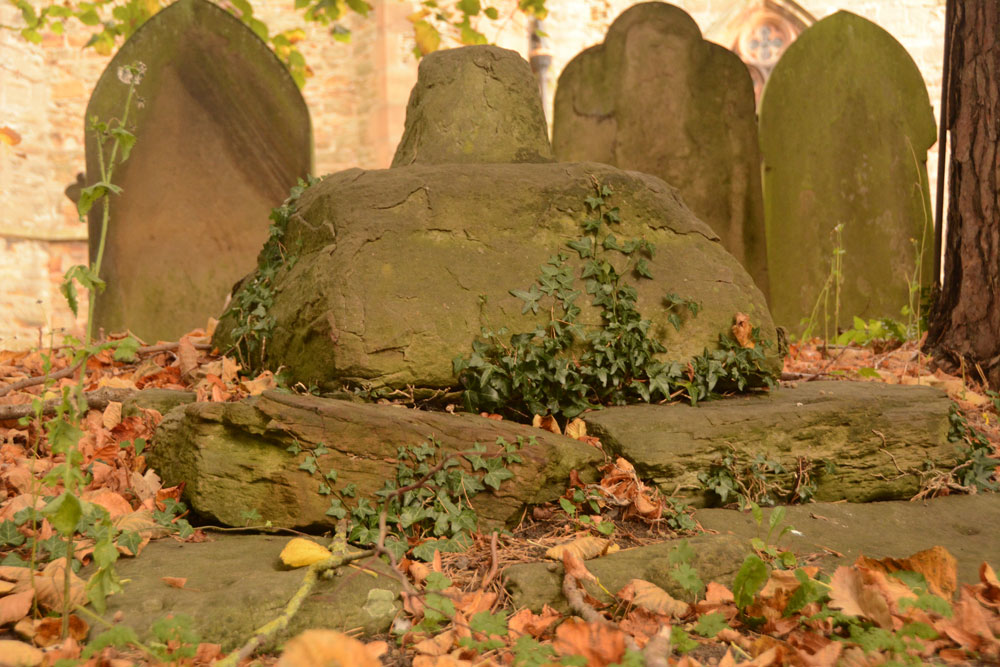
St Peter's Church (Bishopton) submitted by Anne T on 16th Oct 2017. Standing next to the churchyard wall which runs along High Street, looking over the wall to the cross base, socket stone and remains of the shaft.
(View photo, vote or add a comment)
Log Text: Medieval Cross in St. Peter's Churchyard, Bishopton: Driving into Bishopton, I realised looking at the cottages and houses that this was a very old village, and had it not been for all the parked cars, it would have been very picturesque.
The church was locked so we couldn’t go in, but the remains of this cross was visible near the edge of the churchyard. It was easier to photograph it from the road, looking over the wall.
I didn’t photograph the replacement village cross, in the very small village green, near the wall memorial, as I thought it was modern, and we didn’t stop after looking at the earthworks nearby.
Castle Hill (Bishopton)
Trip No.56 Entry No.2 Date Added: 16th Oct 2017
Site Type: Misc. Earthwork
Country: England (County Durham)
Visited: Yes on 15th Oct 2017. My rating: Condition 2 Ambience 4 Access 4
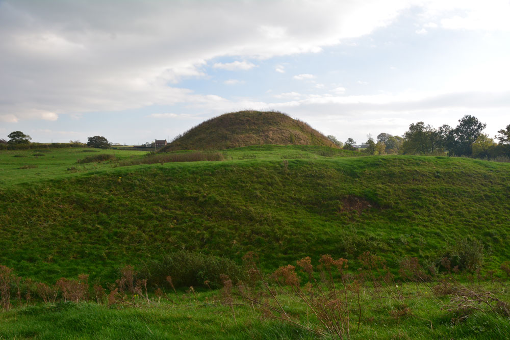
Castle Hill (Bishopton) submitted by Anne T on 16th Oct 2017. The motte from the north western outer defensive bank.
(View photo, vote or add a comment)
Log Text: Castle Hill, Bishoptop: This monument is literally just within sight of the church, just over 420 metres to the north west, at the south eastern edge of the village, opposite the pub and next to a garage.
There is a public footpath which runs through the field in which this motte and bailey is sited, accessible by a rather tumbledown stile. There is also an information board, although this had cracked and fallen off its plinth. We pieced it back together to have a quick read, although the text was so faded we couldn’t really make it out.
The site is really well preserved, and I’ve not seen another quite like this. It is as if someone has built a large hillfort in a flat piece of land and put a round mound towards one end. There are also extensive earthworks leading off this.
The motte itself has been fenced off, presumably to stop the sheep and cattle from damaging it, although there is a gate in the south western part of the fence, with a very steep path leading up to the top of the motte.
We walked around the exterior twice, marvelling at the deep ditches and banks.
All Saints (Rudby-in-Cleveland)
Trip No.56 Entry No.3 Date Added: 16th Oct 2017
Site Type: Early Christian Sculptured Stone
Country: England (Yorkshire (North))
Visited: Yes on 15th Oct 2017. My rating: Condition 3 Ambience 4 Access 5
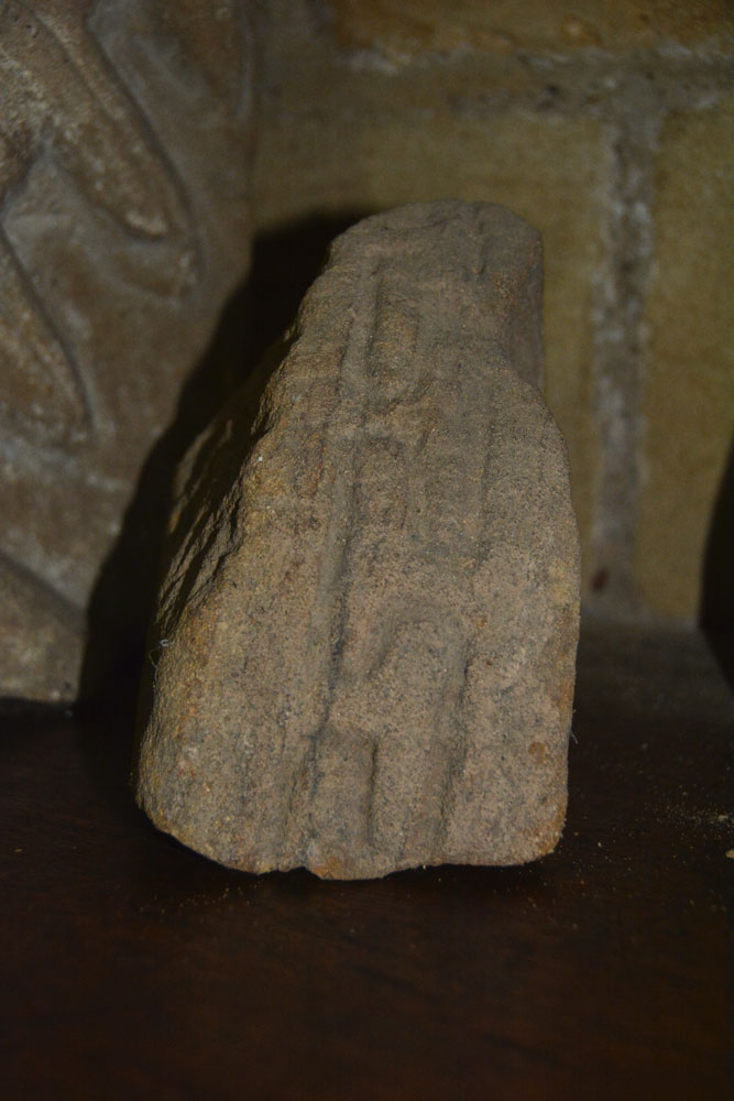
All Saints (Rudby-in-Cleveland) submitted by Anne T on 16th Oct 2017. The outer edge of AS Corpus Rudby 01, which shows a 'grooved meander' pattern. This stone fragment could date from the 11th century, and is possibly earlier.
(View photo, vote or add a comment)
Log Text: All Saints Church, Rudby-in-Cleveland: We’d spent so much time walking round Castle Hill, that by this time of day the sun was very low in the sky and dusk was going to fall pretty quickly, pretty soon.
Parking opposite the church at NZ 47133 06667, just off Rudby Bank in a small paved area which apparently used to be used for the main benefactor’s horse and carriage, we walked into the churchyard.
Much to our surprise, the church was open, so we let ourselves in. Parts of this building are really old. There is also an Elizabethan pulpit and a memorial slab to a 14th century monk holding a chalice.
We also found some old pieces of stone, not mentioned in the church guide, but one portion of which was on the AS Corpus.
Whilst I explored the church, Andrew went in search of the moat, and found it running round the northern part of the churchyard. It is very weird – just a large ditch, most of which is largely dry.
The eastern (modern) part of the graveyard contains the grave of Sir Rex Hunt, Governor of the Falkland Islands when Argentina invaded in 1982.
In the west wall of the vestry, this is also a very strange headless statue, which has been inserted into the wall using part of an old tombstone as a shelf.
St Cuthbert's Church (Darlington)
Trip No.57 Entry No.1 Date Added: 25th Oct 2017
Site Type: Ancient Cross
Country: England (County Durham)
Visited: Yes on 25th Oct 2017. My rating: Condition 3 Ambience 4 Access 5

St Cuthbert's Church (Darlington) submitted by Anne T on 25th Oct 2017. AS Corpus Darlington 1 and Darlington 2, displayed in the nave, against the second pier of the south arcade.
(View photo, vote or add a comment)
Log Text: Ancient crosses, Saxon sundials and a hogback in Darlington: Originally due to go out for the whole day, we suddenly found ourselves having to rush back for an engineer arriving at our house after lunch. As we had an appointment to be at the church for 10.30am, to look round whilst there was a service in the chancel, we decided there was time enough to get to Darlington and back.
We met the church wardens we'd been liaising with very briefly to say ‘hello and thanks’ to. It was amusing as at least 3 people came into the church wanting to know where the church office was, so I pointed them in the general direction. It was odd wandering around the church with a communion service taking place in the chancel and sanctuary, and I was careful not to use the flash on the camera, although parts of the church were very dark, especially around the hogback.
We couldn’t find a couple of the catalogued items from the Corpus, and I struggled to identify which of the three cross heads we were seeing against those the Corpus lists. I looked through the Information for Guides folder and found an Architectural Assessment by Petr F. Ryder, Historic Buildings Consultant, dated 1997, part of which read:
“Pre Conquest Sculpture: Six pieces of Pre-Conquest sculpture are listed by Cramp (1984, 62-3). Of these one cross head, with the top of the shaft, dated to the late 10th or early 11th century, and an incomplete cross head of the early 11th century, are displayed in the nave, against the second pier of the south arcade; in a corresponding position on the opposite side of the nave is a supposedly Saxon sundial. In the north transept aumbry is part of a hogback, seen as a ‘crude copying of a type more elegantly represented at Brompton, Yorkshire’, and dated to the second quarter of the 10th century. Another fragment, seen as part of a large recumbent slab of the second half of the 10th century, lies in the south transept along with medieval cross slabs. A fifth stone which formerly lay outside the south transept, seen as possibly part of a dedication or ‘station’ slab from within the church, is now lost.”
St Cuthbert's Church (Billingham)
Trip No.58 Entry No.1 Date Added: 9th Nov 2017
Site Type: Ancient Cross
Country: England (County Durham)
Visited: Yes on 8th Nov 2017. My rating: Condition 3 Ambience 4 Access 5
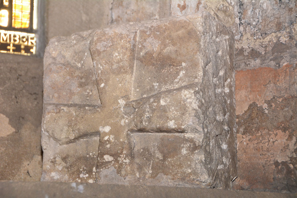
St Cuthbert's Church (Billingham) submitted by Anne T on 9th Nov 2017. AS Corpus Billingham 15, which dates from the late tenth to early eleventh century.
(View photo, vote or add a comment)
Log Text: Anglo Saxon Stones, St. Cuthbert's Billingham: We’d arranged to meet the verger, at the church at 12 noon. We arrived 10 minutes early, and found the south door didn’t have a keyhole, so wondered how we’d get in. It turns out there’s an entrance from the north side of the church. We wandered around the tower looking for the Anglo Saxon cross pieces built into the church tower. Some of these took some spotting, then we heard the verger calling us in.
The church is large, a fusion of 11th century and 1930s extension. The churchyard is huge – a surprise for somewhere so industrial as Billingham, but then this is Billingham Green.
I much enjoyed this visit. The verger spent over an hour taking us round, and took delight in showing us the stones, even one hidden behind a noticeboard against the west wall.
All Saints (Crathorne)
Trip No.58 Entry No.2 Date Added: 9th Nov 2017
Site Type: Ancient Cross
Country: England (Yorkshire (North))
Visited: Yes on 8th Nov 2017. My rating: Condition 3 Ambience 4 Access 5

All Saints (Crathorne) submitted by majick123 on 15th Jun 2013. Plinth where cross may have stood. at the East end of the chutch
(View photo, vote or add a comment)
Log Text: Anglo Saxon Fragments and Hogbacks, All Saints, Crathorne: We’d arranged to meet Robert, the curate, at 2pm. He was a few minutes late but by the time I’d walked round the back of the church, he’d opened up the door and turned the lights on. He seemed really shy, asked us how long we’d be, could we turn the lights off when we left and shut the door; he was going for a little walk.
Whilst not huge, this is a very pleasant little church, with the delightful smell of lilies greeting us as we walked through the door.
Most of the fragments are in the south and north walls of the tower, apart from one cemented onto a window sill in the north wall of the nave, and two broken pieces being used to prop up an effigy behind the font. Naturally, we moved the candles and chairs out of the way to try and get photographs of the pieces.
Behind the stone on the window-sill is a mirror. I stood on the nearest pew to try and get photos of the man carved on its rear side. This was an unusual shape – described as a ‘collared shaft’
St Edwin's (High Coniscliffe)
Trip No.58 Entry No.3 Date Added: 10th Nov 2017
Site Type: Ancient Cross
Country: England (County Durham)
Visited: Yes on 8th Nov 2017. My rating: Condition 3 Ambience 4 Access 5
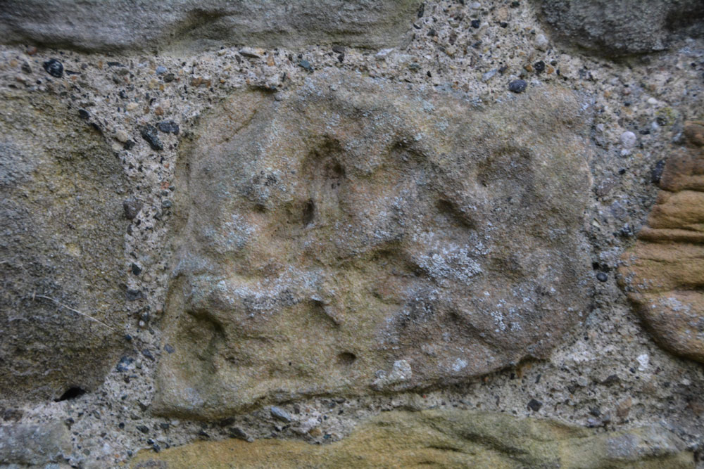
St Edwin's (High Coniscliffe) submitted by Anne T on 9th Nov 2017. This stone is recorded as AS Corpus Coniscliffe 01 and is to be found in the exterior north wall of the tower. It dates from the 10th century.
(View photo, vote or add a comment)
Log Text: Anglo Saxon Fragments, High Coniscliffe: This was a most unexpected location, as my perception was that the church should be within a quiet little village, but the reality was it was just off the main road, the A67 to Bishop Auckland. We parked by the footpath at NZ 22567 15316, and had to walk past the front of the Old Rectory to get to the lych gate.
There were so many stones in the walls of this church. So many of them were greatly weathered sandstone, and looked like any of them could have been carved then worn down. The walls of the church were a real patchwork of colours – light, medium, dark and red sandstone.
We couldn’t get into the porch. A notice on the gate of the church said keys were available at houses nearby, but none of them had lights on, so we headed home, but not before I’d spotted the view from the south western end of the churchyard down to the River Tees below. Great!
Thompson's Rock
Trip No.59 Entry No.2 Date Added: 19th Nov 2017
Site Type: Holed Stone
Country: England (Northumberland)
Visited: Yes on 12th Nov 2017. My rating: Condition 3 Ambience 4 Access 4
Thompson's Rock submitted by Bolddubhglas on 14th Jun 2008. Thompson's Rock Simonside Beacon
(View photo, vote or add a comment)
Log Text: Thompson's Rock, Simonside: This was the coldest, windiest day of the year so far,, and I thought we were going to a much more sheltered spot, so I wasn't dressed for the weather. Ashamed to say I sent husband off with the camera, as he was fully equipped for this moorland. He reported the rock was well worth going to see.
