Contributory members are able to log private notes and comments about each site
Sites Anne T has logged. View this log as a table or view the most recent logs from everyone
High Banks Farm
Date Added: 22nd Sep 2014
Site Type: Rock Art
Country: Scotland (Dumfries and Galloway)
Visited: Couldn't find on 19th Sep 2014
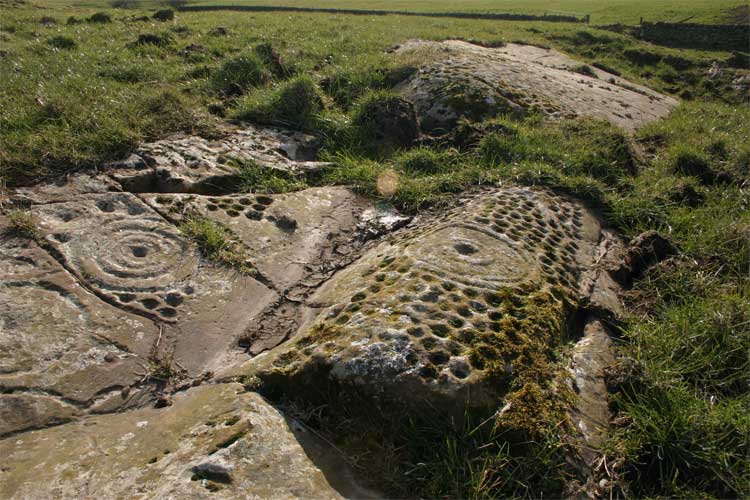
High Banks Farm submitted by TerryStaniforth on 23rd Feb 2005. More detail.
(View photo, vote or add a comment)
Log Text: High Banks Farm Rock Art: Found the track to High Banks Farm easily enough, but husband wouldn't risk our car on the farm track, saying that we'd need a four wheel drive to attempt it. Our tight schedule of sites to visit for the rest of the afternoon didn't allow time to walk up to this rock art site, so sadly we've had to leave this until another day - a future treat!
Anwoth
Date Added: 22nd Sep 2014
Site Type: Class I Pictish Symbol Stone
Country: Scotland (Dumfries and Galloway)
Visited: Couldn't find on 19th Sep 2014
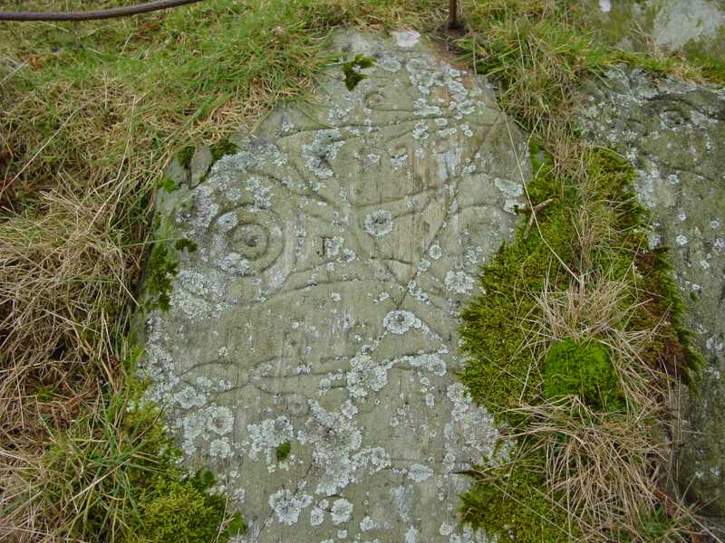
Trusty's Hill submitted by PaulH on 2nd Mar 2003. To W of Gatehouse of Fleet NX588560
Pictish symbols carved in living rock
The "teletubby" !
(View photo, vote or add a comment)
Log Text: Anwoth, Rock Art: Couldn't find as too much gorse and bracken. It was very difficult to orientate ourselves and tried several of the hills, just in case. We have since invested in a cheap and cheerful GPS system, which we've since tested out on Goatstones Rock Art in Northumberland. We did walk onto Rutherford's Monument, the Trig Point and the Millennium Monument and enjoyed the views in the gathering dusk. Will try and visit this site again.
Bogle Walls
Date Added: 12th Apr 2015
Site Type: Hillfort
Country: Scotland (Dumfries and Galloway)
Visited: Yes on 6th Apr 2015. My rating: Condition 2 Ambience 3 Access 5
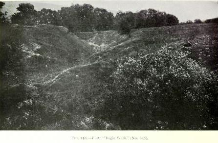
Bogle Walls submitted by durhamnature on 8th Oct 2012. Photo from "Report of Commission on Monuments..." via archive.org
(View photo, vote or add a comment)
Log Text: Bogle Walls Earthwork/Fort, Eskdalemuir: We spotted this earthwork as we drove back to Bentpath and Langholm on the way back from Bessie's Hill and stopped to take a closer look and take a few photographs. Sitting at the foot of Enzieholm Hill to its 'back' and a bend of the River Esk to its 'front' it is an emminently defensible position. Would have liked to take a closer look and walk up to the top of the bank but daylight was fading and we'd seen a lot of other sights that day and my brain was a little tired and overloaded by this stage! Next time - which I hope won't be too long.
Burnswark Hill Cairn
Trip No.4 Entry No.2 Date Added: 7th Aug 2016
Site Type: Cairn
Country: Scotland (Dumfries and Galloway)
Visited: Yes on 31st Jul 2016. My rating: Condition 3 Ambience 4 Access 3
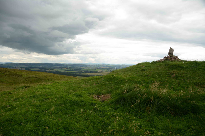
Burnswark Hill Cairn submitted by Anne T on 7th Aug 2016. The Cairn at Burnwark Hill as seen from the path from the hillfort.
(View photo, vote or add a comment)
Log Text: Cairn at Burnswark Hill, near Ecclefechan: After walking around the hill fort, we spotted this cairn on the next hill top to the north east and followed the tracks over. There were great views down to the Roman fortifications on the north western side of the fort. Whilst Romans usually leave me cold, the juxtaposition between the hillfort, the fortifications and the cairn, together with the views of the Solway Firth, Criffel and Helvelyn in the Lake District beyond, were stunning. A great afternoon, and well worth the visit.
Rutherford's Well
Date Added: 21st Sep 2014
Site Type: Holy Well or Sacred Spring
Country: Scotland (Dumfries and Galloway)
Visited: Yes on 19th Sep 2014. My rating: Condition 3 Ambience 2 Access 4
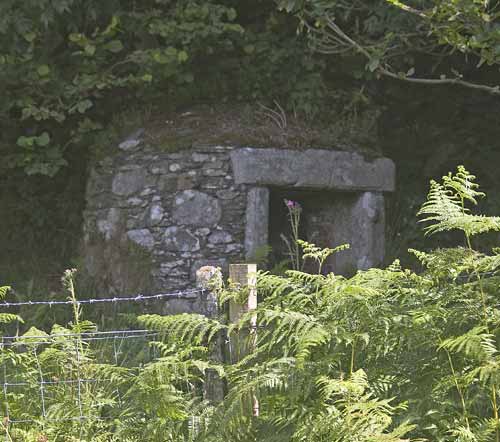
Rutherford's Well submitted by kelpie on 13th Jul 2004. This well is accessed via the path to the right of the ruined church in Anwoth. The well is housed in a domed building and there is a low stone trough outside.
NX 58384 56221
(View photo, vote or add a comment)
Log Text: Rutherford's Well, Anwoth, Dumfries and Galloway: Having just visited Cairn Holy 1 and 2, husband, Andrew, had identified some Pictish motifs, a holy well and some rock art at Trusty’s Hill which seemed worth visiting on our way back home. Anwoth seemed the ideal location for a base for this short walk. Whilst the Old Kirk was marked on the OS map, we didn’t expect this to be so eerie or atmospheric, and we spent a good half an hour wandering around the church – it even has tombstones and memorials inside the old walls of red sandstone - before setting off to find the well.
Parking the car next to the footpath which runs down the right hand side of the church (coming from the A75 and driving north into Anwoth), we set off in search of this Holy Well. I have to say it was difficult to find! We eventually spotted it to the left hand side of the footpath, just before the first metal gate leading uphill to Rutherford’s Monument, hidden behind a wire fence, and tucked between this fence and a tumbled down old stone wall (dyke in this part of the world) behind. The well is only around 190 metres from the rear of the Old Kirk which can be clearly seen across the boggy field between the Kirk and the well.
People obviously still visit regularly, as there were t-lights inside and around. The Scottish Churches website reports that the water from the well is still used for baptisms today. As with other wells we’ve visited, there is a modern brick-built structure over the well itself. The Stewartry Kirks web site tells me that the well is really a shallow pool fed by a spring which comes from the base of the slope behind. The well is named after Samuel Rutherford, minister of Anwoth between 1627 to 1639. Rutherford must have been an amazing man, if the church was dedicated to him, the well named after him, and a huge (but ugly – sorry! Just my opinion) monument built to him on the hills nearby.
Twelve Apostles (Dumfries)
Date Added: 22nd Sep 2014
Site Type: Stone Circle
Country: Scotland (Dumfries and Galloway)
Visited: Yes on 19th Sep 2014. My rating: Condition 4 Ambience 4 Access 5
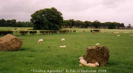
Twelve Apostles (Dumfries) submitted by kelpie on 4th Jul 2002. Some of the Twelve Apostles, the circle is too big to include them all
NX947794
(View photo, vote or add a comment)
Log Text: The Twelve Apostles, Dumfries: Shortly after we moved to Irongray in 1992 and my husband was touring the county to get to know it for his work with Dumfries and Galloway Enterprise, he came home one lunchtime and said we needed to go and see a stone circle. Being then only 6 miles from our house, we went off to look. I can still remember this visit really clearly. “It’s just in a farmer’s field, with a hedge running through it.” And it was.
The hedge has now been grubbed up, but the scar of where it was still remains in the field. My memory must be playing me slightly false, as we both remember the stones being smaller and the circle more compact, but this might be the result of part of the circle being cut by the hedge.
Following the A75 westwards around Dumfries, turn right at the Lochside roundabout onto the A76 (Glasgow Road). (Did anyone else spot the rhino on the right hand side next to the housing estate? This used to be on top of the bus shelter, but has been moved onto a plinth of its own now). Just past a garage on the left hand side, there is a left hand turn onto Irongray Road, and follow this until you go over a quaint little bridge over Cluden Water. Then take the next right hand turn. The stone circle is on your right, and there is now a stile over the fence, although I’m guessing that most people park further up at the road junction with the B729 and use the gate into the field (which is the next turn left along the A76 if you miss the first).
Sited in a gentle bowl, we wondered if the circle had been built where Cluden Water and the larger River Nith meet - the course of the rivers may have changed since the circle was built - this feels like a special place. We counted only 11 stones, but then one stone looked as if there were two next to each other. The stones are also not of the local Locharbriggs sandstone, being largely whinstone and course granite, and where they were brought from, I’ve not yet been able to identify. The RCAHMS notes say the circle is 260 feet in diameter, more in keeping with the size of a henge.
One of the stones had what I took to be cup marks in an odd pattern, but the RCAHMS notes say they are caused by natural weathering.
In walking up to the gate to take a few pictures to try and make into a panorama, I spotted another boulder by the roadside, next to the gate (grid reference: NX 94533 79488 – it can be seen on aerial photographs) and wondered if at one point this had been associated with the circle, and moved by the farmer in the past.
Cairnholy 1
Date Added: 22nd Sep 2014
Site Type: Chambered Cairn
Country: Scotland (Dumfries and Galloway)
Visited: Yes on 19th Sep 2014. My rating: Condition 4 Ambience 4 Access 5
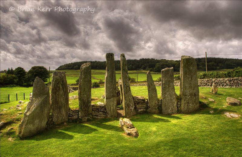
Cairnholy 1 submitted by wolfnighthunter on 19th Nov 2008. Cairnholy 1
NX518539
(View photo, vote or add a comment)
Log Text: Cairn Holy 1: Having lived in Dumfries and Galloway for 10 years in the 1990s, we’ve driven by the signs to Cairn Holy on many an occasion, but never detoured to look. Now having seen the images, my husband described both these cairns as ‘like Pentre Ifan, but without the people’ (not quite, but almost!).
Easy enough to find, these cairns can be reached by turning right off the A75 to Stranraer, up the signposted track.
It was quiet, peaceful and atmospheric, with great views over the Fleet Bay and Wigtown Bay to the south.
Our first glimpse of the stones at the first cairn gave the impression of tall, ragged teeth, challenging us to pass them. The rabbits had certainly had fun digging burrows in and around the mound, and I’m sure they must be making good use of any chambers/gaps underneath the turf.
I loved this spot. I would love to see any excavation notes to see how similar or different this cairn is to the chambered cairns in Orkney that we saw.
Cairnholy 2
Date Added: 22nd Sep 2014
Site Type: Chambered Cairn
Country: Scotland (Dumfries and Galloway)
Visited: Yes on 19th Sep 2014. My rating: Condition 4 Ambience 4 Access 4
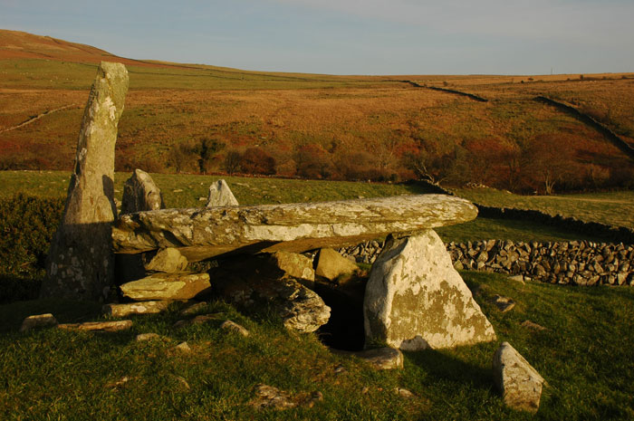
Cairnholy 2 submitted by nicoladidsbury on 18th Nov 2008. Cairn Holy II
Golden Sunlight over Cairn Holy II
(View photo, vote or add a comment)
Log Text: Cairn Holy 2, Dumfries and Galloway: From Cairn Holy 1, there is a gate in the stone wall leading up to this monument. In the field to the left of this footpath there is the remains of another possible cairn.
I found Cairn Holy 2 more atmospheric that Cairn Holy 1, but the ambience was spoiled by the close proximity of a bungalow and farm buildings (but what a view to have outside your lounge window!).
A smaller, only slightly less spectacular than Pentre Ifan, it is on steeper ground than Cairn Holy 2. The cap stone has two modern holes drilled in, presumably to lift it back into place.
With it now being late afternoon and a hint of dusk starting to fall, we wanted to go onto Anwoth to find the Holy Well and visit Trusty’s Hill.
In the hour we spent at Cairn Holy 1 and 2 we only saw one other couple walking a dog. Almost as quiet and empty as Northumberland!
The Ruthwell Cross
Date Added: 13th Oct 2014
Site Type: Ancient Cross
Country: Scotland (Dumfries and Galloway)
Visited: Yes on 12th Oct 2014. My rating: Condition 4 Ambience 4 Access 5
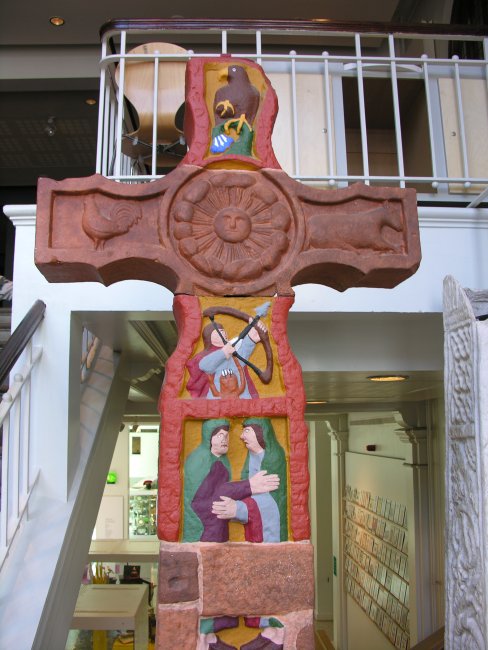
The Ruthwell Cross submitted by TimPrevett on 29th Jul 2007. A painted caster plast replica of the Ruthwell Cross in Manchester Museum, situated from the ground to first floor staircase.
(View photo, vote or add a comment)
Log Text: The Ruthwell Cross, Ruthwell: I’ve visited the Savings Bank Museum in Ruthwell to have meetings with the curator on more than one occasion and thought I had visited the Ruthwell Cross before (both my husband and I have vivid memories of taking the children to see an ancient sandstone cross in a churchyard when we first moved to Dumfries and Galloway in 1992, and while we both thought it was this one, it’s not – a mystery!).
There is a large visitors’ car park to the west end of the church. A key is available from the manse cottage, in a little stand outside with a blue label saying ‘church key’ and a small box with a lift up lid.
I was surprised by the sheer size of the cross, which absolutely dominates the church. Andrew clambered down into the pit and took some photographs looking up the whole of the cross, which was quite difficult to photograph given the sky lights overhead – we needed a dull day to avoid the light spilling in.
This is the second cross with runes on we’ve seen in three days (the other at Bewcastle), although the Ruthwell guide goes to great lengths to point out they are a true preaching cross, not a memorial!
Some of the elements at the top of the cross don’t quite seem to fit – they are much darker sandstone than the rest, but have probably not been weathered so much.
I was staggered by the price of a guide book (£5). There was a constant stream of visitors, coming in ones and twos – one family leaving as we arrived and another we handed the key to as we left.
Chapman's Stone
Trip No.124 Entry No.2 Date Added: 5th Apr 2019
Site Type: Standing Stone (Menhir)
Country: Scotland (Dumfries and Galloway)
Visited: Yes on 4th Apr 2019. My rating: Condition 3 Ambience 3 Access 5

Chapman's Stone submitted by Anne T on 5th Apr 2019. Standing just to the west of stone, looking eastwards. The end of the stone nearest us is the tapered end, which would have been the top of the stone when it stood upright.
(View photo, vote or add a comment)
Log Text: Chapman's Stone: Our second stop of the day, and easy to stop alongside the road where it widens slightly, at NY 10746 99049 and walked back the short way to the stone. The stone has a fence built right over the middle of it (it looks like it could be used as a stile). It’s eastern side looks as if it has been knocked and broken by farm equipment. Looking at where the stone is placed in the landscape, it is along an old drover’s road, with the River Annan to its western side; to the NE, there are two flat topped hills in the distance.
Girdle Stanes
Date Added: 11th Apr 2015
Site Type: Stone Circle
Country: Scotland (Dumfries and Galloway)
Visited: Yes on 6th Apr 2015. My rating: Condition 3 Ambience 4 Access 4
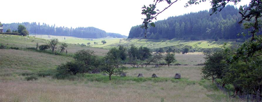
Girdle Stanes submitted by nicoladidsbury on 31st Mar 2004. This is an evocative large stone circle, surrounded by ancient hawthorn trees which are covered in large lichen. Half the circle has been eroded by the river running by leaving only a semi circle. The stones stand on a low earth bank. Close by are the Loupin Stanes. We visited this circle on a beautiful hot day in summer, there was no one else around, it was a very peaceful place to be. To see images please visit my website www.northernfells.co.uk
Grid Ref: NY253962
Condition:4 Ambience:5 A...
(View photo, vote or add a comment)
Log Text: Girdle Stanes, Stone Circle near Eskdalemuir: Even though we lived only 10 ½ miles from Eskdalemuir for 4 years in the laste 1990's, we’d never explored this area, apart from taking our (then very young) kids to a local river to paddle and visit a few of the Roman forts nearby, which in hindsight was a shame, but we’re rectifying that now.
Driving along the B709, about 2 km before Eskdalemuir, we spotted the signpost to Girdle Stanes on the right hand side of the road and pulled into the field gateway, making sure we weren’t blocking access. There was a splendid view of the Girdle Stanes and the White Esk in the valley below. As the road is about 100 feet above the stones, it was easy to see how part of the circle had been eroded by the river.
It was a glorious, warm day with no breeze. The footpath was an easy downhill stroll. The stones felt welcoming and the sun glinted off the river. The stones appear to be built within a bank which is still visible. Someone had left a bunch of flowers underneath the stone which sat underneath the largest hawthorn tree, and we wondered if it had been the monks from Samye Ling (the Buddhist monks in this area of Northumberland also celebrate standing stones and stone circles here).
Looking across the valley to a where the map showed earthworks, we saw these clearly, but contained within these earthworks was a cemetery. We decided to explore this feature later in the day. I've just found (10th April) out that this site is a moated homestead, RCAHMS site ID 67233.
Just to the north of the stones, a footpath sign pointed us in the direction to the Loupin’ Stanes, following the fields along the edge of the river.
Loupin' Stanes NW
Date Added: 9th Apr 2015
Site Type: Stone Circle
Country: Scotland (Dumfries and Galloway)
Visited: Yes on 6th Apr 2015. My rating: Condition 4 Ambience 4 Access 4
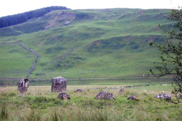
Loupin' Stanes NW submitted by nicoladidsbury on 31st Mar 2004. This small stone circle is close by the Girdle Stanes.
Loupin means Leaping in Borders dialect and Loup means wolf in French.
Grid Ref: NY256966
(View photo, vote or add a comment)
Log Text: The Loupin' Stanes, Stone Circle near Eskdalemuir: From the Girdle Stanes, the footpath pointed along the field boundary above the river, so we attempted to follow this line, although there were lots of boggy areas and field drains to step/jump across. A tall, but well built stile helped us over the first fence nearest to the Girdle Stanes, which even I managed! Although it hadn’t rained in a while, there was plenty of surface water, presumably from springs in the field so we had to deviate onto higher ground. This had the benefit of us being able to spot several larger (presumably fallen) stones along the route between the two stone circles. As the circles are ‘hidden’ from each other by a small hill in-between, we were curious as to whether this was a deliberately marked route.
The Loupin’ Stanes formed a smaller circle than the Girdle Stanes and seemed to sit on a platform of earth. The two larger stones form an entrance towards the west. As at the Girdle Stanes, someone had placed a small bunch of flowers against the thinner of the two tallest stones, which also had a mask sculpture placed upon it.
We were curious as to the stones between this stone circle and the road – is this the third (now destroyed) stone circle that is referred to in some of the literature? We walked round them, but couldn’t make out a definitive pattern.
On the way back, we walked back to the road rather than retrace our steps back to the Girdle Stanes. Because the field gate had been shut with barbed wire, needed to climb the high stile. We’d walked further than we thought; it was a good ten minutes walk back to the car. From this site, I wanted to try and explore the Stone Rings/remains of a settlement just north east of Rennaldburn. Although we were unable to get into the forest (blocked by a substantial fence) we did get an excellent view of the Loupin’ Stanes site from the forest track on the way back to the car at grid reference NY 25936 97021.
Poldean menhir
Trip No.124 Entry No.3 Date Added: 5th Apr 2019
Site Type: Standing Stone (Menhir)
Country: Scotland (Dumfries and Galloway)
Visited: Yes on 4th Apr 2019. My rating: Condition 3 Ambience 3 Access 4
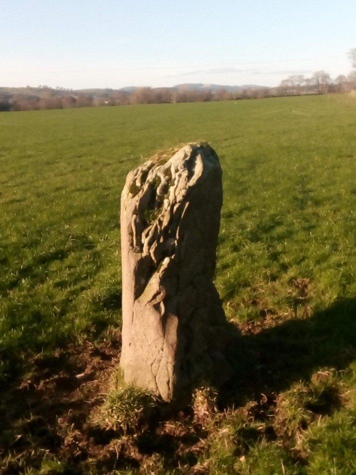
Poldean submitted by Apocryphus on 20th Jan 2019. A smaller stone located opposite Poldean Farm on a minor road south of Moffat
(View photo, vote or add a comment)
Log Text: Poldean Standing Stone: The third stop of the day with this stone easily visible just to the west of the road, towards the eastern edge of a large field of pasture.
We let ourselves in through the gate NY 10424 99981, walking over a small stream, again with the River Annan to its west and the busy A754(M) in the distance.
The eastern side of the stone is very craggy, as if bedding planes have been worn/broken away. There appears to have been a cup low down on its western side, but this could be a solution hole, if the stone had been lying flat for some considerable time in the past.
Loupin' Stanes SE
Date Added: 11th Apr 2015
Site Type: Stone Row / Alignment
Country: Scotland (Dumfries and Galloway)
Visited: Yes on 6th Apr 2015. My rating: Condition 2 Ambience 4 Access 4
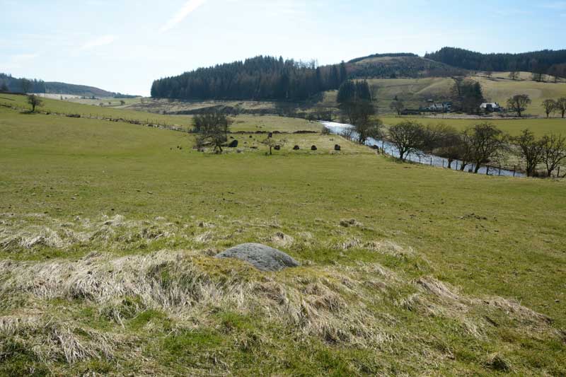
Loupin' Stanes SE submitted by Anne T on 11th Apr 2015. This was the first of the boulders we came across between the Girdle Stanes and the Loupin' Stanes. The Girdle Stanes can be seen just upwards of centre in this photo.
(View photo, vote or add a comment)
Log Text: The Loupin' Stanes Stone Row, Eskdalemuir: The walk between the Girdle Stanes and the Loupin’ Stanes along the side of the river was boggy and wet and we kept having to step over modern field drainage ditches so we deviated onto higher ground towards the road. In doing so, we came across a number of boulders sitting on the hillside in isolation. After seeing a couple, we began to wonder if we were walking along an avenue between the stones, although without taking the grid references and plotting them on a map, we weren’t sure if there was any alignment between these stones. One seemed to be more of a small cairn.
The Ancient Scotland web site (site 106) makes reference to this line of stones, as does the ‘Langholm Walks (Loupin)’ brochure, saying they either link the stone circles or act as pointers. The latter asks us to make our own mind up as to whether it's a stone row or not. We were undecided and stood scratching our heads - there was obviously some purpose to these boulders being placed - they didn't seem like natural bedrock.
Bessie's Hill Fort
Date Added: 11th Apr 2015
Site Type: Hillfort
Country: Scotland (Dumfries and Galloway)
Visited: Yes on 6th Apr 2015. My rating: Condition 3 Ambience 4 Access 3

Bessie's Hill Fort submitted by Anne T on 11th Apr 2015. This is a panorama (4 photos stitched together) of Bessie's Hill Fort from the forest track which ran north west along the western edge of the fort.
(View photo, vote or add a comment)
Log Text: Bessie’s Hill Hill Fort, Eskdalemuir: Travelling on from the enigmatic earthworks and cemetery at the foot of Holm Craig (which I haven’t been able to find anything out about – yet), by the time we arrived here it was gone 5pm and the forest was deserted, apart from one other car in the visitors car park (no sign of its occupants anywhere). It was a very pleasant walk in the early evening sunlight up a soft, springy mossy path through the forest up to the fort, if a little steep in one place where there were steps to aid visitors. Once onto the top of this first hill, another trail led into the fort itself.
Unusually, we could hear the sound of rabbits thumping in their burrows as well as the call of the curlews as we followed this trail, at one point squelching over an area of grass and reeds (a spring? the water source for the fort?) just before the first double ditch/bank. The construction of this fort reminded me so much of Maiden Castle in North Yorkshire (but without the heather in bloom). I drew my breath in at the steepness of the drop on the south eastern side, where the land drops steeply down to the White Esk valley, although we were unable to see much of the river because of the tall pine trees in between.
We walked to the far end of the fort where the interpretation board was, but this was in very bad repair.
As the light was going and my husband was keen to see Castle O’Er before dark we didn’t venture further up the hill to the settlement, but will come back another time. There really is so much to see in this part of the world.
Over Rig
Date Added: 11th Apr 2015
Site Type: Misc. Earthwork
Country: Scotland (Dumfries and Galloway)
Visited: Yes on 6th Apr 2015. My rating: Condition 2 Ambience 4 Access 4
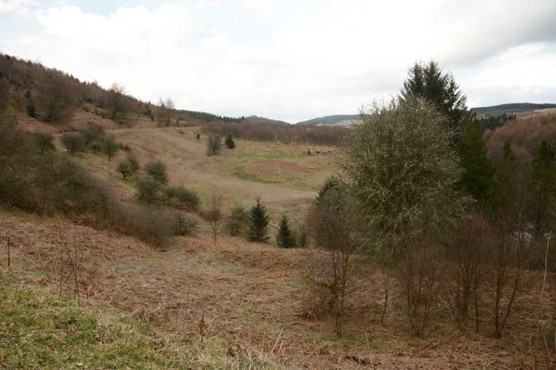
Over Rig submitted by Anne T on 11th Apr 2015. A view of Over Rig standing by the information board looking northwards (the White Esk river is hidden behind the trees to the right of the picture).
(View photo, vote or add a comment)
Log Text: Over Rigg Enclosure/Settlement, Eskdalemuir (south of Bessie's Hill but before reaching Castle O'er): We saw this natural amphitheatre to the right hand side as we drove down towards Castle O’er, seeing what looked like man-made banks and ditches on its slopes with the meandering White Esk glinting in the evening sunlight below. Rounding the corner, we came upon an information board and screeched to a halt, to the annoyance of two cars which had suddenly appeared behind us (not having passed much traffic all day); fortunately there was room to park on the verge near the board.
There was an information sheet in a wooden box below the board which visitors were free to take with them on a walk around the site and replace when they’d finished with it. This told us “Over Rig now consists of three well-defined banks and ditches, forming a deliberately designed concentric system which is surrounded by a further (and later) rectangular ditch .... this is one of the few Prehistoric Trail sites to have been excavated recently (note: in the 1980s) .... revealed that a platform had been constructed of clay material that had sealed off sections of the site. Beneath this, on the eroded river side of the site, were discovered the partial imprints of two circular constructions identified as houses.”
The RCAHMS records (site 67422) state that this “enclosure was presumably originally circular, but has been eroded away by the White Esk, almost to a semi-circle, which a chord of 200 ft and a radius of 85 ft. It is surrounded by an inner ditch 3 to 4 fet deep and 13 feet wide, a concentric rampart 5 ft high and 18 ft broad and an outer ditch 3 ft deep and 15 feet wide.”
We debated the use of this site; whilst a lovely place to be located, the lower part of the site must be a flood plain for the river. Whilst the information sheet/board indicate it might be for habitation or industrial uses, other sources I’ve looked at since our visit suggest it could be a funerary or religious monument, an enclosure for animals or an unfinished settlement.
If you are passing, it is well worth stopping to look. Apparently the acoustics, should you wander down to the river, are amazing. There is a good view of another settlement on top of a hill across the valley.
Wamphray Place
Trip No.124 Entry No.5 Date Added: 11th Apr 2019
Site Type: Misc. Earthwork
Country: Scotland (Dumfries and Galloway)
Visited: Saw from a distance on 4th Apr 2019. My rating: Condition 1 Ambience 3 Access 4
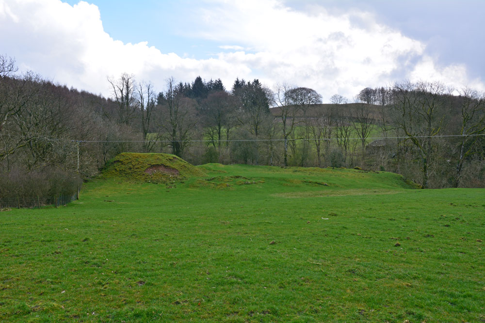
Wamphray Place submitted by Anne T on 11th Apr 2019. Having seen the cross slab at Wamphray Church, we stopped by the side of the road to photograph this picturesque motte and bailey castle, high above Wamphray Water, but as we had a rendezvous, didn't stop to explore further. This site was known to be occupied in the 12th century and was still in use until the mid 18th century. Possibly, the motte is built upon a more ancient site.
(View photo, vote or add a comment)
Log Text: Wamphray Place Motte & Bailey: Continuing down the hill (north west) from Wamphray Church, past the mill and over the narrow bridge, as we climbed the hill at the other side of the river, we spotted this small, compact motte and bailey and stopped to take a few quick photos. Wish we’d had more time to explore and photograph this site from the river, but we wanted to try and find the cairn cemetery at Pumplaburn before heading off to meet our daughter at Annandale Water services.
Pumplaburn
Trip No.124 Entry No.6 Date Added: 11th Apr 2019
Site Type: Cairn
Country: Scotland (Dumfries and Galloway)
Visited: Saw from a distance on 4th Apr 2019. My rating: Condition 1 Ambience 2 Access 4
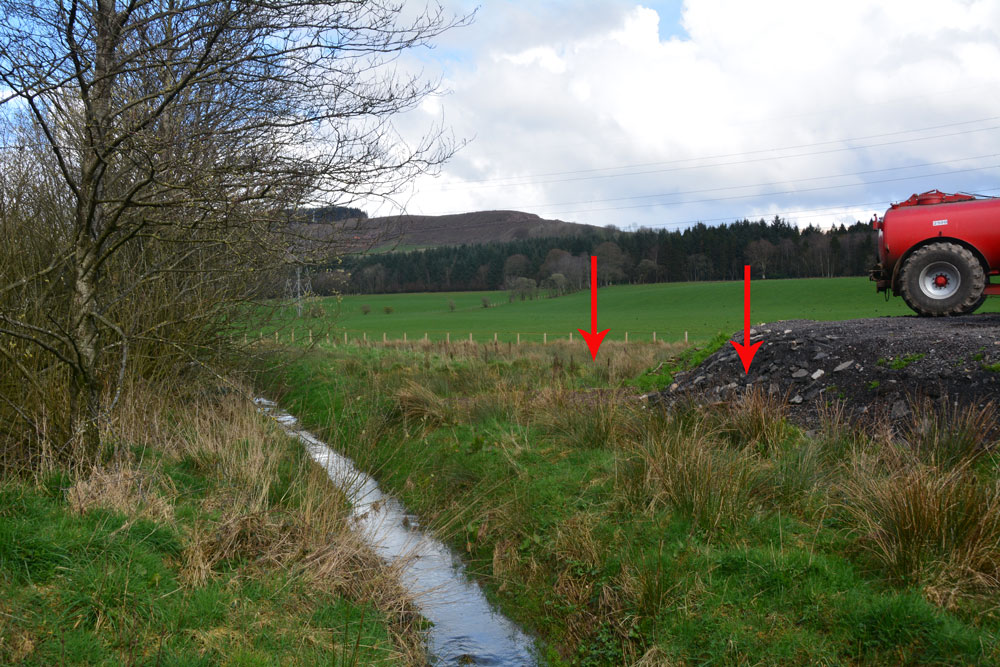
Pumplaburn submitted by Anne T on 11th Apr 2019. The two arrows show approximately where the two cairns should be - one buried (almost buried?) by the new hardstanding area; the other further back in the field. Photograph taken from the corner of the field at NY 11832 96456.
(View photo, vote or add a comment)
Log Text: Pumplaburn Cairns: Making our way back towards Annandale Water, we went under the smallest railway bridge we’d ever travelled under – 7ft tall and 7ft wide! We didn’t find these cairns, despite wandering up and down the road. Looks like they may have been buried by the large hardstanding for tractors next to Pumplaburn Steading. From plotting the ngrs on UK Grid Reference Finder, the cairn at NY 1191 9650 may still be there, but we only saw it from a distance.
Mossknowe Tumulus
Trip No.127 Entry No.6 Date Added: 7th May 2019
Site Type: Cairn
Country: Scotland (Dumfries and Galloway)
Visited: Saw from a distance on 2nd May 2019. My rating: Condition 2 Ambience 3 Access 4
Mossknowe Tumulus submitted by graemefield on 27th Jun 2012. The cairn before excavation
(View photo, vote or add a comment)
Log Text: Mossknowe Cairn 1/ Belten Mound: We stopped outside the cottage to the west of the minor road at NY 27846 69513, but could not see much. Carrying on to where the road bends at NY 28117 69281, the only gate into the field from the road here is at NY 28067 69222 and hadn't been opened in such a long time, the hawthorn hedge had grown round the edges. With the rain starting to pelt down, and with evening rapidly falling, we decided to cut our loses, quickly photograph the cairns from a distance and go home.
Mossknowe 2
Trip No.127 Entry No.3 Date Added: 7th May 2019
Site Type: Cairn
Country: Scotland (Dumfries and Galloway)
Visited: Saw from a distance on 2nd May 2019. My rating: Condition 2 Ambience 3 Access 4
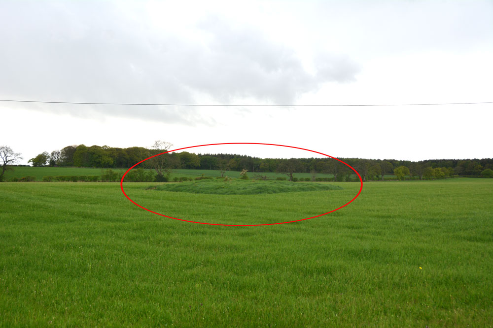
Mossknowe 2 submitted by Anne T on 7th May 2019. The location of this cairn is marked by the red oval. We could really only spot the location of the cairn by the tall grass left around it by the farmer. We were unable to open the gate into the field, and with the rain pelting down and light rapidly fading, we contented ourselves with photographing it from over the hedge.
(View photo, vote or add a comment)
Log Text: Mossknowe Cairn: the cairn nearest to the bend in the road, south east of the cottage which has Mossknowe Tumulus in its garden. Nothing special, but another site ticked off the list.
