Contributory members are able to log private notes and comments about each site
Sites Anne T has logged. View this log as a table or view the most recent logs from everyone
Cross House Incised Stone
Trip No.90 Entry No.2 Date Added: 31st Jul 2018
Site Type: Ancient Cross
Country: England (Cumbria)
Visited: Yes on 30th Jul 2018. My rating: Condition 3 Ambience 4 Access 4
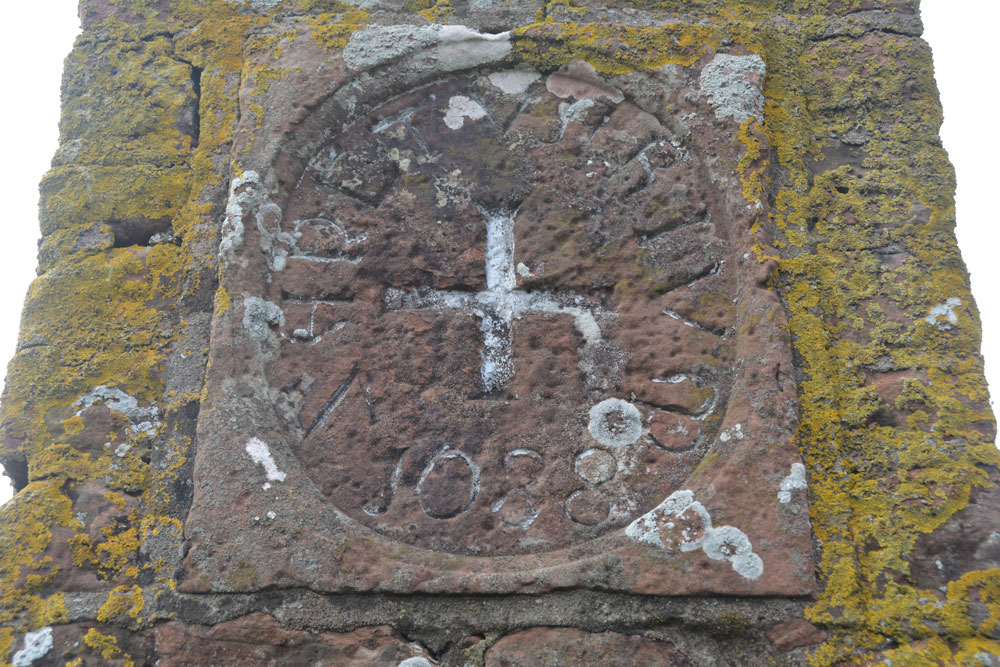
Cross House Incised Stone submitted by Anne T on 31st Jul 2018. The inscribed stone, now mounted in a 19th century pillar. The age of the stone is unknown, but it is believed to be the remains of an old wayside or boundary cross.
(View photo, vote or add a comment)
Log Text: Cross House Incised Stone, Staffield: We parked at NY 53519 43219, where a gate lets you into the footpath which goes down the hill, and joins a second footpath to Chapel Well. We walked back up the hill towards Cross House. The pillar was just visible through the hedge. We let ourselves in to the field by the gate near Cross House (there was no-one around to ask) and quickly walked to the pillar to photograph the cross.
Interesting that HE classes this as a sanctuary cross, and Pastscape as a possible wayside or boundary cross.
On processing the photographs to post to the Portal this morning, I realised we’d been to this site in October 2015, but hadn’t submitted a new site or photos to the Portal. I had asked the lady hanging out her washing in the garden of Cross House and she’d given us permission to go into the field.
Splendid views south over to the River Eden and the site of the old priory. The pillar was very near the hedge, , but it was still possible to get photos of the recut stone in its 19th century pillar.
Cross Shaped Stone of Keverigg
Trip No.180 Entry No.4 Date Added: 11th Jul 2022
Site Type: Ancient Cross
Country: England (Cumbria)
Visited: Yes on 9th Jul 2022. My rating: Condition 3 Ambience 3 Access 3
Cross Shaped Stone of Keverigg submitted by MonumentMan on 13th Oct 2019. 'Cross-Shaped' stone of Keverigg
in Shap Blue granite due south of the 19thC cross carved boulder of the same name which marks the parish boundaries of Shap, Crosby Ravensworth and Sleagill.
(View photo, vote or add a comment)
Log Text: Cross Shaped Stone of Keverigg: We went looking for the boundary stone inscribed with a cross, as marked on the modern OS map, but were unable to find it (grass too high and lots of lichen and moss on surrounding rocks to be able to make out the carved cross).
My impression of this particular stone is that it's the remnants of a quarried stone (or natural), as it lies on/near a long line of limestone pavement.
Cross Stone of Keverigg
Trip No.180 Entry No.3 Date Added: 11th Jul 2022
Site Type: Ancient Cross
Country: England (Cumbria)
Visited: Couldn't find on 9th Jul 2022
Log Text: Cross Stone of Keverigg: The location of the stone was clearly marked on the Historic England Map search map, but despite my husband clambering (very carefully) over the dry stone wall and stock fence at the eastern end of the access land, he was unable to find the stone. There was considerable growth of grass and weeds in the area, and plenty of moss and lichen on the surrounding stones. He did, however, find the Cross Shaped Stone that MonumentMan has submitted (SID 52464), 23m away.
Cross Well (Linlithgow)
Trip No.25 Entry No.3 Date Added: 21st May 2017
Site Type: Holy Well or Sacred Spring
Country: Scotland (West Lothian)
Visited: Yes on 18th May 2017. My rating: Condition 4 Ambience 3 Access 5
Cross Well (Linlithgow) submitted by KiwiBetsy on 17th Oct 2006. Site in West Lothian
The present Cross Well stands in the High street of Linlithgow just outside the lane that leads to Linlithgow Palace.
(View photo, vote or add a comment)
Log Text: Cross Well, Linlithgow: From the Knock Modern Stone Circle, we set off towards the Gogar Stone. Passing through Linlithgow (we plan on going to see the Palace and nearby Hopetoun House) another day.
There was no market today, so I persuaded my friend to quickly stop which I got a proper photograph of the well! (Note the friend's car hiding behind the structure!)
Cross Well (Linlithgow)
Trip No.24 Entry No.3 Date Added: 16th May 2017
Site Type: Holy Well or Sacred Spring
Country: Scotland (West Lothian)
Visited: Yes on 13th May 2017. My rating: Condition 3 Ambience 3 Access 5
Cross Well (Linlithgow) submitted by KiwiBetsy on 17th Oct 2006. Site in West Lothian
The present Cross Well stands in the High street of Linlithgow just outside the lane that leads to Linlithgow Palace.
(View photo, vote or add a comment)
Log Text: Cross Well, Linlithgow: This was our last stop on this rainy day, and we arrived to find a small market around the well, along with an event happening at the Burgh Halls immediately behind it. Couldn’t really get close to the well itself until later in the afternoon, as there were lots of stallholders, children and dogs. Truly a centre point for the town. No water in the well today – the spout and basin were completely dry. I confess I was disappointed to find such a modern structure - I'd expected something a lot older and less ornate.
We tried to find the Dogwell, walking up Dog Well Wynd as far as the railway line, but nothing.
After photographing the well as best I could, we wandered around the loch, then back round via St. Michael’s church, with its internal walls marked by musket balls and sword sharpening marks from Cromwell’s soldiers.
Crossfield Lane Barrow (Kinnerton)
Trip No.168 Entry No.4 Date Added: 4th Aug 2021
Site Type: Round Barrow(s)
Country: Wales (Powys)
Visited: Yes on 14th Jul 2021. My rating: Condition 2 Ambience 3 Access 4
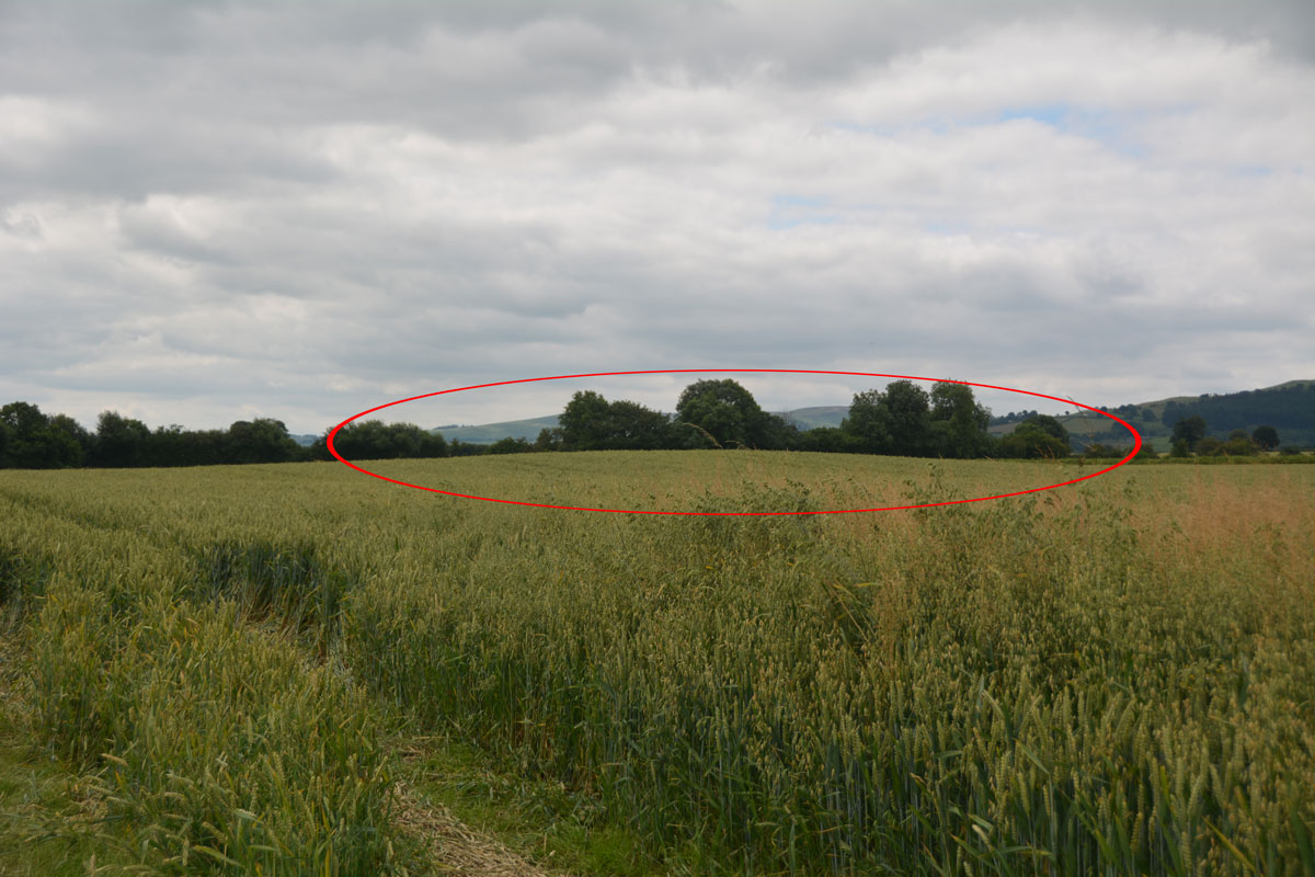
Crossfield Lane Barrow (Kinnerton) submitted by Anne T on 4th Aug 2021. The red oval highlights the location of this barrow in the field. Largely lost by ploughing, it was worth a quick investigation before moving on.
(View photo, vote or add a comment)
Log Text: Crossfield Lane Barrow, near Kinnerton: as this was marked on the OS map, and on our way to Kinnerton, we quickly parked in the field entrance (which was put to pasture) and walked a little way along the edge of the field to take a closer look.
The barrow has been largely lost to ploughing, but a low, circular 'hump' in the field can be made out (easier to see with the naked eye rather than in a photograph).
Crossfoot Farm Standing Stone
Trip No.169 Entry No.5 Date Added: 9th Aug 2021
Site Type: Standing Stone (Menhir)
Country: Wales (Powys)
Visited: Couldn't find on 15th Jul 2021. My rating: Ambience 3 Access 4

Crossfoot Farm Standing Stone submitted by jfarrar on 18th May 2019. Standing stone north of Clyro in a private field.
(View photo, vote or add a comment)
Log Text: Crossfoot Farm Standing Stone: We tried to find this stone, and even hopped across the gate into the field which the OS map shows it in, but no standing stone was visible.
The field is next to a building site and it looks as if the field was being used to store both materials and rubble, making the field very difficult to walk across.
We think the stone now may have fallen, and may be in an area of unmown grass, so is not visible from the highly chained and padlocked gate into the field.
Crosshall Cross
Trip No.123 Entry No.1 Date Added: 2nd Apr 2019
Site Type: Ancient Cross
Country: Scotland (Scottish Borders)
Visited: Yes on 31st Mar 2019. My rating: Condition 3 Ambience 4 Access 4
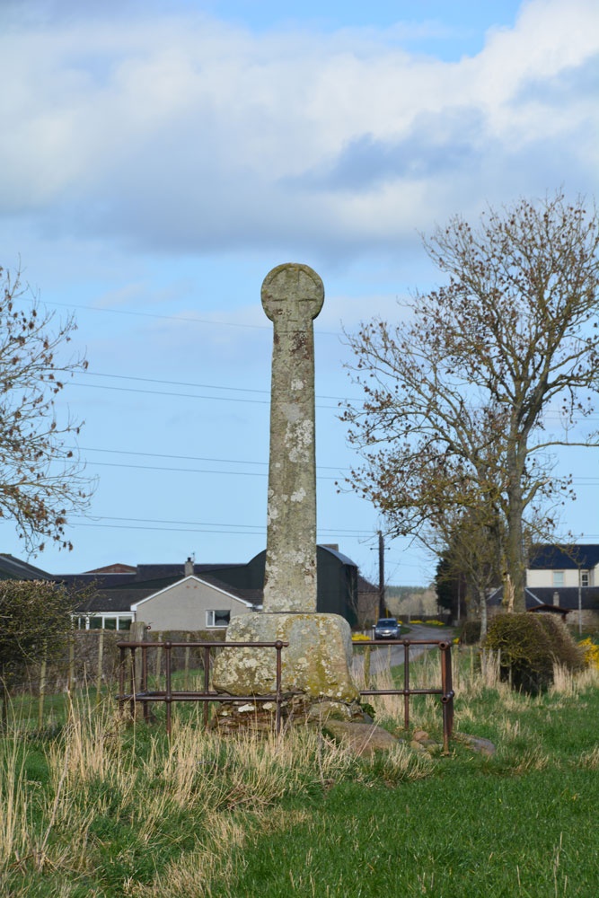
Crosshall Cross submitted by Anne T on 2nd Apr 2019. The western side of the cross, as seen from inside the field. This face has "has a Latin cross with pointed ends to its arms, surmounted by shield", although the carvings are worn and difficult to see, with the cross easier to see than the shield.
(View photo, vote or add a comment)
Log Text: Crosshall Cross: Details of this cross had printed out along with some details of Kelso Abbey, which we visited beforehand. Having found it was not far from Kelso, we decided to take the short drive to see it, and it was well worth it.
This was a little further out of Kelso than we originally thought, but it was a pleasant drive. Whilst the cross was 'protected' by an old iron railing, with the remains of an old signpost next to it, the fence was a taut wire/barbed wire fence with no 'give' to squeeze through, so we walked down the lane, away from the farm to the gate into the field. The ‘gate’ into the field with the cross was right at the cross roads, so we climbed over and walked back down the field of pasture to take a closer look.
The low, very bright, sun, made it difficult to photograph its eastern side with its man and its hound (we thought it was a lamb), but it was well worth seeing this cross, with its Latin crosses, shields, incised man with his hound, and a Crusader sword.
Crow Stone (Wigtown)
Trip No.137 Entry No.15 Date Added: 29th Jun 2019
Site Type: Standing Stone (Menhir)
Country: Scotland (Dumfries and Galloway)
Visited: Yes on 18th Jun 2019. My rating: Condition 3 Ambience 4 Access 4
Crow stone (Wigtown) submitted by kelpie on 7th Jul 2002. A holed stone at NX 36637 55606. I could not gain access to the field and the shot was taken with a long lens, hand-held, thus the poor quality.
(View photo, vote or add a comment)
Log Text: Holed Stone/Crow Stone, Crouse: Coming to these last two sites marked the start of our return journey back to Northumberland, and I wasn’t really ready to go back! This stone stood near the northern edge of a field of grass, just east of the B7052, and south of the White Cairn at Crouse.
The field of grass had just been cut and the farmer and his various tractors and trailers were collecting the grass in the surrounding fields and transporting it back to Crouse farmhouse, just to the south and on the other side of the road. Because of all the traffic on the road, we dumped the car in a wide gated field entrance at NX 36446 55808, ready to run back to the car if we needed to move it. We got into the field with the holed stone through a gate at NX 36533 55647, walking NE towards it; it was further than it looked, having to step over the mounds of cut grass.
A very nice spot, with the Galloway Hills a dark blue/grey in the distance.
Crunzierton Wood Scooped Settlement
Trip No.164 Entry No.4 Date Added: 27th Jun 2021
Site Type: Ancient Village or Settlement
Country: Scotland (Dumfries and Galloway)
Visited: Yes on 25th Jun 2021. My rating: Condition 2 Access 4
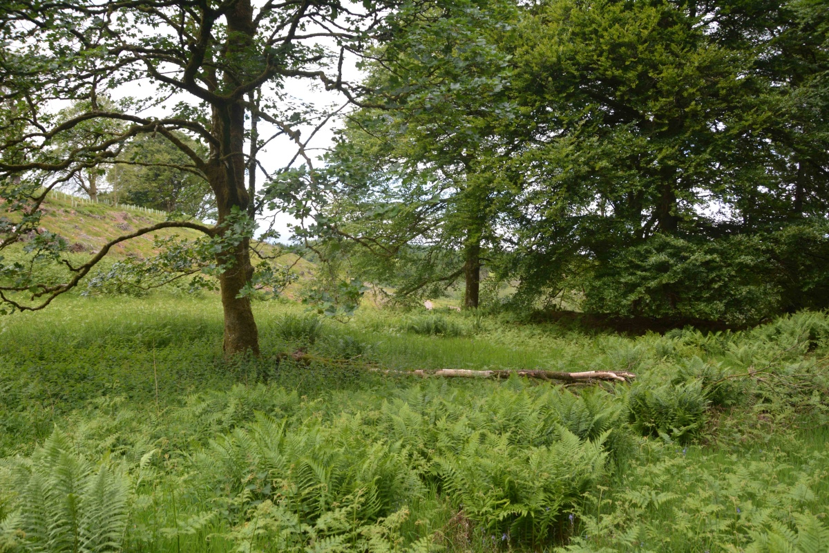
Crunzierton Wood Scooped Settlement submitted by Anne T on 27th Jun 2021. Standing in the middle of the southern bank of this settlement, looking north/north east across the sub-circular scoop. To the middle/left of the photo, the banks (which can more easily be seen with the naked eye) on the north western side of the scoop can be made out by the change in vegetation and the rise in ground level.
(View photo, vote or add a comment)
Log Text: Crunzierton Wood Scooped Settlement: I found the 'scramble' up the steep, leaf covered slope to reach the settlement a little bit of a challenge, and rather than slide back down, we came back down on what had been a forestry track (now ruined by recent harvesting) on the north eastern side of the settlement.
What a pleasant part of the world, very rural, with what appeared to be mixed forestry rather than just pine.
Easier to see the outline of the settlement with the naked eye rather than try and capture it with the camera. Would love to come back when the undergrowth has died back.
Crystal Well (Benrig)
Trip No.158 Entry No.2 Date Added: 2nd Mar 2020
Site Type: Holy Well or Sacred Spring
Country: Scotland (Scottish Borders)
Visited: Yes on 27th Feb 2020. My rating: Condition 3 Ambience 4 Access 4

Crystal Well (Benrig) submitted by Anne T on 2nd Mar 2020. The spring/well grotto from its southern side. It is a very attractive feature. Whilst the spring must have older origins, the surrounding structure is 19th century.
(View photo, vote or add a comment)
Log Text: Crystal Well and Mule Gang, Benrig: We retraced our steps along the road from Hier Well almost to the wooden bridge, then turned north and followed a track through the woodland between a bank on our left hand side and the River Tweed on our right.
What looked like lime kilns came into view, although this turned out to be the very interesting Mule Gang and pump house. The gate into the Crystal Well was open, and I straddled the small stream of water emerging from it to photograph the well basin and chamber behind. The water appeared to gush straight out of gravel at the back of the well chamber.
A really beautiful location, and I’m surprised there weren’t more walkers and visitors around here.
Culroy Cairn 1
Trip No.137 Entry No.10 Date Added: 28th Jun 2019
Site Type: Cairn
Country: Scotland (Dumfries and Galloway)
Visited: Yes on 18th Jun 2019. My rating: Condition 3 Ambience 3 Access 4
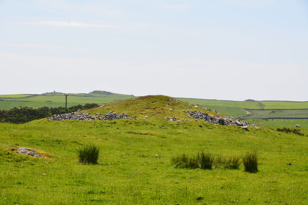
Culroy Cairn 1 submitted by Anne T on 28th Jun 2019. The northern side of Culroy Cairn 1, as seen from NX 24931 54457.
(View photo, vote or add a comment)
Log Text: Culroy Cairn 1: On the way back from Culroy White Cairn, we had intended to stop and photograph another 4 cairns along this road, but the road was far to narrow to park on, and with large tractors and other traffic coming along, I hopped out of the car and photographed this cairn as best I could.
By this time of the afternoon, I was getting twitchy and impatient to get to Whithorn and the museum, with their fantastic collection of cross slabs, cross heads and other early Christian stones, so finding an entrance into the field was pretty low priority!
Culroy White Cairn
Trip No.138 Entry No.9 Date Added: 28th Jun 2019
Site Type: Cairn
Country: Scotland (Dumfries and Galloway)
Visited: Yes on 18th Jun 2019. My rating: Condition 2 Ambience 3 Access 4
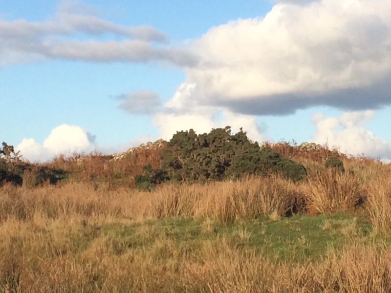
Culroy White Cairn submitted by markj99 on 21st Oct 2018. Culroy White Cairn as seen from the road
(View photo, vote or add a comment)
Log Text: Culroy White Cairn: The intention was to drive down this minor road, stopping to photograph three cairns to the south of the road on our way to Crouse. However, the road was very, very narrow with no marked passing places (just field entrances and the occasional driveway) and the stone walls were too tall to see over. All we could see in the end was one of these cairns and we could find no entrance/gate into the field, wo we contented ourselves with photographing the ones we could find.
We drove to where the minor road forks, just to the north west of a farm called Culroy. Taking the northern (left hand) fork, we parked on the short grass. This cairn is at the end of a quarried knoll, and not really obvious until you get up close to it, when the piles of white stones are clearly different from the quarried area around it.
We visited just after a period of dry weather; the ground in front of the cairn was covered in marsh grass, some areas still with small puddles, so wellies would be recommended after a rainy day or two (although you can always approach from the north if needed).
Dacre Church
Date Added: 6th Nov 2017
Site Type: Ancient Cross
Country: England (Cumbria)
Visited: Yes on 5th Nov 2017. My rating: Condition 3 Ambience 4 Access 5
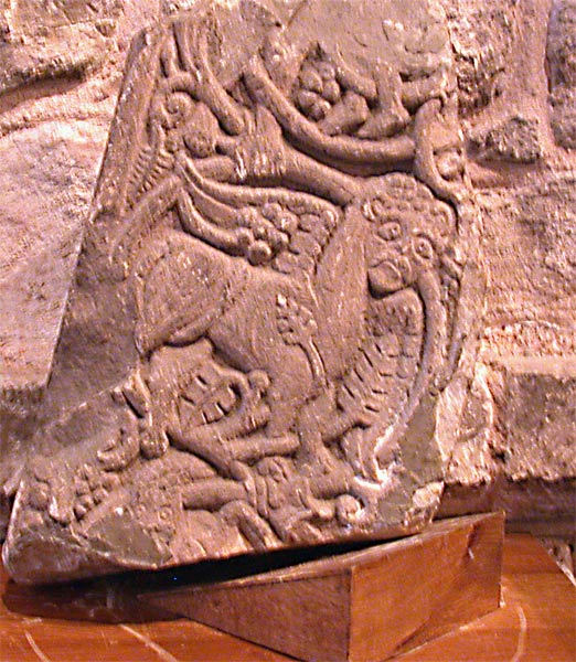
Dacre Church submitted by nicoladidsbury on 22nd May 2005. St Andrew's Church - 9th Century Cross Fragment.
This is the smaller fragment, which is believed to date from the 9th century, was found in 1900 close to the Church and deep in clay. It is considerably damaged but some detail of the carving is still quite sharp. The least damaged face of the shaft, where the top has been broken off, shows two pairs of human feet. Beneath is a lion-like winged creature, with a large face and sorrowful eyes, with the head and part of the body of a serpent.
(View photo, vote or add a comment)
Log Text: St Andrew's Church, Dacre: Anglo Saxon Cross Fragments: We'd visited this church back in early 2014, before I joined the Portal, to photograph the bears; the church was firmly locked on the day of our visit. This time, the door was open, and we walked into this lovely church, parts of which are extremely old. The smell of the nave was reminiscent of the church where I used to sing in the choir when I was 10/11 years old - it's been a long time since I was reminded of those ancient days!
I'd called up the Corpus of Anglo Saxon Stone Sculpture website, which showed four recorded stones for Dacre. We could only find 3 (2 of them combined in the Dacre entry), Dacre 3 having been removed to Lancaster University. Despite an intensive hunt, Dacre 1 was also not to be found.
Dacre 4, in the exterior south wall of the chancel took some finding; to my very untrained eye, the motif could have been weathering. Glad I have the Corpus image to refer to, and then it took two of us well over five minutes to find it!
Dalginross
Trip No.53 Entry No.3 Date Added: 10th Oct 2017
Site Type: Stone Circle
Country: Scotland (Perth and Kinross)
Visited: Yes on 28th Sep 2017. My rating: Condition 3 Ambience 4 Access 5
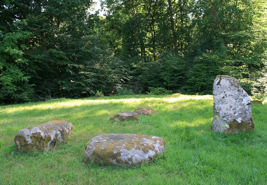
Dalginross submitted by postman on 13th Aug 2013. Peace and quiet, some cars may have gone past, but I didn't notice them.
(View photo, vote or add a comment)
Log Text: Dalginross Four Poster, Near Comrie: From the Roman Stone and its companions, we headed north towards Comrie. Where the B827 takes a sharp left hand turn through Dalginross and Comrie, take the South Crieff Road towards Easter Dalginross and Muirhead Cemetery, where there is ample parking.
From the layby by the cemetery, we walked back to the road junction with South Crieff Road and the trck to Dalginross Muir Farm; the stone circle is nestled under the trees, with moss covered tree stumps around it.
Quite an enigmatic little stone circle, but I confess that it seemed a little like it had been recently put in here, perhaps as a landscaping feature. I had a bit of a hard time convincing myself it was Bronze Age, but Canmore confirms it is indeed.
Dalineun
Trip No.87 Entry No.2 Date Added: 28th Jul 2018
Site Type: Chambered Tomb
Country: Scotland (Argyll)
Visited: Yes on 17th Jul 2018. My rating: Condition 3 Ambience 4 Access 4

Dalineun submitted by hamish on 17th Feb 2004. On your way to Strontoiller you must visit this lovely Cairn at Dalnaneun Farm.The chamber and capstone are completely exposed and not much of the original covering is left.It is interesting to see the construction of one of these.Plenty of places to park,but access is over a barbed wire fence which is just at crotch height so be careful.
NM879267.Argyll.Chambred Cairn.
(View photo, vote or add a comment)
Log Text: Dalineun (Dalnaneun Farm) Chambered Cairn, Loch Nell: We made the mistake of thinking the chambered cairn was in the field opposite the crannog, and climbed over a small stile over the fence; however, we realised that we were in the wrong field, climbed back onto the road and walked down to the gate in the field at about NM 88045 26771; this way there were no small streams or field drains to cross.
Climbing up the slope, the stones of the cist came into view – it reminded me of the photos that Kristiansen has been sending in from Denmark. Turning to look east, there were great views across Loch Nell. Another nice place to be buried.
This was by far a much more atmospheric chambered cairn that the one in Adfern that we’d looked at the night before, as the location seemed both isolated and special. We walked round all sides of the cairn, photographing it as best we could. The Barnacarry crannog is visible from here, and I manged to get a photograph with the lens on maximum zoom. Certainly wish I’d had the plan whilst we were here – should have done a lot more research before we visited, but then that takes the spontaneity out of our daily trips.
It was certainly hot up on this hill. I could have stayed here for a few hours, just looking over the loch, but time marched on, and other sites called.
Danby Rigg (Crossley Gate)
Trip No.32 Entry No.4 Date Added: 5th Jul 2017
Site Type: Cairn
Country: England (Yorkshire (North))
Visited: Yes on 2nd Jul 2017. My rating: Condition 2 Ambience 4 Access 4
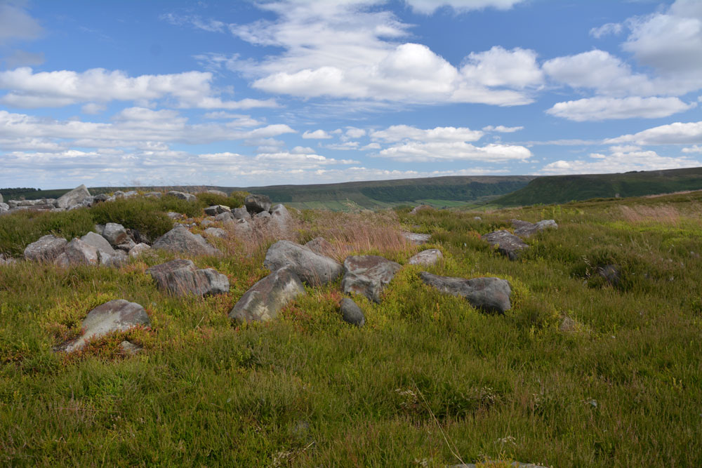
Danby Rigg (Crossley Gate) submitted by Anne T on 4th Jul 2017. Standing on the western side of the cairn looking towards Little Fryup Dale.
(View photo, vote or add a comment)
Log Text: Round cairn overlooking Crossley Gate, Danby Rigg, North Yorkshire: From the other marker stones along the track between Little Fryup Dale and Danby Dale, we walked back to the trig point, then took the footpath (mountain bike track) headed north east along the path that runs along the eastern edge of Danby Rigg. There are great views down to Lower Fryup Dale below. Even I managed this path. There was a steady breeze, which got stronger as the afternoon progressed, but it was warm and relatively easy walking until we headed off into the heather.
We first saw the long, low cross dyke just before the cairn. This mound was largely hidden in the tall heather, which had just started to flower, attracting the steady buzz of the worker bees. I could make out the stones in the mound.
This cairn is just to the north of this cross dyke and is prominent with its stoney mound surrounded by bright green growth which shows up the circular nature of the feature. On the horizon to the west it looks as if other low cairns pop up out of the heather.
Danby Rigg (Slate Hill)
Trip No.32 Entry No.1 Date Added: 5th Jul 2017
Site Type: Marker Stone
Country: England (Yorkshire (North))
Visited: Yes on 2nd Jul 2017. My rating: Condition 4 Ambience 4 Access 4
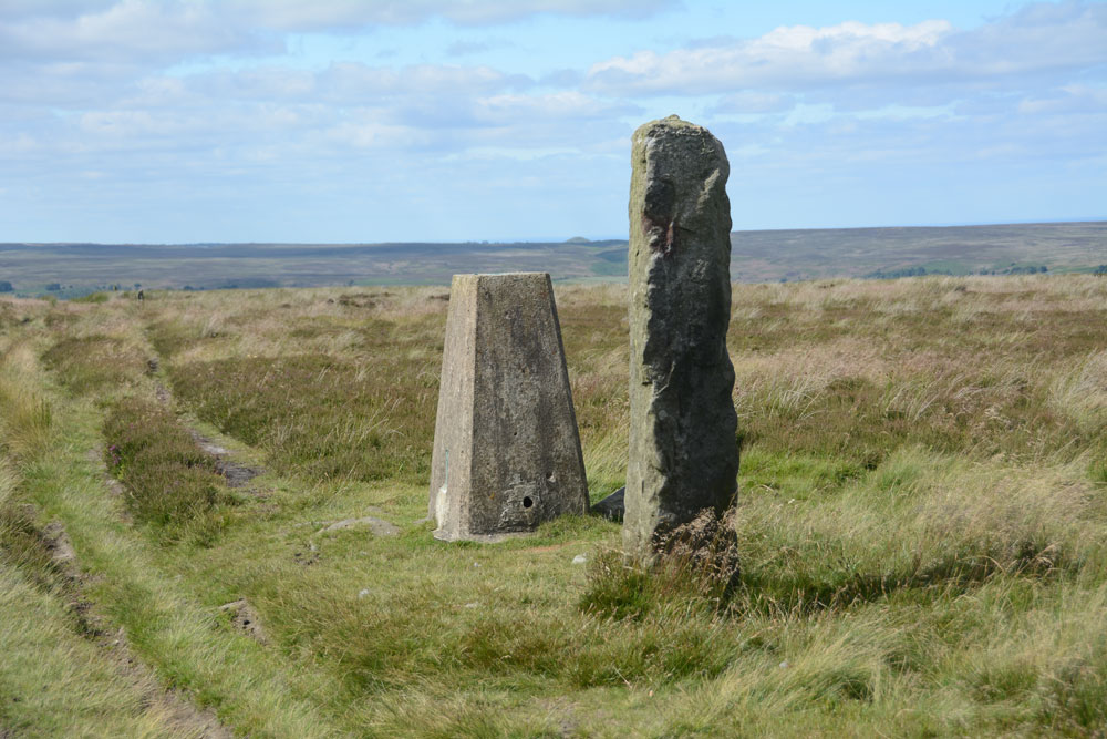
Danby Rigg (Slate Hill) submitted by Anne T on 4th Jul 2017. First view of this marker stone and the trig point (TP2728 at NZ 70788 05869) on the eastern edge of Danby Rigg.
(View photo, vote or add a comment)
Log Text: Marker/Standing Stone & Trig Point, Danby Rigg, North Yorkshire: Not marked on the OS map, this stone sits within a couple of metres of Trig Point TP2728 (Danby Moor). It is sited almost on the eastern edge of Danby Rigg, where the ridge starts to slope sharply down to Little Fryup Dale. There is no information recorded about it on Pastscape, although their information for the area indicates a number of way markers, some scheduled, which mark the route of a medieval footpath which runs from Slate Head to Ainthorpe. Other way markers (such as this) mark out two separate footpaths from Little Fryup Dale in the east to Danby Dale at the western most side of the ridge. This sits at the side of the western most track, continuing the farm track east-west over the ridge.
The area has a long history and plays host to many features, including cairn cemeteries, cross dykes, cairn circles and round cairns, many dating to the Bronze Age and possibly Neolithic.
The easiest way to reach this stone and trig point is to walk from (or park at) the cross roads just to the south of Slate Hill House (where Castle Lane, New Way and Slate Hill meet). There is a farm track and a footpath starting almost from the same point up to the top of Danby Rigg. The footpath is somewhat overgrown and steep towards the top, so we followed the well used farm track which heads almost directly west then tracks north east up the slope. Almost as soon as the path levels out, you see the stone and the trig point. The views back towards where Little Fryup Dale meets Great Fryup Dale. The views across these valleys and northwards back towards Ainthorpe are stunning.
Danby Rigg Cairn With Standing Stone
Trip No.32 Entry No.6 Date Added: 5th Jul 2017
Site Type: Ring Cairn
Country: England (Yorkshire (North))
Visited: Yes on 2nd Jul 2017. My rating: Condition 2 Ambience 4 Access 3
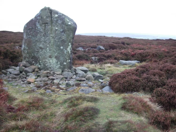
Danby Rigg submitted by tlgreen on 11th Sep 2011. Standing stone on Ainthope Rigg, remnant of a former stone circle.
(View photo, vote or add a comment)
Log Text: Danby Rigg Ring Cairn with Standing Stone, North Yorkshire: Of all the sites on Danby Rigg, this was the one I wanted to see most of all, especially after seeing the photos on the Portal, and I wasn't disappointed, although rather than a stone circle, I found a ring cairn with standing stone. The views to the west to Danby Dale and Little Fryup Dale were lovely on this cloudy, but warm, afternoon.
I was very aware of being in a very ancient landscape and there appeared to be many cairns popping out of the ground (where the heather had been burnt away) and vegetation covered low mounds everywhere.
The cairn is recorded on Pastscape (Monument ID 28809) and also Historic England, where the whole Danby Rigg landscape is recorded 'en masse'. The latter says: "The northernmost, which incorporates a standing stone, was excavated by Atkinson in 1863 and re-excavated in 1986-89. At the centre of the ring cairn there was a 1.7m by 1.1m pit containing two Bronze Age cremation urns and a large quantity of burnt bone. The stones of the ring bank were uncovered but not removed during the excavation and further archaeological remains are expected to survive underneath."
There was a further way marker along the track to the west towards Danby Dale.
Danby Rigg Cross Dyke (Crossley Side)
Trip No.32 Entry No.3 Date Added: 5th Jul 2017
Site Type: Misc. Earthwork
Country: England (Yorkshire (North))
Visited: Yes on 2nd Jul 2017. My rating: Condition 2 Ambience 4 Access 4
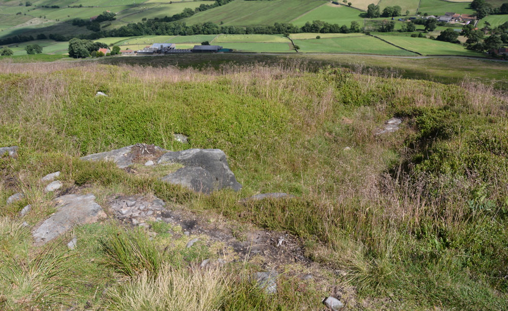
Danby Rigg Cross Dyke (Crossley Side) submitted by Anne T on 5th Jul 2017. Standing some 10 metres from the footpath in the middle of the cross dyke looking down into Little Fryup Dale with Crossley House Farm below.
(View photo, vote or add a comment)
Log Text: Danby Rigg Cross Dyke (Crossley Side), North Yorkshire: From the standing stone (marker stone) and trig point, we walked along the footpath leading approx. north east along the eastern side of the ridge towards the large round cairn. I confess to having walked past this at first, almost reaching the round cairn, but turned round and spotted the long, low hump rising out of the heather.
Walking along the earthwork, it is made of earth and stones and feels substantial under the feet. What a view down to Lower Fryup Dale and Crossley House Farm below.
I was keen to photograph this and the cairn and move onto the 'stone circle'. So much to see on this ridge - it's a very complex Bronze Age landscape. I had no idea how much was here until we started walking. A very beautiful part of the world.
