Contributory members are able to log private notes and comments about each site
Sites Anne T has logged. View this log as a table or view the most recent logs from everyone
Giants Cave Holy Well (Edenhall)
Trip No.188 Entry No.3 Date Added: 15th Sep 2022
Site Type: Holy Well or Sacred Spring
Country: England (Cumbria)
Visited: Saw from a distance on 13th Sep 2022. My rating: Condition 1 Ambience 4 Access 3
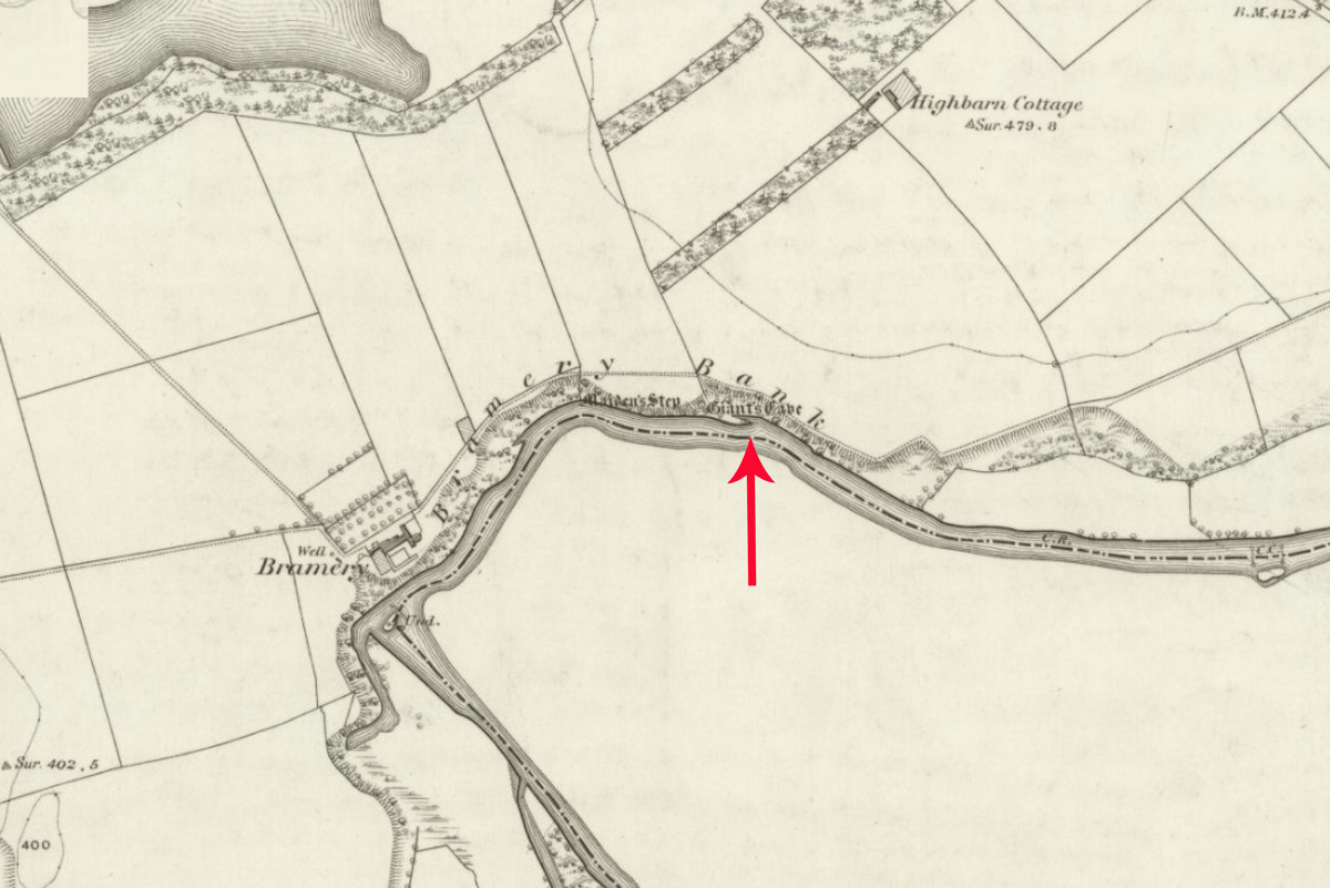
Giants Cave Holy Well (Edenhall) submitted by Anne T on 8th Sep 2022. The exact location of this well is not known. It could be either north or south of the River Eamont, in the vicinity of Giant's Cave (marked with a red arrow). Shared under the terms of the National Library of Scotland Creative Commons Attribution-NonCommercial-ShareAlike 4.0 International (CC-BY-NC-SA) licence. See Sheet Cumberland LIX.2.
(View photo, vote or add a comment)
Log Text: Giant's Cave Holy Well: Having walked to St. Ninian's Church, Ninekirks, and wandered around the site of St Ninian's preconquest monastery, it was only a short walk northwards across the field towards the location of the Giant's Cave and the River Eamont.
There was no sign of the well on the south side of the river, and the river was too big, wide and fast flowing to cross to get to the Giant's Cave, so we tried to spot it from afar.
This section of the river is dominated by red sandstone cliffs, with heavy tree cover, so it wasn't really possible to spot either the cave or the well.
The photographs show approximate locations for the well, given the 'vague' grid reference. Goodness knows how those Victorian revellers got to the cave, but there are beaches along the river, and a beautiful meadow on the south of the river for celebrations at the well to have taken place at.
St Ninian's Church (Ninekirks)
Trip No.188 Entry No.1 Date Added: 18th Sep 2022
Site Type: Ancient Cross
Country: England (Cumbria)
Visited: Yes on 13th Sep 2022. My rating: Condition 3 Ambience 4 Access 3
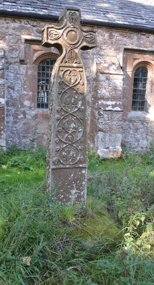
St Ninian's Church (Ninekirks) submitted by Anne T on 18th Sep 2022. Again, the cross base can hardly be seen for the tall grass covering it. Topped by a modern cross shaft and head (a modern grave marker), the cross base sits a few metres south of the nave.
(View photo, vote or add a comment)
Log Text: St Ninian's Church, Ninekirks: We parked in a very small car park which is at the start of a green lane/permissive footpath, at NY 55815 28944. This was quite tricky to spot as the entrance to the car park is small and hidden by tall grass.
The permissive footpath initially leads us a gentle slope at the northern side of a very recently ploughed field, with the River Eamont downslope to our left. The path then turns northwards, still with a steep drop down to a loop of the river, but with pasture to our right. The sheep here were so large they looked like calves.
Through the trees, we could see a large tower attached to a large building, so it came as a bit of a shock to drop down to river level and see the church was so small. It turned out that the building we could see was on top of a hill on the northern side of the river.
Whilst there was no church guide book, the notes left by the Churches Conservation Trust were very helpful.
Beautiful spot, and well worth the walk.
Penrith Museum
Trip No.189 Entry No.1 Date Added: 25th Feb 2023
Site Type: Museum
Country: England (Cumbria)
Visited: Yes on 13th Oct 2022. My rating: Condition 3 Ambience 4 Access 4
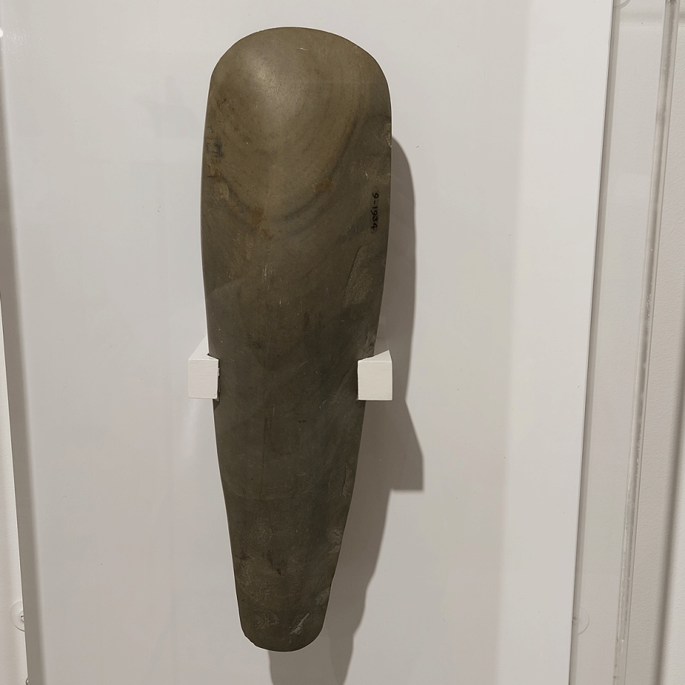
Penrith Museum submitted by Anne T on 25th Feb 2023. This polished late Neolithic Stone Axe was found in Botcherby (the village in which I now live), and comes from the Tullie House Museum collection.
(View photo, vote or add a comment)
Log Text: Penrith Museum: With relatively few trains running between Penrith and Carlisle, and recovering from a broken shoulder, this was of necessity a brief, but reasonably interesting visit. Only a relatively small museum, it has a surprising number of exhibits, although not displayed in any cohesive way, and with frustratingly little information about the items on display. However, I was made very welcome by the staff (volunteer?) members manning the reception desk.
I asked permission to take photographs of some of the exhibits, particularly the cross base, and this was readily granted, providing I didn't use flash. I would go back for another look next time I'm in Penrith, feeling better, and able to carry my proper camera with me, rather than using my mobile phone. Am planning on going back in the not too distant future.
St Mary's Churchyard Cross (Wirksworth)
Date Added: 24th Feb 2019
Site Type: Ancient Cross
Country: England (Derbyshire)
Visited: Yes on 17th Sep 2015. My rating: Condition 3 Ambience 4 Access 5

St Mary's Churchyard Cross (Wirksworth) submitted by Anne T on 22nd Oct 2015. This cross shaft and base sits in the north west part of the church yard. The church guide tells me that whilst the cross shaft dates from the 13th century, the cross base is pre-Norman.
(View photo, vote or add a comment)
Log Text: St Mary's Churchyard Cross, Wirksworth: I've split this page off as the cross has it's own HE scheduling record and Pastscape record, and got a little lost in with the other Anglo Saxon carved stones within the church itself.
Until we wandered around the churchyard, we didn't know this cross was here, so it was a really nice surprise to have seen it.
St Mary the Virgin (Wirksworth)
Date Added: 22nd Oct 2015
Site Type: Early Christian Sculptured Stone
Country: England (Derbyshire)
Visited: Yes on 17th Sep 2015. My rating: Condition 3 Ambience 4 Access 5
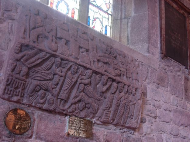
St Mary the Virgin (Wirksworth) submitted by TimPrevett on 29th May 2006. The Wirksworth Stone - 8th or 9th Century carved coffin lid depicting Christ washing the feet of the disciples, the crucifixion, the body of the BVM being borne for burial, the presentation of Christ in the temple before Simeon, Christ's descent into Hell, Christ's Ascension, the Annunciation, and the Mission of the Church.
The picture was very difficult to take; direct sunlight coming through the window, spacial constraints, and the church busying ahead of a Choral Evensong; not that pleased ...
(View photo, vote or add a comment)
Log Text: Anglo Saxon Stones at St. Mary The Virgin, Wirksworth, Derbyshire: My husband's father had died unexpectedly last week and we were down sorting out the funeral and his house. It all got a bit too much, and I asked to 'run away' for the afternoon to do something different. Funny, we'd nearly bought a house here in the early 1980's, on the hills just outside the town, but never really explored this pretty little market town with its boutique shops.
We found the church behind the shops opposite the market square in a pretty oval shaped churchyard. It was much bigger than expected, feeling light and airy - more like a mini-cathedral - and with what Anglo Saxon treasures.
There were groups of stones built into the walls - by the north door, the walls of the south transept and the south western part of the nave.
The church offered a good guide book, but most useful was the 'treasure trail' for children along with the laminated guide sheet which showed the locations of the stones with a short description.
As I only had the camera on my phone we decided to go back with the camera proper, but time has run away with us and we never did get to go back. Thanks to modern technology the phone on my camera is better than the mini digital camera I usually carry with me.
Yew Tree Well
Trip No.170 Entry No.2 Date Added: 11th Aug 2021
Site Type: Holy Well or Sacred Spring
Country: England (Derbyshire)
Visited: Yes on 16th Jul 2021. My rating: Condition 4 Ambience 3 Access 5
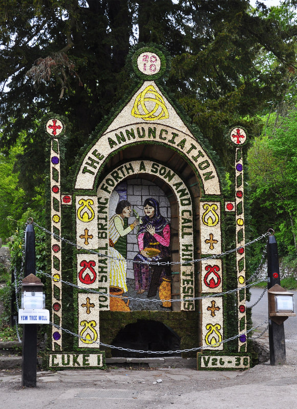
Yew Tree Well submitted by Creative Commons on 6th May 2013. Dressing of Yew Tree Well - Tissington 2010
The last day of the various dressings and colours have faded but do not detract to the effort that goes into dressing of the wells in the village.
Copyright Mick Lobb and licensed for reuse under this Creative Commons Licence.
(View photo, vote or add a comment)
Log Text: Yew Tree Well, Tissington: The second well of the day. We walked down The Street from Hall Well (with the cafe to our right hand side and church to our left), turning left into Narlow Street. This well is almost at the entrance to the Candle Workshop, underneath a tall, but relatively young Yew Tree.
There was water in the well basin, but nothing seemed to be flowing into or out of the well, or along the drainage channel at the front of it, at the time of our visit.
Town Well
Trip No.170 Entry No.3 Date Added: 11th Aug 2021
Site Type: Holy Well or Sacred Spring
Country: England (Derbyshire)
Visited: Yes on 16th Jul 2021. My rating: Condition 4 Ambience 3 Access 4
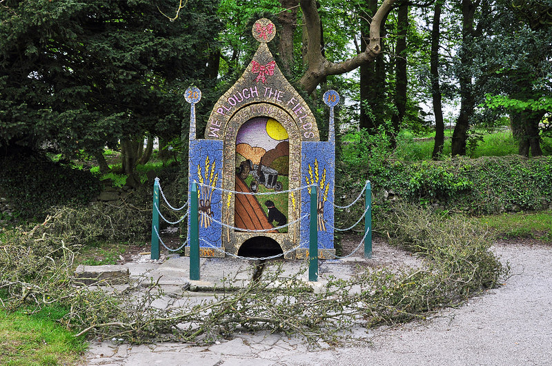
Town Well submitted by Creative Commons on 6th May 2013. Dressing of Town Well - Tissington 2010
The designs are laid out on a frame with stretched sacking to which is applied wet mud into which the decoration is applied. The week saw warm dry weather that dried out the mud which cracked like the dried up bed of a lake. This photograph shows deterioration of the dressing on the final display day.The next day the display was removed.
Copyright Mick Lobb and licensed for reuse under this Creative Commons Licence
(View photo, vote or add a comment)
Log Text: Town Well, Tissington: Our third well out of the six in the village. From Yew Tree Well, we headed east along The Green, past the pond (which had very cute young ducklings being taught to swim by their parents). The well is just to your left hand side at the far side of the green.
Children's Well
Trip No.170 Entry No.5 Date Added: 12th Aug 2021
Site Type: Holy Well or Sacred Spring
Country: England (Derbyshire)
Visited: Yes on 16th Jul 2021. My rating: Condition 3 Ambience 3 Access 5
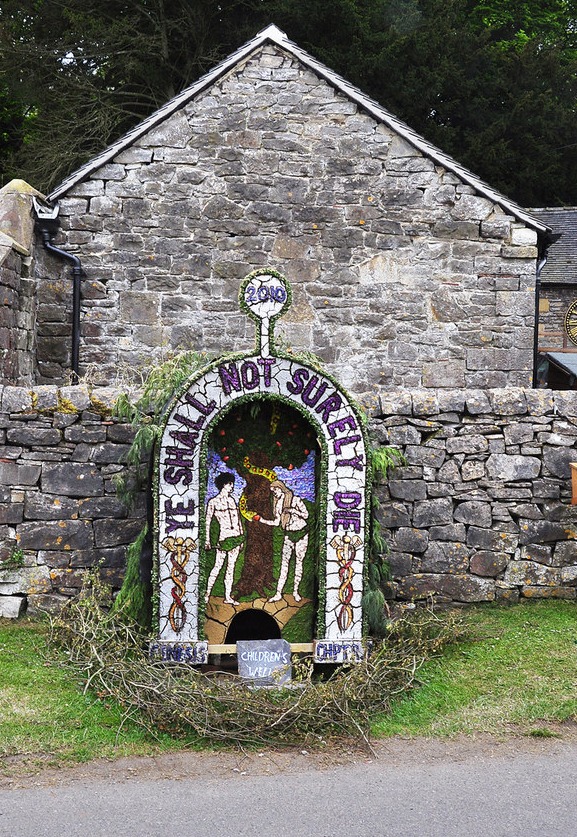
Children's Well submitted by Creative Commons on 6th May 2013. Dressing of Children's Well - Tissington 2010
Rather a macabre sentiment from children I would think.
Copyright Mick Lobb and licensed for reuse under this Creative Commons Licence.
(View photo, vote or add a comment)
Log Text: Children's Well, Tissington: The fifth well we visited in the village, and easy to spot. Not recorded on HE or HERR. The basin within the well head was slightly muddy and dry, but looking over the dry stone wall, there is a boggy area of ground, which is where the water appears to rise, and a stone trough just behind the well head, which was full of water.
Hands Well
Trip No.170 Entry No.6 Date Added: 12th Aug 2021
Site Type: Holy Well or Sacred Spring
Country: England (Derbyshire)
Visited: Yes on 16th Jul 2021. My rating: Condition 3 Ambience 3 Access 5
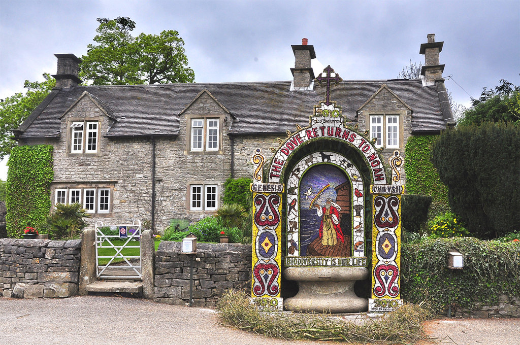
Hands Well submitted by Creative Commons on 6th May 2013. Hands Well dressing and cottage - Tissington 2010
Copyright Mick Lobb and licensed for reuse under the Creative Commons Licence.
(View photo, vote or add a comment)
Log Text: Hands Well, Tissington: The sixth, and final, well marked on the Tissington village leaflet map, and looked like a large, stone cotton-reel. As we approached it, some people were dipping their hands into the water. There was no flow of water into the basin, although the water appeared fresh and clear.
Hall Well (Tissington)
Trip No.170 Entry No.1 Date Added: 11th Aug 2021
Site Type: Holy Well or Sacred Spring
Country: England (Derbyshire)
Visited: Yes on 15th Jul 2021. My rating: Condition 4 Ambience 4 Access 5
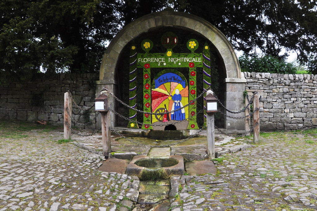
Hall Well (Tissington) submitted by Creative Commons on 6th May 2013. Dressing of Hall Well - Tissington 2010
Copyright Mick Lobb and licensed for reuse under this Creative Commons Licence.
(View photo, vote or add a comment)
Log Text: Hall Well, Tissington: We have been to Tissington before, on a Well Dressing weekend, a long, long time ago (about 38 years!), but because of the sheer number of visitors and really only interested in seeing the church, we took a quick look around only. This time, we walked round to see the wells in their 'ordinary' state. There was a large number of visitors again, but no-one else seemed particularly interested in the wells. It being a very, very hot and humid day, we were grateful for the cafe being open, although the queues to get ice-cream from the traditional sweet shop were horrendous, so we gave up.
I picked up a leaflet in the main cafe which showed the location of the wells, which made locating them easy.
A very pleasant village, and well worth visiting. Would have liked to have spent longer.
Coffin Well
Trip No.170 Entry No.4 Date Added: 11th Aug 2021
Site Type: Holy Well or Sacred Spring
Country: England (Derbyshire)
Visited: Yes on 16th Jul 2021. My rating: Condition 2 Ambience 2 Access 5

Coffin Well submitted by AngieLake on 12th Feb 2007. The beautiful clay-based panel of dried flowers and seeds creating this artistic well-dressing at the Coffin Well in 2003.
(View photo, vote or add a comment)
Log Text: Coffin Well, Tissington: Finding this well was pretty tricky, as even with the leaflet showing the location of all the wells in Tissington, we walked up and down, and down and up a lane called 'The Foot'. Eventually, I realised that whoever was in the cottage had parked their car right across the front of the well, with the front passenger tyre almost in the well itself. I had to do contortions, avoiding the bonnet of the car, to get any photograph at all.
Presumably the main part of the well is behind the garden wall, in the private garden. The gate to the cottage had a sign which said 'no entry' or 'strictly private', and I was reluctant to knock on the front door and seek permission.
Not impressed by the parking, and no sign to say this was the well.
All Saints (Bradbourne)
Trip No.170 Entry No.7 Date Added: 12th Aug 2021
Site Type: Ancient Cross
Country: England (Derbyshire)
Visited: Yes on 16th Jul 2021. My rating: Condition 3 Ambience 4 Access 4
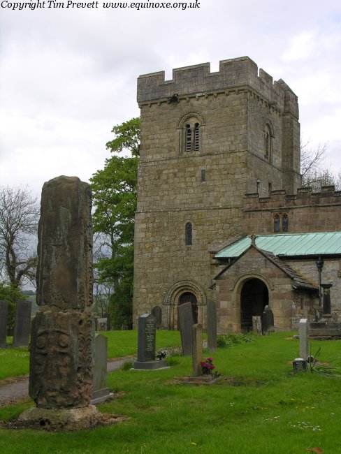
All Saints (Bradbourne) submitted by TimPrevett on 13th May 2007. The remains of the Anglo Saxon cross shaft at Bradbourne, which until quite recently formed parts of a stile... nice, but has not faired as well as that at Eyam.
(View photo, vote or add a comment)
Log Text: All Saints, Bradbourne: Our last visit of this holiday. We had a very 'interesting' journey to Bradbourne, as the police had closed off the main road and routed all traffic down some very minor, single track roads, in which traffic was trying to move in both directions, and not succeeding, which was very frustrating.
There is a large parking area outside the church, although the actual entrance to the churchyard was a bit tricky to find, as there were a number of entrances to different driveways, and we ended up walking down one of these by accident.
The first cross is just inside the churchyard, to your right as you enter from the south. The sundial is just a little further to the north-north-east.
We missed the second cross within the churchyard, as we didn't have access to the HE website at the time of our visit, and whilst looking around, thought it was just another grave marker, so I didn't photograph it.
Loved the carving on the door into the south side of the tower.
Whilst there, a couple of other visitors were very keen for us to see the grave of actor Alan Bates ("Who?" I asked, to much disgust on their part), so we did wander round to find it, out of curiosity.
Watching Place Waymarker
Trip No.130 Entry No.1 Date Added: 22nd May 2019
Site Type: Marker Stone
Country: England (Devon)
Visited: Yes on 11th May 2019. My rating: Condition 3 Ambience 3 Access 5
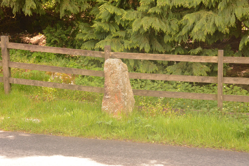
Watching Place Waymarker submitted by Anne T on 22nd May 2019. The Beetor/Watching Place waymarker. This stone dates only to the 18th century, but marks the original site of the Beetor Cross, now located some 100m to the south.
(View photo, vote or add a comment)
Log Text: Watching Place Waymarker/original site of Beetor Cross: Having seen the OS map and sorted out the Pastscape entries, I finally realised that this 'standing stone' was where the cross had originally been located.
Our first stop today was to go and photograph it so I could complete the Beetor Cross entry. It was nice to understand the relationship between the waymarker stone and the wayside cross, although it too me a while to understand the confusion between the names (HE calls the waymarker the Beetor Cross and the cross the Watching Place Cross).
I had to be careful photographing the front of the cross as cars sped quickly at irregular intervals.
Moretonhampstead Cross
Trip No.130 Entry No.4 Date Added: 24th May 2019
Site Type: Ancient Cross
Country: England (Devon)
Visited: Yes on 11th May 2019. My rating: Condition 3 Ambience 3 Access 5
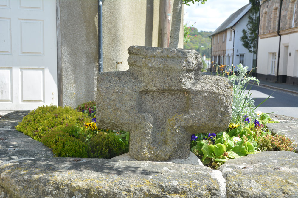
Moretonhampstead Cross submitted by Anne T on 24th May 2019. The eastern side of the cross head, with its T shaped recess (Pastscape describes it as cross shaped).
(View photo, vote or add a comment)
Log Text: Moretonhamstead Village Cross: The remains of this old village cross can be found, surprisingly, on Cross Street, outside the gate at the south side of the churchyard. I confess I had not expected to see a wayside/village cross mounted in a large flower bed! I got some strange looks from locals and visitors photographing this flower bed from different angles.
We then went to explore the church (St Andrew's) then for soup and a cup of tea in a nearby café (the Gateway Tearooms) with superb table service. Carrot and ginger soup with freshly made soda bread. Yum!
Higher Combe Cross
Trip No.130 Entry No.7 Date Added: 30th May 2019
Site Type: Ancient Cross
Country: England (Devon)
Visited: Saw from a distance on 11th May 2019. My rating: Condition 3 Ambience 3 Access 4

Higher Combe Cross submitted by Anne T on 30th May 2019. Andrew (husband) balanced on top of the low stone wall between the minor road to Lustleigh and Cross Park Field to get this photograph of the cross head, from about 100m away. Not the best focused of photographs, but the closest we could get.
(View photo, vote or add a comment)
Log Text: Higher Combe Cross: If we could have obtained access to this cross, access would have been a short walk across a field of improved pasture. Shame the gate was double-chained with two electric fences virtually up against the gate. Lovely horse in the field, though.
Andrew resorted to standing on top of the low stone wall just to the south of the cross, where there was a sufficient enough gap in the trees/hedges to see through. A shame, because it looked as if it was in such a lovely location, just above a small stream, and against an old hollow way.
Bishop's Stone (Lustleigh)
Trip No.130 Entry No.9 Date Added: 1st Jun 2019
Site Type: Ancient Cross
Country: England (Devon)
Visited: Yes on 11th May 2019. My rating: Condition 3 Ambience 3 Access 5
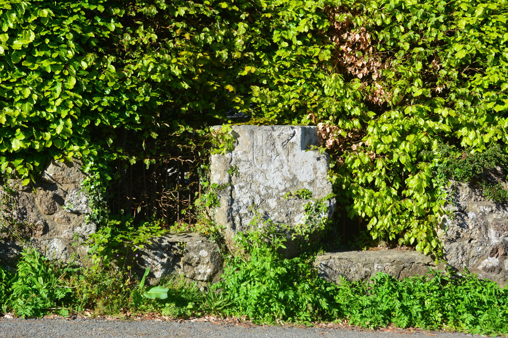
Bishop's Stone (Lustleigh) submitted by Anne T on 1st Jun 2019. The Bishop's Stone, seen from part way across this busy, minor road. The Pastscape photograph shows the stone set against an iron railing; a substantial hedge has since grown up around it.
(View photo, vote or add a comment)
Log Text: Bishop's Stone, Lustleigh: This stone is on a corner of a busy road junction of three minor roads– I needed to pick my time to step part way across the road to photograph the stone from the front. The metal railing shown in the Pastscape photo is now largely hidden by a beech hedge. The stone goes about around a metre or so back into the garden of the house. It’s a lot bigger than it looks at first glance. We were also lucky that the bright sunlight also helped to show up the incised shield.
South Harton Cross
Trip No.130 Entry No.10 Date Added: 1st Jun 2019
Site Type: Ancient Cross
Country: England (Devon)
Visited: Yes on 11th May 2019. My rating: Condition 3 Ambience 4 Access 5
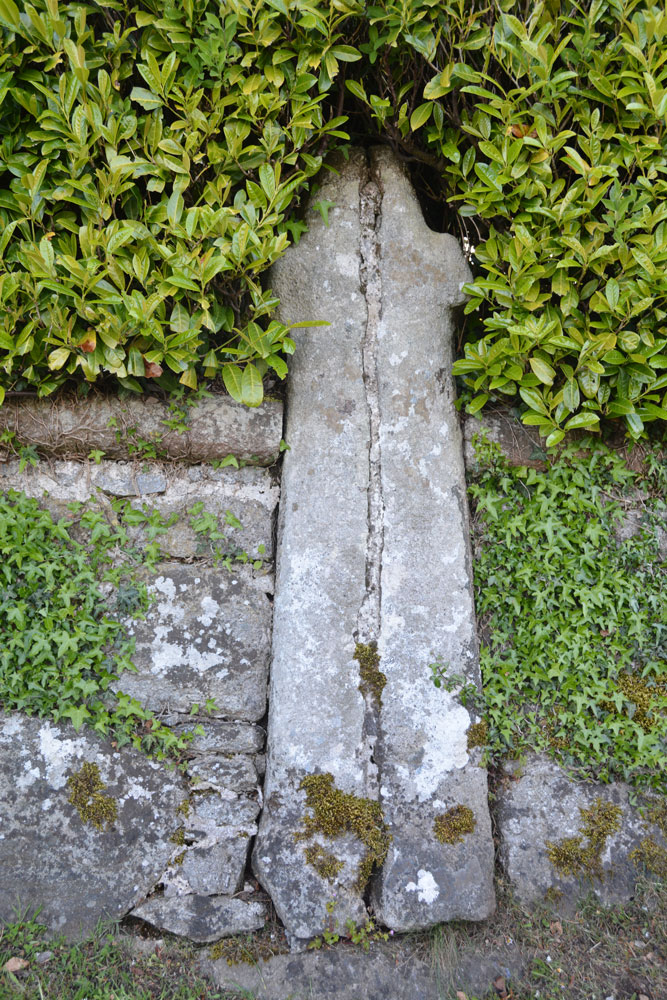
South Harton Cross submitted by Anne T on 1st Jun 2019. This wayside cross leans against a drystone wall, just west of the gateway into South Harton Farm. It has been split into two and re-assembled at some point in its past, but is a nice specimen, and it was worth braving the tiny lanes to find it.
(View photo, vote or add a comment)
Log Text: South Harton Wayside Cross: As we drove along the minor roads from the Bishop’s Stone towards South Harton Farm, the sun went in and a haze started to drift across the fields and it started to become very chilly.
This cross simply leans against the dry stone wall, just to the west of the gated driveway leading to South Harton Farm. It has very obviously been cemented together, but is none-the-less spectacular, and I’m glad we braved the narrow lane to find this cross.
Out of curiosity, I walked to the gate and looked to see if the cross was visible from the other side of the wall, but it is hidden by the drystone wall and the hedge.
Shorter Cross
Trip No.131 Entry No.2 Date Added: 3rd Jun 2019
Site Type: Ancient Cross
Country: England (Devon)
Visited: Yes on 12th May 2019. My rating: Condition 3 Ambience 3 Access 5
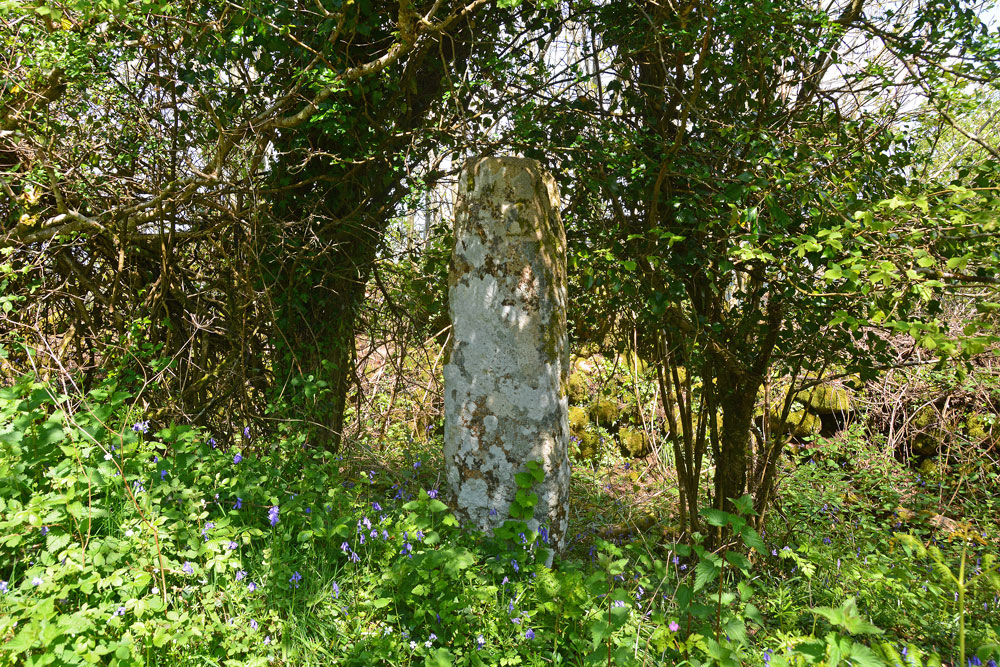
Shorter Cross submitted by Anne T on 3rd Jun 2019. At first glance the standing stone is just another tree-trunk along the side of the minor road - until you look closer. It is remarkably like a standing stone, but very well preserved.
(View photo, vote or add a comment)
Log Text: Shorter Cross, near Druid's Well, Chagford: Not far from Druid’s Well (about 350m as the crow flies), this is a lovely cross, more like a standing stone, with no cross arms.
The cross is well hidden behind/between trees, but we were able to walk into the dip/ditch between the road and the dry stone wall. The crosses on both faces of the stone were clearly visible; on the side nearer the road there was a small, square, equal armed cross inside a larger cross in relief.
Addiscott Cross
Trip No.132 Entry No.1 Date Added: 5th Jun 2019
Site Type: Ancient Cross
Country: England (Devon)
Visited: Yes on 13th May 2019. My rating: Condition 3 Ambience 3 Access 5

Addiscott Cross submitted by Anne T on 5th Jun 2019. The cross, taken from half way across the minor road (showing its southern face).
(View photo, vote or add a comment)
Log Text: Addiscott Wayside Cross: Our first stop on this bright, sunny and breezy day, which made us glad to be out of doors.
The Pastscape entry is indeed correct, as the cross is virtually hidden by the surrounding shrubbery and almost impossible to see until we got closer and the sun bounced off its light yellow surface.
A lovely cross, very well made. It looks as if it could have been carved yesterday, although Pastscape dates it to the 14th century and HE to the 15th.
Ringhole Copse Cross
Trip No.132 Entry No.2 Date Added: 5th Jun 2019
Site Type: Ancient Cross
Country: England (Devon)
Visited: Yes on 13th May 2019. My rating: Condition 3 Ambience 3 Access 5

Ringhole Copse Cross submitted by Anne T on 5th Jun 2019. Standing on the grass verge to the east of the Ringhole Copse Wayside Cross, looking west. Historic England says this cross "(is) on an upland ridge which is the watershed between the valleys of tributaries to the River Yeo and River Taw". With the busy A30 just metres away to the north (right hand side of the cross), the cross felt lonely and isolated. Just think what foot traffic passed it in Medieval times!
(View photo, vote or add a comment)
Log Text: Ringhole Copse Wayside Cross: Not on our original list, but we spotted this cross on the map, with only a minor detour to our next few stops for this morning.
This wayside cross is adjacent to, and just south of, the A30, about 20m west of the road which connects the minor roads running over the A30 . Strangely, it looks as if it is in its original spot, although the HE scheduling information tells me that it was relocated to its present position in 1988 when they improved the A30.
The incised cross on the eastern side is clearly visible, but only part of the carving on the western face is visible under the covering of lichen.
