Contributory members are able to log private notes and comments about each site
Sites Anne T has logged. View this log as a table or view the most recent logs from everyone
Axwell Park Barrow
Trip No.18 Entry No.3 Date Added: 24th Apr 2017
Site Type: Round Barrow(s)
Country: England (Tyne and Wear)
Visited: Couldn't find on 23rd Apr 2017. My rating: Ambience 2 Access 5
Axwell Park Barrow submitted by durhamnature on 7th Aug 2012. Axwell Park Barrow
(View photo, vote or add a comment)
Log Text: Axwell Park Tumulus, Gateshead: OK, even with the grid reference, we couldn't find any trace of this - not surprising, since checking the Pastscape records this morning (24th April), they say no trace of the mound exists! There were lots and lots of humps and hollows on the slope to the left of the path as you walk up the hill. The area seems to be part of an estate and has been heavily modified, with an artificial waterfall and stone-lined channels for water visible in the undergrowth.
This area today is on the edge of a modern housing estate, which is still being constructed. The only thing I can say about this is that it is an easy walk up through the park on tarmacked road.
Four Stones Hill Standing Stones
Trip No.15 Entry No.3 Date Added: 3rd Apr 2017
Site Type: Standing Stones
Country: England (Cumbria)
Visited: Couldn't find on 2nd Apr 2017. My rating: Access 3
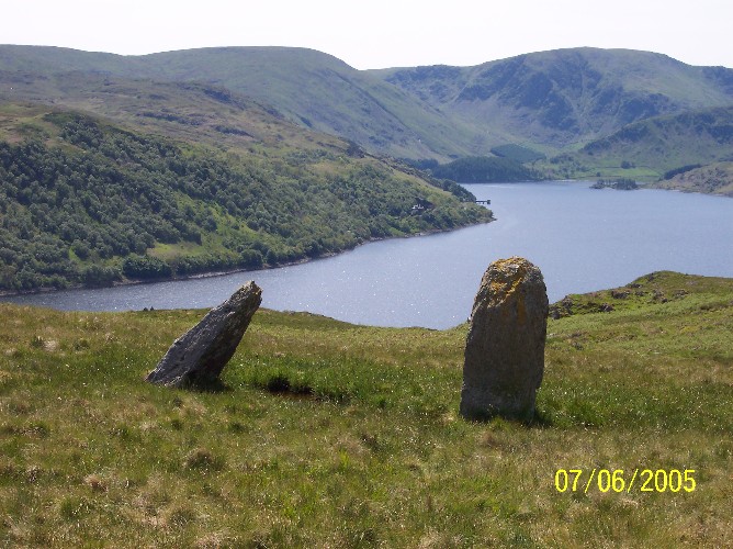
Four Stones Hill Standing Stones submitted by donstobbart on 11th Jun 2005. I have to agree with Nicoladidsbury that I did not feel any ambience when I visited this site. But I did get a great view of the lake!
(View photo, vote or add a comment)
Log Text: Four Stones Hill, Haweswater: Ashamed to say I was defeated by the large stiles with big drops and missing steps. Was so looking forward to going to see this site and from Google Earth, it seemed possible for me to walk this route. Did look for gates in the fields to avoid the stiles, but up by Lower Drybarrows, couldn't find any entry/exits; the one there was said very clearly "no public right of way". Perhaps I should have ignored those and tramped through the fields anyway, but it would have left me feeling guilty. Will try again. Note to self: parking was very difficult up by Winder Hill. Needed to wedge the car in besides a stone wall to leave ready access to the fields.
Five Kings
Date Added: 10th Jan 2017
Site Type: Stone Row / Alignment
Country: England (Northumberland)
Visited: Couldn't find on 1st Jan 2017. My rating: Access 3

Five Kings submitted by Strider on 4th Feb 2003. Five Kings, Northumberland
NT955001
Alignment of four large, irregular stones - the fifth may have fallen but I could not be certain.
(View photo, vote or add a comment)
Log Text: Five Kings, near Grasslees, Northumberland: The easiest access looked as if it was from the footpath near Ovenstone Plantation off the B6341, just past Grasslees. Parking off the road at the entrance to the footpath, we headed off up the track - easy walking at this stage. 100 metres up the track there was a gate/stile with two display boards. Neither bore any similarity to each other, or to the OS map. We had intended walking up the footpath to its fork, 100 metres further up, then take the right hand fork following the stone wall up past The Long Chirn and Woodhouses to the Five Kings. Sadly (presumably being military land) this part of the footpath no longer exists and the walking was difficult (very tussocky, marshy ground). When the heavens opened (despite the weather forecast saying it would be fine!), we contemplated finding a second footpath through Dueshill Farm but it would be dark by the time we reached the stone row, so we decided to go somewhere else and headed back to the car and try another route on a better day. I was so disappointed, as this was a stone row I'd loved to have seen, but the Tosson Tower and Lordenshaw had to suffice for this afternoon.
Barmishaw Stone
Date Added: 20th Apr 2015
Site Type: Rock Art
Country: England (Yorkshire (West))
Visited: Couldn't find on 17th Apr 2015
Barmishaw Stone submitted by DavidRaven on 3rd Nov 2003. The Barmishaw Stone. Very faint carvings including the odd 'ladder' motif. I
could hardly make out the shapes. The stone is just above the wood near the
'Keighley Road' track that traverses the moor, west of White Wells, by a
footpath.
(View photo, vote or add a comment)
Log Text: Barmishaw Stone, Ilkley: we planned to find this piece of rock art after visiting the Comet Stone as it's not far away. From the small car park on the Keighley Road near the Comet Stone grid reference, there is no direct footpath but a track through the moorland grass could be made out. My husband was bold enough to try, but his route was blocked by a rock face. An approach from a different direction will be needed on our next visit.
We abandoned finding this stone to get to the Wulfhere Cross at Addingham before the church closed for the evening.
St John's Well (Osmotherley)
Date Added: 8th Oct 2014
Site Type: Holy Well or Sacred Spring
Country: England (Yorkshire (North))
Visited: Couldn't find on 5th Oct 2014
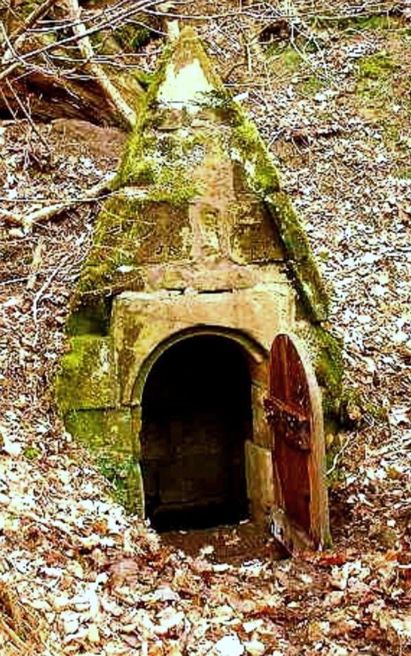
St John's Holy Well submitted by Sunny100 on 14th Jun 2010. St John's Holy Well, near Osmotherley, N.Yorkshire, at SE.447981.
(View photo, vote or add a comment)
Log Text: St John's Well (Osmotherlery): This being a glorious late afternoon, and having not only precise instructions on how to reach St John’s Well from the Mount Grace Priory staff but the GPS co-ordinates and a map I’d printed off with the exact location of the well, we set off to try and reach it. Not as easy as it first appeared! The first path, following what we both thought were the directions given to us, went too far up hill, then path just stopped at the top of the hill. Retracing our steps and turning on the GPS device, we followed the watercourse wending its way south away from the priory, between the edge of the forest and the adjoining meadow and found the track we should have followed. Whilst we could see the path leading up the hill towards the well, I let my husband take the lead, but it became just too difficult – waist high bracken, broken branches and large, boggy holes to fall into – it would have been too easy to twist and ankle or fall over. As it was getting late, we decided to come back in the winter, when the undergrowth has died back. We knew that this well was one of three which supplied the Priory, the first being in the north east corner, just outside the Great Cloister. A second is to the south of this, supplying the Lesser Cloister, and the third (not managed by English Heritage) is St. John’s Well. We did manage to get a photograph of Well House one. Despite there having been a lengthy dry spell, there was still a good flow of water from this spring, and the water was beautifully clear. There is a great similarity between the well house we saw and the image of St John's Well submitted by Sunny100.
Anwoth
Date Added: 22nd Sep 2014
Site Type: Class I Pictish Symbol Stone
Country: Scotland (Dumfries and Galloway)
Visited: Couldn't find on 19th Sep 2014
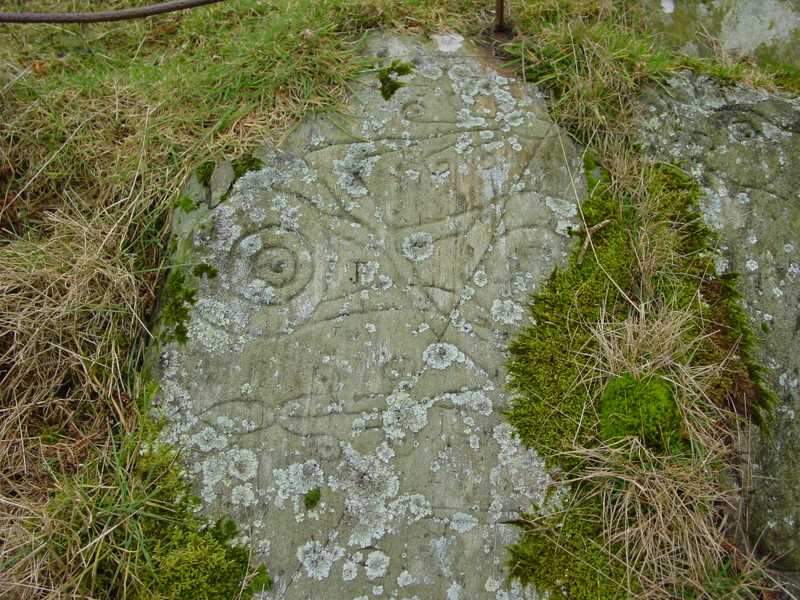
Trusty's Hill submitted by PaulH on 2nd Mar 2003. To W of Gatehouse of Fleet NX588560
Pictish symbols carved in living rock
The "teletubby" !
(View photo, vote or add a comment)
Log Text: Anwoth, Rock Art: Couldn't find as too much gorse and bracken. It was very difficult to orientate ourselves and tried several of the hills, just in case. We have since invested in a cheap and cheerful GPS system, which we've since tested out on Goatstones Rock Art in Northumberland. We did walk onto Rutherford's Monument, the Trig Point and the Millennium Monument and enjoyed the views in the gathering dusk. Will try and visit this site again.
High Banks Farm
Date Added: 22nd Sep 2014
Site Type: Rock Art
Country: Scotland (Dumfries and Galloway)
Visited: Couldn't find on 19th Sep 2014
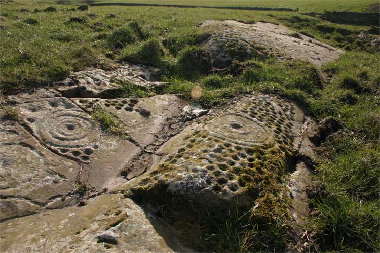
High Banks Farm submitted by TerryStaniforth on 23rd Feb 2005. More detail.
(View photo, vote or add a comment)
Log Text: High Banks Farm Rock Art: Found the track to High Banks Farm easily enough, but husband wouldn't risk our car on the farm track, saying that we'd need a four wheel drive to attempt it. Our tight schedule of sites to visit for the rest of the afternoon didn't allow time to walk up to this rock art site, so sadly we've had to leave this until another day - a future treat!
Doddington Moor
Date Added: 1st Sep 2014
Site Type: Stone Circle
Country: England (Northumberland)
Visited: Couldn't find on 30th Aug 2014
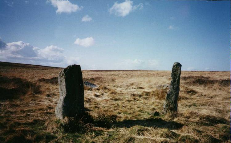
Doddington Moor submitted by Andy B on 24th Nov 2001. Doddington Moor Stone Circle
(View photo, vote or add a comment)
Log Text: Doddington Stone Circle, Northumberland (second failed attempt!). Having visited Weetwood Moor, as we were so near, and it was still only relatively early (5pm), we decided to drive a couple of miles further up the road to Weetwood Hall and try the footpath I’d identified as a possible easier route to Doddington Stone Circle.
We parked the car park where the footpath splits off northwards from the road just after Weetwood Hall (there is just room for one car opposite the field entrance at the corner of the junction). There is a metalled road which goes past the two or more houses to the left hand side, then it become a grassy path between two hedges, with tractor ruts in either side. After about half a mile, just past a wood to the right hand side, there is a gate with a footpath sign on, and the track becomes quad bike marks in the grass, and we followed these up the hill. There is a new stile (narrow, but new) , then the track more or less disappears, and is marked by a series of Scots Pines, standing alone, but growing more or less in a line north-north-west up the hill.
Passing an outcrop of rock to our left hand side, we climbed to the brow of the hill, but just where the land started to go downhill again, we were met by boggy land, covered completely with a heavy coverage of low growing thistles and gorse, which went on as far as the eye could see. Andrew decided this was impossible, so we turned back and went to find the cup and ring marked rocks marked on the map on the way back down the hill.
We'd previously tried to visit on 17th August 2014, but the quarry next to Wooler Golf Club had been extended and the footpaths had disappeared (or we couldn't find them).
There is a third possible footpath to try, from West Horton, so this will go on the 'want to do' list.
Ketley Crag Rock Shelter 1
Date Added: 28th Jul 2014
Site Type: Rock Art
Country: England (Northumberland)
Visited: Couldn't find on 27th Jul 2014. My rating: Access 1
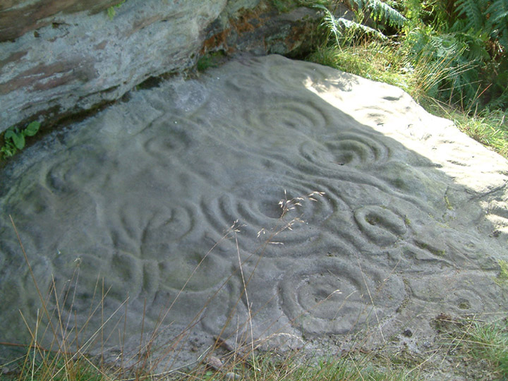
Ketley Crag Rock Shelter 1 submitted by stu on 11th Oct 2003. NU0743 2978. Is there anything better looking? I'd say not.....lots of other impressive cup and ring carvings on the walk over from Chatton Hill.
(View photo, vote or add a comment)
Log Text: We went to seek this magnificent example of rock art, well armed with map, compass and camera, and parked outside South Lyham farm. At the adjacent cottages, one of the residents came out to speak to us, and pointed out the way to the permissive footpath across to Ketley Crag and Chattonpark Hill, telling us how to find the Ketley Stone. It had rained heavily the night before, and following the footpath across the first field from the farm, we remained undeterred by boggy ground and wet feet in the dip where the permissive path splits off right from the farm track. After a search, we found the wooden footbridge across the stream and the permissive footpath sign.
The bracken was shoulder high, and 50 feet further up the path, we were confronted by a high wall of bracken, which proved impossible to get through. So sadly we retraced our steps. Apparently we missed a sheep track through the bracken, which the resident, talking to us on our way back, told us had been there a month before.
We then tried again from the access track from the B6349, at grid reference NU 06362 30614. This was easy walking for the first kilometre or so, but just past the ford, the trackway became very overgrown, with deep ruts and it was very hard work to make progress through the weeds, and despite waterproofs, we were soggy. We did try walking along the edges of the fields rather than on the trackway, but there were no gates between fields, so sadly we had to give up.
I had been really looking forward to seeing this rocky crag; there is a third option, which is from this same trackway, but from Chatton Park Farm, which takes us up over the top of Chattonpark Hill, so we'll try this another day.
We then went in search of some rock art at Doddington, to see if this was more accessible
Giants Cave Holy Well (Edenhall)
Trip No.188 Entry No.3 Date Added: 15th Sep 2022
Site Type: Holy Well or Sacred Spring
Country: England (Cumbria)
Visited: Saw from a distance on 13th Sep 2022. My rating: Condition 1 Ambience 4 Access 3
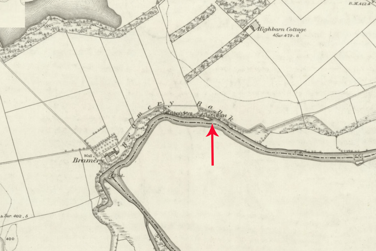
Giants Cave Holy Well (Edenhall) submitted by Anne T on 8th Sep 2022. The exact location of this well is not known. It could be either north or south of the River Eamont, in the vicinity of Giant's Cave (marked with a red arrow). Shared under the terms of the National Library of Scotland Creative Commons Attribution-NonCommercial-ShareAlike 4.0 International (CC-BY-NC-SA) licence. See Sheet Cumberland LIX.2.
(View photo, vote or add a comment)
Log Text: Giant's Cave Holy Well: Having walked to St. Ninian's Church, Ninekirks, and wandered around the site of St Ninian's preconquest monastery, it was only a short walk northwards across the field towards the location of the Giant's Cave and the River Eamont.
There was no sign of the well on the south side of the river, and the river was too big, wide and fast flowing to cross to get to the Giant's Cave, so we tried to spot it from afar.
This section of the river is dominated by red sandstone cliffs, with heavy tree cover, so it wasn't really possible to spot either the cave or the well.
The photographs show approximate locations for the well, given the 'vague' grid reference. Goodness knows how those Victorian revellers got to the cave, but there are beaches along the river, and a beautiful meadow on the south of the river for celebrations at the well to have taken place at.
Hallrigg Standing Stone
Trip No.175 Entry No.1 Date Added: 28th May 2022
Site Type: Standing Stone (Menhir)
Country: England (Cumbria)
Visited: Saw from a distance on 28th May 2022. My rating: Condition 3 Ambience 3 Access 1
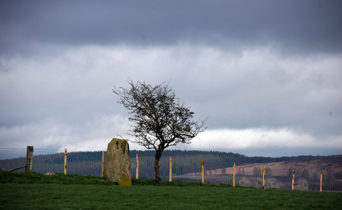
Hallrigg Standing Stone submitted by nicoladidsbury on 9th Apr 2007. Hallrigg Standing Stone - rediscovered standing stone, 2 miles north of Lowhouse Standing Stone, 5 miles north of Penrith. It appears to be red sandstone, approx 1.5m tall
(View photo, vote or add a comment)
Log Text: Hallrigg Standing Stone, Plumpton: The nearest we could get was the very back (staff only area) of the Pot Place Car Park, and we asked permission to take this photograph from the member of staff working in this area.
We did try numerous other ways to get closer to the standing stone, but couldn't even find a track and/or gate to walk across the fields, or who to ask permission off.
Photo taken with a tripod and 50-300mm zoom lens at maximum zoom, but even this didn't give an excellent photo, given the haze in the atmosphere.
St Maelog's Cross
Trip No.167 Entry No.3 Date Added: 22nd Jul 2021
Site Type: Ancient Cross
Country: Wales (Powys)
Visited: Saw from a distance on 12th Jul 2021
St Maelog's Cross submitted by Sunny100 on 11th May 2010. St Maelog's Cross, Llowes Church, Powys at SO193417
(View photo, vote or add a comment)
Log Text: St Maelog's Cross: Despite being told the church was open, and going armed with masks and hand sanitiser, the door was very firmly locked. We could see the back of the cross through the windows at the north western corner of the church, but it was impossible to photograph through the tiny, dirty panes. So disappointed. I did spot a sundial in the churchyard, built into a memorial stone, so had to be content with photographing that.
Clyro Court
Trip No.167 Entry No.1 Date Added: 22nd Jul 2021
Site Type: Chambered Tomb
Country: Wales (Powys)
Visited: Saw from a distance on 12th Jul 2021. My rating: Condition 2 Ambience 3 Access 4
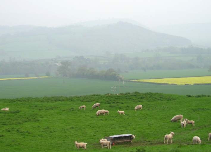
Clyro Court submitted by thecaptain on 14th May 2004. Clyro Court, Chambered Tomb, Powys, SO213432
Marked on the OS map as Chambered Long Cairn, the ruined remains of this tomb can be seen on a little hillock behind a house, beside the busy A438, overlooking the valley of the River Wye at Clyro, just over the river from Hay-on-Wye.
The remains of the tomb can be seen here from the northwest, and are the usual lumpy ground on top of the hillock. What looks like the remains of a stone chamber can be seen sticking out of the ground in the middl...
(View photo, vote or add a comment)
Log Text: Clyro Court Chambered Tomb: This tomb, marked on the OS map, lies on private ground behind a cottage. There was no one at home in the cottage, and the gates into the field had been padlocked with the largest padlocks and chains I've seen in a long time! We had to content ourselves with finding a vantage point by the barbed wire fence and photographing the cairn from there. Lumps and bumps vaguely visible. Would have loved to have climbed over for a closer look.
Wades Stone (South)
Trip No.159 Entry No.3 Date Added: 6th Mar 2020
Site Type: Standing Stone (Menhir)
Country: England (Yorkshire (North))
Visited: Saw from a distance on 4th Mar 2020
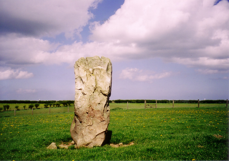
Wades Stone (South) submitted by DavidRaven on 13th May 2005. The southern Wade's Stone, looking north.
(View photo, vote or add a comment)
Log Text: Wades Stone (South): As per our last visit, we were unable to find anyone to ask at the now Council Depot (not the Outdoor Centre as marked on the map), and couldn't see any field access into the field containing the stone, either from the corner of East Barnby Lane and the A171 (at NZ 82845 13203), or off the main road. As there were other sites we were really keen to see, we drove on without making an attempt to see this stone. Shame.
Whitefield Loch Crannog
Trip No.137 Entry No.11 Date Added: 28th Jun 2019
Site Type: Crannog
Country: Scotland (Dumfries and Galloway)
Visited: Saw from a distance on 18th Jun 2019. My rating: Condition 1 Ambience 3 Access 4
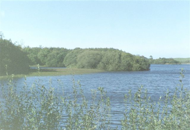
Whitefield Loch Crannog submitted by cosmic on 9th Oct 2004. Viewed from East
(View photo, vote or add a comment)
Log Text: Dorman's Island/Loch Whitefield Crannog (east): We went seeking Dorman’s Island crannog at the eastern side of the loch. Having missed the fisherman's road, and the road being too narrow to turn round, we ended up parking in the fisherman's car park at NX 23531 54887 and walked down the angler’s slipway but the tree cover was too dense to really make out anything. We could just about see round the small headland to our eastern side, and took a couple of photographs and may have just caught the crannog.
Looking at the Canmore map there is also a Tree Island crannog to the western end of the loch.
St Andrew's Well (Wells)
Trip No.136 Entry No.3 Date Added: 12th Jun 2019
Site Type: Holy Well or Sacred Spring
Country: England (Somerset)
Visited: Saw from a distance on 17th May 2019. My rating: Condition 4 Ambience 4 Access 4
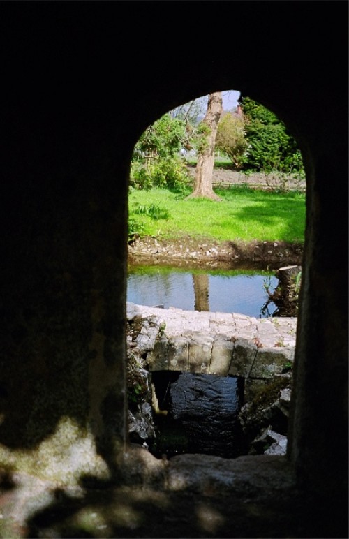
St Andrew's Well (Wells) submitted by KiwiBetsy on 21st Nov 2004. A peep hole gives a view of St Andrew's Well.
(View photo, vote or add a comment)
Log Text: St Andrew's Well, Wells Cathedral: After having had an abortive trip trying to find the sculptured Anglo Saxon stones (now shut up in boxes and cages on the triforium, only accessible by cathedral staff) I only photographed this through the hole in the garden wall separating the cathedral from the Bishop’s Palace. We didn’t have time to go to the Palace as we needed to beat the traffic and get to Deerhurst or Bradford on Avon before the churches shut for the evening.
Higher Combe Cross
Trip No.130 Entry No.7 Date Added: 30th May 2019
Site Type: Ancient Cross
Country: England (Devon)
Visited: Saw from a distance on 11th May 2019. My rating: Condition 3 Ambience 3 Access 4

Higher Combe Cross submitted by Anne T on 30th May 2019. Andrew (husband) balanced on top of the low stone wall between the minor road to Lustleigh and Cross Park Field to get this photograph of the cross head, from about 100m away. Not the best focused of photographs, but the closest we could get.
(View photo, vote or add a comment)
Log Text: Higher Combe Cross: If we could have obtained access to this cross, access would have been a short walk across a field of improved pasture. Shame the gate was double-chained with two electric fences virtually up against the gate. Lovely horse in the field, though.
Andrew resorted to standing on top of the low stone wall just to the south of the cross, where there was a sufficient enough gap in the trees/hedges to see through. A shame, because it looked as if it was in such a lovely location, just above a small stream, and against an old hollow way.
Mossknowe 2
Trip No.127 Entry No.3 Date Added: 7th May 2019
Site Type: Cairn
Country: Scotland (Dumfries and Galloway)
Visited: Saw from a distance on 2nd May 2019. My rating: Condition 2 Ambience 3 Access 4
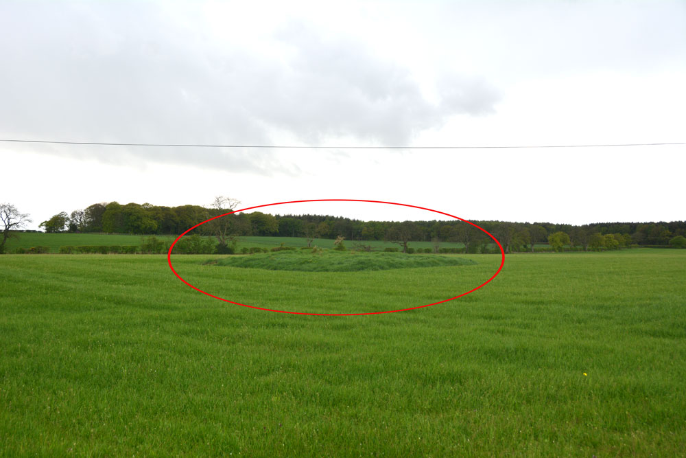
Mossknowe 2 submitted by Anne T on 7th May 2019. The location of this cairn is marked by the red oval. We could really only spot the location of the cairn by the tall grass left around it by the farmer. We were unable to open the gate into the field, and with the rain pelting down and light rapidly fading, we contented ourselves with photographing it from over the hedge.
(View photo, vote or add a comment)
Log Text: Mossknowe Cairn: the cairn nearest to the bend in the road, south east of the cottage which has Mossknowe Tumulus in its garden. Nothing special, but another site ticked off the list.
Mossknowe Tumulus
Trip No.127 Entry No.6 Date Added: 7th May 2019
Site Type: Cairn
Country: Scotland (Dumfries and Galloway)
Visited: Saw from a distance on 2nd May 2019. My rating: Condition 2 Ambience 3 Access 4
Mossknowe Tumulus submitted by graemefield on 27th Jun 2012. The cairn before excavation
(View photo, vote or add a comment)
Log Text: Mossknowe Cairn 1/ Belten Mound: We stopped outside the cottage to the west of the minor road at NY 27846 69513, but could not see much. Carrying on to where the road bends at NY 28117 69281, the only gate into the field from the road here is at NY 28067 69222 and hadn't been opened in such a long time, the hawthorn hedge had grown round the edges. With the rain starting to pelt down, and with evening rapidly falling, we decided to cut our loses, quickly photograph the cairns from a distance and go home.
Mossknowe 3
Trip No.127 Entry No.5 Date Added: 7th May 2019
Site Type: Cairn
Country: Scotland (Dumfries and Galloway)
Visited: Saw from a distance on 2nd May 2019. My rating: Condition 2 Ambience 3
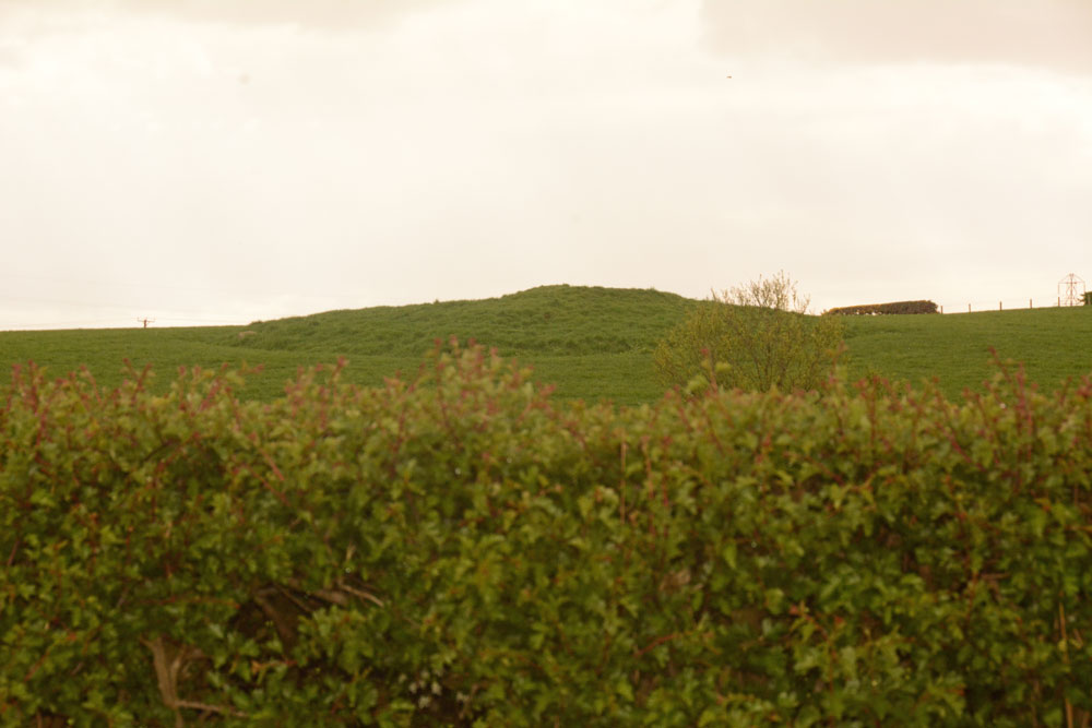
Mossknowe 3 submitted by Anne T on 7th May 2019. The third of the three cairns in close proximity. We only saw this from a distance, as the light was fading rapidly, the rain was heavy and we were unable to open the gate into the first field. Of the three cairns, this looked the most interesting to see, so I'd like to do a 'repeat visit' to all three at some time in the near future, if we pass through this area again.
(View photo, vote or add a comment)
Log Text: Mossknowe Cairn 3: Saw this from a distance only, as the light was fading rapidly, the rain was pelting down and we couldn’t open the gate into the first field. Couldn’t get too excited about this, although it looked the most interesting of the three cairns.
