Contributory members are able to log private notes and comments about each site
Sites Anne T has logged. View this log as a table or view the most recent logs from everyone
Swinburne Stone
Date Added: 15th Jun 2014
Site Type: Standing Stone (Menhir)
Country: England (Northumberland)
Visited: Yes on 13th Jun 2014. My rating: Condition 3 Ambience 4 Access 4
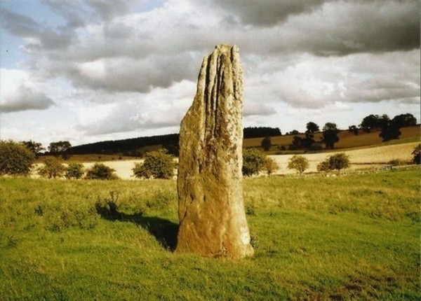
Swinburne Stone submitted by Bladup on 30th Dec 2013. The lovely tall and slender Swinburn Castle standing stone.
(View photo, vote or add a comment)
Log Text: We sought the landowner's permission prior to visiting the stone. We parked outside the Roman Catholic Church at Ox Hills, and walked back to the footpath leading firstly to Swinburne Castle, then splitting off to the left at a large tree to tumuli and the standing stone.
The footpath is easy walking. Almost immediately to the left are some impressive earthworks (possibly related to the original castle?) and some large terraces - much bigger than normal ridge and furrow ploughing. Websites from local historians say these may be medieval strip lynchets.
We first visited the tumuli just before a gate/field boundary crosses the path, before doubling back to the gate which allowed access to the field with the stone (there being sunken stone walls between the footpath and the field boundary, presumably allowing views of the stone from the upper floors of the castle (now private house).
The stone isn't visible from the footpath, but as soon as you top the brow of a small hill, the stone stands below you in the middle of the field.
The stone is impressive, being around 12 feet tall, and if the compass on my phone is correct (it switched 180 degrees several times during my visit) the wider faces are orientated north-north-west/south-south-east.
The southern face of the stone has some easily identifiable cup marks; generally there are quite a few initials carved into the stone.
There are also a couple of other tumuli, which are in private fields, but this is beautiful and peaceful part of the countryside, and we spent a very pleasant afternoon exploring.
Brecken Hills
Date Added: 2nd Jul 2014
Site Type: Hillfort
Country: England (Northumberland)
Visited: Yes on 13th Jun 2014. My rating: Condition 2 Ambience 4 Access 4
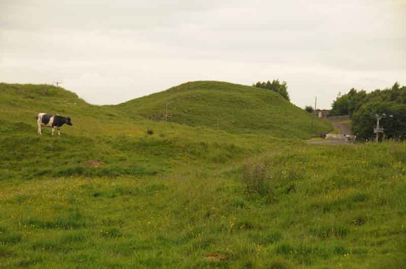
Brecken Hills submitted by Anne T on 17th Jun 2014. Photograph of Blue Crags/Brecken Hills Hillfort taken from gateway at southern edge of site.
(View photo, vote or add a comment)
Log Text: We know this site as 'Blue Crags Hillfort', rather than 'Brecken Hills', so both names are in use. The English Heritage Schedule describes Blue Crags Hillfort as a 'defended settlement of Iron Age/Romano-British date'. It makes excellent use of an existing outcrop of rock (whinstone, from the official records) as part of the defences, and there are very clear ramparts/defensive earthworks on the east, west and south sides of the site, with the main entrance appearing to be to the south west.
We originally went to look at the wells in Colwell (Pricky's well and Coley's Well), but spotted the extensive earthworks of the hillfort marked on the Ordnance Survey map just north west of Colwell, and went to take a look. Blue Crags is situated to the east of the course of Dere Street, with the A68 running between the hillfort and Dere Street.
There is a marked footpath running up to the fort from the west of Colwell, although the visible route vanishes when it reaches the field immediately south of the site, so we followed a vague track through the grass to a large barn which sits at the southern most edge of the hillfort.
The hillfort itself is impressively large and imposing as you walk up to it, as it sits on a hill above you. There is a further footpath that runs north west towards woodland, which would give a superb view of the fort and the outcrop on which it sits, but there were several large bulls, together with cows and their calves in this field, so we trod gingerly trying to get the best photographs from the area around the field entrance to illustrate the site.
On returning home, I logged onto the UK Grid Finder website. The aerial views show about 12 very clear hut circles on the platform of the fort. I will certainly go back in the autumn/early winter to have a closer look.
Coley's Well
Date Added: 3rd Aug 2019
Site Type: Holy Well or Sacred Spring
Country: England (Northumberland)
Visited: Yes on 13th Jun 2014. My rating: Condition 2 Ambience 3 Access 4
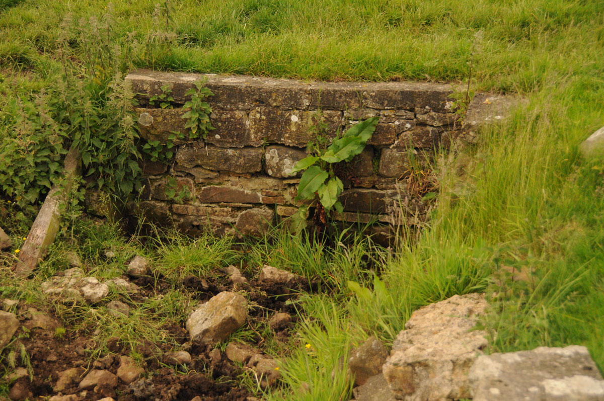
Coley's Well submitted by Anne T on 3rd Aug 2019. A closer look at the ruined back of the well/drinking trough. For a well that used to be known as the Bridal of Colwell and was dressed annually, it is now very sadly neglected. Photograph taken 13th June 2014.
(View photo, vote or add a comment)
Log Text: Coley's Well, Colwell: There is a brick well house close to the houses/farm buildings to the west, although there is also a dry drinking trough/well basin which looked as if this was the original spot where the waters emerged. For a well that used to be called 'Bridal of Colwell' it is now very sadly neglected.
Pricky's Well
Date Added: 3rd Aug 2019
Site Type: Holy Well or Sacred Spring
Country: England (Northumberland)
Visited: Yes on 13th Jun 2014. My rating: Condition 2 Ambience 3 Access 4
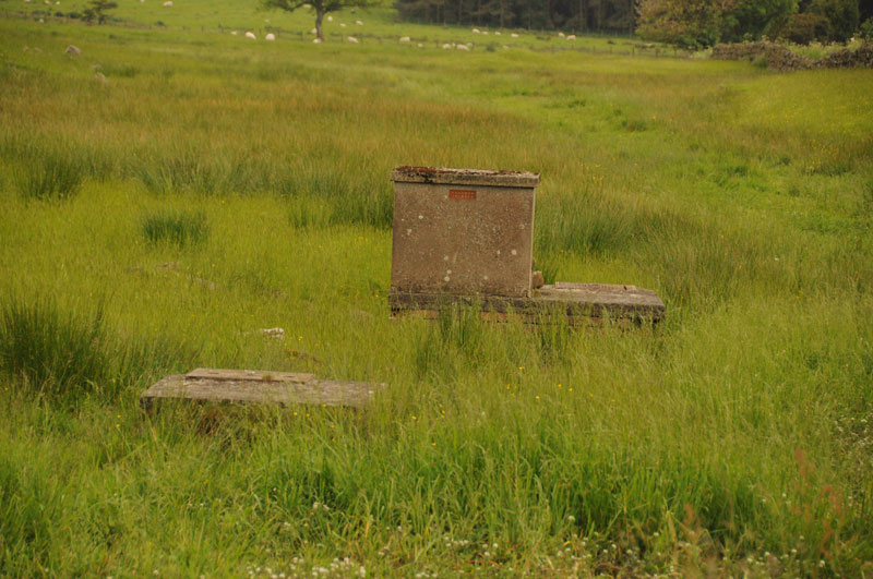
Pricky's Well submitted by Anne T on 4th Sep 2014. Close up of Pricky's Well from the layby by the track to Liddell Hall off the B6342.
(View photo, vote or add a comment)
Log Text: Pricky's Well, Colwell: One of three wells in close proximity in Colwell village. This one sits right by the burn, but is now just a modern brick well house with a wooden door, used to storage some buckets and animal feed inside.
Matfen
Date Added: 16th Jun 2014
Site Type: Standing Stone (Menhir)
Country: England (Northumberland)
Visited: Yes on 15th Jun 2014. My rating: Condition 3 Ambience 3 Access 5
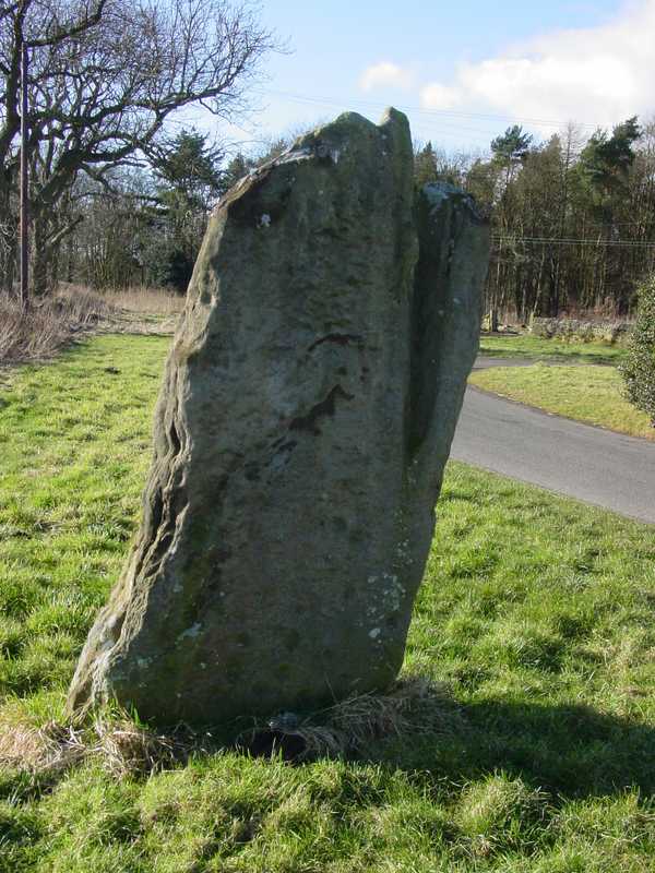
Matfen submitted by PaulH on 2nd Mar 2003. In the village of Matfen. About 2km north of the B6318, the modern road that follows the course of Hadrian's wall.
NZ032705
(View photo, vote or add a comment)
Log Text: This standing stone, near Matfen Hall Hotel/Golf Course, stands on the edge of a road in a hamlet called 'Standing Stone'. It is easy to find, being on a right hand turn just before the main entrance to Matfen Hall Golf Course, and opposite Standing Stone House, about 100 yards from the road junction.
It is difficult to park adjacent to the stone, unless you park in the entrance to the farm/farm buildings, but just opposite the road junction to Standing Stone hamlet, there is another left hand turn with room for a few cars to park at the side of the junction.
The short walk back to the stone was a little difficult, due to the stream of traffic and bicycles moving quickly along the road, but as long as you are careful, it's fine.
There are some impressive cup marks at the base of the north face of the stone, and some more at the top.
Worth seeing, and on the way to The Warrior Stone at Inghoe and Bygate Hill.
Warrior Stone (Ingoe)
Date Added: 16th Jun 2014
Site Type: Standing Stone (Menhir)
Country: England (Northumberland)
Visited: Yes on 15th Jun 2014. My rating: Condition 3 Ambience 4 Access 4
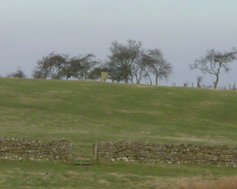
Warrior Stone (Ingoe) submitted by PaulH on 3rd Mar 2003. Northumberland
NZ044747
No public access to the stone itself
(View photo, vote or add a comment)
Log Text: We've visited Inghoe before, but to look at the remains of the medieval village and also the hut circles just beyond Sandyway Heads Farm.
Having just visited the Matfen Standing Stone, and having tried to visit the Bygate Hill site (which is a private plantation with a telecommunications mast and permission is needed to access the site), it was only a few more miles to the Warrior Stone. We parked just past the 'village green' (with a bus stop) and walked along the farm track. We were last here about 5 years ago, and the friendly farmer came out to tell us about the homestead in the field beyond the farm, showed us the cup and ring stone and quern stone by the gate to his cottage, and gave us permission to visit the Warrior Stone, which stands alone in a field just before the farm cottage. There was no-one around this time to ask permission, so I felt guilty about walking into his field.
There are beautiful views across the valley towards Matfen and Stamfordham, even though it was drizzly and misty.
A couple of web sites by local antiquarians describe cup marks on the stone, but I wasn't sure if we'd identified the right marks.
Will go back again when we've got blue skies to appreciate the site in all it's glory.
Bygate Hill
Date Added: 23rd Jun 2014
Site Type: Standing Stone (Menhir)
Country: England (Northumberland)
Visited: Yes on 22nd Jun 2014. My rating: Condition 3 Ambience 4 Access 4
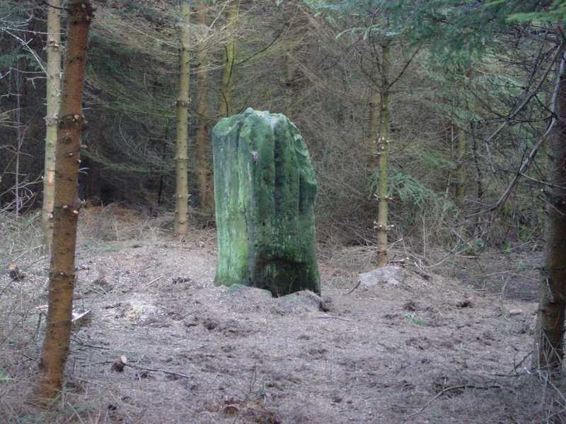
Bygate Hill submitted by PaulH on 3rd Mar 2003. Northumberland
NZ069770
(View photo, vote or add a comment)
Log Text: Having previously visited the site the weekend previously, we were put off from going in by alarms coming from within the plantation and a notice 'not to enter without the necessary authority' on the gate, so I sought the landowner's permission to enter. Bygate Hill Plantation houses a telecommunications mast (which apparently requires a permit to go near) and the landowner told me there are also regular paintballing activities carried out within the plantation.
There is a grassy track from the gate to the mast, with a small track running off to the right (just before the mast) through the trees which leads to the stone which stands in a small clearing.
The standing stone itself is impressive, and very atmospheric amidst the trees with the sunshine breaking through.
The land surface has clearly built up with all the leaf debris built up around the base of the stone, which also appears to have been propped up on one side by two smaller stones, to stop it leaning further.
There also appears to be a smaller buried (heel?) stone within a few yards of the main stone.
Had it not been for the trees, the site would command superb views of the surrounding land. We later walked up to West Bitchfield Peel Tower (grid reference: NZ 09081 77126) and looked back towards the plantation. The views were magnificent.
The landowner told me that Buddhist Monks from nearby Harnham Monastery regularly visit the stone and hang bells, and indeed there are charms and wind chimes on the trees surrounding the stone, and offerings placed on top of the stone.
Cop Stone
Date Added: 1st Jul 2014
Site Type: Standing Stone (Menhir)
Country: England (Cumbria)
Visited: Yes on 28th Jun 2014. My rating: Condition 4 Ambience 4 Access 4
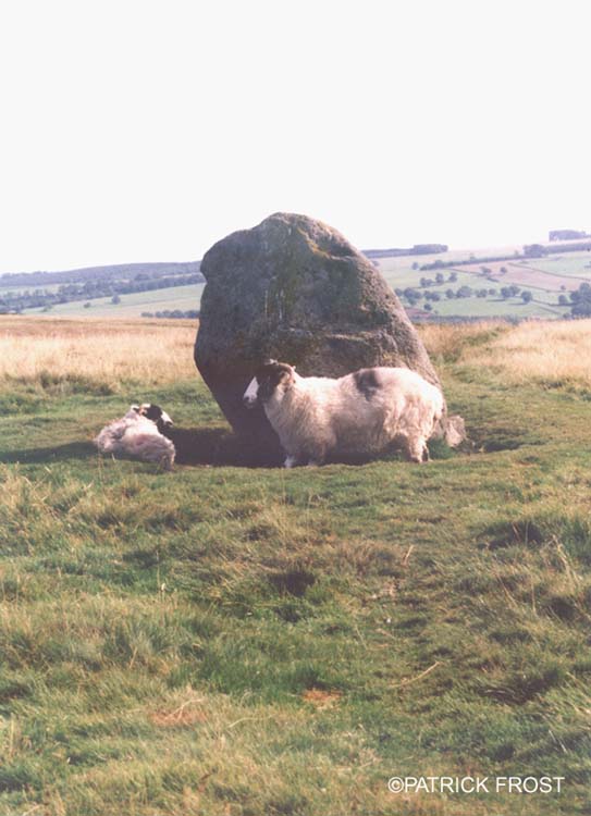
Cop Stone submitted by Patrick Frost on 14th Oct 2002. The Cop Stone in Cumbria at GR: 496216
(View photo, vote or add a comment)
Log Text: For a long time we've wanted to walk along High Street, the Roman Road, but the scramble up from Ullswater side was too difficult for me. My husband managed to identify another route, via the B road through Askham and Helton, then following the track past Outgang Farm and Heltonhead. There were other cars parked on the grass at the side of the road, so we joined them, and walked the 100 yards up to Cop Stone.
This was just the start of our journey through this fascinating landscape; whilst there are obvious quarried area and shake holes, there are a wide variety of cairns and tumuli, with the footpath leading up past The Cockpit Stone Circle and High Street.
The more we looked, the more there was to see. Well worth a visit, and easy walking.
Goggleby Stone
Date Added: 1st Jul 2014
Site Type: Standing Stone (Menhir)
Country: England (Cumbria)
Visited: Yes on 28th Jun 2014. My rating: Condition 3 Ambience 4 Access 4
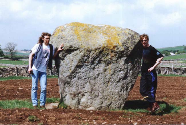
Goggleby Stone submitted by blingo on 30th Jan 2003. Goggleby stone near Shap.
(View photo, vote or add a comment)
Log Text: After failing to park along the narrow lanes around Keld, to see various stones in Shap Row, we finally parked outside the Fire Station on the A6 running through Shap, and followed the footpaths westward to the Googleby Stone and the partially toppled stone in Asper's Field.
This is a short walk, with a couple of stiles to cross, but easy enough.
I was impressed by the size of this stone, although we could discern no cup or ring marks anywhere on it.
I was a bit disappointed to see this stone had been concreted into place to keep it upright!
Aspers Field
Date Added: 1st Jul 2014
Site Type: Standing Stone (Menhir)
Country: England (Cumbria)
Visited: Yes on 28th Jun 2014. My rating: Condition 4 Ambience 4 Access 3
Aspers Field submitted by baz on 26th Apr 2003. This stone (at NY558152) lies in the next field to the more well known Goggleby Stone (NY559151), from which I took this picture (with zoom). Both of these stones form a part of the Shap Stone Avenue.
(View photo, vote or add a comment)
Log Text: This stone is within sight of the Googleby Stone, although a little more difficult to access. The gate to access the field is in Keld Lane, but it's difficult to park here, and we were wary about walking in private fields. There were some dog walkers from the nearby caravan park walking in the fields, so we took advantage of a tumbled stone wall to get a photograph of the cup and ring mark.
Having come home and found out the extent of the stone row at Shap, we'll be going back to see more.
White Raise Cairn
Date Added: 1st Jul 2014
Site Type: Cairn
Country: England (Cumbria)
Visited: Yes on 28th Jun 2014. My rating: Condition 3 Ambience 4 Access 3
White Raise Cairn submitted by baz on 3rd May 2003. White Raise Cairn (NY489224). This 20m. long cairn has an exposed central cist.
(View photo, vote or add a comment)
Log Text: From the footpath leading from the Cop Stone to The Cockpit Stone Circle, this cairn lies after the Cairn Circle, on the right hand side of the footpath.
It initially appears unremarkable as a large mound with stones marking the extent of the cairn, but walking up the slope I came across the excavated burial chamber, which was a great surprise.
It's clearly a favourite with sheep, as the stones retain the heat from the sun, and they were unmoving as we wandering around.
There are great views across the valley towards Ullswater, although it's not quite possible to see the lake from the cairn.
Well worth a visit.
Moor Divock 3
Date Added: 9th Feb 2023
Site Type: Cairn
Country: England (Cumbria)
Visited: Yes on 28th Jun 2014. My rating: Condition 3 Ambience 4 Access 3
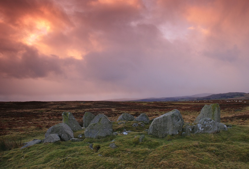
Moor Divock 4 submitted by postman on 25th Oct 2012. Sometimes a friend at work will ask why I do this , but the question isn't why I do, it's why don't you ? (though really I know the answer)
(View photo, vote or add a comment)
Log Text: After visiting the Cop Stone, we walked up to the Cairn Circle (which is clearly visible from the footpath). Whilst ruined, it's atmospheric. The more I sat on the edge of the cairn and looked round, the more there is to see. I'd like to go round with someone who knows this area better than I, so I can understand it better. [Note: I originally confused this with Moor Divock 4, the cairn circle and small stone row just to the north. Looking back on my photographs, I could find no evidence of this feature on the ground].
The Cockpit
Date Added: 1st Jul 2014
Site Type: Stone Circle
Country: England (Cumbria)
Visited: Yes on 28th Jun 2014. My rating: Condition 3 Ambience 4 Access 3
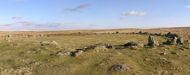
The Cockpit submitted by LivingRocks on 18th Mar 2005. A panoramic view of the Cockpit Stone Circle which according to Magicmap ‘includes a circular kerbed stone bank 2.8m -11.2m wide and up to 0.5m high which encloses an area approximately 27m in diameter. There are 27 (?) standing and recumbent stones set largely into the internal face of this bank, thereby creating the stone circle. The tallest standing stone measures about 0.95m high and some of the recumbent stones are up to 1.9m in length. Within the eastern side of the stone circle, abuttin...
(View photo, vote or add a comment)
Log Text: Almost at the course of High Street Roman Road, there is a view of Ullswater from the footpath just below the Cock Pit Stone Circle.
As the circle is on a good footpath, most of the people stopped at the circle. It's always nice to see people appreciate ancient sites, but I had to wait quite a while to get take photographs without anyone else in it! We found a couple of the outlying stones, and identified a couple of cairns nearby, but couldn't get good enough photographs to make these out properly.
By standing just below the circle, on the main footpath, it's possible to make out the bank.
Well worth a visit, and the view of Ullswater and Pooley Bridge below was worth the easy walk.
Cow and Calf Rocks
Date Added: 16th Jul 2017
Site Type: Rock Outcrop
Country: England (Yorkshire (West))
Visited: Yes on 30th Jun 2014. My rating: Condition 3 Ambience 4 Access 4
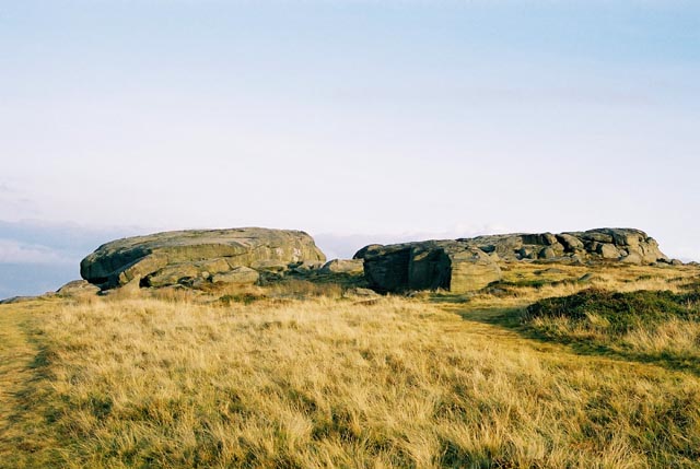
Cow and Calf Rocks submitted by andy_h on 10th Nov 2003. The most prominent landmark for miles around. There are no visible megalithic remains at this huge rock outcrop, but local folklore refers to this being a place worthy of strong consideration.
I've always found it a little strange that as the most prominent landmark for miles around, the Cow n' Calf didn't bear any cup n' ring marks as they can be found both to the left and the right of the outcrop. It is possible that any that may have been on the rock could have been lost under the onslaugh...
(View photo, vote or add a comment)
Log Text: Cow & Calf Rocks, Ilkley: We visited here on a very blustery day after having seen Maiden Castle hill fort. By now rain was threatening and the moorland bleak. Parking at the café down below, we walked up the footpath. The view from the Cow and Calf over to Ilkley was great, although there were lots of people around. Walking into the horseshoe shaped quarry next to these crags there were groups of climbers roped up to the rock face.
Goatstones Four-Poster
Date Added: 1st Jul 2014
Site Type: Stone Circle
Country: England (Northumberland)
Visited: Yes on 30th Jun 2014. My rating: Condition 4 Ambience 4 Access 4
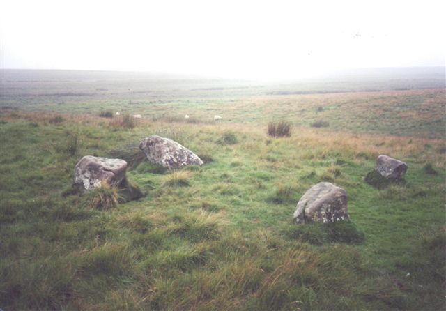
Goatstones Four-Poster submitted by cosmic on 13th Feb 2005. Another of Goatstones courtesy of Ian Simpson
(View photo, vote or add a comment)
Log Text: There are a couple of parking spaces next to 'Manor House' on Ward Lane, just below Ravensheugh Crags, and followed the footpath up to the crags, turning right up to the stone circle.
It is an easy walk, with spectacular views - the visibility was around 30 miles - we could see the Cheviot Hills in the distance.
The stones of this unusual four poster stone circle are low to the ground (with other outlying stones buried in the grass around?) but very atmospheric. It feels very remote, with very little noise apart from birdsong, although there is a steady (but small) stream of traffic along Ward Lane.
There are very definite cup marks on the eastern most stone, and other possible cups on the southern most stone (now partly toppled and hidden by marsh grass).
We met the farmer from Great Lonbrough, at the very end of the footpath, and he told us more about the hut circles and cairns in the fields below. We checked the Portal when we got home and were inspired by the photographs of the rock art at Goatstones, so we intend to go back and look again in the next few weeks and look at these, plus also walk along to Standingstone Rigg.
Will most definitely visit again.
Houghton Camp, Heddon on the Hill
Date Added: 1st Jul 2014
Site Type: Ancient Village or Settlement
Country: England (Northumberland)
Visited: Yes on 1st Jul 2014. My rating: Condition 1 Ambience 2 Access 3
Houghton Camp, Heddon on the Hill submitted by durhamnature on 16th Aug 2012. Houghton Camp, north ditch and earthworks.
(View photo, vote or add a comment)
Log Text: Return visit on 1st July 2014: I obtained permission from Close House Golf Club to walk across the golf course to look at the settlement from the side furthest from the road. They told me that they are unable to do anything with this parcel of land 'because of the antiquities, but there isn't much to see' and were sure that the farmer they lease the land from would be happy for me to visit, having asked permission.
Parking was a problem again; I tried the field gates next to the road, but they were tied very firmly shut and the next gate to the field with the camp in hadn't been opened in a very long time, so to avoid climbing over, I parked at the Golfing Range and walked back towards the road over the golf course to the settlement - all slightly uphill, but very pleasant in the warm sunshine, and what views back over the Tyne Valley.
I confess to having been disappointed, as the banks and ditches weren't as clear from this side of the site as from the road. Having walked up to the eastern end of the camp, and to the highest point in this landscape adjacent to the field boundary, the yellow (parched) grasses gave a vague indication of where the banks were.
The aerial photographs of the camp show a very clear blunt-ended oval shape, and having driven along this road for many years to and from work, I am determined to have another look in the winter months to see if any structures become clearer.
A local lady told me the nearby farms are historic and are well worth a visit, having medieval features.
First visit on 18th June 2014: I was visiting Heddon-on-the-Wall today, to see the section of Hadrian's Wall at the east edge of the village, plus the ancient church of St Andrew's in the village centre, and spotted this settlement on the Portal.
I had to drive past several times and eventually managed to park in a field entrance. I did try driving down the entrance to Close House Golf Course/Hotel, to see if I could walk across the grounds to see the site from the south, but there was nowhere to stop at all.
The photograph on the Portal was very helpful in identifying the part of the field the settlement was in, as I struggled to separate the ditches/boundaries of the settlement from the works that had been done for the pylon on the east side, and the golf course on the west. Away from the field entrance, the hedges were too high (for me) to see over.
I have applied to the landowner for permission to walk across the fields to get closer to the settlement, to take photographs from a better angle, so will report back if I manage to get agreement, and re-visit this site (which is only a few miles from my house).
Thunder Stone (Shap)
Date Added: 26th Sep 2016
Site Type: Natural Stone / Erratic / Other Natural Feature
Country: England (Cumbria)
Visited: Yes on 5th Jul 2014. My rating: Condition 4 Ambience 4 Access 4
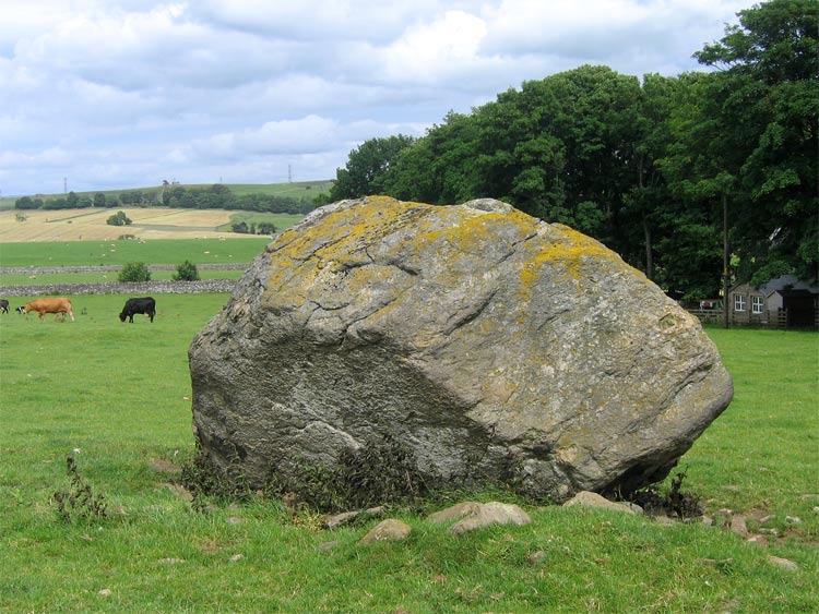
Thunder Stone submitted by LivingRocks on 7th Jul 2005. The enormous Thunder Stone, the largest stone of the Shap Avenue.
(View photo, vote or add a comment)
Log Text: Return visit 5th July 2014: We recently obtained the farmer's permission to walk across the fields to look at any of the Shap Row Stones on his land. Having woken up after a night of heavy, heavy rain to grey skies, we hopped in the car and went over to the Lake District, where the forecast was much better, having spent half an hour researching the exact position of the stones near Shap Village from a map the Shap Local History Society website (well worth a visit to get further information).
The Thunder Stone field was commanded (literally!) by a young bull who was very protective of his cows and calves, and made a move for us the minute we opened the gate, so we backed off (the farmer did warn us he had a bull in the field, but some bulls can be quite placid if kept at a distance). Having come all this way, I didn't want to go away without a picture, so walked up the farm track in front of High Buildings Farm House and round the back of the barns, to get a photograph from the gate to the field.
There is a smaller stone within this same field, so when we go back to Shap in the autumn, once the undergrowth has died back more), we'll visit again to get some more photographs.
First visit 28th June 2014: We went to have a look at some of the stones in Shap Stone Row, but found it almost impossible to park on the very narrow lanes around Keld. I was curious to see The Thunder Stone, and we managed to squeeze our car into the road junction leading down to Shap Abbey and walked back to look at the stone. It lies within a private field, and a clear view was difficult. I have since written to the landowner to ask for permission to get into the field to take photographs, so I'll see what comes back. There is a footpath along the far edge of the field the stone is in, but this leads away from the stone, so this was the closest we could get for now.
The stone is a little difficult to make out in the photograph I've submitted, as there was a lot of farming 'clutter' around the stone.
Swinside
Date Added: 7th Jul 2014
Site Type: Stone Circle
Country: England (Cumbria)
Visited: Yes on 5th Jul 2014. My rating: Condition 4 Ambience 5 Access 3
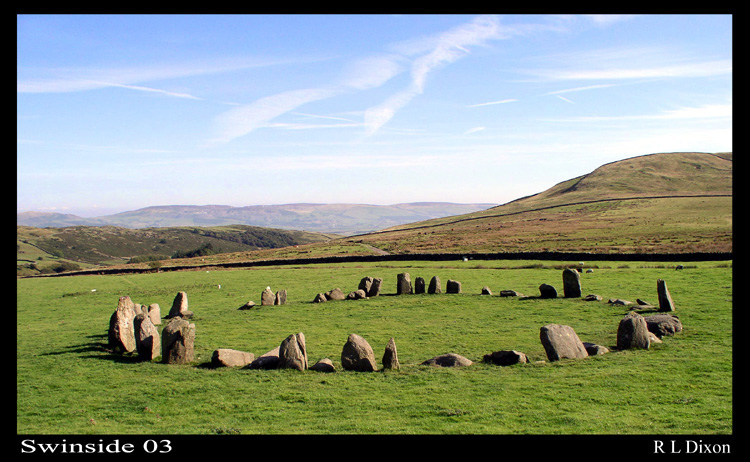
Swinside submitted by rldixon on 15th Jan 2006. Swinside well worth the walk
(View photo, vote or add a comment)
Log Text: After an afternoon spent visiting the Shap Stone Row, my husband was particularly keen to see Swinside Stone Circle, so we took an additional hour to travel to this site. I have to say it was well worth the visit, and I would very definitely go again.
We parked in a small layby just down from Cragg Hall and walked up the marked public bridleway to Swinside (Sunkenkirk) Stone Circle. The first part of the track was steep, but concreted and thankfully short; the rest of the walk was relatively level and had magnificent views. Visibility during our visit was amazing, and we estimated we could see a good 30 miles to the eastern lakes in the far distance. The tide was out, but we had a good view of (what I am assuming from my limited map reading skills!) Duddon Sands in the estuary below until the land levelled out and we could see the circle in the far distance ahead of us.
Surprisingly, we were passed by two separate cars heading up to the farmhouses further up the track - what a remote, but very lovely place to live.
The circle surpassed my expectations. It had a wonderful atmosphere, and I would happily have stayed there until sunset, which, being summer, was a good 5 or 6 hours away, and sadly we had to get home the same evening.
My photographs aren't as good as some of the ones already on the Portal website, so in the images I've submitted, I've tried to pick out some of the features which stood out for me, which include the portal stones at the entrance to the circle.
On reflection, I think we should have climbed up Swinside Fell to get a distant shot of the circle, which would have completed my album for the circle. Next time.
Just to note that in the fields to either side of the bridlepath (particularly the right hand side) leading up to the circle, there were a large number of what appeared to be shaped stones, and we wondered if at one time there had been an avenue leading up to the circle. I've submitted a picture of one stone which has a striking resemblance to the stone in the circle with the quartz banding across it.
Kemp Howe
Date Added: 7th Jul 2014
Site Type: Stone Circle
Country: England (Cumbria)
Visited: Yes on 5th Jul 2014. My rating: Condition 2 Ambience 2 Access 4
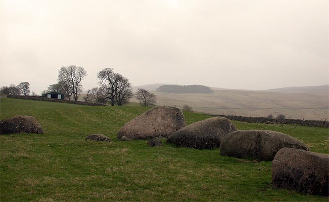
Kemp Howe submitted by nicoladidsbury on 29th Mar 2004. This is the remains of what must have been a beautiful stone circle. The stones are pink granite and have a lovely glow. Unfortunately the ambience has been shattered by the "wonderful" victorians, who built the railway on top of it.
(View photo, vote or add a comment)
Log Text: Having been kept awake most of the night by heavy, heavy rain, then being greeted by leaden skies with a distinctly autumn feel, the weather in Cumbria, according to the weather forecast, seemed a lot more appealing.
Armed with information from the Portal and a map with the locations of stones in the Stone Row from the Shap Local History Society, we hopped in the car and drove west.
We parked at the entrance to the field with Kemp Howe in it (the gate to the field was left wide open, and there was a short trackway up to the stones, although the road was horrendously busy), and walked the 100 feet or so up to the stones. Whilst the grass in the field had recently been cut, the undergrowth round the stones had been left uncut.
I confess to being horrified at the damage done to these stones by the Victorians - what a travesty. We got to admire several trains passing by at very close quarters, and could almost have waved to the quarry men the other side of the railway line. The views of the fells to the west (across the road) and beyond was appreciated and were in stark contrast with what was behind us.
This marked the start of an afternoon well spent exploring the Stone Row in glorious sunshine, with a nice lunch stop at the Shap Coffee Shop in the village, then taking in the stones at the west of Shap Village, finishing with the Tumulus at Skellow Hill and the Thunder Stone.
Shap Avenue
Date Added: 7th Jul 2014
Site Type: Multiple Stone Rows / Avenue
Country: England (Cumbria)
Visited: Yes on 5th Jul 2014. My rating: Condition 2 Ambience 4 Access 3
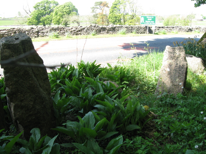
Shap Avenue submitted by AngieLake on 3rd Jun 2011. These were the most noticeable stones fringing the east side of the road, heading back towards the village after visiting Kemp Howe, that might have possibly come from the ancient monuments.
(View photo, vote or add a comment)
Log Text: Armed with information from the Portal and a map of the locations of the stones they've mapped in the stone row so far from Shap Local History Society, we started off at Kemp Howe stone circle, and walked round the village looking for stones. We met a couple of the more senior locals as we went round, and they were keen to help and point out where the stones were, and tell us of others. There are so many stones around and near to the village, most of them clearly on the same alignment that we became quite overwhelmed with the scale and sense of what our ancestors achieved and what it all represented.
We ended up at Skellaw Hill and the Thunder Stone, then had to call it a day, as we wanted to travel over to Swinside Stone Circle before heading off home.
The Shap Stone Row is certainly intriguing, and I came back with around 100 photos of possible stones and locations - I've picked two to submit that aren't already recorded on this page.
Well worth exploring, and whilst visiting, I'd also recommend hopping down to Shap Abbey and Keld Chapel nearby, too. Both are free to get into, and are in picturesque locations, with a lot of history attached.
