Contributory members are able to log private notes and comments about each site
Sites Anne T has logged. View this log as a table or view the most recent logs from everyone
Tullybannocher
Trip No.53 Entry No.4 Date Added: 11th Oct 2017
Site Type: Stone Circle
Country: Scotland (Perth and Kinross)
Visited: Yes on 28th Sep 2017. My rating: Condition 3 Ambience 4 Access 4
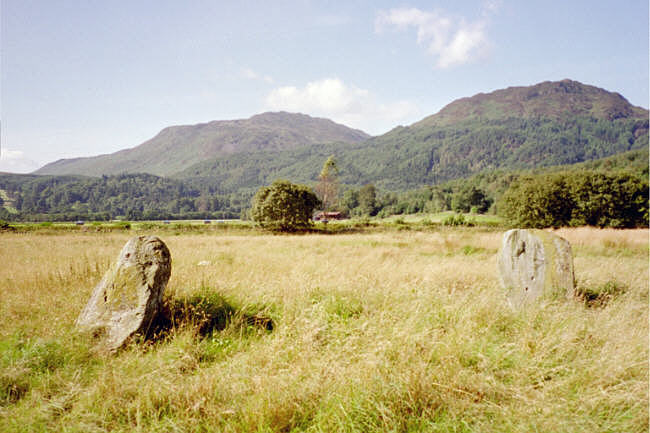
Tullybannocher submitted by hamish on 23rd Jul 2005. It's easy to miss this one, I stopped in a field gateway to look at the map glanced round and there it was in that field. It was a four poster by repute but only two remain. Nick thinks there are cupmarks on the stones but not so sure myself.
(View photo, vote or add a comment)
Log Text: Wester Tullybannocher Stone Circle, Comrie: From the Dalginross/Dunmoid Four Poster Stone Circle, we made our way north through Comrie, heading west on the A85, over Dalginross Bridge then turning left. The road goes through a zig-zag then a bend, passing a caravan park on the right hand side at Twenty Shilling Wood. Just after the road turns a right hand bend there is a farm track to your right hand side, with room for a car to pull in before the gate (on opening the gate there is a small area of hard-standing for a couple of cars). We parked just in front of the gate and walked along the farm track to the stones, which were peeping out of knee high grass in the un cultivated part of the field to our left hand side.
We couldn’t spot any cup marks on the western stone, despite walking round the stones several times. Sited on flat pastureland with low hills rising around, and lying just north of the River Earn, this is a lovely spot, although a little spoiled by the heavy traffic on the A85 just to the south of the stones.
Lawers
Trip No.53 Entry No.6 Date Added: 11th Oct 2017
Site Type: Standing Stone (Menhir)
Country: Scotland (Perth and Kinross)
Visited: Saw from a distance on 28th Sep 2017. My rating: Condition 3 Ambience 3 Access 4

Lawers submitted by BigSweetie on 19th May 2004. Perthshire stones photo by Andy Sweet
(View photo, vote or add a comment)
Log Text: Lawers Standing Stone, East of Comrie: From St Fillan’s Chapel, we headed back towards Comrie, this time continuing east along the A85 until we reached the gatehouse at the northern side of the road, just before Comrie Croft Caravan Park.
The landowner had padlocked all the gates, but being within site of the stone, we ended up scrambling over the low stone wall by the small stream running parallel with the eastern side of the field, and separated from the field by a tree lined footpath/track.
On getting level with the stone, I tried (very hard) to photograph it, but was constantly head-butted by a very friendly ginger horse! He was to friendly to contemplate climbing the wooden fence into the field without a bag of apples or pony nuts, so I had to content myself with having my sleeves chewed whilst I tried to photograph the standing stone.
We walked back along the footpath and along the northern side of the field, but the stone was too far away to get a good image of, even with maximum zoom on the camera lens. Having reached the western side of the field, the gates were padlocked. Andrew could squeeze between the wooden rails of the fence, but I was a bit too plump, so clambered unceremoniously over the somewhat higher stone wall at this end of the field.
St Fillan's Chapel (Comrie)
Trip No.53 Entry No.5 Date Added: 11th Oct 2017
Site Type: Ancient Cross
Country: Scotland (Perth and Kinross)
Visited: Yes on 28th Sep 2017. My rating: Condition 2 Ambience 4 Access 4

St Fillan's Chapel (Comrie) submitted by Anne T on 11th Oct 2017. The cross slab, lying just to the south of the south wall of the chapel. In 2014 it was found recumbent but, comparing photographs with the Canmore page (24872), it has now been stood upright.
(View photo, vote or add a comment)
Log Text: St. Fillan's Chapel, west of Comrie: From Wester Tullybannocher Stone Circle, we carried on west along the A85, turning left into a road leading down to St. Fillan’s Golf Club and Western Dundurn Farm. Just before the farm buildings, the track splits. The eastern most track is gated off, and the road was very narrow, so we squeezed the car in by the gate intending to run back and move it if it got in the way. There was a herd of cattle in the field, although the churchyard has a dry stone wall around it.
Walking along the track, watched curiously by the golfers on the adjacent course, until I was level with the church ruins (very like Logie Old Kirk), then squidged my way through the wet turf to the far side, where the iron gate to the churchyard was locked, but there was a stone stile into the graveyard.
This is a very, very pretty spot. It is a very old site. Typically, there was no phone signal here so I couldn’t call up the Canmore record. I went round photographing lots of different things. I managed to miss the recumbent cross slab (most of them were overgrown with grass), although there were a couple of other interesting stones and features. Lovely site but disappointing not to have found the cross slab, even though I must have looked at it.
Also known as St Fillian's; Dundurn Burial-ground; Stewarts Of Ardvoirlich Burial-place.
Craigneich Farm
Trip No.53 Entry No.7 Date Added: 11th Oct 2017
Site Type: Standing Stone (Menhir)
Country: Scotland (Perth and Kinross)
Visited: Yes on 11th Oct 2017. My rating: Condition 3 Ambience 3 Access 5
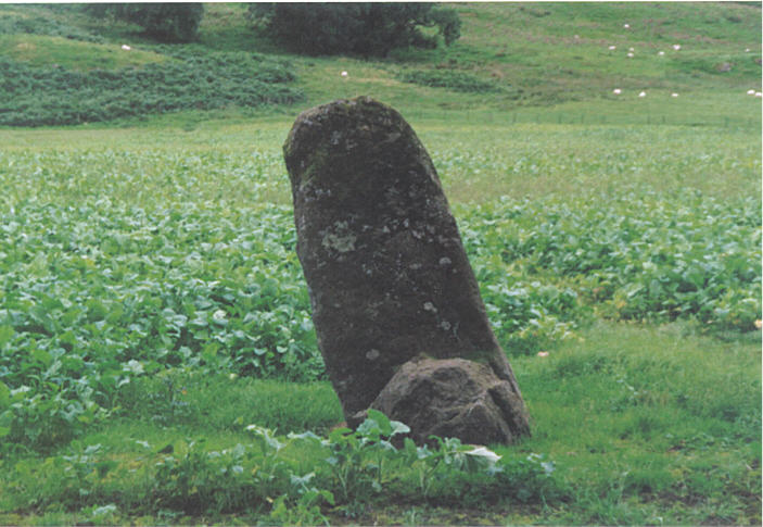
Craigneich Farm submitted by hamish on 26th Jul 2005. This stone is easily seen from the roadside.
(View photo, vote or add a comment)
Log Text: Craigneich Farm Standing Stone, south of Comrie: From the Lawers Standing Stone, we drove south back through Comrie on the B827, to the junction of a minor road at Coilcambus with a phone box on the corner. Turning right (travelling south), we followed the road along to where Machany Water ran close to the road, just before Craigneich Farm. There was a track leading up to the moors on the opposite side of the road, and on this single track road, we needed to pull the car into this entrance for a few minutes while we looked for the stone. We had to climb over wall into field, but the stone wall was low and the wiring broken, so it was easy to access the field.
A somewhat neglected stone, separated from those on the moorland to the south by the road and hedges, it was oddly shaped. By now it was dusk, and I had to use the flash on the camera to get a decent photograph. Worth stopping to have a look.
There were other standing stones which we could see up on the moor to the south, but it was too late in the day to walk up to these and back as it would have been dark by the time we reached the first one.
Wester Biggs (Dunblane)
Trip No.83 Entry No.5 Date Added: 24th Jul 2018
Site Type: Stone Circle
Country: Scotland (Perth and Kinross)
Visited: Couldn't find on 13th Jul 2018. My rating: Condition -1 Ambience 4 Access 5
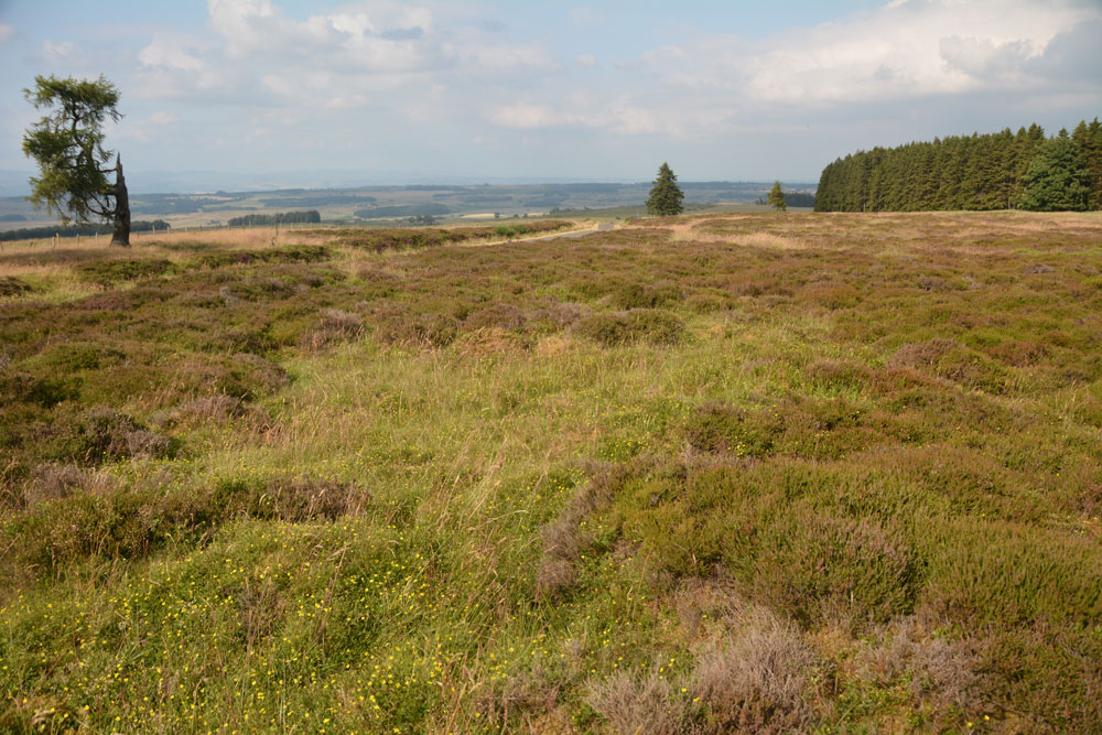
Wester Biggs (Dunblane) submitted by Anne T on 24th Jul 2018. Thinking this stone circle was just by the side of the road, and therefore relatively easy to see, we spent ages with our GPS wandering around trying to spot stones of any description. The heather and vegetation was calf deep, so any small stones would have been difficult to spot. However, 6m away from where our GPS said the circle was, there was only this slight change in vegetation (the shorter, green area). Either the stones are hidden, or they've been sadly removed. View looking NE, towar...
(View photo, vote or add a comment)
Log Text: Wester Biggs Stone Circle, Near Dunblane: Returning from tea and cakes in Dunblane, we resumed our search for megalithic sites. Next stop, hopefully, a not-before-photographed stone circle, right by the side of the road.
Finding the telephone mast and driving a couple of hundred yards further on, we parked at NN 86368 06240 and walked back south along the road, armed with the Canmore listing on my phone and the GPS.
Despite an intensive search of the land east of the road around this point, we were unable to locate any stones amongst the tall heather. However, there was a circle of gras/vergetation which was different from any heather at almost exactly the grid reference given by Canmore, so I photographed ‘the spot’. Andrew thinks the stones may have been removed. Always possible, but I think we need to return when the shrubbery has died back.
The Boat Stone
Trip No.83 Entry No.6 Date Added: 24th Jul 2018
Site Type: Standing Stone (Menhir)
Country: Scotland (Perth and Kinross)
Visited: Yes on 13th Jul 2018. My rating: Condition 3 Ambience 4 Access 4
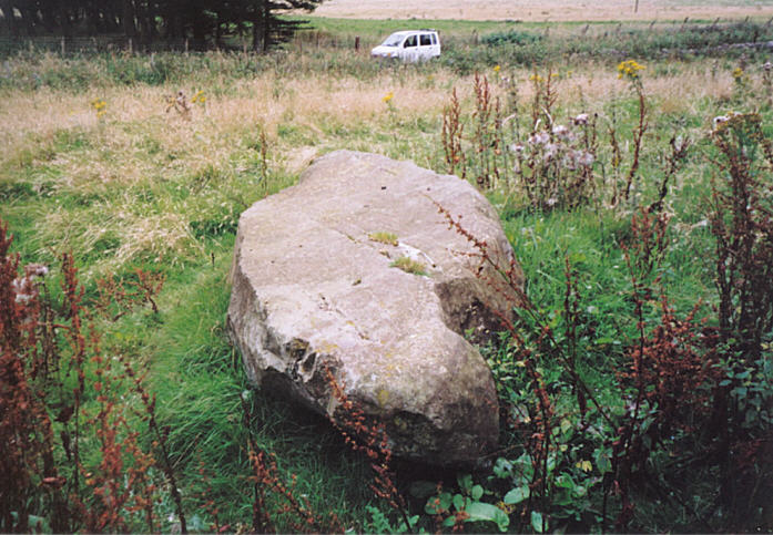
The Boat Stone submitted by hamish on 23rd Jul 2005. After you have been to Sherriffmuir Stones keep on up the road. Don't try to find Wester Briggs Circle, it's hidden in the heather. Just down the road past the woods on the left is the Boat Stone. You have to clamber over the stone wall with a barbed wire topping to get to this stone. Nearly broke my leg but survived.
(View photo, vote or add a comment)
Log Text: The Boat Stone, Sheriffmuir to Dunblane lane: Marked on the OS map, but not on Canmore, this fallen standing stone is featured on the Portal and The Northern Antiquarian. The road is single track at this point, with not many passing places. The farmer had left the gate into the field wide open, and it was dry, bare soil. We dared to pull the car just inside the gate.
The farmer had heaped a beautifully large pile of maturing manure between the gate and the stone, so I took a slightly wider berth round this than I might have, with the heat and the flies!
This large stone is impressive. It sites on a mound (I walked around it to photograph it and had to step up the mound to get to the top of the stone) and has some lovely quartz inclusions.
Gleneagles B
Trip No.83 Entry No.8 Date Added: 25th Jul 2018
Site Type: Standing Stone (Menhir)
Country: Scotland (Perth and Kinross)
Visited: Yes on 13th Jul 2018. My rating: Condition 3 Ambience 3 Access 4
Gleneagles B submitted by cosmic on 19th Feb 2005. The Incised Mark/s on the North Side
(View photo, vote or add a comment)
Log Text: Peterhead Farm Pictish Symbol Stone: Right next to the A9, so the atmosphere wasn’t brilliant, but ignoring the traffic, looking east, this was a glorious setting.
There was a gate into this field full of sheep, so we let ourselves in and walked over to the stone, which now sits within 30m of a slip road leading to the A9. The Gleneagles roundabout with its golf club ‘sculpture’ provide a strange backdrop.
The views to the east are somewhat different, and facing this way, you could almost believe you were in the country. Whilst the black clouds were gathering to the north and east, there was no rain.
I was fascinated by the two quartz inclusions underneath the symbols.
Dupplin Cross
Trip No.84 Entry No.1 Date Added: 25th Jul 2018
Site Type: Ancient Cross
Country: Scotland (Perth and Kinross)
Visited: Yes on 14th Jul 2018. My rating: Condition 4 Ambience 4 Access 5
Dupplin Cross submitted by cosmic on 16th May 2007.
Back of the cross with the dedication panel top middle
(View photo, vote or add a comment)
Log Text: Dupplin Cross, St Serf's, Dunning: Our first stop of the day, and a very old, popular, tourist village. We first saw a drinking fountain outside the churchyard, almost at the cross roads.
By the southern door to the church were two hogbacks.
Inside was the Duppline Cross and a smaller cross slab to its north west. There was a guide, already talking to a gentleman about the cross, but when she saw us, she interrupted her talk and came up to us to ask us to join in. Not usually one for ‘tours’ we reluctantly joined her, as I really wanted space and time to drink in this cross on my own, then photograph it; this was not to be, as there was a steady stream of visitors coming into the church. As we went out, another family came in, followed later by a large walking group.
I photographed most of the individual panels around the Dupplin cross and need to sort these out using the diagrams in the 'Official Souvenir Guide' (£1). I was particularly fascinated by the base, which appeared to have carved lines across one corner, and cups (or very worn interlacing) on its base.
Dunning
Trip No.84 Entry No.2 Date Added: 25th Jul 2018
Site Type: Standing Stone (Menhir)
Country: Scotland (Perth and Kinross)
Visited: Saw from a distance on 14th Jul 2018. My rating: Condition 3 Ambience 3 Access 4

Dunning submitted by Nick on 5th Nov 2002. The stone looking north
(View photo, vote or add a comment)
Log Text: Dunning North Standing Stone: From St Serf’s church, we walked along Kirk Wynd, down alongside the stream, down past some cottages, to where the footpath split. The standing stone was right in front of us, albeit in the middle of a ripening crop of wheat. It seemed very far away, and I was very, very reluctant to trample any of the crop, so we stuck to the footpath. With the camera lens on maximum zoom I tried to capture the different faces of the stone, but as the footpath ran roughly west-east, we couldn’t really get close.
The guide in the church told us there were two standing stones nearby; most people visited the northern (this) stone, but apparently not many people went to the southern stone.
If the field hadn’t been set with a crop, I’d have been tempted to look for the gate, or an alternate route to get closer.
Our next stop was to the very peculiar "Maggie Wall Monument", 1km west of Dunning on the B8062. This is a 20ft tall monument topped by a cross to a witch called Maggie Wall who was apparently burnt in 1657. The stories I've all tracked down say Maggie Wall didn't exist. This monument definitely made me shiver!
Forteviot Cross
Trip No.84 Entry No.4 Date Added: 25th Jul 2018
Site Type: Sculptured Stone
Country: Scotland (Perth and Kinross)
Visited: Yes on 14th Jul 2018. My rating: Condition 5 Ambience 4 Access 5
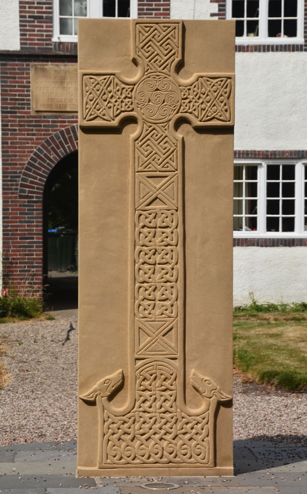
Forteviot Cross submitted by Anne T on 25th Jul 2018. The front of this modern Pictish cross slab, only unveiled in mid-March this year.
(View photo, vote or add a comment)
Log Text: Modern Pictish Cross Slab, Forteviot: Having been spooked by the Maggie Wall Memorial and disappointed at not being able to get into Forteviot parish church (St. Andrews), the lady gardener told us to walk down the road to look at the new cross slab that had just been erected.
Just behind the bus-stop, and in front of a charming courtyard of whitewashed houses, we found out later this cross had been erected only on either 17th or 18th March 2018, so very new.
The lady gardener told us there were some leaflets ‘in the bus stop’ and indeed there were several tucked underneath the bus timetable board. The cross was carved by David McGovern, of Monikierockart for the 2017 Tay Landscape Partnership project. “In the form of a Pictish Cross Slab, the new cross celebrates Forteviot’s status as an early Christian site and its association with King Cinead mac Alpin. The Pictish stone fragments that inspired the cross design can also be visited across the road in St Andrew’s Church (when open).” The leaflet also gives a guide to the patterns on the cross.
Gray Stone (Dunning)
Trip No.84 Entry No.5 Date Added: 26th Jul 2018
Site Type: Standing Stone (Menhir)
Country: Scotland (Perth and Kinross)
Visited: Yes on 14th Jul 2018. My rating: Condition 3 Ambience 4 Access 4
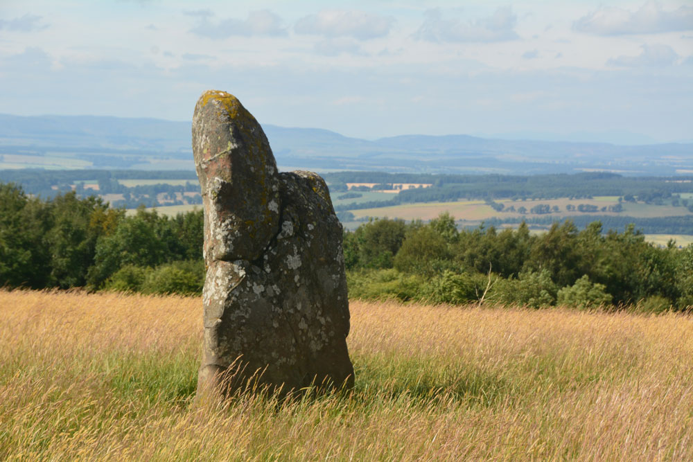
Gray Stone (Dunning) submitted by Anne T on 26th Jul 2018. Getting closer to the stone, approaching it from the gate into the field (south), we started to see the 'shoulder' on its northern side.
(View photo, vote or add a comment)
Log Text: The Gray Stone, Dunning: Thrilled to be seeing my second standing stone of the day (and one we were likely to get close to), we parked at the end of the driveway up to The Knowes farm. The stone is signposted, but the signpost follows the line of the fence and wood to the north west. Undecided whether to follow the sign and walk through the knee high grass or take the farm track which ran directly westwards. Consulting the map, we didn’t come to any firm conclusion, so to avoid having to climb over any fences, we ended up walking up the farm track, ending up at the cottage just before the gate to the big farmhouse to the left. Turning to our right here, in front of the cottage, there is a way across the deep, wide ditch which ran to our right hand side all along the track, then followed another farm track which ran north east to two field gates at NO 02171 11700. Opening the left hand gate, we let ourselves into the field, and the stone was immediately in front of us, about half way along the middle of the field, near to the fence line with the neighbouring wood which is to the stone’s eastern side.
Walking towards the stone (through what looked like a field of wheat, looking back on the photos, but is actually tall, yellow grass which has gone to seed) which is about 7ft tall, we realised it had a ‘shoulder’ to its northern side. Having seen a few other stones like this recently (the Megget Stone springs immediately to mind), I wondered if this had been deliberately cut like this, but looking at the bashes this stone has had, and the cracks and loose pieces on it, it looks as if it has fractured and a piece fallen off.
Whilst the views to the south and east are blocked now by forestry, there was a great vista northwards to Dunning and the hills (which appeared as a blue mist) in the far distance. On its northern side, there is a change in slope down from the stone; to its west and slightly to the south, there is a very slight rise. I wondered if the change in ground level might be because either farming, or perhaps a prevailing wind over time, has caused the ground level to build up here.
A very peaceful and beautiful place.
Bull Stone (Crook of Devon)
Trip No.109 Entry No.2 Date Added: 10th Nov 2018
Site Type: Standing Stone (Menhir)
Country: Scotland (Perth and Kinross)
Visited: Yes on 31st Oct 2018. My rating: Condition 2 Ambience 3 Access 4
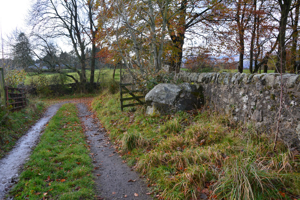
Bull Stone (Crook of Devon) submitted by Anne T on 10th Nov 2018. The Bull Stone, showing how it sits in relation to the footpath leading south from Church Road, and the farm track leading east.
(View photo, vote or add a comment)
Log Text: The Bull Stone, Crook of Devon: We parked in St Serf’s Road, Crook of Devon, at NO 03303 00037 and walked down Church Road, then took the right hand fork of the footpath, which lead almost directly south. Just under 220 metres from the fork, there is a farm track which leads off to the east. The Bull Stone is showed on the map just up this track, on its northern side.
I thought this stone was just part of an old stone wall, as the stone was fragmented and cemented together again. It wasn’t until I saw the photo on TNA that I believed we had seen the right stone! Not a brilliant monument, but a nice, short walk, and another to ‘tick off the list’ of sites seen.
Kelvingrove Museum and Art Gallery
Trip No.107 Entry No.4 Date Added: 15th Nov 2018
Site Type: Museum
Country: Scotland (North Lanarkshire)
Visited: Yes on 29th Oct 2018. My rating: Condition 3 Ambience 3 Access 5

Kelvingrove Museum and Art Gallery submitted by Creative Commons on 13th Mar 2014. Kelvingrove Art Gallery And Museum
Taken from Kelvingrove Park.
Copyright Paul McIlroy and licensed for reuse under this Creative Commons Licence
Site in North Lanarkshire Scotland
(View photo, vote or add a comment)
Log Text: Kelvingrove Museum, Glasgow: After Glasgow Cathedral and the Govan Stones, I found the exhibition of Scotland's Early People a little small and disappointing, but what they had on display was interesting. Best items on display for me were the beaker found when they excavated Temple Wood in Kilmartin and a wooden ladder from a crannog. And of course the rock art stone Andy B was photographed with!
St Mungo's Well (Glasgow Cathedral)
Trip No.107 Entry No.1 Date Added: 7th Nov 2018
Site Type: Holy Well or Sacred Spring
Country: Scotland (North Lanarkshire)
Visited: Yes on 29th Oct 2018. My rating: Condition 3 Ambience 4 Access 4
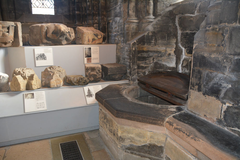
St Mungo's Well (Glasgow Cathedral) submitted by Anne T on 18th Nov 2018. St Kentigern's Holy Well in the south west corner of the crypt, with the small collection of stones from earlier cathedral buildings to its left hand side, against the east wall of the lower crypt.
(View photo, vote or add a comment)
Log Text: St Mungo's/St Kentigern's Well, Glasgow Cathedral: This Cathedral is also known as Barony Kirk, High Church, Metropolitan Kirk & St Mongo’s. The holy well is in the south eastern corner of the crypt/undercroft, next to a collection of architectural fragments and part of the arcade of the original St Mungo’s tomb.
Whilst we were there, the Cathedral guide repeatedly brought people to the well, if only for a brief look. I had to chuckle (only a little) as the well cover made looked like an old fashioned toilet seat. I’m not sure how deep the well is, even with a light, but I couldn’t see any water in it – it was either very deep or dry.
The only mention of this well in the Church’s guide book is on page 16: “In the south east corner of the crypt is St Kentigern’s Well, from which water was drawn for liturgical use. Also in that chapel is a display of carved stones, including possible fragments from the base of St Kentigern’s Shrine, and a painted stone thought to have come from the cathedral of the 1100s.
Lady Well (Glasgow)
Trip No.107 Entry No.2 Date Added: 7th Nov 2018
Site Type: Holy Well or Sacred Spring
Country: Scotland (North Lanarkshire)
Visited: Yes on 29th Oct 2018. My rating: Condition 3 Ambience 3 Access 5
Lady Well (Glasgow) submitted by KiwiBetsy on 23rd Sep 2006. Site in Renfrewshire The well used to flow from the east bank of the Merchants Park, but when this was converted to the Necropolis, the well became polluted and was closed. In 1836, The Merchants House built a niche on the spot to mark the site of it’s exit from the brae. This was rebuilt in 1874.
(View photo, vote or add a comment)
Log Text: Lady Well, Glasgow: To get to this well, we had to walk through the path to the south of the cathedral leading to the Necropolis, then use a gate at the junction of Wishart Street and Ladywell Street, walking east towards the dead end of this street. The well is to the northern side of Ladywell Street, opposite an entrance into Tennent’s Wellpark brewery. It is dry, and now somewhat delapidated, although people have left offerings of money.
As the Canmore entry reads, Lady Well was “anciently a holy well dedicated to the Virgin Mary, was probably one of the sixteen public wells in Glasgow in 1736. It used to flow from the E bank of the Merchants' Park, but when this was converted to the Necropolis, the well became polluted and was closed. The Merchants' House, in 1836, built a niche on the spot to mark the site of its exit from the brae. This was rebuilt in 1874.”
A small brass plaque reads: “The Lady Well. Restored by Tennent Caledonian Breweries Ltd. 1983.”
The Govan Stones
Trip No.107 Entry No.3 Date Added: 8th Nov 2018
Site Type: Museum
Country: Scotland (North Lanarkshire)
Visited: Yes on 29th Oct 2018. My rating: Condition 3 Ambience 5 Access 5
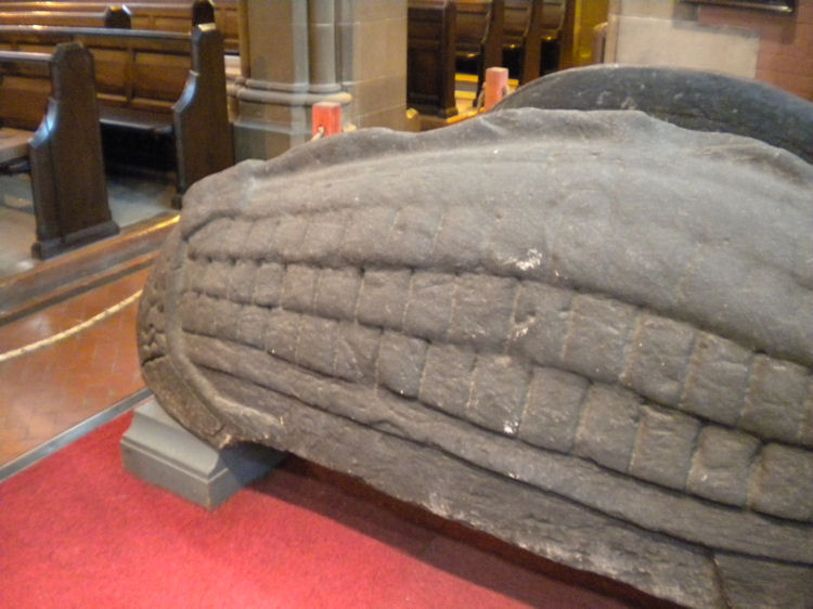
The Govan Stones submitted by joedkins on 19th Jun 2011. Hogback stone in Govan Old Church, Glasgow
(View photo, vote or add a comment)
Log Text: The Govan Stones, Govan Old Church: We only found out about this exhibition/display through a chance email to Glasgow Life, enquiring if St Mungo's Museum of Religious Life and Art next to Glasgow Cathedral had any early Christian stones we could see and photograph. They replied 'no' but told us about The Govan Stones. With only a few days to go before the exhibition closed for the winter on 31st October, we rushed to see it at the first opportunity, and were blown away!
We spent about 2 hours here, wandering around, looking at the stones, hogbacks and the sarcophagus. A guide joined us for part of our visit and put on special lights in which to view the sarcophagus.
I photographed most of the stones, and am still trying to find out more about each one. This exhibition deserves to be much, much wider known than it currently is. It is the best display of early Christian stones that we've seen to date, and I would go again in a heart-beat.
Very, very highly recommended indeed.
Since my visit, I've been in touch with Govan Heritage Trust to find out more information about the stones. They have been immensely helpful and even provided some of the photographs for submission here.
Hunterian Museum
Trip No.145 Entry No.1 Date Added: 29th Aug 2019
Site Type: Museum
Country: Scotland (North Lanarkshire)
Visited: Yes on 21st Aug 2019. My rating: Condition 4 Ambience 3 Access 4
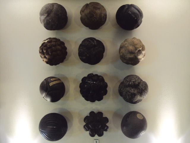
Hunterian Museum submitted by cosmic on 9th Jul 2013. The Hunterian Museum has one of the largest collections of carved stone balls in the country.
(View photo, vote or add a comment)
Log Text: Hunterian Museum: A (very) rainy day in Glasgow stopped us from going out on my 'well hunt', so we found our way to the Hunterian Museum, which I've always wanted to visit. The displays were nicely done, although the museum as a whole was a lot smaller than I anticipated.
I found the display on the Antonine Wall fascinating, along with some of the medical and scientific items on the first floor. At the time of our visit, the Royal College of Surgeon's building was closed (the website said until 2021, for redevelopment).
Unlike most museums, where you need to seek approval to post photographs, the Hunterian says: Photograph Policy: Our visitors are welcome to take photographs and video for personal, non-commercial use. We hope you will share them on your social networks! #hunterian (note: see their copyright statement on the line re works of art).
Note: the stone balls were not on display at the time of our visit.
St George's Well (Edinburgh)
Date Added: 30th Dec 2015
Site Type: Holy Well or Sacred Spring
Country: Scotland (Midlothian)
Visited: Yes on 17th Dec 2015. My rating: Condition 3 Ambience 2 Access 4
St George's Well (Edinburgh) submitted by KiwiBetsy on 12th Sep 2006. The wellhouse was erected in 1810, to celebrate the jubilee of King George III, over the site of a reputed healing spring. Over the years attempts have been made to market the chalybeate water but it proved unpopular due to it's foul taste.
(View photo, vote or add a comment)
Log Text: St George's Well, Edinburgh: An easy walk along the Water of Leith walkway. I wouldn't have recognised this as a well without the Portal. It looks like a very run down stone gardener's house, complete with chimney, sitting between the walkway and the river, which was running very high at the time of my visit. The iron gate was unbolted but the door to the well house was locked. The area surrounding this little building was heavily littered, not only with general rubbish but lots of empty cans and bottles - in dire need of a clean up.
Ravenswood Avenue
Trip No.11 Entry No.3 Date Added: 26th Feb 2017
Site Type: Standing Stone (Menhir)
Country: Scotland (Midlothian)
Visited: Yes on 20th Feb 2017. My rating: Condition 3 Ambience 2 Access 4
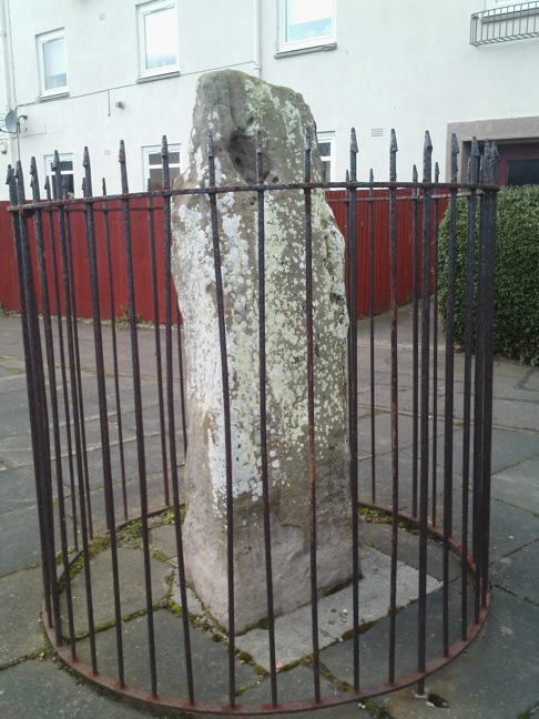
Ravenswood Avenue submitted by crannog on 27th Feb 2012. Closer look.
(View photo, vote or add a comment)
Log Text: Ravenswood Avenue Standing Stone, Edinburgh: Our third stop of the day, and another ‘not impressive’ one. Definitely not in situ, at the end of a heavily parked-up cul-de-sac, outside a small block of flat, protected by a tall circular iron railing.
I was glad to escape from this site – it felt very depressing and I surprised not to see any graffiti on the stone. One source I’d seen said there were a couple of cup marks, but I could only see any, only natural weathering and what looked like a heavily worn quarry mark.
St Anthony's Well (Edinburgh)
Trip No.11 Entry No.5 Date Added: 26th Feb 2017
Site Type: Holy Well or Sacred Spring
Country: Scotland (Midlothian)
Visited: Yes on 20th Feb 2017. My rating: Condition 3 Ambience 3 Access 4
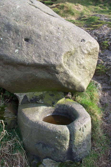
St. Anthony's Well (Edinburgh) submitted by feorag on 11th Aug 2006. St. Anthony's Well, Holyrood Park, Edinburgh. Photographed 16th March 2003.
(View photo, vote or add a comment)
Log Text: St Anthony's Well, Holyrood, Edinburgh: Located some 400 metres east south east from St. Margaret’s Well, the paths lead up the hill away from Arthur’s Seat, up to St. Anthony’s Chapel. Where the paths going up the hill divide (the left hand fork leading to the cave and chapel, the right continuing up the hill), there appears to be a large boulder about 100 yards up the right hand path. This is actually the well. From the base of the boulder a lead pipe protrudes into a stone basin. There was no water flowing. Again heavily graffitied and littered; the friend I was with described it as a 'Neolithic toilet'!
