Contributory members are able to log private notes and comments about each site
Sites Anne T has logged. View this log as a table or view the most recent logs from everyone
Greystoke Village Cross
Trip No.146 Entry No.7 Date Added: 30th Aug 2019
Site Type: Ancient Cross
Country: England (Cumbria)
Visited: Yes on 27th Aug 2019. My rating: Condition 3 Ambience 4 Access 5
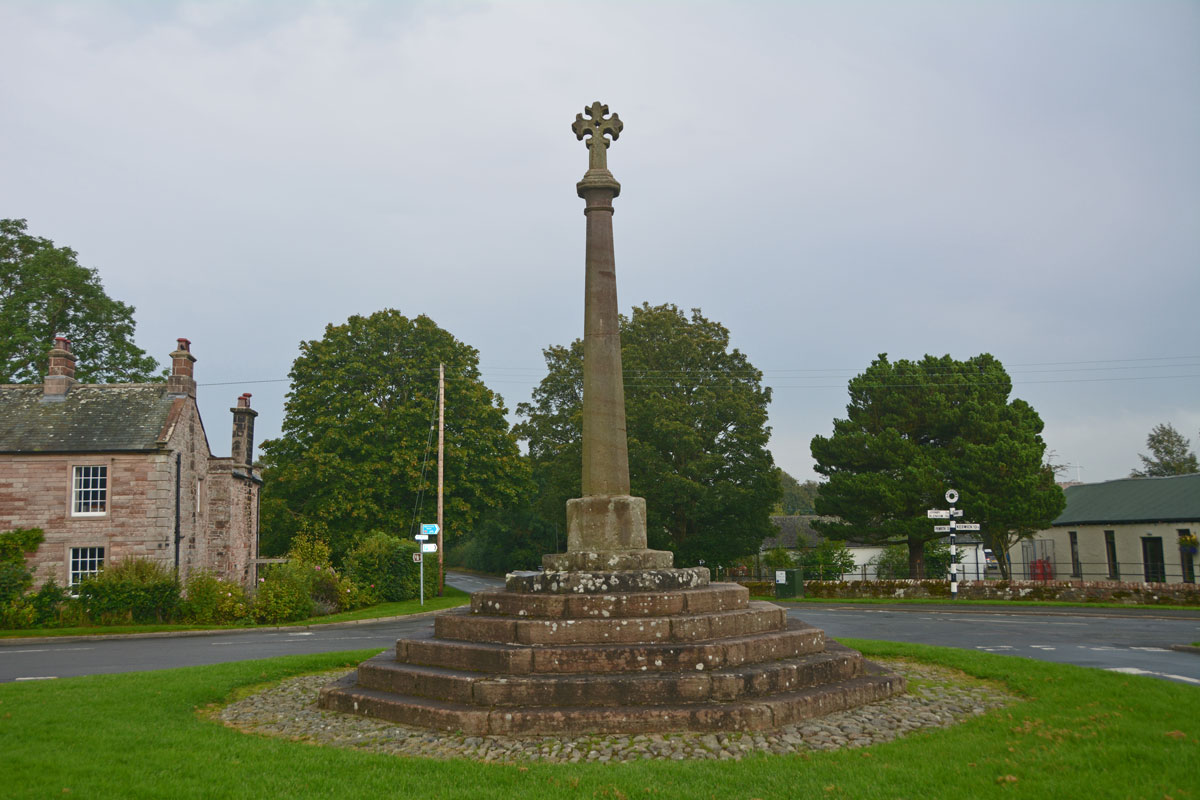
Greystoke Village Cross submitted by Anne T on 30th Aug 2019. Looking eastwards across the village green and the cross, along the B5288 which goes to Click Em and Pallethill.
(View photo, vote or add a comment)
Log Text: Greystoke Village Cross: We've been to this area before, on the hunt for the possible Newbeggin Stone Rows, but never driven into this very pretty little village. We left this until the last stop of the day (just before the rain started to hurl down), after having seen the Eyekeld Well, the village Church and the Sanctuary Stone.
There are parts of the original medieval cross built into this largely 'modern' structure. Whilst Pastscape and HE say the socket stone is original, it looked like the top three steps were original (the new socket stone had chamfered and shaped corners and was a much brighter/less weathered stone than the rest).
Sanctuary Stone (Greystoke)
Trip No.146 Entry No.6 Date Added: 30th Aug 2019
Site Type: Early Christian Sculptured Stone
Country: England (Cumbria)
Visited: Yes on 27th Aug 2019. My rating: Condition 2 Ambience 3 Access 5
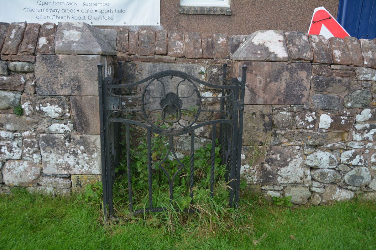
Sanctuary Stone (Greystoke) submitted by Anne T on 29th Aug 2019. Nothing could be seen of the actual sanctuary stone, which lies virtually flat to the ground within in a concrete base. It used to lie some 10 feet south of its current position. With a very busy heated, outdoor swimming pool, I didn't dare lean over and pull the nettles away (perhaps I should have asked permission at the swimming pool).
(View photo, vote or add a comment)
Log Text: Greystoke Sanctuary Stone: We didn't know this stone was here until I read the church guide book as we walked around the church. There is also a plaque stone somewhere, but we'd almost run out of time today. This stone was disappointing, as it wasn't visible underneath a dense covering of nettles and weeds. I'm now kicking myself for not asking at the swimming pool reception a few metres away if it was possible to pull a few of these away to take a closer look. There was a photograph of the cleared enclosure on the Old Cumbria Gazetteer.
Eye Keld Well
Trip No.146 Entry No.5 Date Added: 29th Aug 2019
Site Type: Holy Well or Sacred Spring
Country: England (Cumbria)
Visited: Yes on 27th Aug 2019. My rating: Condition 2 Ambience 3 Access 4
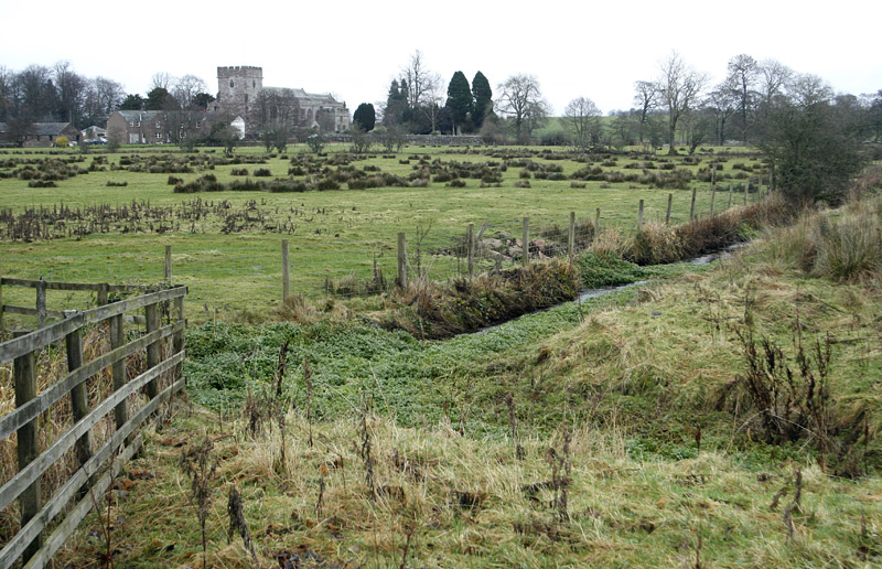
Eye Keld Well submitted by MisterBus on 28th Nov 2010. Eyekeld well, Greystoke, Cumbria, UK. The spring is in the foreground but is a neglected state. In the background is St Andrews Church, Greystoke
(View photo, vote or add a comment)
Log Text: Eyekeld Well, Greystoke: On the eastern side of the B5288 Icold Road which runs south from the village centre. The spring is only visible by peering over the dry stone wall, and the channel is covered with weeds and bracken, although there is a plentiful supply of water running from it, judging by the sounds of trickling water. There is also a long, straight water channel which runs east from the spring.
The Springs of Living Water, page 22 (with a photograph on page 25) has a couple of references to two wells in Greystoke, telling us they are dedicated to St Kentigern (aka St Mungo):
“The site of the well at Greystoke is on the roadside when entering the village from the south. This could well have been the place of a preaching stop … There was a well to the north of Greystoke, called Thanet Well after the name of St. Kentigern’s mother St. Tenue. The well is now covered by a concrete slab in a barn/garage belonging to the house next to the holiday park. The name of the well is preserved in the name of the park”.
In McIntire's "Holy Wells of Cumbria", he mentions a visit by Bishop Nicholson on 26th July 1705: "In ye morning we walk'd out to view (and taste) several extraordinary springs about the Town of Greystock; one of which they call Eye-Keld, Mary-Keld, Tolly-Keld." McIntire notes: "Eye Cold Spring still exists as Icold spring; "Mary-Keld" has had its name corrupted to Marigold. It rises in the park. "Tolly Keld" is a small stream discharging into the Petteril."
St Cuthbert's Well (Clifton)
Trip No.146 Entry No.4 Date Added: 29th Aug 2019
Site Type: Holy Well or Sacred Spring
Country: England (Cumbria)
Visited: Yes on 27th Aug 2019. My rating: Condition 3 Ambience 3 Access 5
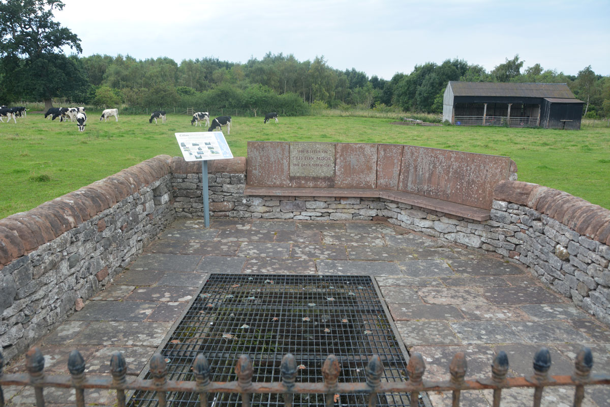
St Cuthbert's Well (Clifton) submitted by Anne T on 29th Aug 2019. The spring/well now covered by a close metal grille, which made taking photographs of the steps and water channel somewhat difficult, despite using manual focus. The enclosure commemorates the last battle on English soil between the Jacobite army and Government troops on 18th December 1745.
(View photo, vote or add a comment)
Log Text: St Cuthbert's Well (or Kelter Well), Clifton: The enclosure for this well is to the western side of the A6, towards the southern end of Clifton village. In some ways, this well is very disappointing, as the grid over it does not allow you to see very much, apart from some stone steps leading down to what appears to be a culvert with a strong flow of water running through it.
The well has been built into an enclosure which commemorates the last battle on English soil between the retreating Jacobite army and Government troops. This took place on 18th December 1745 (the battle of Clifton Moor).
No entry on either Pastscape or Historic England, although a well is shown on their map if you enter the grid reference above.
St Anne's Well (Cotehill)
Trip No.146 Entry No.3 Date Added: 28th Aug 2019
Site Type: Holy Well or Sacred Spring
Country: England (Cumbria)
Visited: Yes on 27th Aug 2019. My rating: Condition 3 Ambience 3 Access 4
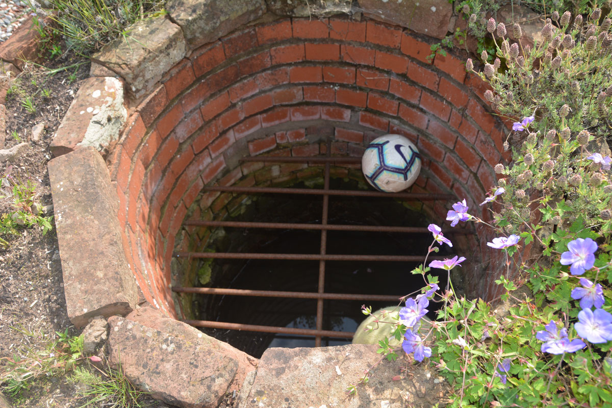
St Anne's Well (Cotehill) submitted by Anne T on 28th Aug 2019. Taking a closer look, there is a proper, brick-lined well, topped with a substantial metal grille.
(View photo, vote or add a comment)
Log Text: St Anne's Well, Cotehill: We squeezed on the odd little road junction that led to a small, new housing development, under the footpath sign.
We followed the footpath sign, which led straight through someone’s garden. We got a bit lost at this point, as several tracks through the grass had been mown flatter than others. Andrew followed two of them but could not see the well structure at all. As we were standing looking more closely at the map, the lady of the house and her children came out. I asked her if she knew where St. Anne’s Well was, and she said she had never heard of it.
Looking more closely, Andrew said the circle for the well was on the edge of the courtyard enclosed by the houses, before the footpath went through the garden of the house, so we retraced our steps a few metres.
There, in the house to our right hand side (facing the footpath and the meadows/open farmland beyond), was a circular brick flower bed. Andrew pronounced “that’s it”. I said ‘surely not’.
The structure was about 10m on private property within the garden, and I was to go up and knock on the door of the house and ask for permission to take photographs, but there no signs of life. “Who can run quickest?” I asked Andrew jokingly, and took a few steps into the garden, feeling very guilty.
There, inside the circular brick structure was a heavy iron grate, with a pool of water inside. This was definitely a well. I took three photographs very quickly, retreating back to the courtyard.
No mention in Pastscape or Historic England, although the well is shown as a blue circle on the HE map.
Wetheral Village Cross
Trip No.146 Entry No.3 Date Added: 29th Aug 2019
Site Type: Ancient Cross
Country: England (Cumbria)
Visited: Yes on 27th Aug 2019. My rating: Condition 3 Ambience 4 Access 4

Wetheral Village Cross submitted by Anne T on 29th Aug 2019. Standing just to the south east of the cross, looking north west towards the main part of the village, over the B6263 Steele's Bank. The cross head appears far older than the 'modern' shaft and steps.
(View photo, vote or add a comment)
Log Text: Wetheral Village Cross: a very pretty village. The steps and shaft of this cross are relatively modern, erected sometime between 1838 to 1844. The head of the cross is much weathered and appears older than the rest of the cross, although neither Pastscape nor Historic England mention this.
The cross is less than 150m to the west of the church and the River Eden. At the church, there is the remains of an Anglo Saxon cross shaft.
Gilsland Spa Sulphur Spring
Trip No.146 Entry No.2 Date Added: 28th Aug 2019
Site Type: Holy Well or Sacred Spring
Country: England (Cumbria)
Visited: Couldn't find on 27th Aug 2019
Log Text: Gilsland Spa Sulphur Spring: We tried to find this well from both sides of the river. Continuing west along the river walk for about 20m, we found the path had been washed away, and not even husband-cum-mountain-goat Andrew felt comfortable walking this section of the river (he said it would have been easier to walk in the river).
We did cross the footbridge and made our way along the side of the river to within what should have been 'sighting distance' of the well, but the banks were too heavily wooded to see. Shame, as I really wanted to find this well-in-a-grotto. May return and have a second look from the Irthing Gorge walk path.
Gilsland Spa Well
Trip No.146 Entry No.1 Date Added: 28th Aug 2019
Site Type: Holy Well or Sacred Spring
Country: England (Northumberland)
Visited: Yes on 27th Aug 2019. My rating: Condition 3 Ambience 3 Access 4
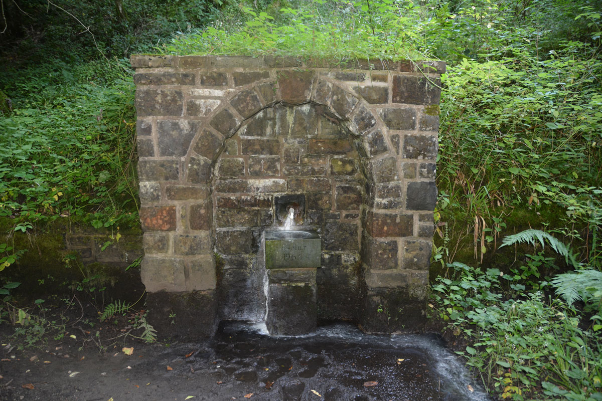
Gilsland Spa Well submitted by Anne T on 28th Aug 2019. Standing between the well structure and the river Irthing. The spring emerges from the base of a tall cliff, and smells strongly of sulphur. The plinth, basin and pipe/spout were rebuilt in 1964.
(View photo, vote or add a comment)
Log Text: Gilsland Spa Well: From the hotel car park, we followed the signs for the Sulphur Spa, leading on a path with a steep drop to our right hand side down to the River Irthing below. The path winds round to the left, then splits just above the southern side of the footbridge across the river. Take the right hand fork, walk about 20m, then take the small flight of steps down to the well, which can be smelt well in advance of reaching it!
The ground was very wet, with a steady flow of water coming out of the well spout. The eastern side of the well basin was covered with a white sulphurous stain, which carried on with the flow of water overflowing from the basin down to the river. I did dip my finger into the running water and had a quick taste. Very sulphurous, but not really unpleasant
As we approached the well, another couple were making a beeline from the well, coming from a path to the east. We fell into conversation, and it turned out they were from Doncaster (which is where I lived my early life), and lived near the race course. They were staying at the hotel for a week, returning home on Friday.
The path leading west from the well and the footbridge had been eroded away by the river. We got to within 120m of the sulphur spring, but not even Andrew wanted to walk this section of path; he said it would have been easier to walk along the river bed. We did try and see it from the other side of the river, but it was too heavily wooded to see anything.
This well is mentioned only briefly in the Springs of Living Water book by Fr John Muster, page 80, under the small section headed ‘Spa Wells’: “Though called holy wells, none are ever found identified with a saint. A good example is the one at Gilsland”. They have a photo on page 86.
No entries on Pastscape or HE, although if you type in the grid reference to the HE map search, it shows a circle where this well is located, and calls the general area to the west of the well a ‘Sulphur Spring’.
Hunterian Museum
Trip No.145 Entry No.1 Date Added: 29th Aug 2019
Site Type: Museum
Country: Scotland (North Lanarkshire)
Visited: Yes on 21st Aug 2019. My rating: Condition 4 Ambience 3 Access 4
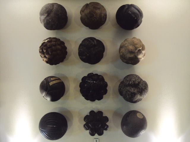
Hunterian Museum submitted by cosmic on 9th Jul 2013. The Hunterian Museum has one of the largest collections of carved stone balls in the country.
(View photo, vote or add a comment)
Log Text: Hunterian Museum: A (very) rainy day in Glasgow stopped us from going out on my 'well hunt', so we found our way to the Hunterian Museum, which I've always wanted to visit. The displays were nicely done, although the museum as a whole was a lot smaller than I anticipated.
I found the display on the Antonine Wall fascinating, along with some of the medical and scientific items on the first floor. At the time of our visit, the Royal College of Surgeon's building was closed (the website said until 2021, for redevelopment).
Unlike most museums, where you need to seek approval to post photographs, the Hunterian says: Photograph Policy: Our visitors are welcome to take photographs and video for personal, non-commercial use. We hope you will share them on your social networks! #hunterian (note: see their copyright statement on the line re works of art).
Note: the stone balls were not on display at the time of our visit.
Askrigg Cross
Trip No.144 Entry No.6 Date Added: 13th Aug 2019
Site Type: Ancient Cross
Country: England (Yorkshire (North))
Visited: Yes on 8th Aug 2019. My rating: Condition 3 Ambience 3 Access 5
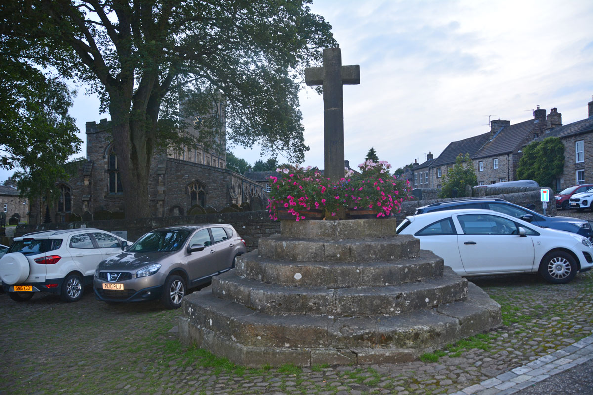
Askrigg Cross submitted by Anne T on 13th Aug 2019. The market cross, looking west towards the church in Askrigg. The shaft dates from 1830, but the steps are 16th century, possibly earlier. Picture taken as dusk was rapidly falling, so not brilliant!
(View photo, vote or add a comment)
Log Text: Askrigg Market Cross and Water Pump: It was dusk by the time we arrived back in Askrigg, and just as I started to take photographs, a large Tesco ‘click and collect’ van pulled up right next to the cross. Typical. With all the cars parked around what must have been the old village green, it wasn't a brilliant spot to linger.
Casterton
Trip No.144 Entry No.5 Date Added: 13th Aug 2019
Site Type: Stone Circle
Country: England (Cumbria)
Visited: Yes on 8th Aug 2019. My rating: Condition 2 Ambience 3 Access 3
Casterton submitted by WindC on 26th Feb 2012. Looking eastwards, a moment when the cloud base lifted..
26/2/12
(View photo, vote or add a comment)
Log Text: Casterton Stone Circle and Settlement: I found this walk VERY difficult once we were in the field containing the stone circle, largely due to the steepness of the slope, but mainly due to all the stones and boulders hidden under the turf. I did not enjoy this visit at all, despite having really wanted to visit this stone circle.
We parked at SD 64084 79316 and walked northwards up the lane towards Brownthwaite Pike, a steady uphill plod, passing a spring which emerged from just the other side of the wall, and piped under the footpath to the field beyond.
Reaching the gate into the field with the stone circle, which the farmer allows access to, we had to wade through the first 10-15m, as water was trickling down the slope from across the footpath and pooling around the gate. I was quite astonished at all the heaps of stones (clearance cairns) and part-walls all across the field. It reminded me of the ‘5,000 tons of stones’ site in County Durham that Time Team looked at but couldn’t work out what it was.
On (finally) reaching the stone circle, which took the best part of 40 minutes, my interpretation was that this was a ring cairn, not a stone circle.
On the way back up the slope, did we find a boulder with cup mark? The interior was very smooth, unlike the solution holes, which have a rim. There was also another boulder with a large ‘solution hole’ on its side – an odd location for a solution hole.
Keld Bank Settlement
Trip No.144 Entry No.4 Date Added: 13th Aug 2019
Site Type: Ancient Village or Settlement
Country: England (Yorkshire (North))
Visited: Yes on 8th Aug 2019. My rating: Condition 2 Ambience 4 Access 3
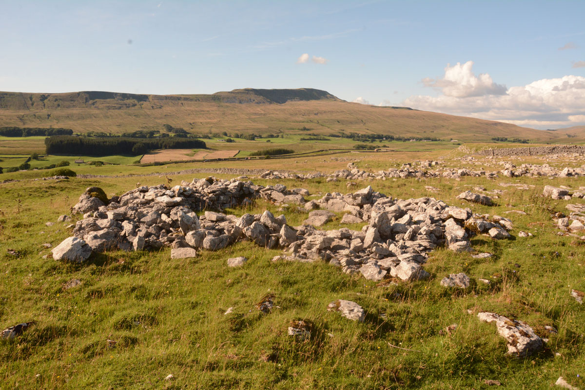
Keld Bank Settlement submitted by Anne T on 13th Aug 2019. The remains of the roundhouse, with an attached enclosure, on the western edge of the settlement. This view looks NW. On the terrace below, there are the remains of clearance cairns and the low banks of field systems
(View photo, vote or add a comment)
Log Text: Keld Bank Settlement: Sitting down in the sunshine, recording the photographs I’d taken for the Keld Bank Propped Stone, I picked up the OS map and realised there was a settlement here. In fact, where I’d chosen to sit, on the edge of a scar, was right on the eastern edge of it.
This settlement is marked on the HE map of the area, but not recorded or scheduled. It was very reminiscent of the Whittenknowles Rocks settlement on Dartmoor, where the walls and hut circles had been built round the natural stones/boulders. Built on the terrace just below the propped stone, extending to the terrace below. The sharp ‘edges’ of the terrace by the hut circle made it look a little like a hill fort – natural defences.
Towards the northern side, I identified a clear hut circle with an enclosure attached; this is clearly visible on UK Grid Reference Finder. There were other clearance cairns and the remains of old buildings and field systems in the terrace below the propped stones.
Keld Bank (Ingleborough)
Trip No.144 Entry No.3 Date Added: 13th Aug 2019
Site Type: Rock Art
Country: England (Yorkshire (North))
Visited: Yes on 8th Aug 2019. My rating: Condition 3 Ambience 4 Access 3
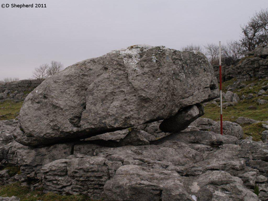
Keld Bank (Ingleborough) submitted by DavidShepherd on 10th May 2018. Keld Bank Propped Stone, photo taken by David Shepherd.
Top stone seems to have come from the adjacent collapse feature on the scar. There is an enlarged joint beneath blocked with a flake.
(View photo, vote or add a comment)
Log Text: Keld Bank Propped Stone: We parked in the small car park for Great Douk Caves on the northern side of the B6255, Low Sleights Road, and began by following the footpath up to the caves, passing the lime kiln on the way. We then largely followed a quad bike track SSE up the slope to the first limestone scar, then headed north east towards the grid reference given by David Shepherd.
The piece of land this propped stone sits on is a nature reserve, managed by Natural England, so we assumed we were safe to walk up over the limestone ridges or scars, of which I counted three. There were easy routes up over each raised section of scar, so I made the walk to the stone easily. Again, we needed to use the GPS and David’s photograph to confirm we were looking at the correct stone, as there were a number of possibilities in the area, including one nicely ‘balanced’ stone nearby.
My comments about this propped stone as the same as above. Even Andrew was less convinced this time, given there were so many other stones around that could also have been counted as ‘propped’ or ‘balanced’.
We ‘called off’ the walk for the third stone as a result of this visit, opting to go and find the stone circle at Casterton.
Sleights Pasture Propped Stone
Trip No.144 Entry No.2 Date Added: 13th Aug 2019
Site Type: Rock Outcrop
Country: England (Yorkshire (North))
Visited: Yes on 8th Aug 2019. My rating: Condition 3 Ambience 4 Access 4
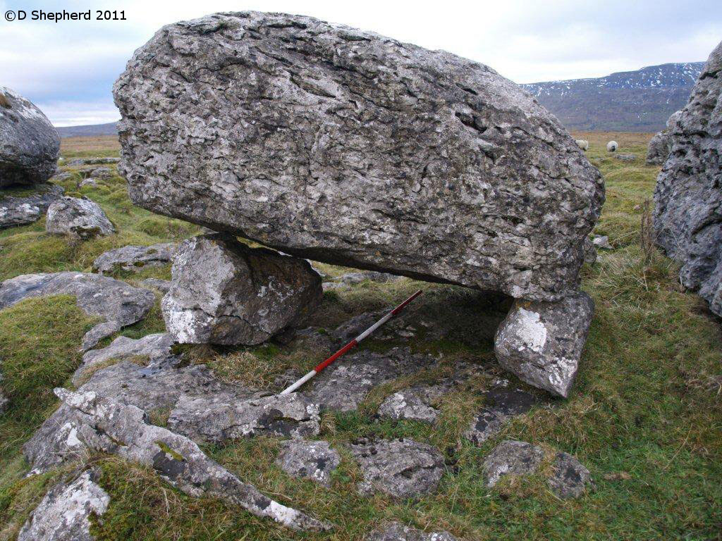
Sleights Pasture Propped Stone submitted by DavidShepherd on 10th May 2018. Sleights Pasture Propped Stone, photo by David Shepherd
(View photo, vote or add a comment)
Log Text: Sleights Pasture Propped Stone: We parked at SD 75081 78117, just beyond the cattle grid on this single-tracked public road (there is room for a couple of cars between the road and the stone wall) then along the very busy, and fast, B6255 Low Sleights Road, walking NE towards the Ribblehead Viaduct, then crossing the road to the footpath leading to this limestone scar, then heading SE along another minor footpath, marked on the map, but barely visible on the ground.
As there were several possibilities of which this propped stone might be, I made doubly sure I had the correct GPS and we were within 1m of the reading. We also compared it with the photograph on the Portal and the diagram (figure 7, in David’s paper “Propped Stones: The Modification of Natural Features and the Construction of Place” (Time and Mind, November 2013)) - I'd taken a copy with me, just in case.
Sorry, but I’m really sceptical about this being a propped stone. I would have been convinced if the propping stones were of a different material to the top stone. It looked like a ‘happy accident’ of glacial deposits and erosion. Another large boulder to its west was placed almost symmetrically on top of a ‘base pad’ of bed rock, and we spotted another couple of stones that also might have been taken as being propped. It reminded me very much of the ‘Guide Stones to the Great Langdale Axe Factory’, where it was difficult to pick one guide stone out of so many on the ground.
I also wasn’t convinced about the double propping, unless I have misinterpreted what David means about this. The boulder at the western end of the stone appeared to be cracked through, viewed from the north, rather than being two separate boulders on top of each other. Both propping stones were placed/located onto top of a bed of limestone.
There was also a very mysterious wall at SD 75748 78030, which Andrew pointed out, partly built with limestone pavement blocks for its ends. Looked like a sheep shelter to me.
Carperby Cross
Trip No.144 Entry No.1 Date Added: 13th Aug 2019
Site Type: Ancient Cross
Country: England (Yorkshire (North))
Visited: Yes on 8th Aug 2019. My rating: Condition 3 Ambience 4 Access 5
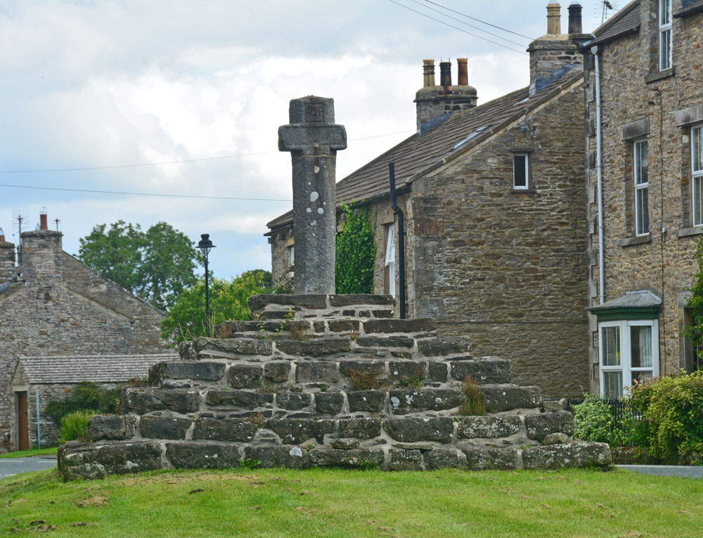
Carperby Cross submitted by Anne T on 13th Aug 2019. The cross from the village green, just to its western side, looking up the road through the village towards Redmire and Leyburn
(View photo, vote or add a comment)
Log Text: Carperby Cross: Not on our original schedule, we drove past this market cross and just had to turn back to take a closer look. Located on the village green in Carperby, which is a long, narrow, triangular strip of grass orientated SW-NE, the base or steps of the cross looked ancient, whereas the shaft of the cross looks modern, although it is dated 1674. The top of the cross has been broken off and re-cemented in at some stage. There are some interesting carved faces at the ends of the short, horizontal arms.
The information sign reads: “Carperby (West End). ‘Kerperbi’ is found in the Domesday Book of 1086. The name probably comes from early Scandinavian settlers, with ‘-by’ meaning farmstead and ‘kjarr’ meaning a bushy, boggy area, in old Danish.
Carperby has been designated as a Conservation Area because of its important historic character. The village is unusual in that it has two distinct centres, one at this end around the 17th century market cross and one at the east end where the original medieval manor house may have been.
The Market
The Market Cross suggests that Carperby’s medieval markets were held here but research shows otherwise. The original site at the far end of the village seems to have fallen into disuse after 1587 when Askrigg began to corner trade in the upper dale. It was briefly revived again in the 17th century, but this time at this end of the village. The date of 1674 carved on the cross supports this theory.
Religion
From the mid-17th century, non-conformism began to sweep through the Yorkshire Dales. The first converts worshipped in each other’s houses but eventually they built their own chapels.
West Lea Cottage was the first Methodist chapel, built in 1826. A little further east is its 1890 replacement (Greygarth), a simple Gothic building.
The Grade II listed Friends Meeting House of 1864 is the most sophisticated looking building in the village, with its heavily carved stonework. It seems to have replaced an earlier meeting house (Quaker Cottages) licensed in 1828 but later converted into cottages.
Education
Formal education in Carperby was provided by the school (Quarter House). It looks to be of 19th century date and the school records go back to 1870. A shaped tablet between the windows is inscribed ‘Carperby School’ but the rest is hidden by the later porch roof. The school closed in 1962.”
Hadrian's Wall (Turret 44b)
Trip No.143 Entry No.3 Date Added: 11th Jul 2019
Site Type: Misc. Earthwork
Country: England (Northumberland)
Visited: Yes on 8th Jul 2019. My rating: Condition 2 Ambience 4 Access 4
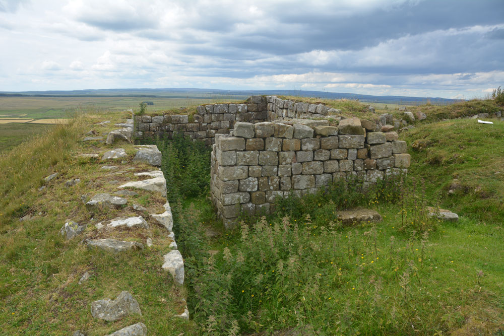
Hadrian's Wall (Turret 44b) submitted by Anne T on 11th Jul 2019. Standing almost at the western edge of the turret, with the crags dropping down sharply, just off shot to the left, looking north across the turret. Photo by Andrew T
(View photo, vote or add a comment)
Log Text: Turret 44b, Hadrian's Wall: Located on the crag above King Arthur's Well, this is a lovely spot. We had difficulty in locating the holy well, so whilst I continue to search for the it and see if I could find any structure or water course, Andrew ascended the steps to the top of the crag, and came back about 20 minutes later.
This turret is on the Hadrian’s Wall path, which runs almost due east-west here. It is in a very pretty spot. Even with it being a Monday afternoon, and a very warm day, there were lots of walkers here. Many passed me on the paved section of path but none appeared to stop and look at the turret, as no-one seemed to linger at this point. Perhaps they had already seen too many turrets around here - there are certainly a lot of them!
King Arthur's Well (Walltown Gap)
Trip No.143 Entry No.2 Date Added: 12th Jul 2019
Site Type: Holy Well or Sacred Spring
Country: England (Northumberland)
Visited: Yes on 8th Jul 2019. My rating: Condition 1 Ambience 4 Access 4
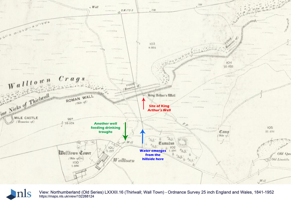
King Arthur's Well (Walltown Gap) submitted by Anne T on 12th Jul 2019. This is an image taken from the National Library of Scotland's 1895 OS map for Thirwall and Wall Town, dated 1895, and licensed for re-use under Creative Commons. Link: https://maps.nls.uk/copyright.html. The location of King Arthur's Well is marked by the red arrow, although if it exists is well hidden under turf and reeds. The blue arrow marks the location NY 68041 66551, where a spring emerges further down the hillside. The green arrow marks the location of another well which feeds drinking t...
(View photo, vote or add a comment)
Log Text: King Arthur's Well, Walltown Crags: Whilst this well may now be destroyed or lost, the scenery here is fantastic, and it was well worth coming out to look.
We were unable to find this holy well, despite having the GPS to guide us to the spot. However, we did see signs of reeds and tall grasses where the water might have pooled and flowed.
On the way up to the nick in the crags where the well is located, there is water emerging from the hillside at NY 68041 66551, which runs in a small stream down the slope, feeding two drinking troughs in the field below. We did visit after a period of prolonged dry weather, so wondered if the water emerges from higher up the hill after wet weather.
Hadrian's Wall (Poltross Burn)
Trip No.143 Entry No.1 Date Added: 11th Jul 2019
Site Type: Stone Fort or Dun
Country: England (Cumbria)
Visited: Yes on 8th Jul 2019. My rating: Condition 3 Ambience 4 Access 4
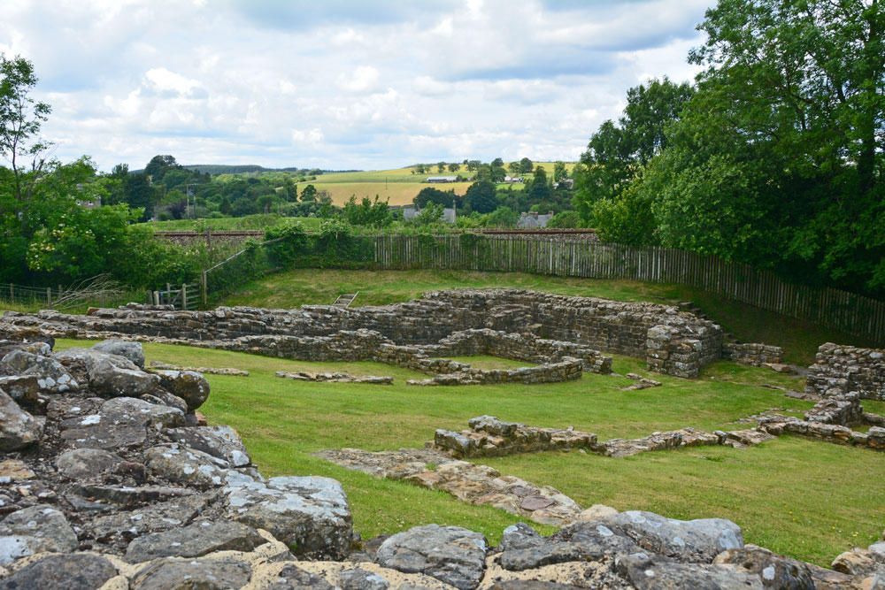
Hadrian's Wall (Poltross Burn) submitted by Anne T on 11th Jul 2019. Standing at the south western corner of the milecastle/small fort, looking towards its north eastern corner.
(View photo, vote or add a comment)
Log Text: Poltross Burn Milecastle: We last visited this site on 27th October 2013, and it hasn’t’ changed at all. Andrew, in typical engineering fashion, went round and talked about the offsets and revetted construction of this small fort. It’s layout is remarkably easy to read.
Andrew recalled reading about a house built right on top of the wall, but we were unable to find it.
Smith's Shield Milestone
Trip No.142 Entry No.3 Date Added: 6th Jul 2019
Site Type: Marker Stone
Country: England (Northumberland)
Visited: Yes on 4th Jul 2019. My rating: Condition 2 Ambience 3 Access 4
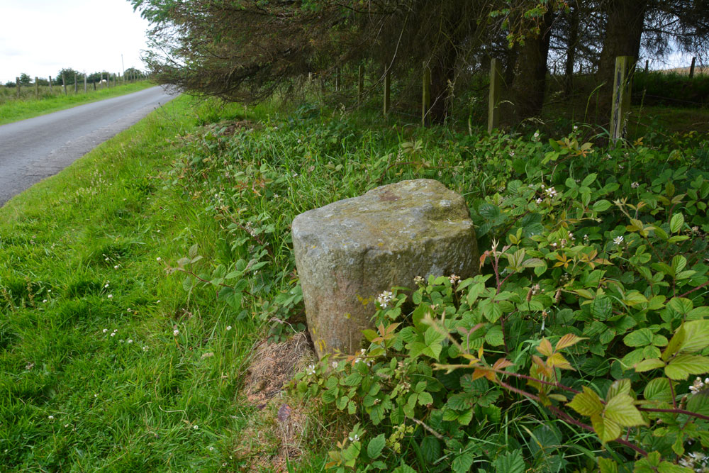
Smith's Shield Milestone submitted by Anne T on 6th Jul 2019. The base of the Smith's Shield Roman milestone, showing its location next to the minor road running east to Vindolanda. It is just over 100m east of the road junction which is just below Smith's Shield farmhouse.
(View photo, vote or add a comment)
Log Text: Smith's Shield Roman Milestone (base of): The base of this Roman milestone, located at the northern side of the road which runs east towards Vindolanda, is easy to spot.
A note of warning to future visitors - we had a run in with the AD122 local bus service who told us off for parking in what he thought was a passing place, but wasn't; there was plenty of room for him to pass, and he parked alongside us before he started yelling. I think he just wanted to shout at someone, but it certainly ruined my day.
There is a second, intact milestone at the eastern entrance to Vindolanda, which we have yet to go back and see.
Hadrian's Wall (Chesters Bridge Abutment)
Trip No.142 Entry No.2 Date Added: 7th Jul 2019
Site Type: Misc. Earthwork
Country: England (Northumberland)
Visited: Yes on 4th Jul 2019. My rating: Condition 3 Ambience 4 Access 4
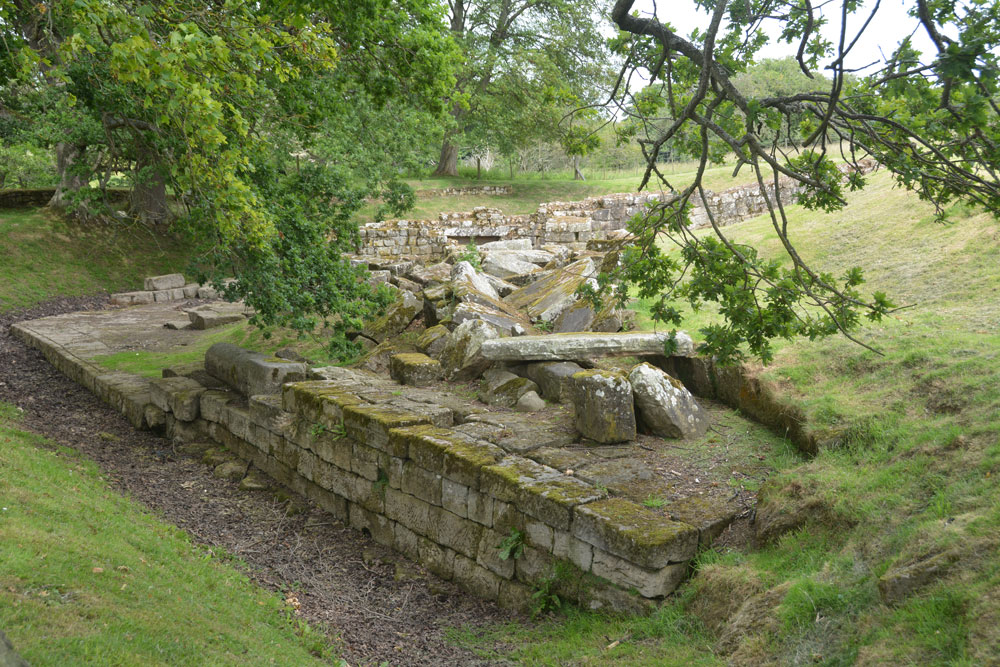
Hadrian's Wall (Chesters Bridge Abutment) submitted by Anne T on 7th Jul 2019. A look at the western side of the bridge abutment, giving an idea of its substantial structure and size. Behind me is a huge store of blocks which have fallen from the structure over the years and have been placed neatly waiting for restoration at some point?
(View photo, vote or add a comment)
Log Text: Chesters Bridge Abutment: It's been some time since we came here to photograph the rock art panel, which is still here (although heavily lichen covered). This is where “The River Hunters” did a search in their series not long ago, just opposite the bath house at Chesters on the opposite bank. This was visible from the bridge abutment.
We met the American party again and another gentleman who said he had been walking round the poppy field trying to get some good photos. I set him a challenge - looking for the phallus symbol and the rock art. He got quite excited about the symbol and told me that he walked the wall looking for these symbols. He'd recently been trying to find one near Gilsland but without success.
One of the sources used by Historic England is my book bought for £1 from Hexham car boot sale: Bruce, J C, Handbook to the Roman wall, (1863), 117-120 and Bruce, J C, Handbook to the Roman wall, (1863), 109-111
