Contributory members are able to log private notes and comments about each site
Sites Anne T has logged. View this log as a table or view the most recent logs from everyone
Goatstones Four-Poster
Date Added: 1st Jul 2014
Site Type: Stone Circle
Country: England (Northumberland)
Visited: Yes on 30th Jun 2014. My rating: Condition 4 Ambience 4 Access 4
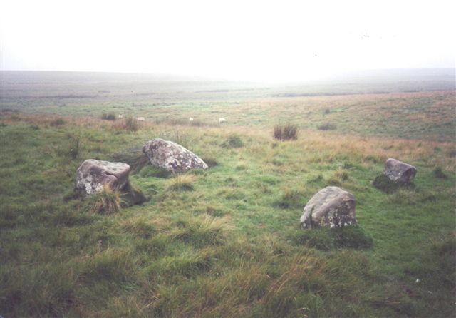
Goatstones Four-Poster submitted by cosmic on 13th Feb 2005. Another of Goatstones courtesy of Ian Simpson
(View photo, vote or add a comment)
Log Text: There are a couple of parking spaces next to 'Manor House' on Ward Lane, just below Ravensheugh Crags, and followed the footpath up to the crags, turning right up to the stone circle.
It is an easy walk, with spectacular views - the visibility was around 30 miles - we could see the Cheviot Hills in the distance.
The stones of this unusual four poster stone circle are low to the ground (with other outlying stones buried in the grass around?) but very atmospheric. It feels very remote, with very little noise apart from birdsong, although there is a steady (but small) stream of traffic along Ward Lane.
There are very definite cup marks on the eastern most stone, and other possible cups on the southern most stone (now partly toppled and hidden by marsh grass).
We met the farmer from Great Lonbrough, at the very end of the footpath, and he told us more about the hut circles and cairns in the fields below. We checked the Portal when we got home and were inspired by the photographs of the rock art at Goatstones, so we intend to go back and look again in the next few weeks and look at these, plus also walk along to Standingstone Rigg.
Will most definitely visit again.
Bygate Hill
Date Added: 23rd Jun 2014
Site Type: Standing Stone (Menhir)
Country: England (Northumberland)
Visited: Yes on 22nd Jun 2014. My rating: Condition 3 Ambience 4 Access 4
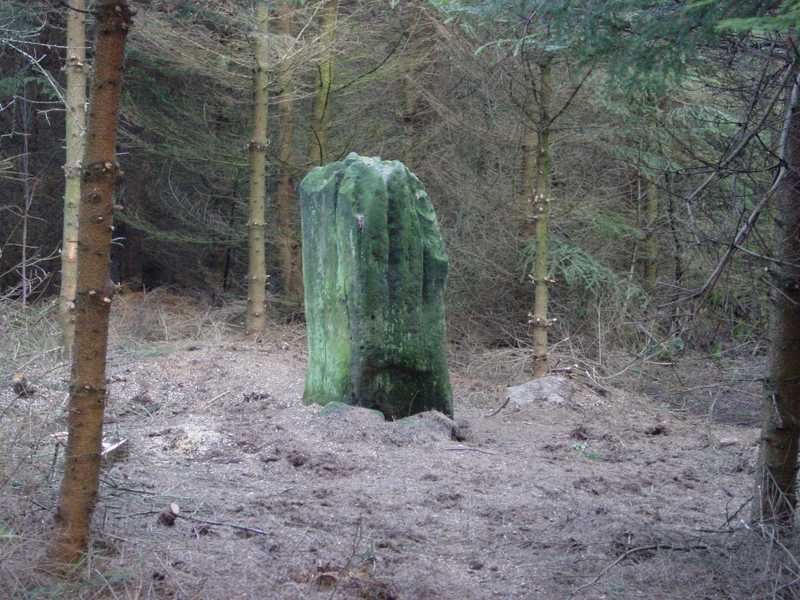
Bygate Hill submitted by PaulH on 3rd Mar 2003. Northumberland
NZ069770
(View photo, vote or add a comment)
Log Text: Having previously visited the site the weekend previously, we were put off from going in by alarms coming from within the plantation and a notice 'not to enter without the necessary authority' on the gate, so I sought the landowner's permission to enter. Bygate Hill Plantation houses a telecommunications mast (which apparently requires a permit to go near) and the landowner told me there are also regular paintballing activities carried out within the plantation.
There is a grassy track from the gate to the mast, with a small track running off to the right (just before the mast) through the trees which leads to the stone which stands in a small clearing.
The standing stone itself is impressive, and very atmospheric amidst the trees with the sunshine breaking through.
The land surface has clearly built up with all the leaf debris built up around the base of the stone, which also appears to have been propped up on one side by two smaller stones, to stop it leaning further.
There also appears to be a smaller buried (heel?) stone within a few yards of the main stone.
Had it not been for the trees, the site would command superb views of the surrounding land. We later walked up to West Bitchfield Peel Tower (grid reference: NZ 09081 77126) and looked back towards the plantation. The views were magnificent.
The landowner told me that Buddhist Monks from nearby Harnham Monastery regularly visit the stone and hang bells, and indeed there are charms and wind chimes on the trees surrounding the stone, and offerings placed on top of the stone.
Roughting Linn Rock Art
Date Added: 20th Jun 2014
Site Type: Rock Art
Country: England (Northumberland)
Visited: Yes on 20th May 2014
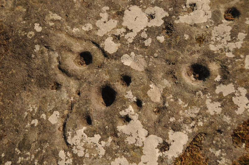
Roughting Linn Rock Art submitted by Anne T on 20th May 2014. Close up of some of the marks on the Roughting Linn outcrop.
(View photo, vote or add a comment)
Log Text: None
Middleton Standing Stone (Northumberland)
Date Added: 20th Jun 2014
Site Type: Standing Stone (Menhir)
Country: England (Northumberland)
Visited: Yes on 27th May 2014
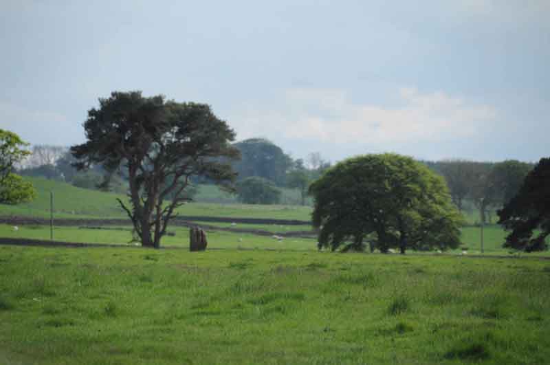
Middleton Standing Stone (Northumberland) submitted by Anne T on 27th May 2014. Middleton Standing Stone in the context of the landscape, looking towards the south west.
(View photo, vote or add a comment)
Log Text: None
Meg's Well, Aydon
Date Added: 20th Jun 2014
Site Type: Holy Well or Sacred Spring
Country: England (Northumberland)
Visited: Yes on 28th May 2014
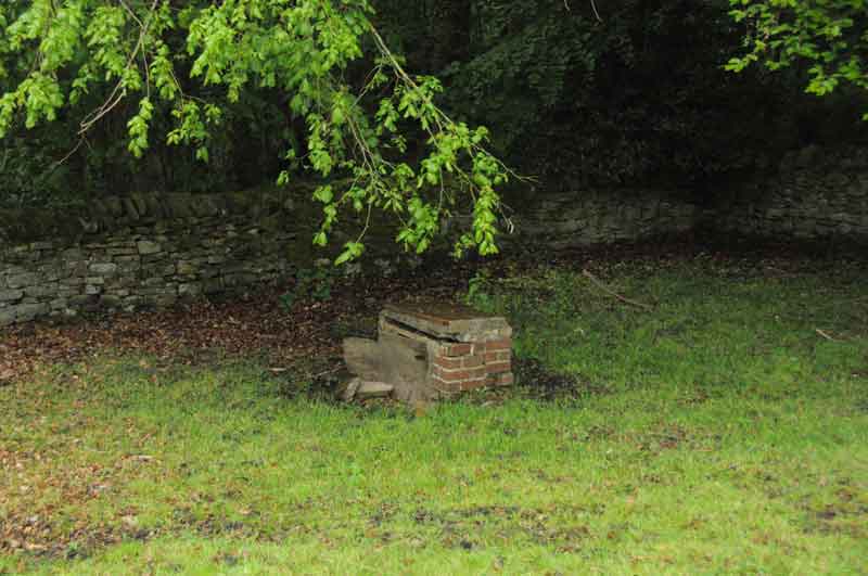
Meg's Well, Aydon submitted by Anne T on 28th May 2014. This is a view of Meg's Well from the road through the village, just below Aydon Cottage, adjacent to the footpath running towards Aydon Castle. The field appears to be private, and when we visited was full of livestock, so there's no direct access. I wouldn't have recognised the well without having already seen an image on the Megalithic Portal (so thank you!). There are no signposts to the well, and the site is very sadly neglected. I haven't been able to find much about the history of the ...
(View photo, vote or add a comment)
Log Text: None
Bow Bridge Homestead
Date Added: 20th Jun 2014
Site Type: Ancient Village or Settlement
Country: England (Northumberland)
Visited: Yes on 28th May 2014
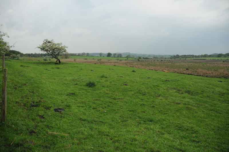
Bow Bridge Homestead submitted by Anne T on 28th May 2014. Image of Bow Bridge Settlement, near Aydon, Northumberland, taken from the road. At the time of our visit, there was a very large bull with his ladies in the field, so I didn't venture nearer! You can see a very clear settlement platform, looking down onto Shildon Bog (right hand side of photograph). The settlement runs underneath the road. We had a quick look for signs on the opposite side of the road, but at first sight appears to have been ploughed out.
(View photo, vote or add a comment)
Log Text: None
Grasmere Cup-Marked Rocks
Date Added: 20th Jun 2014
Site Type: Rock Art
Country: England (Cumbria)
Visited: Yes on 2nd Jun 2014
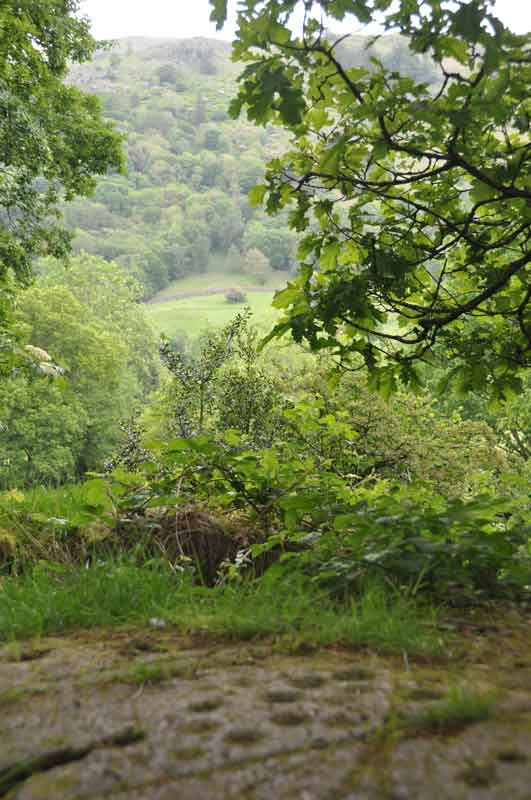
Grasmere Cup-Marked Rocks submitted by Anne T on 2nd Jun 2014. We made an impromptu visit to Grasmere yesterday (1st June) and as the café we were in had WiFi, I checked the Portal, and found the images taken by DrewParsons of the Cup-Marked Rocks at the entrance to the car park we were parked in. Thank you - this was an unexpected treat. This image shows the context of the rock outcrop, overlooking the river Rothay and (I think) Rydal Fell in the background. A beautiful spot.
(View photo, vote or add a comment)
Log Text: None
Sidwood Iron Age Settlement
Date Added: 20th Jun 2014
Site Type: Ancient Village or Settlement
Country: England (Northumberland)
Visited: Yes on 11th Jun 2014
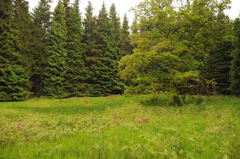
Sidwood Iron Age Settlement submitted by Anne T on 11th Jun 2014. This was our first view of the settlement, on the left hand side of the footpath from Tarset Burn. The site is in a forest clearing, demarked by an old tree which stands on its own.
The foundations of two hut circles are clearly visible through the grass and bracken, and the entrance (to the left hand middle of the photograph) and sunken yard are clearly identifiable.
(View photo, vote or add a comment)
Log Text: None
Warrior Stone (Ingoe)
Date Added: 16th Jun 2014
Site Type: Standing Stone (Menhir)
Country: England (Northumberland)
Visited: Yes on 15th Jun 2014. My rating: Condition 3 Ambience 4 Access 4
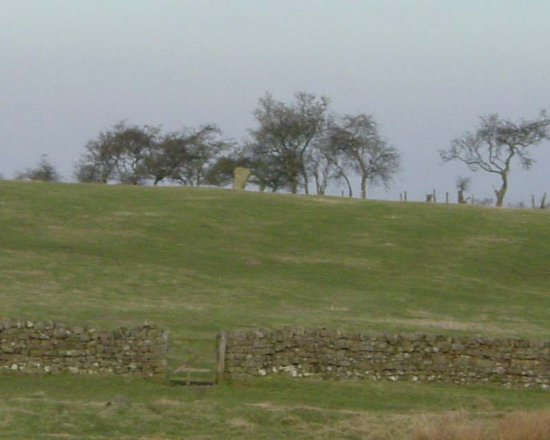
Warrior Stone (Ingoe) submitted by PaulH on 3rd Mar 2003. Northumberland
NZ044747
No public access to the stone itself
(View photo, vote or add a comment)
Log Text: We've visited Inghoe before, but to look at the remains of the medieval village and also the hut circles just beyond Sandyway Heads Farm.
Having just visited the Matfen Standing Stone, and having tried to visit the Bygate Hill site (which is a private plantation with a telecommunications mast and permission is needed to access the site), it was only a few more miles to the Warrior Stone. We parked just past the 'village green' (with a bus stop) and walked along the farm track. We were last here about 5 years ago, and the friendly farmer came out to tell us about the homestead in the field beyond the farm, showed us the cup and ring stone and quern stone by the gate to his cottage, and gave us permission to visit the Warrior Stone, which stands alone in a field just before the farm cottage. There was no-one around this time to ask permission, so I felt guilty about walking into his field.
There are beautiful views across the valley towards Matfen and Stamfordham, even though it was drizzly and misty.
A couple of web sites by local antiquarians describe cup marks on the stone, but I wasn't sure if we'd identified the right marks.
Will go back again when we've got blue skies to appreciate the site in all it's glory.
Matfen
Date Added: 16th Jun 2014
Site Type: Standing Stone (Menhir)
Country: England (Northumberland)
Visited: Yes on 15th Jun 2014. My rating: Condition 3 Ambience 3 Access 5
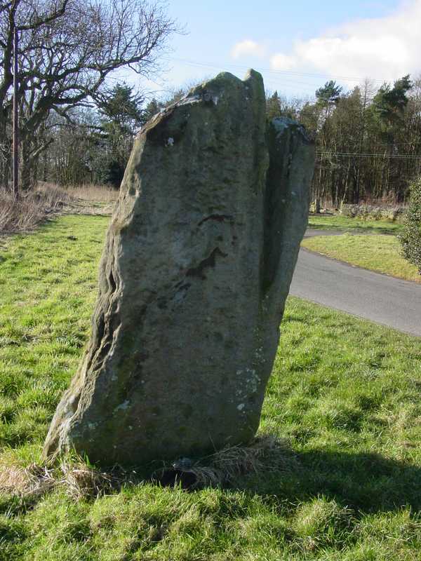
Matfen submitted by PaulH on 2nd Mar 2003. In the village of Matfen. About 2km north of the B6318, the modern road that follows the course of Hadrian's wall.
NZ032705
(View photo, vote or add a comment)
Log Text: This standing stone, near Matfen Hall Hotel/Golf Course, stands on the edge of a road in a hamlet called 'Standing Stone'. It is easy to find, being on a right hand turn just before the main entrance to Matfen Hall Golf Course, and opposite Standing Stone House, about 100 yards from the road junction.
It is difficult to park adjacent to the stone, unless you park in the entrance to the farm/farm buildings, but just opposite the road junction to Standing Stone hamlet, there is another left hand turn with room for a few cars to park at the side of the junction.
The short walk back to the stone was a little difficult, due to the stream of traffic and bicycles moving quickly along the road, but as long as you are careful, it's fine.
There are some impressive cup marks at the base of the north face of the stone, and some more at the top.
Worth seeing, and on the way to The Warrior Stone at Inghoe and Bygate Hill.
Swinburne Stone
Date Added: 15th Jun 2014
Site Type: Standing Stone (Menhir)
Country: England (Northumberland)
Visited: Yes on 13th Jun 2014. My rating: Condition 3 Ambience 4 Access 4
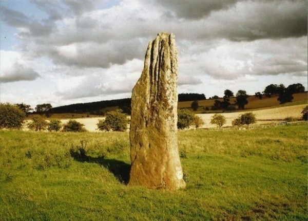
Swinburne Stone submitted by Bladup on 30th Dec 2013. The lovely tall and slender Swinburn Castle standing stone.
(View photo, vote or add a comment)
Log Text: We sought the landowner's permission prior to visiting the stone. We parked outside the Roman Catholic Church at Ox Hills, and walked back to the footpath leading firstly to Swinburne Castle, then splitting off to the left at a large tree to tumuli and the standing stone.
The footpath is easy walking. Almost immediately to the left are some impressive earthworks (possibly related to the original castle?) and some large terraces - much bigger than normal ridge and furrow ploughing. Websites from local historians say these may be medieval strip lynchets.
We first visited the tumuli just before a gate/field boundary crosses the path, before doubling back to the gate which allowed access to the field with the stone (there being sunken stone walls between the footpath and the field boundary, presumably allowing views of the stone from the upper floors of the castle (now private house).
The stone isn't visible from the footpath, but as soon as you top the brow of a small hill, the stone stands below you in the middle of the field.
The stone is impressive, being around 12 feet tall, and if the compass on my phone is correct (it switched 180 degrees several times during my visit) the wider faces are orientated north-north-west/south-south-east.
The southern face of the stone has some easily identifiable cup marks; generally there are quite a few initials carved into the stone.
There are also a couple of other tumuli, which are in private fields, but this is beautiful and peaceful part of the countryside, and we spent a very pleasant afternoon exploring.
Kirkmaiden Old Church
Trip No.137 Entry No.12 Date Added: 28th Jun 2019
Site Type: Ancient Cross
Country: Scotland (Dumfries and Galloway)
Visited: Visited (still working on) on 18th Jun 2019. My rating: Condition 2 Ambience 4 Access 4
Kirkmaiden Old Church submitted by markj99 on 8th Sep 2019. Kirkmaiden Churchyard (St Medan)
(View photo, vote or add a comment)
Log Text: Kirkmaiden Old Church: A very lovely drive along the coast road (A747) through Port William to the golf course. We had difficulty finding the grassy track down to the church, but eventually stumbled upon it using the GPS.
Down a steep cliff on its eastern side, and with steps down to the beach to the west, this is a lovely spot. Whilst we could hear the sea, we couldn’t see it for the trees. The site comprises two very small churches – the old one to the west of the site, and the new church to the east. The old church really is just a ruin, but almost buried under ivy, it is very atmospheric.
The three cross slabs mentioned in Canmore we could not find– if there was a slab in the fenced enclosure, there were too many weeds to see. Another two are recorded as being in the church, which is padlocked with a huge chain. The padlock seemed so rusty, I’m not sure when it had last been opened.
With time pressing, I really wanted to get to Whithorn, so we went back to the car and drove on.
Torhousekie Standing Stone
Trip No.136 Entry No.7 Date Added: 25th Jun 2019
Site Type: Standing Stone (Menhir)
Country: Scotland (Dumfries and Galloway)
Visited: Visited (still working on) on 17th Jun 2019
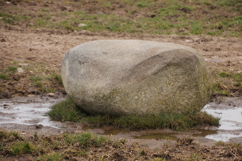
Torhousekie Standing Stone submitted by SumDoood on 22nd Mar 2016. Just over the wall near the gate into the 2nd field on the right (west), when approaching the farm "Cunninghame".
(View photo, vote or add a comment)
Log Text: Torhouskie Standing Stone: At the time of our visit, the only route to this stone was either along the very busy minor road then down the farm track (didn't fancy getting run over as sight lines for cars weren't very good) or across the field. With The Huge Bull standing guard, and watching our every move, we had a quick chat with another visitor who was keen to see the stones, we decided we were not brave enough to risk it!
Seeing SumDoood's photographs of this stone on the site page, the size of the stone is very similar in size and shape to the one lying in the field just to the east of the stone circle.
On my list for another visit.
Minnigaff Old Church
Trip No.139 Entry No.2 Date Added: 23rd Jun 2019
Site Type: Ancient Cross
Country: Scotland (Dumfries and Galloway)
Visited: Visited (still working on) on 17th Jun 2019
Minnigaff Old Church submitted by markj99 on 12th Jul 2020. Minnigaff Old Church
(View photo, vote or add a comment)
Log Text: Cross Slabs, Minnigaff Old Church: The Canmore record says clearly that these two cross slabs are within the ruins of the old church at Minnigaff. We found these enigmatic ruins easily, within the burial ground of the modern-day church. However, the stones have been moved inside the modern church, and there is an information board just to the north of the west door into the church. I was very disappointed. I have sent Canmore a message, which they've acknowledged, so they can update their webpage for future visitors.
St Andrew's Church (Forteviot)
Trip No.84 Entry No.3 Date Added: 25th Jul 2018
Site Type: Class III Pictish Cross Slab
Country: Scotland (Perth and Kinross)
Visited: Visited (still working on) on 14th Jul 2018. My rating: Ambience 3 Access 5
Log Text: St. Andrew's, Forteviot: We drove up to this church to find a lovely local lady garden by the gate into the churchyard. She told us the church would be locked, "but it'll be open on 29th (July)." We explained we were only here for the day, so this was too late. She told us about the recently erected modern cross, just down the road from the church, next to the bus stop. We thanked her kindly and walked down to take a look.
Newbeggin Stone Row
Trip No.9 Entry No.4 Date Added: 15th Feb 2017
Site Type: Stone Row / Alignment
Country: England (Cumbria)
Visited: Visited (still working on) on 12th Feb 2017
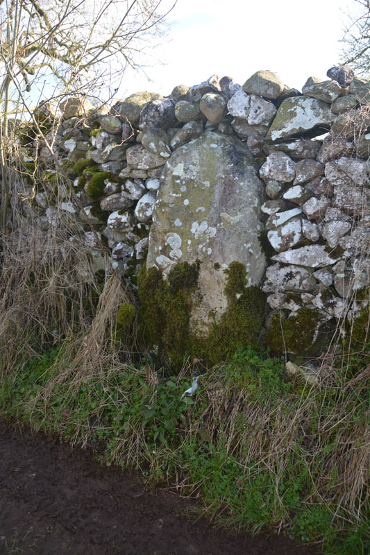
Newbeggin Stone Row (Possible) submitted by Anne T on 28th Mar 2017. This stone is built into a stone wall on a footpath which follows the Carlsike Burn, around Hoghouse Hill to Newbeggin. Located at NY 48058 29531. Note: 3rd April 2017. The Lead Officer for the Historic Environment and Commons says "This is slightly more interesting. I would not like to guess at when this might have been erected."
(View photo, vote or add a comment)
Log Text: Newbiggin Stone Row, near Penrith: See comment on main page. Tried to find. Seen an image of a stone in an enclosure wall but unable to locate. Working on finding exact location and will return!
Jedburgh Rock Art
Date Added: 23rd May 2015
Site Type: Rock Art
Country: Scotland (Scottish Borders)
Visited: Visited (still working on) on 23rd May 2015
Log Text: Jedburgh Rock Art: We spotted this site page after our last visit to Jedburgh earlier this month, and having missed this piece of rock art first time round, we decided to stop when we next passed through to see if we could find it. Armed with SolarMegalith's grid reference, we went scouting, but were unable to find any rock or boulders in the vicinity.
I called up this page on my mobile phone and went into the visitor centre to ask if they knew anything about it. Neither of the guides knew anything about this at all, taking my phone to consult each other, and even double-checking the guide book to find out where the courtyard referred to in the earlier reference might be.
In the end, we all had to admit defeat on this occasion, but I'd be interested to find out if this piece of rock art has been moved to a local museum. Curious! I'd now love to found this stone and post a photograph.
Westwood Drive 01
Date Added: 19th Apr 2015
Site Type: Rock Art
Country: England (Yorkshire (West))
Visited: Visited (still working on) on 17th Apr 2015. My rating: Condition 2 Ambience 2 Access 5
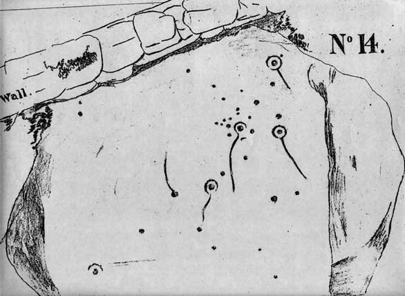
Westwood Drive 01 submitted by brigantia on 30th Nov 2006. The Comet Stone:
First known drawing of this carving done around 1878 and collated in J. Thornton Dale's previously unpublished "Collection of 14 drawings of cup-marked rocks deposited at Ilkley Library, prepared and presented by Dr. Call" in 1880.
(View photo, vote or add a comment)
Log Text: The Comet Stone, Ilkely: (we found the grid reference but queried if this was the stone): From the Panorama Stones, driving the 700 metres up towards the moor we parked by the footpath sign just west of the junction of Moorlands and Westwood Drive and headed up the steep path (with steps) onto the moor (to get nearer, Keighley Road travels up onto the moor and there is a small car park near to the grid reference given).
The grid reference led us to the back stone wall of a house. The grass had been badly overgrown and someone had put weed-killer down on this patch of ground, but nettles were springing up in between the dead undergrowth.
Walking up and down the wall and identifying several possible stones, the grid reference led us back again and again to the same stone over which the stone boundary wall between a garden and the moorland was built. Cheekily peering over the wall of the house, found the stone extended some way into the garden. It had shrubs growing over the sides and was covered by moss and twigs so it wasn’t possible to make out any of the rock art by eye.
Shame, as I thought I’d be the first to submit a photograph of this stone, but it will take a knock on the door of the house when someone is in to get permission to go round and look!
