Contributory members are able to log private notes and comments about each site
Sites Anne T has logged. View this log as a table or view the most recent logs from everyone
West Lordenshaw Main Rock
Date Added: 10th Jan 2017
Site Type: Rock Art
Country: England (Northumberland)
Visited: Yes on 1st Jan 2017. My rating: Condition 3 Ambience 4 Access 4
West Lordenshaw Main Rock submitted by DrewParsons on 2nd Oct 2011. One of the deep cup and ring marks on this rock. September 2011.
(View photo, vote or add a comment)
Log Text: West Lordenshaw Main Rock, Northumberland: From Channel Rock, we walked back through the hill fort, stopping to admire a possible cairn field and three roundhouses next to the path. Main Rock generally had other visitors around it, but by this time it was starting to get really quite dark and we could spot heavy rain heading to us from across the valley in Rothsbury. I wanted to see both Main Rock and Horseshoe Rock before heading home, but time was too short and we only made it to Main Rock before torches would have been needed to see our way back to the car.
Having also visited the Portal site and seen how many other pieces of rock art there are here, I was regretting loss of our GPS last year on a Level 3 survey with the archaeology group – definitely need to replace it!
Needed to use the flash to get any photographs at this point. Some impressive motifs. Would have liked longer (and warmer weather) to sit and study this rock. A repeat visit (with GPS) to Lordenshaw is on my 'must' list!
West Shank Enclosure
Date Added: 1st Aug 2015
Site Type: Misc. Earthwork
Country: England (Northumberland)
Visited: Yes on 15th Jul 2015. My rating: Condition 2 Ambience 3 Access 3
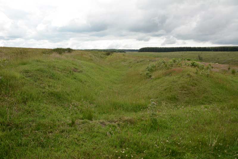
West Shank Enclosure submitted by Anne T on 18th Jul 2015. Standing in the boundary ditch where the footpath cuts the enclosure looking east back towards Hollinghill Enclosure. The banks rise gently up on either side. The vegetation here is short grass, cropped by sheep, so are more obvious than the banks and ditches of the neighbouring Hollinghill Enclosure.
(View photo, vote or add a comment)
Log Text: West Shank Enclosure, near Fontburn Reservoir, Northumberland: See visit report for Hollinghill Enclosure.
West Wyke Farm Cross
Trip No.132 Entry No.15 Date Added: 9th Oct 2019
Site Type: Ancient Cross
Country: England (Devon)
Visited: Yes on 13th May 2019. My rating: Condition 3 Ambience 3 Access 4

West Wyke Farm Cross submitted by Anne T on 9th Jun 2019. This cross sits just to the west of the entrance to farm buildings on the northern side of the track. It stands about 18 inches / 45 cms high.
(View photo, vote or add a comment)
Log Text: West Wyke Farm Cross: This cross is not recorded on Pastscape or Historic England, so we didn't expect to see it here. It looks relatively modern, like a small rounded-headed grave marker such as we saw in St Mary's in Belstone. It sits quietly by the entrance to the farm buildings, north of the track and West Wyke farmhouse.
Note: the track up to the farm and houses here is marked private road. We parked at the viewpoint at SX 65298 93020 and walked up the lane.
West Wykes Farm Tau and Latin Crosses
Trip No.132 Entry No.16 Date Added: 9th Oct 2019
Site Type: Ancient Cross
Country: England (Devon)
Visited: Yes on 13th May 2019. My rating: Condition 3 Ambience 5 Access 4

West Wykes Farm Tau and Latin Crosses submitted by Anne T on 9th Jun 2019. The Latin cross under the tree at West Wyke farm, having been rescued from 'duty as a gatepost' by E. Masson Phillips in 1958 and erected here. The cross has lost one of its arms, and on each face there is are incised Latin crosses. One, carved somewhat lopsidedly is 1 foot 7 inches high by 1 foot 2 inches. On the reverse face the cross measures 11 inches high by 11 inches across. Just to the right of the tree (just above centre right of the photo) can be see the octagonal arm of the Tau cross.
(View photo, vote or add a comment)
Log Text: West Wyke Tau and Latin Crosses: The lane to West Wyke farm and the houses here is marked private, so we parked at the viewpoint at SX 65298 93020 and walked the 600m or so up the lane - a very pleasant walk in the evening sunshine.
Despite taking the HE and Pastcape printouts with us, I didn't appreciate what I'd seen until sitting at the computer today (9th June 2019). Good job I photographed the pile of stones at the western side of the tree, as this was the Tau Cross! The smaller cross next to the entrance to the barns on the opposite side of the road is not recorded on HE or Pastscape, and I'd been really confused until re-reading the entries.
Wester Biggs (Dunblane)
Trip No.83 Entry No.5 Date Added: 24th Jul 2018
Site Type: Stone Circle
Country: Scotland (Perth and Kinross)
Visited: Couldn't find on 13th Jul 2018. My rating: Condition -1 Ambience 4 Access 5
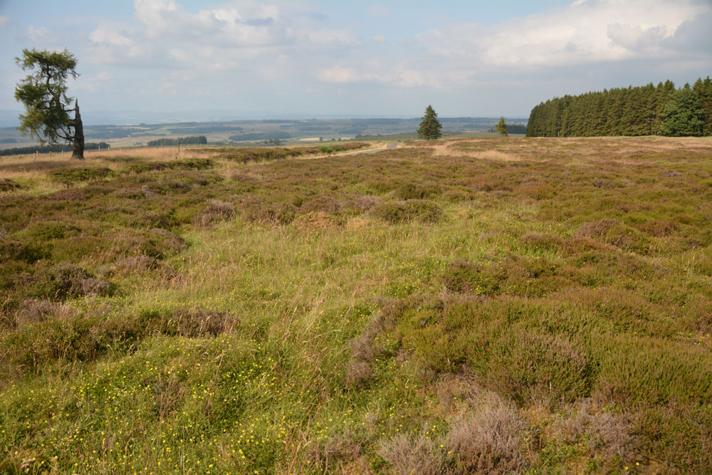
Wester Biggs (Dunblane) submitted by Anne T on 24th Jul 2018. Thinking this stone circle was just by the side of the road, and therefore relatively easy to see, we spent ages with our GPS wandering around trying to spot stones of any description. The heather and vegetation was calf deep, so any small stones would have been difficult to spot. However, 6m away from where our GPS said the circle was, there was only this slight change in vegetation (the shorter, green area). Either the stones are hidden, or they've been sadly removed. View looking NE, towar...
(View photo, vote or add a comment)
Log Text: Wester Biggs Stone Circle, Near Dunblane: Returning from tea and cakes in Dunblane, we resumed our search for megalithic sites. Next stop, hopefully, a not-before-photographed stone circle, right by the side of the road.
Finding the telephone mast and driving a couple of hundred yards further on, we parked at NN 86368 06240 and walked back south along the road, armed with the Canmore listing on my phone and the GPS.
Despite an intensive search of the land east of the road around this point, we were unable to locate any stones amongst the tall heather. However, there was a circle of gras/vergetation which was different from any heather at almost exactly the grid reference given by Canmore, so I photographed ‘the spot’. Andrew thinks the stones may have been removed. Always possible, but I think we need to return when the shrubbery has died back.
Westfield Farm Refuge Stone
Trip No.54 Entry No.1 Date Added: 11th Oct 2017
Site Type: Early Christian Sculptured Stone
Country: Scotland (West Lothian)
Visited: Yes on 30th Sep 2017. My rating: Condition 2 Ambience 2 Access 4
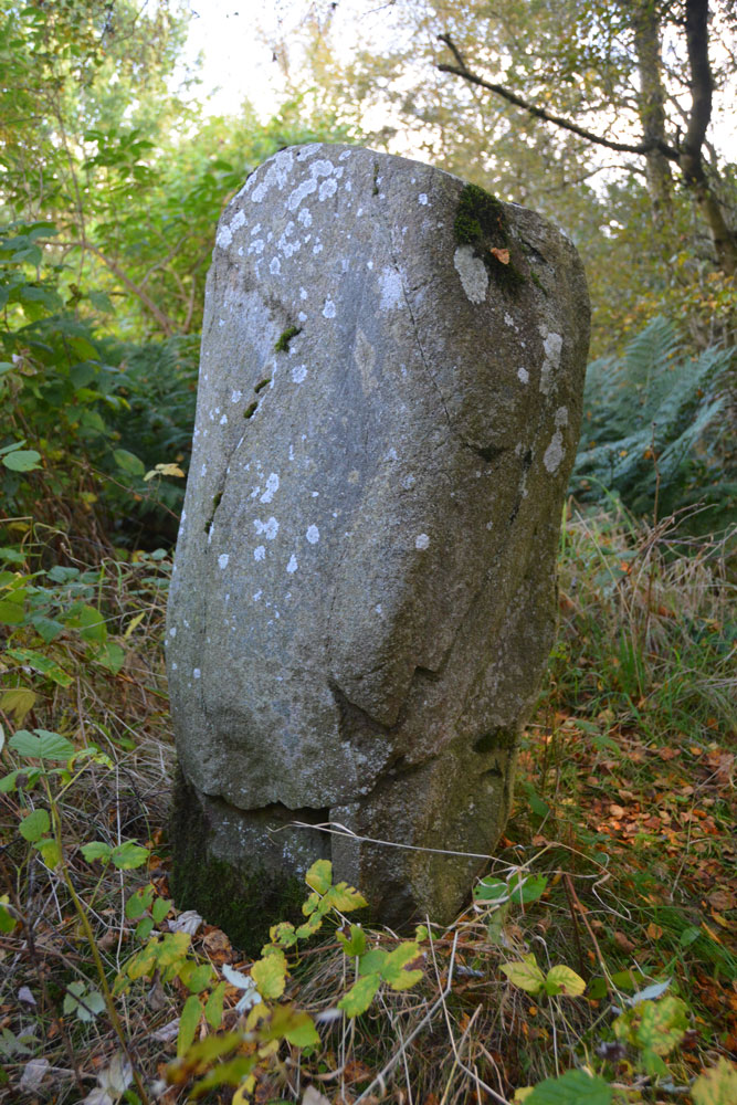
Westfield Farm Refuge Stone submitted by Anne T on 11th Oct 2017. One of the other faces of the stone, where it shows slight traces of damage, presumably from having been toppled and re-erected. If the 1998 excavation report from Historic Scotland is correct, this stone may be prehistoric and associated with a larger prehistoric site, maybe having been reused as a Refuge Stone after the establishment of Torphichen Preceptory.
(View photo, vote or add a comment)
Log Text: Westfield Farm Refuge Stone (possibly prehistoric), West Lothian: Our last day for exploring before heading home, and this was a day we’d set aside during the week to try and find some of the refuge stones associated with Torphichen Preceptory. We didn’t have a detailed map for this area, and didn’t pass a place to buy one, so had to make do with mobile phones and Canmore records.
The Westfield Farm Refuge Stone is situated to the east of Westfield Village, south of the B8047, near a ‘fish food factory’. Driving through Westfield village on the B8028, we turned right onto the B8047 and followed it round a couple of bends and found the factory. Just before the factory, located on a bend, I spotted a sign saying ‘Refuge Stone’, heading off south east through some wasteland.
We managed to park just by the sign, in a small layby which had been used for fly-tipping. Following the very vague footpath through the wooded area, this eventually disappeared and we were left surrounded by birch trees and weeds. Through the shrubbery there was a mound, and peering closer, there was a set of very overgrown steps that had been cut into the bank. Climbing up these, and hunting around some more, we finally spotted this much neglected stone virtually hidden in the weeds. I trod down some of the taller weeds to see the stone more clearly.
A treasure, but one hidden away in a tumble of brambles, nettles and detritus. It looked as if no-one had visited this stone in a long time. I was very pleased to have found it.
Weston Moor
Date Added: 1st Nov 2017
Site Type: Rock Art
Country: England (Yorkshire (North))
Visited: Yes on 25th Mar 2015. My rating: Condition 4 Ambience 4 Access 4
Weston Moor (541) submitted by rich32 on 27th Nov 2004. ‘Greystone Rock’ Weston Moor, North Yorks SE1843349648
A large rock with 20+ cups, 3 with 3 rings & a few grooves to boot.
This is ref number 541 in Boughey & Vickermans ‘Prehistoric Rock Art of the West Riding’.
(View photo, vote or add a comment)
Log Text: Needs moving to new site page: Weston Moor (Greystone Rock, Boughey & Vickerman 541)) Rock Art: We had fun and games getting to this site from Otley, as the road over the River Wharfe had been shut for roadworks, then the Weston Moor Road was also closed. We managed to park by the stile over the stone wall close to where Moor Road meets Weston Moor Road. The ground was very boggy indeed. We did have to stray a little way from the footpath to find this stone, but a dog walker was already in the field with his golden labrador.
Following the footpath west, we went in search of 'The Spectacles' at SE 1843 4965 but even with a 10 digit grid reference and after almost an hour of walking around the same spot, came to the conclusion it was buried too deeply under the turf, and we weren't going to dig around to find it.
Just north of the footpath from the spot where The Spectacles was supposed to be located, both husband and I thought we spotted what might be a cairn rising some 20 to 30 cms in a circle above the surrounding landscape. Given the number of boulders in the surrounding landscape (most part of larger outcrops) it is probable this might be a clearance cairn. The evening light helped this feature to stand out, and I enjoyed trying to photograph it.
Westwood Drive 01
Date Added: 19th Apr 2015
Site Type: Rock Art
Country: England (Yorkshire (West))
Visited: Visited (still working on) on 17th Apr 2015. My rating: Condition 2 Ambience 2 Access 5
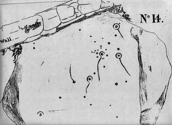
Westwood Drive 01 submitted by brigantia on 30th Nov 2006. The Comet Stone:
First known drawing of this carving done around 1878 and collated in J. Thornton Dale's previously unpublished "Collection of 14 drawings of cup-marked rocks deposited at Ilkley Library, prepared and presented by Dr. Call" in 1880.
(View photo, vote or add a comment)
Log Text: The Comet Stone, Ilkely: (we found the grid reference but queried if this was the stone): From the Panorama Stones, driving the 700 metres up towards the moor we parked by the footpath sign just west of the junction of Moorlands and Westwood Drive and headed up the steep path (with steps) onto the moor (to get nearer, Keighley Road travels up onto the moor and there is a small car park near to the grid reference given).
The grid reference led us to the back stone wall of a house. The grass had been badly overgrown and someone had put weed-killer down on this patch of ground, but nettles were springing up in between the dead undergrowth.
Walking up and down the wall and identifying several possible stones, the grid reference led us back again and again to the same stone over which the stone boundary wall between a garden and the moorland was built. Cheekily peering over the wall of the house, found the stone extended some way into the garden. It had shrubs growing over the sides and was covered by moss and twigs so it wasn’t possible to make out any of the rock art by eye.
Shame, as I thought I’d be the first to submit a photograph of this stone, but it will take a knock on the door of the house when someone is in to get permission to go round and look!
Wetheral Village Cross
Trip No.146 Entry No.3 Date Added: 29th Aug 2019
Site Type: Ancient Cross
Country: England (Cumbria)
Visited: Yes on 27th Aug 2019. My rating: Condition 3 Ambience 4 Access 4

Wetheral Village Cross submitted by Anne T on 29th Aug 2019. Standing just to the south east of the cross, looking north west towards the main part of the village, over the B6263 Steele's Bank. The cross head appears far older than the 'modern' shaft and steps.
(View photo, vote or add a comment)
Log Text: Wetheral Village Cross: a very pretty village. The steps and shaft of this cross are relatively modern, erected sometime between 1838 to 1844. The head of the cross is much weathered and appears older than the rest of the cross, although neither Pastscape nor Historic England mention this.
The cross is less than 150m to the west of the church and the River Eden. At the church, there is the remains of an Anglo Saxon cross shaft.
Whitcastle Hill
Trip No.93 Entry No.10 Date Added: 31st Aug 2018
Site Type: Hillfort
Country: Scotland (Scottish Borders)
Visited: Saw from a distance on 29th Aug 2018. My rating: Condition 2 Ambience 4 Access 3
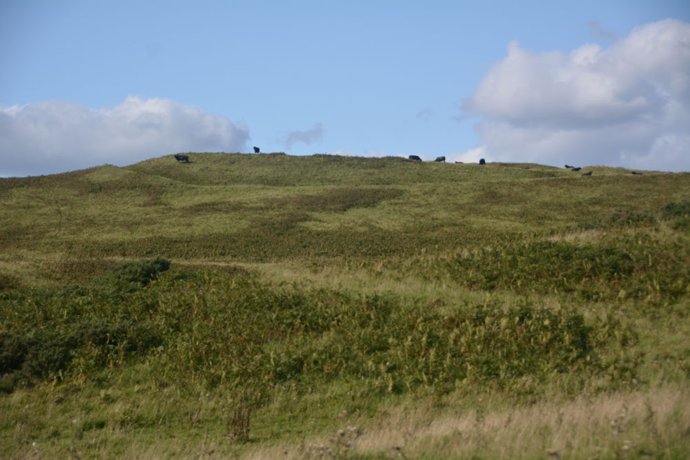
Whitcastle Hill submitted by Anne T on 31st Aug 2018. The groove of the outer defensive bank and ditch of this large prehistoric earthwork/hillfort can be seen at the top of the hill. Having already had one encounter with large cattle earlier in the day, we elected to return another day to take a closer look.
(View photo, vote or add a comment)
Log Text: Whitcastle Hill Prehistoric Earthwork: We decided to return to this site another day, having had a glimpse of the herd of very large cattle grazing over the site. Shame - the aerial photograph of this site on Canmore looks absolutely fascinating!
Whitcastle Sike
Trip No.93 Entry No.9 Date Added: 31st Aug 2018
Site Type: Ancient Village or Settlement
Country: Scotland (Scottish Borders)
Visited: Yes on 29th Aug 2018. My rating: Condition 2 Ambience 3 Access 4

Whitcastle Sike submitted by Anne T on 31st Aug 2018. This panoramic view is the only way I could capture the form of this settlement, and is a stitch of three photos. Here I'm standing on a small bank which rises out of the tributary of Newmill Burn which runs to the western side of the settlement, forming a pool of water. The land to the north and west is marshy, and it looks as if the land has been built up around these sides to form a raised enclosure. Parts of the settlement have been quarried out. At the left hand side of the hill above is t...
(View photo, vote or add a comment)
Log Text: Whitcastle Sike Settlement: The OS map shows a group of settlements and hillforts which can be found to the east north east of Broxholme Easter Loch, and today in a pretty remote spot down a gated road. We parked at NT 43929 11939, at the wide entrance to a farm track/field entrance and walked to the gate into the field opposite.
On the map, it looked like these settlements would be pretty easy to pick out. Unfortunately, on the ground, the land had been heavily quarried and tall grass and bracken made picking out the land shapes a little tricky. We managed to identify this settlement by its location next to the stream. Whilst it had been heavily quarried, walking around its outline made it easier to identify.
To the west of this settlement is a very pretty burn which trickles past, forming pools in several areas. To the west and north, the ground around the settlement is boggy, but the area of the settlement is a metre or so above the water and dry; it looks as if the edges of the oval enclosure has been deliberately built up to form a protective kerb.
White Cairn (Crouse)
Trip No.137 Entry No.16 Date Added: 29th Jun 2019
Site Type: Cairn
Country: Scotland (Dumfries and Galloway)
Visited: Yes on 18th Jun 2019. My rating: Condition 2 Ambience 3 Access 4
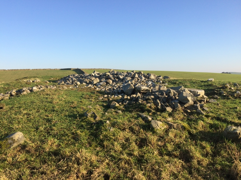
White Cairn (Crouse) submitted by markj99 on 31st Mar 2019. White Cairn (Crouse)
(View photo, vote or add a comment)
Log Text: White Cairn, Crouse: Our very last stop of this visit, and not a hugely dramatic one. The cairn has been used for field clearance, and there were lumps of concrete, barbed wire and old fence posts dumped at its western side.
Whilst I was photographing the holed stone, I got an excited cry from Andrew, to say; “You can see through the holed stone from the cairn”, so I wandered through the gate between the two fields and walked onto the cairn. Yes, he was right – there was a glimmer of light through the hole, although what it was sighted on, I’m not sure.
White Castle Fort
Trip No.52 Entry No.7 Date Added: 10th Oct 2017
Site Type: Hillfort
Country: Scotland (East Lothian)
Visited: Yes on 27th Sep 2017. My rating: Condition 3 Ambience 4 Access 5
White Castle Fort submitted by cosmic on 30th May 2008. Site in West Lothian:
Janet in first ditch
(View photo, vote or add a comment)
Log Text: White Castle Hillfort, East Lothian: This is in a wild and lonely spot. As we approached the hillfort, the mist started to roll in over the Thorter Burn Valley, the wind got up and whipped spots of rain across our faces.
I was amazed to be able to park right by the gate, where there were interpretation boards. Mind you, someone had left a pile of rubbish just inside the gate, which was horrible.
The ramparts to the south/west side of the fort are so crisp and clear, they could have been dug yesterday. The views down Thorter Burn valley were great, and to some extent the fort was protected by the hillside to the south.
We did see some evidence of disturbance on the top of the hillfort, together with what looked like an not-very defined house/structure to the northern side of the oval top of the fort. After being almost blown off the top of the hill, we decided on one last stop before heading back to Armadale for the night.
White Cross (Newcastle)
Trip No.148 Entry No.1 Date Added: 9th Sep 2019
Site Type: Ancient Cross
Country: England (Tyne and Wear)
Visited: Yes on 7th Sep 2019. My rating: Condition -1 Ambience 3 Access 4
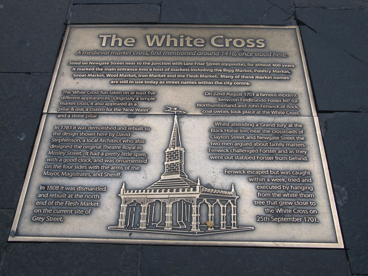
White Cross (Newcastle) submitted by Anne T on 9th Sep 2019. The metal plaque set into the pavement showing the location of the White Cross, first recorded in local history in 1410. The image shows how was rebuilt in 1783, having been a simple market cross, then a pillar and dial, then a cistern for water, then a stone pillar. We know in 1701 a white thorn tree grew nearby, as a man named John Fenwick was hanged from this tree after murdering a local MP called Fernando Forster.
(View photo, vote or add a comment)
Log Text: Site of the White Cross (Newcastle): Having typed 'Cross' and 'Newcastle' into Pastscape, I was surprised to find two crosses come up. So, armed with my GPS I set off to try and find these sites.
This cross used to be located at the corner of Newgate Street and Low Friar Street, north west of the junction of Clayton Street and Newgate Street.
I cross the road regularly here to walk through the lane to the side of the Gate, down towards West Walls and Akhbar’s, but this is a part of the pavement I’ve never been on. About 30m to the south east (following the pavement), outside what is now Debenham’s, a large metal plaque is set into the pavement.
The plaque reads: The White Cross. A medieval market cross, first mentioned around 1410, once stood here. / Sited on Newgate Street near to the junction with Low Friar Street (opposite), for almost 400 years, it marked the main entrance into a host of markets including the Bigg Market, Poultry Market, Groat Market, Wool Market, Iron Market and the Flesh Market. Many of the market names are still in use today as street names within the city centre. / The ‘White Cross’ has taken on at least five different appearances. Originally a simple market cross, it also appeared as a pillar & dial, a cistern for the ‘New Water’ and a stone pillar. / In 1783 it was demolished and rebuilt to the design shown here by David Stephenson, a local Architect who also designed the original Theatre Royal in Mosley Street. It had a pretty little spire, with a good clock, and was ornamented on the four sides with the arms of the Mayor, Magistrates and Sheriff. / In 1808 it was dismantled and rebuilt at the north end of the Flesh Market on the current site of Grey Street. / On 22nd August 1701 a famous incident between Ferdinando Forster MP for Northumberland and John Fenwick of Rock, coal owner, took place at the White Cross. / Whilst attending a ‘Grand Jury’ at the Black Horse Inn, near the crossroads of Clayton Street and Newgate Street the two men argued about family matters. Fenwick challenged Forster and as they went out stabbed Forster from behind. Fenwick escaped but was caught within a week, tried and executed by hanging from the white thorn tree that grew close to the White Cross on 25th September 1701.”
White Cross (Three Howes Rigg)
Trip No.15 Entry No.1 Date Added: 10th Apr 2017
Site Type: Marker Stone
Country: England (Yorkshire (North))
Visited: Yes on 9th Apr 2017. My rating: Condition 2 Ambience 2 Access 5
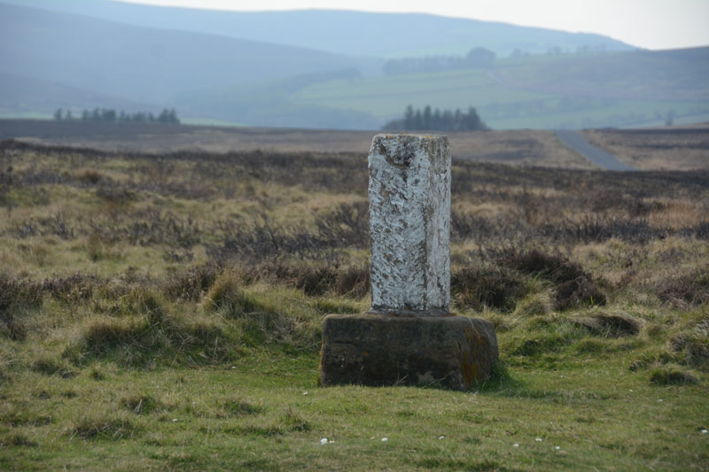
White Cross (Three Howes Rigg) submitted by Anne T on 10th Apr 2017. Standing on Smeathorns Road looking across to the stone and its earlier cross base, with the moors of the National Park in the distance to the west.
(View photo, vote or add a comment)
Log Text: White Cross, Three Howes Rigg, North Yorkshire: Approaching the Three Howes Tumuli on Smeathorns Road, we spotted this "White Cross" marked on the map at the road junction with Commondale Village. Stopping and running across the road in between the fast moving traffic, I took some photographs. This cross is listed by Historic England as entry 1250385, and is described as an "early to mid-C19 boundary stone on medieval base of wayside cross." The views across the National Park to the west would have been spectacular but for mist.
White Raise Cairn
Date Added: 1st Jul 2014
Site Type: Cairn
Country: England (Cumbria)
Visited: Yes on 28th Jun 2014. My rating: Condition 3 Ambience 4 Access 3
White Raise Cairn submitted by baz on 3rd May 2003. White Raise Cairn (NY489224). This 20m. long cairn has an exposed central cist.
(View photo, vote or add a comment)
Log Text: From the footpath leading from the Cop Stone to The Cockpit Stone Circle, this cairn lies after the Cairn Circle, on the right hand side of the footpath.
It initially appears unremarkable as a large mound with stones marking the extent of the cairn, but walking up the slope I came across the excavated burial chamber, which was a great surprise.
It's clearly a favourite with sheep, as the stones retain the heat from the sun, and they were unmoving as we wandering around.
There are great views across the valley towards Ullswater, although it's not quite possible to see the lake from the cairn.
Well worth a visit.
Whiteadder Reservoir
Trip No.105 Entry No.2 Date Added: 4th Nov 2018
Site Type: Cairn
Country: Scotland (East Lothian)
Visited: Yes on 27th Oct 2018. My rating: Condition 2 Ambience 4 Access 4

Whiteadder Reservoir submitted by Anne T on 4th Nov 2018. This appears to be all that is left of the stone setting and cairn, although the grass and bracken were mid-calf height, so other stones could have been hidden underneath. The cairn is easily identifiable, as it stands above the surrounding ground level, with a stone emerging from one side of the centre of the mound. This view is looking west north west over the cairn.
(View photo, vote or add a comment)
Log Text: Whiteadder Reservoir cairn and stone setting: We parked at NT 64304 64291 and walked along the first part of the Herring Road onto the land high above Whiteadder Reservoir with the GPS to find this stone setting and enclosure, with the cold winds whipping around our ears. From what I'd read on Canmore, I expected something a little different from what we found on the ground, which was in effect a cairn.
Despite walking round the area looking for these stones, and trying to feel for stones under our feet, we only found what looked like a cairn with one stone sticking up out of it. It is the same area as that given by Canmore. A 1971 entry says the enclosure has been completely destroyed, except "three small stones exist." As the grass and heather was calf deep, it was probable the stones were hidden underneath.
Looking at the map on the Canmore record, the cairn we spotted is in the correct location for the stones, with the enclosure about 20m to the south, identifiable as there is a flat, circular area in the bracken. Beautiful views over the reservoir.
The sign on the ‘public path’ signpost reads: Heritage Path, Herring Road. This old path is named because it was used by the fishwives of Dunbar when carrying massive creels of herring to market in Lauder. This track was one of many different routes that were used by the fishwives over the centuries as paths became eroded and were replaced.” And “Herring Road to Dunbar, 12.5miles via Dunbar Common and Halls”.
Whitefield Loch Crannog
Trip No.137 Entry No.11 Date Added: 28th Jun 2019
Site Type: Crannog
Country: Scotland (Dumfries and Galloway)
Visited: Saw from a distance on 18th Jun 2019. My rating: Condition 1 Ambience 3 Access 4
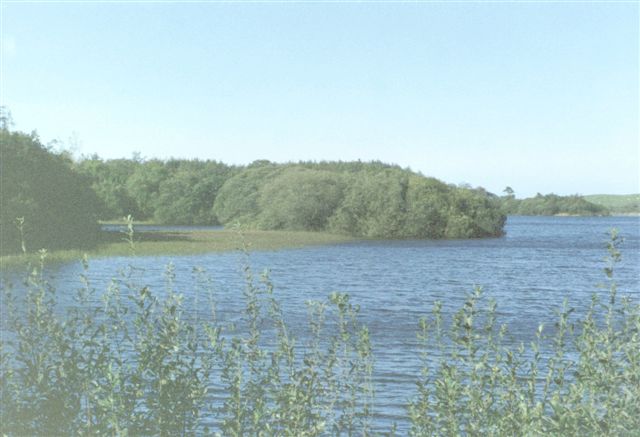
Whitefield Loch Crannog submitted by cosmic on 9th Oct 2004. Viewed from East
(View photo, vote or add a comment)
Log Text: Dorman's Island/Loch Whitefield Crannog (east): We went seeking Dorman’s Island crannog at the eastern side of the loch. Having missed the fisherman's road, and the road being too narrow to turn round, we ended up parking in the fisherman's car park at NX 23531 54887 and walked down the angler’s slipway but the tree cover was too dense to really make out anything. We could just about see round the small headland to our eastern side, and took a couple of photographs and may have just caught the crannog.
Looking at the Canmore map there is also a Tree Island crannog to the western end of the loch.
Whiteholme Rig
Trip No.4 Entry No.3 Date Added: 7th Aug 2016
Site Type: Stone Circle
Country: Scotland (Dumfries and Galloway)
Visited: Yes on 31st Jul 2016. My rating: Condition 2 Ambience 2 Access 3

Whiteholme Rig submitted by Anne T on 7th Aug 2016. The first stone in this ancient monument that we saw from the edge of the adjacent field. The farmer hadn't made it easy for visitors to reach this stone circle, and it was a real shame the ground had been left to go wild, which made it difficult to make out any monument at all.
(View photo, vote or add a comment)
Log Text: Seven Brethren Stone Circle, near Lockerbie: I was surprised to find this was so near where we used to live at Corrie. But when we lived here, with three young children, we didn't have the same interests as we do now, so (although the kids say we traumatised them by taking them to so many monuments) we never visited. We parked by the gate to the disused quarry near Standburn farm, hopped over the gate and followed the track up to Whiteholm Rigg. At present, along the top of this low ridge, a row of trees follows the trackway. Right at the end, motorway barriers have been erected to form a large, robust enclosure, gated at both ends, which looks as if it's used as a stock enclosure. Beyond the gate at the eastern end, cows and their calves grazed in the lush grass on the hillside below. Walking along the edge of the field, small toppled stones could be seen in the grass, which had been left to grow long and untended around the stones, but mown in the area beyond. Walking around the tussocks we spotted the remains of 6 stones, but how unimpressive this site is. If we hadn't have known that this was a stone circle, we would have thought these were just a few outcrops in the grass. Such a shame.
A funny (now) moment occurred at the end of our visit. Going back to clamber over the gates into the enclosure, the bulls in the field (of which there were several, excitable!) came to investigate. One stood pawing the ground with its front hoof. Husband climbed the 8 ft tall motorway barrier, which left me stuck in the stone circle field. However, husband managed to distract the cattle whilst I climbed over two gates to get back to safety!
Whithorn Museum
Trip No.137 Entry No.13 Date Added: 29th Jun 2019
Site Type: Museum
Country: Scotland (Dumfries and Galloway)
Visited: Yes on 18th Jun 2019. My rating: Condition 4 Ambience 5 Access 4

Whithorn Museum submitted by Sunny100 on 24th Sep 2010. St Peter's Stone no 2 in the museum.
(View photo, vote or add a comment)
Log Text: Whithorn Visitor Centre, Museum, Priory and Roundhouse: I can honestly say that I have never felt so welcomed anywhere as being here as a visitor to Whithorn. From the moment we stepped into the Visitor Centre café for refreshments before buying our tickets, then looking around the round house, museum and priory, the staff were attentive, welcoming and made sure we were well looked after.
The café had good food at very reasonable prices, and the prices to get into the museum and priory were well below those we'd expected. A small guided tour had just started, but as we wanted to wander round on our own, we elected not to join. However, round at the museum, we learned that we were only able to get into the round house with a guide present, so we were very kindly let into the round house grounds to join the tour for ten minutes or so.
The interior of the round house was much, much bigger and far more practical than I'd ever imagined. The guide spoke with great knowledge about day-to-day living within this space and we had chance to look around the outside at the various tools and farming methods they were using.
We left to go and explore the museum and I was stunned to see the collection of over 60 early Christian stones displayed in this space. I had previously checked with the Whithorn Trust that is was OK to take photographs of the stones for my walk/photo journal, and was told this was OK if it was 'for personal use'. So armed with my camera, I double checked with the guide. The knowledge of the staff member (Ruaridh) and the time he took to talk to us was extraordinary.
After walking round the Priory and trying to recreate some of the photos in the guide book, we returned to the museum for another wander round, but it was closing at 5pm, so we needed to be swift. The one downside was that there was no guide book describing each of the stones, but I was allowed to use the Museum Interactive Display Screen, and to photograph the majority of the screens (a good job, as trying to find the stones on Canmore has proved a little tricky, as many of their entries don't have photographs).
We had time to go back to the Visitor Centre to buy some postcards, and I had my eye on an expensive reference book. With only a few moments to spare before closing, I decided not to buy it, but on getting home regretted my decision. On emailling the team the next day, they organised for me to buy the book, pay over the phone, and arranged for postage. Great customer service!
I also asked for, and received permission, to post a visit report and photographs to the Portal.
I just wish I'd had a whole day to spend here, and would love to return. 150/100 for visitor experience.
