Contributory members are able to log private notes and comments about each site
Sites Anne T has logged. View this log as a table or view the most recent logs from everyone
Raise Howe Cairn
Date Added: 9th Sep 2014
Site Type: Cairn
Country: England (Cumbria)
Visited: Yes on 7th Sep 2014. My rating: Condition 2 Ambience 3 Access 5
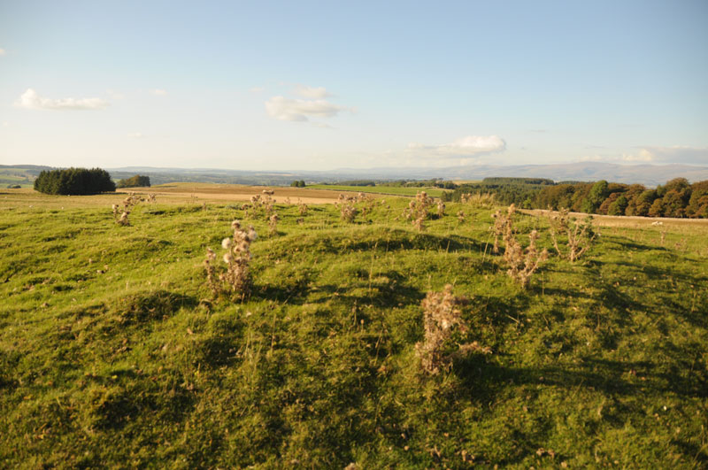
Raise Howe Cairn submitted by Anne T on 9th Sep 2014. Standing on top of Raise Howe Cairn looking north/north-east with Maskriggs Wood at the top right hand side of the picture.
(View photo, vote or add a comment)
Log Text: Raise Howe Cairn, Cumbria: From Gamelands Stone Circle, 1 km east of the village of Orton, we drove back into the village and found the B6260 which heads over the moors towards Crosby Ravensworth and Appleby-in-Westmorland. The road climbs steeply from Orton, leading up onto Orton Scar, Beacon Hill and Gaythorpe Plain. We stopped quickly to see if we could see Gamelands within the context of the landscape, but it seemed to be hidden within a dip beneath Knott Hill in the distance.
The B6260 is a very fast road and once on moorland we needed to be careful of the sheep meandering at the side (and sometimes across) the road. At first glance, you might be forgiven for thinking that Raise Howe Cairn is just a spoil heap next to a quarry, but parking on the verge opposite and walking up to the cairn, its shape and function become apparent. Limestone rubble appears under the soil and turf, and at the top of the mound, there are humps and bumps which make it appear as if the mound has been excavated (although the English Heritage Pastscape records say it has not been).
Our first reaction was “what a spot to be buried in” – there are 360 degree views all around and the landscape as a whole seems too large to take in. The Scale Beck valley lies to the east, the Lyvennet Beck valley to the west and the river Lune in the distance to the south.
Having checked the English Heritage records on my return home, they tell me this is a turf covered, slightly mutilated oval mound of earth and limestone rubble up to 1.2 high, maximum dimensions 23m x 18m and dates from the Bronze Age.
This seems to be a popular picnic spot as there was a lot of rubbish lying around, and a sign next to the quarry says ‘no motor vehicles’ as if someone might drive over the edge of the quarry face.
Not particularly a place to travel to just to see the cairn, but well worth stopping to appreciate the beauty of the landscape and the burial practices of our ancestors.
Kalmott cairn circle
Date Added: 9th Sep 2014
Site Type: Ring Cairn
Country: England (Cumbria)
Visited: Yes on 7th Sep 2014. My rating: Condition 3 Ambience 3 Access 4
Kalmott cairn circle submitted by VapourTrail on 28th Sep 2009. Kalmott cairn on a typically dull Cumbrian day in September.
(View photo, vote or add a comment)
Log Text: Kalmott Cairn Circle, Oddendales, Cumbria: Arriving at Oddendales to see the cairns marked on the OS map, just past the footpath sign pointing us to the Coast-to-Coast/Crosby Ravensworth, we were surprised to come across what appeared to be a small cairn with a ring of stones with a central cluster. It’s not marked on the Ordnance Survey maps.
Sitting between the stone wall of Oddendales Farm on the left and the modern trackway we were walking on, it seemed surprising that this cairn had survived intact. Not been able to find out any more about it, which has been frustrating. I record a photograph here to show what we saw. I’ve now only just found a photograph and brief description about this on Hedge Druid's web site; Hedge Druid says he then submitted it to the Portal for inclusion.
Having taken a couple of photos, we then made our way up to Seal Howe Cairn.
Seal Howe
Date Added: 9th Sep 2014
Site Type: Cairn
Country: England (Cumbria)
Visited: Yes on 7th Sep 2014. My rating: Condition 3 Ambience 3 Access 4
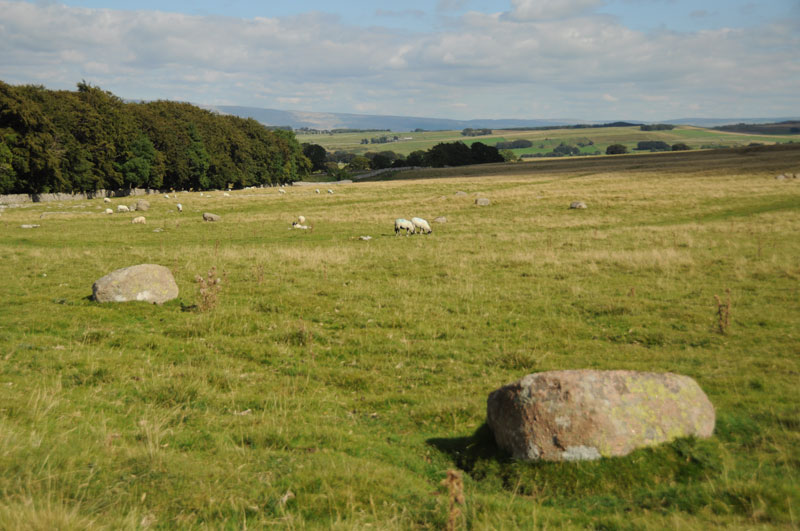
Seal Howe submitted by Anne T on 9th Sep 2014. To the left hand side of the path leading to Seal Howe, we were amazed at the number of red granite rocks lying in the landscape. They stood out clearly from the limestone pavement bedrock.
(View photo, vote or add a comment)
Log Text: Seal Howe Cairn, Oddendale, Cumbria: Having passed Kalmott Cairn Circle by the stone wall next to Oddendale, we made our way to the Bield and Cairn Circle marked on the map.
All around, the limestone pavement/bedrock pushed its way above the grass; it was particularly spectacular on the right hand side of the path. My husband and I were both transfixed and amazed at the number of red Shap Granite stones in the landscape and wished we had a GPS device to map the locations of some of the stones, as there seems to be a much larger prehistoric landscape here. These red granite stones must have been transported up to the site from where they were quarried (which a quick check on the geology of the Lake District indicates just south of Shap).
The modern cairn built on top of Seal Howe wasn’t quite what I was expecting, but the views over to Yorkshire to the east were spectacular. To the north-north-west, the scar of Hardendale Quarry was easily visible.
From Seal Howe, we made our way over the west side of the track to where the map promised us a ‘cairn circle’. This was a treat I wasn’t expecting – the Oddendale Stone Circle.
Oddendale
Date Added: 9th Sep 2014
Site Type: Stone Circle
Country: England (Cumbria)
Visited: Yes on 7th Sep 2014. My rating: Condition 4 Ambience 5 Access 4
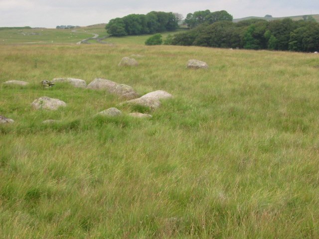
Oddendale submitted by stu on 20th Jul 2002. 592129 NE Lakes Sheet.
Excellent double ringed circle, a must see.
(View photo, vote or add a comment)
Log Text: Oddendales Stone Circle, Oddendale, Cumbria: From Seal Howe, heading directly north west across the pasture to the ‘cairn circle’ was interesting walking, as the ground was lumpy and bumpy with hidden stones underneath. I was not prepared for what we found – a beautiful stone circle of some 34 stones (if I counted correctly) with an inner circle that looked like it had been a cairn or inner mound.
I wish I had a wide-angled lens to capture the beauty of this stone circle in the landscape (if you can successfully ignore the scar of Hardendale Quarry in the background, which we did). Even with my husband perched on top of a nearby stone to get a higher angle, we couldn’t achieve the shot we wanted.
Nearby are also other large red granite stones that we thought might have formed an avenue (but we are quite imaginative people, and would love to have the skills to interpret the prehistoric landscape).
Walking back to the car by the hamlet of Oddendale (according to the Visit Cumbria website, not simply just a farm), the limestone pavement is impressive.
Driving onto Gamelands Stone Circle, it hit me how large the prehistoric landscape is around Shap, and how important an area it must have been in the past.
Iron Hill North
Date Added: 9th Sep 2014
Site Type: Stone Circle
Country: England (Cumbria)
Visited: Yes on 7th Sep 2014. My rating: Condition 3 Ambience 4 Access 4
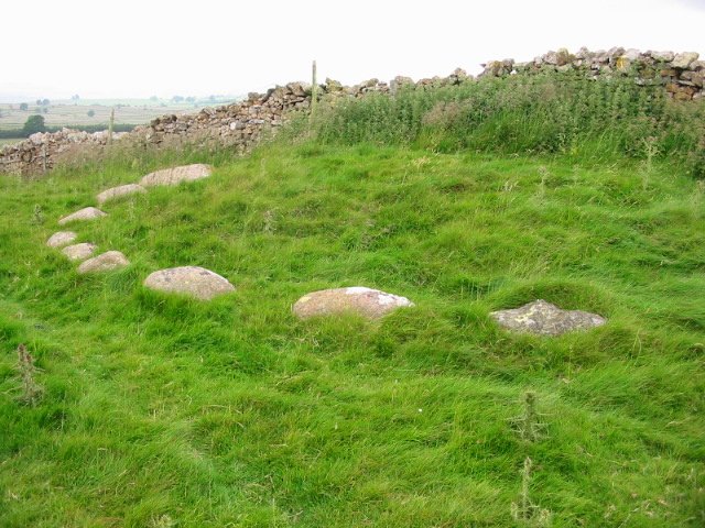
Iron Hill North submitted by stu on 21st Jul 2002. 596147 NE Lakes Sheet.
10 stones remain on one side of a wall.
First stone on right is limestone the rest granite, this is found also at the Gamelands circle, Gunnerkeld and Iron Hill south a few metres away.
(View photo, vote or add a comment)
Log Text: Iron Hill North Cairn/Stone Circle: From Castlehowe Scar Stone Circle, we drove down the single track road towards Hardendale Quarry, with Castlehouse Scar wood on our left hand side. Where the wood ends, the road turns a sharp left and right. Just where the road turns right, there is a marked footpath, walled on both sides, running uphill towards Harberwain Rigg. It is an easy walk despite the path being a little overgrown.
There is a cairn and a cairn circle marked on the Ordnance Survey map. At first all we could see was a limestone scar running to our right, then the first of the stones poked their heads above the grass in front of us, forming a semi-circle around slight mound against a stone wall above us. The stones shone pink in the bright sunlight. If I’m allowed to use the word, this was another ‘cute’ circle and I felt privileged to see it. In the background, the bright water of the lake at the bottom of Hardendale Quarry with its muddy gray ramps and walls contrasted sharply, horribly and incongruously with this wonderful little monument.
Out of interest, we walked a little way up the footpath to where it dissects another running northwards and peered over the gate to see the other side of the circle. I saw one stone peeping (just) above the grass, but couldn’t be sure it was part of the circle.
With a party of walkers making their way down hill towards us, we ventured south to find the other stone circle or cairn at Iron Hill South.
Iron Hill South
Date Added: 9th Sep 2014
Site Type: Stone Circle
Country: England (Cumbria)
Visited: Yes on 7th Sep 2014. My rating: Condition 3 Ambience 4 Access 4
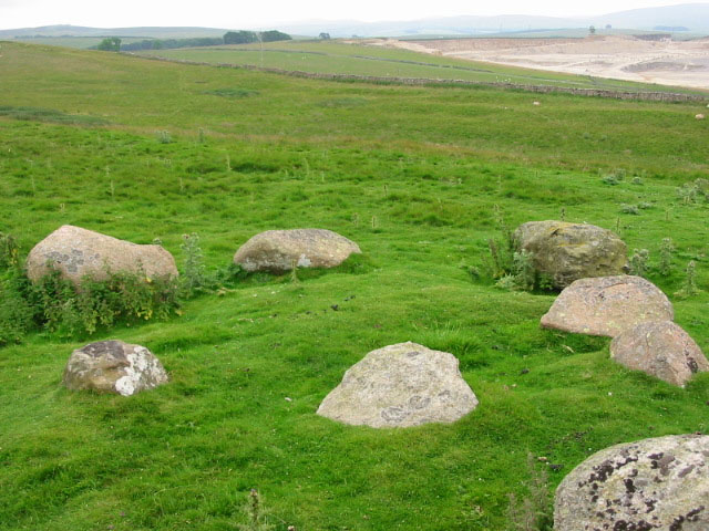
Iron Hill South submitted by stu on 16th Jul 2004. NY596 148.
The small, slightly odd circle of Iron Hill South.
(View photo, vote or add a comment)
Log Text: Iron Hill South Cairn/Stone Circle, near Oddendale, Cumbria: Just 50 metres south of Iron Hill North Cairn/Stone Circle there is another monument, not far from a limestone scar (small modern quarry or crag?). It can be easily seen from Iron Hill North.
Whilst we were looking at this monument, we could hear a party of walkers were coming down the hill towards us. With loud voices, one of the men was proclaiming ‘there’s a stone circle just over here’. Waving his GPS device as he approached us, we were quizzed about which was the cairn and which was the stone circle (both are marked as a cairn and a cairn circle on our OS map), then the walkers left without really taking a look. This amused me greatly, although I wished I had his GPS device.
I couldn’t make up my mind as to whether this was a cairn or another stone circle; instinct said ‘cairn circle’ as there was a grouping of stones in the centre.
After soaking in the atmosphere of this place, we left to go onto Oddendale hamlet, further south along the single track road, and effectively a dead end, to see Seal Howe cairn and the cairn circle nearby.
Fontburn B
Date Added: 7th Sep 2014
Site Type: Rock Art
Country: England (Northumberland)
Visited: Yes on 5th Sep 2014. My rating: Condition 3 Ambience 4 Access 3
Fontburn B submitted by SolarMegalith on 16th Jun 2013. Decorated horizontal surface of Fontburn B boulder (photo taken on June 2013).
(View photo, vote or add a comment)
Log Text: Fontburn B (Rock Art), near Rothbury, Northumberland: Fontburn Reservoir is just over 12 km north of Wallington and 9 km south-south-west of Rothbury. Despite it not being very far from where I live I can’t say I’ve ever heard of it this reservoir, yet it’s clearly very popular with fishermen and has a cafe that’s open at weekends. On the map, there were no clear roads up to the reservoir yet two car parks clearly marked, so this was a little bit of a voyage of discovery. And there it was - a single track road with passing places that wound its way up past Roughlees Farm and the Goats On The Roof cafe to the dam.
Parking at the southern-most end of the car park, as far as we could get past the fishing shack, we walked clockwise around the lake. From the car park, heading southwards, a barrier blocks entry to cars, but the footpath turns and continues westwards along a grassy track, wending through the trees with the reservoir to the right hand side. There are good, solid boardwalks in the boggiest areas and wooden guard rails at some of the edges of the lake (but not always in the steepest places); being someone who hates sheer drops, the height down to the lake wasn’t too bad, and it was an easy path to walk on. About a third of the way around the southern side of the reservoir, the path divides. The small track which follows the edge of the reservoir enters a nature reserve and disappears amongst the trees; the footpath signs turn you left, leading up a slight hill to a gate (with a very heavy spring) which took you onto Access Land (avoiding the nature reserve) where the terrain was much rougher and more difficult to walk with humps and bumps and small streams to cross.
We missed the first stone, Fontburn N02, at grid reference: NZ0395993186, as in the trees along the riverside walk it was difficult to gauge how far we had gone. By the time we came to the access land and orientated ourselves using the fence boundaries and the sheepfolds, we had to walk a fair way back to see NO2, and decided to go back to it on the return journey. But an hour later, the skies were heavy and grey and it felt like thunder, so we returned to the car along the easier footpath to the north of the reservoir.
As an aside, we came upon an unknown Rock (Grid reference: NZ0310993518) just to the left hand side of the path. Just into the access land, we came upon what looked like the remains of a cairn, but couldn’t be sure as field drains had been dug into the field around it, but there was a clear oval shape in the grass, topped by stones. Just after this, we found the said stone sitting alongside the left hand side of the footpath, although it wasn’t clear if there was rock art on it. There was also a smaller stone located alongside with other marks on it. Looking this up on the ERA database and the Portal, there are no references to this rock at all, so the marks are just weathering or perhaps where ploughs have hit it [note: we missed Fontburn N01, which is located between the two halves of the car parks at the eastern end of the reservoir! grid reference: NZ 04897 93466].
Continuing along the footpath, and rounding the right hand turn it takes, Fontburn B came clearly into view to the left of the footpath. It looks like an erratic dropped at the side of the path above the (now) reservoir. It’s impressive in size, although it looks as if the northern edge has been quarried away as there is a sheer, rather than a rounded face on this side.
A few cup marks were visible from the ground, and many more visible by climbing a few metres up the hill to the south. Even better was just to carefully hop up the side of the rock and sit on top of it, just like our ancestors must have done all those thousands of years ago. In the sunshine, it was a remarkable spot, although dominated by the ground rising to the south. In the past, there would have been clear views down to the river below.
We then carried on following the footpath to where it loops back round to the reservoir, and goes back onto the Northumberland Water Board Water Trail and onto Fontburn Four-Poster.
Doing some research on the web since getting home, I’ve discovered that Fontburn B is a published landmark/site to see on the National Trust Greenleighton Moor Walk around the Wallington area.
Fontburn Four-Poster
Date Added: 7th Sep 2014
Site Type: Stone Circle
Country: England (Northumberland)
Visited: Yes on 5th Sep 2014. My rating: Condition 3 Ambience 4 Access 3
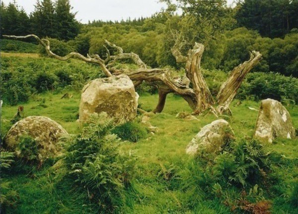
Fontburn Four-Poster submitted by Bladup on 30th Dec 2013. Fontburn Four-Poster.
(View photo, vote or add a comment)
Log Text: Fontburn Four Poster, near Rothbury, Northumberland: This was a continuation of our very pleasant meander around Fontburn Reservoir from Fontburn B.
Crossing over Fallowlees Burn and just starting to head back along the northern edge of the reservoir the Stone Circle comes into view on the horizon at the top of the hill.
My first impression is that this is a cairn, as there are many more stones around than the four uprights, but then why would two of the stones have cups on the top surfaces if they were meant to be covered up? Perhaps the site was used in antiquity? This site is likened to Goatstones Four Poster, but I’m not sure I saw much similarity (I'll need to sit and compare images).
Sitting on this small plateau with Dod Knowe hill rising up behind, and with the burn trickling pleasantly down below, this small stone circle is in a peaceful and lovely spot. It’s also very atmospheric, with the very old (hawthorn?) tree lying in broken pieces at the feet of the circle. There appear to be clear cup marks on two of the stones.
It was a very misty day, so we couldn’t make out any of the distant landmarks, so after lingering for a while to absorb the atmosphere, we made our way back to the marked path and walked back round to Fontburn Dam.
The place to seek permission to visit Fontburn Stone Circle is Newbiggin Farm, north of the reservoir, although there are references to finding the stone circle on the notice boards by the reservoir.
Hexham Abbey
Date Added: 24th Aug 2015
Site Type: Ancient Cross
Country: England (Northumberland)
Visited: Yes on 3rd Sep 2014. My rating: Condition 3 Ambience 4 Access 5
Hexham Abbey submitted by Thorgrim on 18th Sep 2004. Roman tombstone now in Hexham Abbey NY773684
Memorial to Flavinus a Roman Standard hero
(see same design in Colchester Castle)
(View photo, vote or add a comment)
Log Text: Hexham Abbey, Northumberland: St Acca and Spital Cross Shafts.
23rd August 2015: Took my daughter and her husband to the new visitor centre after a lovely lunch in the Refectory (much recommended). We had great fun dressing up as Queen Ethelreda, Bishop Wilfrid and Augustinian monks). There was brass rubbing and computerised caligraphy to try. As well as interactive displays for the young at heart, there is also a serious section with a display of Anglo Saxon and Viking stones, a model of, and press-screen history of the abbey. A great time was had by all and I found not only the Spital Cross but a number of other stones I'd been searching for in the Anglo Saxon Corpus of Stone Sculpture and not found in my previous visit. Well worth coming.
3rd September 2014: Acca succeeded St. Wilfrid as the Bishop of Hexham in AD709, withdrawing (or also said to have been deposed) from office in AD732 and dying in AD740. The two crosses purported to mark the head and foot of his grave stand in the south transept of Hexham Abbey (on the right hand side as you enter the main church from the porch), next to St. Etheldreda’s Chapel. However, there is some confusion as to whether or not these two cross shafts are St. Acca’s grave markers, or whether the larger may just be a preaching cross set up in the first years of Christianity. However, Hexham Abbey proudly displays them as St. Acca’s.
The two cross shafts stand side by side. The larger cross shaft is called ‘St. Acca’s Cross’. The second, smaller cross-shaft, is known as the ‘Spital Cross’.
I approached a steward to ask if was OK to take some photographs, and he told me it was, providing I didn’t use flash. He knew a fair bit about the crosses, very kindly photocoping a leaflet on Acca and Acca’s Cross for me to take away. He told me that St. Acca’s cross had been broken up in antiquity and the pieces scattered, being put back together in the 19th century – there is a plain piece of modern stone where the cross arms would have been. Interestingly, he told me that the lower portion of St. Acca’s cross was found at nearby Dilston, where it had been used as a lintel in a farmhouse door.
St. Acca’s Cross is most gloriously decorated with vine scrolls which interleave and entwine.
The Spital Cross, as described in his leaflet: “was found at Spital which is 1.3 km west of Hexham, and stood near a house on the site of the medieval Hospital ofSt. Giles.” This cross shaft has very interesting vine scrolls on three sides and a crucifixion scene on its front face.
The area within the Abbey immediately around the crosses is used by the Stewards who greet people who come to look at the Abbey and to display information for visitors and worshippers – which strangely echoes their possible past uses as preaching crosses. When I was there, most people actually walked by without noticing them, although because I was taking photographs, a couple of people came up to ask more.
Opposite both cross shafts, and at the bottom of the Abbey night stair, is a Roman tombstone which dates from the first century.
Robin Hood's Well (Chollerton)
Date Added: 4th Sep 2014
Site Type: Holy Well or Sacred Spring
Country: England (Northumberland)
Visited: Yes on 3rd Sep 2014. My rating: Condition 1 Ambience 2 Access 4

Robin Hood's Well (Chollerton) submitted by Anne T on 4th Sep 2014. Walking across the field from the footpath from the B6342 to Well House Farm, this is the first view of Robin Hood's Spring/Holy Well. [I double checked the grid reference to ensure I had the right place].
(View photo, vote or add a comment)
Log Text: Robin Hood's Well, Colwell, Northumberland: I last visited Colwell on 13th June 2014, when we went in search of the old chapel (located in someone’s back garden, so not accessible without permission), the two wells in the centre of the village – Coley’s Well and Pricky’s Well – and Blue Crags Hill Fort (also known as Brecken Hills Fort).
Both Coley’s Well and Pricky’s Well are at the eastern edge of the village at the cross-roads where the northern most side-road from the A68 leads eastwards to meet the B6342. Whilst part of the area’s rich history, neither well is pleasing to the eye (very similar to Meg’s Well in Aydon). They sit alongside a small stream, the Coal Burn.
About 200 yards south of the village is a third well, Robin Hood’s Well. As this is recorded as a holy spring, I was keen to see this, so stopped off whilst I was passing by.
There is parking in a layby by the road junction mentioned above, near to Pricky’s Well. From here, it is a 200 yard walk south down the B6342 to the footpath which leads eastwards towards Well House (grid reference: NY 96641 74198. This is a very busy little road, with no footpaths, so I had to keep stepping up onto the grass verges to avoid the traffic.
Robin Hood’s Well is almost on the field boundary next to the road. To reach it, on opening the gate to the field by the footpath sign, you need to turn right immediately and walk 50 yards or so to the south (towards the woodland). The first view is of a post sticking up from marsh grass, which looks like a fence post. As you get closer, you will see a stone lying next to the post. A closer look shows a pool of water around the post and stone, and boggy ground surrounding it – a shame it is so unremarkable for such a historic well.
There is a further spring which appears 100 yards further south down the field, which has a clearer water course marked by stones on either side, but was dry (although the ground was very boggy) on the day of my visit.
At (or near) Well House Farm (according to the Hexham Courant and Visitor UK web sites) there is also a fourth sulphurous well, The Bore Well, reputed to improve fertility and which is well cared for with a proper housing.
St Michael's Church (Warden)
Date Added: 5th May 2019
Site Type: Ancient Cross
Country: England (Northumberland)
Visited: Yes on 3rd Sep 2014. My rating: Condition 4 Ambience 4 Access 5
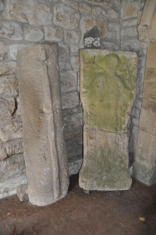
St Michael's Church (Warden) submitted by Anne T on 4th Sep 2014. The Warden Man, carved on a stone split from a Roman altar, situated on the western wall of the porch. Another grave cover stands to it's left hand side in this image.
(View photo, vote or add a comment)
Log Text: St Michael's Church, Warden, Northumberland: On the way back from Robin Hoods' Holy Well at Colwell, I detoured via Warden, a church we’ve visited before whilst visiting the Roman enclosure on the hill above Warden, but not really seen. On this last visit, on approaching St Michael’s, we heard a saxophone being played nearby – the same tune repeated over and over (and very badly (sorry, player!)). As we were going into the church, another couple were coming out. The noise of the saxophone got louder and louder, and a man appeared to serenade us. He proved a bit of a nuisance, so we escaped to the Boat pub for a drink, only to be closely followed by the saxophone and it’s player who then sat next to us.
The current church is 18th century, but built on much older foundations, originally thought to be the site of the oratory of the Anglo-Saxon saint St. John of Beverley.
On today's visit, I met a lady going into the church with some leaflets, and got chatting to her. She told me the same man still lives in the village, and she’d just come from his house. She also told me the Parish had just had the church restored and how proud they were of it now, pointing out the 7th century cross at the south side of the tower, by the porch.
The lady didn’t know anything about the Warden Man, so as we went into the porch, I spotted it and pointed it out. “Perhaps we should scrape the moss of it”, she exclaimed. I gulped loudly. “I think you should leave it as it is – you need to ask a professional before doing that”.
There are some fascinating features within the church – the 11th century arch at the base of the tower includes a roman stone, and the Saxon gravestone which is on the floor in the chancel (northern wall, next to the choir stalls, just before the altar rails).
The Saxon gravestone, in the right light, shows tegulations (a word I hadn’t heard of before I picked up the guide book for the church! – “use light and shade to create a distinctive appearance”) to look like a tiled roof. Outside, there is the 7th century cross (which the Keys To The Past record says is 7th to 11th century), gravestones with iron hoops over them to prevent body-snatchers taking the bodies and a Saxon tower.
In the porch, opposite the Warden Man, is a collection of grave stones. There was a really interesting small roundel, with what looked like knot-work on it. I was unable to find out any more about the date of these.
Weetwood Moor 3a
Date Added: 1st Sep 2014
Site Type: Rock Art
Country: England (Northumberland)
Visited: Yes on 31st Aug 2014. My rating: Condition 3 Ambience 5 Access 4
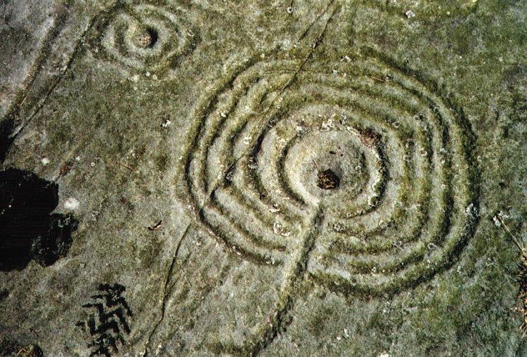
Weetwood Moor 3a submitted by rockartuk on 3rd Aug 2001.
(View photo, vote or add a comment)
Log Text: Weetwood Moor 3a (Bicycle Rock), Northumberland: My husband had seen photographs of the rock art at Weetwood Moor, which was very near the Fowberry Mains/Fowberry Park site we'd seen on 17th August 2014). Parking at the road junction next to where the metalled track runs alongside North Plantation, we walked down to find the footpath, which is located to the right hand side of the road, just passed the cattle grid. My goodness, was this overgrown for the first 20 to 30 metres – I stepped through head high bushes and gorse, eventually emerging into a rocky moorland.
After a 100 yards or so, the footpath bears left. There is a clear sign straight ahead, declaring ‘not access land’, but there was clear evidence of small footpaths carrying along across the heather. We went up a little way to try and see what was there, when a lady walking her dog sailed past us, waving and shouting ‘hello’ cheerfully as she went, so we assumed it was alright to carry on (we’ve since found a published Rock Art walk which takes us past the rocks we wanted to see).
Andrew found the Bicycle rock first of all – this was amazing - and I took photographs. To the east of this rock, someone had built a small cairn in a cup shape, this cup containing what looked like a Wiccan altar with sea shells, a bone and some berries.
Walking to the quarry face immediately to the east of Bicycle Rock, I noticed (for the first time) evidence of fluting on the edge of the rock, similar to the weathering on other standing stones in the area (ones that immediately spring to mind are Matfen and the Newtown Mill standing stone).
We found other rocks with cup marks, and I’ll need to sit down and compare my images to the other pages for Weetwood Moor on the Portal, to make sure I’m recording them against the right pages.
Doddington Moor
Date Added: 1st Sep 2014
Site Type: Stone Circle
Country: England (Northumberland)
Visited: Couldn't find on 30th Aug 2014
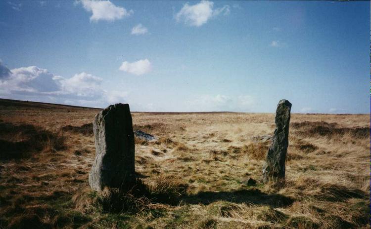
Doddington Moor submitted by Andy B on 24th Nov 2001. Doddington Moor Stone Circle
(View photo, vote or add a comment)
Log Text: Doddington Stone Circle, Northumberland (second failed attempt!). Having visited Weetwood Moor, as we were so near, and it was still only relatively early (5pm), we decided to drive a couple of miles further up the road to Weetwood Hall and try the footpath I’d identified as a possible easier route to Doddington Stone Circle.
We parked the car park where the footpath splits off northwards from the road just after Weetwood Hall (there is just room for one car opposite the field entrance at the corner of the junction). There is a metalled road which goes past the two or more houses to the left hand side, then it become a grassy path between two hedges, with tractor ruts in either side. After about half a mile, just past a wood to the right hand side, there is a gate with a footpath sign on, and the track becomes quad bike marks in the grass, and we followed these up the hill. There is a new stile (narrow, but new) , then the track more or less disappears, and is marked by a series of Scots Pines, standing alone, but growing more or less in a line north-north-west up the hill.
Passing an outcrop of rock to our left hand side, we climbed to the brow of the hill, but just where the land started to go downhill again, we were met by boggy land, covered completely with a heavy coverage of low growing thistles and gorse, which went on as far as the eye could see. Andrew decided this was impossible, so we turned back and went to find the cup and ring marked rocks marked on the map on the way back down the hill.
We'd previously tried to visit on 17th August 2014, but the quarry next to Wooler Golf Club had been extended and the footpaths had disappeared (or we couldn't find them).
There is a third possible footpath to try, from West Horton, so this will go on the 'want to do' list.
Hurl Stone
Date Added: 31st May 2017
Site Type: Standing Stone (Menhir)
Country: England (Northumberland)
Visited: Yes on 30th Aug 2014. My rating: Condition 2 Ambience 3 Access 4
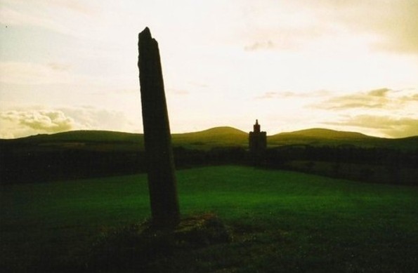
Hurl Stone submitted by Bladup on 30th Dec 2013. The Hurl stone, In the background is a folly built in 2000.
(View photo, vote or add a comment)
Log Text: The Hurl Stone, Newtown, Northumberland. Second visit: Saturday, 30th August 2014. Armed with a letter from the landowner allowing us access, we set off back to the Hurl Stone before the weather turned.
The farmer was busy herding sheep down the road to the field next to the Newtown Mill standing stone. He was using an army style buggy and 4 sheep dogs, which was fascinating in itself. Having watched this, we drove the 100 yards further up to farm at Newtown and bumped up onto the grass verge next to the gate leading into the Hurl Stone field.
It was a longer walk than it looked, through lush ankle high grass to the top of the slight hill. The tall Hurl Stone commandeered the horizon, but I was only about 20 yards away when I realised it had been concreted in. It looked as if at some time it had toppled and been recently re-erected (but if they’d done this, why let the stone lean, unless it was to give the impression it had indeed been hurled? Sorry, this is me being sceptical). This took a little of the shine off seeing the Hurl Stone, but my goodness, what a 360 degree view, which I’ve tried to represent in the photographs submitted to the Portal.
The face of the stone facing the recently built tower (I’m told this is used as a conference centre, but haven’t been able to verify this yet) looks as if it has broken at some time in the past. The quartz crystals within the stone sparkled in the sunlight. There was some, but not much, graffiti carved into it.
The landowner, who resides nearby, opens his gardens under the National Garden Scheme, and according to an archived article in the Hexham Courant, our local paper, has a 14th century chapel, a crusader tomb and two grave slabs belonging to Knights Templar, so I’ll be looking out for dates to go and see these other treasures.
I’m going to write to thank the landowner for allowing us access.
First visit, August 17th 2014: Driving down the road southwards past the hamlet of Newton, we at first only saw the recently built tower in the field to our right. Driving a little further on, we stopped at the standing stone on the opposite side of the road, just below Ewe Hill, to take photographs. When we turned the car and drove back up the road, the Hurl Stone appeared like a sharp needle, just below the top of the hill.
It’s proximity to the modern tower seems suspicious (we immediately asked ourselves if the stone had been moved to provide a good view of it from Liliburn Tower, the landowner’s house, as from the maps, the modern tower and the stone seem to be in direct alignment?).
There were no public footpaths to the stone, so I stopped at the field gateway and took a photograph. I have since written to the landowner to ask for permission to walk to the stone across the field.
Wall Crags Settlement
Date Added: 3rd Sep 2014
Site Type: Ancient Village or Settlement
Country: England (Northumberland)
Visited: Yes on 25th Aug 2014. My rating: Condition 2 Ambience 3 Access 4
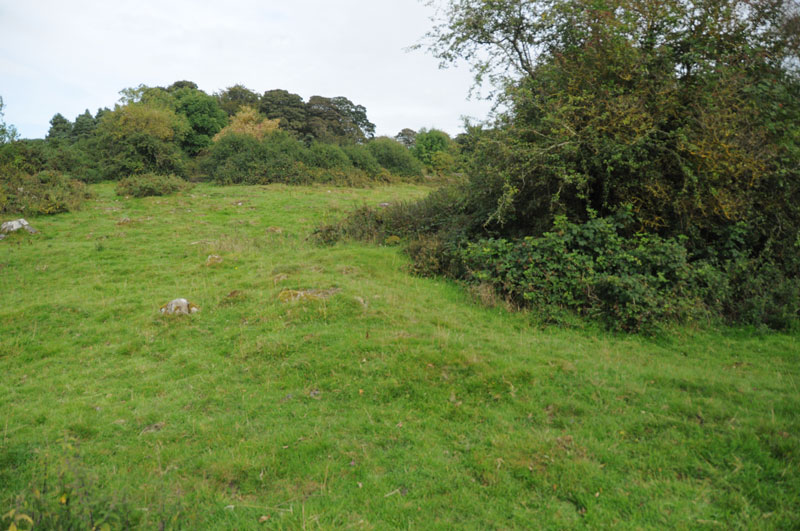
Wall Crags Settlement submitted by Anne T on 1st Sep 2014. To our untutored eye, the circular bank running from the centre of the photograph to the right hand side looked like the possible foundations of a roundhouse (now has trees growing in the middle).
(View photo, vote or add a comment)
Log Text: Wall Crags Settlement, Northumberland: It was 4pm on Bank Holiday Monday and we wanted to go somewhere, but didn’t have time to go far. Husband Andrew had spent the afternoonon the internet looking at rock art on the old Roman Bridges at Chollerford, and spotted the settlement to the east of Wall village as somewhere else to go on route. We drive through Wall on a regular basis, and neither of us had been aware of a settlement here until we looked closer at the map.
We parked on a side street just above the chapel in Wall at approx. grid reference NY 91744 69094, and walked down to the chapel, turning left towards the park. There were some very old cottages to our left hand side (on the walk back, I’m sure the one nearest the start of the footpath was dated 1642). The footpath took us across the southern end of the park, with a gate leading to some stone steps leading up the hill.
We climbed quickly up the steep slope, then the steps stopped, and open grassland began. The slope must have been about 40 degrees, and was slippery enough in the dry, and would have been lethal in the wet. I’m afraid I bottled out at this point - getting up would have been OK, but getting down (for me) would have been a nightmare, so I sat on the grass and handed the camera to Andrew, so he's to thank for the images on the Portal.
He was gone about 20 minutes, coming back to say it was fairly difficult to identify the features up on top of the hill, as whilst the top was level, there were trees, large stones and the ground looked as if it had been heavily trampled by cattle and was difficult to walk on. The ramparts were visible, as were the possible foundations of a couple of roundhouses.
I haven’t been able to find out much about this settlement at all, except for a brief mention on Keys To The Past (page reference N13760) which is a shame, but I’ll keep my eyes open for any information.
Chesters Roman Site b
Date Added: 3rd Sep 2014
Site Type: Rock Art
Country: England (Northumberland)
Visited: Yes on 25th Aug 2014. My rating: Condition 4 Ambience 4 Access 4
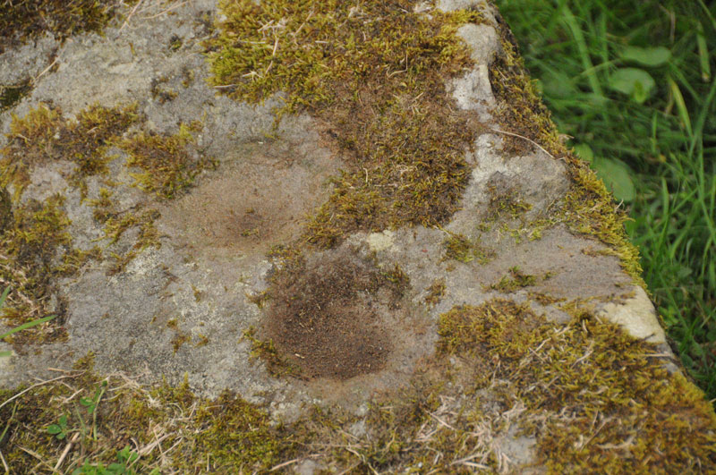
Chesters Roman Site b submitted by Anne T on 1st Sep 2014. Photograph showing two cup marks (0.09m) on stone, with third just on right hand edge.
(View photo, vote or add a comment)
Log Text: Chesters Roman Bridge Rock Art, Chollerford, Northumberland: Parking at the George Hotel at Chollerford on the north side of the river Tyne, we walked back over the bridge and found the small gate to the west side of the bridge to the footpath leading to the Roman Bridge. This is a really easy walk along a long straight footpath defined by wired fences on both sides (it feels like being a sheep being herded to a pen!). After a short kilometre, the path bears right down to the river, and a further gate lead to remains of two old Roman bridges on the same site. The ruins are impressive.
There seems to be some confusion about what rock art is at this site, and what isn’t. What is certain is that we found a stone block with three clear cup marks on in the location described by the England’s Rock Art record 769. Thank goodness we had the images of the location of this stone downloaded onto my phone, otherwise we would have spent hours searching the bridge piers.
This is a lovely location, right next to the Tyne, surrounded by old Roman remains. It would have been nice to have been able to see the other two stones purportedly found here, too.
There are also substantial remains of the bridges and other structures on the northern bank of the Tyne, which we'll go back and explore at some time in the future.
Our find was 'rewarded' with a drink at the hotel afterwards - this was a very pleasant early evening in late August.
Hogtivis Stone
Date Added: 28th Aug 2014
Site Type: Early Christian Sculptured Stone
Country: Wales (Pembrokeshire)
Visited: Yes on 23rd Aug 2014. My rating: Condition 3 Ambience 4 Access 4
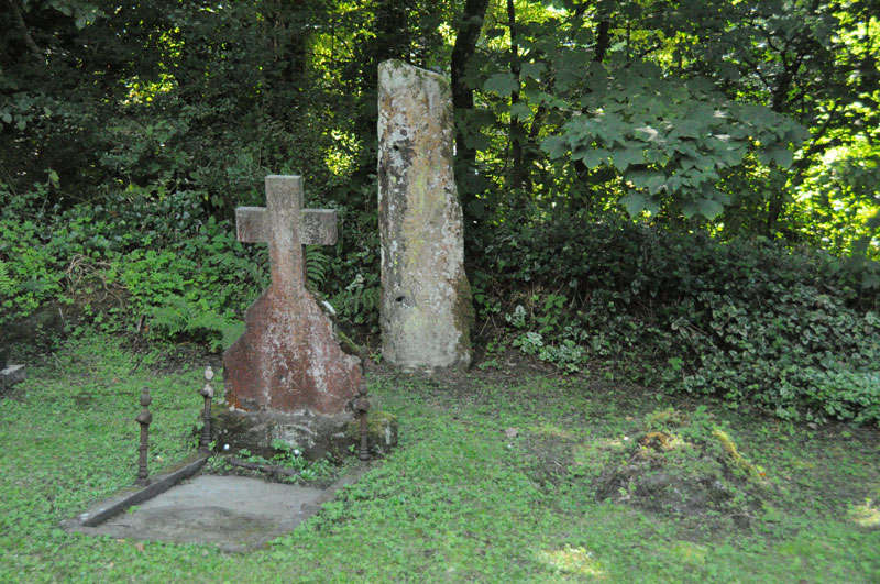
Hogtivis Stone submitted by Anne T on 25th Aug 2014. Photograph showing the location of the Hogtivis Stone from the west end of the church. It is nestled snuggly against the boundary bank of the church yard and the car park, between grave stones.
(View photo, vote or add a comment)
Log Text: Intrigued by just the word ‘Stone’ on the map, we drove from Garnturne burial chamber towards Sealyham Bridge, looking for the church next to ‘The Stone’. There are just a few farms and an outdoor centre here; it is a very pretty little spot. Just before the bridge over the river Afon Anghof, there was a small cark park (surrounded by overhanging trees on three sides) on the right hand side of the road. The church was invisible, being hidden by these trees, so we ended up driving past, turning round and going back. Turning into the car park, the top of the church and the gateway into the church yard immediately became visible.
This was one of the smallest churches I’ve come across. The wrought iron gate to the church spelled out the year 1870, and the church did indeed look relatively modern; but looking closer, there appeared to be a tiny chapel embedded in the larger building which looked much, much older. The church was locked, so sadly we couldn’t get in, as I would have loved to look round the interior of the building, and there was no contact telephone number to call to arrange a visit. Doing some research on arriving home, I found out that the nave and south aisle were separated by Norman arches, which I would love to have seen.
The churchyard was also tiny, largely dominated by wrought iron railings surrounding a large family plot immediately to the south of the church, by the porch. The two bells were rung by ropes coming down the exterior west end of the building.
In the corner of the churchyard, lodged snuggly against the bank between the church yard and the car park, and tucked between two graves, was The Stone. It had obviously been used as a gatepost at some time, with several holes, some still containing metal pins (my immediate reaction was ‘poor thing’). There were obvious signs of carving on the right hand side of the front face of The Stone which looked like Ogham, plus some other possible carving to the left, which the records tell me is a Latin inscription. Funnily enough, the camera was able to pick out the Latin inscription better than my eye, as recorded in the image submitted here.
The Archaeological Data Service record states that the stone is 5th or 6th century, and “was found in 1897 'a few hundred yards' from Little Treffgarne farmhouse. If it was in situ, then it may have been associated with the monastic site of Little Treffgarne”.
This site is only a couple of kilometres from the A40, east of the village of Wolf’s Castle, and 9 miles north of Haverfordwest. The Genuki website saying this parish is traditionally known and the birthplace and burial place of Owain Glyndwr who “is said to have been born at Little Trefgarn and to have been interred at the small village of Wolf’s Castle’.
Bedd Morris
Date Added: 26th Aug 2014
Site Type: Standing Stone (Menhir)
Country: Wales (Pembrokeshire)
Visited: Yes on 23rd Aug 2014. My rating: Condition 3 Ambience 3 Access 5
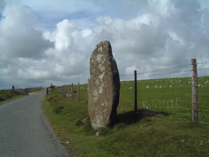
Bedd Morris submitted by enkidu41 on 3rd Jun 2004. SN 0382 3650
A 6'6" high menhir which tapers to a point.
(View photo, vote or add a comment)
Log Text: I spotted this standing stone by the right hand side of the road as we were driving over the Ffordd Bedd Morris road from the A487 towards Cwm Gwaun, where we were staying for a few days. After an eight hour journey, and with the rain coming down in huge droplets, we drove past and returned on the way back home to take a closer look.
Bedd Morris is very easy to find, being opposite the main car park for walkers at the top of the hill. Whilst impressive, it’s hard to believe this stone is still in its original location. There are professionally carved inscriptions on the stone, leading us to believe it is now being utilised as a boundary marker. Looking this up on the return home, the Bedd Morris record on the Archaeological Data Service web site confirms this stone is used as a marker between the parishes of Llanychlwyddog and Newport.
Their site also goes onto say that the stone fell over and broke, probably after being hit by a vehicle (hence the protective stones either side) and was repaired and re-erected in 2012.
There is also a trig point carved into the front of the stone, next to some graffiti.
We were on our way home, with an 8 hour journey in front of us, and other places we wanted to see, otherwise it would have been really nice to have done some walking in this area – the location just screamed at me to get my walking boots on.
Driving northwards towards Newport, there are splendid views of Dinas Head and Newport Sands from the viewpoint further along the road.
Pentre Ifan
Date Added: 27th Aug 2014
Site Type: Portal Tomb
Country: Wales (Pembrokeshire)
Visited: Yes on 23rd Aug 2014. My rating: Condition 3 Ambience 5 Access 4

Pentre Ifan submitted by PaulM on 24th Aug 2001. PENTRE IFAN CHAMBERED LONG CAIRN WITH FORECOURT
NGR: SN09953702 (Landranger map 145/Outdoor Leisure North Pembrokeshire map (No 35))
Located 4km east of Newport on a public footpath. One of the most spectacular and famous monuments of its type it consists of a tilted capstone perched on three uprights. A blocking stone obstructs the doorway and a semi-circular forecourt is found at the southern end. Originally covered by a huge long mound - traces of possible kerbstones can still be fou...
(View photo, vote or add a comment)
Log Text: Pentre Ifan, Pembrokeshire: I was particularly excited to go to the site, as I’d seen many photographs and paintings of Pentre Ifan during our brief visit to Pembrokeshire, together with photographs on the Portal. I was unprepared for the sheer number of visitors who came to see this spectacular burial chamber. However, everyone seemed to respect others need to take photographs and kept out of each other’s way, which was nice. We also got into conversation with a Japanese lady about how they had raised the cap stone.
I was truly amazed at how the cap stone balances on the pointed tips of just three uprights. All around are larger stones which may have been part of the structure in the past.
The views over to Newport sands and the sea are wonderful. I would like to go back to the site at a quieter time and just sit and absorb it.
Trefael
Date Added: 27th Aug 2014
Site Type: Rock Art
Country: Wales (Pembrokeshire)
Visited: Saw from a distance on 23rd Aug 2014
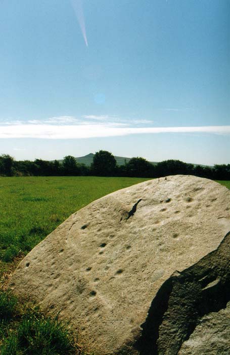
Trefael submitted by PaulM on 17th Aug 2002. This cup-marked stone stands in a field near Trefael at SN10294028. See main site entry for more details.
(View photo, vote or add a comment)
Log Text: Trafael Rock Art, Pembrokshire: We were looking forward to seeing this rare example of rock art in Wales, but despite driving up and down the B4582 road twice, we couldn’t find any of the marked footpaths. We could identify from the field pattern from our detailed map exactly where the stone was located. I suggested going to Bayvil church, further down the footpath, and walking back from there. On our second drive-past, we saw a very clear, official notice on the gate to the field saying ‘access to the capstone only with the permission of the landowner’. As we will have to research who the landowner is, we’ll need to save a visit to this rock art for another time.
However, we were well compensated by stumbling upon Nevern church with its stone crosses a few minutes later.
