Contributory members are able to log private notes and comments about each site
Sites AngieLake has logged. View this log as a table or view the most recent logs from everyone
Trencrom
Date Added: 26th Sep 2010
Site Type: Hillfort
Country: England (Cornwall)
Visited: Yes on 18th Oct 2006

Trencrom submitted by AngieLake on 18th Oct 2006. Looking approximately NNW across the plateau of Trencrom Hill towards what could be the Gorsedd rocks of this ancient settlement. It is neatly framed in the dip of the distant hills, and could have marked the Midwinter Solstice sunset.
(The pits of the hut circles in Jim Champion's photo lie across the centre of this view.)
(View photo, vote or add a comment)
Log Text: None
Trendlebere Down
Date Added: 26th Sep 2010
Site Type: Multiple Stone Rows / Avenue
Country: England (Devon)
Visited: Yes on 27th Jul 2010
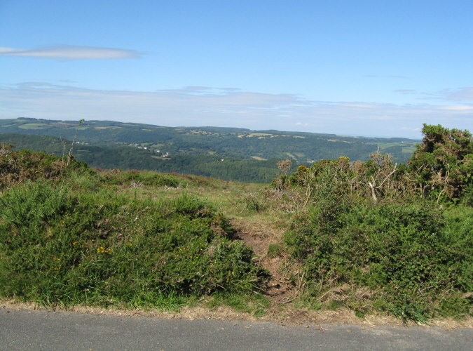
Trendlebere Down submitted by AngieLake on 27th Jul 2010. The 'way to go' to find Trendlebere Down stone row.
(On my OS map - 'Outdoor Leisure 28 Dartmoor', its by the yellow road that leads north from Haytor Vale. I found a good parking space on the left, past North Lodge, and walked the rest of the way.)
(View photo, vote or add a comment)
Log Text: None
Trethevy Quoit
Date Added: 26th Sep 2010
Site Type: Burial Chamber or Dolmen
Country: England (Cornwall)
Visited: Yes on 22nd Sep 2008
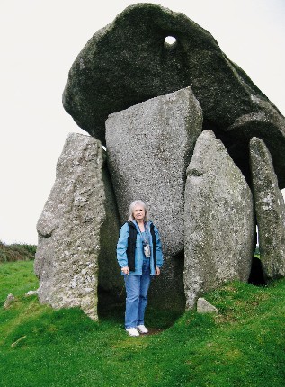
Trethevy Quoit submitted by AngieLake on 22nd Sep 2008. Visiting Trethevy Quoit last Tuesday afternoon, and got my friend Jackie [not JackME!] to take this pic. (I'm 5'4" for comparison.)
(View photo, vote or add a comment)
Log Text: None
Trevelgue Barrows
Date Added: 26th Sep 2010
Site Type: Barrow Cemetery
Country: England (Cornwall)
Visited: Yes on 24th Feb 2006
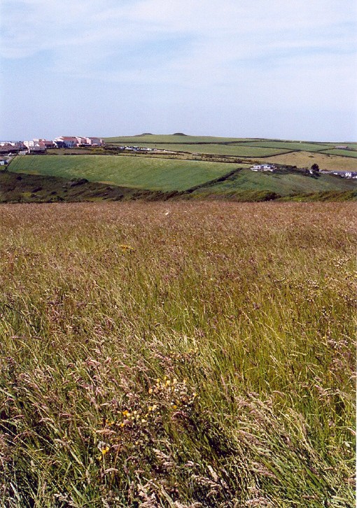
Trevelgue Barrows submitted by AngieLake on 24th Feb 2006. An interesting shot of the two barrows - high on the skyline - on Trevelgue Downs, taken from the old footpath from St Columb Minor near Newquay. This path leads up a lane near the church towards Porth, where Trevelgue promontory fort can be found. It's a pleasant walk along a fenced lane between fields, then down tracks through a field (here) sloping towards the coast. These barrows are on the cliff edge of the next headland to the north of the promontory fort.
(View photo, vote or add a comment)
Log Text: None
Trevelgue Head
Date Added: 26th Sep 2010
Site Type: Promontory Fort / Cliff Castle
Country: England (Cornwall)
Visited: Yes on 24th Feb 2006
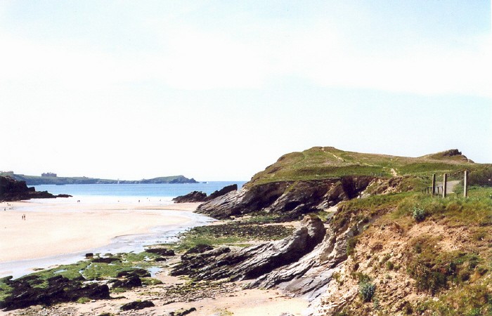
Trevelgue Head submitted by AngieLake on 24th Feb 2006. Porth Island or Trevelgue Iron Age Promontory fort with its defensive banks.
(View photo, vote or add a comment)
Log Text: None
Trowlesworthy
Date Added: 26th Sep 2010
Site Type: Barrow Cemetery
Country: England (Devon)
Visited: Yes on 14th Oct 2004
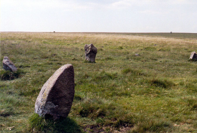
Ringmoor Down stone circle submitted by AngieLake on 14th Oct 2004. This stone - looking like an electric iron, poised for use, is almost opposite the other unusual stone in Ernar's Trowlesworthy circle. It does make you think that these were especially chosen for their shapes, and begs the questions, "Why?", and, "Were they in this actual position for a reason?""
(View photo, vote or add a comment)
Log Text: None
Two Barrows (Hamel Down)
Date Added: 26th Sep 2010
Site Type: Round Barrow(s)
Country: England (Devon)
Visited: Yes on 22nd Apr 2007

Two Barrows (Hamel Down) submitted by AngieLake on 22nd Apr 2007. Two Barrows (north) seen from its northwest side in late afternoon sun. Haytor rocks can be seen on the distant horizon, left. This is the barrow where a beautiful dagger pommel was found. (See site page for more). That is the 'Duke' stone sticking out of the central hollow. The southern of this pair can be seen supporting the drystone wall, right.
(View photo, vote or add a comment)
Log Text: None
Ty Mawr (Nr Holyhead)
Date Added: 26th Sep 2010
Site Type: Standing Stone (Menhir)
Country: Wales (Anglesey)
Visited: Yes on 30th Oct 2009
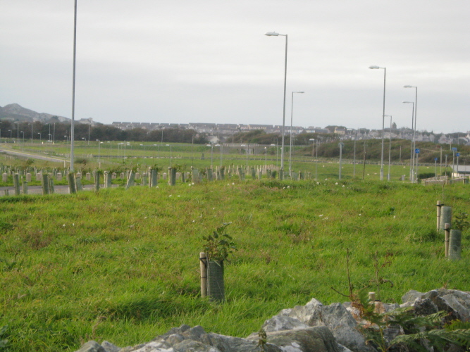
Ty Mawr (Nr Holyhead) submitted by AngieLake on 30th Oct 2009. This shot was taken near Trefignath, while walking back down the lane. In the distance I spied Ty Mawr, and zoomed in to try to capture the poor isolated menhir, surrounded by its 'triffid-like' lamp-posts.
[See centre of photo, above new tree planting.]
(View photo, vote or add a comment)
Log Text: None
Tyddyn-bach
Date Added: 26th Sep 2010
Site Type: Standing Stone (Menhir)
Country: Wales (Anglesey)
Visited: Yes on 4th Dec 2009
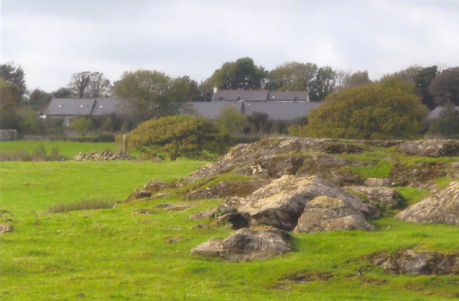
Tyddyn-bach submitted by AngieLake on 4th Dec 2009. A zoomed shot of Tyddyn-Bach from Bryn Celli Ddu's enclosure.
The stone is to left of centre here and the obvious outcrop of rock in the next field, on right.
(View photo, vote or add a comment)
Log Text: None
Ugborough Parish Church Prehistoric Earthwork
Date Added: 26th Sep 2010
Site Type: Ancient Village or Settlement
Country: England (Devon)
Visited: Yes on 14th Sep 2007
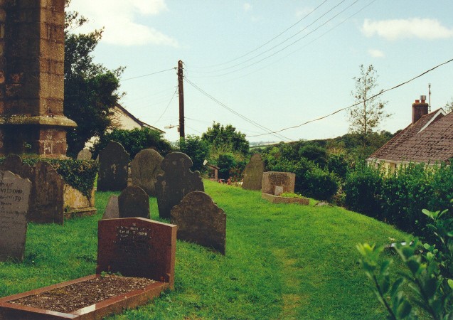
Ugborough Parish Church Prehistoric Earthwork submitted by AngieLake on 14th Sep 2007. This photo shows the NW curve of the ancient prehistoric earthworks on which the present church is situated.
(View photo, vote or add a comment)
Log Text: None
Upwey Wishing Well
Date Added: 26th Sep 2010
Site Type: Holy Well or Sacred Spring
Country: England (Dorset)
Visited: Yes on 23rd Jun 2008
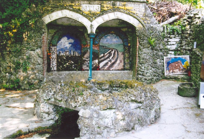
Upwey Wishing Well submitted by AngieLake on 23rd Jun 2008. Upwey Wishing Well and its 2008 Well-Dressings on 13th May.
L to R: Stonehenge, Hut and Farmer ploughing [behind pillar], Maiden Castle, and far right, the children's Mammoth.
(View photo, vote or add a comment)
Log Text: None
Vespasian's Camp
Date Added: 26th Sep 2010
Site Type: Hillfort
Country: England (Wiltshire)
Visited: Yes on 4th Jan 2009
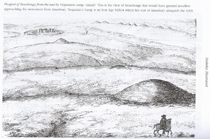
Vespasian's Camp submitted by AngieLake on 4th Jan 2009. Vespasian's Camp as shown in 'Stukeley Illustrated', compiled by Neil Mortimore, Green Magic publishing.
(View photo, vote or add a comment)
Log Text: None
Virtuous Well
Date Added: 26th Sep 2010
Site Type: Holy Well or Sacred Spring
Country: Wales (Monmouthshire)
Visited: Yes on 4th Sep 2006
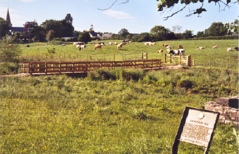
Virtuous Well submitted by AngieLake on 4th Sep 2006. The Virtuous Well in bottom right-hand corner, showing the position of Trellech church. The gate to the field is behind me here.
The sign reads:"The Virtuous Well.
Once known as St Ann's Well and famous for its cures. It was visited by many pilgrims as late as the seventeenth century. It is said to be four separate springs, three containing iron and each curing a different illness. Its niches held offerings and cups. Stone seats gave rest to the weary traveller."
(View photo, vote or add a comment)
Log Text: None
Walton Palisaded Enclosure
Date Added: 26th Sep 2010
Site Type: Timber Circle
Country: Wales (Powys)
Visited: Yes on 9th Aug 2008
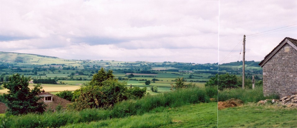
Walton Palisaded Enclosure submitted by AngieLake on 9th Aug 2008. Hindwell "a major ceremonial focus in Wales" near Walton. The palisaded enclosure might have been visible in the valley below here.
Photographed from Old Radnor Church graveyard. [Standing to the NW of church, looking north.]
The flat Walton Basin surrounded by hills also contains the Four Stones and Kinnerton Stones, as well as the Walton Cursus.
(View photo, vote or add a comment)
Log Text: None
Wambarrows
Date Added: 26th Sep 2010
Site Type: Barrow Cemetery
Country: England (Somerset)
Visited: Yes on 27th May 2007

Wambarrows submitted by AngieLake on 27th May 2007. The Wambarrow nearest the trig point, April 07.
(View photo, vote or add a comment)
Log Text: None
Watch Stone (Orkney)
Date Added: 26th Sep 2010
Site Type: Standing Stone (Menhir)
Country: Scotland (Orkney)
Visited: Yes on 22nd Jul 2010
Watch Stone (Orkney) submitted by AngieLake on 22nd Jul 2010. Taken in 2001, this shot of the Watchstone shows Stenness's stones in the background. Barnhouse Settlement is off to the left of Stenness.
(View photo, vote or add a comment)
Log Text: None
Water Music Stone
Date Added: 26th Sep 2010
Site Type: Standing Stone (Menhir)
Country: England (Cornwall)
Visited: Yes on 12th Sep 2008
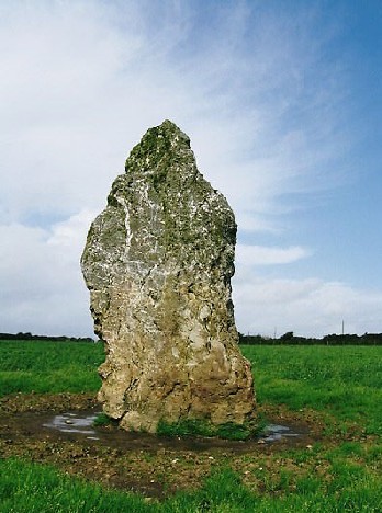
Water Music Stone submitted by AngieLake on 12th Sep 2008. The imposing Water Music stone taken in early September 2008.
(View photo, vote or add a comment)
Log Text: None
Wayland's Smithy
Date Added: 26th Sep 2010
Site Type: Long Barrow
Country: England (Oxfordshire)
Visited: Yes on 8th Jul 2005
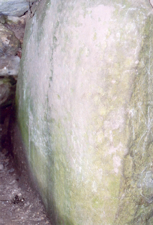
Wayland's Smithy submitted by AngieLake on 8th Jul 2005. The stone at the rear right of Wayland's Smithy's Chamber.
(View photo, vote or add a comment)
Log Text: None
Wendron South
Date Added: 15th Jun 2019
Site Type: Stone Circle
Country: England (Cornwall)
Visited: Would like to visit
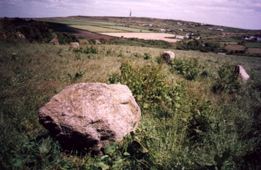
Wendron South submitted by TimPrevett on 1st Nov 2002. Wendron / Nine Maidens Stone Circles
SW683365
Parking in layby on the west side of the road opposite the footpath. The path was heavily rutted by cattle, indicating that if it was wet, this would be extremely boggy. Access is over a low point in the wall right next to the stones. Next time I visit I must read the guide books beforehand - two of the stones are actually set in the wall! One still in its original place, the other moved. The field was high with dock when I visited, and had to ...
(View photo, vote or add a comment)
West Kennet Avenue
Date Added: 26th Sep 2010
Site Type: Multiple Stone Rows / Avenue
Country: England (Wiltshire)
Visited: Yes on 29th Nov 2004
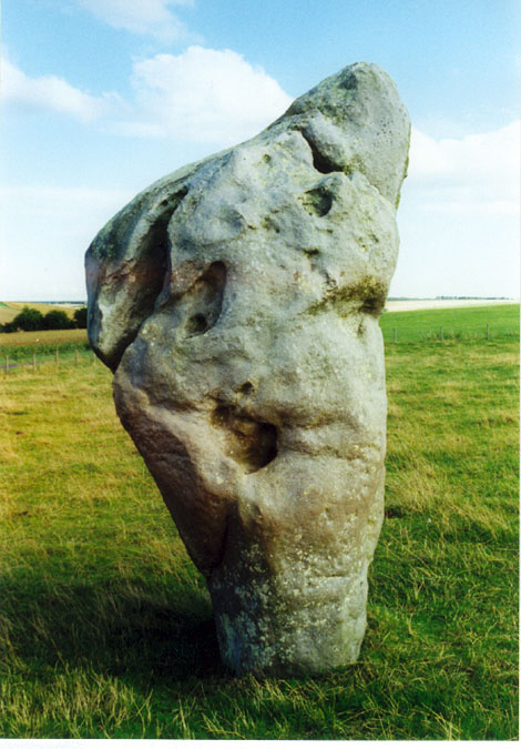
West Kennet Avenue submitted by AngieLake on 29th Nov 2004. West Kennett Avenue - This is my version of "andyb456"'s 'Jaws', viewed from the inside of the avenue. As you can see, he has quite a few holes, and you have to wonder whether they - especially the larger one at wrist level - were significant. I recently asked if anyone has any idea why this particular shape of prominently angled stones (there's one in Callanish's avenue too) were placed where they are. Was there a moon, sun, star alignment for instance, at a particular time of the year? Perhaps...
(View photo, vote or add a comment)
Log Text: None
