 with our Megalithic Portal iPhone app")

<< Text Pages >> Auchmachar Clump - Ancient Village or Settlement in Scotland in Aberdeenshire
Submitted by vicky on Monday, 26 August 2002 Page Views: 6885
Multi-periodSite Name: Auchmachar ClumpCountry: Scotland
NOTE: This site is 1.3 km away from the location you searched for.
County: Aberdeenshire Type: Ancient Village or Settlement
Map Ref: NJ950498 Landranger Map Number: 30
Latitude: 57.538306N Longitude: 2.08517W
Condition:
| 5 | Perfect |
| 4 | Almost Perfect |
| 3 | Reasonable but with some damage |
| 2 | Ruined but still recognisable as an ancient site |
| 1 | Pretty much destroyed, possibly visible as crop marks |
| 0 | No data. |
| -1 | Completely destroyed |
| 5 | Superb |
| 4 | Good |
| 3 | Ordinary |
| 2 | Not Good |
| 1 | Awful |
| 0 | No data. |
| 5 | Can be driven to, probably with disabled access |
| 4 | Short walk on a footpath |
| 3 | Requiring a bit more of a walk |
| 2 | A long walk |
| 1 | In the middle of nowhere, a nightmare to find |
| 0 | No data. |
| 5 | co-ordinates taken by GPS or official recorded co-ordinates |
| 4 | co-ordinates scaled from a detailed map |
| 3 | co-ordinates scaled from a bad map |
| 2 | co-ordinates of the nearest village |
| 1 | co-ordinates of the nearest town |
| 0 | no data |
Be the first person to rate this site - see the 'Contribute!' box in the right hand menu.
Internal Links:
External Links:
Ancient Settlement in Aberdeenshire
Have you visited this site? Please add a comment below.
You may be viewing yesterday's version of this page. To see the most up to date information please register for a free account.
Do not use the above information on other web sites or publications without permission of the contributor.
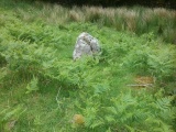
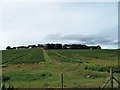
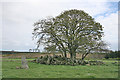
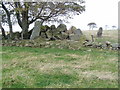
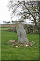
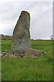
Nearby Images from Geograph Britain and Ireland:
©2018(licence)
©2015(licence)
©2008(licence)
©2015(licence)
©2015(licence)
The above images may not be of the site on this page, they are loaded from Geograph.
Please Submit an Image of this site or go out and take one for us!
Click here to see more info for this site
Nearby sites
Key: Red: member's photo, Blue: 3rd party photo, Yellow: other image, Green: no photo - please go there and take one, Grey: site destroyed
Download sites to:
KML (Google Earth)
GPX (GPS waypoints)
CSV (Garmin/Navman)
CSV (Excel)
To unlock full downloads you need to sign up as a Contributory Member. Otherwise downloads are limited to 50 sites.
Turn off the page maps and other distractions
Nearby sites listing. In the following links * = Image available
538m NNW 338° Auchmachar* Stone Circle (NJ948503)
639m NW 321° Knapperty Hill* Chambered Cairn (NJ946503)
639m NW 323° Auchmachar Long Cairn* Cairn (NJ9461850314)
1.1km E 93° Loudon Wood* Stone Circle (NJ96104974)
2.1km N 352° White Cow Wood* Chambered Cairn (NJ947519)
2.5km SE 133° Old Deer* Class I Pictish Symbol Stone (NJ96854810)
2.8km SSE 162° Aikey Brae* Stone Circle (NJ95884709)
3.2km ENE 76° Fetterangus* Class I Pictish Symbol Stone (NJ98135056)
3.5km ENE 61° Gaval Standing Stone* Standing Stone (Menhir) (NJ9805651504)
4.9km NNW 344° Strichen House* Stone Circle (NJ93675449)
5.6km S 172° Upper Crichie Stone Circle (NJ9580344301)
6.1km SSE 156° East Crichie Stone Circle (NJ9751344269)
8.5km SW 234° Auchmaliddie* Stone Circle (NJ881448)
8.7km SSE 158° Skelmuir Hill* Stone Circle (NJ9821241706)
10.2km NNW 345° Picts House* Misc. Earthwork (NJ92365963)
10.7km NE 46° Berrybrae* Stone Circle (NK02765716)
11.2km NNE 32° Cortie Brae* Stone Circle (NK01015924)
11.4km NE 53° Greengate* Standing Stone (Menhir) (NK04205662)
11.5km NW 324° Law Cairn* Cairn (NJ88205911)
11.9km NE 51° Netherton* Stone Circle (NK04335722)
12.5km NNE 12° Memsie Burial Cairn* Cairn (NJ97666205)
12.8km WNW 300° Upper Auchnagorth* Stone Circle (NJ8391156272)
13.4km N 351° Tyrie Class I Pictish Symbol Stone (NJ93006310)
14.1km SW 228° St Devenick's Well* Holy Well or Sacred Spring (NJ844404)
14.6km ESE 122° Cairn Catto* Cairn (NK0743542124)
View more nearby sites and additional images


 We would like to know more about this location. Please feel free to add a brief description and any relevant information in your own language.
 Wir möchten mehr über diese Stätte erfahren. Bitte zögern Sie nicht, eine kurze Beschreibung und relevante Informationen in Deutsch hinzuzufügen.
 Nous aimerions en savoir encore un peu sur les lieux. S'il vous plaît n'hesitez pas à ajouter une courte description et tous les renseignements pertinents dans votre propre langue.
 Quisieramos informarnos un poco más de las lugares. No dude en añadir una breve descripción y otros datos relevantes en su propio idioma.