<< Our Photo Pages >> Norton Fitzwarren - Hillfort in England in Somerset
Submitted by ermine on Tuesday, 15 October 2024 Page Views: 10803
Iron Age and Later PrehistorySite Name: Norton Fitzwarren Alternative Name: Norton CampCountry: England
NOTE: This site is 0.761 km away from the location you searched for.
County: Somerset Type: Hillfort
Nearest Village: Norton Fitzwarren
Map Ref: ST196263 Landranger Map Number: 181
Latitude: 51.030419N Longitude: 3.147903W
Condition:
| 5 | Perfect |
| 4 | Almost Perfect |
| 3 | Reasonable but with some damage |
| 2 | Ruined but still recognisable as an ancient site |
| 1 | Pretty much destroyed, possibly visible as crop marks |
| 0 | No data. |
| -1 | Completely destroyed |
| 5 | Superb |
| 4 | Good |
| 3 | Ordinary |
| 2 | Not Good |
| 1 | Awful |
| 0 | No data. |
| 5 | Can be driven to, probably with disabled access |
| 4 | Short walk on a footpath |
| 3 | Requiring a bit more of a walk |
| 2 | A long walk |
| 1 | In the middle of nowhere, a nightmare to find |
| 0 | No data. |
| 5 | co-ordinates taken by GPS or official recorded co-ordinates |
| 4 | co-ordinates scaled from a detailed map |
| 3 | co-ordinates scaled from a bad map |
| 2 | co-ordinates of the nearest village |
| 1 | co-ordinates of the nearest town |
| 0 | no data |
Internal Links:
External Links:
")
Finds from the site are on display in Taunton Museum.
More on this site at Digital Digging.
Page originally by Vicky.
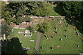
Note: South-West Heritage Trust have transformed the centre of this important hillfort into a nature reserve rather than a ploughed field - view a 360 degree panorama by Ermine here.
You may be viewing yesterday's version of this page. To see the most up to date information please register for a free account.
")
")
")
")
Do not use the above information on other web sites or publications without permission of the contributor.
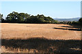
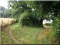
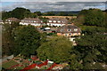
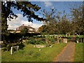
Nearby Images from Geograph Britain and Ireland:
©2005(licence)
©2009(licence)
©2011(licence)
©2008(licence)
©2011(licence)
The above images may not be of the site on this page, they are loaded from Geograph.
Please Submit an Image of this site or go out and take one for us!
Click here to see more info for this site
Nearby sites
Key: Red: member's photo, Blue: 3rd party photo, Yellow: other image, Green: no photo - please go there and take one, Grey: site destroyed
Download sites to:
KML (Google Earth)
GPX (GPS waypoints)
CSV (Garmin/Navman)
CSV (Excel)
To unlock full downloads you need to sign up as a Contributory Member. Otherwise downloads are limited to 50 sites.
Turn off the page maps and other distractions
Nearby sites listing. In the following links * = Image available
3.4km ESE 120° Museum of Somerset* Museum (ST225246)
4.6km NW 320° Devil's Whispering Well* Holy Well or Sacred Spring (ST1671029841)
5.7km NNW 347° St. Agnes Well* Holy Well or Sacred Spring (ST18423186)
6.3km ESE 105° Cambria Farm Ancient Village or Settlement (ST257246)
9.4km NNW 340° Wills Neck* Barrow Cemetery (ST16533516)
10.0km N 352° Plainsfield Camp* Misc. Earthwork (ST18433622)
10.1km W 280° Kings Castle Hillfort (ST097282)
10.1km NNW 341° Triscombe Stone* Standing Stone (Menhir) (ST16363592)
10.5km SE 139° The Devilstones* Natural Stone / Erratic / Other Natural Feature (ST264183)
10.7km NNW 338° Great Hill Platform cairn* Barrow Cemetery (ST15653625)
11.0km SSE 162° Robin Hoods Butt 2 (Somerset) Round Barrow(s) (ST22801575)
11.6km NNW 338° West Hill Platform Cairn* Cairn (ST15423717)
11.6km NNW 335° Fire Beacon Cairn* Cairn (ST14913697)
12.3km NNW 343° Dead Woman's Ditch* Misc. Earthwork (ST162381)
12.5km SSE 163° Robin Hood's Butts North* Barrow Cemetery (ST230143)
12.6km NNW 339° Wilmots Pool Cairn* Cairn (ST15303813)
12.9km NNW 337° Black Hill Tumuli* Barrow Cemetery (ST14653819)
12.9km NNW 335° Hurley Beacon Tumulus* Cairn (ST14223808)
12.9km SE 143° Castle Neroche* Hillfort (ST272158)
13.4km NNW 344° Dowsborough Castle* Hillfort (ST160392)
13.9km NNW 334° Halsway Tumuli* Barrow Cemetery (ST137389)
14.0km W 261° Castles Camp Hillfort (ST057244)
14.1km SSE 162° Robin Hood's Butts South* Barrow Cemetery (ST237128)
14.3km NE 36° St. John's Well (Somerset)* Holy Well or Sacred Spring (ST282377)
14.3km NNW 333° Thorncombe Hill Cairns* Barrow Cemetery (ST13183914)
View more nearby sites and additional images


 We would like to know more about this location. Please feel free to add a brief description and any relevant information in your own language.
 Wir möchten mehr über diese Stätte erfahren. Bitte zögern Sie nicht, eine kurze Beschreibung und relevante Informationen in Deutsch hinzuzufügen.
 Nous aimerions en savoir encore un peu sur les lieux. S'il vous plaît n'hesitez pas à ajouter une courte description et tous les renseignements pertinents dans votre propre langue.
 Quisieramos informarnos un poco más de las lugares. No dude en añadir una breve descripción y otros datos relevantes en su propio idioma.