

<< Our Photo Pages >> The Devilstones - Natural Stone / Erratic / Other Natural Feature in England in Somerset
Submitted by Antonine on Sunday, 19 September 2021 Page Views: 553
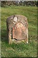
Natural PlacesSite Name: The DevilstonesCountry: England County: Somerset Type: Natural Stone / Erratic / Other Natural Feature
Nearest Village: Staple Fitzpaine
Map Ref: ST264183
Latitude: 50.959406N Longitude: 3.049327W
Condition:
| 5 | Perfect |
| 4 | Almost Perfect |
| 3 | Reasonable but with some damage |
| 2 | Ruined but still recognisable as an ancient site |
| 1 | Pretty much destroyed, possibly visible as crop marks |
| 0 | No data. |
| -1 | Completely destroyed |
| 5 | Superb |
| 4 | Good |
| 3 | Ordinary |
| 2 | Not Good |
| 1 | Awful |
| 0 | No data. |
| 5 | Can be driven to, probably with disabled access |
| 4 | Short walk on a footpath |
| 3 | Requiring a bit more of a walk |
| 2 | A long walk |
| 1 | In the middle of nowhere, a nightmare to find |
| 0 | No data. |
| 5 | co-ordinates taken by GPS or official recorded co-ordinates |
| 4 | co-ordinates scaled from a detailed map |
| 3 | co-ordinates scaled from a bad map |
| 2 | co-ordinates of the nearest village |
| 1 | co-ordinates of the nearest town |
| 0 | no data |
Be the first person to rate this site - see the 'Contribute!' box in the right hand menu.
Internal Links:
External Links:
I have visited· I would like to visit
hevveh would like to visit
")
The second part of the name comes from the Fitzpaine family who owned the manor between 1233 and 1393.
You may be viewing yesterday's version of this page. To see the most up to date information please register for a free account.
")
")
Do not use the above information on other web sites or publications without permission of the contributor.
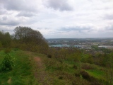
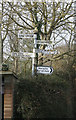
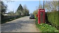
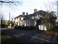
Nearby Images from Geograph Britain and Ireland:
©2019(licence)
©2015(licence)
©2013(licence)
©2019(licence)
©2023(licence)
The above images may not be of the site on this page, they are loaded from Geograph.
Please Submit an Image of this site or go out and take one for us!
Click here to see more info for this site
Nearby sites
Key: Red: member's photo, Blue: 3rd party photo, Yellow: other image, Green: no photo - please go there and take one, Grey: site destroyed
Download sites to:
KML (Google Earth)
GPX (GPS waypoints)
CSV (Garmin/Navman)
CSV (Excel)
To unlock full downloads you need to sign up as a Contributory Member. Otherwise downloads are limited to 50 sites.
Turn off the page maps and other distractions
Nearby sites listing. In the following links * = Image available
2.6km SSE 161° Castle Neroche* Hillfort (ST272158)
4.4km SW 234° Robin Hoods Butt 2 (Somerset) Round Barrow(s) (ST22801575)
5.2km SW 219° Robin Hood's Butts North* Barrow Cemetery (ST230143)
6.1km SSW 205° Robin Hood's Butts South* Barrow Cemetery (ST237128)
6.3km N 353° Cambria Farm Ancient Village or Settlement (ST257246)
6.5km E 85° Skipperhams Well* Holy Well or Sacred Spring (ST329188)
6.8km SSE 152° Combe Beacon Tumulus* Long Barrow (ST295122)
7.0km SSE 165° Northay Barrow* Long Barrow (ST281115)
7.4km NNW 327° Museum of Somerset* Museum (ST225246)
10.5km NW 319° Norton Fitzwarren* Hillfort (ST196263)
10.7km ENE 63° St. Catherine's Well (Swell)* Holy Well or Sacred Spring (ST360231)
13.6km NE 35° Athelney* Hillfort (ST344293)
15.1km NW 319° Devil's Whispering Well* Holy Well or Sacred Spring (ST1671029841)
15.1km SSW 192° Stockland Little Castle Hillfort (ST22980362)
15.6km S 173° Membury Castle Hillfort (ST282028)
15.7km NNW 329° St. Agnes Well* Holy Well or Sacred Spring (ST18423186)
16.1km SSW 193° Stockland Great Castle* Hillfort (ST22620262)
16.8km SSW 211° Dumpdon Great Camp* Hillfort (ST176040)
18.3km SW 225° Row Barrow (Devon)* Round Barrow(s) (ST13180561)
18.9km NNE 30° Westonzoyland Cursus Cursus (ST36263450)
19.4km ESE 115° Pople's Well* Holy Well or Sacred Spring (ST4387909886)
19.4km WNW 300° Kings Castle Hillfort (ST097282)
19.5km N 4° St. John's Well (Somerset)* Holy Well or Sacred Spring (ST282377)
19.5km NNW 329° Wills Neck* Barrow Cemetery (ST16533516)
19.6km NNW 335° Plainsfield Camp* Misc. Earthwork (ST18433622)
View more nearby sites and additional images


 We would like to know more about this location. Please feel free to add a brief description and any relevant information in your own language.
 Wir möchten mehr über diese Stätte erfahren. Bitte zögern Sie nicht, eine kurze Beschreibung und relevante Informationen in Deutsch hinzuzufügen.
 Nous aimerions en savoir encore un peu sur les lieux. S'il vous plaît n'hesitez pas à ajouter une courte description et tous les renseignements pertinents dans votre propre langue.
 Quisieramos informarnos un poco más de las lugares. No dude en añadir una breve descripción y otros datos relevantes en su propio idioma.