

<< Our Photo Pages >> High Willhays North - Ring Cairn in England in Devon
Submitted by Anne T on Thursday, 27 October 2016 Page Views: 1764
Neolithic and Bronze AgeSite Name: High Willhays North Alternative Name: Grinsell Okehampton Hamlets 5; Turner A64Country: England County: Devon Type: Ring Cairn
Nearest Town: Okehampton Nearest Village: Sourton / Meldon
Map Ref: SX58028944
Latitude: 50.687240N Longitude: 4.011287W
Condition:
| 5 | Perfect |
| 4 | Almost Perfect |
| 3 | Reasonable but with some damage |
| 2 | Ruined but still recognisable as an ancient site |
| 1 | Pretty much destroyed, possibly visible as crop marks |
| 0 | No data. |
| -1 | Completely destroyed |
| 5 | Superb |
| 4 | Good |
| 3 | Ordinary |
| 2 | Not Good |
| 1 | Awful |
| 0 | No data. |
| 5 | Can be driven to, probably with disabled access |
| 4 | Short walk on a footpath |
| 3 | Requiring a bit more of a walk |
| 2 | A long walk |
| 1 | In the middle of nowhere, a nightmare to find |
| 0 | No data. |
| 5 | co-ordinates taken by GPS or official recorded co-ordinates |
| 4 | co-ordinates scaled from a detailed map |
| 3 | co-ordinates scaled from a bad map |
| 2 | co-ordinates of the nearest village |
| 1 | co-ordinates of the nearest town |
| 0 | no data |
Internal Links:
External Links:
I have visited· I would like to visit
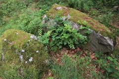
TheCaptain visited on 2nd Aug 2024 - their rating: Cond: 3 Amb: 4 Access: 2 Now heading north across the indistinct top of High Willhays towards Yes Tor, I keep an eye open for what we have marked as a ring cairn, which I find positioned adjacent to one of the rock outcrops at the northern top of High Willhays. It seems to be a sort of ring cairn combined with a tor top cairn like that on Showery Tor on Bodmin Moor. It looks a bit like a semi circular retaining bank for a pool.
Silkscream visited on 6th Mar 2021 - their rating: Cond: 5 Amb: 5 Access: 2
Average ratings for this site from all visit loggers: Condition: 4 Ambience: 4.5 Access: 2
")
Information about the High Willhays (N) Stone Ring Cairn Circle comes from the Prehistoric Dartmoor Walks (PDW) website.
The PDW web page gives links to further information on Pastscape, Monument Number 440500, which tells us this is "a revetted mound (which) adjoins the south side of one of the granite outcrops at High Willhays. Measuring 19m east to west by 18m overall it stands around 0.8m high. The sides of the mound are formed by coursed granite slabs and boulders and the top is largely flat though a hollow has formed in the southern half .... this feature must be regarded as a tor cairn though its construction is somewhat uncharacteristic of similar features. There is no evidence to suggest the presence of a cist or more conventional kerb."
The cairn is also recorded as Pastscape Monument No. 965852, as MDV20152 (Tor cairn 180 metres north of High Willhays summit), and scheduled as Historic England List Entry No. 1010593 (Tor cairn 180m north of High Willhays summit).
You may be viewing yesterday's version of this page. To see the most up to date information please register for a free account.
")
")
")
Do not use the above information on other web sites or publications without permission of the contributor.
Nearby Images from Geograph Britain and Ireland:

©2009(licence)

©2025(licence)

©2008(licence)

©2014(licence)

©2014(licence)
The above images may not be of the site on this page, they are loaded from Geograph.
Please Submit an Image of this site or go out and take one for us!
Click here to see more info for this site
Nearby sites
Key: Red: member's photo, Blue: 3rd party photo, Yellow: other image, Green: no photo - please go there and take one, Grey: site destroyed
Download sites to:
KML (Google Earth)
GPX (GPS waypoints)
CSV (Garmin/Navman)
CSV (Excel)
To unlock full downloads you need to sign up as a Contributory Member. Otherwise downloads are limited to 50 sites.
Turn off the page maps and other distractions
Nearby sites listing. In the following links * = Image available
220m S 176° High Willhays kerb cairn* Ring Cairn (SX58038922)
711m SW 217° Fordsland Ledge Chambered cairn* Chambered Cairn (SX57588888)
763m N 353° Yes Tor cairns* Barrow Cemetery (SX57959020)
1.9km NW 317° Longstone Hill stone* Standing Stone (Menhir) (SX56729089)
2.1km NW 321° Longstone Hill cairn* Cairn (SX56709113)
2.2km NNW 343° Black Down West Cairn (SX57469153)
2.2km WNW 301° Homerton Hill North* Cist (SX56139065)
2.5km E 87° Oke Tor* Stone Row / Alignment (SX605895)
2.7km W 262° Branscombe's Loaf* Ring Cairn (SX55318912)
2.8km W 262° Corn Ridge Rock* Ring Cairn (SX5521989145)
2.9km W 262° Cornridge SE* Stone Circle (SX5517589119)
2.9km W 263° Corn Ridge Stone Ring Cairn Circle* Ring Cairn (SX5513889153)
3.1km W 259° Corndon Ridge Propped Stones Marker Stone (SX5493088942)
3.3km W 271° Sourton Tors Stone Circle* Stone Circle (SX54688958)
3.4km W 268° Sourton Tors Cairn* Cairn (SX5460389438)
3.6km ENE 57° Winter Tor* Cist (SX6110291335)
3.6km W 259° Sourton Tors Ring Cairns* Ring Cairn (SX5441888858)
3.7km NE 46° Belstone Common Cairns* Cairn (SX6077491956)
4.1km ENE 74° Metheral circle* Stone Circle (SX62059044)
4.2km WSW 240° Little Links Tor* Stone Row / Alignment (SX5428587463)
4.2km ENE 75° Taw Marsh cairnfield* Barrow Cemetery (SX62159042)
4.3km ENE 76° Metheral Kerb Cairn* Cairn (SX62189037)
4.3km SW 225° Great Links Tor Cairn* Cairn (SX5491686496)
4.5km NNE 13° Fitz's Well* Holy Well or Sacred Spring (SX5919093783)
4.5km NE 55° Irishman’s Wall circle* Stone Circle (SX61799193)
View more nearby sites and additional images


 We would like to know more about this location. Please feel free to add a brief description and any relevant information in your own language.
 Wir möchten mehr über diese Stätte erfahren. Bitte zögern Sie nicht, eine kurze Beschreibung und relevante Informationen in Deutsch hinzuzufügen.
 Nous aimerions en savoir encore un peu sur les lieux. S'il vous plaît n'hesitez pas à ajouter une courte description et tous les renseignements pertinents dans votre propre langue.
 Quisieramos informarnos un poco más de las lugares. No dude en añadir una breve descripción y otros datos relevantes en su propio idioma.