<< Our Photo Pages >> Dolmen de Peyrogall - Burial Chamber or Dolmen in France in Midi:Ariège (09)
Submitted by TheCaptain on Thursday, 10 February 2005 Page Views: 4097
Neolithic and Bronze AgeSite Name: Dolmen de PeyrogallCountry: France Département: Midi:Ariège (09) Type: Burial Chamber or Dolmen
Nearest Town: Tarascon-sur-Ariège Nearest Village: Mercus-Amplaing
Latitude: 42.884000N Longitude: 1.617900E
Condition:
| 5 | Perfect |
| 4 | Almost Perfect |
| 3 | Reasonable but with some damage |
| 2 | Ruined but still recognisable as an ancient site |
| 1 | Pretty much destroyed, possibly visible as crop marks |
| 0 | No data. |
| -1 | Completely destroyed |
| 5 | Superb |
| 4 | Good |
| 3 | Ordinary |
| 2 | Not Good |
| 1 | Awful |
| 0 | No data. |
| 5 | Can be driven to, probably with disabled access |
| 4 | Short walk on a footpath |
| 3 | Requiring a bit more of a walk |
| 2 | A long walk |
| 1 | In the middle of nowhere, a nightmare to find |
| 0 | No data. |
| 5 | co-ordinates taken by GPS or official recorded co-ordinates |
| 4 | co-ordinates scaled from a detailed map |
| 3 | co-ordinates scaled from a bad map |
| 2 | co-ordinates of the nearest village |
| 1 | co-ordinates of the nearest town |
| 0 | no data |
Internal Links:
External Links:
I have visited· I would like to visit
fornjotr has visited here
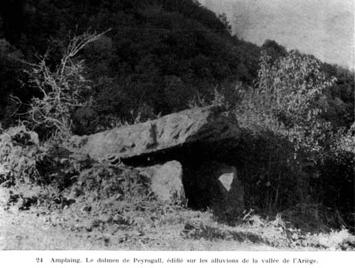
"ARIEGE: A monument that attracts the curiosity of visitors
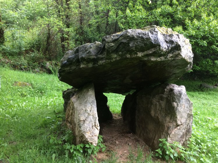
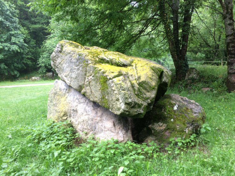
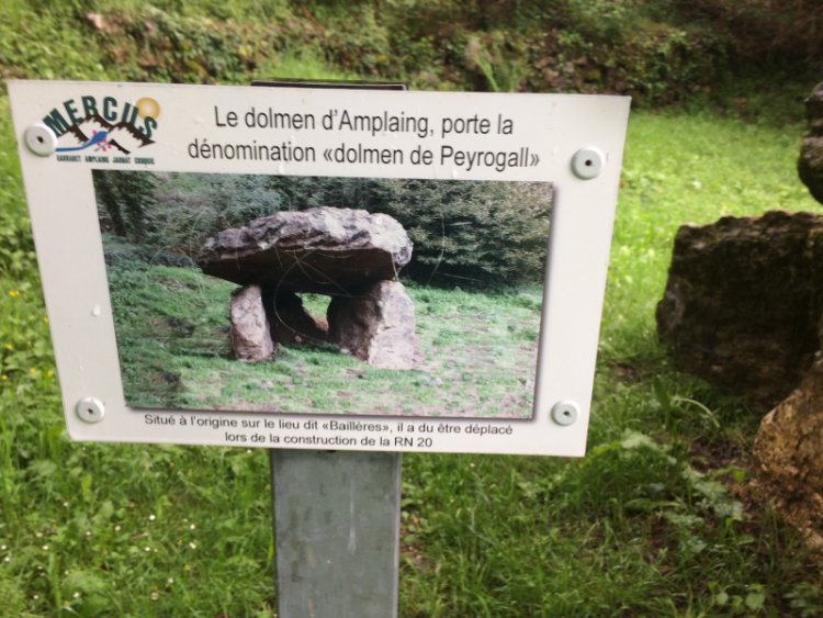
When passing on the main road 8, there a few years ago one could not miss: located close to the Barri of the rock in the town of Amplaing, dolmen Peyrogall was easy to access. Certainly it was not an imposing monument, but it still attracted the curiosity of visitors, and it was the last surviving witness megalithic sector, that Garrabet having disappeared in 1913. Now the monument is not stayed behind, having to identify sites for the construction of the expressway Foix-Tarascon. In October 1991 a survey had shown that the dolmen would be a crushing area of stones for the road. It was necessary to take conservation measures either leaving the dolmen on site with appropriate protection, either by moving it with every precaution to store it on a protected area of road works and replace then in place, once the work completed.
KEPT UNDER COVER
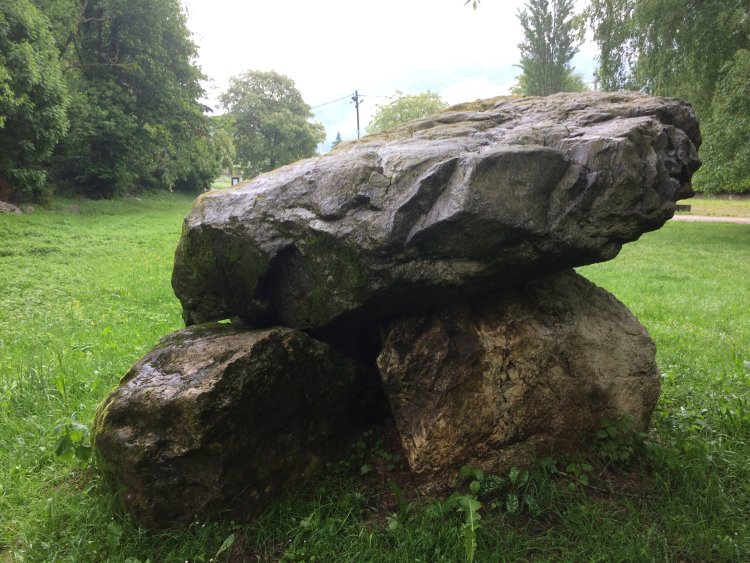
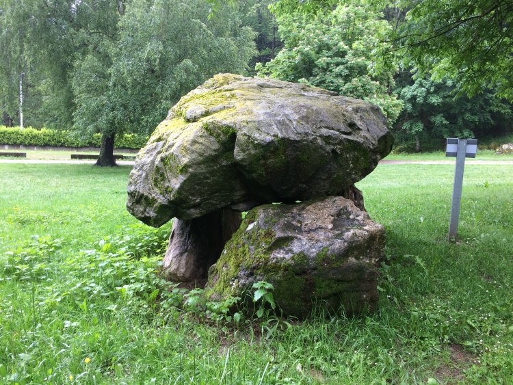
This solution was chosen in June 1992 after a meeting attended by the Regional Archaeological Service, Equipment (DDE), the General Council and the town of Mercus-Amplaing: it was considered that maintaining on site did not guarantee optimum quality security. The dolmen was then moved into several pieces with a hoist and placed on the platform of a tractor with moultes precautions; it was stored on a common, protected by a tarp held by a sand ring.
It now remains to go up since the highway is completed. still expected, though it was one of the themes of the campaign for municipal Amplaing. "It's part of the work program provided for our group said Mayor José Lorenzo, of the five villages of the town we had planned this for Amplaing. This will be done but it must first surrender the DDE us as planned on land that had been given him for crushing and deliver the site condition. "Manuel Alcaine, assistant to the environment, confirms:" At the moment there are a lot of gravel on the site; it will therefore clear. Other big impediment should put the battery in the same place. "In short we should review one of these days this stony witness of the past and it will not be a shame because as Mr. Lorenzo:" The dolmen is always indicated on the IGN maps, but tourists seek and of course do not find the not. "
ladepeche
You may be viewing yesterday's version of this page. To see the most up to date information please register for a free account.
Do not use the above information on other web sites or publications without permission of the contributor.
Click here to see more info for this site
Nearby sites
Click here to view sites on an interactive map of the areaKey: Red: member's photo, Blue: 3rd party photo, Yellow: other image, Green: no photo - please go there and take one, Grey: site destroyed
Download sites to:
KML (Google Earth)
GPX (GPS waypoints)
CSV (Garmin/Navman)
CSV (Excel)
To unlock full downloads you need to sign up as a Contributory Member. Otherwise downloads are limited to 50 sites.
Turn off the page maps and other distractions
Nearby sites listing. In the following links * = Image available
4.1km WSW 251° Grotte de Bédeilhac* Cave or Rock Shelter
4.4km S 191° Musée de Tarascon Museum
4.7km SW 228° Parc Pyrénéen de l'Art Préhistorique* Museum
5.9km SSW 207° Dolmen de la Plagne Burial Chamber or Dolmen
6.3km S 178° Grotte des Eglises Cave or Rock Shelter
6.8km S 181° Grotte de Lombrives* Cave or Rock Shelter
7.4km SSW 195° Grotte de Niaux* Cave or Rock Shelter
7.5km SSW 199° Grotte de La Vache* Cave or Rock Shelter
7.7km SSW 194° Grotte de la Petite Caougno* Cave or Rock Shelter
8.4km SSE 165° Grotte de Fontanet Cave or Rock Shelter
8.9km N 354° Grotte de Cheval Cave or Rock Shelter
9.1km N 353° Musée Départemental de l'Ariège* Museum
9.4km SSW 199° Dolmen de Quiernès Natural Stone / Erratic / Other Natural Feature
10.3km NNE 21° Grotte de l'Herm Cave or Rock Shelter
15.3km SW 214° Palet de Sanson* Natural Stone / Erratic / Other Natural Feature
17.5km NNW 339° Grotte du Portel* Cave or Rock Shelter
17.5km E 93° Montségur* Ancient Village or Settlement
17.7km E 95° Montségur museum* Museum
19.2km E 87° Roc de Fougasse Natural Stone / Erratic / Other Natural Feature
20.3km SE 136° La Cabane de Rolana* Burial Chamber or Dolmen
22.6km NW 305° Hautech ancient copper mine Ancient Mine, Quarry or other Industry
23.8km SE 136° Menhir de Savignac-les-Ormeaux* Standing Stone (Menhir)
23.8km WNW 298° Rougé ancient copper mine Ancient Mine, Quarry or other Industry
23.9km W 273° Grotte du Ker de Massat* Cave or Rock Shelter
24.6km E 88° Source de Fontestorbes* Holy Well or Sacred Spring
View more nearby sites and additional images


 We would like to know more about this location. Please feel free to add a brief description and any relevant information in your own language.
 Wir möchten mehr über diese Stätte erfahren. Bitte zögern Sie nicht, eine kurze Beschreibung und relevante Informationen in Deutsch hinzuzufügen.
 Nous aimerions en savoir encore un peu sur les lieux. S'il vous plaît n'hesitez pas à ajouter une courte description et tous les renseignements pertinents dans votre propre langue.
 Quisieramos informarnos un poco más de las lugares. No dude en añadir una breve descripción y otros datos relevantes en su propio idioma.