 with our Megalithic Portal iPhone app")


<< Our Photo Pages >> Source de Fontestorbes - Holy Well or Sacred Spring in France in Midi:Ariège (09)
Submitted by thecaptain on Tuesday, 28 February 2006 Page Views: 6662
Springs and Holy WellsSite Name: Source de FontestorbesCountry: France Département: Midi:Ariège (09) Type: Holy Well or Sacred Spring
Nearest Town: Lavelanet Nearest Village: Belesta
Latitude: 42.890000N Longitude: 1.920000E
Condition:
| 5 | Perfect |
| 4 | Almost Perfect |
| 3 | Reasonable but with some damage |
| 2 | Ruined but still recognisable as an ancient site |
| 1 | Pretty much destroyed, possibly visible as crop marks |
| 0 | No data. |
| -1 | Completely destroyed |
| 5 | Superb |
| 4 | Good |
| 3 | Ordinary |
| 2 | Not Good |
| 1 | Awful |
| 0 | No data. |
| 5 | Can be driven to, probably with disabled access |
| 4 | Short walk on a footpath |
| 3 | Requiring a bit more of a walk |
| 2 | A long walk |
| 1 | In the middle of nowhere, a nightmare to find |
| 0 | No data. |
| 5 | co-ordinates taken by GPS or official recorded co-ordinates |
| 4 | co-ordinates scaled from a detailed map |
| 3 | co-ordinates scaled from a bad map |
| 2 | co-ordinates of the nearest village |
| 1 | co-ordinates of the nearest town |
| 0 | no data |
Internal Links:
External Links:
I have visited· I would like to visit
TheCaptain visited on 11th Sep 2005 - their rating: Cond: 4 Amb: 4 Access: 5 This is a very interesting place, one of only a few known examples in the world, with its intermittant spring gushing from a cave in a cliff face beside the road, well signposted a kilometre or so to the south of the little Pyrenean town of Belesta. In the dry summer months, due to a complex and not fully understood syphoning mechanism, the spring alternates between full flowing river, and barely a trickle, on an approximately hourly cycle for about 4 months of the year.
The place has been well done up since I was last here 5 years ago, with new parking area, a pedestrian bridge built over the stream, and a building with shop and cafe facilities, with more planned such as a picnic site and nature walk, and there were quite a lot of people here.
When I arrived, the spring was gushing quite a lot, the water easily covering the little steps across the entrance into the cave, just as it was every other time I have visited here in the past (I think I have been here about 4 times before, and never seen the spring dry up). So I went for a look round the little info centre, which now has a bar and lots of information about various tourist places and things, and was being run by a nice friendly couple, and it even has information leaflets about the spring in English these days. This explains the best understanding of the springs working, and states that it does not start cycling until after a long dry spell in the summer (I had always been in spring or early summer before).
As I left the centre, and had another look at the spring, it seemed to be slowing down. After another 5 minutes, the flow had lowered enough that a chap could walk across the steps and into the cave. Ten minutes later, it had slowed right down to a trickle, allowing people to walk across the stepping stones into the cave. It was not easy to see where the water comes from, it must be somewhere under the floor of the pond.
As would be expected of such a strange place, it has been revered since time immemorial, and of course there are many legends and stories associated with it. Excellent, I have at last seen this thing at work !
TheCaptain visited on 24th Apr 2000 - their rating: Access: 5 Lovely sunny day exploring in the Ariege hills. Puivert castle. Fontestorbes intermittent spring fascinating. Montsegur Castle. Pass de ? closed. Plain de ? Ax-les-Thermes, Col de Portel, scary roads. Mas D’Azil. Toulouse late.
Average ratings for this site from all visit loggers: Access: 5
")
The place has been well done up since I was last here 5 years ago, with new parking area, a pedestrian bridge built over the stream, and a building with shop and cafe facilities, with more planned such as a picnic site and nature walk, and there were quite a lot of people here.
When I arrived, the spring was gushing quite a lot, the water easily covering the little steps across the entrance into the cave, just as it was every other time I have visited here in the past (I think I have been here about 4 times before, and never seen the spring dry up). So I went for a look round the little info centre, which now has a bar and lots of information about various tourist places and things, and was being run by a nice friendly couple, and it even has information leaflets about the spring in English these days. This explains the best understanding of the springs working, and states that it does not start cycling until after a long dry spell in the summer (I had always been in spring or early summer before).
As I left the centre, and had another look at the spring, it seemed to be slowing down. After another 5 minutes, the flow had lowered enough that a chap could walk across the steps and into the cave. Ten minutes later, it had slowed right down to a trickle, allowing people to walk across the stepping stones into the cave. It was not easy to see where the water comes from, it must be somewhere under the floor in the cave.
As would be expected of such a strange place, it has been revered since time immemorial, and of course there are many legends and stories associated with it.
You may be viewing yesterday's version of this page. To see the most up to date information please register for a free account.
")
")
Do not use the above information on other web sites or publications without permission of the contributor.
Nearby Images from Flickr
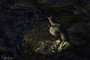
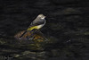
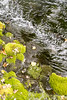


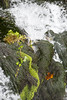
The above images may not be of the site on this page, but were taken nearby. They are loaded from Flickr so please click on them for image credits.
Click here to see more info for this site
Nearby sites
Click here to view sites on an interactive map of the areaKey: Red: member's photo, Blue: 3rd party photo, Yellow: other image, Green: no photo - please go there and take one, Grey: site destroyed
Download sites to:
KML (Google Earth)
GPX (GPS waypoints)
CSV (Garmin/Navman)
CSV (Excel)
To unlock full downloads you need to sign up as a Contributory Member. Otherwise downloads are limited to 50 sites.
Turn off the page maps and other distractions
Nearby sites listing. In the following links * = Image available
5.1km NNE 20° Angauly Dolmen Burial Chamber or Dolmen
5.5km W 274° Roc de Fougasse Natural Stone / Erratic / Other Natural Feature
7.3km WSW 258° Montségur* Ancient Village or Settlement
7.3km WSW 253° Montségur museum* Museum
13.9km ESE 109° Grotte de la Cauna Cave or Rock Shelter
18.6km SSE 156° Dolmen du Col des Trabesses Burial Chamber or Dolmen
18.7km SW 215° La Cabane de Rolana* Burial Chamber or Dolmen
19.7km SSW 205° Menhir de Savignac-les-Ormeaux* Standing Stone (Menhir)
22.7km WNW 293° Grotte de l'Herm Cave or Rock Shelter
24.1km WSW 249° Grotte de Fontanet Cave or Rock Shelter
24.6km W 269° Dolmen de Peyrogall* Burial Chamber or Dolmen
25.4km WSW 254° Grotte des Eglises Cave or Rock Shelter
25.9km WSW 253° Grotte de Lombrives* Cave or Rock Shelter
25.9km W 259° Musée de Tarascon Museum
26.8km WNW 288° Grotte de Cheval Cave or Rock Shelter
27.0km WNW 288° Musée Départemental de l'Ariège* Museum
27.7km WSW 253° Grotte de la Petite Caougno* Cave or Rock Shelter
27.7km WSW 254° Grotte de Niaux* Cave or Rock Shelter
27.9km WSW 258° Dolmen de la Plagne Burial Chamber or Dolmen
28.2km WSW 254° Grotte de La Vache* Cave or Rock Shelter
28.4km W 262° Parc Pyrénéen de l'Art Préhistorique* Museum
28.5km W 266° Grotte de Bédeilhac* Cave or Rock Shelter
29.3km WSW 251° Dolmen de Quiernès Natural Stone / Erratic / Other Natural Feature
29.9km SSE 151° Dolmen de Bruga Burial Chamber or Dolmen
30.5km SE 126° Grand Menhir de Counozouls* Standing Stone (Menhir)
View more nearby sites and additional images


 We would like to know more about this location. Please feel free to add a brief description and any relevant information in your own language.
 Wir möchten mehr über diese Stätte erfahren. Bitte zögern Sie nicht, eine kurze Beschreibung und relevante Informationen in Deutsch hinzuzufügen.
 Nous aimerions en savoir encore un peu sur les lieux. S'il vous plaît n'hesitez pas à ajouter une courte description et tous les renseignements pertinents dans votre propre langue.
 Quisieramos informarnos un poco más de las lugares. No dude en añadir una breve descripción y otros datos relevantes en su propio idioma.