 with our Megalithic Portal iPhone app")


<< Text Pages >> La Pierre-Levée-de-Courçu - Standing Stone (Menhir) in France in Poitou:Vienne (86)
Submitted by TheCaptain on Saturday, 16 April 2005 Page Views: 2884
Neolithic and Bronze AgeSite Name: La Pierre-Levée-de-CourçuCountry: France Département: Poitou:Vienne (86) Type: Standing Stone (Menhir)
Nearest Town: Loudun Nearest Village: Trois-Moutiers (Les)
Latitude: 47.047700N Longitude: 0.0354W
Condition:
| 5 | Perfect |
| 4 | Almost Perfect |
| 3 | Reasonable but with some damage |
| 2 | Ruined but still recognisable as an ancient site |
| 1 | Pretty much destroyed, possibly visible as crop marks |
| 0 | No data. |
| -1 | Completely destroyed |
| 5 | Superb |
| 4 | Good |
| 3 | Ordinary |
| 2 | Not Good |
| 1 | Awful |
| 0 | No data. |
| 5 | Can be driven to, probably with disabled access |
| 4 | Short walk on a footpath |
| 3 | Requiring a bit more of a walk |
| 2 | A long walk |
| 1 | In the middle of nowhere, a nightmare to find |
| 0 | No data. |
| 5 | co-ordinates taken by GPS or official recorded co-ordinates |
| 4 | co-ordinates scaled from a detailed map |
| 3 | co-ordinates scaled from a bad map |
| 2 | co-ordinates of the nearest village |
| 1 | co-ordinates of the nearest town |
| 0 | no data |
Internal Links:
External Links:
Menhir in Vienne
IMPORTANT NOTE: Positional co-ordinates scaled from a detailed map source
You may be viewing yesterday's version of this page. To see the most up to date information please register for a free account.
Do not use the above information on other web sites or publications without permission of the contributor.
Nearby Images from Flickr
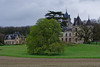
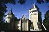
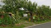
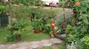
The above images may not be of the site on this page, but were taken nearby. They are loaded from Flickr so please click on them for image credits.
Click here to see more info for this site
Nearby sites
Click here to view sites on an interactive map of the areaKey: Red: member's photo, Blue: 3rd party photo, Yellow: other image, Green: no photo - please go there and take one, Grey: site destroyed
Download sites to:
KML (Google Earth)
GPX (GPS waypoints)
CSV (Garmin/Navman)
CSV (Excel)
To unlock full downloads you need to sign up as a Contributory Member. Otherwise downloads are limited to 50 sites.
Turn off the page maps and other distractions
Nearby sites listing. In the following links * = Image available
3.2km ENE 62° Vaon Dolmen* Burial Chamber or Dolmen
3.5km E 81° Dolmen de la Rente de Fontevrault* Burial Chamber or Dolmen
3.9km E 83° La Pierre Crapaud* Burial Chamber or Dolmen
4.0km N 8° Dolmen de la Fontaine au Son 1* Burial Chamber or Dolmen
4.0km N 9° Dolmen de la Fontaine au Son 2* Burial Chamber or Dolmen
4.1km E 87° Menhir de la Porte Rouge* Standing Stone (Menhir)
4.2km E 89° Dolmen de la Porte Rouge* Burial Chamber or Dolmen
4.5km ENE 69° Trois-Moutiers dolmen Burial Chamber or Dolmen
4.5km E 93° Dolmen du Tertre des Fées* Burial Chamber or Dolmen
5.3km ESE 103° La Roche Vernaise* Burial Chamber or Dolmen
6.5km N 350° Les Dormants Dolmen Burial Chamber or Dolmen
7.3km NW 326° Grande Pierre Levée de la Daviere Standing Stone (Menhir)
7.6km S 173° Dolmen dit la Pierre-de-Verre* Burial Chamber or Dolmen
9.4km SE 129° Dolmen de Lassay Burial Chamber or Dolmen
9.6km WNW 304° Dolmen du Griffier* Burial Chamber or Dolmen
9.7km S 176° La Petite Pierre Levée (Chantebrault)* Burial Chamber or Dolmen
9.8km S 176° La Grande Pierre Levée (Chantebrault)* Burial Chamber or Dolmen
9.8km S 172° Dolmen de Champs Lochet* Burial Chamber or Dolmen
10.0km E 84° Dolmen d'Epennes* Burial Chamber or Dolmen
10.9km NW 316° l'Accomodement Menhir* Standing Stone (Menhir)
11.3km NE 52° La Pierre-Folle allée couverte* Passage Grave
11.5km SSE 161° Tumulus de Chassigny* Round Barrow(s)
11.6km SSE 160° Dolmen de Briande 1* Burial Chamber or Dolmen
11.7km SW 236° Dolmen dit le Gras du Chien* Burial Chamber or Dolmen
11.7km SW 236° Pierre Levée (St Léger-de-Montbrun)* Burial Chamber or Dolmen
View more nearby sites and additional images


 We would like to know more about this location. Please feel free to add a brief description and any relevant information in your own language.
 Wir möchten mehr über diese Stätte erfahren. Bitte zögern Sie nicht, eine kurze Beschreibung und relevante Informationen in Deutsch hinzuzufügen.
 Nous aimerions en savoir encore un peu sur les lieux. S'il vous plaît n'hesitez pas à ajouter une courte description et tous les renseignements pertinents dans votre propre langue.
 Quisieramos informarnos un poco más de las lugares. No dude en añadir una breve descripción y otros datos relevantes en su propio idioma.