

<< Our Photo Pages >> Pen Howe (Sleights Moor) - Round Barrow(s) in England in Yorkshire (North)
Submitted by johndhunter on Sunday, 17 July 2022 Page Views: 428
Neolithic and Bronze AgeSite Name: Pen Howe (Sleights Moor) Alternative Name: Pin HoweCountry: England County: Yorkshire (North) Type: Round Barrow(s)
Nearest Town: Whitby Nearest Village: Grosmont
Map Ref: NZ8563903722
Latitude: 54.421734N Longitude: 0.681655W
Condition:
| 5 | Perfect |
| 4 | Almost Perfect |
| 3 | Reasonable but with some damage |
| 2 | Ruined but still recognisable as an ancient site |
| 1 | Pretty much destroyed, possibly visible as crop marks |
| 0 | No data. |
| -1 | Completely destroyed |
| 5 | Superb |
| 4 | Good |
| 3 | Ordinary |
| 2 | Not Good |
| 1 | Awful |
| 0 | No data. |
| 5 | Can be driven to, probably with disabled access |
| 4 | Short walk on a footpath |
| 3 | Requiring a bit more of a walk |
| 2 | A long walk |
| 1 | In the middle of nowhere, a nightmare to find |
| 0 | No data. |
| 5 | co-ordinates taken by GPS or official recorded co-ordinates |
| 4 | co-ordinates scaled from a detailed map |
| 3 | co-ordinates scaled from a bad map |
| 2 | co-ordinates of the nearest village |
| 1 | co-ordinates of the nearest town |
| 0 | no data |
Internal Links:
External Links:
 (PID:244693)")
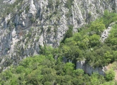
A bronze age round barrow in a prominent position on Sleights Moor with good all round views.
This is ‘HERR’ MONUMENT 29299 which tells us that it is flat topped, 19m in diameter and 1.4 m high.
The record also tells us that there is an adjacent, smaller round barrow about 30m to the south, which is 12m in diameter and 0.5m high. This is at NZ 85638 03693 (my gps) and though the record doesn’t say, it is also flat topped. Whilst both barrows are generally heather covered, Pen Howe because of its height stands out clearly from a distance, not so the adjacent barrow you usually have to get quite close before you spot it.
Note : On some historical maps it is named Pin Howe
You may be viewing yesterday's version of this page. To see the most up to date information please register for a free account.
 (PID:244692)")
 (PID:244691)")
 (PID:244690)")
 (PID:244689)")
 (PID:244688)")
 (PID:244686)")
 (PID:244685)")
Do not use the above information on other web sites or publications without permission of the contributor.
Click here to see more info for this site
Nearby sites
Key: Red: member's photo, Blue: 3rd party photo, Yellow: other image, Green: no photo - please go there and take one, Grey: site destroyed
Download sites to:
KML (Google Earth)
GPX (GPS waypoints)
CSV (Garmin/Navman)
CSV (Excel)
To unlock full downloads you need to sign up as a Contributory Member. Otherwise downloads are limited to 50 sites.
Turn off the page maps and other distractions
Nearby sites listing. In the following links * = Image available
410m SW 221° Breckon Howe (Sleights Moor)* Round Barrow(s) (NZ8537603406)
897m N 353° Flat Howe (Sleights Moor)* Round Barrow(s) (NZ85510461)
997m SSW 208° Sil Howe* Round Barrow(s) (NZ8519002830)
1.1km NW 326° High Bridestones (Yorks)* Stone Circle (NZ8499704629)
1.2km SSE 152° Flass Brow Marker Stones* Marker Stone (NZ8620802708)
1.2km E 99° Greenland's Howe (Sleights Moor)* Cist (NZ8688103552)
1.4km SSE 166° Flass Brow Round Barrow* Round Barrow(s) (NZ860024)
1.6km NW 317° Low Bridestones (Yorks)* Stone Row / Alignment (NZ8454104859)
1.7km W 262° Stony Rigg RB1 (Goathland Moor)* Round Barrow(s) (NZ8395703441)
2.1km SSE 147° Robbed Howe* Round Barrow(s) (NZ8685001958)
2.6km WSW 251° Allan Tofts 9* Rock Art (NZ8316902842)
2.7km WSW 257° Allan Tofts 2d* Rock Art (NZ8303503047)
2.7km WSW 257° Allan Tofts 2b* Rock Art (NZ8300503083)
2.7km WSW 257° Allan Tofts 2c* Rock Art (NZ8300503059)
2.7km WSW 256° Allan Tofts 2e* Rock Art (NZ8298903016)
2.8km WSW 256° Allan Tofts 2g* Rock Art (NZ8294903016)
2.9km WSW 251° Allan Tofts 7* Rock Art (NZ8294502747)
2.9km WSW 255° Allan Tofts 4b* Rock Art (NZ8283002928)
3.1km WSW 254° Allan Tofts 5c* Rock Art (NZ8265502816)
3.1km SE 136° York Cross (Sneaton High Moor)* Ancient Cross (NZ8785901524)
3.3km SSE 148° Foster Howes* Round Barrow(s) (NZ8744800991)
3.4km WSW 247° Pennock Puzzle Stone* Carving (NZ8252902337)
4.1km SSE 150° Ann's Cross* Ancient Cross (NZ8777400168)
4.3km N 6° Aislaby Moor Rock Art (NZ8608)
4.5km ESE 104° John Cross (Shooting House Rigg)* Ancient Cross (NZ9000802704)
View more nearby sites and additional images


 We would like to know more about this location. Please feel free to add a brief description and any relevant information in your own language.
 Wir möchten mehr über diese Stätte erfahren. Bitte zögern Sie nicht, eine kurze Beschreibung und relevante Informationen in Deutsch hinzuzufügen.
 Nous aimerions en savoir encore un peu sur les lieux. S'il vous plaît n'hesitez pas à ajouter une courte description et tous les renseignements pertinents dans votre propre langue.
 Quisieramos informarnos un poco más de las lugares. No dude en añadir una breve descripción y otros datos relevantes en su propio idioma.