

<< Text Pages >> Wishing Pot (Minnigaff) - Holy Well or Sacred Spring in Scotland in Dumfries and Galloway
Submitted by Anne T on Monday, 20 June 2022 Page Views: 285
Springs and Holy WellsSite Name: Wishing Pot (Minnigaff) Alternative Name: Wishing Well (Minnigaff)Country: Scotland County: Dumfries and Galloway Type: Holy Well or Sacred Spring
Nearest Town: Newton Stewart Nearest Village: Minnigaff
Map Ref: NX4132666941
Latitude: 54.971745N Longitude: 4.480481W
Condition:
| 5 | Perfect |
| 4 | Almost Perfect |
| 3 | Reasonable but with some damage |
| 2 | Ruined but still recognisable as an ancient site |
| 1 | Pretty much destroyed, possibly visible as crop marks |
| 0 | No data. |
| -1 | Completely destroyed |
| 5 | Superb |
| 4 | Good |
| 3 | Ordinary |
| 2 | Not Good |
| 1 | Awful |
| 0 | No data. |
| 5 | Can be driven to, probably with disabled access |
| 4 | Short walk on a footpath |
| 3 | Requiring a bit more of a walk |
| 2 | A long walk |
| 1 | In the middle of nowhere, a nightmare to find |
| 0 | No data. |
| 5 | co-ordinates taken by GPS or official recorded co-ordinates |
| 4 | co-ordinates scaled from a detailed map |
| 3 | co-ordinates scaled from a bad map |
| 2 | co-ordinates of the nearest village |
| 1 | co-ordinates of the nearest town |
| 0 | no data |
Be the first person to rate this site - see the 'Contribute!' box in the right hand menu.
Internal Links:
External Links:
Holy Well or Sacred Spring in Dumfries and Galloway
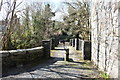
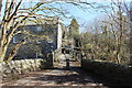
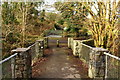
The Wishing Pot "does not appear on any available mapping but is known locally as a wishing well beneath Queen Mary's Bridge". Whilst a wishing well is an odd site type to be included here, it may be the tradition of wishing has grown over time from using the well water for healing purposes, each time making a wish (or asking for a blessing) that healing results from use of, or contact with, the well water. Use of the water for healing may have ceased, but the wishing tradition remains.
Information about this well has been collected by the Can You Dig It: Lost Wells of Galloway project. They add: "It is a round, deep hole in the rocks about 30cms across, probably formed naturally by the action of the water. Well known in the Newton Stewart and Minnigaff areas as a wishing well requiring stones to be dropped into it from the bridge for a wish to come true. The number of stones needing to be dropped into the well varies but three seems to be a common figure".
If anyone knows anything more about this well, and whether its water was used for healing or restorative purposes, please add a comment here.
The Lost Wells of Galloway project is a community project, "setting out to map and better understand lost wells in Galloway, considering how we relate to these historic features now and how this has changed over time".
Note: Do you have any photographs of this site or information you can add? Thank you.
You may be viewing yesterday's version of this page. To see the most up to date information please register for a free account.
Do not use the above information on other web sites or publications without permission of the contributor.
Nearby Images from Geograph Britain and Ireland:
©2014(licence)
©2014(licence)
©2015(licence)
©2013(licence)
©2014(licence)
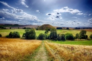
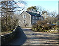
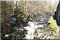
The above images may not be of the site on this page, they are loaded from Geograph.
Please Submit an Image of this site or go out and take one for us!
Click here to see more info for this site
Nearby sites
Key: Red: member's photo, Blue: 3rd party photo, Yellow: other image, Green: no photo - please go there and take one, Grey: site destroyed
Download sites to:
KML (Google Earth)
GPX (GPS waypoints)
CSV (Garmin/Navman)
CSV (Excel)
To unlock full downloads you need to sign up as a Contributory Member. Otherwise downloads are limited to 50 sites.
Turn off the page maps and other distractions
Nearby sites listing. In the following links * = Image available
486m SW 216° Minnigaff Old Church* Ancient Cross (NX4102666557)
1.3km S 183° Charlie's Well (Minnigaff) Holy Well or Sacred Spring (NX4121565608)
1.4km SSE 163° Creebridge Cairn* Cairn (NX4168765595)
1.6km ESE 106° Gout Well of Larg (Minnigaff) Holy Well or Sacred Spring (NX4281766466)
1.7km SE 124° Kirroughtree House N* Cairn (NX42676596)
1.7km ESE 118° Parliament Knowe Fort Hillfort (NX428661)
1.8km SE 134° Kirroughtree House W* Cairn (NX42576566)
1.8km SSE 147° High Lessons* Cairn (NX42266540)
1.9km SE 130° Kirroughtree House E* Cairn (NX42716568)
1.9km SE 143° Low Lessons* Cairn (NX42426539)
2.0km WSW 252° Barnkirk Hill Hillfort (NX394664)
2.1km ENE 75° Pot Well (Minnigaff) Holy Well or Sacred Spring (NX4340367419)
2.2km NNW 338° Boreland* Chambered Cairn (NX40576900)
2.7km NW 312° Drumwhirn Cairn* Cairn (NX39356884)
3.0km NNW 334° Barclye Rocking Stone* Natural Stone / Erratic / Other Natural Feature (NX4011169664)
3.0km NW 304° Barclye Cairn* Cairn (NX38906873)
4.0km N 349° Drannandow S* Cairn (NX40697088)
4.2km SSE 162° St Ninian's Well (Upper Barr) Holy Well or Sacred Spring (NX42506286)
4.2km NNW 339° Drumfern S* Cairn (NX39957096)
4.3km NNW 340° Drannandow Circle* Stone Circle (NX39997099)
4.3km N 351° Rorie Gill * Cairn (NX40797117)
4.4km N 352° Drannandow Chambered Cairn* Chambered Cairn (NX40837135)
4.5km NNW 341° Drumfern Cairn* Round Cairn (NX39977124)
4.7km NNW 347° The Thieves* Standing Stones (NX4044071597)
5.3km S 178° High Baltersan* Cairn (NX41346168)
View more nearby sites and additional images


 We would like to know more about this location. Please feel free to add a brief description and any relevant information in your own language.
 Wir möchten mehr über diese Stätte erfahren. Bitte zögern Sie nicht, eine kurze Beschreibung und relevante Informationen in Deutsch hinzuzufügen.
 Nous aimerions en savoir encore un peu sur les lieux. S'il vous plaît n'hesitez pas à ajouter une courte description et tous les renseignements pertinents dans votre propre langue.
 Quisieramos informarnos un poco más de las lugares. No dude en añadir una breve descripción y otros datos relevantes en su propio idioma.