<< Our Photo Pages >> Dún na Manach wedge tomb - Wedge Tomb in Ireland (Republic of) in Co. Kerry
Submitted by GaelicLaird on Monday, 18 October 2021 Page Views: 1476
Neolithic and Bronze AgeSite Name: Dún na Manach wedge tomb Alternative Name: Púicín an Chairn (Pookauncorrin)Country: Ireland (Republic of) County: Co. Kerry Type: Wedge Tomb
Nearest Village: Lispole
Latitude: 52.127270N Longitude: 10.15398W
Condition:
| 5 | Perfect |
| 4 | Almost Perfect |
| 3 | Reasonable but with some damage |
| 2 | Ruined but still recognisable as an ancient site |
| 1 | Pretty much destroyed, possibly visible as crop marks |
| 0 | No data. |
| -1 | Completely destroyed |
| 5 | Superb |
| 4 | Good |
| 3 | Ordinary |
| 2 | Not Good |
| 1 | Awful |
| 0 | No data. |
| 5 | Can be driven to, probably with disabled access |
| 4 | Short walk on a footpath |
| 3 | Requiring a bit more of a walk |
| 2 | A long walk |
| 1 | In the middle of nowhere, a nightmare to find |
| 0 | No data. |
| 5 | co-ordinates taken by GPS or official recorded co-ordinates |
| 4 | co-ordinates scaled from a detailed map |
| 3 | co-ordinates scaled from a bad map |
| 2 | co-ordinates of the nearest village |
| 1 | co-ordinates of the nearest town |
| 0 | no data |
Internal Links:
External Links:
I have visited· I would like to visit
rrmoser would like to visit
")
Officially recorded as monument number KE054-045
A stone at the E edge of the mound and a 2nd stone immediately within the perimeter at NW are well set in the ground and may be kerb-stones. The gallery, which at present measures 3.85m in length, decreases in height and width from W to E. It is 1.7m wide and 1.5m high at W and .9m wide and .75m high at E. The backstone is missing but has been replaced by a later stone wall. The entrance at W has also been closed by secondary walling.
The N side of the gallery is represented by 4 orthostats. A gap of .9m between the 2 westernmost stones now provides access to the interior but probably originally contained a 5th orthostat. A single stone outside the wall, towards its E end, forms a doubling of the wall here. The S side of the gallery also consists of 4 orthostats. The structure is roofed by 2 slabs, that to W being supported partly by the side walls and partly by the E roof stone.
The above description is derived from J. Cuppage, ‘Corca Dhuibhne. Dingle Peninsula archaeological survey. Ballyferriter. Oidhreacht Chorca Dhuibhne’ (1986), no. 34.
You may be viewing yesterday's version of this page. To see the most up to date information please register for a free account.
")
")
")
Do not use the above information on other web sites or publications without permission of the contributor.
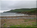
Nearby Images from Geograph Britain and Ireland:
©2006(licence)
©2006(licence)
©2006(licence)
©2006(licence)
©2008(licence)
The above images may not be of the site on this page, they are loaded from Geograph.
Please Submit an Image of this site or go out and take one for us!
Click here to see more info for this site
Nearby sites
Click here to view sites on an interactive map of the areaKey: Red: member's photo, Blue: 3rd party photo, Yellow: other image, Green: no photo - please go there and take one, Grey: site destroyed
Download sites to:
KML (Google Earth)
GPX (GPS waypoints)
CSV (Garmin/Navman)
CSV (Excel)
To unlock full downloads you need to sign up as a Contributory Member. Otherwise downloads are limited to 50 sites.
Turn off the page maps and other distractions
Nearby sites listing. In the following links * = Image available
745m NW 322° Ardamore* Stone Row / Alignment (Q521000)
1.1km ESE 104° Minard W Standing Stones (V536991)
1.2km NNE 31° An Gráig standing stone* Standing Stone (Menhir)
1.3km W 279° Áth an Charbaill rock art* Rock Art
2.7km N 9° Gownlaneard Standing Stones (Q53050203)
2.9km W 268° Kinard East* Carving (V496994)
4.9km NW 311° Ballyrishteen Standing Stones (Q489027)
6.1km W 271° Ballintaggart Nine Stones* Early Christian Sculptured Stone (V464997)
7.4km NE 48° Coumduff Standing Stones (Q58200418)
8.7km N 360° Ballyhoneen Wedge Tomb* Wedge Tomb
8.9km NE 54° Derrygorman Standing Stones (Q599044)
9.0km NE 48° Dromvally SE* Standing Stones (Q59440514)
9.7km W 278° Baile an Mhuilinn rock art* Rock Art
9.7km W 278° Gallán na Cille Brice standing stone* Standing Stone (Menhir)
9.7km W 279° Milltown N* Standing Stones (Q42960113)
9.7km W 278° Milltown S Standing Stones (Q429010)
10.4km W 270° Colaiste Ide Ogham Stones* Museum (V4211599651)
10.8km WNW 291° Kilfountan Standing Stone* Standing Stone (Menhir) (Q425035)
10.9km WNW 289° Kilfountain Cross Slab* Early Christian Sculptured Stone (Q423032)
11.1km WNW 295° Knockavrogeen E Standing Stones (Q42580434)
11.8km N 1° Drom E Standing Stones (Q53181124)
13.5km N 352° Cloonsherragh Stone Row / Alignment (Q511128)
13.5km NW 322° Brandon Mountain Modern Stone Circle etc (Q445103)
13.7km WNW 303° Corr Aille Spiral* Rock Art
13.9km WNW 295° Cathair Deargáin cashel* Stone Fort or Dun
View more nearby sites and additional images


 We would like to know more about this location. Please feel free to add a brief description and any relevant information in your own language.
 Wir möchten mehr über diese Stätte erfahren. Bitte zögern Sie nicht, eine kurze Beschreibung und relevante Informationen in Deutsch hinzuzufügen.
 Nous aimerions en savoir encore un peu sur les lieux. S'il vous plaît n'hesitez pas à ajouter une courte description et tous les renseignements pertinents dans votre propre langue.
 Quisieramos informarnos un poco más de las lugares. No dude en añadir una breve descripción y otros datos relevantes en su propio idioma.