<< Our Photo Pages >> Kilfountan Standing Stone - Standing Stone (Menhir) in Ireland (Republic of) in Co. Kerry
Submitted by Anthony_Weir on Sunday, 08 May 2011 Page Views: 6029
Neolithic and Bronze AgeSite Name: Kilfountan Standing Stone Alternative Name: GallánCountry: Ireland (Republic of) County: Co. Kerry Type: Standing Stone (Menhir)
Map Ref: Q425035
Latitude: 52.161333N Longitude: 10.302392W
Condition:
| 5 | Perfect |
| 4 | Almost Perfect |
| 3 | Reasonable but with some damage |
| 2 | Ruined but still recognisable as an ancient site |
| 1 | Pretty much destroyed, possibly visible as crop marks |
| 0 | No data. |
| -1 | Completely destroyed |
| 5 | Superb |
| 4 | Good |
| 3 | Ordinary |
| 2 | Not Good |
| 1 | Awful |
| 0 | No data. |
| 5 | Can be driven to, probably with disabled access |
| 4 | Short walk on a footpath |
| 3 | Requiring a bit more of a walk |
| 2 | A long walk |
| 1 | In the middle of nowhere, a nightmare to find |
| 0 | No data. |
| 5 | co-ordinates taken by GPS or official recorded co-ordinates |
| 4 | co-ordinates scaled from a detailed map |
| 3 | co-ordinates scaled from a bad map |
| 2 | co-ordinates of the nearest village |
| 1 | co-ordinates of the nearest town |
| 0 | no data |
Internal Links:
External Links:
I have visited· I would like to visit
X-Ice has visited here
")
You may be viewing yesterday's version of this page. To see the most up to date information please register for a free account.
Do not use the above information on other web sites or publications without permission of the contributor.
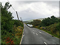
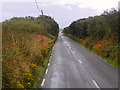
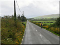
Nearby Images from Geograph Britain and Ireland:
©2019(licence)
©2019(licence)

©2006(licence)
©2019(licence)

©2006(licence)
The above images may not be of the site on this page, they are loaded from Geograph.
Please Submit an Image of this site or go out and take one for us!
Click here to see more info for this site
Nearby sites
Click here to view sites on an interactive map of the areaKey: Red: member's photo, Blue: 3rd party photo, Yellow: other image, Green: no photo - please go there and take one, Grey: site destroyed
Download sites to:
KML (Google Earth)
GPX (GPS waypoints)
CSV (Garmin/Navman)
CSV (Excel)
To unlock full downloads you need to sign up as a Contributory Member. Otherwise downloads are limited to 50 sites.
Turn off the page maps and other distractions
Nearby sites listing. In the following links * = Image available
360m SSW 212° Kilfountain Cross Slab* Early Christian Sculptured Stone (Q423032)
843m N 4° Knockavrogeen E Standing Stones (Q42580434)
2.4km SSE 167° Milltown N* Standing Stones (Q42960113)
2.5km SSE 167° Baile an Mhuilinn rock art* Rock Art
2.5km SSE 168° Gallán na Cille Brice standing stone* Standing Stone (Menhir)
2.5km S 169° Milltown S Standing Stones (Q429010)
3.2km NW 308° Cathair Deargáin cashel* Stone Fort or Dun
3.5km NW 319° Kilmalkedar Ogham Stone* Standing Stone (Menhir) (Q403062)
3.5km NW 318° Cill Maoilchéadair sundial* Early Christian Sculptured Stone
3.5km NW 318° Kilmalkedar Early Christian Sculptured Stone* Early Christian Sculptured Stone (Q40230622)
3.6km WNW 291° Gallarus Oratory* Ancient Temple (Q392049)
3.7km W 269° Leataoibh Meánach standing stone* Standing Stone (Menhir)
3.9km NNW 338° Corr Aille Spiral* Rock Art
3.9km S 184° Colaiste Ide Ogham Stones* Museum (V4211599651)
4.3km WSW 243° Kilcolman Cross-Inscribed Ogham Stone* Early Christian Sculptured Stone (Q386017)
5.1km WSW 239° Giant's Table* Wedge Tomb (Q3801)
5.4km SE 133° Ballintaggart Nine Stones* Early Christian Sculptured Stone (V464997)
5.9km W 279° Reask* Early Christian Sculptured Stone (Q367046)
6.2km WNW 288° Baile an Reannaigh ogham stone* Ancient Village or Settlement
6.4km E 95° Ballyrishteen Standing Stones (Q489027)
6.6km W 275° Ballineanig-Castlequarter Standing Stones (Q359043)
7.1km NNE 15° Brandon Mountain Modern Stone Circle etc (Q445103)
7.3km W 270° Altóir na Gréine* Wedge Tomb
8.2km ESE 118° Kinard East* Carving (V496994)
8.5km W 270° Teeravane Stone Circle (Q340037)
View more nearby sites and additional images


 We would like to know more about this location. Please feel free to add a brief description and any relevant information in your own language.
 Wir möchten mehr über diese Stätte erfahren. Bitte zögern Sie nicht, eine kurze Beschreibung und relevante Informationen in Deutsch hinzuzufügen.
 Nous aimerions en savoir encore un peu sur les lieux. S'il vous plaît n'hesitez pas à ajouter une courte description et tous les renseignements pertinents dans votre propre langue.
 Quisieramos informarnos un poco más de las lugares. No dude en añadir una breve descripción y otros datos relevantes en su propio idioma.