


<< Our Photo Pages >> D8a Kniphorstbos - Passage Grave in Netherlands in Drenthe
Submitted by ShamrockStone on Friday, 19 February 2021 Page Views: 362
Neolithic and Bronze AgeSite Name: D8a KniphorstbosCountry: Netherlands Province: Drenthe Type: Passage Grave
Nearest Town: Assen Nearest Village: Annen
Latitude: 53.059270N Longitude: 6.699770E
Condition:
| 5 | Perfect |
| 4 | Almost Perfect |
| 3 | Reasonable but with some damage |
| 2 | Ruined but still recognisable as an ancient site |
| 1 | Pretty much destroyed, possibly visible as crop marks |
| 0 | No data. |
| -1 | Completely destroyed |
| 5 | Superb |
| 4 | Good |
| 3 | Ordinary |
| 2 | Not Good |
| 1 | Awful |
| 0 | No data. |
| 5 | Can be driven to, probably with disabled access |
| 4 | Short walk on a footpath |
| 3 | Requiring a bit more of a walk |
| 2 | A long walk |
| 1 | In the middle of nowhere, a nightmare to find |
| 0 | No data. |
| 5 | co-ordinates taken by GPS or official recorded co-ordinates |
| 4 | co-ordinates scaled from a detailed map |
| 3 | co-ordinates scaled from a bad map |
| 2 | co-ordinates of the nearest village |
| 1 | co-ordinates of the nearest town |
| 0 | no data |
Internal Links:
External Links:
")
Source: www.hunebeddeninfo.nl
You may be viewing yesterday's version of this page. To see the most up to date information please register for a free account.
Do not use the above information on other web sites or publications without permission of the contributor.
Nearby Images from Flickr


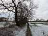
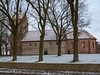
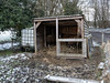
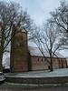
The above images may not be of the site on this page, but were taken nearby. They are loaded from Flickr so please click on them for image credits.
Click here to see more info for this site
Nearby sites
Click here to view sites on an interactive map of the areaKey: Red: member's photo, Blue: 3rd party photo, Yellow: other image, Green: no photo - please go there and take one, Grey: site destroyed
Download sites to:
KML (Google Earth)
GPX (GPS waypoints)
CSV (Garmin/Navman)
CSV (Excel)
To unlock full downloads you need to sign up as a Contributory Member. Otherwise downloads are limited to 50 sites.
Turn off the page maps and other distractions
Nearby sites listing. In the following links * = Image available
27m E 90° D8b Kniphorstbos* Passage Grave
79m NNW 337° D8 Kniphorstbos* Passage Grave
282m NW 307° Anloo Galgenberg* Round Barrow(s)
577m NNW 334° Grafheuvel Driemarkenpunt Round Barrow(s)
1.0km WNW 282° D7 Kniphorstbos* Passage Grave
1.1km ENE 77° D9 Annen* Passage Grave
2.0km NNW 345° Grafheuvel Zuidlaren (46190) Round Barrow(s)
2.1km SSE 155° Grafheuvel Annen (45012)* Round Barrow(s)
2.5km SSE 167° Grafheuvels Annen (45013)* Round Barrow(s)
3.0km WSW 243° Grafheuvel Gasteren (45014) Round Barrow(s)
3.3km S 170° D11 Anloo* Passage Grave
3.4km SW 236° D10 Gasteren* Passage Grave
3.4km SSE 169° Grafheuvel Anloo* Round Barrow(s)
3.4km SSW 208° Grafheuvel Gasteren (45016) Round Barrow(s)
3.6km SSE 152° Grafheuvel Eext (45020)* Round Barrow(s)
3.9km SSE 149° Grafheuvel Eext (45021)* Round Barrow(s)
4.3km SE 134° Grafheuvel Eext (45033) Round Barrow(s)
4.9km SSE 164° Grafheuvel Eext (45023) Round Barrow(s)
5.0km WNW 290° D6 Tynaarlo* Passage Grave
5.0km S 176° Grafheuvel Eext (45022) Round Barrow(s)
5.1km SSE 152° Zwerfsteen Eext* Natural Stone / Erratic / Other Natural Feature
5.2km SSE 162° D12 Eext* Passage Grave
5.3km SSE 154° Zwerfkei Eext* Natural Stone / Erratic / Other Natural Feature
5.6km NNW 328° Grafheuvels Midlaren (45399) Round Barrow(s)
5.6km SSE 161° D13 Eext* Passage Grave
View more nearby sites and additional images


 We would like to know more about this location. Please feel free to add a brief description and any relevant information in your own language.
 Wir möchten mehr über diese Stätte erfahren. Bitte zögern Sie nicht, eine kurze Beschreibung und relevante Informationen in Deutsch hinzuzufügen.
 Nous aimerions en savoir encore un peu sur les lieux. S'il vous plaît n'hesitez pas à ajouter une courte description et tous les renseignements pertinents dans votre propre langue.
 Quisieramos informarnos un poco más de las lugares. No dude en añadir una breve descripción y otros datos relevantes en su propio idioma.