<< Our Photo Pages >> Bransdale West Guide Stone GS1 - Marker Stone in England in Yorkshire (North)
Submitted by johndhunter on Friday, 27 November 2020 Page Views: 623
Modern SitesSite Name: Bransdale West Guide Stone GS1Country: England County: Yorkshire (North) Type: Marker Stone
Nearest Village: Cockayne
Map Ref: SE6120495435
Latitude: 54.350790N Longitude: 1.059879W
Condition:
| 5 | Perfect |
| 4 | Almost Perfect |
| 3 | Reasonable but with some damage |
| 2 | Ruined but still recognisable as an ancient site |
| 1 | Pretty much destroyed, possibly visible as crop marks |
| 0 | No data. |
| -1 | Completely destroyed |
| 5 | Superb |
| 4 | Good |
| 3 | Ordinary |
| 2 | Not Good |
| 1 | Awful |
| 0 | No data. |
| 5 | Can be driven to, probably with disabled access |
| 4 | Short walk on a footpath |
| 3 | Requiring a bit more of a walk |
| 2 | A long walk |
| 1 | In the middle of nowhere, a nightmare to find |
| 0 | No data. |
| 5 | co-ordinates taken by GPS or official recorded co-ordinates |
| 4 | co-ordinates scaled from a detailed map |
| 3 | co-ordinates scaled from a bad map |
| 2 | co-ordinates of the nearest village |
| 1 | co-ordinates of the nearest town |
| 0 | no data |
Internal Links:
External Links:
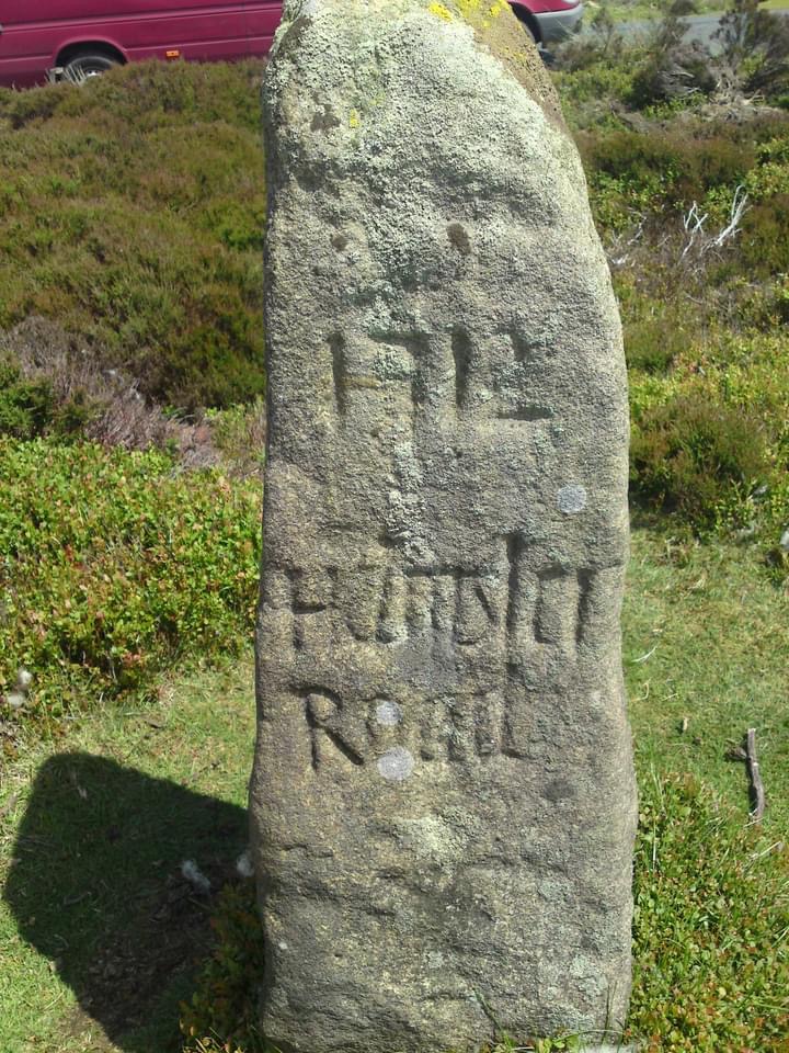
The Guide Stone is Historic England List Entry 1149035. However the detail (as of December 2020) given in the List Entry as regards the inscriptions on the stone, is in my view, both confusing and not wholly accurate. Consequently the information provided below is from both my own observations and Raymond H. Hayes 1988 publication “Old Roads and Pannierways in North East Yorkshire” pages 41, 42 and plate 13 (photo taken 1955).
North Face – ‘To Stoxla’ (Stokesley),
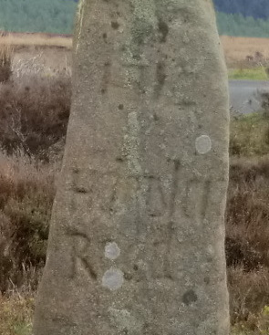
West Face – ‘1712’at the top then ‘Helmsla Road’(Helmsley) in the middle.
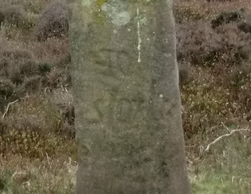
East Face – ‘This Kirby Road’ (Kirkbymoorside) according to Hayes. All I can make out clearly is the word Kirby
South Face – ‘TH’ according to Hayes, also he questions whether the inscription is unfinished. Myself I think it is, the lettering which could also be ‘IH’ or ‘RH’ is towards the centre of the stone and my “guess” as to its meaning is that it may be the initials of the person who erected the stone. My reasoning on this; there are many such stones in the Glaisdale area with the initials ‘TH’ of Thomas Harwood the surveyor of Glaisdale parish who erected them. So maybe these are also the initials of the surveyor of this parish who erected this stone, anyway that’s my “guess”.
The route by which it stands was an ancient trackway, once one of the main north south routes over the moors. First documented in 1145 AD it is known as the Thurkilsti* or Thurkil’s Hill Road, its southern point of origin is not known but is thought to have been York. From there it headed north via what is now Castle Howard and then Welburn before beginning its slow ascent onto the moors along the lane now known as Skiplam Road at SE 67163 85290 between Kirkbymoorside and Nawton. Today, initially road, then turning into track, climbing up onto Pockley Moor past the Hanging Stone and onto this Guide Stone where there is another short section of road. From here it continued north along Bransdale Ridge where it turns into track again to Stump Cross then over Crook Staff Hill and onto the Badger Stone . From here it then probably went east onto Cockayne Ridge before again heading due north crossing what was once an east west paved trod (now a shooters track) known in 1642 as ‘Street Way’ in the vicinity of the boundary stone named as the Red Stone at NZ 60444 01514 on historical OS maps before joining up with the Rudland Rigg north south route (Waingate) at the Jenny Bradley Cross from where it continued to be known as the Thurkilsti as it continued north, descending the moors at Ingleby Bank (NZ 59795 06170) and then heading for Stokesley. The modern 1:25 OS map shows a viewpoint at the top bend of the route on Ingleby Bank, this is known locally as Turkey Nab and is thought to be derived from Thurkilsti Nab.
*Information on the Thurkilsti and its route is also from Hayes publication. Hayes also quotes a Mr. R.B. Turton who names three Thurkylls, one in the Anglo Saxon Chronicle in 915 AD; another a jarl who landed in 1069 and plundered York and Thorkyll de Cliveland who is mentioned in the Whitby Cartulary.
Note: Whilst the Thurkilsti in its entirety was certainly an early mediaeval trackway, my view is that large sections of it, especially on the moorland ridges would have originated in prehistoric times, the numerous round barrows and other monuments along its route are evidence of this. In fact the ridge routes would have more than likely have been used as far back as the Mesolithic with the hunter gatherers returning to their seasonal camps along them. There are, for example numerous flint sites** along Bransdale Ridge itself within the grid reference square SE 6097 which is evidence of this activity.
** Source: Spratt D. A. “Prehistoric and Roman Archaeology of North East Yorkshire” Vol. BAR 104, (Revised to 1990), published 1993, pages 64, 65.
Pastscape also has information on these flint sites in this area at
Monument 58970 and Monument 58973
You may be viewing yesterday's version of this page. To see the most up to date information please register for a free account.



Do not use the above information on other web sites or publications without permission of the contributor.
Click here to see more info for this site
Nearby sites
Key: Red: member's photo, Blue: 3rd party photo, Yellow: other image, Green: no photo - please go there and take one, Grey: site destroyed
Download sites to:
KML (Google Earth)
GPX (GPS waypoints)
CSV (Garmin/Navman)
CSV (Excel)
To unlock full downloads you need to sign up as a Contributory Member. Otherwise downloads are limited to 50 sites.
Turn off the page maps and other distractions
Nearby sites listing. In the following links * = Image available
125m NW 308° Locking Stone (Bransdale)* Marker Stone (SE6110495511)
809m NNW 341° Bransdale Ridge BS2* Marker Stone (SE6092596195)
1.5km NNW 342° Bransdale Ridge (Cowl House)* Round Barrow(s) (SE6073496810)
1.7km NNW 343° Bransdale Ridge (Low Cornfield House)* Round Barrow(s) (SE6068997032)
1.9km W 261° Money Howe* Round Barrow(s) (SE59379511)
2.0km WNW 289° Loosehow Hill MS1* Marker Stone (SE5934496060)
2.1km NNW 347° Round Barrow 900m west of Colt House Farm* Round Barrow(s) (SE6069997426)
2.4km NNW 348° Round Barrow 400m south of Stump Cross* Round Barrow(s) (SE6067997744)
2.8km N 350° Stump Cross (Bransdale Ridge)* Ancient Cross (SE6068698172)
3.0km WSW 246° Coniser Howl RB1* Round Barrow(s) (SE5849894180)
3.4km SSE 160° Hanging Stone (Pockley Moor)* Standing Stone (Menhir) (SE6241392266)
3.4km NE 37° Three Howes Southern Pair (Bransdale)* Cairn (SE6321598186)
3.4km NNW 341° Slape Wath Moor Waymarkers* Marker Stone (SE6002998645)
3.4km NE 35° Three Howes Central (Bransdale)* Round Barrow(s) (SE6314298276)
3.5km NE 34° Three Howes Northern (Bransdale)* Round Barrow(s) (SE6313398338)
3.5km SW 226° Roppa Cross North* Ancient Cross (SE5869992992)
3.6km ENE 77° Golden Heights Ring Cairn and Wayside Cross* Ring Cairn (SE6472496300)
3.7km NE 45° Rudland Rigg Guide Stone GS1* Marker Stone (SE6378898039)
3.7km SW 228° Carr Cote Ridge (Laskill Pasture Moor)* Round Barrow(s) (SE5844092920)
3.7km SW 222° Roppa Cross South* Ancient Cross (SE5872492614)
3.9km SW 215° Helmsley Moor RB1* Round Barrow(s) (SE5904992216)
3.9km N 7° High Plantation (Bransdale Moor)* Round Cairn (SE6165499324)
4.1km NNE 28° Cockan Cross* Ancient Cross (SE6311599071)
4.3km NNW 344° Crook Staff Hill* Round Barrow(s) (SE5993599584)
4.4km NW 318° Ship Stone (Tripsdale)* Natural Stone / Erratic / Other Natural Feature (SE5822698640)
View more nearby sites and additional images




 We would like to know more about this location. Please feel free to add a brief description and any relevant information in your own language.
 Wir möchten mehr über diese Stätte erfahren. Bitte zögern Sie nicht, eine kurze Beschreibung und relevante Informationen in Deutsch hinzuzufügen.
 Nous aimerions en savoir encore un peu sur les lieux. S'il vous plaît n'hesitez pas à ajouter une courte description et tous les renseignements pertinents dans votre propre langue.
 Quisieramos informarnos un poco más de las lugares. No dude en añadir una breve descripción y otros datos relevantes en su propio idioma.