

<< Our Photo Pages >> Watenan South Broch - Broch or Nuraghe in Scotland in Caithness
Submitted by SolarMegalith on Tuesday, 18 October 2011 Page Views: 2597
Iron Age and Later PrehistorySite Name: Watenan South BrochCountry: Scotland County: Caithness Type: Broch or Nuraghe
Nearest Town: Wick Nearest Village: Ulbster
Map Ref: ND3171641147
Latitude: 58.353467N Longitude: 3.168439W
Condition:
| 5 | Perfect |
| 4 | Almost Perfect |
| 3 | Reasonable but with some damage |
| 2 | Ruined but still recognisable as an ancient site |
| 1 | Pretty much destroyed, possibly visible as crop marks |
| 0 | No data. |
| -1 | Completely destroyed |
| 5 | Superb |
| 4 | Good |
| 3 | Ordinary |
| 2 | Not Good |
| 1 | Awful |
| 0 | No data. |
| 5 | Can be driven to, probably with disabled access |
| 4 | Short walk on a footpath |
| 3 | Requiring a bit more of a walk |
| 2 | A long walk |
| 1 | In the middle of nowhere, a nightmare to find |
| 0 | No data. |
| 5 | co-ordinates taken by GPS or official recorded co-ordinates |
| 4 | co-ordinates scaled from a detailed map |
| 3 | co-ordinates scaled from a bad map |
| 2 | co-ordinates of the nearest village |
| 1 | co-ordinates of the nearest town |
| 0 | no data |
Internal Links:
External Links:
I have visited· I would like to visit
SandyG visited on 9th Aug 2014 - their rating: Cond: 2 Amb: 4 Access: 4
")
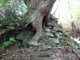
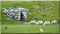
Remains of a broch preserved as a mound of 20 m diameter and 1,1 m height, which is located on a rocky knoll. Around the broch there are remains of the ditch.
Read More at ScotlandsPlaces.
You may be viewing yesterday's version of this page. To see the most up to date information please register for a free account.
")
")
")
Do not use the above information on other web sites or publications without permission of the contributor.
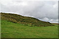
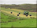
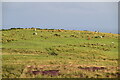
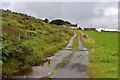
Nearby Images from Geograph Britain and Ireland:
©2022(licence)
©2010(licence)
©2022(licence)
©2017(licence)
©2021(licence)
The above images may not be of the site on this page, they are loaded from Geograph.
Please Submit an Image of this site or go out and take one for us!
Click here to see more info for this site
Nearby sites
Key: Red: member's photo, Blue: 3rd party photo, Yellow: other image, Green: no photo - please go there and take one, Grey: site destroyed
Download sites to:
KML (Google Earth)
GPX (GPS waypoints)
CSV (Garmin/Navman)
CSV (Excel)
To unlock full downloads you need to sign up as a Contributory Member. Otherwise downloads are limited to 50 sites.
Turn off the page maps and other distractions
Nearby sites listing. In the following links * = Image available
71m SSE 159° Loch Watenan* Multiple Stone Rows / Avenue (ND31744108)
211m WNW 282° Watenan Farm* Multiple Stone Rows / Avenue (ND3150941193)
321m NNE 15° Watenan North Broch Broch or Nuraghe (ND3180441456)
363m WNW 292° Garrywhin Multiple Stone Rows* Multiple Stone Rows / Avenue (ND3138241291)
386m W 265° Cairn o'Get* Chambered Cairn (ND31334112)
415m W 279° Broughwin I* Multiple Stone Rows / Avenue (ND3130741222)
437m ENE 63° Marquel Stone Row / Alignment (ND32114134)
495m WSW 247° Broughwin II* Multiple Stone Rows / Avenue (ND3125440965)
516m WNW 295° Garrywhin Fort* Hillfort (ND3125341377)
519m WSW 253° Broughwin IV* Multiple Stone Rows / Avenue (ND3121541004)
705m WSW 240° Broughwin III* Stone Row / Alignment (ND3110040800)
718m WSW 245° Cairn east of Cairn Hanach* Cairn (ND31064085)
773m WSW 246° Cairn Hanach* Chambered Cairn (ND31004085)
794m ENE 63° Ulbster School Broch or Nuraghe (ND3243141497)
846m SW 234° Groat’s Loch, South* Stone Row / Alignment (ND3102340658)
847m SSW 212° Clash-an-dam* Stone Row / Alignment (ND3125640434)
892m N 359° Watenan East* Stone Row / Alignment (ND31724204)
1.1km NNW 338° Watenan West* Stone Row / Alignment (ND31324218)
1.1km ENE 59° Heatherquoy Broch or Nuraghe (ND3271341714)
1.4km W 272° Warehouse Hill Broch or Nuraghe (ND3034841227)
1.5km NW 308° Warehouse South* Chambered Cairn (ND3057342081)
1.5km NW 308° Warehouse West* Cairn (ND3050742107)
1.6km NW 308° Warehouse Standing Stone* Standing Stone (Menhir) (ND3046242147)
1.6km NW 314° Warehouse North* Chambered Cairn (ND3056742276)
1.7km NW 310° Yarrows Fort* Hillfort (ND3041342265)
View more nearby sites and additional images


 We would like to know more about this location. Please feel free to add a brief description and any relevant information in your own language.
 Wir möchten mehr über diese Stätte erfahren. Bitte zögern Sie nicht, eine kurze Beschreibung und relevante Informationen in Deutsch hinzuzufügen.
 Nous aimerions en savoir encore un peu sur les lieux. S'il vous plaît n'hesitez pas à ajouter une courte description et tous les renseignements pertinents dans votre propre langue.
 Quisieramos informarnos un poco más de las lugares. No dude en añadir una breve descripción y otros datos relevantes en su propio idioma.