<< Text Pages >> Watenan North Broch - Broch or Nuraghe in Scotland in Caithness
Submitted by SolarMegalith on Saturday, 04 December 2010 Page Views: 2588
Iron Age and Later PrehistorySite Name: Watenan North Broch Alternative Name: Watenan NorthCountry: Scotland County: Caithness Type: Broch or Nuraghe
Nearest Town: Wick
Map Ref: ND3180441456
Latitude: 58.356256N Longitude: 3.167027W
Condition:
| 5 | Perfect |
| 4 | Almost Perfect |
| 3 | Reasonable but with some damage |
| 2 | Ruined but still recognisable as an ancient site |
| 1 | Pretty much destroyed, possibly visible as crop marks |
| 0 | No data. |
| -1 | Completely destroyed |
| 5 | Superb |
| 4 | Good |
| 3 | Ordinary |
| 2 | Not Good |
| 1 | Awful |
| 0 | No data. |
| 5 | Can be driven to, probably with disabled access |
| 4 | Short walk on a footpath |
| 3 | Requiring a bit more of a walk |
| 2 | A long walk |
| 1 | In the middle of nowhere, a nightmare to find |
| 0 | No data. |
| 5 | co-ordinates taken by GPS or official recorded co-ordinates |
| 4 | co-ordinates scaled from a detailed map |
| 3 | co-ordinates scaled from a bad map |
| 2 | co-ordinates of the nearest village |
| 1 | co-ordinates of the nearest town |
| 0 | no data |
Internal Links:
External Links:
Broch in Caithness
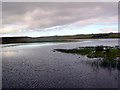
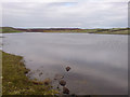
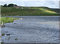
Remains of a broch are located on the hill over Western bank of Loch Watenan. Remains of the walls and entrance at SSE side of the mound are still distinguishable.
You may be viewing yesterday's version of this page. To see the most up to date information please register for a free account.
Do not use the above information on other web sites or publications without permission of the contributor.
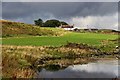
Nearby Images from Geograph Britain and Ireland:
©2007(licence)
©2017(licence)
©2007(licence)
©2007(licence)
©2017(licence)
The above images may not be of the site on this page, they are loaded from Geograph.
Please Submit an Image of this site or go out and take one for us!
Click here to see more info for this site
Nearby sites
Key: Red: member's photo, Blue: 3rd party photo, Yellow: other image, Green: no photo - please go there and take one, Grey: site destroyed
Download sites to:
KML (Google Earth)
GPX (GPS waypoints)
CSV (Garmin/Navman)
CSV (Excel)
To unlock full downloads you need to sign up as a Contributory Member. Otherwise downloads are limited to 50 sites.
Turn off the page maps and other distractions
Nearby sites listing. In the following links * = Image available
321m SSW 195° Watenan South Broch* Broch or Nuraghe (ND3171641147)
326m ESE 110° Marquel Stone Row / Alignment (ND32114134)
381m S 189° Loch Watenan* Multiple Stone Rows / Avenue (ND31744108)
394m SW 227° Watenan Farm* Multiple Stone Rows / Avenue (ND3150941193)
452m WSW 248° Garrywhin Multiple Stone Rows* Multiple Stone Rows / Avenue (ND3138241291)
548m WSW 244° Broughwin I* Multiple Stone Rows / Avenue (ND3130741222)
555m W 261° Garrywhin Fort* Hillfort (ND3125341377)
580m SW 234° Cairn o'Get* Chambered Cairn (ND31334112)
589m N 351° Watenan East* Stone Row / Alignment (ND31724204)
626m E 85° Ulbster School Broch or Nuraghe (ND3243141497)
736m SW 227° Broughwin II* Multiple Stone Rows / Avenue (ND3125440965)
741m SW 231° Broughwin IV* Multiple Stone Rows / Avenue (ND3121541004)
869m NW 325° Watenan West* Stone Row / Alignment (ND31324218)
942m ENE 73° Heatherquoy Broch or Nuraghe (ND3271341714)
957m SW 230° Cairn east of Cairn Hanach* Cairn (ND31064085)
960m SW 226° Broughwin III* Stone Row / Alignment (ND3110040800)
1.0km SW 232° Cairn Hanach* Chambered Cairn (ND31004085)
1.1km SW 223° Groat’s Loch, South* Stone Row / Alignment (ND3102340658)
1.2km SSW 207° Clash-an-dam* Stone Row / Alignment (ND3125640434)
1.4km WNW 296° Warehouse South* Chambered Cairn (ND3057342081)
1.4km WNW 296° Warehouse West* Cairn (ND3050742107)
1.5km W 260° Warehouse Hill Broch or Nuraghe (ND3034841227)
1.5km WNW 303° Warehouse North* Chambered Cairn (ND3056742276)
1.5km WNW 296° Warehouse Standing Stone* Standing Stone (Menhir) (ND3046242147)
1.6km WNW 299° Yarrows Fort* Hillfort (ND3041342265)
View more nearby sites and additional images


 We would like to know more about this location. Please feel free to add a brief description and any relevant information in your own language.
 Wir möchten mehr über diese Stätte erfahren. Bitte zögern Sie nicht, eine kurze Beschreibung und relevante Informationen in Deutsch hinzuzufügen.
 Nous aimerions en savoir encore un peu sur les lieux. S'il vous plaît n'hesitez pas à ajouter une courte description et tous les renseignements pertinents dans votre propre langue.
 Quisieramos informarnos un poco más de las lugares. No dude en añadir una breve descripción y otros datos relevantes en su propio idioma.