<< Our Photo Pages >> The two Wells of the Light - Holy Well or Sacred Spring in France in Bretagne:Côtes-D'Armor (22)
Submitted by JohnGinny on Friday, 18 March 2011 Page Views: 3558
Springs and Holy WellsSite Name: The two Wells of the LightCountry: France Département: Bretagne:Côtes-D'Armor (22) Type: Holy Well or Sacred Spring
Nearest Town: Bourbriac Nearest Village: St Gilles Pligeaux
Latitude: 48.378900N Longitude: 3.0964W
Condition:
| 5 | Perfect |
| 4 | Almost Perfect |
| 3 | Reasonable but with some damage |
| 2 | Ruined but still recognisable as an ancient site |
| 1 | Pretty much destroyed, possibly visible as crop marks |
| 0 | No data. |
| -1 | Completely destroyed |
| 5 | Superb |
| 4 | Good |
| 3 | Ordinary |
| 2 | Not Good |
| 1 | Awful |
| 0 | No data. |
| 5 | Can be driven to, probably with disabled access |
| 4 | Short walk on a footpath |
| 3 | Requiring a bit more of a walk |
| 2 | A long walk |
| 1 | In the middle of nowhere, a nightmare to find |
| 0 | No data. |
| 5 | co-ordinates taken by GPS or official recorded co-ordinates |
| 4 | co-ordinates scaled from a detailed map |
| 3 | co-ordinates scaled from a bad map |
| 2 | co-ordinates of the nearest village |
| 1 | co-ordinates of the nearest town |
| 0 | no data |
Internal Links:
External Links:
I have visited· I would like to visit
gritstone visited on 17th Aug 2021 - their rating: Cond: 4 Amb: 4 Access: 5
rrmoser visited on 14th Jun 2017 - their rating: Cond: 4 Amb: 5 Access: 5
Average ratings for this site from all visit loggers: Condition: 4 Ambience: 4.5 Access: 5
")
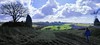
We were closely scrutinized by an elderly local whose house stood opposite. Maybe they watered the flowers?
You may be viewing yesterday's version of this page. To see the most up to date information please register for a free account.
")
Do not use the above information on other web sites or publications without permission of the contributor.
Nearby Images from Flickr


The above images may not be of the site on this page, but were taken nearby. They are loaded from Flickr so please click on them for image credits.
Click here to see more info for this site
Nearby sites
Click here to view sites on an interactive map of the areaKey: Red: member's photo, Blue: 3rd party photo, Yellow: other image, Green: no photo - please go there and take one, Grey: site destroyed
Download sites to:
KML (Google Earth)
GPX (GPS waypoints)
CSV (Garmin/Navman)
CSV (Excel)
To unlock full downloads you need to sign up as a Contributory Member. Otherwise downloads are limited to 50 sites.
Turn off the page maps and other distractions
Nearby sites listing. In the following links * = Image available
2.0km NW 324° Lesquiolec Standing Stone (Menhir)
2.1km ESE 123° Menhir de Kergornec* Standing Stone (Menhir)
2.2km ESE 115° Menhir dit le Pâtre* Standing Stone (Menhir)
3.2km ENE 77° Cre'h Ogel menhir* Standing Stone (Menhir)
3.3km SE 135° Menhir de Goresto* Standing Stone (Menhir)
3.3km ENE 77° La Croix du Pasquiou* Standing Stone (Menhir)
3.6km NE 35° Coat Ar Belleques* Standing Stone (Menhir)
3.8km SE 124° Menhir de Bodquelen* Standing Stone (Menhir)
3.9km ENE 72° Dolmen de Pasquiou* Burial Chamber or Dolmen
3.9km ENE 66° Pasquiou menhir* Standing Stone (Menhir)
4.5km NE 48° Menhir de La Villeneuve* Standing Stone (Menhir)
4.6km ENE 78° Porzic menhir* Standing Stone (Menhir)
5.1km NW 317° Dolmen de Keranquéré* Burial Chamber or Dolmen
5.2km NNE 12° Menhir de Kerprat Standing Stone (Menhir)
5.6km NE 46° Menhir de Coldabry Standing Stone (Menhir)
6.3km NE 46° Allée couverte du Parc-Kerdic* Passage Grave
6.4km NW 321° Caillouan Menhir* Standing Stone (Menhir)
6.6km ENE 64° Menhir de Keranhouët* Standing Stone (Menhir)
6.7km ENE 62° Vieux Bourg Tumulus Chambered Tomb
6.7km ENE 66° Botudo menhirs* Standing Stones
7.1km E 82° Monument aux Morts* Standing Stone (Menhir)
7.1km SSW 211° Menhir de Dzillou Standing Stone (Menhir)
7.2km SW 219° Menhir de Kraudy* Standing Stone (Menhir)
7.2km WNW 288° St Gildas Well (Magoar)* Holy Well or Sacred Spring
7.5km NW 316° Menhir de Toul-du* Standing Stone (Menhir)
View more nearby sites and additional images


 We would like to know more about this location. Please feel free to add a brief description and any relevant information in your own language.
 Wir möchten mehr über diese Stätte erfahren. Bitte zögern Sie nicht, eine kurze Beschreibung und relevante Informationen in Deutsch hinzuzufügen.
 Nous aimerions en savoir encore un peu sur les lieux. S'il vous plaît n'hesitez pas à ajouter une courte description et tous les renseignements pertinents dans votre propre langue.
 Quisieramos informarnos un poco más de las lugares. No dude en añadir una breve descripción y otros datos relevantes en su propio idioma.