


<< Our Photo Pages >> Caer Estyn - Hillfort in Wales in Wrexham
Submitted by VirtHist on Saturday, 28 July 2007 Page Views: 10058
Iron Age and Later PrehistorySite Name: Caer EstynCountry: Wales County: Wrexham Type: Hillfort
Map Ref: SJ314574
Latitude: 53.109358N Longitude: 3.026226W
Condition:
| 5 | Perfect |
| 4 | Almost Perfect |
| 3 | Reasonable but with some damage |
| 2 | Ruined but still recognisable as an ancient site |
| 1 | Pretty much destroyed, possibly visible as crop marks |
| 0 | No data. |
| -1 | Completely destroyed |
| 5 | Superb |
| 4 | Good |
| 3 | Ordinary |
| 2 | Not Good |
| 1 | Awful |
| 0 | No data. |
| 5 | Can be driven to, probably with disabled access |
| 4 | Short walk on a footpath |
| 3 | Requiring a bit more of a walk |
| 2 | A long walk |
| 1 | In the middle of nowhere, a nightmare to find |
| 0 | No data. |
| 5 | co-ordinates taken by GPS or official recorded co-ordinates |
| 4 | co-ordinates scaled from a detailed map |
| 3 | co-ordinates scaled from a bad map |
| 2 | co-ordinates of the nearest village |
| 1 | co-ordinates of the nearest town |
| 0 | no data |
Be the first person to rate this site - see the 'Contribute!' box in the right hand menu.
Internal Links:
External Links:
")
Found this on the map. Anyone know anything about it? From COFLEIN: A six acre univallate hillfort on the summit of a low hill. Date unknown
You may be viewing yesterday's version of this page. To see the most up to date information please register for a free account.
Do not use the above information on other web sites or publications without permission of the contributor.
coldrum has found this location on Google Street View:
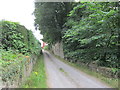
Nearby Images from Geograph Britain and Ireland:
©2009(licence)
©2008(licence)
©2013(licence)
©2006(licence)
©2013(licence)
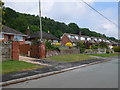
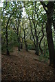
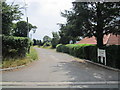
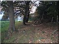
The above images may not be of the site on this page, they are loaded from Geograph.
Please Submit an Image of this site or go out and take one for us!
Click here to see more info for this site
Nearby sites
Key: Red: member's photo, Blue: 3rd party photo, Yellow: other image, Green: no photo - please go there and take one, Grey: site destroyed
Download sites to:
KML (Google Earth)
GPX (GPS waypoints)
CSV (Garmin/Navman)
CSV (Excel)
To unlock full downloads you need to sign up as a Contributory Member. Otherwise downloads are limited to 50 sites.
Turn off the page maps and other distractions
Nearby sites listing. In the following links * = Image available
1.1km NNW 337° Hope Church Early Medieval Stones* Ancient Cross (SJ310584)
1.2km SW 217° Siambr Gladdu Abermorddu* Cairn (SJ30695648)
1.9km NW 316° Park in the Past* Museum (SJ301588)
2.1km SW 216° Plas Maen Stone* Rock Art (SJ3015555755)
4.0km SE 126° The Atropos Altar Stone* Sculptured Stone (SJ34645497)
4.1km SSE 154° Bryn Alyn* Hillfort (SJ33125370)
4.1km S 191° Bryn Y Gaer Hillfort and St Paul's Church Hillfort (SJ30585334)
5.3km E 84° St Peter's Well (Denbighshire) Holy Well or Sacred Spring (SJ36735784)
6.1km SSE 150° Wrexham Gorsedd Circle Modern Stone Circle etc (SJ3436752064)
6.6km W 277° Carreg-y-Llech* Standing Stone (Menhir) (SJ24875835)
6.7km SE 137° Borras Quarry Neolithic Village Ancient Village or Settlement (SJ35855243)
6.8km SW 220° Minera Cup Stone* Rock Art (SJ26875225)
7.0km W 275° Bryntirion Round Barrows* Round Barrow(s) (SJ2445058160)
7.2km W 273° Pen Y Stryt Barrow* Round Barrow(s) (SJ2423057830)
7.2km SSE 165° Wrexham County Borough Museum* Museum (SJ3318950455)
7.4km W 269° Pentre Round Barrow* Round Barrow(s) (SJ2401057440)
8.0km SSE 167° Fairy Oak* Round Barrow(s) (SJ33144962)
8.3km SSE 165° Hillbury* Round Barrow(s) (SJ33424939)
9.0km E 82° Poulton Timber Circle* Ancient Village or Settlement (SJ4033558472)
9.3km S 183° Croes-Foel* Round Barrow(s) (SJ307481)
9.4km WSW 238° Maes Maelor* Barrow Cemetery (SJ23275255)
9.6km NW 312° Bryn-yr-Ellyllon* Round Barrow(s) (SJ2434063930)
9.7km E 97° Knowl Plantation Barrow Cemetery (SJ410561)
9.7km S 182° Hafod-y-bwch* Round Barrow(s) (SJ309477)
9.8km E 99° Churton* Long Barrow (SJ411558)
View more nearby sites and additional images


 We would like to know more about this location. Please feel free to add a brief description and any relevant information in your own language.
 Wir möchten mehr über diese Stätte erfahren. Bitte zögern Sie nicht, eine kurze Beschreibung und relevante Informationen in Deutsch hinzuzufügen.
 Nous aimerions en savoir encore un peu sur les lieux. S'il vous plaît n'hesitez pas à ajouter une courte description et tous les renseignements pertinents dans votre propre langue.
 Quisieramos informarnos un poco más de las lugares. No dude en añadir una breve descripción y otros datos relevantes en su propio idioma.