Featured: Friendly specialist tours to ancient, mystical and historical sites in the UK and beyond

Friendly specialist tours to ancient, mystical and historical sites in the UK and beyond

Random Image


Bundi

A New Dimension to Ancient Measures - from many years of research and fieldwork

A New Dimension to Ancient Measures - from many years of research and fieldwork

Who's Online

There are currently, 392 guests and 4 members online.

You are a guest. To join in, please register for free by clicking here

Sponsors

<< Our Photo Pages >> Chaco Culture NHP - Ancient Village or Settlement in United States in The Southwest

Submitted by bat400 on Friday, 11 December 2015  Page Views: 25161

Multi-periodSite Name: Chaco Culture NHP Alternative Name: Chaco Canyon
Country: United States Region: The Southwest Type: Ancient Village or Settlement
Nearest Town: Farmington  Nearest Village: Nageezi
Latitude: 36.045100N  Longitude: 107.872W
Condition:
5Perfect
4Almost Perfect
3Reasonable but with some damage
2Ruined but still recognisable as an ancient site
1Pretty much destroyed, possibly visible as crop marks
0No data.
-1Completely destroyed
3 Ambience:
5Superb
4Good
3Ordinary
2Not Good
1Awful
0No data.
5 Access:
5Can be driven to, probably with disabled access
4Short walk on a footpath
3Requiring a bit more of a walk
2A long walk
1In the middle of nowhere, a nightmare to find
0No data.
4 Accuracy:
5co-ordinates taken by GPS or official recorded co-ordinates
4co-ordinates scaled from a detailed map
3co-ordinates scaled from a bad map
2co-ordinates of the nearest village
1co-ordinates of the nearest town
0no data
4

Internal Links:
External Links:

I have visited· I would like to visit

jeffrep visited on 1st Oct 2015 - their rating: Cond: 3 Amb: 5 Access: 4

mfrincu visited on 28th Nov 2014 - their rating: Cond: 4 Amb: 5 Access: 4 Superb ambience and lots of kivas to see and explore. We've done the loop plus the trail to the supernova pictograph in just one day.

rrmoser visited on 18th Jul 2014 - their rating: Cond: 5 Amb: 5 Access: 5

bat400 visited on 25th Apr 2012 - their rating: Cond: 3 Amb: 5 Access: 4 The park is must see for anyone visiting northwest New Mexico. However, the park is in a remote area, with minimal services. (In my opinion, this is part of the experiance.) Be sure to review the park website to properly prepare for your trip. Camping at the park and extending your visit for several days would have many rewards, but all the major sites along the paved driving loop can be visited in one long day. If you are at all fit, take one of the "back country" trails to visit one or more sites on the mesa tops surrounding the canyon and "Downtown Chaco". Park ranger tours are available at the main sites several times a day during high season, see the website for the National Park. Inexpensive guide books are often available as you enter specific sites, or from the Visitor's Center. Wheel chair access is possible for portions of the walking trail at Pueblo Bonito, but even there the path is sand or gravel, not paved. Large chair tires or an assistant would be necessary. Note: A sturdy passenger vehicle is adequate to cross aproximately 13 miles of unpaved, washboard roads to reach the park itself. No not use a vehicle with "low profile" tires, and call for road conditions during the winter or following any periods of rain. Locals take the dirt road at speeds that you would not think possible, and actually reaching speeds of 45-55 mph will reduce the severe impacts as your car's shock absorbers dampen out the input frequency of the roadbed. (Try this, but remember that you MUST slow on curves, when coming on rises, or whenever visiblity is degraded. Otherwise you will slide off the road or strike other vehicles or livestock.)


Average ratings for this site from all visit loggers: Condition: 3.75 Ambience: 5 Access: 4.25

Chaco Culture NHP - Pueblo Bonito
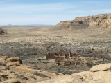
Chaco Culture NHP - Pueblo Bonito submitted by bat400 : Pueblo Bonito Great House, taken from the cliff edge directly north of the site. Photo by bat400, April 2012. (Vote or comment on this photo)
Petroglyphs, Ancient Buildings, Ancient Roads, Artifacts in San Juan County, New Mexico. Chaco Canyon appears on satellite maps as a sliver of green, but this is only by comparison to the desert surrounding it. A thousand years ago it was the center of a complex culture stretching a hundred miles in any direction.

The Chaco culture of the Ancestral Puebloans (Hisatsinom, previously identified as 'Anasazi') included a variety of architecture, a complex community life, and a trading network that stretched into Mexico and the great Mesoamerican cultures. The great expansion of Chaco seems to have been cut short after a regional, fifty year drought hit in the twelfth century. In successive years the Chaco culture and lifestyle appears to have broken and dispersed, although studies of the effect of drought on crop yields in the area indicate that other reasons besides basic survival may have led to a total abandonment of the villages in the canyon itself. The modern Pueblo Indians claim the Ancestral Puebloans as their ancestors and specific features of culture bear out a multitude of connections.

Earlier years of excavation led to immediate postulation of a high population count of "apartment" dwellers, but over the years analysis of the finds and consideration of the ability of the surroundings to supply wild and cultivated foods and fuel has changed that original view. The Great House complexes are now seen as centers of trade and/or worship that had relatively small year round populations. The Chaco Culture may have been revolved around an elite who controlled the collection and distribution for stored food or luxury goods.

The park contains a visitor's center with museum, and a multitude of archaeological sites, many of which may be driven to, and many others that are accessible by hiking trails. The highlights of the park are five large pueblo sites, covering acres of land. Some are completely excavated. Others have been left unexcavated, or have been examined and partially reburied.

Although classic Pueblo structures predate the Chaco Culture phenomena, Chaco sites are known for "Great House" structures where this architecture was carried out on a massive scale, creating large plazas and individual rooms, and ranks of multiple stories of rooms. The buildings are of the canyon's natural sandstone, laid with little or no mortar, and the room structures created by the use of large primary timbers overlaid with smaller timber beams to create a wooden sub-floor that was then covered with clay and sand. All larger timbers were brought into the canyon from forests 40-50 miles away, without beasts of burden. The massive walls of the Great Houses were created with a core and veneer method and are up to three feet thick and were plastered inside and out. The most massive of the Great Houses, Pueblo Bonito, has been said to rival the Roman Colosseum, although it was built without the use of metal tools.

Early archaeologists and the National Park Service has stabilized the structures to prevent or reduce further damage. In general, if structures were intact after excavation the Park Service has attempted to stabilize them in that condition, which has sometime required re-building.

Petrogylphs and solar calendar sites are here, as well as traces of a road system connecting Chaco to other settlements.

The extremely dry weather of the canyon itself, with poor growing conditions, little game, and minimal firewood was one of the primary reasons to dispute an original concept of large, permanent populations within the Great Houses. Other indications include relatively small numbers of burials for the time periods of construction, and large numbers of the Great House rooms without hearths or the debris of daily living.

See individual Megalithic Portal site pages for individual structures and features within the park.

Location is given for the east access point to the park, the current recommended entrance for best road conditions (2012.) Please review the park's website before visiting. Services within the park and within 60 miles are limited; Nageezi, 25 miles (13 miles on unpaved, wash-panned surface) from the north entrance has no lodging, but does have gasoline, food, and some supplies. The large village of Cuba, NM, and the town of Farmington, NM offer lodging, banking, and many other services.
Once you are in the park most Great House sites are reached by short footpaths from a paved driving loop. Other sites require hikes of variable length and difficulty. Weather conditions may be severe. Camping is available at the park year round, but temperatures range from 10 deg F to 98 deg F - for the most part there is no shade. Sudden rain storms can wash out roads and result in sudden temperature drops. The entire area is above 6000 feet and some visitors will feel the effects of the altitude while hiking.

[Information from National Park Service website, including the brochure, " Chaco Culture National Historical Park" by Ron Lusser,
People of Chaco by Kendrick Frazier,
The Chaco Research Archive, and
the Nageezi Chapter House website, among other sources.] Chaco Canyon is an Unesco World Heritage Site.

National Park Website.

Note: Dendroprovenance shows switch in wood source corresponds with flourishing of Chacoan culture, see the latest comment for more
You may be viewing yesterday's version of this page. To see the most up to date information please register for a free account.

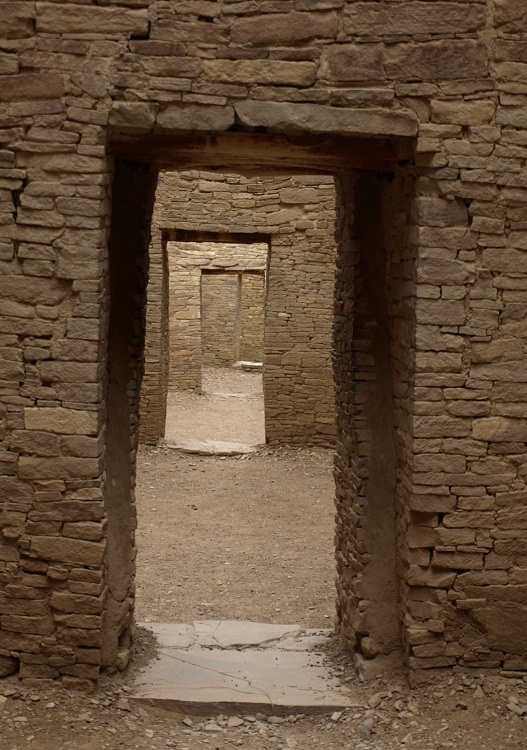
Chaco Culture NHP - Kin Kletso
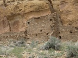
Chaco Culture NHP - Kin Kletso submitted by bat400 : View from a resting place halfway up the cliff just north of the site. Photo by bat400, April 2012. (Vote or comment on this photo)

Chaco Culture NHP - Pueblo Bonito
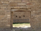
Chaco Culture NHP - Pueblo Bonito submitted by bat400 : Rooms within Pueblo Bonito and the other Great Houses of Chaco are large when compared with Ancestral Puebloan structures in other locations, of the same time period. A suite of rooms on the "ground floor" are connected by doorways, but there is generally no direct entrance to the plaza or exterior. Instead ladders were used, and access was through a ceiling opening. Photo by bat400, April 201... (Vote or comment on this photo)

Chaco Culture NHP - Pueblo Bonito
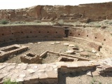
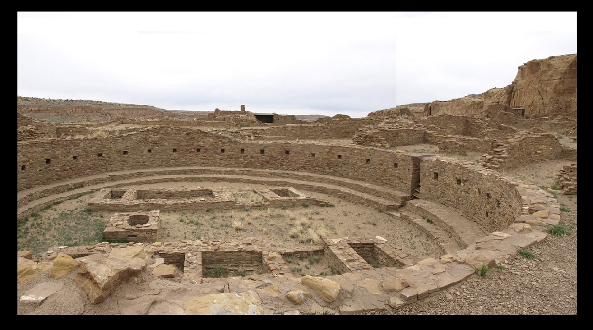
Chaco Culture NHP - Pueblo Bonito submitted by bat400 : The Great Kiva of the Pueblo Bonito complex. This underground room was the largest of its kind within Pueblo Bonito and its assumed to have been used by multiple clans for major ceremonies or public gatherings. There are four larger kivas within the complex and 25 smaller kivas. Photo by bat400, April 2012 (1 comment - Vote or comment on this photo)

Chaco Culture NHP - Casa Rinconada
Chaco Culture NHP - Casa Rinconada submitted by bat400 : In this view you can see the stone bench around the base of the interior wall, the many niches, and the room structure outside the kiva on the north side of the building. Photo by bat400, April 2012. (Vote or comment on this photo)

Chaco Culture NHP - Casa Rinconada
Chaco Culture NHP - Casa Rinconada submitted by bat400 : View through the south doorway, showing two of the circular base structures for roof posts, the center square firebox, and the two rectangular floor structures. Photo by bat400, April 2012.

Chaco Culture NHP - Hungo Pavi
Chaco Culture NHP - Hungo Pavi submitted by bat400 : The interior of a room in the northeast corner of the complex. The ground floor room is almost completely filled with shifted sand and earth. The second floor room above it is marked by the line of secondary beams below it. Photo by bat400, April 2012.

Chaco Culture NHP - Pueblo Alto
Chaco Culture NHP - Pueblo Alto submitted by bat400 : One of the larger standing walls of the ruin. Most of the structure has been backfilled for its protection. Photo by bat400.

Chaco Culture NHP - Pueblo del Arroyo
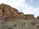
Chaco Culture NHP - Pueblo del Arroyo submitted by bat400 : A view of the Great House taken from the cliffs on the north side of the canyon. Photo by bat400, April 2012.

Chaco Culture NHP - Casa Rinconada
Chaco Culture NHP - Casa Rinconada submitted by bat400 : A view of interior niches from the solstice 'window'. Photo by bat400, April 2012.

Chaco Culture NHP - Hungo Pavi
Chaco Culture NHP - Hungo Pavi submitted by bat400 : View of the main east-west roomblock taken from the location of the plaza. The Hungo Pavi Great House is situated on a slight rise, but the builders basically raised the entire area so the and final enclosed plaza configuration was even with the second tier of rooms.

Chaco Culture NHP - Hungo Pavi
Chaco Culture NHP - Hungo Pavi submitted by bat400 : View of the west side of the main room block. photo by bat400, April 2012.

Chaco Culture NHP - Hungo Pavi
Chaco Culture NHP - Hungo Pavi submitted by bat400 : The back wall of the east-west roomblock. Photo by bat400, April 2012.

Chaco Culture NHP - Hungo Pavi
Chaco Culture NHP - Hungo Pavi submitted by bat400 : Detail from the generally intact main back wall of the east-west roomblock. The large circles were the location of primary beams that would have supported the third floor of rooms. Photo by bat400, April 2012.

Chaco Culture NHP - Pueblo Bonito
Chaco Culture NHP - Pueblo Bonito submitted by bat400 : 'Corner' windows or openings are found in only seven locations in Pueblo Bonito. All were part of extensive construction periods that took place relatively late in the Chaco culture as it existed in the canyon (1075 - 1115 AD.) Some, but not all, of these openings appear to have functions as solstice calendars. Photo by bat400 April 2012.

Chaco Culture NHP - Pueblo Bonito
Chaco Culture NHP - Pueblo Bonito submitted by bat400 : The signature "T shaped" doorway of the Ancestral Puebloans. It's been postulated that the shape had significance as an entry to a special location, such as a plaza or gathering space, but a lot of variation exists in their locations in the complexes. This shape is also found in Mexico and has frequently been used into the modern era. Researchers differ over where the shape originated and its me... (3 comments)

Chaco Culture NHP - Pueblo Bonito
Chaco Culture NHP - Pueblo Bonito submitted by bat400 : In this completely excavated block, the floor of both a second and third floor room had collapsed, so the space is now open to the sky, although the floor/roof beams can be seen. The original excavations found wall plaster, much deteriorated, and in some cases traces of decorative paintings. No doors with attachments have been found. For some small doorways, sheets of stone have been found...

Chaco Culture NHP - Pueblo Bonito
Chaco Culture NHP - Pueblo Bonito submitted by bat400 : This view shows how sturdy the structure was. The doorway is at the second floor of the Great House. To the left you can see a room on the first floor. Above the room with the doorway is a third floor, and the back wall of a fourth floor. When constructed, all of the interior and exterior surfaces would have been coated with a mud/clay plaster. Photo by bat400, April 2012.

Chaco Culture NHP - Pueblo Bonito
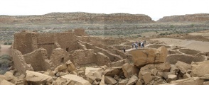
Chaco Culture NHP - Pueblo Bonito submitted by bat400 : A view of the eastern half of the complex. Near where the tour is standing there are multiple kivas. These were enclosed within square rooms and are smaller than the one great kiva found in the main plaza of the complex. Photo by bat400, April 2012.

Chaco Culture NHP - Chetro Ketl
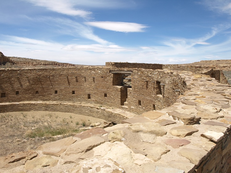
Chaco Culture NHP - Chetro Ketl submitted by bat400 : The Great Kiva of Chetro Ketl. Aside from the missing roof and plaster, this is possible the finest preserved Great Kiva in the southwest. Photo by bat400, April 2012.

Chaco Culture NHP - Una Vida
Chaco Culture NHP - Una Vida submitted by bat400 : A view of the Great House ruin from the cliffside to the north east. Fajada Butte is in the distance. Photo by bat400.

Chaco Culture NHP - Pueblo Bonito
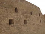
Chaco Culture NHP - Pueblo Bonito submitted by bat400 : Detail of window construction. The small logs (aprox 3 inch dia) provide the support for the window opening. Doors were constructed in a similar fashion. Photo by bat400, April 2012.

Chaco Culture NHP - Pueblo Bonito
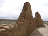
Chaco Culture NHP - Pueblo Bonito submitted by bat400 : Pueblo Bonito Great House, taken from the cliff edge directly north of the site. Photo by bat400, April 2012. (3 comments)

Chaco Culture NHP - Pueblo Bonito
Chaco Culture NHP - Pueblo Bonito submitted by bat400 : Pueblo Bonito. Taken from the north western side of the plaza, looking east. April 2012, photo by GCM.

Chaco Culture NHP - Kin Kletso
Chaco Culture NHP - Kin Kletso submitted by jeffrep : Kin Kletso an Ancestral Puebloan great house in Chaco Culture National Historical Park in northern New Mexico in the U.S. Southwest.

These are just the first 25 photos of Chaco Culture NHP. If you log in with a free user account you will be able to see our entire collection.

Do not use the above information on other web sites or publications without permission of the contributor.
Click here to see more info for this site

Nearby sites

Click here to view sites on an interactive map of the area

Key: Red: member's photo, Blue: 3rd party photo, Yellow: other image, Green: no photo - please go there and take one, Grey: site destroyed

Download sites to:
KML (Google Earth)
GPX (GPS waypoints)
CSV (Garmin/Navman)
CSV (Excel)

To unlock full downloads you need to sign up as a Contributory Member. Otherwise downloads are limited to 50 sites.


Turn off the page maps and other distractions

Nearby sites listing. In the following links * = Image available
 2.1km S 174° Chaco Culture NHP - Wijiji Ancient Village or Settlement
 3.7km WSW 252° Chaco Culture NHP - Una Vida Petroglyph site* Rock Art
 3.8km WSW 251° Chaco Culture NHP - Una Vida* Ancient Village or Settlement
 4.5km SW 230° Chaco Culture NHP- Fajada Butte* Rock Art
 5.2km W 276° Chaco Culture NHP - Hungo Pavi* Ancient Village or Settlement
 7.6km WNW 283° Chaco Culture NHP - Chetro Ketl* Ancient Village or Settlement
 7.8km W 263° Chaco Culture NHP - Tsin Kletzin* Ancient Village or Settlement
 8.0km W 278° Chaco Culture NHP - Casa Rinconada* Ancient Temple
 8.2km WNW 290° Chaco Culture NHP - Pueblo Alto* Ancient Village or Settlement
 8.2km WNW 282° Chaco Culture NHP - Pueblo Bonito* Ancient Village or Settlement
 8.4km WNW 289° Chaco Culture NHP - New Alto* Ancient Village or Settlement
 8.6km WNW 282° Chaco Culture NHP - Pueblo del Arroyo* Ancient Village or Settlement
 9.1km WNW 284° Chaco Culture NHP - Kin Kletso* Ancient Village or Settlement
 11.1km WNW 288° Chaco Culture NHP - Penasco Blanco Trail Petroglyphs* Rock Art
 12.3km WNW 290° Chaco Culture NHP - Supernova pictograph* Rock Art
 12.5km WNW 289° Chaco Culture NHP - Peñasco Blanco* Ancient Village or Settlement
 18.2km W 264° Chaco Culture NHP - Kin Klizhin* Ancient Village or Settlement
 19.4km ESE 113° Pueblo Pintado* Ancient Village or Settlement
 24.6km W 259° Kin Bineola* Ancient Village or Settlement
 46.5km SSW 208° Kin Ya'a* Ancient Village or Settlement
 68.4km S 191° Blue J Ancient Village or Settlement
 70.8km SSW 193° Casamero* Ancient Village or Settlement
 74.3km N 349° Salmon Ruins* Ancient Village or Settlement
 88.5km N 353° Aztec Ruins National Monument* Ancient Village or Settlement
 88.6km NNE 12° Simon Canyon Ruins* Ancient Village or Settlement
View more nearby sites and additional images

<< Virmėnų akmuo

Santakos parkas >>

Please add your thoughts on this site

Children Of The Stones DVD

Children Of The Stones DVD

Sponsors

Auto-Translation (Google)

Translate from English into:

"Chaco Culture NHP" | Login/Create an Account | 12 News and Comments
  
Go back to top of page    Comments are owned by the poster. We aren't responsible for their content.
Unexpected Wood Source for Chaco Canyon Great Houses by bat400 on Wednesday, 09 December 2015
(User Info | Send a Message)
Research shows switch in wood source corresponds with flourishing of Chacoan culture.

The wood in the monumental "great houses" built in Chaco Canyon by ancient Puebloans came from two different mountain ranges, according to new research from the University of Arizona Laboratory of Tree-Ring Research.

The UA scientists report that before 1020, most of the wood came from the Zuni Mountains about 50 miles to the south. The species of tree used in the buildings did not grow nearby, so the trees must have been transported from distant mountain ranges.
By 1060, the Chacoans had switched to harvesting trees from the Chuska Mountains about 50 miles to the west.

The switch in wood sources coincides with important developments in Chacoan culture, said Guiterman, a doctoral candidate in UA’s School of Natural Resources and the Environment.

"There’s a change in the masonry style — the architectural signature of the construction. A massive increase in the amount of construction — about half of 'downtown Chaco' houses were built at the time the wood started coming from the Chuska Mountains," he said.

By reviewing archaeological records, the team found other materials coming to Chaco from the Chuskas at the same time.
"There’s pottery and there’s chipped-stone tools — things like projectile points and carving devices," he said.

About 240,000 trees were used to build massive structures, some five stories high and with hundreds of rooms, in New Mexico’s arid, rocky Chaco Canyon during the time period 850 to 1140. The buildings include some of the largest pre-Columbian buildings in North America.

To figure out where the trees for the beams had grown, Guiterman used a method known as dendroprovenance that had not been used in the American Southwest before.

Guiterman wondered if the annual growth rings of trees could reveal the origin of beams. Doing such a study also would test the results from the chemical method of determining the wood's source.
He decided to try the dendroprovenance technique, which has been used in Europe to figure out the source of wood in artifacts.
Guiterman had the necessary materials at hand: Laboratory of Tree-Ring Research founder A.E. Douglass and his student Emil Haury collected wood from ancient Puebloan structures and nearby mountain ranges throughout the Southwest starting in the 1920s and used the material to date the great ruins of the Southwest.
Guiterman said there are more than 6,000 wood specimens from Chaco Canyon great houses alone.

The annual growth rings in trees reflect regional climate: Rings are wide in good growing years; thin in bad ones. The patterns of thick-and-thin rings in trees that grow in the mountain ranges that surround Chaco Canyon are similar because the climate is the same.
However, each mountain range has slightly different conditions. Therefore, growth patterns of trees from one mountain range are not identical to those of trees in nearby ranges.

The dendroprovenance method requires finding a strong match between the tree-ring patterns in a beam and the average tree-ring patterns from trees of the same age known to be from a particular mountain range.

The work is painstaking. Guiterman had to compare the patterns on 170 individual beams with archived tree-ring patterns from seven different nearby mountain ranges.

Guiterman, UA Regents’ Professor Emeritus Thomas Swetnam and UA Professor Emeritus Jeffrey Dean will publish their paper, "Eleventh-Century Shift in Timber Procurement Areas for the Great Houses of Chaco Canyon," in an upcoming issue of the Proceedings of the National Academy of Sciences.

Swetnam said, "We think this is a powerful new method to use in the Southwest. We tested the method using modern trees and could determine their source of origin with 90 percent accuracy."

For more, see University of Arizona news r

Read the rest of this post...
[ Reply to This ]

The Mystery of Chaco Canyon Documentary by Andy B on Friday, 29 August 2014
(User Info | Send a Message)
Produced by The Solstice Project
Narrated by Robert Redford

This is the long-awaited sequel to Anna Sofaer's classic film THE SUN DAGGER, which changed forever our perception of America's earliest Indian peoples.

THE MYSTERY OF CHACO CANYON examines the deep enigmas presented by the massive prehistoric remains found in Chaco Canyon in northwestern New Mexico. It is the summation of 20 years of research. The film reveals that between 850 and 1150 AD, the Chacoan people designed and constructed massive ceremonial buildings in a complex celestial pattern throughout a vast desert region. Aerial and time lapse footage, computer modeling, and interviews with scholars show how the Chacoan culture designed, oriented and located its major buildings in relationship to the sun and moon. Pueblo Indians, descendants of the Chacoan people, regard Chaco as a place where their ancestors lived in a sacred past. Pueblo leaders speak of the significance of Chaco to the Pueblo world today.

The film challenges the notion that Chaco Canyon was primarily a trade and redistribution center. Rather it argues that it was a center of astronomy and cosmology and that a primary purpose for the construction of the elaborate Chacoan buildings and certain roads was to express astronomical interests and to be integral parts of a celestial patterning.

While the Chacoans left no written text to help us to understand their culture, their thoughts are preserved in the language of their architecture, roads and light markings. Landscape, directions, sun and moon, and movement of shadow and light were the materials used by the Chacoan architects and builders to express their knowledge of an order in the universe.

http://documentaryheaven.com/the-mystery-of-chaco-canyon/

Available on DVD
http://www.southwestindian.com/p/the-mystery-of-chaco-canyon-dvd
[ Reply to This ]

Time to protect integrity of area around Chaco - from oil and gas drilling by bat400 on Friday, 13 September 2013
(User Info | Send a Message)
Last week, the Society for American Archaeology, New Mexico Archaeological Council, Chaco Alliance, WildEarth Guardians and San Juan Citizens Alliance petitioned the Bureau of Land Management to designate a Greater Chaco Landscape Area of Critical Environmental Concern. The ACEC would include about 1.1 million acres surrounding the national historic park.

The current park is just the core of an area rich in archaeological treasures. The ACEC would include several Chacoan Great House Communities, as well as the Great North Road, which linked Chaco to the current Aztec Ruins National Monument.

The recognition of the unique values of the area have been recognized by the BLM and the National Park Service, which supported the designation of the area as a World Heritage Site because of the many important features not included within the park itself.

The primary threat to these ancient treasures is from gas and oil development. In 2003, when the BLM completed the management plan for the area, it found the likelihood of much development in the area to be very small. Yet, now, the most active area of new oil drilling in the San Juan Basin is just to the north. There have been three attempts by industry to get the BLM to lease parcels right on the edge of the park. While the BLM has so far indicated it would defer those leases, a more permanent solution is critically needed.

The effects of gas and oil development in the Greater Chaco area would include: a loss of the vast, empty feel of the landscape; loss of the notable and important silence that impresses all who visit; a real threat of rock fall or structure collapse from seismic events (small earthquakes) because of drilling, fracking or waste-water injection; and in many ways unique to this area, the loss of night darkness.

Recently, the Hopi Tribe sent a letter asking for congressional assistance, as the tribe has lost faith in the BLM’s willingness to protect the area. The San Juan Basin is more than an energy sacrifice area. The BLM still fails to understand that, and 94 percent is not enough for the energy companies. It is time to make the area an ACEC and protect this unique and important region.

For more, see the entire piece by Dan Randolph, executive director of the San Juan Citizens Alliance, Durango Herald
[ Reply to This ]

Chaco Research Archive Online by bat400 on Thursday, 10 May 2012
(User Info | Send a Message)
"The Chaco Research Archive is an online resource providing access to a wealth of information documenting the history of archaeological research in Chaco Canyon, New Mexico. The archive includes material from dozens of sites excavated in the Chaco Culture National Historical Park and beyond."

Funded by the Andrew Mellon Foundation, the archive researchers have created a database and have been systematically collecting and entering data from all the institutions that have been involved with excavation and analysis of the Chaco Culture since 1896. To date "the Chaco Research Archive team has processed over 15,000 images, created an architectural stabilization database of another 10,000 images, entered over 40,000 specimens, and processed nearly 500 rooms from three different sites."

You can find the archive at: http://www.chacoarchive.org/cra/.

[ Reply to This ]

Big series of articles by architect Richard Thornton by Andy B on Saturday, 22 May 2010
(User Info | Send a Message)
There is a very big series of articles by architect Richard Thornton, author of "Ancient Roots I: the Indigenous People and Architecture of the Southern Highlands" running online in The Examiner. He seems to be serialising most if his book and there are some very interesting sites described that we will be returning to.

A good place to start is here with an explanation and glossary of the various types of cultures and time periods he is writing about.

http://www.examiner.com/x-40598-Architecture--Design-Examiner~y2010m4d12-The-Mesoamerican-connection-part-one--ancient-words-and-marble-statues
[ Reply to This ]

Was Chaco Canyon culturally related to the Pacific Coast of South America? by Andy B on Friday, 21 May 2010
(User Info | Send a Message)
Three part article in The Examiner about Chaco Canyon architecture, including the Anasazi Road System

http://www.examiner.com/x-40598-Architecture--Design-Examiner~y2010m5d16-Americas-architectural-heritage-Chaco-Canyon-New-Mexico--Part-1

http://www.examiner.com/x-40598-Architecture--Design-Examiner~y2010m5d17-Americas-Architectural-Heritage-Chaco-Canyon-New-Mexico--Part-2


http://www.examiner.com/x-40598-Architecture--Design-Examiner~y2010m5d20-Americas-architectural-heritage-Chaco-Canyon-New-Mexico--Part-3
[ Reply to This ]

Ohio Wesleyan art professor uncovers celestial connection in desert Southwest by Andy B on Tuesday, 08 December 2009
(User Info | Send a Message)
Jim Krehbiel and Natalie Cunningham spent years uncovering why ancient kivas were built in such remote sites in Utah.

Jim Krehbiel was up past midnight making a piece of art by layering maps and field notes onto photos he had taken of an ancient ritual site high on a cliff ledge in the desert Southwest.

He looked at the image of the kiva and remembered how the ruins were nearly inaccessible. Krehbiel had to lower himself on a rope to reach them.

Why, he wondered that night in the fall of 2007, would anyone build something so important in such a remote spot among the canyons and mesas?

It was then that the chairman of Ohio Wesleyan University's art department found himself at the conjunction of archaeology and astronomy.

Perhaps, he thought, the site was an observatory; a place to help religious leaders keep track of the solstices, time rituals and plantings.

"Their world around them is absolute, total chaos," Krehbiel said. "They were really at the mercy of the elements.

"So where do they go for something that's predictable, that remains the same, that you can count on: The sky and the relationship of those things on the horizon."

A discussion with Barbara Andereck, a professor of astronomy and physics at Ohio Wesleyan, put Krehbiel on a path that would help him test his ideas about the remote kivas he visited each summer.

Krehbiel was stepping into archeo-astronomy, the study of the ways ancient cultures tracked the sky's movements. The science has been gaining acceptance as a branch of archaeology since the 1970s.

England's Stonehenge, for example, is well known for its alignments with astronomical phenomena. In Ohio, archaeologists agree that ancient mound builders lined up some works with the movements of the sun and the moon.

In the Southwest, the most famous site is the Chaco Sun Dagger. The sun and moon shine through the spaces between slabs of rock to make slashes of light on a spiral carving in conjunction with the solstices and the movements of the moon.

But no one had identified such alignments at hundreds of remote ruins that dot the canyons of southeastern Utah.

One of Andereck's students, Natalie Cunningham, was looking for a senior project in 2008 and agreed to help Krehbiel.

"I had to do a lot of math to go back into the past and see where the sun and moon were," said Cunningham, who was studying English and astrophysics.

In the summer of 2008, Krehbiel took Cunningham to Utah to take readings.

Back at the kiva he'd pondered on that fall night, Krehbiel set up his transit and sighted in on a gap in the opposite canyon rim where he thought the winter solstice sun might rise.

Instead, he found that the moon rises there during an event called the major lunar standstill, which occurs every 18.6 years.

The major standstill occurs when the moon rises and sets in its longest arc across the horizon -- the lunar version of the annual summer solstice when the sun makes its longest arc across the sky.

But they also found that the calculations Cunningham made in relatively flat Ohio only went so far in the canyons of Utah.

The cliff-top kiva is on a relatively flat plane with the features on the opposite canyon rim and with the horizon, so the calculations were close enough to work there. But they didn't work for kivas deep inside a canyon.Because the canyon rim is high above, the sun and moon don't appear to observers at those sites until they're far above the true horizon. Since they cross the sky in an arc, the sun and moon appeared in a different spot than Cunningham had calculated.

"I said 'Oh, crap, it's not nearly good enough,' " said Cunningham, who is now at the University of Arizona pursuing a graduate degree in nonfiction writing.

She found a better model that summer in a book publ

Read the rest of this post...
[ Reply to This ]

New discovery at Chaco by bat400 on Sunday, 30 August 2009
(User Info | Send a Message)
Submitted by coldrum --
CHACO CANYON NATIONAL HISTORICAL PARK — New discoveries have a knack for coming about in unusual ways, as archaeologists at Chaco Canyon National Historical Park found out this summer. It is not very romantic, but archaeologists monitoring work in progress on a sewer upgrade stopped work when signs of ancient human activity showed up at the proposed site of a lift station.
The discovered pit house predates the Chaco pueblo culture by 1500 years.

See photo in the Gallup Independent.
[ Reply to This ]

Scientist Tries to Connect Migration Dots of Ancient Southwest by bat400 on Wednesday, 01 July 2009
(User Info | Send a Message)
Originally submitted by coldrum --

From the sky, the Mound of the Cross at Paquimé, a 14th-century ruin in the Mexican state of Chihuahua, looks like a compass rose — the roundish emblem indicating the cardinal directions on a map. About 30 feet in diameter and molded from compacted earth and rock taken near the banks of the Casas Grandes River, the crisscross arms point to four circular platforms. They might as well be labeled N, S, E and W.

“It’s a hell of a long way from here to Chaco,” says Steve Lekson, an archaeologist from the University of Colorado, as he sights along the north-south spoke of the cross. Follow his gaze 400 miles north and you reach Chaco Canyon in northwestern New Mexico, a major cultural center occupied from about A.D. 900 to A.D. 1150 by the pueblo people known as Anasazi. Despite the distance, Dr. Lekson believes the two sites were linked by an ancient pattern of migration and a common set of religious beliefs.

But don’t stop at Chaco. Continue about 60 miles northward along the same straight line and you come to another Anasazi center called Aztec Ruins. For Dr. Lekson the alignment must be more than a coincidence.

A decade ago in “The Chaco Meridian: Centers of Political Power in the Ancient Southwest,” he argued that for centuries the Anasazi leaders, reckoning by the stars, aligned their principal settlements along this north-south axis — the 108th meridian of longitude. In an article this year for Archaeology magazine, he added two older ruins to the trajectory: Shabik’eschee, south of Chaco, and Sacred Ridge, north of Aztec. Each in its time was the regional focus of economic and political power, and each lies along the meridian. As one site was abandoned, because of drought, violence, environmental degradation — the reasons are obscure — the leaders led an exodus to a new location: sometimes north, sometimes south, but hewing as closely as they could to the 108th meridian.

“I think the reason is ideological,” Dr. Lekson said on a recent visit to Paquimé. “The cultural response to something not working is to move north, and when that doesn’t work you move south. And then you move north again and then you move south again, and then you finally say the hell with it, I’m out of here, and you go down to Chihuahua.”

For many of Dr. Lekson’s colleagues that is an awfully big leap. With all the ambiguities involved in interpreting patterns of dirt and rock — the Anasazi left no written history — archaeologists have been more comfortable focusing on a particular culture or a particular ruin. Dr. Lekson is constantly reaching — some say overreaching — to make connections between isolated islands of thought. Scheduled for publication this summer, his new book, “A History of the Ancient Southwest,” will go even further, offering a kind of unified theory of the Native American population movements that have puzzled Southwest archaeologists for many years.

“Steve has definitely been the one who has dragged us kicking and screaming into ‘big picture’ archaeology,” said William D. Lipe, emeritus professor of archaeology at Washington State University. “In many ways, Steve’s ideas and publications have driven much of the intellectual agenda for Southwestern archaeology over the last 20 or more years.” That does not mean, Dr. Lipe added, that he buys the idea of the Chaco meridian.

For more on Lekson's theories and evidence for and against, see New York Times.
[ Reply to This ]

New look at turquoise treasures of the Aztecs; Ancestral Puebloans by bat400 on Saturday, 10 May 2008
(User Info | Send a Message)
Thirty years ago the archaeological scientists Garman Harbottle and Edward Sayre used neutron activation analysis to show that turquoise mosaics from Mexico, found as far away as the great Maya city of Chichén Itzá in Yucatan and dating back to around AD900, used raw material originating in the Cerrillos mines between Albuquerque and Santa Fe in New Mexico, an overland distance of some 3,200 km (2,000 miles). It was assumed that the Cerrillos mines had also supplied more local demand, for instance from the Chaco Canyon communities west of Santa Fe. A new technique of source characterisation, using hydrogen and copper isotope ratios established by secondary ion mass spectrometry (SIMS), shows that this picture was altogether too simple.

Sharon Hull and her colleagues report in the Journal of Archaeological Science this month that of eleven samples from Chaco Canyon sites, dating from AD550 to 1050, only two could be attributed to the Cerrillos source. Two others came from Orogrande in southern New Mexico, three from the No 8 Mine in northern Nevada, and one from the Montezuma source in southern Nevada.

Although none of the Mexican mosaics has yet been re-examined in detail, this looks like a good idea: not only the Chichén Itzá pieces, but Aztec turquoise mosaics, such as those in the British Museum’s Mexican Gallery, could well yield evidence that ancient trade networks in late pre-Columbian America were much more complex than we have assumed.

From Journal of Archaeological Science 35; 1355-1369 as reported at

Times On Line.
[ Reply to This ]

Stolen Women: Chaco Culture and Possible Warfare by bat400 on Monday, 13 November 2006
(User Info | Send a Message)
Article on possible reasons for warfare among 11th Century Ancient Puebloan cultures. Gender imbalances in human remains may indicate patterns of taking captives.

Physorg article.

[ Reply to This ]

Your Name: Anonymous [ Register Now ]
Subject:


Add your comment or contribution to this page. Spam or offensive posts are deleted immediately, don't even bother

<<< What is five plus one as a number? (Please type the answer to this question in the little box on the left)
You can also embed videos and other things. For Youtube please copy and paste the 'embed code'.
For Google Street View please include Street View in the text.
Create a web link like this: <a href="https://www.megalithic.co.uk">This is a link</a>  

Allowed HTML is:
<p> <b> <i> <a> <img> <em> <br> <strong> <blockquote> <tt> <li> <ol> <ul> <object> <param> <embed> <iframe>

We would like to know more about this location. Please feel free to add a brief description and any relevant information in your own language.
Wir möchten mehr über diese Stätte erfahren. Bitte zögern Sie nicht, eine kurze Beschreibung und relevante Informationen in Deutsch hinzuzufügen.
Nous aimerions en savoir encore un peu sur les lieux. S'il vous plaît n'hesitez pas à ajouter une courte description et tous les renseignements pertinents dans votre propre langue.
Quisieramos informarnos un poco más de las lugares. No dude en añadir una breve descripción y otros datos relevantes en su propio idioma.